Author: Patricia

  • Tenerife Ocean Safety Guide: Beach Flags, Waves, Currents and Natural Pools

    Tenerife Ocean Safety Guide: Beach Flags, Waves, Currents and Natural Pools

    Tenerife Ocean Safety Guide is a practical topic I would rather understand before the trip than solve under pressure. Tenerife has beaches for almost every kind of traveller, but the Atlantic is not a swimming pool. Conditions can change between one bay and the next, and a calm-looking shoreline can still have surf, currents, slippery lava rock or a strong shore break. I treat the beach flag and the lifeguard as part of the plan, not as background scenery.

    This guide is about making simple decisions before entering the water. The Government of the Canary Islands uses the familiar green, yellow and red beach-flag system, while 112 Canarias regularly reminds residents and visitors to respect coastal alerts, avoid exposed piers and breakwaters during rough seas, and call 112 immediately in an emergency.

    At a glance

    Topic Tenerife ocean safety
    My approach Use official information for rules and safety, then keep a simple backup plan rather than overcomplicating the holiday.
    When to recheck Anything involving alerts, medical guidance, road rules, live infrastructure or beach conditions should be checked again close to the day.
    Emergency number 112 for urgent medical, rescue, fire or security emergencies in the Canary Islands.

    What I would know before the trip

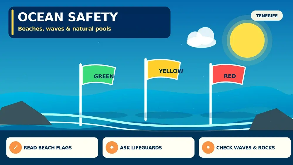
    • 112 Canarias states that a red flag means bathing is prohibited, yellow means caution and green means conditions are considered suitable for bathing.
    • Official Canary Islands emergency advice warns that north-coast beaches can be more exposed to wind, swell and currents than many sheltered southern beaches.
    • During coastal alerts, authorities advise avoiding piers, breakwaters and places where waves can sweep people into the sea.
    • Natural pools can become dangerous when swell overtops walls or lava shelves even if the water inside looked calm a few minutes earlier.
    • In any serious coastal emergency in Tenerife, 112 is the single emergency number for rescue, medical and security coordination.

    Official sources I would save: 112 Canarias sea-safety advice · 112 Canarias coastal alerts.

    How I read beach flags before swimming

    I look for the flag before I choose where to put the towel. A green flag does not mean there is zero risk; it means current conditions are considered suitable for bathing. Yellow tells me to reduce ambition, stay where I can stand or swim comfortably, and pay closer attention to the lifeguard. Red is simple: I do not enter the water.

    I also notice whether the flag has changed during the day. Wind and swell can build after a calm morning. If the lifeguard closes a section or asks swimmers to move, I follow that instruction immediately rather than judging the sea from the shore.

    Waves, shore break and currents

    The most common mistake I see is judging only the height of a wave. A modest-looking shore break can knock someone over in shallow water, while a current can pull a swimmer sideways or away from the easiest exit. I watch the water for several minutes before entering and choose a supervised section when I am unfamiliar with the beach.

    If I feel myself being carried or I am no longer comfortable, I stop trying to prove anything and signal for help. I do not exhaust myself fighting the sea. The exact response to a current depends on conditions and ability, so lifeguard instructions at that beach take priority over generic internet advice.

    Why natural pools need extra respect

    Tenerife natural pools are beautiful because they sit directly in volcanic coastline, but that also means they are exposed to swell. A pool can be calm inside while a larger set of waves suddenly crosses the outer wall. Wet lava is slippery, ladders can be difficult in surge, and spectators standing on the seaward edge can be at greater risk than swimmers.

    I only use a natural pool when local access is open and the sea state looks appropriate. If waves are overtopping the structure, if barriers are closed or if locals are staying back from the edge, I treat that as a clear sign to choose another activity.

    North coast versus south coast

    I never turn the phrase “the north is rougher” into a rule that the south is safe. It is simply a planning clue. North and west coasts are often more exposed to Atlantic swell, while several southern resort beaches have breakwaters and lifeguards. But local wind, tide and swell direction can reverse expectations on a particular day.

    For families or weaker swimmers, I prioritise a supervised beach with easy access and facilities rather than the most dramatic cove in a photograph. I save wild beaches for walking, photography or a dry-foot visit when conditions are uncertain.

    Coastal alerts and rough-sea days

    When the Canary Islands government issues a coastal warning, I do not drive around trying to find a place where the alert “does not look serious”. I postpone exposed swimming, cliff-edge photography and fishing from wave-washed rocks. Rough-sea incidents often happen to people who never intended to swim but were standing too close to breaking waves.

    A rough-sea day is easy to repurpose in Tenerife: historic towns, museums, inland viewpoints, food markets and sheltered urban walks can all work. I would rather lose one beach session than turn a holiday into a rescue.

    What I do if someone gets into difficulty

    If a lifeguard is present, I alert them immediately. If there is no professional rescue service, I call 112 and give the exact beach, nearest access point and what I can see. I avoid entering rough water for an improvised rescue unless I am trained and equipped, because a second casualty makes the incident harder.

    I keep my phone accessible rather than buried under everything in the beach bag. On remote coasts I also note the name of the beach or cove before going down, because describing an unnamed cliff from memory during an emergency wastes time.

    How I verify information on the day

    I use a simple source hierarchy. Safety and health information comes from the competent public authority; road rules come from DGT; live infrastructure comes from the operator or current map; hotel-specific details come from the property in writing. Traveller reviews are useful for atmosphere and recurring practical problems, but I do not use an old review to overrule a current official rule.

    I also pay attention to dates. Tenerife information can stay high in search results long after a restriction, warning system or operating procedure has changed. If a detail affects safety, health, money or whether I can legally use a service, I verify it again shortly before acting.

    What I keep offline on my phone

    I keep the accommodation address, one emergency contact, insurance details when relevant and the one official page I may need if mobile data becomes unreliable. I do not save dozens of screenshots. A small offline folder is useful only when I can find the answer quickly.

    For driving or remote days I also keep the rental-company assistance number, a charged power bank and the exact name of the place I am visiting. For health-related topics I carry the documentation or medication I have been advised to bring rather than assuming I can reconstruct everything after a problem begins.

    Common mistakes I would avoid

    The first mistake is turning a general travel tip into a legal or medical rule. The second is relying on a screenshot from a previous year. The third is taking a small inconvenience and solving it with a risky shortcut—swimming under a red flag, driving with the wrong child restraint, continuing with an almost empty fuel tank or ignoring a serious allergic reaction because the holiday schedule is busy.

    I would rather lose twenty minutes to a check than lose a day to a preventable problem. Good travel planning is not about removing uncertainty; it is about knowing which decisions deserve a reliable source and which can stay flexible.

    Useful related guides already on this site

    Best Beaches In Tenerife, Tenerife Safety Guide, Tenerife Weather By Month, Tenerife Travel Apps Guide. I use these pages to connect this practical topic with the wider Tenerife itinerary without repeating the same advice everywhere.

    Where accommodation changes the answer

    Accommodation can remove a surprising amount of friction. I compare the exact location, reception hours, parking or transport access, kitchen facilities and any service relevant to the trip. For current availability I use Booking.com accommodation in Tenerife, then verify the property details that matter before I pay.

    A central hotel can simplify emergency access and short transfers; an apartment can help with food routines, children or a longer stay; a rural house offers space but often increases driving and self-sufficiency. I choose the format that makes the specific itinerary easier rather than the one with the longest amenity list.

    Bookable activities and tours

    I use an organised activity when it solves a real planning problem such as transport, specialist equipment, local interpretation or a day when I do not want to drive. I still check meeting points, physical requirements, cancellation terms and current conditions before booking.

    Frequently asked questions

    What does a red flag mean on a Tenerife beach?

    Bathing is prohibited. I stay out of the water and follow lifeguard instructions.

    Is the north coast always dangerous?

    No, but many northern beaches are more exposed to Atlantic swell and currents. Conditions vary by beach and day.

    Are Tenerife natural pools safe in rough seas?

    They can become dangerous when swell overtops the walls or lava shelves. Use them only when access is open and sea conditions are suitable.

    What number should I call for a sea emergency?

    Call 112 in the Canary Islands for urgent rescue, medical or security assistance.

    Can I rely on a green flag all day?

    No. Conditions and flags can change, so I keep checking the sea and any lifeguard instructions.

    Final thoughts

    Tenerife ocean safety is easiest when I keep the decision tree short: know the main rule, save the right official source, prepare one backup and then get on with the holiday. Tenerife has enough variety that changing a beach, route or transport plan rarely means losing the entire day.

    I would use this page as a planning framework and recheck anything time-sensitive shortly before travel. That combination—good preparation without rigid scheduling—is what makes the practical side of Tenerife feel simple rather than stressful.

  • Tenerife Honeymoon Guide: Romantic Areas, Hotels, Beaches and Couple Experiences

    Tenerife Honeymoon Guide: Romantic Areas, Hotels, Beaches and Couple Experiences

    Tenerife Honeymoon Guide is the kind of practical Tenerife topic that can change the shape of an entire trip. I prefer to make the key decisions before arrival, then keep the daily plan flexible enough for weather, local rules and the way the island actually feels once I am there.

    This guide separates stable planning advice from details that can change. Where rules, access or services matter, I rely on official Tenerife or Canary Islands information and recommend checking again shortly before travel. I do not invent opening hours, prices or permissions when the current source does not guarantee them.

    At a glance

    TopicPlanning a tenerife honeymoon that balances romantic downtime with the island’s landscapes
    Best planning approachDecide the non-negotiables early, verify current rules, and leave room for Tenerife’s microclimates and local conditions.
    Who this guide helpsFirst-time visitors, repeat travellers and anyone whose accommodation, food, transport or trip style depends on this topic.
    My ruleUse official information for rules and safety; use travel advice for route order, convenience and trade-offs.

    What current official information confirms

    • Turismo de Tenerife promotes a dedicated luxury offer covering high-end hotels, villas, wellness, gastronomy and exclusive experiences.
    • The island’s tourism strategy has explicitly treated weddings, honeymoons and romantic breaks as a distinct visitor segment.
    • Tenerife offers very different honeymoon settings within short distances: dry southern resorts, volcanic highlands, green northern towns and dramatic western sunsets.
    • Two airports make it practical to choose arrival and departure logistics around the part of the island where the couple stays.
    • Whale watching, stargazing, spa time, fine dining, scenic drives and boutique heritage stays can all fit a honeymoon without requiring a beach-resort-only itinerary.

    Choose the honeymoon mood before choosing the hotel

    The most useful question is not ‘What is the best honeymoon hotel?’ but ‘What do we want the days to feel like?’. Costa Adeje works for polished resorts, spas and easy beach time. La Caleta is quieter and food-focused. The Abama/Guía de Isora area suits privacy and sunsets. Puerto de la Cruz or Garachico suits couples who prefer character, gardens and historic streets over a large resort complex.

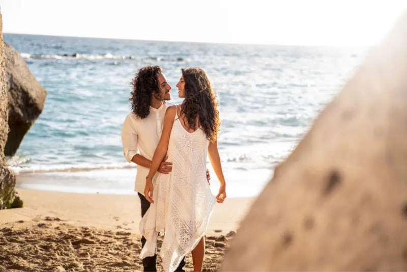
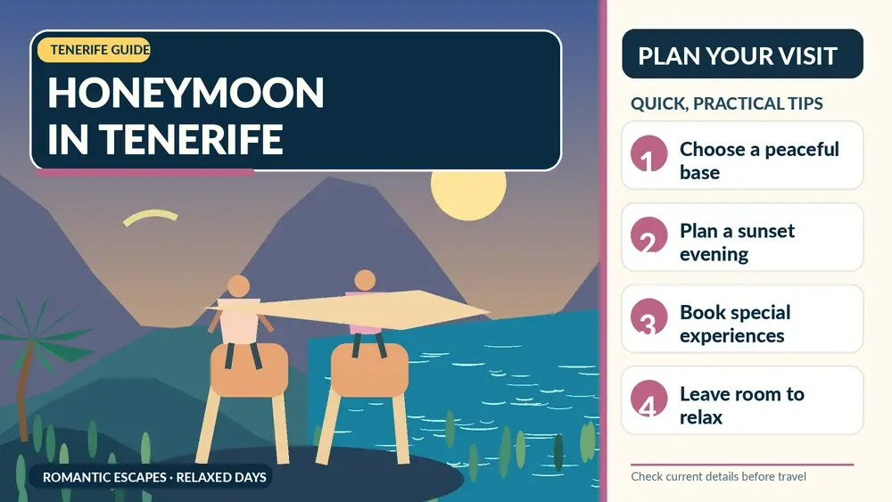
    Illustrated guide: Tenerife Honeymoon, with practical visitor tips
    Illustrated guide: Tenerife Honeymoon.

    Once the mood is clear, hotel comparison becomes much easier. I prioritise room privacy, balcony or terrace, noise level, pool style and walking access to dinner. A honeymoon suite is less valuable if the property’s location forces a taxi every evening for the experiences we actually want.

    A honeymoon needs empty time

    I would never schedule Tenerife as a checklist of attractions from 08:00 to 20:00 every day. The island has enough variety that it is tempting to do Teide, Anaga, Masca, whale watching and La Gomera in one week. That can turn a honeymoon into a logistics exercise.

    My preferred rhythm alternates a bigger experience with a slower day. After Teide and stargazing, I keep the next morning relaxed. After a boat trip, I leave the evening flexible. This gives weather-dependent activities room to move and makes the expensive hotel or villa part of the holiday rather than only a place to sleep.

    The romantic experiences that feel specifically Tenerife

    Sunset with La Gomera on the horizon, high-altitude stargazing near Teide, a quiet dinner in La Caleta, a walk through La Orotava, a boat trip to see cetaceans responsibly, and a drive through volcanic landscapes all feel tied to the island. I choose these over generic ‘romance packages’ that could happen anywhere.

    I also like one food-focused experience: a wine tasting, a special Canarian dinner or a market-and-village day. Shared memories become more distinctive when the place itself is part of them.

    South versus north for couples

    The south is easier for reliable sun, resort facilities and ocean-facing evenings. The north is greener, more atmospheric and often better for historic-town wandering. A split stay can work well on a 7- to 10-night honeymoon: four or five nights in the south and two or three in the north, or the reverse depending on priorities.

    Couple On Holiday In Tenerife

    I would not split a short four-night trip. Packing and transfer time can consume the benefit. For a short honeymoon, I choose one base and use a private tour or rental car for the other side of the island.

    How much should I pre-book?

    I reserve the room, any high-demand Teide access or premium tour, and one or two important dinners. I leave the rest open. Weather can alter mountain plans, and couples often discover they want more pool or beach time than expected after the wedding period.

    I also check cancellation terms carefully. Honeymoon trips often involve more expensive rooms and experiences, so flexible conditions can be worth paying a little more for.

    Small details that improve the trip more than expensive upgrades

    A well-timed airport transfer, a room away from nightlife, one sunset dinner booked for the right time, a late checkout if the flight is evening, and a realistic driving day can improve the honeymoon more than a decorative package in the room.

    I tell the hotel it is a honeymoon, but I never plan around promised freebies. If an upgrade appears, it is a bonus. I book the room category I would be happy to keep.

    Useful related guides already on this site

    I would plan this topic together with Tenerife for Couples, Costa Adeje Travel Guide, Stargazing in Tenerife. For a broader second layer, I also use Whale Watching in Tenerife. Those pages cover the transport, location or activity details that would make this article unnecessarily repetitive.

    How I turn this advice into an actual trip

    I start with the parts that are difficult to change: airport, accommodation area, any permit or reservation, and the days that depend on weather. Then I place planning a Tenerife honeymoon that balances romantic downtime with the island’s landscapes inside that framework instead of allowing one concern to dominate the whole holiday. Tenerife is compact, but mountain roads, microclimates and busy resort zones make over-planning surprisingly easy.

    I keep one flexible half-day in every week. If Teide is cloudy, a trail closes, the sea is rough or a restaurant cannot accommodate what I need, I want a backup that still feels worthwhile. Santa Cruz, La Laguna, Puerto de la Cruz, local markets, museums and coastal promenades can all work as alternatives depending on the base.

    Couple At Teide Volcano Crater Tenerife

    Choosing where to stay

    Location often solves more problems than an extra hotel star. The south gives the widest resort infrastructure and generally drier coastal weather; the north gives greener landscapes and easier access to many historic towns; Santa Cruz and La Laguna work well for urban travellers. I compare current accommodation on Booking.com, checking the exact map position rather than relying on the destination name.

    I read recent reviews for the detail that matters to this specific trip: parking, dietary handling, pet policy, noise, accessibility, kitchen facilities or transfer convenience. A high average score does not answer those questions.

    Practical habits I use on Tenerife

    I save official pages offline or bookmark them before a mountain or rural day. Mobile coverage is generally good in populated areas, but I do not want a rule, reservation or trail map to depend on perfect reception. I also carry water, sun protection and a light layer because the island can change temperature quickly with altitude.

    I avoid building a schedule around exact driving times from a map. Parking, viewpoints, buses, roadworks and slow mountain traffic can add time. If I have a fixed booking, I arrive early and make the stop before it optional rather than after it.

    How I handle information that changes

    Travel blogs are good for explaining choices; they are not the final authority for a current permit, temporary closure, health notice, hotel inclusion or municipal rule. I use the official source linked below close to the travel date and follow on-site instructions. This is especially important for protected natural areas, water, animals, dietary safety and camping.

    I also distinguish between a documented rule and my own preference. When I recommend a route, base or meal strategy, that is planning advice. When I state that a reservation is required or a facility has specific services, that should come from the current official information.

    Activities and tours

    I use organised tours selectively—mainly when they solve transport, permits, guiding or a safety/logistics problem. I compare current options below, but I do not book an excursion simply to fill every day.

    Frequently asked questions

    Is Tenerife good for a honeymoon?

    Yes. It combines resort comfort with Teide, volcanic coast, historic towns, whale watching, food and year-round mild coastal weather.

    Which area is most romantic?

    Costa Adeje and La Caleta are easy for polished beach-and-dining stays; Guía de Isora suits privacy, while Garachico and Puerto de la Cruz offer a more historic northern atmosphere.

    Should we split the honeymoon between north and south?

    For 7–10 nights it can work well. For a shorter stay, one base plus day trips is usually more relaxing.

    What should we book early?

    Book the accommodation, any permit- or capacity-limited Teide plans, premium boat/private tours and the few dinners that really matter to you.

    Official information to check before travelling

    For the current rules or background used in this article, I check the relevant official Tenerife or Canary Islands information. I would recheck it close to departure because access conditions, hotel products, local regulations and public notices can change after an article is published.

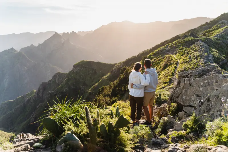
    Couple Exploring Tenerife

    Final thoughts

    Tenerife Honeymoon Guide is most useful when it helps me make a few better decisions rather than adding another layer of complexity. Tenerife rewards flexible planning: choose the right base, respect current local rules, give mountain and ocean conditions room to change, and leave enough unscheduled time to enjoy the island rather than only manage it.

    That is the approach I would use for planning a Tenerife honeymoon that balances romantic downtime with the island’s landscapes: verify the facts that matter, keep the itinerary realistic and let the rest of the holiday stay pleasantly adaptable.

  • Tenerife Road Trip Guide: Best Driving Loops, Scenic Roads and 7-Day Plan

    Tenerife Road Trip Guide: Best Driving Loops, Scenic Roads and 7-Day Plan

    Tenerife Road Trip Guide is the kind of practical Tenerife topic that can change the shape of an entire trip. I prefer to make the key decisions before arrival, then keep the daily plan flexible enough for weather, local rules and the way the island actually feels once I am there.

    This guide separates stable planning advice from details that can change. Where rules, access or services matter, I rely on official Tenerife or Canary Islands information and recommend checking again shortly before travel. I do not invent opening hours, prices or permissions when the current source does not guarantee them.

    At a glance

    TopicPlanning a road trip around tenerife without spending the holiday inside the car
    Best planning approachDecide the non-negotiables early, verify current rules, and leave room for Tenerife’s microclimates and local conditions.
    Who this guide helpsFirst-time visitors, repeat travellers and anyone whose accommodation, food, transport or trip style depends on this topic.
    My ruleUse official information for rules and safety; use travel advice for route order, convenience and trade-offs.

    What current official information confirms

    • Turismo de Tenerife publishes official driving routes for different stay lengths, including 1-day, 3-day and 8-day ideas.
    • Official route themes include Teide, Isla Baja, wine country, La Laguna and Anaga, the south coast and Santa Cruz.
    • The tourism board says most highlighted routes use paved roads suitable for a conventional car, while some secondary or unpaved sections may justify a more capable vehicle.
    • Teide can be approached by several roads from north, south and west, making loop itineraries possible instead of repeating the same road.
    • Tenerife’s microclimates mean a road trip can cross sunny coast, cloud forest and high-altitude conditions in a single day.

    The best Tenerife road trip is a sequence of regions, not a lap of the motorway

    It is possible to drive around much of Tenerife quickly on the motorway, but that is not the road trip I recommend. The island becomes interesting when I treat Teide, Anaga, Isla Baja, the Orotava Valley and the south as distinct landscape days. Turismo de Tenerife’s own driving-route collection follows the same logic, offering themed itineraries rather than one endless coastal circuit.

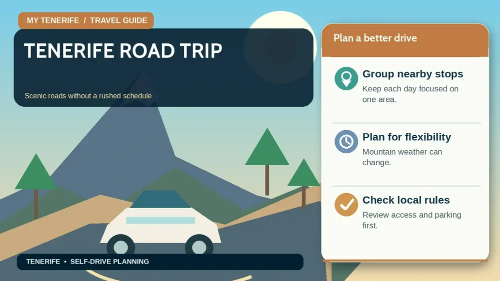
    Illustrated guide: Tenerife Road Trip, with practical visitor tips
    Illustrated guide: Tenerife Road Trip.

    I build the week so each day has a clear geographic centre. That reduces backtracking and makes it easier to stop spontaneously at viewpoints or villages. The island is compact enough to change base only once or twice, so I do not need a different hotel every night to enjoy a genuine road trip.

    My seven-day road-trip structure

    Day one is a gentle south-coast orientation after the airport. Day two is Teide via one access road and down another. Day three is the Orotava Valley and Puerto de la Cruz. Day four moves west through Icod, Garachico and Isla Baja. Day five is Teno or Masca with a conservative schedule. Day six is La Laguna and Anaga. Day seven is Santa Cruz, Candelaria or an easier coastal day depending on the departure airport.

    I deliberately leave space. A road trip becomes frustrating when every scenic stop has a reservation attached. Teide permits, cable-car times or protected trails may be fixed, but the rest of the day should absorb weather, traffic and the inevitable unplanned viewpoint.

    Teide works best as a one-way mountain crossing

    One of my favourite planning tricks is to climb toward Teide from one side and descend another. Official tourism information explicitly notes the multiple access roads. That gives a stronger sense of the island’s north-south contrast and avoids repeating scenery.

    I still check weather and road conditions before leaving. Coastal sunshine tells me little about high-altitude temperature, wind or visibility. I keep a warm layer in the car year-round and never let a tight dinner booking pressure me into descending mountain roads faster than I want.

    Anaga and Masca require a different driving mindset

    These are not days for chasing mileage. Both areas contain narrow, winding roads where buses, cyclists and local traffic need space. I choose fewer stops, use official parking where possible and turn around if a route feels uncomfortable for my vehicle or experience level.

    Green ravines and the mountain road above Masca

    In Anaga, I like combining La Laguna with Cruz del Carmen and one village or coast section rather than trying to reach every beach. Around Masca, I plan transport and parking around the specific hike or viewpoint rather than expecting to improvise in the tiny village core.

    Parking and fuel are easier when I think ahead by one stop

    I fuel before mountain days instead of waiting for a warning light in a remote area. For historic towns I aim for larger edge-of-centre parking and walk the final streets. That is usually faster than circling narrow lanes hoping for a space beside the main square.

    At beaches and viewpoints, I never create an unofficial parking space that blocks visibility, buses or emergency access. Popular locations can fill early, especially at weekends. A road trip should make the island easier to explore, not turn every stop into a parking battle.

    When I would skip the rental car altogether

    A car is not mandatory for Tenerife. If I stay mainly in Costa Adeje, Los Cristianos, Santa Cruz or Puerto de la Cruz and plan organised excursions, public transport can be more relaxing. The car becomes most valuable when I want rural villages, multiple viewpoints, flexible hiking starts or sunrise/sunset timing.

    Couple With Rental Car Tenerife

    I therefore rent for the part of the holiday that needs it. A seven-night trip can work well with four car days and three no-car days. That reduces parking stress and lets me enjoy a wine tasting, boat trip or city day without thinking about the vehicle.

    Useful related guides already on this site

    I would plan this topic together with Tenerife by Car, Tenerife 7-Day Itinerary, Mount Teide Guide. For a broader second layer, I also use Best Viewpoints in Tenerife. Those pages cover the transport, location or activity details that would make this article unnecessarily repetitive.

    How I turn this advice into an actual trip

    I start with the parts that are difficult to change: airport, accommodation area, any permit or reservation, and the days that depend on weather. Then I place planning a road trip around Tenerife without spending the holiday inside the car inside that framework instead of allowing one concern to dominate the whole holiday. Tenerife is compact, but mountain roads, microclimates and busy resort zones make over-planning surprisingly easy.

    I keep one flexible half-day in every week. If Teide is cloudy, a trail closes, the sea is rough or a restaurant cannot accommodate what I need, I want a backup that still feels worthwhile. Santa Cruz, La Laguna, Puerto de la Cruz, local markets, museums and coastal promenades can all work as alternatives depending on the base.

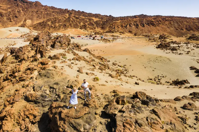
    Driving Through Teide National Park Tenerife

    Choosing where to stay

    Location often solves more problems than an extra hotel star. The south gives the widest resort infrastructure and generally drier coastal weather; the north gives greener landscapes and easier access to many historic towns; Santa Cruz and La Laguna work well for urban travellers. I compare current accommodation on Booking.com, checking the exact map position rather than relying on the destination name.

    I read recent reviews for the detail that matters to this specific trip: parking, dietary handling, pet policy, noise, accessibility, kitchen facilities or transfer convenience. A high average score does not answer those questions.

    Practical habits I use on Tenerife

    I save official pages offline or bookmark them before a mountain or rural day. Mobile coverage is generally good in populated areas, but I do not want a rule, reservation or trail map to depend on perfect reception. I also carry water, sun protection and a light layer because the island can change temperature quickly with altitude.

    I avoid building a schedule around exact driving times from a map. Parking, viewpoints, buses, roadworks and slow mountain traffic can add time. If I have a fixed booking, I arrive early and make the stop before it optional rather than after it.

    How I handle information that changes

    Travel blogs are good for explaining choices; they are not the final authority for a current permit, temporary closure, health notice, hotel inclusion or municipal rule. I use the official source linked below close to the travel date and follow on-site instructions. This is especially important for protected natural areas, water, animals, dietary safety and camping.

    I also distinguish between a documented rule and my own preference. When I recommend a route, base or meal strategy, that is planning advice. When I state that a reservation is required or a facility has specific services, that should come from the current official information.

    Activities and tours

    I use organised tours selectively—mainly when they solve transport, permits, guiding or a safety/logistics problem. I compare current options below, but I do not book an excursion simply to fill every day.

    Frequently asked questions

    How many days do I need for a Tenerife road trip?

    Seven days gives a comfortable first loop, while official tourism also publishes shorter 1- and 3-day driving ideas and longer routes.

    Do I need an SUV in Tenerife?

    Most main tourist driving routes are paved and suitable for a normal car. Choose a larger or more capable vehicle only if your specific route and rental conditions justify it.

    Can I drive up Teide from one side and down another?

    Yes. Teide has road access from multiple directions, which makes a one-way mountain crossing an excellent road-trip day.

    Is Tenerife difficult to drive?

    Motorways are straightforward, but Anaga, Masca and some village roads are narrow and winding. Drive conservatively and do not over-schedule those days.

    Official information to check before travelling

    For the current rules or background used in this article, I check the relevant official Tenerife or Canary Islands information. I would recheck it close to departure because access conditions, hotel products, local regulations and public notices can change after an article is published.

    Volcanic Road In Teide National Park Tenerife

    Final thoughts

    Tenerife Road Trip Guide is most useful when it helps me make a few better decisions rather than adding another layer of complexity. Tenerife rewards flexible planning: choose the right base, respect current local rules, give mountain and ocean conditions room to change, and leave enough unscheduled time to enjoy the island rather than only manage it.

    That is the approach I would use for planning a road trip around Tenerife without spending the holiday inside the car: verify the facts that matter, keep the itinerary realistic and let the rest of the holiday stay pleasantly adaptable.

  • Tenerife Campervan and Motorhome Guide: Campsites, Overnight Rules and Practical Tips

    Tenerife Campervan and Motorhome Guide: Campsites, Overnight Rules and Practical Tips

    Tenerife Campervan and Motorhome Guide is the kind of practical Tenerife topic that can change the shape of an entire trip. I prefer to make the key decisions before arrival, then keep the daily plan flexible enough for weather, local rules and the way the island actually feels once I am there.

    This guide separates stable planning advice from details that can change. Where rules, access or services matter, I rely on official Tenerife or Canary Islands information and recommend checking again shortly before travel. I do not invent opening hours, prices or permissions when the current source does not guarantee them.

    At a glance

    TopicTravelling around tenerife by campervan or motorhome
    Best planning approachDecide the non-negotiables early, verify current rules, and leave room for Tenerife’s microclimates and local conditions.
    Who this guide helpsFirst-time visitors, repeat travellers and anyone whose accommodation, food, transport or trip style depends on this topic.
    My ruleUse official information for rules and safety; use travel advice for route order, convenience and trade-offs.

    What current official information confirms

    • Tenerife ON is the Cabildo de Tenerife’s official platform for routes, protected natural areas, facilities, alerts and reservations.
    • Official caravan-camping areas include high-altitude sites such as Chío and Las Lajas, where advance reservation is required.
    • At Chío and Las Lajas, official information warns that water points are not suitable for drinking and that there are no black/grey-water dumping points, electric hookups or drinking-water refill stations.
    • The official campsite conditions distinguish authorised camping pitches from ordinary parking areas; at these facilities, overnight stays in the parking area are forbidden.
    • Mountain campsites can sit above 1,500 metres, so temperatures can be very different from the coast even on the same day.

    Campervan freedom is real, but “park anywhere” is the wrong mindset

    A campervan can be one of the most flexible ways to explore Tenerife, especially if I want to combine sunrise in the pine forest, a village lunch and a coastal sunset without returning to the same hotel every night. What I would not do is treat the island as an unrestricted wild-camping destination. Protected landscapes, municipal rules, road-safety rules and specific campsite conditions all matter. The practical difference between parking a vehicle and establishing a campsite is important, but the safest planning approach is to use authorised overnight facilities and check the current rules for the exact place where I intend to stay.

    Tenerife ON is the resource I keep open throughout the trip because it combines official facilities, reservations and alerts. That matters more than old forum posts or a pin on a camper app. A place that was tolerated two years ago can be regulated differently today, and a legal parking space does not automatically give me permission to put out chairs, an awning or cooking equipment.

    What the official mountain areas are actually like

    The official Chío and Las Lajas motorhome areas are not resort-style campsites. They are mountain facilities in Canary pine forest, both at roughly 1,500 metres or higher. That is part of their appeal: dark skies, forest atmosphere and immediate access to the highlands. It also means colder nights, wind and large day-to-night temperature changes. I pack for altitude even if the coast is warm enough for shorts.

    View Of Mount Teide From Pine Forest Tenerife

    I also plan around limited services. The official information for these sites states that there is no black- or grey-water disposal, no electrical charging point and no potable-water filling point. Nearby recreational areas may provide toilets, tables and other facilities, but opening times and conditions vary. I arrive self-sufficient rather than assuming a European full-service motorhome aire.

    A route that works better than circling the island every day

    For a campervan road trip, I divide Tenerife into zones. I might spend one night around the south or southwest, move through Teide or the western highlands, then continue to Isla Baja or the north. That reduces repeated motorway kilometres and lets the landscape change naturally. The island looks small on a map, but mountain roads and viewpoint stops stretch driving time considerably.

    I avoid planning Teide, Anaga and Masca in one aggressive loop. A van is larger than a normal rental car, and narrow village roads, steep gradients and limited turning space can make ambitious routing tiring. My best days are the ones with one major road segment and several small stops, not six hours of moving the vehicle.

    Waste, water and cooking are the details that decide whether the trip feels easy

    Before each overnight stop, I know where I can legally deal with fresh water and waste. I never empty tanks outside authorised facilities, and I do not assume a forest-area tap is drinking water. Tenerife ON explicitly labels non-potable water at some official camping areas, so I carry a separate drinking-water supply and refill only where potable water is confirmed.

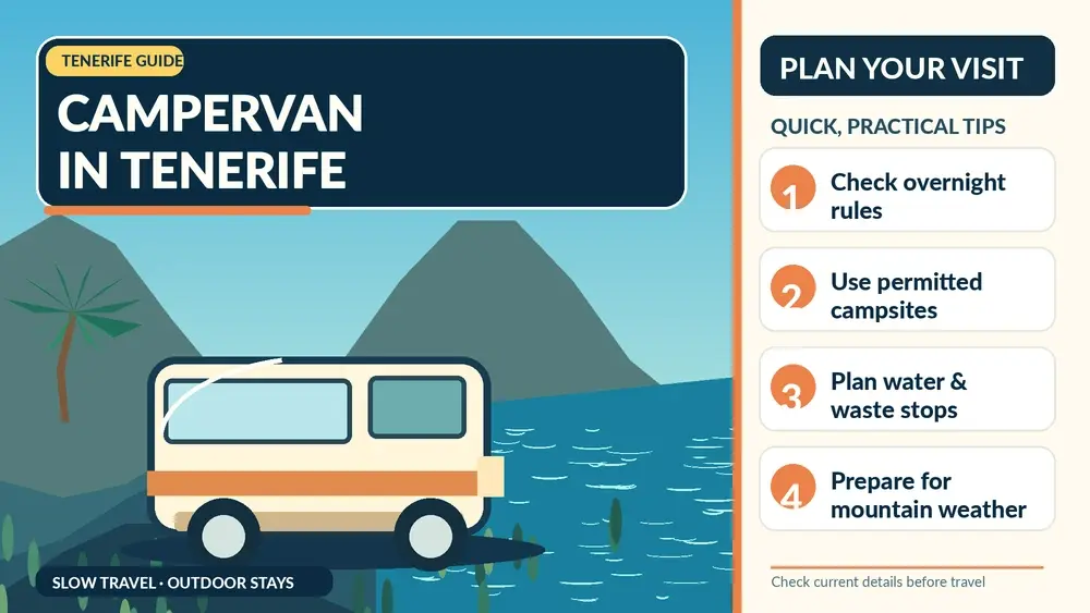
    Illustrated guide: Tenerife Campervan and Motorhome, with practical visitor tips
    Illustrated guide: Tenerife Campervan and Motorhome.

    Cooking rules can also be strict in natural areas because of wildfire risk. The official campsite conditions prohibit portable barbecues at the cited mountain areas and regulate gas use. Seasonal fire restrictions can become even tighter. I treat food preparation as a safety issue, not a lifestyle accessory, and I check current alerts before driving into forest zones.

    Where campervans are easy and where I would be cautious

    Wide coastal roads, motorway links and many rural routes are straightforward, but historic centres and mountain hamlets can be awkward in a larger vehicle. I would park outside compact centres such as Garachico, La Orotava or La Laguna and walk in. I also think twice before entering a road simply because a navigation app says it is technically possible.

    Masca and some Anaga roads demand particular concentration because of bends, buses, cyclists and limited space. If I am not comfortable with the vehicle dimensions, I use a safer parking point and public transport or walk for the final section. The goal is not to prove that the van can reach every viewpoint; it is to travel without blocking roads or turning a scenic day into a stressful one.

    My campervan checklist before each overnight stop

    I check four things: whether the overnight stay is authorised, whether a reservation is needed, whether I have enough potable water, and what the weather will do at that elevation. Then I confirm waste facilities and the next fuel stop. I also keep food sealed and the exterior tidy; wind in exposed areas can turn loose objects into litter quickly.

    Finally, I keep a conventional accommodation option in mind for one or two nights. A hotel or apartment can be useful after several days on the road, especially for laundry, a proper shower, charging equipment and a break from changing mountain weather. Campervan travel works best for me when flexibility includes the option not to sleep in the van every single night.

    Useful related guides already on this site

    I would plan this topic together with Camping in Tenerife, Tenerife by Car, Tenerife Hiking Permits and Trail Rules. For a broader second layer, I also use Chío Recreation Area. Those pages cover the transport, location or activity details that would make this article unnecessarily repetitive.

    How I turn this advice into an actual trip

    I start with the parts that are difficult to change: airport, accommodation area, any permit or reservation, and the days that depend on weather. Then I place travelling around Tenerife by campervan or motorhome inside that framework instead of allowing one concern to dominate the whole holiday. Tenerife is compact, but mountain roads, microclimates and busy resort zones make over-planning surprisingly easy.

    I keep one flexible half-day in every week. If Teide is cloudy, a trail closes, the sea is rough or a restaurant cannot accommodate what I need, I want a backup that still feels worthwhile. Santa Cruz, La Laguna, Puerto de la Cruz, local markets, museums and coastal promenades can all work as alternatives depending on the base.

    Choosing where to stay

    Location often solves more problems than an extra hotel star. The south gives the widest resort infrastructure and generally drier coastal weather; the north gives greener landscapes and easier access to many historic towns; Santa Cruz and La Laguna work well for urban travellers. I compare current accommodation on Booking.com, checking the exact map position rather than relying on the destination name.

    I read recent reviews for the detail that matters to this specific trip: parking, dietary handling, pet policy, noise, accessibility, kitchen facilities or transfer convenience. A high average score does not answer those questions.

    Practical habits I use on Tenerife

    I save official pages offline or bookmark them before a mountain or rural day. Mobile coverage is generally good in populated areas, but I do not want a rule, reservation or trail map to depend on perfect reception. I also carry water, sun protection and a light layer because the island can change temperature quickly with altitude.

    I avoid building a schedule around exact driving times from a map. Parking, viewpoints, buses, roadworks and slow mountain traffic can add time. If I have a fixed booking, I arrive early and make the stop before it optional rather than after it.

    How I handle information that changes

    Travel blogs are good for explaining choices; they are not the final authority for a current permit, temporary closure, health notice, hotel inclusion or municipal rule. I use the official source linked below close to the travel date and follow on-site instructions. This is especially important for protected natural areas, water, animals, dietary safety and camping.

    I also distinguish between a documented rule and my own preference. When I recommend a route, base or meal strategy, that is planning advice. When I state that a reservation is required or a facility has specific services, that should come from the current official information.

    Activities and tours

    I use organised tours selectively—mainly when they solve transport, permits, guiding or a safety/logistics problem. I compare current options below, but I do not book an excursion simply to fill every day.

    Frequently asked questions

    Can I wild camp anywhere in Tenerife?

    No. Do not assume roadside parking or a scenic pull-off allows camping or an overnight stay. Use official facilities and check current local and protected-area rules.

    Do official motorhome areas need booking?

    Some official Tenerife ON caravan-camping areas require an advance reservation; the current facility page is the place to check.

    Do Chío and Las Lajas have electric hookups and waste dumping?

    Their official facility pages state that they do not provide electrical charging or black/grey-water disposal.

    Is a campervan practical for Teide?

    It can be, but altitude, wind, temperature changes and vehicle size matter. Plan conservative routes and check alerts before entering mountain areas.

    Official information to check before travelling

    For the current rules or background used in this article, I check the relevant official Tenerife or Canary Islands information. I would recheck it close to departure because access conditions, hotel products, local regulations and public notices can change after an article is published.

    Final thoughts

    Tenerife Campervan and Motorhome Guide is most useful when it helps me make a few better decisions rather than adding another layer of complexity. Tenerife rewards flexible planning: choose the right base, respect current local rules, give mountain and ocean conditions room to change, and leave enough unscheduled time to enjoy the island rather than only manage it.

    That is the approach I would use for travelling around Tenerife by campervan or motorhome: verify the facts that matter, keep the itinerary realistic and let the rest of the holiday stay pleasantly adaptable.

  • Mirador de El Guincho Guide: Garachico Coast, Roque Views and Accessible Lookout

    Mirador de El Guincho Guide: Garachico Coast, Roque Views and Accessible Lookout

    Mirador de El Guincho is a useful stop for travellers who want to understand Tenerife beyond beaches and headline attractions. I would not cross the whole island only for this one place, but I would absolutely use it to add historical and local context to a day in Garachico.

    In this guide I separate documented facts from practical planning. Dates, dimensions, artistic details and historical associations come from official tourism or municipal heritage sources. My suggestions about timing, route order, photography and combinations are travel-planning advice. I avoid inventing fixed opening hours, prices or guaranteed access when current official information is uncertain.

    At a glance

    PlaceMirador de El Guincho
    WhereEl Guincho, Garachico, Tenerife
    Best forpanoramic photography, Garachico orientation and an easy roadside viewpoint
    Time to allow15–30 minutes
    Planning ruleCombine it with nearby sights, verify current access and keep the route flexible.

    Why I would include Mirador de El Guincho in a Tenerife itinerary

    One of the easiest mistakes on Tenerife is to jump from one major attraction to another without understanding the towns between them. Places like Mirador de El Guincho slow the trip down in a useful way. They show how local history, religion, trade, architecture, geology or landscape developed at the level of an individual community.

    I also value stops that work inside a compact cluster. In Garachico, I can usually combine several worthwhile places without repeated driving. That gives me more time to notice details, stop for coffee, change plans if access is closed and still finish the day without feeling that I have been chasing a checklist.

    My rule is simple: a small site earns its place when it helps explain the destination. I would rather spend thirty attentive minutes somewhere meaningful than add three generic viewpoints just to increase the number of stops.

    What the official record confirms

    • The viewpoint looks toward Garachico, its rugged coast, the Roque, El Guincho cliffs and the newer marina and fishing port.
    • Looking in the opposite direction reveals abandoned agricultural terraces from earlier cultivation.
    • Official tourism information lists parking and a nearby bus stop.
    • The official page also lists disabled access and an interpretation panel or table.

    Why El Guincho gives a different Garachico view

    Many travellers see Garachico from viewpoints directly above the old town, but El Guincho shifts the angle along the coast. The official viewpoint description highlights the Roque in the foreground, the cliff line, the modern marina and fishing port, and the broader town beyond. That lateral perspective is useful because it shows how Garachico occupies a narrow volcanic coastal shelf rather than appearing as a flat cluster of roofs from above.

    I would stop here either before entering the town, to understand the geography, or after visiting, to recognise places I have just walked. The view is especially good for comparing the old historic core with newer coastal infrastructure. It is less about a dramatic Teide panorama and more about reading the relationship between settlement, cliff and Atlantic.

    The abandoned terraces tell the inland half of the story

    Looking the other way, the viewpoint reveals old terraces that once supported cultivation. I think this side is easy to ignore because the eye naturally goes to the sea, but it helps explain why north-Tenerife communities were never purely maritime. Agriculture occupied steep slopes wherever people could create usable land, and terrace walls record that effort long after fields stop being actively worked.

    For a travel article, this is one of those small details that improves the whole route. After seeing the terraces, I notice agricultural traces more readily around Isla Baja and the lower slopes. The viewpoint becomes more than a photo stop because it connects coastal trade with the land that helped feed and support the communities behind it.

    Accessibility and practical value

    Turismo de Tenerife lists parking, a bus stop, disabled access and an interpretation panel at the viewpoint. Those facilities make El Guincho easier to recommend to mixed groups than many natural overlooks that require uneven paths. I still check the exact condition on the day, because roadworks, maintenance or temporary closures can affect access, and I never block traffic for a photograph if designated parking is full.

    The stop is short enough to combine with almost any Garachico day. I would not build a whole itinerary around it, but as an orientation point it adds value disproportionate to the time required. On a clear afternoon, the coast can be especially photogenic; in low cloud, the closer views of cliffs and terraces can still be worthwhile.

    What to combine with it nearby

    I would build the visit around nearby pages already covered on this site rather than create an isolated detour. Good combinations include Mirador de Garachico, El Caletón, PR-TF 43 Garachico–Chinyero. For a broader planning option, I also keep Isla Baja guide in the same cluster.

    Aerial View Of Garachico Tenerife

    How I plan the visit

    I start by deciding whether Mirador de El Guincho is the anchor of the outing or a supporting stop. For a small heritage or nature site, the second option is usually better. I allow enough time to read information, look at details and take a few photographs, but I do not turn a short visit into half a day simply because the itinerary has empty space.

    I then check the official source shortly before travelling. Religious services, conservation work, local events, sea conditions, trail restrictions, seasonal timetables or staffing can change access. If one element is unavailable, I want the surrounding route to remain worthwhile.

    1. Start with the most time-sensitive stop, such as a museum, church interior or safe coastal window.
    2. Continue on foot to exterior heritage, public squares, paths or viewpoints.
    3. Keep lunch or coffee flexible so a delay does not break the itinerary.
    4. Leave the final stop optional, especially if traffic, weather or a local event changes the pace.

    This style of planning works particularly well in Tenerife’s northern towns. Short map distances can hide steep streets, difficult parking, wet paths or strong Atlantic conditions, while a compact regional loop often reveals much more than several rushed car stops.

    How I read the history without oversimplifying it

    Heritage sites often mix documented facts, later restoration, local tradition and popular legend. I try to keep those layers separate. A date recorded by an official heritage inventory is not the same kind of evidence as a story passed through generations, even though both can be valuable for understanding the place.

    I also avoid treating Tenerife’s colonial period as a neutral backdrop. Conquest, Indigenous Guanche history, Atlantic trade, migration, agriculture and religious institutions all shaped the island. Where one of those themes is relevant to Mirador de El Guincho, I name it directly rather than reducing the story to decorative architecture.

    What I look for on site

    Before reaching for my phone, I look at materials and relationships: volcanic stone, timber, limewashed walls, ironwork, paving, water channels, old trees, surf patterns or the way a building faces a square. These details usually tell me more than a single façade photograph.

    I also pay attention to later changes. Historic places are rarely frozen in one century. Fires, floods, new roads, restorations, changing religious use, domestic water systems and civic adaptation can all become part of the story. I find a place more interesting when I can see those layers rather than searching for an imaginary “original” version.

    Getting there and moving around

    For Garachico, I compare driving with public transport according to the rest of the day. A car is helpful when I am continuing to rural viewpoints or another municipality, but it can be inconvenient in older streets with limited parking. If I am concentrating on a historic centre or marked coastal area, I prefer to park once and walk.

    Garachico Coast Aerial View Tenerife

    TITSA serves the main towns and tourist areas of Tenerife. I check the current journey planner instead of hard-coding a bus number into an evergreen article, because routes and stops can change. Travellers with a pushchair, luggage or limited mobility should also inspect the final approach: gradients, cobbles, steps and natural rock often matter more than the intercity journey.

    Best time of day

    For architecture and street photography, morning or late afternoon usually gives softer light. For a church or museum, access arrangements matter more than the angle of the sun. For beaches, natural pools and exposed paths, tide, swell, wind and rain matter more than a fixed clock time.

    Weekends, feast days and local events can transform a quiet place into a busy community space. That can be a highlight if I want atmosphere, but it can also affect parking and access. I check local notices when travelling around major religious, municipal or coastal events.

    Practical tips that make the stop better

    Comfortable shoes are my default even for short visits. Historic paving can be uneven, north-Tenerife towns often have steeper streets than a map suggests and volcanic coastal rock can be slippery. I carry water and a light layer because cloud, breeze and sun can change quickly across short distances.

    I do not assume that a public-looking heritage building has toilets, step-free access or continuous opening. Travellers who need specific accessibility features should verify them directly with the venue or municipality. At natural sites I also check whether the final approach is suitable for the whole group.

    For churches and devotional spaces, I dress respectfully and keep noise low. For schools or working cultural sites, I follow access instructions. On beaches, pools and protected volcanic terrain, I stay within legal access and never treat calm-looking water as proof that swimming is safe.

    Photography without missing the place itself

    I take one wide establishing image, then look for details: stonework, wood, metal, inscriptions, paving, water infrastructure, vegetation or the relationship between geology and human use. That produces a more useful visual record than ten almost identical front-on photographs.

    I never assume drone use is legal simply because a place looks quiet. Tenerife has controlled airspace, protected areas and populated zones. A travel guide cannot replace current aviation rules or local restrictions.

    Where to eat and how I fit meals into the route

    I prefer eating near the area I am already exploring instead of driving across the island for a single restaurant. In Garachico, that might mean a café in the historic centre, a traditional Canarian lunch or a longer meal after the walking portion of the day. I check recent opening information because weekly closing days and kitchen hours change.

    Local food makes more sense when connected to the place: papas arrugadas, mojo, gofio, cheeses, fish and Tenerife wines all reflect agriculture, trade and everyday island life. I would rather choose a simple meal that fits the route than interrupt the day for a famous restaurant far away.

    Where to stay

    If I want to explore this part of Tenerife over more than one day, I compare current accommodation on Booking.com. I pay attention to the exact map position, parking, elevation and recent guest comments rather than relying only on the property name.

    For a first visit, I choose a base according to the majority of the itinerary. A good location saves more time over a week than staying next to one small attraction that I will visit only once.

    Activities and tours

    A heritage or nature stop can pair well with one organised experience elsewhere on the island. I use the widget below to compare current options, but I avoid stacking a long excursion immediately before or after a dense driving day.

    Who will enjoy this stop most?

    Mirador de El Guincho is best for travellers who enjoy context rather than only headline attractions. Couples and solo travellers can fold it into a slow regional day; families can use it as a short educational stop when access and terrain are suitable; repeat visitors may appreciate it because it reveals a layer of Tenerife that is easy to miss on a first trip.

    It may be less useful for someone with only a few hours on the island who is still trying to prioritise Teide, Anaga or a major beach. I would rather say that clearly than label every place a “must-see”. A good guide should help readers decide what fits their interests.

    Common mistakes I would avoid

    • Driving across Tenerife only for this single stop without combining it with the surrounding area.
    • Assuming old opening hours, trail information or sea conditions are still valid.
    • Underestimating gradients, parking limitations, wet rock or narrow historic streets.
    • Treating local legends as proven history without saying they are traditions.
    • Ignoring services, worship, school security, safety signs, closures or private boundaries because a place appears visitor-oriented.

    Frequently asked questions

    What can I see from Mirador de El Guincho?

    Garachico, the Roque, the El Guincho cliffs, the marina and fishing port, plus old agricultural terraces in the opposite direction.

    Is there parking?

    Yes. The official tourism page lists parking at the viewpoint.

    Can I reach it by bus?

    The official page lists a nearby bus stop.

    Is the viewpoint accessible?

    Turismo de Tenerife lists disabled access, though travellers with specific needs should verify current conditions before visiting.

    Official information

    For the documented background used in this guide and for any current operational information, I check the official visitor or heritage information for Mirador de El Guincho shortly before travelling. Same-day signs, staff instructions, parish notices, municipal updates, sea warnings and safety restrictions always take priority over an evergreen article.

    Garachico Coast And Natural Pools Tenerife

    Final thoughts

    I would include Mirador de El Guincho when it strengthens the story of a day in Garachico. Its value is not measured by how many hours it occupies. A short stop can be meaningful when it explains architecture, faith, trade, geology, water, landscape or everyday life.

    My preferred approach is simple: know the key facts before arriving, stay flexible about access, respect the place as part of local life and connect it with nearby sights. Done that way, it becomes one more piece of a Tenerife itinerary that feels coherent rather than crowded.

  • Ermita de San Roque Garachico Guide: 17th-Century Chapel and August Romería

    Ermita de San Roque Garachico Guide: 17th-Century Chapel and August Romería

    Ermita de San Roque is a useful stop for travellers who want to understand Tenerife beyond beaches and headline attractions. I would not cross the whole island only for this one place, but I would absolutely use it to add historical and local context to a day in Garachico.

    In this guide I separate documented facts from practical planning. Dates, dimensions, artistic details and historical associations come from official tourism or municipal heritage sources. My suggestions about timing, route order, photography and combinations are travel-planning advice. I avoid inventing fixed opening hours, prices or guaranteed access when current official information is uncertain.

    At a glance

    PlaceErmita de San Roque
    WhereCamino Real Garachico, 1, 38450 Garachico
    Best forlocal devotion, simple Canarian religious architecture and festival history
    Time to allow20–30 minutes outside festival periods
    Planning ruleCombine it with nearby sights, verify current access and keep the route flexible.

    Why I would include Ermita de San Roque in a Tenerife itinerary

    One of the easiest mistakes on Tenerife is to jump from one major attraction to another without understanding the towns between them. Places like Ermita de San Roque slow the trip down in a useful way. They show how local history, religion, trade, architecture, geology or landscape developed at the level of an individual community.

    I also value stops that work inside a compact cluster. In Garachico, I can usually combine several worthwhile places without repeated driving. That gives me more time to notice details, stop for coffee, change plans if access is closed and still finish the day without feeling that I have been chasing a checklist.

    My rule is simple: a small site earns its place when it helps explain the destination. I would rather spend thirty attentive minutes somewhere meaningful than add three generic viewpoints just to increase the number of stops.

    What the official record confirms

    • The chapel was built by the residents of Garachico at the beginning of the 17th century.
    • It stands at the entrance to the historic town.
    • The building has a simple rectangular plan and a four-sided roof.
    • Its main doorway is formed by a stone arch.

    A chapel built by the community, not a grand institutional monument

    The official description emphasises that Garachico’s residents themselves built the chapel at the beginning of the seventeenth century. That gives San Roque a different character from the town’s large convents and noble houses. Its importance comes from local devotion and continuity rather than architectural scale. For me, that makes the simple rectangular plan, hipped roof and stone entrance arch feel appropriate rather than plain.

    I would not oversell the visit as a major architectural attraction. The chapel works best when I understand why communities built small religious landmarks at entrances, crossroads and neighbourhood edges. In that context, a short stop can explain more about lived religion than a much larger church where the social story is harder to see.

    The entrance to town is part of the experience

    San Roque stands at the entrance to Garachico, which is exactly where I would expect a small devotional landmark to have a strong relationship with movement. Travellers, processions and residents approaching the town all encounter this edge differently from the central plazas. I like to imagine the chapel as a threshold rather than as an isolated object.

    That position also makes it easy to combine with a longer route. I can start here and walk into the historic centre, or visit at the end before continuing toward higher roads and viewpoints. I avoid stopping unsafely on the roadside just for a photograph; the best visit is one planned around legal parking and a short walk.

    Festival context without promising a fixed annual programme

    San Roque is one of Garachico’s strongest devotional traditions, and August festivities can transform the town with processions, music and large crowds. Because programmes, road closures and event formats vary by year, I do not hard-code a timetable into an evergreen guide. Instead, I check the municipal calendar if I am travelling in August and decide whether I want the energy of a festival day or the calm of an ordinary visit.

    For photographers and families, that choice matters. A fiesta can provide extraordinary atmosphere but also noise, heat, restricted parking and dense crowds. Outside the celebrations, the chapel is easier to appreciate architecturally. Neither version is ‘better’; they offer different ways of understanding the same local tradition.

    What to combine with it nearby

    I would build the visit around nearby pages already covered on this site rather than create an isolated detour. Good combinations include El Caletón, Mirador de Garachico, PR-TF 43 Garachico–Chinyero. For a broader planning option, I also keep Isla Baja guide in the same cluster.

    Garachico Town And Coast Tenerife

    How I plan the visit

    I start by deciding whether Ermita de San Roque is the anchor of the outing or a supporting stop. For a small heritage or nature site, the second option is usually better. I allow enough time to read information, look at details and take a few photographs, but I do not turn a short visit into half a day simply because the itinerary has empty space.

    I then check the official source shortly before travelling. Religious services, conservation work, local events, sea conditions, trail restrictions, seasonal timetables or staffing can change access. If one element is unavailable, I want the surrounding route to remain worthwhile.

    1. Start with the most time-sensitive stop, such as a museum, church interior or safe coastal window.
    2. Continue on foot to exterior heritage, public squares, paths or viewpoints.
    3. Keep lunch or coffee flexible so a delay does not break the itinerary.
    4. Leave the final stop optional, especially if traffic, weather or a local event changes the pace.

    This style of planning works particularly well in Tenerife’s northern towns. Short map distances can hide steep streets, difficult parking, wet paths or strong Atlantic conditions, while a compact regional loop often reveals much more than several rushed car stops.

    How I read the history without oversimplifying it

    Heritage sites often mix documented facts, later restoration, local tradition and popular legend. I try to keep those layers separate. A date recorded by an official heritage inventory is not the same kind of evidence as a story passed through generations, even though both can be valuable for understanding the place.

    I also avoid treating Tenerife’s colonial period as a neutral backdrop. Conquest, Indigenous Guanche history, Atlantic trade, migration, agriculture and religious institutions all shaped the island. Where one of those themes is relevant to Ermita de San Roque, I name it directly rather than reducing the story to decorative architecture.

    What I look for on site

    Before reaching for my phone, I look at materials and relationships: volcanic stone, timber, limewashed walls, ironwork, paving, water channels, old trees, surf patterns or the way a building faces a square. These details usually tell me more than a single façade photograph.

    I also pay attention to later changes. Historic places are rarely frozen in one century. Fires, floods, new roads, restorations, changing religious use, domestic water systems and civic adaptation can all become part of the story. I find a place more interesting when I can see those layers rather than searching for an imaginary “original” version.

    Getting there and moving around

    For Garachico, I compare driving with public transport according to the rest of the day. A car is helpful when I am continuing to rural viewpoints or another municipality, but it can be inconvenient in older streets with limited parking. If I am concentrating on a historic centre or marked coastal area, I prefer to park once and walk.

    Aerial View Of Garachico Tenerife

    TITSA serves the main towns and tourist areas of Tenerife. I check the current journey planner instead of hard-coding a bus number into an evergreen article, because routes and stops can change. Travellers with a pushchair, luggage or limited mobility should also inspect the final approach: gradients, cobbles, steps and natural rock often matter more than the intercity journey.

    Best time of day

    For architecture and street photography, morning or late afternoon usually gives softer light. For a church or museum, access arrangements matter more than the angle of the sun. For beaches, natural pools and exposed paths, tide, swell, wind and rain matter more than a fixed clock time.

    Weekends, feast days and local events can transform a quiet place into a busy community space. That can be a highlight if I want atmosphere, but it can also affect parking and access. I check local notices when travelling around major religious, municipal or coastal events.

    Practical tips that make the stop better

    Comfortable shoes are my default even for short visits. Historic paving can be uneven, north-Tenerife towns often have steeper streets than a map suggests and volcanic coastal rock can be slippery. I carry water and a light layer because cloud, breeze and sun can change quickly across short distances.

    I do not assume that a public-looking heritage building has toilets, step-free access or continuous opening. Travellers who need specific accessibility features should verify them directly with the venue or municipality. At natural sites I also check whether the final approach is suitable for the whole group.

    For churches and devotional spaces, I dress respectfully and keep noise low. For schools or working cultural sites, I follow access instructions. On beaches, pools and protected volcanic terrain, I stay within legal access and never treat calm-looking water as proof that swimming is safe.

    Photography without missing the place itself

    I take one wide establishing image, then look for details: stonework, wood, metal, inscriptions, paving, water infrastructure, vegetation or the relationship between geology and human use. That produces a more useful visual record than ten almost identical front-on photographs.

    I never assume drone use is legal simply because a place looks quiet. Tenerife has controlled airspace, protected areas and populated zones. A travel guide cannot replace current aviation rules or local restrictions.

    Where to eat and how I fit meals into the route

    I prefer eating near the area I am already exploring instead of driving across the island for a single restaurant. In Garachico, that might mean a café in the historic centre, a traditional Canarian lunch or a longer meal after the walking portion of the day. I check recent opening information because weekly closing days and kitchen hours change.

    Local food makes more sense when connected to the place: papas arrugadas, mojo, gofio, cheeses, fish and Tenerife wines all reflect agriculture, trade and everyday island life. I would rather choose a simple meal that fits the route than interrupt the day for a famous restaurant far away.

    Where to stay

    If I want to explore this part of Tenerife over more than one day, I compare current accommodation on Booking.com. I pay attention to the exact map position, parking, elevation and recent guest comments rather than relying only on the property name.

    For a first visit, I choose a base according to the majority of the itinerary. A good location saves more time over a week than staying next to one small attraction that I will visit only once.

    Activities and tours

    A heritage or nature stop can pair well with one organised experience elsewhere on the island. I use the widget below to compare current options, but I avoid stacking a long excursion immediately before or after a dense driving day.

    Who will enjoy this stop most?

    Ermita de San Roque is best for travellers who enjoy context rather than only headline attractions. Couples and solo travellers can fold it into a slow regional day; families can use it as a short educational stop when access and terrain are suitable; repeat visitors may appreciate it because it reveals a layer of Tenerife that is easy to miss on a first trip.

    It may be less useful for someone with only a few hours on the island who is still trying to prioritise Teide, Anaga or a major beach. I would rather say that clearly than label every place a “must-see”. A good guide should help readers decide what fits their interests.

    Common mistakes I would avoid

    • Driving across Tenerife only for this single stop without combining it with the surrounding area.
    • Assuming old opening hours, trail information or sea conditions are still valid.
    • Underestimating gradients, parking limitations, wet rock or narrow historic streets.
    • Treating local legends as proven history without saying they are traditions.
    • Ignoring services, worship, school security, safety signs, closures or private boundaries because a place appears visitor-oriented.

    Frequently asked questions

    When was Ermita de San Roque built?

    Official tourism information places its construction at the beginning of the 17th century.

    Who built it?

    The official page says it was built by the residents of Garachico.

    What does the building look like?

    It has a rectangular plan, a four-sided roof and a stone arch at the main entrance.

    When is San Roque celebrated?

    Garachico is well known for San Roque festivities in August, but exact annual programmes should be checked with the municipality.

    Official information

    For the documented background used in this guide and for any current operational information, I check the official visitor or heritage information for Ermita de San Roque shortly before travelling. Same-day signs, staff instructions, parish notices, municipal updates, sea warnings and safety restrictions always take priority over an evergreen article.

    Garachico Coast Aerial View Tenerife

    Final thoughts

    I would include Ermita de San Roque when it strengthens the story of a day in Garachico. Its value is not measured by how many hours it occupies. A short stop can be meaningful when it explains architecture, faith, trade, geology, water, landscape or everyday life.

    My preferred approach is simple: know the key facts before arriving, stay flexible about access, respect the place as part of local life and connect it with nearby sights. Done that way, it becomes one more piece of a Tenerife itinerary that feels coherent rather than crowded.

  • Santo Domingo Dominican Convent Garachico Guide: Seven Balconies, Museum and Auditorium

    Santo Domingo Dominican Convent Garachico Guide: Seven Balconies, Museum and Auditorium

    Convento Dominico de Santo Domingo is a useful stop for travellers who want to understand Tenerife beyond beaches and headline attractions. I would not cross the whole island only for this one place, but I would absolutely use it to add historical and local context to a day in Garachico.

    In this guide I separate documented facts from practical planning. Dates, dimensions, artistic details and historical associations come from official tourism or municipal heritage sources. My suggestions about timing, route order, photography and combinations are travel-planning advice. I avoid inventing fixed opening hours, prices or guaranteed access when current official information is uncertain.

    At a glance

    PlaceConvento Dominico de Santo Domingo
    WhereSanto Domingo, 1, 38450 Garachico
    Best forarchitecture, adaptive reuse, culture and the 1706 eruption story
    Time to allow30–60 minutes depending on current museum or event access
    Planning ruleCombine it with nearby sights, verify current access and keep the route flexible.

    Why I would include Convento Dominico de Santo Domingo in a Tenerife itinerary

    One of the easiest mistakes on Tenerife is to jump from one major attraction to another without understanding the towns between them. Places like Convento Dominico de Santo Domingo slow the trip down in a useful way. They show how local history, religion, trade, architecture, geology or landscape developed at the level of an individual community.

    I also value stops that work inside a compact cluster. In Garachico, I can usually combine several worthwhile places without repeated driving. That gives me more time to notice details, stop for coffee, change plans if access is closed and still finish the day without feeling that I have been chasing a checklist.

    My rule is simple: a small site earns its place when it helps explain the destination. I would rather spend thirty attentive minutes somewhere meaningful than add three generic viewpoints just to increase the number of stops.

    What the official record confirms

    • The convent’s location allowed it to escape the destruction of Garachico’s 1706 eruption.
    • Its historic façade retains seven balconies.
    • The complex now includes a residence for older people, a contemporary-art museum and the Municipal Auditorium.
    • Its current functions show how a historic religious building has been adapted to civic and cultural uses.

    Seven balconies and a lucky position in 1706

    The feature most visitors can appreciate immediately is the façade with seven balconies. Official tourism information also explains that the convent’s location kept it out of the path of the 1706 eruption. That makes the building useful for understanding the geography of the disaster. Lava did not affect every street equally, and surviving structures help reveal which parts of town escaped the most destructive flows.

    I would compare its position with the lower waterfront and old-port zone rather than think of survival as pure chance. A viewpoint before or after the visit makes the topography clearer. Garachico’s steep setting means small differences in elevation and route can have major historical consequences, and the convent is a good example of how landscape shaped what remains today.

    From Dominican convent to a mixed civic complex

    What I find most interesting now is the range of current uses. Turismo de Tenerife lists a residence for older people, a contemporary-art museum and the Municipal Auditorium within the complex. A building created for one religious institution has therefore become several kinds of social and cultural space. That is a strong example of adaptive reuse rather than heritage preserved only as a static monument.

    Because different parts of the complex may have different access rules, I check the current programme before visiting. An exhibition or concert can make the stop more rewarding, but I do not assume the whole convent is open whenever one cultural facility is operating. Respect for residents and working spaces matters more than completing a checklist of interiors.

    How I use the convent to balance a Garachico itinerary

    After several houses and churches, a functioning cultural complex changes the rhythm of the day. I would schedule Santo Domingo around any exhibition or event that genuinely interests me, then walk toward the central squares and coast. If there is no event, I still use the façade and surroundings as a historical stop on the route.

    I also like pairing this convent with the Conceptionist convent because their survival stories differ. One is highlighted for its position outside the main 1706 destruction; the other endured lava proximity, fire and sea damage. Together they prevent me from telling Garachico’s history as a single simple before-and-after narrative.

    What to combine with it nearby

    I would build the visit around nearby pages already covered on this site rather than create an isolated detour. Good combinations include Mirador de Garachico, El Caletón, Franciscan Conceptionist Convent. For a broader planning option, I also keep Isla Baja guide in the same cluster.

    How I plan the visit

    I start by deciding whether Convento Dominico de Santo Domingo is the anchor of the outing or a supporting stop. For a small heritage or nature site, the second option is usually better. I allow enough time to read information, look at details and take a few photographs, but I do not turn a short visit into half a day simply because the itinerary has empty space.

    I then check the official source shortly before travelling. Religious services, conservation work, local events, sea conditions, trail restrictions, seasonal timetables or staffing can change access. If one element is unavailable, I want the surrounding route to remain worthwhile.

    1. Start with the most time-sensitive stop, such as a museum, church interior or safe coastal window.
    2. Continue on foot to exterior heritage, public squares, paths or viewpoints.
    3. Keep lunch or coffee flexible so a delay does not break the itinerary.
    4. Leave the final stop optional, especially if traffic, weather or a local event changes the pace.

    This style of planning works particularly well in Tenerife’s northern towns. Short map distances can hide steep streets, difficult parking, wet paths or strong Atlantic conditions, while a compact regional loop often reveals much more than several rushed car stops.

    How I read the history without oversimplifying it

    Heritage sites often mix documented facts, later restoration, local tradition and popular legend. I try to keep those layers separate. A date recorded by an official heritage inventory is not the same kind of evidence as a story passed through generations, even though both can be valuable for understanding the place.

    I also avoid treating Tenerife’s colonial period as a neutral backdrop. Conquest, Indigenous Guanche history, Atlantic trade, migration, agriculture and religious institutions all shaped the island. Where one of those themes is relevant to Convento Dominico de Santo Domingo, I name it directly rather than reducing the story to decorative architecture.

    What I look for on site

    Before reaching for my phone, I look at materials and relationships: volcanic stone, timber, limewashed walls, ironwork, paving, water channels, old trees, surf patterns or the way a building faces a square. These details usually tell me more than a single façade photograph.

    I also pay attention to later changes. Historic places are rarely frozen in one century. Fires, floods, new roads, restorations, changing religious use, domestic water systems and civic adaptation can all become part of the story. I find a place more interesting when I can see those layers rather than searching for an imaginary “original” version.

    Getting there and moving around

    For Garachico, I compare driving with public transport according to the rest of the day. A car is helpful when I am continuing to rural viewpoints or another municipality, but it can be inconvenient in older streets with limited parking. If I am concentrating on a historic centre or marked coastal area, I prefer to park once and walk.

    Garachico Historic Town Tenerife

    TITSA serves the main towns and tourist areas of Tenerife. I check the current journey planner instead of hard-coding a bus number into an evergreen article, because routes and stops can change. Travellers with a pushchair, luggage or limited mobility should also inspect the final approach: gradients, cobbles, steps and natural rock often matter more than the intercity journey.

    Best time of day

    For architecture and street photography, morning or late afternoon usually gives softer light. For a church or museum, access arrangements matter more than the angle of the sun. For beaches, natural pools and exposed paths, tide, swell, wind and rain matter more than a fixed clock time.

    Weekends, feast days and local events can transform a quiet place into a busy community space. That can be a highlight if I want atmosphere, but it can also affect parking and access. I check local notices when travelling around major religious, municipal or coastal events.

    Practical tips that make the stop better

    Comfortable shoes are my default even for short visits. Historic paving can be uneven, north-Tenerife towns often have steeper streets than a map suggests and volcanic coastal rock can be slippery. I carry water and a light layer because cloud, breeze and sun can change quickly across short distances.

    I do not assume that a public-looking heritage building has toilets, step-free access or continuous opening. Travellers who need specific accessibility features should verify them directly with the venue or municipality. At natural sites I also check whether the final approach is suitable for the whole group.

    For churches and devotional spaces, I dress respectfully and keep noise low. For schools or working cultural sites, I follow access instructions. On beaches, pools and protected volcanic terrain, I stay within legal access and never treat calm-looking water as proof that swimming is safe.

    Photography without missing the place itself

    I take one wide establishing image, then look for details: stonework, wood, metal, inscriptions, paving, water infrastructure, vegetation or the relationship between geology and human use. That produces a more useful visual record than ten almost identical front-on photographs.

    I never assume drone use is legal simply because a place looks quiet. Tenerife has controlled airspace, protected areas and populated zones. A travel guide cannot replace current aviation rules or local restrictions.

    Where to eat and how I fit meals into the route

    I prefer eating near the area I am already exploring instead of driving across the island for a single restaurant. In Garachico, that might mean a café in the historic centre, a traditional Canarian lunch or a longer meal after the walking portion of the day. I check recent opening information because weekly closing days and kitchen hours change.

    Garachico Town And Coast Tenerife

    Local food makes more sense when connected to the place: papas arrugadas, mojo, gofio, cheeses, fish and Tenerife wines all reflect agriculture, trade and everyday island life. I would rather choose a simple meal that fits the route than interrupt the day for a famous restaurant far away.

    Where to stay

    If I want to explore this part of Tenerife over more than one day, I compare current accommodation on Booking.com. I pay attention to the exact map position, parking, elevation and recent guest comments rather than relying only on the property name.

    For a first visit, I choose a base according to the majority of the itinerary. A good location saves more time over a week than staying next to one small attraction that I will visit only once.

    Activities and tours

    A heritage or nature stop can pair well with one organised experience elsewhere on the island. I use the widget below to compare current options, but I avoid stacking a long excursion immediately before or after a dense driving day.

    Who will enjoy this stop most?

    Convento Dominico de Santo Domingo is best for travellers who enjoy context rather than only headline attractions. Couples and solo travellers can fold it into a slow regional day; families can use it as a short educational stop when access and terrain are suitable; repeat visitors may appreciate it because it reveals a layer of Tenerife that is easy to miss on a first trip.

    It may be less useful for someone with only a few hours on the island who is still trying to prioritise Teide, Anaga or a major beach. I would rather say that clearly than label every place a “must-see”. A good guide should help readers decide what fits their interests.

    Common mistakes I would avoid

    • Driving across Tenerife only for this single stop without combining it with the surrounding area.
    • Assuming old opening hours, trail information or sea conditions are still valid.
    • Underestimating gradients, parking limitations, wet rock or narrow historic streets.
    • Treating local legends as proven history without saying they are traditions.
    • Ignoring services, worship, school security, safety signs, closures or private boundaries because a place appears visitor-oriented.

    Frequently asked questions

    Did Santo Domingo survive the 1706 eruption?

    Yes. The official tourism page says its location meant it was saved from the eruption.

    What is special about the façade?

    It retains a distinctive row of seven balconies.

    What is the building used for now?

    Official information lists a residence for older people, a contemporary-art museum and the Municipal Auditorium.

    Should I check an events calendar?

    Yes. Museum access and auditorium programming can change, so current municipal information is useful before visiting.

    Official information

    For the documented background used in this guide and for any current operational information, I check the official visitor or heritage information for Convento Dominico de Santo Domingo shortly before travelling. Same-day signs, staff instructions, parish notices, municipal updates, sea warnings and safety restrictions always take priority over an evergreen article.

    Aerial View Of Garachico Tenerife

    Final thoughts

    I would include Convento Dominico de Santo Domingo when it strengthens the story of a day in Garachico. Its value is not measured by how many hours it occupies. A short stop can be meaningful when it explains architecture, faith, trade, geology, water, landscape or everyday life.

    My preferred approach is simple: know the key facts before arriving, stay flexible about access, respect the place as part of local life and connect it with nearby sights. Done that way, it becomes one more piece of a Tenerife itinerary that feels coherent rather than crowded.

  • Franciscan Conceptionist Convent Garachico Guide: 1643 Cloister, Lava and Storm Survival

    Franciscan Conceptionist Convent Garachico Guide: 1643 Cloister, Lava and Storm Survival

    Convento de Concepcionistas Franciscanas is a useful stop for travellers who want to understand Tenerife beyond beaches and headline attractions. I would not cross the whole island only for this one place, but I would absolutely use it to add historical and local context to a day in Garachico.

    In this guide I separate documented facts from practical planning. Dates, dimensions, artistic details and historical associations come from official tourism or municipal heritage sources. My suggestions about timing, route order, photography and combinations are travel-planning advice. I avoid inventing fixed opening hours, prices or guaranteed access when current official information is uncertain.

    At a glance

    PlaceConvento de Concepcionistas Franciscanas
    WhereCalle San Diego, 15, 38450 Garachico
    Best forreligious history, disaster-and-recovery stories and historic architecture
    Time to allow20–40 minutes from the exterior and any currently accessible areas
    Planning ruleCombine it with nearby sights, verify current access and keep the route flexible.

    Why I would include Convento de Concepcionistas Franciscanas in a Tenerife itinerary

    One of the easiest mistakes on Tenerife is to jump from one major attraction to another without understanding the towns between them. Places like Convento de Concepcionistas Franciscanas slow the trip down in a useful way. They show how local history, religion, trade, architecture, geology or landscape developed at the level of an individual community.

    I also value stops that work inside a compact cluster. In Garachico, I can usually combine several worthwhile places without repeated driving. That gives me more time to notice details, stop for coffee, change plans if access is closed and still finish the day without feeling that I have been chasing a checklist.

    My rule is simple: a small site earns its place when it helps explain the destination. I would rather spend thirty attentive minutes somewhere meaningful than add three generic viewpoints just to increase the number of stops.

    What the official record confirms

    • The cloistered religious community began life in the building in 1643.
    • The convent endured the nearby lava flow of 1706, a fire three years later and destructive sea action in 1856.
    • Official tourism information describes it as the only convent that still survives in Garachico.
    • The sober white façade has a stone entrance and heraldic details; the surviving small chapel contains an altarpiece with an image of Nuestra Señora de la Concepción.

    A survival story that goes far beyond the 1706 eruption

    Garachico’s eruption dominates most summaries of the town, but the Conceptionist convent reminds me that disaster came in several forms. The community began cloistered life here in 1643. The building later faced the proximity of the 1706 lava flow, then a fire only three years later, and destructive sea action in 1856. Official tourism material identifies it as the only convent still surviving in Garachico. That sequence makes the building one of the clearest places to discuss long-term resilience rather than a single dramatic event.

    I am careful with the word ‘survived’. It does not mean nothing changed. Buildings that pass through fires, eruptions, storms and centuries of use are repaired and adapted. The value lies precisely in those layers. When I visit, I try to imagine how each episode altered the relationship between the convent, the town and the coastline.

    What to notice in the restrained exterior and chapel

    The façade is described as sober and white, with a stone doorway and heraldic elements. That restraint suits a cloistered institution and creates a strong contrast with more decorative noble houses nearby. I would look closely at the entrance stonework, the rhythm of openings and how little the façade reveals about the enclosed life behind it.

    The small surviving chapel is presided over by an altarpiece with an image of Nuestra Señora de la Concepción. Interior access may depend on current religious use, so I never promise that a visitor can simply walk in. If the chapel is closed, the exterior and documented history still make the stop worthwhile as part of a route connecting Garachico’s religious houses with its civic and commercial heritage.

    How I connect the convent to women’s history in Garachico

    Religious heritage is often narrated through founders, bishops or architecture, while the women who inhabited convents become almost invisible. Here, the fact that a cloistered female community began in 1643 should remain central. The nearby Casa del Marqués de la Quinta Roja also appears in the official record as temporary accommodation for Franciscan nuns, which gives a second point from which to discuss how the community navigated changing circumstances.

    I would use those connections to make the route more human. Instead of seeing the convent only as a photogenic façade, I think about enclosed religious life, labour, prayer, crisis and institutional continuity. That is a richer travel experience and avoids reducing historic Garachico to architecture without people.

    What to combine with it nearby

    I would build the visit around nearby pages already covered on this site rather than create an isolated detour. Good combinations include El Caletón, Mirador de Garachico, Casa del Marqués de la Quinta Roja. For a broader planning option, I also keep Isla Baja guide in the same cluster.

    How I plan the visit

    I start by deciding whether Convento de Concepcionistas Franciscanas is the anchor of the outing or a supporting stop. For a small heritage or nature site, the second option is usually better. I allow enough time to read information, look at details and take a few photographs, but I do not turn a short visit into half a day simply because the itinerary has empty space.

    I then check the official source shortly before travelling. Religious services, conservation work, local events, sea conditions, trail restrictions, seasonal timetables or staffing can change access. If one element is unavailable, I want the surrounding route to remain worthwhile.

    1. Start with the most time-sensitive stop, such as a museum, church interior or safe coastal window.
    2. Continue on foot to exterior heritage, public squares, paths or viewpoints.
    3. Keep lunch or coffee flexible so a delay does not break the itinerary.
    4. Leave the final stop optional, especially if traffic, weather or a local event changes the pace.

    This style of planning works particularly well in Tenerife’s northern towns. Short map distances can hide steep streets, difficult parking, wet paths or strong Atlantic conditions, while a compact regional loop often reveals much more than several rushed car stops.

    How I read the history without oversimplifying it

    Heritage sites often mix documented facts, later restoration, local tradition and popular legend. I try to keep those layers separate. A date recorded by an official heritage inventory is not the same kind of evidence as a story passed through generations, even though both can be valuable for understanding the place.

    I also avoid treating Tenerife’s colonial period as a neutral backdrop. Conquest, Indigenous Guanche history, Atlantic trade, migration, agriculture and religious institutions all shaped the island. Where one of those themes is relevant to Convento de Concepcionistas Franciscanas, I name it directly rather than reducing the story to decorative architecture.

    What I look for on site

    Before reaching for my phone, I look at materials and relationships: volcanic stone, timber, limewashed walls, ironwork, paving, water channels, old trees, surf patterns or the way a building faces a square. These details usually tell me more than a single façade photograph.

    I also pay attention to later changes. Historic places are rarely frozen in one century. Fires, floods, new roads, restorations, changing religious use, domestic water systems and civic adaptation can all become part of the story. I find a place more interesting when I can see those layers rather than searching for an imaginary “original” version.

    Getting there and moving around

    For Garachico, I compare driving with public transport according to the rest of the day. A car is helpful when I am continuing to rural viewpoints or another municipality, but it can be inconvenient in older streets with limited parking. If I am concentrating on a historic centre or marked coastal area, I prefer to park once and walk.

    TITSA serves the main towns and tourist areas of Tenerife. I check the current journey planner instead of hard-coding a bus number into an evergreen article, because routes and stops can change. Travellers with a pushchair, luggage or limited mobility should also inspect the final approach: gradients, cobbles, steps and natural rock often matter more than the intercity journey.

    Best time of day

    For architecture and street photography, morning or late afternoon usually gives softer light. For a church or museum, access arrangements matter more than the angle of the sun. For beaches, natural pools and exposed paths, tide, swell, wind and rain matter more than a fixed clock time.

    Garachico Coast And Natural Pools Tenerife

    Weekends, feast days and local events can transform a quiet place into a busy community space. That can be a highlight if I want atmosphere, but it can also affect parking and access. I check local notices when travelling around major religious, municipal or coastal events.

    Practical tips that make the stop better

    Comfortable shoes are my default even for short visits. Historic paving can be uneven, north-Tenerife towns often have steeper streets than a map suggests and volcanic coastal rock can be slippery. I carry water and a light layer because cloud, breeze and sun can change quickly across short distances.

    I do not assume that a public-looking heritage building has toilets, step-free access or continuous opening. Travellers who need specific accessibility features should verify them directly with the venue or municipality. At natural sites I also check whether the final approach is suitable for the whole group.

    For churches and devotional spaces, I dress respectfully and keep noise low. For schools or working cultural sites, I follow access instructions. On beaches, pools and protected volcanic terrain, I stay within legal access and never treat calm-looking water as proof that swimming is safe.

    Photography without missing the place itself

    I take one wide establishing image, then look for details: stonework, wood, metal, inscriptions, paving, water infrastructure, vegetation or the relationship between geology and human use. That produces a more useful visual record than ten almost identical front-on photographs.

    I never assume drone use is legal simply because a place looks quiet. Tenerife has controlled airspace, protected areas and populated zones. A travel guide cannot replace current aviation rules or local restrictions.

    Where to eat and how I fit meals into the route

    I prefer eating near the area I am already exploring instead of driving across the island for a single restaurant. In Garachico, that might mean a café in the historic centre, a traditional Canarian lunch or a longer meal after the walking portion of the day. I check recent opening information because weekly closing days and kitchen hours change.

    Garachico Historic Town Tenerife

    Local food makes more sense when connected to the place: papas arrugadas, mojo, gofio, cheeses, fish and Tenerife wines all reflect agriculture, trade and everyday island life. I would rather choose a simple meal that fits the route than interrupt the day for a famous restaurant far away.

    Where to stay

    If I want to explore this part of Tenerife over more than one day, I compare current accommodation on Booking.com. I pay attention to the exact map position, parking, elevation and recent guest comments rather than relying only on the property name.

    For a first visit, I choose a base according to the majority of the itinerary. A good location saves more time over a week than staying next to one small attraction that I will visit only once.

    Activities and tours

    A heritage or nature stop can pair well with one organised experience elsewhere on the island. I use the widget below to compare current options, but I avoid stacking a long excursion immediately before or after a dense driving day.

    Who will enjoy this stop most?

    Convento de Concepcionistas Franciscanas is best for travellers who enjoy context rather than only headline attractions. Couples and solo travellers can fold it into a slow regional day; families can use it as a short educational stop when access and terrain are suitable; repeat visitors may appreciate it because it reveals a layer of Tenerife that is easy to miss on a first trip.

    It may be less useful for someone with only a few hours on the island who is still trying to prioritise Teide, Anaga or a major beach. I would rather say that clearly than label every place a “must-see”. A good guide should help readers decide what fits their interests.

    Common mistakes I would avoid

    • Driving across Tenerife only for this single stop without combining it with the surrounding area.
    • Assuming old opening hours, trail information or sea conditions are still valid.
    • Underestimating gradients, parking limitations, wet rock or narrow historic streets.
    • Treating local legends as proven history without saying they are traditions.
    • Ignoring services, worship, school security, safety signs, closures or private boundaries because a place appears visitor-oriented.

    Frequently asked questions

    When did the convent community begin here?

    Official tourism information dates the beginning of cloistered life in the building to 1643.

    What disasters affected the convent?

    The official record mentions the nearby 1706 lava flow, a fire in 1709 and destructive sea action in 1856.

    Is it really the only surviving convent in Garachico?

    Yes, that is how Turismo de Tenerife describes it.

    What remains inside?

    The official page mentions a small chapel with an altarpiece and an image of Nuestra Señora de la Concepción.

    Official information

    For the documented background used in this guide and for any current operational information, I check the official visitor or heritage information for Convento de Concepcionistas Franciscanas shortly before travelling. Same-day signs, staff instructions, parish notices, municipal updates, sea warnings and safety restrictions always take priority over an evergreen article.

    Garachico Town And Coast Tenerife

    Final thoughts

    I would include Convento de Concepcionistas Franciscanas when it strengthens the story of a day in Garachico. Its value is not measured by how many hours it occupies. A short stop can be meaningful when it explains architecture, faith, trade, geology, water, landscape or everyday life.

    My preferred approach is simple: know the key facts before arriving, stay flexible about access, respect the place as part of local life and connect it with nearby sights. Done that way, it becomes one more piece of a Tenerife itinerary that feels coherent rather than crowded.

  • Casa Palacio de los Condes de La Gomera Garachico Guide: Casa de Piedra and 1706 Restoration

    Casa Palacio de los Condes de La Gomera Garachico Guide: Casa de Piedra and 1706 Restoration

    Casa Palacio de los Condes de La Gomera is a useful stop for travellers who want to understand Tenerife beyond beaches and headline attractions. I would not cross the whole island only for this one place, but I would absolutely use it to add historical and local context to a day in Garachico.

    In this guide I separate documented facts from practical planning. Dates, dimensions, artistic details and historical associations come from official tourism or municipal heritage sources. My suggestions about timing, route order, photography and combinations are travel-planning advice. I avoid inventing fixed opening hours, prices or guaranteed access when current official information is uncertain.

    At a glance

    PlaceCasa Palacio de los Condes de La Gomera
    WhereFrancisco Montesdeoca y García, 1, 38460 Garachico
    Best forstone architecture, volcanic-history context and old-town photography
    Time to allow15–30 minutes as part of a historic-centre walk
    Planning ruleCombine it with nearby sights, verify current access and keep the route flexible.

    Why I would include Casa Palacio de los Condes de La Gomera in a Tenerife itinerary

    One of the easiest mistakes on Tenerife is to jump from one major attraction to another without understanding the towns between them. Places like Casa Palacio de los Condes de La Gomera slow the trip down in a useful way. They show how local history, religion, trade, architecture, geology or landscape developed at the level of an individual community.

    I also value stops that work inside a compact cluster. In Garachico, I can usually combine several worthwhile places without repeated driving. That gives me more time to notice details, stop for coffee, change plans if access is closed and still finish the day without feeling that I have been chasing a checklist.

    My rule is simple: a small site earns its place when it helps explain the destination. I would rather spend thirty attentive minutes somewhere meaningful than add three generic viewpoints just to increase the number of stops.

    What the official record confirms

    • The palace is also known as Casa de Piedra, or the Stone House.
    • Its ashlar-stone façade is the feature highlighted by the official tourism description.
    • The building was commissioned between the 16th and 17th centuries.
    • It required restoration after Garachico’s volcanic eruption of 1706.

    Why “Casa de Piedra” is the clue to what to notice

    The official heritage description singles out the building’s stone façade, which explains the alternative name Casa de Piedra. In a town where whitewashed walls, timber and volcanic stone often work together, an imposing ashlar façade immediately communicates status and craftsmanship. I would spend a few minutes looking at proportions, masonry joints, openings and the way the façade meets the street rather than taking a single front-on photograph and moving on.

    Stonework also makes a useful comparison with nearby religious buildings and defensive architecture. The same volcanic island supplied materials for homes, churches, fortifications and infrastructure, but the level of finish and the social meaning varied. That is why I like architectural walks in Garachico: the town is compact enough to compare materials directly rather than reading about them in abstraction.

    A building that survived through restoration rather than untouched preservation

    Tourism de Tenerife says the palace was commissioned between the sixteenth and seventeenth centuries and restored after the 1706 eruption. That distinction matters. I do not describe it as a perfectly intact pre-eruption house, because the volcanic disaster became part of the building’s physical history. Restoration is not a footnote here; it is evidence of the decision to rebuild a town whose economic centre had been transformed.

    When I later walk toward the lava-shaped coast, the connection becomes clearer. The eruption did not erase every monument, nor did every surviving building remain unchanged. Garachico is a patchwork of survival, repair, reconstruction and new uses. Casa de Piedra is a concise example of that process and makes the famous eruption story less simplistic.

    The best way to photograph and contextualise the palace

    Narrow streets can make monumental façades difficult to photograph symmetrically. I prefer a slightly angled composition that includes paving, neighbouring buildings and some sense of scale. Early or late light can soften contrast on the stone, but I would not delay an entire itinerary for perfect conditions. The most useful image is the one that shows how the palace belongs to the street.

    I then connect the stop with Casa de los Molinos and the waterfront. One explains elite architecture, another everyday technology and the coast explains the volcanic turning point. Together they produce a more balanced picture of Garachico than a route focused only on churches or natural pools.

    What to combine with it nearby

    I would build the visit around nearby pages already covered on this site rather than create an isolated detour. Good combinations include Mirador de Garachico, El Caletón, Casa de los Molinos. For a broader planning option, I also keep Isla Baja guide in the same cluster.

    Garachico Coast Aerial View Tenerife

    How I plan the visit

    I start by deciding whether Casa Palacio de los Condes de La Gomera is the anchor of the outing or a supporting stop. For a small heritage or nature site, the second option is usually better. I allow enough time to read information, look at details and take a few photographs, but I do not turn a short visit into half a day simply because the itinerary has empty space.

    I then check the official source shortly before travelling. Religious services, conservation work, local events, sea conditions, trail restrictions, seasonal timetables or staffing can change access. If one element is unavailable, I want the surrounding route to remain worthwhile.

    1. Start with the most time-sensitive stop, such as a museum, church interior or safe coastal window.
    2. Continue on foot to exterior heritage, public squares, paths or viewpoints.
    3. Keep lunch or coffee flexible so a delay does not break the itinerary.
    4. Leave the final stop optional, especially if traffic, weather or a local event changes the pace.

    This style of planning works particularly well in Tenerife’s northern towns. Short map distances can hide steep streets, difficult parking, wet paths or strong Atlantic conditions, while a compact regional loop often reveals much more than several rushed car stops.

    How I read the history without oversimplifying it

    Heritage sites often mix documented facts, later restoration, local tradition and popular legend. I try to keep those layers separate. A date recorded by an official heritage inventory is not the same kind of evidence as a story passed through generations, even though both can be valuable for understanding the place.

    I also avoid treating Tenerife’s colonial period as a neutral backdrop. Conquest, Indigenous Guanche history, Atlantic trade, migration, agriculture and religious institutions all shaped the island. Where one of those themes is relevant to Casa Palacio de los Condes de La Gomera, I name it directly rather than reducing the story to decorative architecture.

    What I look for on site

    Before reaching for my phone, I look at materials and relationships: volcanic stone, timber, limewashed walls, ironwork, paving, water channels, old trees, surf patterns or the way a building faces a square. These details usually tell me more than a single façade photograph.

    I also pay attention to later changes. Historic places are rarely frozen in one century. Fires, floods, new roads, restorations, changing religious use, domestic water systems and civic adaptation can all become part of the story. I find a place more interesting when I can see those layers rather than searching for an imaginary “original” version.

    Getting there and moving around

    For Garachico, I compare driving with public transport according to the rest of the day. A car is helpful when I am continuing to rural viewpoints or another municipality, but it can be inconvenient in older streets with limited parking. If I am concentrating on a historic centre or marked coastal area, I prefer to park once and walk.

    TITSA serves the main towns and tourist areas of Tenerife. I check the current journey planner instead of hard-coding a bus number into an evergreen article, because routes and stops can change. Travellers with a pushchair, luggage or limited mobility should also inspect the final approach: gradients, cobbles, steps and natural rock often matter more than the intercity journey.

    Best time of day

    For architecture and street photography, morning or late afternoon usually gives softer light. For a church or museum, access arrangements matter more than the angle of the sun. For beaches, natural pools and exposed paths, tide, swell, wind and rain matter more than a fixed clock time.

    Garachico Coast And Natural Pools Tenerife

    Weekends, feast days and local events can transform a quiet place into a busy community space. That can be a highlight if I want atmosphere, but it can also affect parking and access. I check local notices when travelling around major religious, municipal or coastal events.

    Practical tips that make the stop better

    Comfortable shoes are my default even for short visits. Historic paving can be uneven, north-Tenerife towns often have steeper streets than a map suggests and volcanic coastal rock can be slippery. I carry water and a light layer because cloud, breeze and sun can change quickly across short distances.

    I do not assume that a public-looking heritage building has toilets, step-free access or continuous opening. Travellers who need specific accessibility features should verify them directly with the venue or municipality. At natural sites I also check whether the final approach is suitable for the whole group.

    For churches and devotional spaces, I dress respectfully and keep noise low. For schools or working cultural sites, I follow access instructions. On beaches, pools and protected volcanic terrain, I stay within legal access and never treat calm-looking water as proof that swimming is safe.

    Photography without missing the place itself

    I take one wide establishing image, then look for details: stonework, wood, metal, inscriptions, paving, water infrastructure, vegetation or the relationship between geology and human use. That produces a more useful visual record than ten almost identical front-on photographs.

    I never assume drone use is legal simply because a place looks quiet. Tenerife has controlled airspace, protected areas and populated zones. A travel guide cannot replace current aviation rules or local restrictions.

    Where to eat and how I fit meals into the route

    I prefer eating near the area I am already exploring instead of driving across the island for a single restaurant. In Garachico, that might mean a café in the historic centre, a traditional Canarian lunch or a longer meal after the walking portion of the day. I check recent opening information because weekly closing days and kitchen hours change.

    Garachico Historic Town Tenerife

    Local food makes more sense when connected to the place: papas arrugadas, mojo, gofio, cheeses, fish and Tenerife wines all reflect agriculture, trade and everyday island life. I would rather choose a simple meal that fits the route than interrupt the day for a famous restaurant far away.

    Where to stay

    If I want to explore this part of Tenerife over more than one day, I compare current accommodation on Booking.com. I pay attention to the exact map position, parking, elevation and recent guest comments rather than relying only on the property name.

    For a first visit, I choose a base according to the majority of the itinerary. A good location saves more time over a week than staying next to one small attraction that I will visit only once.

    Activities and tours

    A heritage or nature stop can pair well with one organised experience elsewhere on the island. I use the widget below to compare current options, but I avoid stacking a long excursion immediately before or after a dense driving day.

    Who will enjoy this stop most?

    Casa Palacio de los Condes de La Gomera is best for travellers who enjoy context rather than only headline attractions. Couples and solo travellers can fold it into a slow regional day; families can use it as a short educational stop when access and terrain are suitable; repeat visitors may appreciate it because it reveals a layer of Tenerife that is easy to miss on a first trip.

    It may be less useful for someone with only a few hours on the island who is still trying to prioritise Teide, Anaga or a major beach. I would rather say that clearly than label every place a “must-see”. A good guide should help readers decide what fits their interests.

    Common mistakes I would avoid

    • Driving across Tenerife only for this single stop without combining it with the surrounding area.
    • Assuming old opening hours, trail information or sea conditions are still valid.
    • Underestimating gradients, parking limitations, wet rock or narrow historic streets.
    • Treating local legends as proven history without saying they are traditions.
    • Ignoring services, worship, school security, safety signs, closures or private boundaries because a place appears visitor-oriented.

    Frequently asked questions

    Why is the palace called Casa de Piedra?

    The nickname refers to its prominent stone or ashlar façade, highlighted by the official tourism description.

    How old is the building?

    It was commissioned between the 16th and 17th centuries.

    Did the 1706 eruption affect it?

    Yes. Official information states that the palace had to be restored after the eruption.

    How long do I need?

    For an exterior heritage stop, 15–30 minutes is usually enough before continuing through the historic centre.

    Official information

    For the documented background used in this guide and for any current operational information, I check the official visitor or heritage information for Casa Palacio de los Condes de La Gomera shortly before travelling. Same-day signs, staff instructions, parish notices, municipal updates, sea warnings and safety restrictions always take priority over an evergreen article.

    Final thoughts

    I would include Casa Palacio de los Condes de La Gomera when it strengthens the story of a day in Garachico. Its value is not measured by how many hours it occupies. A short stop can be meaningful when it explains architecture, faith, trade, geology, water, landscape or everyday life.

    My preferred approach is simple: know the key facts before arriving, stay flexible about access, respect the place as part of local life and connect it with nearby sights. Done that way, it becomes one more piece of a Tenerife itinerary that feels coherent rather than crowded.

  • Casa del Marqués de la Quinta Roja Garachico Guide: Noble House and Rural Hotel

    Casa del Marqués de la Quinta Roja Garachico Guide: Noble House and Rural Hotel

    Casa del Marqués de la Quinta Roja is a useful stop for travellers who want to understand Tenerife beyond beaches and headline attractions. I would not cross the whole island only for this one place, but I would absolutely use it to add historical and local context to a day in Garachico.

    In this guide I separate documented facts from practical planning. Dates, dimensions, artistic details and historical associations come from official tourism or municipal heritage sources. My suggestions about timing, route order, photography and combinations are travel-planning advice. I avoid inventing fixed opening hours, prices or guaranteed access when current official information is uncertain.

    At a glance

    PlaceCasa del Marqués de la Quinta Roja
    WhereGlorieta San Francisco, 38450 Garachico
    Best fornoble architecture, Franciscan history and a compact Garachico heritage route
    Time to allow15–30 minutes from the public exterior unless current hotel access applies
    Planning ruleCombine it with nearby sights, verify current access and keep the route flexible.

    Why I would include Casa del Marqués de la Quinta Roja in a Tenerife itinerary

    One of the easiest mistakes on Tenerife is to jump from one major attraction to another without understanding the towns between them. Places like Casa del Marqués de la Quinta Roja slow the trip down in a useful way. They show how local history, religion, trade, architecture, geology or landscape developed at the level of an individual community.

    I also value stops that work inside a compact cluster. In Garachico, I can usually combine several worthwhile places without repeated driving. That gives me more time to notice details, stop for coffee, change plans if access is closed and still finish the day without feeling that I have been chasing a checklist.

    My rule is simple: a small site earns its place when it helps explain the destination. I would rather spend thirty attentive minutes somewhere meaningful than add three generic viewpoints just to increase the number of stops.

    What the official record confirms

    • Official tourism information dates the origins of the building to the late 16th century.
    • It was rebuilt in the 17th century by the first Marqués de la Quinta Roja.
    • The house served as temporary accommodation for Franciscan nuns.
    • Today the historic property functions as a rural hotel.

    A house whose story crosses nobility and religious life

    The Casa del Marqués de la Quinta Roja is useful because its history is not confined to one social role. Tourism de Tenerife places its origins in the late sixteenth century and notes a seventeenth-century rebuilding by the first marquis. It also records that Franciscan nuns used the property as temporary accommodation. In a few facts, the building therefore links elite domestic life with the religious institutions that were deeply embedded in Garachico’s early-modern society.

    I would not try to turn those facts into a romantic story about aristocratic life without evidence. What I can say is that the property’s changing uses reveal how adaptable large houses were. They were residences, symbols of status, emergency or temporary spaces and, in the present, part of the tourism economy. That sequence is more interesting to me than treating the building as a frozen noble mansion.

    Why the location near San Francisco matters

    The Glorieta San Francisco setting makes this an easy stop inside one of Garachico’s most coherent heritage clusters. Within a short walk I can connect convent architecture, civic space, noble houses and the commercial streets leading toward the old port. This is exactly the kind of place where walking is more informative than driving from monument to monument.

    I would approach the house after visiting the former Franciscan complex or Plaza de la Libertad, then continue toward Puerta de Tierra or the waterfront. The short distances make it possible to read how institutions and elite residences were positioned relative to one another. Even if the interior is not available, the building still contributes to the streetscape and to the story of how Garachico rebuilt and adapted over centuries.

    Present-day hotel use: what that means for visitors

    The official page says the property now operates as a rural hotel. That makes current access dependent on the business rather than on museum-style public opening hours. I never assume that a heritage listing gives me the right to enter guest areas. If I am not staying or using a public service, I am content to appreciate the exterior and the surrounding urban context.

    For travellers choosing accommodation, staying in a historic building can be a way to experience the centre after day visitors leave. I still compare practical factors such as parking, stairs, noise, air conditioning and accessibility because old architecture can impose compromises. Heritage character is a benefit only when it fits the way I actually travel.

    What to combine with it nearby

    I would build the visit around nearby pages already covered on this site rather than create an isolated detour. Good combinations include Mirador de Garachico, El Caletón, Casa de los Ponte. For a broader planning option, I also keep Isla Baja guide in the same cluster.

    Aerial View Of Garachico Tenerife

    How I plan the visit

    I start by deciding whether Casa del Marqués de la Quinta Roja is the anchor of the outing or a supporting stop. For a small heritage or nature site, the second option is usually better. I allow enough time to read information, look at details and take a few photographs, but I do not turn a short visit into half a day simply because the itinerary has empty space.

    I then check the official source shortly before travelling. Religious services, conservation work, local events, sea conditions, trail restrictions, seasonal timetables or staffing can change access. If one element is unavailable, I want the surrounding route to remain worthwhile.

    1. Start with the most time-sensitive stop, such as a museum, church interior or safe coastal window.
    2. Continue on foot to exterior heritage, public squares, paths or viewpoints.
    3. Keep lunch or coffee flexible so a delay does not break the itinerary.
    4. Leave the final stop optional, especially if traffic, weather or a local event changes the pace.

    This style of planning works particularly well in Tenerife’s northern towns. Short map distances can hide steep streets, difficult parking, wet paths or strong Atlantic conditions, while a compact regional loop often reveals much more than several rushed car stops.

    How I read the history without oversimplifying it

    Heritage sites often mix documented facts, later restoration, local tradition and popular legend. I try to keep those layers separate. A date recorded by an official heritage inventory is not the same kind of evidence as a story passed through generations, even though both can be valuable for understanding the place.

    I also avoid treating Tenerife’s colonial period as a neutral backdrop. Conquest, Indigenous Guanche history, Atlantic trade, migration, agriculture and religious institutions all shaped the island. Where one of those themes is relevant to Casa del Marqués de la Quinta Roja, I name it directly rather than reducing the story to decorative architecture.

    What I look for on site

    Before reaching for my phone, I look at materials and relationships: volcanic stone, timber, limewashed walls, ironwork, paving, water channels, old trees, surf patterns or the way a building faces a square. These details usually tell me more than a single façade photograph.

    I also pay attention to later changes. Historic places are rarely frozen in one century. Fires, floods, new roads, restorations, changing religious use, domestic water systems and civic adaptation can all become part of the story. I find a place more interesting when I can see those layers rather than searching for an imaginary “original” version.

    Getting there and moving around

    For Garachico, I compare driving with public transport according to the rest of the day. A car is helpful when I am continuing to rural viewpoints or another municipality, but it can be inconvenient in older streets with limited parking. If I am concentrating on a historic centre or marked coastal area, I prefer to park once and walk.

    Garachico Coast Aerial View Tenerife

    TITSA serves the main towns and tourist areas of Tenerife. I check the current journey planner instead of hard-coding a bus number into an evergreen article, because routes and stops can change. Travellers with a pushchair, luggage or limited mobility should also inspect the final approach: gradients, cobbles, steps and natural rock often matter more than the intercity journey.

    Best time of day

    For architecture and street photography, morning or late afternoon usually gives softer light. For a church or museum, access arrangements matter more than the angle of the sun. For beaches, natural pools and exposed paths, tide, swell, wind and rain matter more than a fixed clock time.

    Weekends, feast days and local events can transform a quiet place into a busy community space. That can be a highlight if I want atmosphere, but it can also affect parking and access. I check local notices when travelling around major religious, municipal or coastal events.

    Practical tips that make the stop better

    Comfortable shoes are my default even for short visits. Historic paving can be uneven, north-Tenerife towns often have steeper streets than a map suggests and volcanic coastal rock can be slippery. I carry water and a light layer because cloud, breeze and sun can change quickly across short distances.

    I do not assume that a public-looking heritage building has toilets, step-free access or continuous opening. Travellers who need specific accessibility features should verify them directly with the venue or municipality. At natural sites I also check whether the final approach is suitable for the whole group.

    For churches and devotional spaces, I dress respectfully and keep noise low. For schools or working cultural sites, I follow access instructions. On beaches, pools and protected volcanic terrain, I stay within legal access and never treat calm-looking water as proof that swimming is safe.

    Photography without missing the place itself

    I take one wide establishing image, then look for details: stonework, wood, metal, inscriptions, paving, water infrastructure, vegetation or the relationship between geology and human use. That produces a more useful visual record than ten almost identical front-on photographs.

    I never assume drone use is legal simply because a place looks quiet. Tenerife has controlled airspace, protected areas and populated zones. A travel guide cannot replace current aviation rules or local restrictions.

    Where to eat and how I fit meals into the route

    I prefer eating near the area I am already exploring instead of driving across the island for a single restaurant. In Garachico, that might mean a café in the historic centre, a traditional Canarian lunch or a longer meal after the walking portion of the day. I check recent opening information because weekly closing days and kitchen hours change.

    Garachico Coast And Natural Pools Tenerife

    Local food makes more sense when connected to the place: papas arrugadas, mojo, gofio, cheeses, fish and Tenerife wines all reflect agriculture, trade and everyday island life. I would rather choose a simple meal that fits the route than interrupt the day for a famous restaurant far away.

    Where to stay

    If I want to explore this part of Tenerife over more than one day, I compare current accommodation on Booking.com. I pay attention to the exact map position, parking, elevation and recent guest comments rather than relying only on the property name.

    For a first visit, I choose a base according to the majority of the itinerary. A good location saves more time over a week than staying next to one small attraction that I will visit only once.

    Activities and tours

    A heritage or nature stop can pair well with one organised experience elsewhere on the island. I use the widget below to compare current options, but I avoid stacking a long excursion immediately before or after a dense driving day.

    Who will enjoy this stop most?

    Casa del Marqués de la Quinta Roja is best for travellers who enjoy context rather than only headline attractions. Couples and solo travellers can fold it into a slow regional day; families can use it as a short educational stop when access and terrain are suitable; repeat visitors may appreciate it because it reveals a layer of Tenerife that is easy to miss on a first trip.

    It may be less useful for someone with only a few hours on the island who is still trying to prioritise Teide, Anaga or a major beach. I would rather say that clearly than label every place a “must-see”. A good guide should help readers decide what fits their interests.

    Common mistakes I would avoid

    • Driving across Tenerife only for this single stop without combining it with the surrounding area.
    • Assuming old opening hours, trail information or sea conditions are still valid.
    • Underestimating gradients, parking limitations, wet rock or narrow historic streets.
    • Treating local legends as proven history without saying they are traditions.
    • Ignoring services, worship, school security, safety signs, closures or private boundaries because a place appears visitor-oriented.

    Frequently asked questions

    When was Casa del Marqués de la Quinta Roja built?

    Its origins are in the late 16th century, with a 17th-century rebuilding by the first marquis according to official tourism information.

    What connection does it have with Franciscan nuns?

    The official heritage description says the house served as temporary accommodation for Franciscan nuns.

    What is the building used for today?

    It currently functions as a rural hotel.

    Can I include it in a walking tour?

    Yes. Its central location near San Francisco makes it easy to combine with several major Garachico heritage stops.

    Official information

    For the documented background used in this guide and for any current operational information, I check the official visitor or heritage information for Casa del Marqués de la Quinta Roja shortly before travelling. Same-day signs, staff instructions, parish notices, municipal updates, sea warnings and safety restrictions always take priority over an evergreen article.

    Final thoughts

    I would include Casa del Marqués de la Quinta Roja when it strengthens the story of a day in Garachico. Its value is not measured by how many hours it occupies. A short stop can be meaningful when it explains architecture, faith, trade, geology, water, landscape or everyday life.

    My preferred approach is simple: know the key facts before arriving, stay flexible about access, respect the place as part of local life and connect it with nearby sights. Done that way, it becomes one more piece of a Tenerife itinerary that feels coherent rather than crowded.