Author: Patricia

  • Teide Observatory Guide: Tours, Altitude, Weather and Visit Tips

    Teide Observatory Guide: Tours, Altitude, Weather and Visit Tips

    The Teide Observatory is one of the places I would add when I want to understand why Tenerife is internationally important for astronomy, not just admire a dark sky. The observatory at Izaña is an active scientific facility operated within the Instituto de Astrofísica de Canarias network. That matters: visits are controlled around research, weather and safety rather than functioning like a museum where I can simply walk in.

    The IAC’s current 2026 visitor information says private and group visits require prior reservation. Its 2026 open days were held on 20–21 June and filled completely. The IAC also notes that visits can be affected by adverse weather, while commercial guided daytime visits currently advertise an approximate 1 hour 30 minute experience, minimum age of eight and arrival at least 30 minutes before the scheduled start. I would always re-check the official booking page because prices, calendars and access rules can change.

    Quick planning facts

    LocationIzaña, Tenerife highlands
    AltitudeAbout 2,400 m
    Type of placeActive astronomical research observatory
    Walk-in visitsNo — I would book an authorised visit in advance
    Typical guided daytime visitAbout 1.5 hours according to the current visitor operator
    Age noteCurrent guided visitor information excludes children under 8

    My first source would be the IAC Teide Observatory visits page. For the bookable public daytime tour, I would also check the current guided Observatory visit information.

    Why the observatory is worth adding to a Tenerife trip

    Stargazing from a viewpoint and visiting a research observatory are different experiences. A night under the stars is emotional and visual; the observatory adds instruments, scientific context and an explanation of how astronomers actually study the Sun and universe.

    I would choose the observatory if I am curious about science, travelling with older children or teenagers, or already planning a Teide day and want one structured activity. I would not choose it merely because it sits near Teide; the visit makes most sense when the astronomy itself interests me.

    What a guided daytime visit can include

    The current commercial daytime visit describes solar observation through filtered telescopes, entry into a night-sky telescope and an astrophysics workshop, subject to operational conditions. I would treat the exact telescope access as variable because this is a working observatory. Research priorities and weather can affect what visitors see.
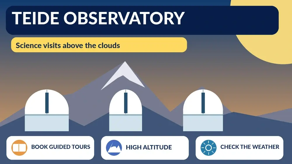
    Illustrated guide: Teide Observatory, with practical visitor tips
    Illustrated guide: Teide Observatory.

    I would listen more than photograph. The value is understanding instruments, wavelengths, solar observation and why the Canary Islands have become such important astronomy locations.

    Booking: do not arrive hoping to improvise

    I would book before driving up. The IAC explicitly requires prior arrangements for visitor access, and the open days can fill quickly. This is not an attraction where I would rely on same-day availability.

    I would save the confirmation offline and bring the identification required by the operator. Current guided-tour information says visitors should arrive at the access gate at least 30 minutes early. I would build a larger buffer because mountain roads and parking take longer than a flat city journey.

    Altitude: the detail I would take seriously

    The observatory is around 2,400 metres above sea level. At that altitude some people notice shortness of breath, headache or fatigue. Current visitor information advises against the visit for people with certain health problems such as heart, respiratory issues or anaemia and notes that the site has walking on paths and stairs.

    If I had any medical concern about altitude, I would ask my own healthcare professional rather than rely on a travel article. I would also move slowly, drink water and avoid arriving dehydrated after a long hike.

    Accessibility and mobility

    The current guided daytime tour says it is not recommended for people with reduced mobility because the visit involves paths and stairs. That is an important distinction from a museum-style attraction. I would contact the operator before booking if mobility needs are significant.

    I would never assume that “low difficulty” means fully accessible. Difficulty describes physical effort broadly; accessibility depends on surfaces, steps and site design.

    Children: check the age rule

    Current public guided-tour information says children under eight are not allowed on the daytime Observatory visit. I would verify that rule at booking because it may apply differently to special educational programmes or future events.

    For older children, I would prepare them with a simple explanation of what they will see. An observatory visit becomes more interesting when a child already understands that the telescopes are research instruments rather than giant binoculars for tourists.

    Weather can cancel the visit

    High-altitude weather is not the same as resort weather. The operator specifically warns that snow, ice, rockfall risk and other adverse conditions can affect access and lead to cancellations. I would keep the rest of my mountain day flexible and never schedule the Observatory immediately before a flight or another inflexible commitment.

    If the tour is cancelled, I would not try to access the facility independently. I would switch to lower-altitude plans or another Teide viewpoint only if roads and authorities indicate conditions are safe.

    What to wear

    I would bring closed shoes, layers, sun protection and a windproof outer layer. Even when the coast is hot, Izaña can feel much cooler and windier. Strong sun at altitude is another reason to use sunscreen and sunglasses.

    I would avoid arriving in beachwear because the visit involves walking around a scientific facility at elevation, not relaxing at a resort.

    Getting there

    Current visitor information says access requires private transport or a booked transfer service for the guided visit, and bicycles are not permitted inside the facility. If I use a taxi, I would clarify the return arrangement because the driver may need to wait outside until the activity ends.

    For most visitors, a rental car or organised transfer is simplest. My getting around Tenerife guide explains the broader transport options.

    Combining the Observatory with Teide National Park

    This is the obvious combination, but I would not overbook. I would choose either a major Teide hike or the Observatory as the structured centre of the day, then use viewpoints and short walks around it. Trying to fit a summit permit, cable car, full observatory tour and sunset stargazing into one day can become exhausting.
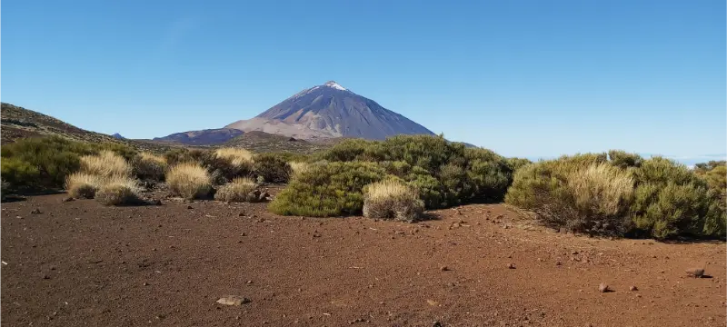
    Mount Teide behind an open volcanic plain and low scrub

    My Mount Teide guide and Roques de García guide help build a realistic route.

    Observatory visit versus stargazing tour

    If I want science and instruments, I would choose the Observatory. If I want a night experience under dark skies, constellations and visual observing, I would choose a stargazing activity. They complement each other but are not substitutes.

    My stargazing in Tenerife guide explains night-sky planning, clothing and location choices.

    2026 open days: useful context, not a permanent schedule

    The IAC held 2026 open days on 20 and 21 June, free in Spanish and lasting three hours, and the places filled. I would mention this only as an example of how special access works, not as something future visitors can use. Open-day dates change by year.

    If I am planning for another year, I would monitor the IAC’s official announcements rather than copy the 2026 dates into my calendar.

    Where to stay

    I would not choose a hotel solely to be near the Observatory because the highland site is not a normal accommodation zone. La Laguna, Puerto de la Cruz, Santa Cruz or southern resorts can all work depending on the rest of the itinerary.

    For a mountain-focused trip I would compare Tenerife accommodation on Booking.com and choose based on the full holiday, not one 90-minute activity.

    Photography and behaviour at an active observatory

    I would follow staff instructions about where photography is allowed. Research facilities have operational areas, equipment and safety rules that are not negotiable for a visitor. I would not wander away from the group for a better image.

    I would also keep noise and phone use under control during explanations. The point is to understand the facility, not simply collect a photograph of a dome.

    Common mistakes I would avoid

    • Driving up without a confirmed reservation.
    • Underestimating the effect of 2,400 m altitude.
    • Wearing only beach clothes because the coast is hot.
    • Arriving late and expecting the tour to wait.
    • Combining too many fixed Teide activities in one day.
    • Assuming the observatory is a public viewpoint that can be entered freely.

    Frequently asked questions

    Can I visit Teide Observatory without booking?

    I would not plan on it. The IAC requires prior arrangements for visitor access, and public tours are reservation-based.

    How high is the observatory?

    About 2,400 metres above sea level.

    Can young children visit?

    The current guided daytime visitor information excludes children under eight. I would confirm the rule for the exact activity booked.

    How long does the visit take?

    The current commercial daytime guided visit is advertised at approximately 1 hour 30 minutes, while special open-day programmes can be longer.

    Can bad weather cancel the visit?

    Yes. High-altitude road and site conditions can lead to cancellations for safety.

    My final take

    The Teide Observatory is most rewarding when I visit with the right expectation: this is a working scientific facility that happens to allow carefully managed public access. I would book ahead, respect altitude and weather, arrive early and use the experience to add scientific depth to a Teide day rather than treating it as another quick sightseeing stop.
  • Chinamada Tenerife Guide: Cave Houses, Anaga Views and Hiking Tips

    Chinamada Tenerife Guide: Cave Houses, Anaga Views and Hiking Tips

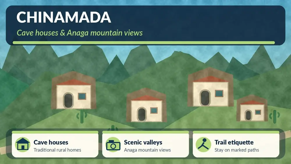
    Chinamada is one of the places in Anaga where I would slow down because the settlement itself matters more than any single viewpoint. The hamlet is known for traditional cave houses that remain inhabited, set within steep agricultural and ravine landscapes in the municipality of La Laguna. I would visit to understand how people have adapted to Anaga’s terrain, not to treat the homes as an open-air attraction.

    Tenerife Tourism describes Chinamada as an old settlement with around thirty well-preserved cave houses still in use. The official trail information also identifies Chinamada as the starting point for the 4.7 km PR-TF 10 section down to Punta del Hidalgo, a medium-difficulty route with an estimated time of about 2 hours 15 minutes. I would separate the village visit from the hike in my planning because they require different time, footwear and transport decisions.

    Chinamada at a glance

    AreaAnaga Rural Park / municipality of La Laguna
    Known forTraditional inhabited cave houses and mountain agriculture
    Best forRural culture, landscape, photography, hiking
    Important etiquetteHomes are private; observe respectfully
    Major hikePR-TF 10 Chinamada–Punta del Hidalgo, check current status before starting

    I would use the official Chinamada and Anaga hamlets page plus the official PR-TF 10 trail information when planning.

    Why the cave houses matter

    The cave houses are not abandoned heritage displays. They are part of a living settlement tradition that uses the volcanic terrain itself as architecture. That is what makes Chinamada culturally interesting and also why visitor behaviour matters.

    I would admire homes from public paths, never enter without invitation, keep voices low and avoid photographing people or private entrances closely. A settlement does not become public property because guidebooks mention it.

    The landscape around Chinamada

    Anaga is a landscape of steep ridges, ravines and agricultural terraces. Chinamada sits within that geometry, and the views can shift dramatically with cloud. On a clear day I would expect wide mountain and coastal perspectives; in mist the scene becomes more intimate but road visibility can deteriorate.

    I would not judge the day only by sunshine. Thin cloud moving through Anaga can be beautiful. Dense fog that makes driving uncomfortable is different, and I would be willing to change plans.

    Driving to Chinamada

    The road into Anaga requires patience. I would expect bends, narrow sections and slower local traffic. I would not drive as if the estimated map time were a target to beat. Pulling over safely for faster local drivers is better than feeling pressured.

    Anaga Forest Tenerife

    My Anaga Rural Park guide explains the broader road and weather logic. If I am nervous about mountain driving, I would consider visiting easier Anaga access points first.

    Parking and village access

    I would use designated or clearly legal spaces and keep turning areas free. Small mountain settlements need access for residents, deliveries and emergency vehicles. I would never park partly across a lane because a viewpoint is only twenty metres away.

    Once parked, I would explore on foot and accept that the best experience may come from quiet observation rather than constant movement.

    PR-TF 10: Chinamada to Punta del Hidalgo

    The official tourism page lists this section at 4.7 km, about 2 hours 15 minutes and medium difficulty. The trail descends through rugged ravine scenery toward Punta del Hidalgo, with views around Roque de los Dos Hermanos and the coast.

    I would treat the numbers as a planning reference, not a promise. Heat, wet rock, fitness, photo stops and transport at the end can change the real duration. Most importantly, I would check current trail status before starting; closures and restrictions in protected areas can change.

    The transport problem with a one-way hike

    A linear descent creates a practical question: where is my car? I would solve this before starting. Options may include public transport connections, two vehicles, taxi arrangements or hiking the route in a different configuration where allowed.

    I would never reach Punta del Hidalgo late in the day and only then begin searching for a way back to a mountain hamlet. Trail logistics are part of the hike.

    What to wear

    For a village-only visit, comfortable walking shoes and a light layer are enough. For the trail, I would use proper footwear with grip, carry water and sun protection, and bring a light waterproof or windproof layer. Anaga can change from cool mist to exposed sun within the same outing.

    I would also keep offline navigation available, while still following official trail markings rather than shortcuts.

    Combining Chinamada with Las Carboneras

    Las Carboneras is one of the nearby Anaga hamlets and makes a natural companion if I am driving through the area. I would keep the day small: two settlements, perhaps a short walk and one viewpoint. Trying to include Taganana, Benijo, Chamorga and Punta del Hidalgo on the same road day is how Anaga becomes tiring instead of magical.

    Combining Chinamada with Punta del Hidalgo

    If I am not hiking, Punta del Hidalgo is still a logical coastal finish. I can descend later for the natural pools, promenade and ocean views. My Bajamar and Punta del Hidalgo guide helps plan the coast.

    La Laguna as the urban base

    Chinamada lies within the municipality of La Laguna, and I would often base the day from the city. La Laguna gives me accommodation, restaurants and an easy cultural backup if Anaga weather becomes poor. It also lets me combine a mountain morning with an evening in the UNESCO historic centre.

    I would compare La Laguna accommodation on Booking.com and look for parking if I am renting a car.

    Food and local spending

    I would use local cafés or restaurants when they are open, but I would not assume a small hamlet can provide meals at any hour. I would carry water and a snack, especially if walking.

    Spending locally is one of the simplest ways to make rural tourism more useful to the communities receiving visitors. I would prefer that over buying generic souvenirs elsewhere.

    Photography with respect

    Chinamada is photogenic because homes and landscape are intertwined. I would photograph wider scenes, paths and ridgelines rather than point a lens into private doors or windows. If a person becomes the main subject, I would ask.

    I would also avoid drones unless I have checked every applicable rule. Protected natural areas and inhabited settlements can have restrictions and privacy concerns beyond basic aviation law.

    Best time to visit

    I would choose morning for the best flexibility. Roads are easier when I am not racing fading light, and I can continue to La Laguna or the coast if the weather changes. Summer can still be hot on exposed trails; winter and shoulder seasons can bring damp, cool conditions in the mountains.

    How I would plan Chinamada on a first Anaga visit

    If Chinamada is my main goal, I would not also plan the full north-coast circuit. I would start from La Laguna, drive into Anaga with one or two viewpoint stops, spend proper time in the hamlet and then choose either a short local walk or the descent toward Punta del Hidalgo. That keeps the day geographically coherent and leaves room for cloud, slow roads and a meal.

    If the weather deteriorates, I would return to La Laguna rather than chase clearer skies across the massif. The historic centre gives me an excellent backup day, and I can try Chinamada again later if the trip is long enough.

    Anaga Laurel Forest Tenerife

    Why the place is better on foot

    Once I have parked legally, I would stop thinking like a driver. Walking a short distance reveals terraces, rock textures, cultivation and the relationship between houses and ravines much better than moving from one roadside photo point to another. Even without doing PR-TF 10, comfortable shoes are worth bringing.

    Common mistakes I would avoid

    • Treating inhabited cave houses as attractions I can approach closely without permission.
    • Starting the one-way hike without a return transport plan.
    • Driving too quickly on Anaga roads.
    • Attempting too many villages in a single day.
    • Assuming an old trail blog proves the route is currently open.

    Frequently asked questions

    Do people still live in Chinamada cave houses?

    Yes. Official tourism information describes around thirty cave houses in good condition that remain inhabited.

    Can I visit the cave houses inside?

    I would treat them as private homes unless a specific authorised visit is clearly offered.

    How long is the hike to Punta del Hidalgo?

    The official PR-TF 10 information lists 4.7 km and about 2 hours 15 minutes for the Chinamada–Punta del Hidalgo section, with medium difficulty.

    Is Chinamada good without hiking?

    Yes. The settlement and Anaga landscape are worthwhile on their own.

    Where should I stay?

    La Laguna is the most practical urban base; Bajamar or Punta del Hidalgo can work for a quieter coastal stay.

    My final take

    I would visit Chinamada for a form of Tenerife travel that asks for more restraint than consumption: look, walk, listen and understand that the famous cave houses are still part of people’s lives. Combined with Anaga scenery and a carefully planned hike, it can be one of the island’s most meaningful rural stops.

  • Mercado Nuestra Señora de África Guide: What to Eat and Buy in Santa Cruz

    Mercado Nuestra Señora de África Guide: What to Eat and Buy in Santa Cruz

    Mercado Nuestra Señora de África is the place I would visit in Santa Cruz when I want the city to feel like somewhere people actually live, shop and eat rather than a sequence of monuments. Known locally as La Recova, the market is one of the capital’s most distinctive everyday spaces: fruit, vegetables, meat, fish, cheese, flowers and prepared food sit within a historic market complex that is still part of local routines.

    Tenerife Tourism describes it as the main market of Santa Cruz, founded in the 1940s and home to more than 200 traders. Its current market guide lists opening hours of 06:00–14:00 Monday to Saturday and 07:00–14:00 on Sunday. Because individual stalls and food businesses can keep different hours, I would arrive in the morning rather than build a visit around the final hour.

    Quick planning facts

    LocationSanta Cruz de Tenerife
    Common nameLa Recova / Mercado Nuestra Señora de África
    General market hoursMon–Sat 06:00–14:00; Sun 07:00–14:00 according to Tenerife Tourism
    Best time for visitorsMorning, especially before late-morning crowds
    What I would look forLocal fruit, cheese, honey, fish, meat, Canarian products and prepared food

    I would check the official Tenerife Tourism market page and the broader Tenerife markets information before travelling if timing is important.

    Why I would put the market near the start of a Santa Cruz day

    Markets are better in the morning. Produce displays are fuller, fish activity is livelier, and I can have coffee or a snack before the city gets hotter. I would then continue on foot toward the historic centre, TEA, MUNA or the waterfront.

    Starting here also changes how I see Santa Cruz. Instead of approaching the capital only through shopping streets and architecture, I begin with food, conversation and everyday logistics. That gives the rest of the city more context.

    What I would buy

    I would prioritize products that actually connect me to Tenerife: island-grown fruit and vegetables, Canarian cheeses, honey, local sauces, dried products and packaged specialties that travel well. I would ask vendors what is in season rather than arrive with a rigid souvenir list.

    For cheese, I would look at milk type and maturity instead of assuming “local” means one style. For honey, I would read the label and origin. For fruit, I would buy only what I can realistically eat during the trip; a hotel room full of ripe tropical fruit is not a good souvenir strategy.

    The fish area

    The fish section is one of the most interesting parts even if I am not self-catering. It gives me a better idea of what appears later on restaurant menus and how Tenerife’s relationship with the sea differs from a generic “Spanish seafood” image.

    If I am staying in an apartment, I would ask what is easiest to cook and how the fish is typically prepared. I would not buy something unfamiliar simply because it looks impressive if I do not have the equipment or confidence to prepare it properly.

    Eating at the market

    One of the best reasons to visit is that the market is not only for grocery shopping. Tenerife Tourism notes that markets such as Nuestra Señora de África have food stalls and cafés where visitors can try local products and simple prepared dishes. I would arrive hungry enough for a second breakfast, tapas or an early lunch.

    I would avoid assuming that every popular stall has instant seating. At busy times I would be flexible, share small plates and treat the market as a tasting stop rather than demand a formal restaurant experience.

    Products I would look for as edible souvenirs

    For luggage-friendly gifts, I would consider sealed mojo sauces, honey, local salt or packaged sweets, always checking airline and destination-country rules. Cheese can be excellent but needs better temperature planning. Wine is an obvious Tenerife souvenir, but checked-baggage weight and breakage risk matter.

    My Tenerife food guide explains the dishes and ingredients I would learn to recognize before visiting the market.

    How the market fits with Santa Cruz sights

    The market is close enough to several important places that I would not visit it as an isolated destination. MUNA is a natural next stop if I want archaeology, Guanche history and natural science. TEA works if I prefer contemporary art and architecture. From there I can continue toward the Auditorio and waterfront or walk back into the centre.

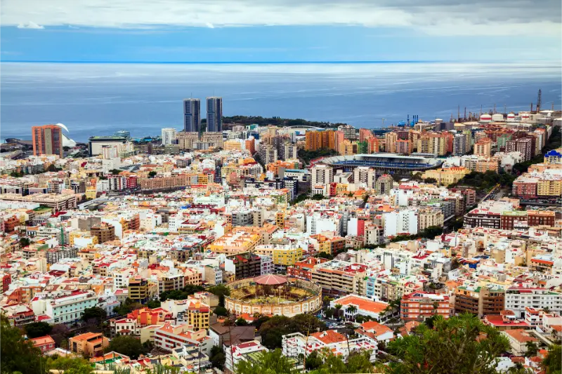
    Aerial View Of Santa Cruz De Tenerife

    My Santa Cruz guide, MUNA guide and TEA guide make an easy cultural route.

    My ideal half-day around La Recova

    I would arrive around breakfast time, walk the market slowly, have coffee and buy a few local products. I would then visit MUNA or TEA, continue toward Plaza de España and the historic streets, and have lunch in the centre. If the weather is good and I have a car or bus plan, Las Teresitas can become the afternoon.

    This is a better rhythm than trying to visit the market after a beach day, when many stalls may already be closed.

    Sunday or weekday?

    The official tourism information says the market opens on Sunday, which is useful for weekend trips. I would still choose a weekday or Saturday if I specifically want the broadest possible mix of traditional food shopping and city activity, because individual traders may vary.

    Sunday can be excellent for atmosphere, but I would verify any particular stall before travelling across the island solely for it.

    Paying: cash or card?

    I would carry both. Many businesses accept cards, but small purchases are easier when I have some cash. I would not withdraw large amounts from an unfamiliar tourist ATM just for the market; my money in Tenerife guide explains the practical approach I use.

    Parking and arriving without a car

    The official tourism listing notes parking for customers, but I would not rely on a guaranteed space at peak time. Santa Cruz also works well by tram and bus, depending on where I am coming from. If I am staying in the city centre, I would walk.

    For a city day, leaving the car parked once is better than moving it between every attraction. Santa Cruz is most enjoyable when I treat the central area as a walking itinerary.

    Where I would stay in Santa Cruz

    If the market, museums and local restaurants matter more than resort beaches, staying in the capital can be a smart choice. I would compare Santa Cruz accommodation on Booking.com and check whether the hotel has parking if I am also exploring Anaga or the north by car.

    Market etiquette I would follow

    I would not photograph vendors at close range without asking, touch produce unnecessarily or block a working counter while filming. I would greet people, ask questions when the stall is not busy and accept that this is a functioning market before it is a visitor attraction.

    If I sample something, I would be prepared to buy if I genuinely like it. Respectful curiosity usually creates a better experience than treating every counter as free entertainment.

    How La Recova differs from farmers’ markets

    Nuestra Señora de África is an urban municipal market with a wide range of traders and food businesses. Tenerife also has farmers’ markets where producers sell more directly from agricultural areas. I would visit both if food is a major interest because they reveal different parts of the island’s food system.

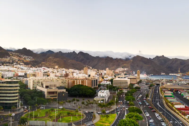
    Panoramic View Of Santa Cruz De Tenerife

    My Tenerife markets guide helps compare the options.

    Common mistakes I would avoid

    • Arriving close to closing time and expecting every stall to be operating.
    • Buying fresh products that will not survive the rest of the travel day.
    • Treating the market as a museum rather than a workplace.
    • Planning to drive between every central Santa Cruz attraction.
    • Buying food souvenirs without checking baggage and customs rules for the destination country.

    Frequently asked questions

    What time does Mercado Nuestra Señora de África open?

    Tenerife Tourism currently lists 06:00–14:00 Monday to Saturday and 07:00–14:00 on Sunday. Individual businesses can vary.

    Can I eat there?

    Yes. The market includes food and café options, making it useful for breakfast, snacks or an early lunch.

    Is it worth visiting if I am not cooking?

    Yes. I would visit for the food culture, prepared dishes, local products and atmosphere even if I am staying in a hotel.

    What should I buy as a souvenir?

    Sealed honey, mojo, sweets and other packaged Canarian products are practical; I would always check travel restrictions.

    How long do I need?

    About one to two hours works for most visitors, longer if I eat there or enjoy food shopping.

    My final take

    Mercado Nuestra Señora de África is one of the places where I would go to understand Santa Cruz through food rather than through sightseeing alone. I would visit early, eat something, ask what is seasonal, buy only what I can use and then continue through the city on foot. It is simple, local and far more revealing than another generic souvenir shop.

  • Playa de San Marcos Guide: Black Sand, Calm Bay and Icod Coast Tips

    Playa de San Marcos Guide: Black Sand, Calm Bay and Icod Coast Tips

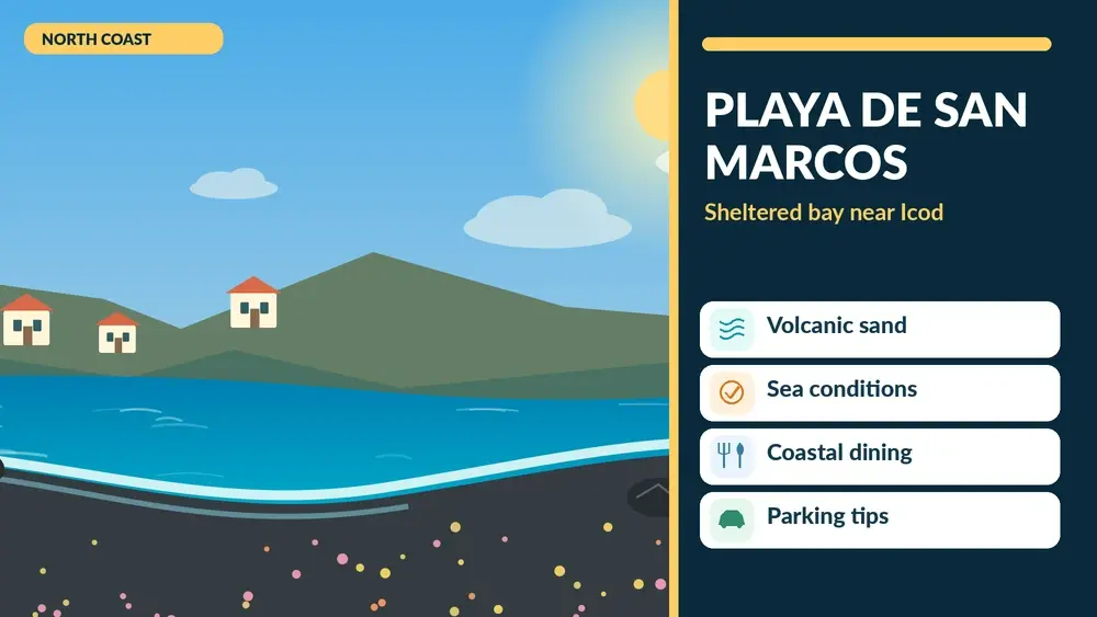
    Playa de San Marcos is one of the north-coast beaches I would consider when I want black sand and a more sheltered setting than the exposed Atlantic beaches nearby. The bay belongs to Icod de los Vinos and has a curved, shell-like shape that helps protect it from some of the swell that affects other northern beaches. That does not make the water permanently calm, but it gives San Marcos a different character from surf-oriented or open-coast beaches.

    Tenerife Tourism lists the beach at around 160 metres long and 40 metres wide, with black volcanic sand, easy pedestrian access, adapted access, toilets, showers, restaurants and parking. It is an urban beach, so I would come for convenience and local atmosphere rather than for an untouched natural setting.

    Playa de San Marcos at a glance

    Location San Marcos, Icod de los Vinos
    Length About 160 m
    Sand Black volcanic sand
    Character Sheltered urban bay
    Accessibility Adapted access listed officially
    Best for North-coast beach time, families in suitable conditions, combining with Icod

    I would check the official Playa de San Marcos page for current services before relying on a specific facility.

    What makes the bay different

    The shape of San Marcos is the key. The surrounding headlands and curved bay reduce direct exposure compared with many stretches of the north coast. Tenerife Tourism describes it as one of the calmer beaches in northern Tenerife, and that is the main reason I would choose it for a swimming day.

    I would still watch the sea carefully. A sheltered bay can have surge, shore break or changing currents, especially when Atlantic swell is larger. I would never use the beach’s reputation as a substitute for flags and local conditions.

    The atmosphere

    San Marcos feels like a small coastal settlement rather than a major resort. Apartment buildings, restaurants and terraces frame the bay, and the beach can become lively with local families in summer. I would not expect the polished promenade scale of Costa Adeje or Las Vistas.

    For me, that is part of the appeal. I can spend a few hours by the water, have lunch overlooking the bay and then drive uphill to Icod’s historic centre without committing to a full resort day.

    Black sand: beautiful and hot

    The volcanic sand gives the beach its visual identity, but it can become hot under strong sun. I would bring sandals and be especially careful with children. The north can feel cooler and cloudier than the south, yet UV exposure remains important even when the sky is not perfectly clear.

    I also find black-sand beaches easier to enjoy when I bring a second small towel for feet and keep electronics protected from fine sand.

    Swimming and family use

    When conditions are calm, the sheltered setting can work well for families. I would choose the central bathing area, stay within any supervised zone and keep younger children close. In summer, when the beach is busier, I would arrive before peak midday hours to find a comfortable space.

    If the sea is rough, I would not force the swim. Icod gives me several inland alternatives, including the Drago area, historic centre and Cueva del Viento if I have a reservation.

    Facilities and accessibility

    The official listing includes toilets, showers, cleaning, restaurants and adapted access. Parking is also available, although the page notes fewer than fifty spaces. That is a useful warning: on busy days I would not assume I can arrive at lunchtime and park immediately beside the water.

    If accessibility is essential, I would confirm the exact beach service and route from parking to sand in advance. My accessible Tenerife guide helps compare alternatives around the island.

    Parking strategy

    San Marcos is reached by descending from Icod toward the coast. I would drive slowly, follow legal parking signs and avoid blocking residential access while searching for a closer space. The final approach is part of a lived-in coastal neighbourhood, not a giant beach car park.

    During summer weekends I would either arrive earlier or accept that I may need to walk farther. I would not create a stressful start to the day by circling indefinitely.

    Combining San Marcos with Icod de los Vinos

    This is the pairing I would recommend most strongly. Icod’s historic centre and famous Drago Milenario are close enough that the town and beach can share the same day without feeling rushed. I would use the morning for Icod when streets are cooler, then descend to the bay for lunch and a swim if conditions are good.

    My Icod de los Vinos guide covers the historic centre, Drago and other practical stops.

    Adding Cueva del Viento

    Cueva del Viento can turn the day into something much more distinctive, but I would only add it with a confirmed booking. Cave visits operate on fixed arrangements and are not something I would assume I can join spontaneously. I would leave enough time between the cave and beach rather than schedule them back to back.

    My Cueva del Viento guide explains clothing, booking and what to expect.

    Where to eat

    The bay has restaurants and terraces, making lunch easy. I would look at current menus rather than choosing only by the closest table to the sand. Fresh fish and Canarian dishes make sense here, but I would clarify prices for seafood sold by weight before ordering.

    If I prefer a guachinche experience, I would eat inland around the north rather than expect the beachfront to provide the same atmosphere.

    Where to stay

    San Marcos can be a peaceful base for travellers who want the north coast and do not need a large nightlife scene. I would compare accommodation around Icod de los Vinos on Booking.com and check whether a property is in the historic town, at the coast or on the slopes between them. Those locations feel very different without being far apart on the map.

    How San Marcos compares with other north beaches

    For drama, I would choose Benijo. For surf atmosphere, El Socorro. For a more secluded volcanic setting near La Orotava, El Bollullo. San Marcos is the practical choice when I want a sheltered urban bay with food and parking nearby.

    My black-sand beaches guide helps compare these different experiences.

    Best time to visit

    I would choose a day when the north-coast forecast and sea conditions are favourable. Morning often gives easier parking and a quieter beach. Summer brings more local families and a livelier atmosphere; winter can still produce beautiful beach days but the ocean deserves extra respect.

    I would not cancel solely because Puerto de la Cruz looks cloudy on an app. North-coast cloud can shift locally, and the bay may still be pleasant. I would combine weather and sea forecasts with real-time observation.

    A realistic half-day plan

    If I were building a half day around San Marcos, I would start in Icod de los Vinos before the historic centre becomes busier, spend time around the Drago and old streets, then descend to the coast for lunch. After eating, I would check the sea from the promenade before deciding whether to swim. This order avoids making the beach the only reason for the trip and gives me an easy fallback if the water is rough.

    I would leave at least a little unplanned time after the beach. Northern Tenerife often rewards small detours: a viewpoint, a bakery, a short walk or simply a second coffee can be more memorable than forcing another major attraction into the afternoon.

    Why I would not rush onward to Garachico

    Garachico is close enough that it is tempting to add it automatically, but I would do so only if I have already seen Icod or if the beach stop is short. Garachico deserves its own walking time, and combining two historic towns, a cave booking and a beach in one day is more driving than it appears on a map. I prefer to leave something for the next day.

    Common mistakes I would avoid

    • Assuming “sheltered” means the sea is always safe.
    • Arriving at peak summer lunch time with no parking plan.
    • Walking barefoot on hot black sand.
    • Trying to fit Icod, Cueva del Viento, Garachico and a long beach session into one rushed day.
    • Choosing a hotel without understanding the vertical difference between Icod town and the coast.

    Frequently asked questions

    Is Playa de San Marcos good for swimming?

    It is often calmer than more exposed north-coast beaches because of the bay shape, but I would always follow current flags and conditions.

    Is it a black-sand beach?

    Yes. The sand is volcanic and dark, typical of much of Tenerife’s northern coast.

    Is it close to Icod de los Vinos?

    Yes. The beach belongs to Icod and is easy to combine with the historic centre and Drago area.

    Does it have restaurants?

    Yes. The urban bay has restaurants and terraces close to the beach.

    Is parking easy?

    Parking exists, but official information indicates limited capacity. I would arrive earlier during busy periods.

    My final take

    Playa de San Marcos is a useful north-Tenerife beach because it combines volcanic character, a relatively sheltered bay and easy access to Icod de los Vinos. I would not cross the island only to collect another beach, but if I am exploring Icod or the northwest, it is exactly the kind of coastal stop that can turn a sightseeing day into a more balanced holiday day.

  • El Caletón Garachico Guide: Natural Pools, Safety and Volcanic History

    El Caletón Garachico Guide: Natural Pools, Safety and Volcanic History

    El Caletón is one of those Tenerife swimming places where the landscape tells the story before I read a single information panel. The natural pools sit directly beside the historic centre of Garachico, formed in a coastline reshaped by volcanic activity. They are beautiful, photogenic and easy to combine with a town visit, but I would never treat them like a hotel pool. The same ocean that fills the lava pools can become powerful enough to make bathing unsafe.

    Tenerife Tourism describes El Caletón as a group of natural bathing pools and one of Garachico’s main attractions. It notes that the water is often calm inside the pools but specifically warns visitors to be cautious because the sea in this area can be strong. That warning is central to how I would plan the visit.

    El Caletón at a glance

    LocationGarachico, north Tenerife
    TypeVolcanic natural pools/charcos
    Best forSwimming in suitable conditions, volcanic scenery, combining with historic Garachico
    Main riskAtlantic swell and waves entering exposed sections
    Planning styleFlexible: visit the town even if the pools are unsafe for swimming

    I would use the official El Caletón page for current visitor information and then judge conditions on site.

    Why El Caletón is different from an ordinary beach

    The experience is shaped by lava. Instead of a long sand shoreline, I move between rock formations, pools and man-made access points. The water feels more enclosed than the open Atlantic, but the pools remain connected to the sea. That is why waves can suddenly matter even when the section where I am standing looks protected.

    I would come for the combination of geology and swimming, not because I expect a large area for sunbathing. Space can feel limited on busy summer days, and the most attractive rock edges are not always the safest places to sit.

    The volcanic story behind Garachico

    Garachico was once one of Tenerife’s important ports before the 1706 eruption changed the coastline and damaged the old harbour. The lava that transformed the town also contributed to the rocky shore that now makes El Caletón so distinctive. I find the pools more meaningful when I see them as part of Garachico’s history rather than as a standalone Instagram stop.

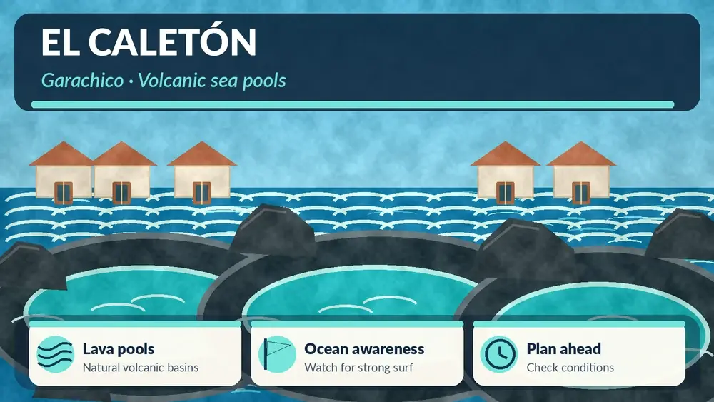
    Illustrated guide: El Caletón Garachico, with practical visitor tips
    Illustrated guide: El Caletón Garachico.

    My Garachico guide connects the pools with the historic streets, churches, old fortifications and the wider story of the town.

    When I would swim — and when I would not

    I would swim only when access is open, local conditions look controlled and there are no warnings indicating danger. I would watch the outer ocean for several minutes before entering. A wave cycle can have quiet intervals that create false confidence.

    If waves are washing strongly over exposed rock or people are being pushed around inside a pool, I would not enter. Natural pools can create an illusion of protection, but their edges, ladders and channels can become slippery or turbulent. I would never climb barriers or ignore closures for a photograph.

    Footwear and moving around the pools

    Wet volcanic rock can be sharp and slippery. I would use secure sandals or water shoes with grip rather than flip-flops that can slide or float away. I would move slowly, use handrails where provided and keep both hands free when descending ladders.

    For children, I would choose the most protected accessible section and stay within arm’s reach. I would not let a child stand on the outer rocks to watch waves, even if other visitors are doing it.

    Water temperature and comfort

    The pools contain ocean water, so they follow the seasonal feel of the Atlantic rather than warming like a shallow hotel pool. On a sunny day the contrast between warm rock and cooler water can be refreshing; on a cloudy northern day it can feel much cooler.

    I would bring a towel and a dry layer if the weather is breezy. My Tenerife sea-temperature guide explains what swimming generally feels like across the year.

    Best time to visit

    I would arrive earlier in the day during busy periods. El Caletón is directly beside a famous historic town, so it can attract both swimmers and sightseeing visitors. Early arrival gives me more space and a better chance to understand conditions before the area becomes crowded.

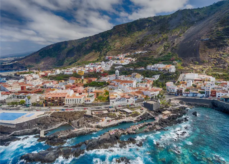
    Garachico Natural Pools And Coast Tenerife

    I would not choose the time only from the weather icon. Swell is more important than sunshine. A grey calm morning can be better for swimming than a bright day with a powerful sea.

    What to do if swimming is unsafe

    This is where El Caletón has a major advantage over remote natural pools: Garachico is right there. If the sea is too rough, I have not wasted the journey. I can walk the historic centre, visit the waterfront, have lunch and watch the ocean from a safe distance.

    That is why I consider El Caletón a strong all-weather planning stop. The swim is a bonus, not the only reason to come.

    Parking in Garachico

    I would park legally in the town or designated public areas and walk. Garachico’s historic streets were not designed for modern visitor traffic, and searching for the closest possible space can create unnecessary stress.

    On weekends and summer days I would add a parking buffer. If I have a lunch reservation or another fixed activity, I would not calculate the schedule from ideal traffic conditions.

    Where to stay

    Garachico can work as a quiet northwestern base for travellers who prefer historic atmosphere to large resorts. I would compare Garachico accommodation on Booking.com, paying attention to parking and stairs in older properties.

    If I am staying elsewhere, El Caletón works well as a day trip from Puerto de la Cruz or as part of a northwest itinerary.

    What I would combine with El Caletón

    I would keep the day geographically coherent. Garachico plus Icod de los Vinos is an obvious pair. Another option is Garachico plus Los Silos and Buenavista del Norte. If I continue toward Punta de Teno, I would check current access rules and avoid overloading the day.

    My best natural pools in Tenerife guide is useful if I want to compare El Caletón with Bajamar, Punta del Hidalgo and other coastal swimming areas.

    Photography without taking risks

    The contrast between dark lava, white water and Garachico’s architecture is extremely photogenic. I would use a zoom or wider composition from a stable position rather than stepping onto wet outer rocks. Waves are unpredictable, and a photograph is not worth a fall into a surge channel.

    I would also keep electronics in a secure waterproof bag. Even a relatively small splash can travel farther than expected when it hits vertical rock.

    Food after the swim

    Garachico has enough restaurants and cafés that I would plan lunch in town rather than carry a large picnic onto the pools. Tenerife Tourism specifically suggests pairing the swim with local seafood and Canarian food.

    After salt water and sun, I would choose a relaxed meal and leave time for a walk before driving mountain roads.

    El Caletón with limited mobility

    I would investigate the exact access before promising a swim to someone with mobility limitations. The surrounding seafront is easy to include in a town visit, but natural-pool access can involve ladders, wet surfaces and irregular rock. Conditions and usable sections matter.

    For travellers prioritizing adapted bathing facilities, I would compare more engineered pools and beaches in my accessible Tenerife guide.

    How I would decide whether to bring children

    El Caletón can be memorable with children, but I would make the decision from the sea rather than from the calendar. On a calm day, older children who are confident in the water may enjoy the protected sections. On a rough day, I would turn the visit into a geology-and-town stop and choose a more controlled beach or pool elsewhere. I would never promise children a swim before seeing conditions, because that can create pressure to enter when the sensible choice is to stay out.

    I would also keep snacks, dry clothes and footwear close. Natural pools often involve more getting in and out, waiting for waves and moving between sections than a normal beach, so comfort becomes part of safety.

    Common mistakes I would avoid

    • Treating the pools like a closed swimming facility rather than part of the ocean.
    • Entering because other people are swimming even when waves look stronger than I am comfortable with.
    • Wearing slippery footwear on wet lava.
    • Driving into the historic centre at the busiest time solely to save a short walk.
    • Leaving the town immediately if the pools are closed; Garachico itself is worth several hours.

    Frequently asked questions

    Are the El Caletón pools natural?

    Yes. They are volcanic coastal pools formed within the lava shoreline, with access adapted for bathing.

    Is El Caletón always safe for swimming?

    No. The official tourism page warns about strong sea conditions. I would decide from current warnings and the actual swell.

    Do I need water shoes?

    They are not mandatory, but secure grippy footwear can make moving across wet volcanic surfaces more comfortable.

    Can I visit without swimming?

    Absolutely. The pools sit beside historic Garachico, so the area is worthwhile even when the sea is too rough.

    How long would I spend there?

    For the pools alone, perhaps one to three hours depending on conditions. Combined with Garachico, I would allow at least half a day.

    My final take

    El Caletón is at its best when I treat it as a volcanic landscape first and a swimming place second. In calm conditions it can be one of the most memorable places to enter the ocean in northern Tenerife. In rough conditions, I would enjoy the geology and historic town from land and come back another time rather than challenge the Atlantic.

  • Playa de Las Vistas Guide: Calm Water, Accessibility and Los Cristianos Tips

    Playa de Las Vistas Guide: Calm Water, Accessibility and Los Cristianos Tips

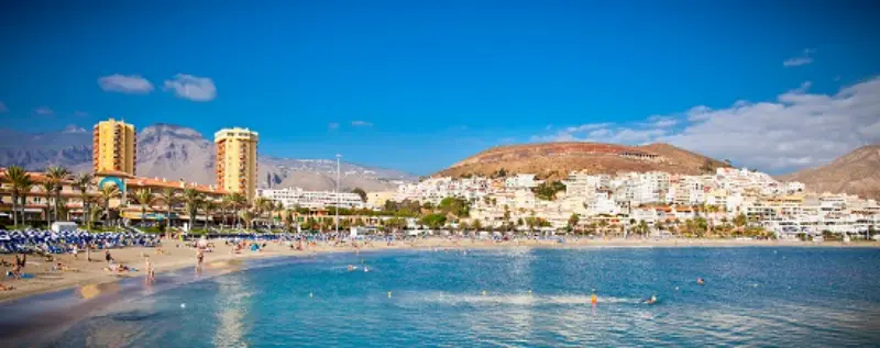
    Playa de Las Vistas is one of the easiest beaches in southern Tenerife to recommend when convenience matters as much as scenery. It is not a hidden cove and I would not visit expecting solitude, but that is exactly why it works so well for families, travellers with reduced mobility, people staying without a car and anyone who wants a straightforward beach day with restaurants, toilets and a long promenade close at hand. Its light-coloured sand and sheltered water also make it feel very different from the wilder black-sand beaches of the north.

    The official Tenerife tourism page lists Las Vistas as an urban beach in Arona, around 850 metres long and 80 metres wide, with adapted access, toilets, showers, sunbed and umbrella rental, food nearby and parking. The beach is protected by breakwaters, so the water is generally calmer than at many open-coast beaches. I would still judge the actual sea on the day rather than treating “calm” as a guarantee.

    Las Vistas at a glance

    LocationArona, between Los Cristianos and Playa de las Américas
    LengthAbout 850 m
    SandLight/golden sand
    CharacterUrban, easy-access, family-friendly
    AccessibilityAdapted access is listed by the official tourism authority
    Best forSwimming, families, long promenade walks, easy beach days

    I would check the official Las Vistas beach page for the latest service information before relying on a specific facility.

    Why Las Vistas is so practical

    Some Tenerife beaches are destinations in themselves; Las Vistas works more like part of a continuous resort coastline. I can arrive on foot from Los Cristianos, spend a few hours swimming, walk toward Playa de las Américas for lunch and return without needing a car. That makes it especially useful on the first or last day of a holiday, when I do not want a complicated excursion.

    The promenade is one of the beach’s biggest strengths. Instead of being trapped in a single bay, I can move between different stretches of coast, cafés and viewpoints. For travellers who become restless after two hours on a towel, that flexibility matters.

    What the beach actually feels like

    I would describe Las Vistas as open, bright and organised rather than wild. The pale sand, broad width and developed seafront create a classic resort-beach atmosphere. An artificial island and fountain in the water are recognizable visual features, and the scale of the beach means that even when it is busy I can usually find a different section rather than leaving immediately.

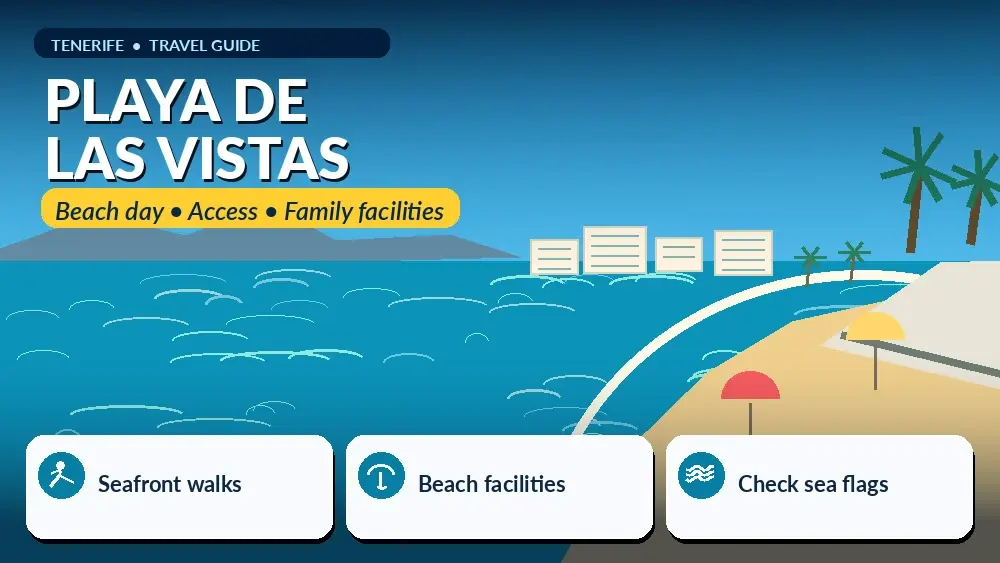
    Illustrated guide: Playa de Las Vistas, with practical visitor tips
    Illustrated guide: Playa de Las Vistas.

    Because it is urban, I would expect noise, families, beach vendors, watersports and plenty of movement. If I wanted dramatic volcanic cliffs and fewer services, I would choose somewhere else. If I wanted a comfortable swim close to my hotel, this would be high on my list.

    Swimming conditions and safety

    The official description emphasizes the beach’s very calm swell, helped by protective breakwaters. That is one reason Las Vistas is popular with families. Even so, I would always check flags, lifeguard instructions and the actual water before entering. A sheltered beach can still have changing currents, wind chop or temporary restrictions.

    For children, I would focus on the shallow entry, but I would not treat any ocean beach like a swimming pool. I would stay close, keep flotation toys under control in wind and use water shoes only if someone prefers them; the sand itself is generally comfortable for bare feet.

    Accessibility: one of the main reasons to choose Las Vistas

    Las Vistas is a strong option for travellers who need a more accessible beach environment. Tenerife Tourism lists adapted access, and the surrounding promenade is much easier to navigate than steep natural coves or beaches reached by long stairs. I would still verify current seasonal assistance, amphibious-chair availability or specific mobility services if they are essential to the trip.

    My accessible Tenerife guide compares beaches and attractions more broadly. Accessibility is not one universal category: a beach can have ramps but still have soft sand, long distances or changing service hours, so I would plan around the actual needs of the traveller.

    Las Vistas with children

    If I were staying in Los Cristianos with young children, Las Vistas would be one of my default choices. The combination of calmer water, toilets, food, shade options and an easy promenade removes many of the logistical problems that make beach days tiring for parents.

    I would arrive with sun protection already applied, bring water even though shops are close, and choose a meeting point in case older children wander along the wide beach. The southern sun can be intense even when the breeze feels comfortable. My family beaches guide gives alternatives if Las Vistas feels too busy.

    Where Las Vistas sits between Los Cristianos and Playa de las Américas

    One of the most useful things to understand is that the beach is part of a larger walkable resort strip. To one side I have Los Cristianos, with its harbour, older resort fabric and ferry connections. In the other direction the promenade leads toward Playa de las Américas, where the atmosphere becomes more nightlife- and entertainment-oriented.

    That means I can choose accommodation based on the neighbourhood I prefer without losing access to Las Vistas. My Los Cristianos guide and Playa de las Américas guide explain the differences.

    Los Cristianos At Sunset Tenerife

    Best time of day

    I would choose the morning for the calmest start, easier sunbed availability and a less crowded promenade. Late afternoon is better if I want softer light and a beach-to-dinner transition. Around midday, especially in peak holiday periods, the beach can feel much busier and the sun is strongest.

    I would not arrive only for sunset expecting a dramatic west-facing horizon like Playa de la Arena or Los Gigantes. Las Vistas is more about an easy full beach session than a single spectacular evening view.

    Sunbeds, umbrellas and shade

    The official page lists sunbed and umbrella rental, but prices and operating arrangements can change. I would treat rental availability as a convenience rather than something to build the entire day around. If shade is essential for a baby or someone sensitive to sun, I would bring a backup plan and check local rules for personal beach shelters.

    The promenade has many opportunities to step out of the sun for food or drinks, which is one advantage over remote beaches.

    Food and drink nearby

    I would not carry a full picnic unless I specifically wanted one. The seafront has a wide range of restaurants, cafés and shops, and walking a few minutes away from the most obvious beachfront tables can sometimes give me more choice and better value.

    For a simple beach lunch I would choose something that does not make the afternoon feel heavy: grilled fish, salad, a sandwich or Canarian dishes shared at the table. I would keep valuables with me rather than leaving a bag unattended while everyone goes to eat.

    Parking and arriving by car

    Tenerife Tourism lists parking, but this is a dense resort area and I would not assume I can park directly beside the sand in high season. I would aim for an established public car park or a legal street space and accept a short walk. Circling narrow resort streets for the “perfect” spot is rarely worth the time.

    If my accommodation is within Los Cristianos or Playa de las Américas, walking is usually the better option. Public buses also serve the broader resort area, making Las Vistas one of the easier Tenerife beaches to visit without a rental car.

    Where I would stay for easy access

    For travellers who want to walk to the beach daily, Los Cristianos is the most obvious base, with Playa de las Américas also very close. I would compare accommodation on Booking.com in Los Cristianos and check the map carefully; “near the beach” can still mean a steep uphill walk in parts of southern Tenerife.

    What I would combine with Las Vistas

    I would keep combinations local. A walk through Los Cristianos harbour, a seafront lunch, Playa del Camisón or an evening in Playa de las Américas all make sense. I would not drive to Teide or Anaga after spending most of the day here; that turns a relaxing beach day into unnecessary logistics.

    Los Cristianos Bay Tenerife

    If I had only one beach day in the south and wanted maximum convenience, Las Vistas would be a strong choice. If I wanted luxury atmosphere I might prefer Playa del Duque; for a broader Costa Adeje resort day, Fañabé is another option.

    Common mistakes I would avoid

    • Assuming calm water means there is no need to check beach flags.
    • Driving into the busiest streets at midday expecting parking beside the sand.
    • Forgetting that the southern sun can be very strong even with a breeze.
    • Choosing accommodation only by distance without checking hills and walking routes.
    • Expecting a secluded “secret Tenerife” atmosphere from a major urban beach.

    Frequently asked questions

    Is Playa de Las Vistas good for families?

    Yes. Its generally calm water, broad sand, services and adapted access make it one of the more practical family beaches in the south.

    Is the sand natural?

    The beach is known for its light-coloured imported sand and engineered protection. I would visit for comfort and accessibility rather than wilderness.

    Can I walk there from Los Cristianos?

    Yes. Las Vistas is directly connected to Los Cristianos by the seafront promenade.

    Can I continue walking to Playa de las Américas?

    Yes. The promenade makes this one of the easiest continuous coastal walks in the resort zone.

    Is Las Vistas accessible?

    The official tourism authority lists adapted access. I would verify any specific seasonal assistance service in advance if it is essential.

    My final take

    I would choose Playa de Las Vistas when I want an uncomplicated swimming beach with strong facilities and a walkable location. It is not Tenerife’s wildest coast, but it is one of the island’s most useful beaches for families, first-time visitors and travellers who value accessibility and convenience. The key is to enjoy it for what it is: a very well-connected urban beach rather than a hidden natural escape.

  • Playas de Troya Guide: Blue Flag Beaches, Swimming and Playa de las Américas Tips

    Playas de Troya Guide: Blue Flag Beaches, Swimming and Playa de las Américas Tips

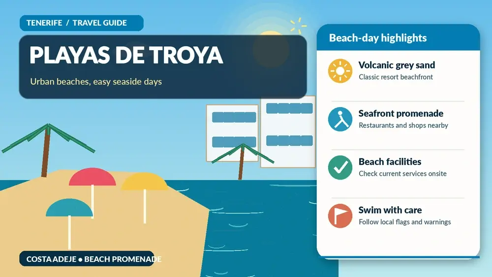
    Playas de Troya are the classic central beaches of the Playa de las Américas and Costa Adeje resort strip, and their biggest advantage is how easy they are to use. Troya I and II form a long urban beachfront with grey volcanic sand, Blue Flag recognition, adapted access and a promenade full of services. I would choose them when I want swimming and resort energy without needing a car. This guide is built around the details I would want before leaving my accommodation: what is actually worth my time, how I would get there, where the friction points are, and what I would combine with the visit without turning the day into a race.

    Quick planning facts

    LocationAdeje / Playa de las Américas resort area
    Combined lengthAbout 650 metres
    Typical widthAbout 20 metres
    SandGrey volcanic sand
    Quality recognitionBlue Flag
    AccessibilityOfficial information lists adapted access

    The first thing I would do is open the official Tenerife tourism page for Playas de Troya. I use the official source for the elements most likely to change — opening times, admission, access restrictions or temporary closures — and use the rest of my itinerary as a flexible framework. I never judge a Tenerife beach only by a photograph. The same stretch of coast can feel completely different with a change in swell, wind or tide. I check the flag or local warning signs on arrival, follow lifeguard instructions where a service is present, and keep an alternative nearby. A flexible beach plan is safer and usually more enjoyable than trying to force the original schedule.

    Why I would put Playas de Troya on an itinerary

    Troya is about location. Hotels, apartments, restaurants, shops, taxis and nightlife are all close, so a beach day can begin and end on foot. That is valuable for travellers who want to reduce driving or who are staying in the heart of Playa de las Américas.

    The grey sand also gives visitors a gentle introduction to Tenerife’s volcanic identity without the remoteness or stronger conditions found at some natural black-sand beaches. I would not call it wild, but it is unmistakably part of a volcanic island.

    What the experience is really like

    The official tourism information describes the usual wave conditions as calm and presents the beaches as suitable for families and water activities. I still read the flag and look at the actual sea before swimming. Urban protection and breakwaters can reduce wave energy, but they do not eliminate ocean risk.

    The atmosphere changes through the day. Morning can feel more relaxed, afternoons are busier, and the surrounding resort comes alive toward evening. I like the ability to swim, shower, change pace and then continue straight into a promenade dinner without another transfer.

    Two connected resort beaches

    Troya I and II function as one broader beachfront experience for most visitors. I do not worry too much about where one name ends and the other begins; I choose the section that looks comfortable on the day.

    Walking the entire stretch first can help me find the right balance of space, water activity and proximity to facilities.

    Grey volcanic sand

    The sand is grey rather than the pale resort sand found on some other southern beaches. That colour is part of the island’s geology and creates a different visual character from Fañabé or Las Teresitas.

    Dark sand can become very hot in strong sun, so I keep footwear accessible rather than leaving it buried under towels.

    Services and adapted access

    The official listing includes showers, foot-wash points, cleaning, loungers, parasols, bars, restaurants and adapted access. That makes Troya practical for a broad range of travellers.

    As always, I verify any specific accessibility equipment or assistance schedule locally if it is essential.

    The promenade and resort atmosphere

    The beachfront avenue is a major part of the experience. I can move between the beach, cafés, shops and hotel areas without repeatedly changing transport.

    This is especially useful at night because I can finish the swim, shower and continue directly into the evening rather than driving after a long beach day.

    Water activities

    Water sports are offered from the area, but I choose operators carefully and ask what is included before paying. I do not assume that a busy beach means every activity is equally suitable for beginners.

    For surf specifically, I use my Tenerife surfing guide because the best conditions and spots vary around the coast.

    How I would get there

    For anyone staying in Playa de las Américas or nearby Costa Adeje, walking is the obvious choice. The beach is built into the resort, and driving a few hundred metres usually creates more hassle than it solves.

    There is no dedicated beach parking listed, but parking exists in surrounding areas and buses serve the resort. If I am arriving from another town, I decide in advance whether public transport or a paid car park is simpler than searching residential streets. If I am comparing transport options across the island, I use my getting around Tenerife guide and, for road-based days, my Tenerife by car guide rather than relying on a route estimate that ignores parking, mountain roads or the walk from the final stop.

    How much time I would allow

    I can spend an entire day here, but I think Troya is especially good for flexible half-days. A morning swim can lead into lunch and another attraction; an afternoon swim can turn naturally into dinner and nightlife.

    That flexibility is one of the beach’s strongest advantages. I do not need a rigid arrival or departure time because almost every practical service is nearby.

    When I would go

    Morning gives me the best chance of a quieter beach and cooler sand. Late afternoon is excellent if I want the transition into the resort evening.

    I avoid judging conditions solely by the forecast for Tenerife South Airport. Local wind and swell can differ even across a short stretch of coast. For the broader seasonal picture, my best time to visit Tenerife guide explains why conditions can differ so much between coasts and elevations.

    Families, accessibility and different travel styles

    The beach’s calm-water reputation and facilities make it practical for families, but I still supervise children continuously. Inflatables, breakwaters and crowds can create a false sense of security.

    Adapted access is listed by the official tourism site. If I need a specific assisted-bathing service, I confirm the current provision locally rather than relying on a general accessibility icon. I never assume that the words “easy” or “accessible” mean the same thing for every traveller, so I check gradients, surfaces, toilets, shade and the distance from parking or public transport. My accessible Tenerife guide gives the wider planning context, while my Tenerife with kids guide is useful for family pacing.

    What I would bring

    Sunscreen, water, hat, sandals and a simple valuables plan are enough for most visitors because food and facilities are close. I do not overpack a resort beach.

    I also carry a light cover-up for restaurants and shops so I can move from sand to promenade without returning to the hotel for every small need. I keep the day bag small enough that I am not tempted to leave valuables visible in a parked car. My Tenerife packing list goes deeper into clothing and gear for mixed beach, city and mountain days.

    Playa De Las Americas At Sunset Tenerife

    What I would combine with it

    Troya pairs naturally with Playa de las Américas itself. I can make a full resort day without adding transport.

    For contrast, I would use another day for La Tejita or Benijo, where the coast feels much less urban.

    Food and breaks nearby

    I have enormous choice around Troya, which is both useful and overwhelming. I would check menus and recent reviews before hunger peaks rather than choose the first place with a promoter outside.

    For a quick beach lunch, convenience wins. For dinner, I am willing to walk farther along the resort strip or inland for somewhere that feels less dependent on passing beach traffic. For local dishes and ordering habits, I use my what to eat in Tenerife guide and eating out in Tenerife guide.

    Where I would stay

    Troya is ideal for travellers who want nightlife, restaurants and beach access within walking distance. It is less suited to people seeking a quiet residential base.

    I compare live accommodation around the area on Booking.com, then check the exact map position before booking. A hotel name can suggest one neighbourhood while the real walk to the beach, bus stop or attraction is much less convenient. My where to stay in Tenerife guide explains how I choose a base by trip style rather than star rating alone.

    A realistic half-day or full-day plan

    I would swim in the morning, walk the full beachfront, choose a shaded lunch, then either return to the beach or take a long break at the hotel during the strongest sun.

    Late afternoon I would come back for another walk and let the beach day turn into dinner or evening entertainment. That is when staying nearby delivers the most value.

    Mistakes I would avoid

    • Driving from a nearby resort hotel when walking is easier.
    • Assuming calm-water reputation means no need to check flags.
    • Walking barefoot on dark sand at the hottest part of the day.
    • Choosing a water-sports operator without asking about safety and total price.
    • Expecting a quiet natural beach atmosphere in the centre of a major resort.

    Most disappointing Tenerife days are not caused by choosing the wrong place; they come from mismatched expectations. I would rather do fewer things with enough time for parking, walking, weather and a proper meal than collect rushed stops that all blur together.

    Playa De Las Americas Bay Aerial View Tenerife

    Frequently asked questions

    Are Playas de Troya sandy?

    Yes. The official description lists grey sand and a combined beachfront of about 650 metres.

    Do they have a Blue Flag?

    Yes, the official tourism page lists Blue Flag recognition.

    Are they accessible?

    Adapted access is listed. I would verify any specific assisted-bathing equipment or service before travelling.

    Are the waves calm?

    The beaches are described as usually having calm wave conditions, but I always check the actual sea and flags on the day.

    Is there parking?

    The official page says there is no dedicated beach parking, although parking can be found in surrounding areas.

    My final take

    Playas de Troya are about convenience, central location and a classic Playa de las Américas atmosphere. I would choose them for a simple urban beach day, respect the Atlantic despite the usual calm-water reputation, and enjoy the fact that the promenade lets the day continue without another journey.

  • Playa de Fañabé Guide: Blue Flag, Swimming, Facilities and Costa Adeje Tips

    Playa de Fañabé Guide: Blue Flag, Swimming, Facilities and Costa Adeje Tips

    Playa de Fañabé is one of the easiest Costa Adeje beaches to recommend when convenience matters as much as scenery. It is an urban, serviced beach with a Blue Flag, light-coloured sand, a long promenade and a broad choice of restaurants and water activities. I would choose it for a comfortable resort beach day rather than for solitude or wild volcanic character. This guide is built around the details I would want before leaving my accommodation: what is actually worth my time, how I would get there, where the friction points are, and what I would combine with the visit without turning the day into a race.

    Quick planning facts

    LocationCosta Adeje
    LengthAbout 600 metres
    WidthAbout 40 metres
    TypeUrban, serviced beach
    AccessibilityOfficial tourism information lists adapted access
    ServicesToilets, showers, foot-wash points, loungers, parasols, children’s area, bars and restaurants

    The first thing I would do is open the official Tenerife tourism beach page. I use the official source for the elements most likely to change — opening times, admission, access restrictions or temporary closures — and use the rest of my itinerary as a flexible framework. I never judge a Tenerife beach only by a photograph. The same stretch of coast can feel completely different with a change in swell, wind or tide. I check the flag or local warning signs on arrival, follow lifeguard instructions where a service is present, and keep an alternative nearby. A flexible beach plan is safer and usually more enjoyable than trying to force the original schedule.

    Why I would put Playa de Fañabé on an itinerary

    Fañabé solves practical problems. I can find food without moving the car, rent a lounger, use a proper promenade and reach the water without a difficult trail. That matters on days when the goal is simply to swim, read, walk and eat rather than turn every beach into an expedition.

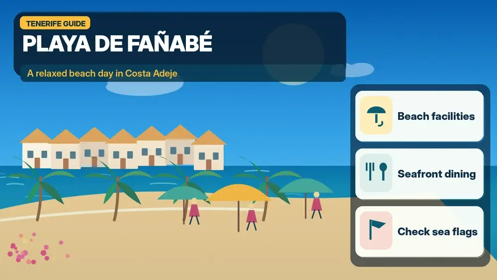
    Illustrated guide: Playa de Fañabé, with practical visitor tips
    Illustrated guide: Playa de Fañabé.

    It is also useful for mixed groups. One person can stay on the sand, another can walk the promenade, children have facilities nearby, and someone who wants more activity can look at water-sports operators. The beach is social and developed, but that is exactly its function.

    What the experience is really like

    The sand is light compared with Tenerife’s classic black-sand beaches, and the official tourism page describes the usual wave conditions as calm. I still make my swimming decision on the day, because “usually calm” is not the same as guaranteed safe.

    The promenade is almost as important as the beach. It connects Fañabé into the wider Costa Adeje waterfront, making it easy to walk toward Torviscas or continue in the direction of Playa del Duque. I often judge Costa Adeje beaches by the whole pedestrian experience, not just the patch of sand.

    A comfortable swimming beach

    For many visitors the main attraction is simple: accessible water, a broad beach and a developed setting where I do not need to carry everything from the hotel.

    I still watch flags, lifeguard instructions and local conditions. A Blue Flag recognises quality criteria; it does not make the Atlantic predictable.

    The promenade

    The promenade gives the day flexibility. If the beach feels crowded, I can walk, stop for coffee or continue to another section of coast without getting back into a car.

    This is why I particularly like Fañabé for travellers staying nearby. The area rewards leaving the keys in the hotel room.

    Facilities and accessibility

    Official information lists toilets, showers, foot-wash points, lounger and parasol rental, children’s facilities and adapted access. That level of infrastructure is a real advantage for families and travellers who do not want a remote beach.

    Availability can still vary by season or maintenance, so I never promise a specific piece of equipment without checking locally.

    Water activities

    A range of water sports is normally offered from the beach area. I choose operators based on safety briefing, insurance and clear pricing rather than the loudest salesperson on the promenade.

    For more specialist activities I compare the experience with my snorkelling and diving guide instead of assuming every coastal activity is equally good everywhere.

    Walking to Playa del Duque

    One of the best additions is the easy waterfront walk toward Playa del Duque. The atmosphere gradually changes, and the walk helps me understand Costa Adeje as a sequence of connected beaches rather than separate resort names.

    Costa Adeje Resort View Tenerife

    I would do this early morning or near sunset in hot weather, not necessarily at the hottest point of the afternoon.

    How I would get there

    If I am staying in Costa Adeje, walking is usually the simplest option. The whole point of choosing this resort area is that beaches, restaurants and accommodation can be connected on foot.

    There is parking in the broader area and interurban bus access, but I would not drive to Fañabé from a nearby hotel merely to avoid a short promenade walk. If I am coming from elsewhere, I compare parking stress with bus or taxi convenience. If I am comparing transport options across the island, I use my getting around Tenerife guide and, for road-based days, my Tenerife by car guide rather than relying on a route estimate that ignores parking, mountain roads or the walk from the final stop.

    How much time I would allow

    Fañabé can fill an entire day, but I rarely plan it by the hour. I set one anchor — perhaps lunch or a sunset walk — and let swimming conditions, heat and energy determine the rest.

    For a shorter visit, two or three hours is enough for a swim and promenade. That makes the beach easy to combine with a morning attraction or an evening meal.

    When I would go

    Morning is quieter and cooler; late afternoon has a more social promenade atmosphere. Midday gives the strongest sun, so I take shade seriously rather than relying on sea breeze to make UV exposure feel harmless.

    Costa Adeje is one of Tenerife’s more reliable areas for resort-style beach weather, but wind and swell still vary. I always check the actual beach when I arrive. For the broader seasonal picture, my best time to visit Tenerife guide explains why conditions can differ so much between coasts and elevations.

    Fanabe Beach Costa Adeje Tenerife

    Families, accessibility and different travel styles

    Families benefit from the urban facilities, gentler-water reputation and nearby food. I still keep children within arm’s reach in the water and do not substitute inflatables for supervision.

    The official tourism page lists adapted access. If I need a specific amphibious chair, assisted-bathing schedule or accessible toilet detail, I verify the current service with the local authority or beach team before relying on it. I never assume that the words “easy” or “accessible” mean the same thing for every traveller, so I check gradients, surfaces, toilets, shade and the distance from parking or public transport. My accessible Tenerife guide gives the wider planning context, while my Tenerife with kids guide is useful for family pacing.

    What I would bring

    High-SPF sunscreen, a hat, water and a reusable bottle are basics even when I rent a lounger. I also bring simple footwear for the promenade because hot sand and pavement can be uncomfortable.

    I do not bring valuables I cannot keep with me. Urban beaches are convenient, but convenience is not a reason to leave phones or wallets unattended while swimming. I keep the day bag small enough that I am not tempted to leave valuables visible in a parked car. My Tenerife packing list goes deeper into clothing and gear for mixed beach, city and mountain days.

    What I would combine with it

    The easiest combination is a waterfront day that includes Fañabé, Torviscas and Playa del Duque. I would walk rather than drive between them.

    If I want a completely different beach another day, Benijo or Tenerife’s black-sand beaches show the island’s wilder side.

    Food and breaks nearby

    Fañabé has abundant restaurants, cafés and bars. I would walk one street back from the busiest frontage as well as checking the promenade, because the best fit for my budget is not always directly beside the sand.

    For a special meal I might continue toward La Caleta; for a simple family lunch I prioritise shade, speed and something everyone actually wants to eat. For local dishes and ordering habits, I use my what to eat in Tenerife guide and eating out in Tenerife guide.

    Where I would stay

    Fañabé is one of the most practical places to stay for a car-light southern holiday. I would check the exact slope from accommodation to the beach because “near the sea” can still mean a steep return walk inland.

    I compare live accommodation around the area on Booking.com, then check the exact map position before booking. A hotel name can suggest one neighbourhood while the real walk to the beach, bus stop or attraction is much less convenient. My where to stay in Tenerife guide explains how I choose a base by trip style rather than star rating alone.

    A realistic half-day or full-day plan

    I would arrive in the morning, swim while the day is cooler, take a long shaded lunch, then decide whether to return to the sand or walk toward Playa del Duque.

    Around sunset I would stay on the promenade rather than rushing back to the hotel. Costa Adeje’s waterfront is at its best when I treat the evening walk as part of the beach day, not an afterthought.

    Costa Adeje Coast Tenerife

    Mistakes I would avoid

    • Assuming a Blue Flag means the ocean is safe in every condition.
    • Driving between neighbouring Costa Adeje beaches that are easy to connect on foot.
    • Underestimating UV exposure because the sea breeze feels cool.
    • Booking a hotel by straight-line distance without checking the uphill walk back.
    • Leaving valuables unattended while swimming.

    Most disappointing Tenerife days are not caused by choosing the wrong place; they come from mismatched expectations. I would rather do fewer things with enough time for parking, walking, weather and a proper meal than collect rushed stops that all blur together.

    Frequently asked questions

    Is Playa de Fañabé good for families?

    Yes. Its calm-water reputation, services, children’s facilities and promenade make it one of the easiest family beaches in Costa Adeje.

    Is it accessible?

    Official tourism information lists adapted access. I would verify any specific assisted-bathing equipment or schedule before relying on it.

    Does it have showers and toilets?

    Yes, the official beach information lists toilets, showers and foot-wash points among the services.

    Can I rent loungers?

    Lounger and parasol rental is listed as a normal service, subject to daily availability.

    Can I walk to Playa del Duque?

    Yes. The connected Costa Adeje promenade makes this a natural waterfront walk.

    My final take

    Playa de Fañabé is not the beach I would choose for solitude; it is the beach I would choose when I want a comfortable, well-serviced Costa Adeje day with easy swimming access, food and a long promenade. I would treat the ocean with the same respect as anywhere else and let the waterfront walking be part of the experience.

  • Sendero de los Sentidos Guide: Anaga Routes, Accessibility and Practical Tips

    Sendero de los Sentidos Guide: Anaga Routes, Accessibility and Practical Tips

    The Sendero de los Sentidos is one of the best introductions to Anaga for travellers who want the atmosphere of laurel forest without committing to a long mountain hike. It starts at Cruz del Carmen and offers three short interpretive routes through monteverde. The shortest is adapted for people with motor or sensory disabilities, while the longer options add old paths, steps, slopes and a viewpoint. This guide is built around the details I would want before leaving my accommodation: what is actually worth my time, how I would get there, where the friction points are, and what I would combine with the visit without turning the day into a race.

    Quick planning facts

    StartCruz del Carmen, Anaga Rural Park
    Route 1340 m; low difficulty; adapted boardwalk/terrace
    Route 2544 m; low difficulty; about 20 m elevation change
    Route 31,272 m; low–medium difficulty; steeper sections; about 100 m elevation change
    EnvironmentLaurisilva/monteverde forest
    Planning sourceCheck Tenerife ON for current trail status before travelling

    The first thing I would do is open the Tenerife ON trail information. I use the official source for the elements most likely to change — opening times, admission, access restrictions or temporary closures — and use the rest of my itinerary as a flexible framework. Even short trails in Tenerife deserve real outdoor planning. Cloud, drizzle and wind can arrive in Anaga while the south coast remains sunny, and forest surfaces can stay damp long after rain. I check Tenerife ON for current conditions, wear closed shoes with grip and keep to the marked route rather than following informal shortcuts.

    Why I would put Sendero de los Sentidos on an itinerary

    Anaga can be intimidating on a first visit because its roads, cloud and steep terrain look serious compared with the resort coast. The Sendero de los Sentidos gives me a controlled first step into that landscape. I can experience damp laurel forest, old path surfaces and changing light without needing a full trekking day.

    Anaga Laurel Forest Tenerife

    The interpretive concept is also unusually good. Instead of simply telling me the names of plants, the route encourages sight, smell and touch where appropriate. That turns a short walk into something more memorable, especially for children and travellers who are not regular hikers.

    What the experience is really like

    Cruz del Carmen sits high enough for cloud to be completely normal. I might begin in bright sun near La Laguna and arrive twenty minutes later in mist, drizzle and cool air. I see that as part of Anaga rather than bad luck. The forest is adapted to moisture, and the shifting atmosphere is central to its character.

    The three routes are not interchangeable. Route 1 is the accessibility-focused option; route 2 adds more traditional trail elements; route 3 reaches farther into the forest and includes stronger gradients. I choose the route that matches the least confident person in my group, not the one that sounds most impressive.

    Route 1: the accessible sensory trail

    The first route is about 340 metres and uses a boardwalk with a small terrace. It was designed for people with motor or sensory disabilities and is the obvious starting point for families with prams or visitors who need a more controlled surface.

    Illustrated guide: Sendero de los Sentidos, with practical visitor tips
    Illustrated guide: Sendero de los Sentidos.

    I still check current conditions because wet wood can feel different from a dry promenade, and accessibility is always personal.

    Route 2: a little more texture

    The second option is a 544-metre circular walk that follows part of an old mountain path, with historic surfaces, steps, a bridge and elevated walkway.

    This is the route I would choose when I want more of a “real trail” feel but still have limited time or modest hiking experience.

    Route 3: deeper into the monteverde

    At roughly 1.272 km, the third route is still short by hiking standards but has around 100 metres of elevation change and sections of steeper slope. It also reaches the Llano de los Loros viewpoint.

    I would wear proper closed shoes, especially in mist. Short distance does not automatically mean dry or flat terrain.

    Cruz del Carmen itself

    The trailhead is more than a car park. The visitor-centre area and viewpoint help me understand where Anaga sits in relation to La Laguna and the north-east of Tenerife.

    I spend a few minutes orienting myself before walking because context makes the forest more meaningful.

    The forest atmosphere

    The real highlight is not a single viewpoint but the laurisilva environment — trunks, leaves, moisture, filtered light and the muffled sound of a dense forest.

    I deliberately put the phone away for sections of the route. A “sensory” trail loses its point if I experience it only through a camera screen.

    How I would get there

    I can reach Cruz del Carmen by road from La Laguna, but parking is limited and popular periods can be busy. I would arrive early, especially at weekends, and never park in a way that blocks traffic or access.

    Public transport can be a good alternative from La Laguna depending on the current timetable. I check TITSA on the day rather than copy bus numbers from an old article because routes and frequencies can change. If I am comparing transport options across the island, I use my getting around Tenerife guide and, for road-based days, my Tenerife by car guide rather than relying on a route estimate that ignores parking, mountain roads or the walk from the final stop.

    How much time I would allow

    The shortest route can be walked quickly, but I would not visit only to record a ten-minute time. I allow at least an hour for the first trail, interpretation, viewpoint and simple wandering around Cruz del Carmen.

    For route 3 I would keep around 60–90 minutes available, more with children or photography. The larger Anaga day then depends on whether I continue toward Taganana, another trail or La Laguna.

    When I would go

    Morning is my favourite because parking pressure is lower and I still have options if cloud becomes dense. In summer the forest can be a refreshing contrast to the south; in winter I expect cooler, wetter conditions.

    I do not cancel simply because the forecast shows cloud. I cancel or change plans for genuinely unsafe weather, closures or warnings. Mist is often part of the experience; heavy wind, intense rain or official restrictions are different. For the broader seasonal picture, my best time to visit Tenerife guide explains why conditions can differ so much between coasts and elevations.

    Families, accessibility and different travel styles

    This is one of the easiest nature introductions for families because I can choose a route by age and confidence. I keep children close, explain that the forest floor and plants are protected, and turn the sensory signs into a game without encouraging them to leave the trail.

    Anaga Laurel Forest Trail Tenerife

    Route 1 was specifically designed to be accessible for people with motor or sensory disabilities. I would still check Tenerife ON and the visitor centre if I need guaranteed step-free conditions, because maintenance or weather can temporarily affect any outdoor route. I never assume that the words “easy” or “accessible” mean the same thing for every traveller, so I check gradients, surfaces, toilets, shade and the distance from parking or public transport. My accessible Tenerife guide gives the wider planning context, while my Tenerife with kids guide is useful for family pacing.

    What I would bring

    Closed shoes with grip, a light waterproof layer, water and a warmer layer than I would wear on the south coast are my essentials. Even on a short route, I avoid flip-flops.

    I also carry a small bag for my own rubbish and keep hands free on steeper or damp sections. Trekking poles are unnecessary for many visitors but can help individuals who already use them confidently. I keep the day bag small enough that I am not tempted to leave valuables visible in a parked car. My Tenerife packing list goes deeper into clothing and gear for mixed beach, city and mountain days.

    What I would combine with it

    The easiest combination is the trail plus La Laguna. That produces a varied day without demanding hours of mountain driving.

    More ambitious travellers can continue deeper into Anaga toward Taganana or Benijo, but I would not stack too many stops if visibility is poor or the roads are unfamiliar.

    Food and breaks nearby

    I would not count on this short forest walk as a food destination. I bring water and perhaps a small snack, then plan a proper meal in La Laguna or one of Anaga’s villages depending on the rest of the route.

    Keeping food simple also reduces litter risk. I take everything back out with me and never leave organic waste on the forest floor. For local dishes and ordering habits, I use my what to eat in Tenerife guide and eating out in Tenerife guide.

    Where I would stay

    La Laguna is the most convenient urban base for repeated access to Anaga. Santa Cruz is also practical, while the southern resorts involve a longer cross-island journey.

    I compare live accommodation around the area on Booking.com, then check the exact map position before booking. A hotel name can suggest one neighbourhood while the real walk to the beach, bus stop or attraction is much less convenient. My where to stay in Tenerife guide explains how I choose a base by trip style rather than star rating alone.

    A realistic half-day or full-day plan

    I would leave La Laguna early, reach Cruz del Carmen before the busiest period, check the current trail information and choose route 1, 2 or 3 based on the group. I would stop at the viewpoint and visitor area instead of jumping straight back into the car.

    Afterwards I would either return to La Laguna for lunch or continue into Anaga for one carefully chosen second stop. A short trail plus a village or beach is more realistic than collecting half the peninsula in one day.

    Anaga Tenerife

    Mistakes I would avoid

    • Wearing beach footwear because the route is short.
    • Assuming sunshine on the south coast means dry conditions in Anaga.
    • Choosing route 3 when someone in the group is uncomfortable with slopes or steps.
    • Arriving at peak time with no backup plan for limited parking.
    • Following unofficial shortcuts rather than the marked route and Tenerife ON guidance.

    Most disappointing Tenerife days are not caused by choosing the wrong place; they come from mismatched expectations. I would rather do fewer things with enough time for parking, walking, weather and a proper meal than collect rushed stops that all blur together.

    Frequently asked questions

    How long is the Sendero de los Sentidos?

    There are three options: about 340 m, 544 m and 1,272 m.

    Which route is accessible?

    The first 340-metre route is the specifically adapted option with boardwalk and terrace.

    Do I need hiking boots?

    Full boots are not essential for everyone, but I strongly prefer closed shoes with grip because the forest can be damp and slippery.

    Do I need a permit?

    I check Tenerife ON before travelling for the current status and any restrictions. The standard sensory routes are presented as visitor trails, but conditions and access can change.

    Can I do it with children?

    Yes. The short routes are well suited to families, provided children stay on the path and the chosen variant matches their ability.

    My final take

    I would recommend the Sendero de los Sentidos to almost anyone curious about Anaga because the experience is short, flexible and genuinely different from Tenerife’s resort coast. The key is to respect the forest weather, choose the right route for the group and check Tenerife ON before setting out.

  • Castillo de San Cristóbal Guide: Free Museum, El Tigre and Santa Cruz History

    Castillo de San Cristóbal Guide: Free Museum, El Tigre and Santa Cruz History

    The Castillo de San Cristóbal is one of Santa Cruz de Tenerife’s easiest historic sights to miss because the surviving walls are underground, directly beneath Plaza de España. That hidden setting is exactly what makes it interesting. The interpretation centre turns fragments uncovered during modern redevelopment into a compact story about the city’s coastal defences, the 1797 British attack and the famous cannon known as El Tigre. This guide is built around the details I would want before leaving my accommodation: what is actually worth my time, how I would get there, where the friction points are, and what I would combine with the visit without turning the day into a race.

    Quick planning facts

    LocationBeneath Plaza de España, Santa Cruz de Tenerife
    AdmissionFree
    2026 hoursMonday–Saturday 10:00–18:00
    Last access15 minutes before closing
    Closed24, 25 and 31 December; 1 and 6 January
    Historic timelineFortification begun in 1575; demolished in 1928; surviving walls rediscovered in 2006

    The first thing I would do is open the official Castillo de San Cristóbal visitor page. I use the official source for the elements most likely to change — opening times, admission, access restrictions or temporary closures — and use the rest of my itinerary as a flexible framework. I treat opening times, show schedules and prices as planning data rather than promises carved in stone. Tenerife attractions can adjust operations for maintenance, weather, capacity or special events, so I always re-check the official page on the morning of the visit. That small habit is especially useful when a visit depends on a particular presentation, planetarium slot or animal activity.

    Why I would put Castillo de San Cristóbal on an itinerary

    I like sights that change the way I read the city around them. After visiting the underground remains, Plaza de España is no longer just an open square by the port; it becomes the site of a defensive structure that once faced the sea. That kind of context is more valuable to me than collecting another photograph of a monument façade.

    The centre is also free and centrally located, so it has almost no logistical cost. I can add it to a Santa Cruz day without reserving half the itinerary, and the indoor setting makes it useful when the weather is hot, windy or briefly wet.

    What the experience is really like

    The visit is compact. I descend below the modern plaza, see portions of the original wall and follow interpretation about Tenerife’s defensive system and the fortifications that protected Santa Cruz and other coastal settlements. The museum is less about decorative objects and more about understanding place, conflict and urban change.

    The best-known object is the bronze cannon El Tigre. Popular tradition links it to the shot that injured Admiral Horatio Nelson during the failed British attack in July 1797, but the museum itself treats that specific attribution with appropriate caution. I would tell the story as tradition and symbolism, not as an unquestioned fact.

    The surviving fortress walls

    The walls are the reason the centre exists. They were found in 2006 during work on Plaza de España and incorporated into an underground gallery rather than removed from public view.

    I spend time looking at the relationship between the masonry and the modern structure above. It is a rare chance to see archaeology preserved directly inside the everyday city.

    El Tigre cannon

    El Tigre is a large eighteenth-century bronze cannon associated in local memory with the defence of Santa Cruz. It has enormous symbolic importance even though the claim that it fired the shot that wounded Nelson cannot be demonstrated conclusively.

    Panoramic View Of Santa Cruz De Tenerife

    That distinction actually makes the object more interesting: it opens a conversation about how communities remember events and how legends attach themselves to physical objects.

    The 1797 attack in context

    Nelson’s failed attack is one of the defining episodes in Santa Cruz history. I would understand it here first, then notice the references to 25 July and the city’s defensive past elsewhere in Santa Cruz.

    Rather than reducing the story to one famous admiral, I pay attention to the local militia, fortifications and broader geography that shaped the outcome.

    A hidden museum under Plaza de España

    The contrast between the bright open plaza and the underground remains is part of the appeal. Many visitors cross the square without realising the museum is below them.

    Because admission is free, there is very little reason not to look inside if I am already exploring central Santa Cruz.

    A good anchor for a walking route

    From Plaza de España I can continue toward Calle del Castillo, the waterfront, TEA, Mercado de Nuestra Señora de África or Parque García Sanabria.

    The centre therefore works best as a historical layer inside a broader city walk, not as an isolated destination that requires a special trip.

    How I would get there

    Plaza de España is one of the easiest places to reach in central Santa Cruz. The official museum information notes that it is around a 10–15 minute walk from the main bus interchange and close to the Fundación stop on tram line 1.

    If I drive, I would use one of the central car parks listed by the museum rather than searching street by street. Parking under Plaza de España itself can be especially convenient for a city-centre day. If I am comparing transport options across the island, I use my getting around Tenerife guide and, for road-based days, my Tenerife by car guide rather than relying on a route estimate that ignores parking, mountain roads or the walk from the final stop.

    How much time I would allow

    I would allow 30 to 60 minutes for the interpretation centre, depending on how much text I read. The attraction is compact enough that rushing is unnecessary.

    Because last access is 15 minutes before closing, I would not arrive at 17:45 expecting a meaningful visit. I prefer to use it as a morning or early-afternoon stop between other Santa Cruz sights.

    When I would go

    Any time of year works. In summer it provides a short indoor break from heat; in winter it can fill the gap between outdoor stops if showers pass over the capital.

    I also like it early in a Santa Cruz visit because the historical context changes how I interpret the streets and waterfront afterwards. For the broader seasonal picture, my best time to visit Tenerife guide explains why conditions can differ so much between coasts and elevations.

    Families, accessibility and different travel styles

    With children, I would keep the history simple: a fortress once stood here to defend the harbour; pieces of it were found under the modern square; and one famous cannon became part of the city’s story. That is enough to make the space tangible without turning it into a lecture.

    Because the centre is a modern interpretation space below the plaza, I would expect better access than in many historic fortifications, but I would still confirm current lift or step-free arrangements directly if they are essential to the visit. I never assume that the words “easy” or “accessible” mean the same thing for every traveller, so I check gradients, surfaces, toilets, shade and the distance from parking or public transport. My accessible Tenerife guide gives the wider planning context, while my Tenerife with kids guide is useful for family pacing.

    What I would bring

    I need almost nothing for the museum itself. A charged phone is useful for city navigation, and a light layer can be comfortable indoors if I have come from a hot waterfront walk.

    I would keep the visit bag light because the real advantage of this stop is how easily it fits into a longer walking day in Santa Cruz. I keep the day bag small enough that I am not tempted to leave valuables visible in a parked car. My Tenerife packing list goes deeper into clothing and gear for mixed beach, city and mountain days.

    Santa Cruz De Tenerife At Night

    What I would combine with it

    My natural route is Plaza de España and the castle remains, then TEA or MUNA, followed by the market or lunch. Later I might continue to Parque García Sanabria.

    If architecture is the priority, I can also include Auditorio de Tenerife. The key is to group central sights geographically instead of crossing Santa Cruz repeatedly.

    Food and breaks nearby

    I would plan food elsewhere in central Santa Cruz. The surrounding streets and market area offer much more choice than treating a small interpretation centre as a meal stop.

    A market lunch creates a satisfying contrast: military and urban history first, then a very contemporary taste of the city. For local dishes and ordering habits, I use my what to eat in Tenerife guide and eating out in Tenerife guide.

    Where I would stay

    Staying in Santa Cruz makes this an effortless walk. La Laguna is also practical thanks to the tram connection and gives a different atmosphere for the evening.

    I compare live accommodation around the area on Booking.com, then check the exact map position before booking. A hotel name can suggest one neighbourhood while the real walk to the beach, bus stop or attraction is much less convenient. My where to stay in Tenerife guide explains how I choose a base by trip style rather than star rating alone.

    A realistic half-day or full-day plan

    I would start at Plaza de España, spend 45 minutes underground, then walk through the central streets toward TEA or MUNA. Lunch would be around the market rather than next to the first sight I finish.

    The afternoon can continue toward García Sanabria or the Auditorio depending on interests. This creates a coherent Santa Cruz day with history, art, food and architecture rather than a scattered list.

    Mistakes I would avoid

    • Walking across Plaza de España without realising the museum is underneath.
    • Repeating the El Tigre/Nelson story as proven fact rather than local tradition.
    • Arriving in the final 15 minutes before closing.
    • Driving between central sights that are easier to connect on foot.
    • Treating the centre as a standalone half-day attraction instead of part of a city route.

    Most disappointing Tenerife days are not caused by choosing the wrong place; they come from mismatched expectations. I would rather do fewer things with enough time for parking, walking, weather and a proper meal than collect rushed stops that all blur together.

    Frequently asked questions

    Is admission really free?

    Yes. The official visitor information currently lists free entry.

    What are the opening hours?

    Monday to Saturday 10:00–18:00, with last access 15 minutes before closing and specified holiday closures.

    Where is the castle?

    The surviving walls are in an underground interpretation centre beneath Plaza de España in central Santa Cruz.

    Did El Tigre really wound Nelson?

    Local tradition says so, but the specific attribution is not historically proven. I would present it as an important legend attached to the 1797 defence.

    How long do I need?

    Around 30–60 minutes is enough for most visitors, making it easy to combine with other Santa Cruz sights.

    My final take

    The Castillo de San Cristóbal is a small but meaningful Santa Cruz stop: free, central and layered directly beneath the modern city. I would visit early in my walking route, treat the El Tigre story with historical nuance and use the museum to understand why the waterfront looks the way it does today.