Author: Patricia

  • Playa de Los Guíos Guide: Black Sand, Los Gigantes Cliffs and Swimming Tips

    Playa de Los Guíos Guide: Black Sand, Los Gigantes Cliffs and Swimming Tips

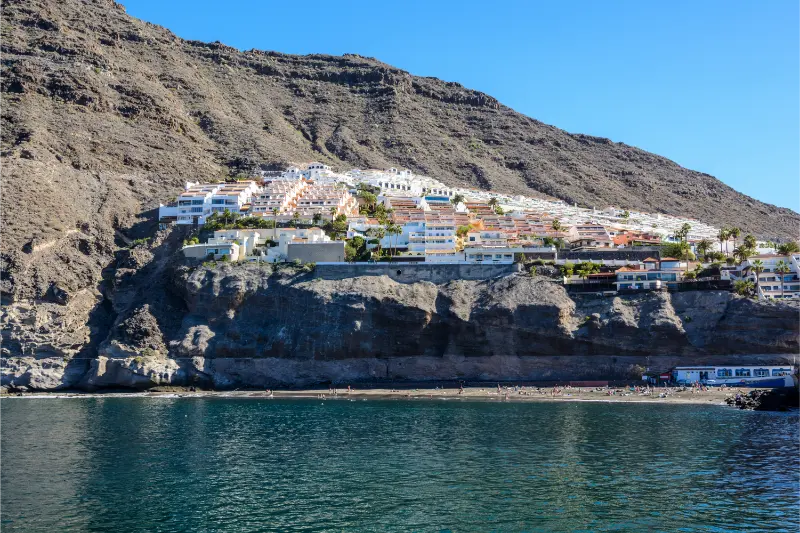
    Playa de Los Guíos is the small black-sand beach that makes the scale of the Los Gigantes cliffs feel real. It sits at the foot of the cliffs beside the marina, so this is not a remote beach day: it is a compact urban stop where swimming, boat trips, lunch and a walk around Los Gigantes can fit into the same half-day. I like it most when I treat the beach as part of the wider Los Gigantes experience rather than expecting a huge resort beach.

    The official Tenerife tourism page describes Los Guíos as a roughly 180-metre black-sand beach with generally calm water, easy pedestrian access, restaurants and boat activities nearby. The setting is its strongest feature. From the sand, the cliffs rise abruptly above the coast and give the beach a sense of enclosure that is completely different from the broad beaches of Costa Adeje or El Médano.

    Quick planning facts

    LocationLos Gigantes, Santiago del Teide
    Beach typeUrban black-sand beach
    Official lengthAbout 180 m
    Best forCliff views, a short swim, combining with marina activities
    ParkingNo dedicated beach parking; use nearby public/paid options
    BusYes; Los Gigantes is served by TITSA
    AccessibilityOfficial beach listing does not classify it as accessible
    Best approachArrive early, check sea conditions, combine with Los Gigantes

    What Los Guíos is really like

    Los Guíos is narrow and visually dramatic rather than spacious. The cliffs are so close that the landscape dominates the experience, especially if I have already seen them from a boat and then return to the beach to look upward from sea level. The sand is volcanic and dark, and the shoreline can change character with swell and tide.

    I do not choose Los Guíos when my priority is a long, flat promenade behind a wide beach with rows of loungers. I choose it because it is one of the easiest places to combine the ocean with the cliffs, marina and old resort centre. For a broader overview of the area, my Los Gigantes guide explains the viewpoints, boat trips and where I would stay.

    Swimming and sea conditions

    The water is often described as relatively calm, but “calm” is never a guarantee on an Atlantic island. I watch the beach flags, ask lifeguards or local staff when available, and look at what the shore break is doing before entering. Dark volcanic sand can also make the waterline feel steeper than on some southern resort beaches.
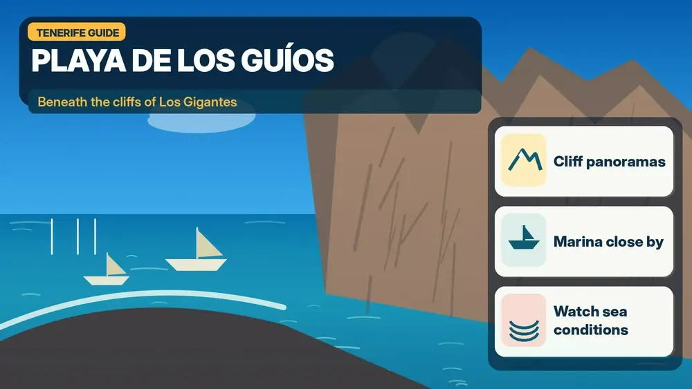
    Illustrated guide: Playa de Los Guíos and the Los Gigantes Cliffs, with practical visitor tips
    Illustrated guide: Playa de Los Guíos and the Los Gigantes Cliffs.

    If the sea is rough, I turn Los Guíos into a scenic stop rather than forcing a swim. That flexibility is one of the reasons I prefer to combine it with lunch, a marina walk or a boat excursion. My Tenerife safety guide covers the ocean habits I use everywhere on the island.

    The best time of day

    I prefer morning for the easiest logistics. The beach and marina can feel busy later, especially when excursion boats are departing and returning. Morning light also makes the cliffs particularly impressive from several angles, while late afternoon can be beautiful if the beach is not crowded.

    The cliff setting means light and shade change through the day. I do not assume that a forecast of full sun means the beach will feel identical to an open south-coast bay. If photography matters, I walk around the marina and nearby streets too rather than staying in one fixed position.

    How to get there without stress

    By car, the difficult part is not finding Los Gigantes but finding a convenient place to leave the car at a busy time. I avoid circling the waterfront repeatedly. If the closest spaces are full, I would rather park farther away legally and walk downhill than squeeze into an awkward roadside space.

    By bus, Los Gigantes is one of the easier west-coast bases to reach compared with remote Teno villages. I check the current TITSA timetable and build in time for the uphill walk back to a stop if necessary. The practical details in my Tenerife bus guide help if I am planning the whole day without a car.

    Parking strategy

    There is no dedicated beach car park listed for Los Guíos, so parking should be part of the plan rather than an afterthought. On a busy day I aim to arrive before the main excursion-boat rush. I also keep in mind that streets around Los Gigantes are steep; a parking place that looks close on the map can involve a noticeable climb on the way back.

    If I am travelling with small children, older relatives or lots of beach equipment, I would drop the group near a safe access point only where stopping is permitted and then park. I never block the marina approaches or private access because the area is compact and working traffic needs room.

    Combining the beach with a boat trip

    Los Gigantes marina is one of the island’s classic departure points for whale-watching and coastal excursions. I like the idea of seeing the cliffs from the water and then spending time on Los Guíos afterward, because the two perspectives make each other more memorable. I choose responsible operators and avoid any experience that promises touching or chasing wildlife.
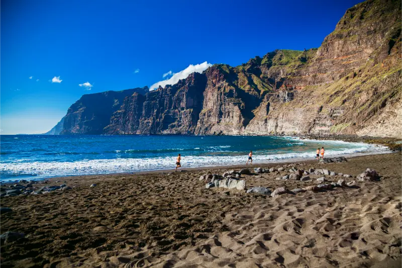
    Playa De Los Guios Beach Los Gigantes Tenerife

    My whale-watching guide explains what I look for in an operator, while the kayaking guide is useful if I prefer a more active outing near the cliffs.

    Food, cafés and facilities

    One advantage of Los Guíos is that I am not isolated. The surrounding area has cafés, restaurants and marina services, so I do not need to carry a full day of supplies. I still bring water and sun protection because shade on the sand can be limited and the black sand becomes hot.

    For lunch, I usually prefer to walk a little away from the immediate excursion departure points and compare menus. A waterfront location can be convenient, but I care more about fresh food, clear pricing and whether the place feels busy with both visitors and residents.

    Who I think will enjoy it most

    Los Guíos works especially well for travellers who want scenery without a long hike. It can also suit couples and families who are already spending time in Los Gigantes. For people whose main goal is a full day of easy swimming with lots of beach space, I would compare it with Playa de La Arena or the southern resort beaches.

    The beach is less suitable for travellers who need a formally accessible beach setup, because the official listing does not mark it as accessible. In that case I would use my accessible Tenerife guide to identify better-equipped options.

    Where I would stay nearby

    Los Gigantes and Puerto de Santiago are practical west-coast bases if I want cliffs, boat trips and a quieter evening atmosphere than Playa de las Américas. Staying nearby also lets me visit Los Guíos early, before day visitors arrive. I can compare accommodation around Los Gigantes on Booking.com.

    I would not choose the west coast solely for this beach, but I would choose it for the combination of Los Gigantes, Playa de La Arena, Santiago del Teide, Teno and boat excursions. That is a much stronger reason to base myself here.

    Los Gigantes Cliffs Coastal Panorama Tenerife

    A realistic half-day plan

    • Arrive in Los Gigantes early enough to park without rushing.
    • Walk to Los Guíos and spend 60–90 minutes on the beach if sea conditions are suitable.
    • Explore the marina and confirm any boat-trip departure details.
    • Have lunch in Los Gigantes or Puerto de Santiago.
    • Finish at a viewpoint or continue to Playa de La Arena for a second coastal stop.

    I keep this plan deliberately loose. If the sea is rough or the beach feels crowded, the cliffs and marina still make the trip worthwhile.

    Useful official information

    For beach characteristics I use the official Tenerife tourism page for Playa de Los Guíos. For buses I check TITSA directly on the day of travel because routes and frequencies can change.

    I also check the weather and sea state rather than relying only on an island-wide forecast. Conditions around the cliffs can feel different from Costa Adeje even on the same afternoon.

    Mistakes I would avoid

    • Assuming there will be easy parking beside the sand.
    • Entering the water just because other people are swimming.
    • Planning only the beach and missing the cliffs, marina and viewpoints.
    • Carrying too much beach equipment down steep streets.
    • Booking a boat trip with no buffer before or after transport connections.

    The best Los Guíos visit is simple: good timing, realistic expectations and enough flexibility to enjoy the whole Los Gigantes setting.

    Frequently asked questions

    Is Playa de Los Guíos sandy?

    Yes. It is a volcanic black-sand beach.

    Can I park directly at the beach?

    The official tourism listing does not list beach parking. I plan to use nearby public or paid parking and walk.

    Is Los Guíos good for swimming?

    It can be, and the water is often relatively calm, but I always follow current flags and sea conditions.

    Can I combine it with whale watching?

    Yes. The nearby marina makes this one of the easiest beach-and-boat combinations on the west coast.

    How long would I spend there?

    For most travellers, one to two hours on the beach plus time for the marina or lunch is realistic.

    My final take

    Los Guíos is not Tenerife’s biggest or most luxurious beach, and that is exactly why I like it. The reason to come is the relationship between black sand, the marina and the immense Los Gigantes cliffs. I would build it into a west-coast day rather than travel across the island only for a sunbathing session.
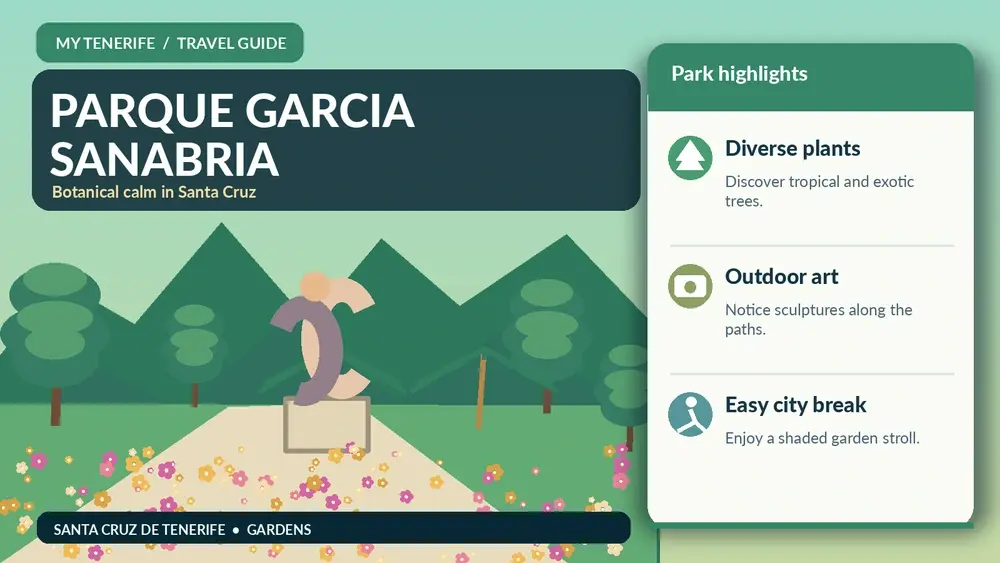
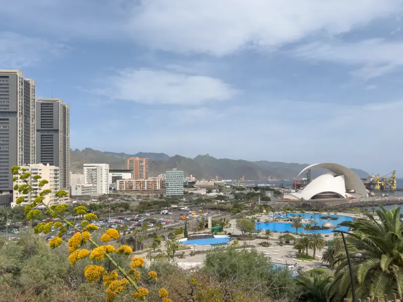
  • Parque García Sanabria Guide: Gardens, Sculptures and a Green Walk in Santa Cruz

    Parque García Sanabria Guide: Gardens, Sculptures and a Green Walk in Santa Cruz

    Parque García Sanabria is not a day-trip attraction in the usual sense; it is the kind of city park that makes Santa Cruz easier to enjoy on foot and gives me a green pause between urban stops.

    A large botanical park in the city centre

    Santa Cruz City Council describes García Sanabria as covering about 55,000 square metres and containing more than 200 plant species from around the world, together with paths, fountains, ponds, children’s areas, monuments and sculptures. That scale is large enough to wander, but compact enough to use naturally inside a city day.

    Why the park exists

    The idea of creating a major urban park in Santa Cruz developed over decades as the city grew and public-health advocates argued for green space. The park is closely associated with mayor Santiago García Sanabria and became one of the capital’s defining civic landscapes. I like knowing that history because it frames the park as infrastructure for city life, not decoration.

    Botanical interest without a ticket

    I can explore palms, tropical and subtropical species without the formal structure of a botanical-garden admission. The city even maintains a geolocated botanical guide. I use labels and the route selectively, because the best experience is still the combination of plants, shade, water and everyday use by residents.

    The sculpture route

    The park contains a recognised sculpture route and the municipal open-data portal provides geolocated information for sculptures and routes. I enjoy discovering works while walking rather than turning the park into a scavenger hunt. Some pieces make more sense when I see how they sit among vegetation and paths.

    A good midday reset

    Santa Cruz can feel hot and bright in exposed streets. García Sanabria gives me shade, benches and a slower pace between museums, shopping or lunch. I still carry water and sun protection because shade is not continuous and the walk to and from the park may be exposed.

    Families and ordinary city life

    The children’s areas and open paths make the park easy to include in a family day. I value it precisely because it does not need to become another scheduled attraction. A child can play, adults can sit, and everyone gets a break from galleries or shopping. That ordinary usefulness is one of its strengths.

    Palmetum comparison

    The Palmetum is the better choice for a specialised botanical visit; García Sanabria is the better choice for a free central-city pause. Plant lovers can visit both without feeling that one repeats the other, because their histories, collections and urban roles are different.

    View from the Palmetum towards the Auditorio and Santa Cruz waterfront

    How I build it into a walking route

    I use the park as part of my Santa Cruz guide, connecting it with the Ramblas, central shopping streets or a museum depending on the day. I avoid driving to the park purely for 20 minutes if I am already parked elsewhere in central Santa Cruz; the city makes more sense on foot.

    How much time I would allow

    I would not rush Parque García Sanabria. For a focused visit I allow enough time to look rather than only photograph, and I add a buffer for the entrance, orientation and any temporary display or guided element. The right duration depends on interest: a specialist can spend much longer than someone adding it to a broader city day. I plan the rest of the day around one or two nearby places, not around an unrealistic chain of timed attractions.

    How I fit it into the surrounding city

    Parque García Sanabria works best when it is part of a coherent local route. I use my Santa Cruz de Tenerife guide to decide what belongs before and after it, keeping lunch and transport on the same side of town whenever possible. This is especially useful in Santa Cruz, where several major cultural sites sit within a relatively compact urban area but traffic and parking can still waste time if I keep moving the car.

    Tickets, opening hours and the one rule I never skip

    Anything operational can change, so I verify the official website shortly before the visit. I do not build a trip around an opening time copied months earlier from a travel article. Temporary exhibitions, guided tours, holiday closures and special events can all alter normal access. When a timed activity matters, I book it; when the visit is flexible, I still save the official page on my phone.

    Getting there and parking

    For Parque García Sanabria, I decide whether public transport is simpler than driving. In central Santa Cruz and Puerto de la Cruz, walking from another attraction or using urban transport can remove the stress of finding a space. If I drive, I choose a public car park first rather than searching for free kerbside parking immediately beside the entrance. The wider transport picture is covered in my getting around Tenerife guide.

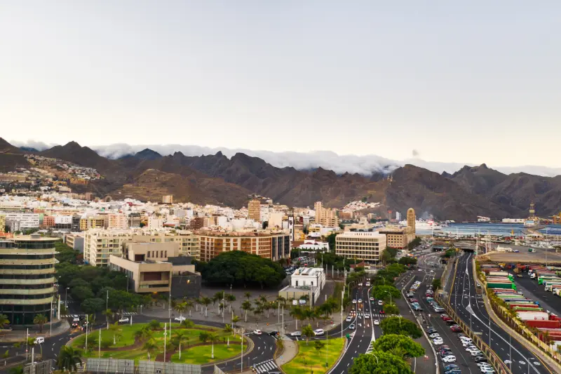
    Panoramic View Of Santa Cruz De Tenerife

    Accessibility and comfort

    As a public urban park, many paths are straightforward, but gradients, surface condition and the most convenient accessible entrance can matter; I check the current route if mobility is limited. I still verify the exact access route if step-free movement, seating, adapted toilets or assistance is essential. Accessibility can be affected by temporary works or by the route between the car park and entrance, not only by the building itself. My accessible Tenerife guide covers the broader island context.

    Visiting with children

    The park is naturally family-friendly because children can move, play and take breaks without the behaviour expectations of a museum. I avoid assuming that a place is either “for children” or “not for children”; the age, attention span and interests matter. A shorter visit with one clear objective often works better than forcing a family to complete every room or garden path. I combine cultural stops with an outdoor break, snack or nearby park when that helps the day feel balanced.

    Photography without losing the experience

    I take photographs at Parque García Sanabria where permitted, but I do not let the phone dictate the visit. I look for context — architecture, planting, light, material and scale — rather than photographing every information panel. In galleries, museums or performance spaces I respect any restrictions on flash, video or specific rooms. If a guided visit has special rules, the guide’s instructions take priority.

    A rainy-day and hot-day advantage

    Parque García Sanabria can be useful when Tenerife weather does not match a beach plan, but I still check conditions around the journey. On a very hot day, an indoor or shaded cultural stop can be a welcome reset; on a wet north-coast day it can rescue an itinerary. I keep the day flexible rather than moving across the island purely to chase a forecast.

    Where I would stay

    I would not choose a hotel solely for Parque García Sanabria, but if several nearby attractions matter, staying in the same urban area can be efficient. I compare current accommodation nearby with my where to stay in Tenerife guide, paying more attention to walkability, evening atmosphere and parking than to being a few hundred metres closer to one entrance.

    Who I think will get the most from it

    Parque García Sanabria is strongest for travellers who enjoy understanding Tenerife beyond beaches and viewpoints. I would include it when the subject genuinely interests me, not because every attraction needs to be checked off. A well-chosen museum, garden or cultural building can add more depth to a trip than another rushed stop, especially when it explains the island’s landscape, history or contemporary life.

    What I check immediately before going

    Before leaving, I check the official page for opening hours, ticketing, closures and temporary programming. I also check the route from my current location and one nearby alternative. This takes only a few minutes and is the best protection against outdated information. If Parque García Sanabria is the main reason for the day, I save proof of any reservation offline.

    Official information I use before visiting

    For current access, opening information and notices, I use Santa Cruz City Council parks and gardens information. I recheck it close to the visit because practical details can change after this article is published.

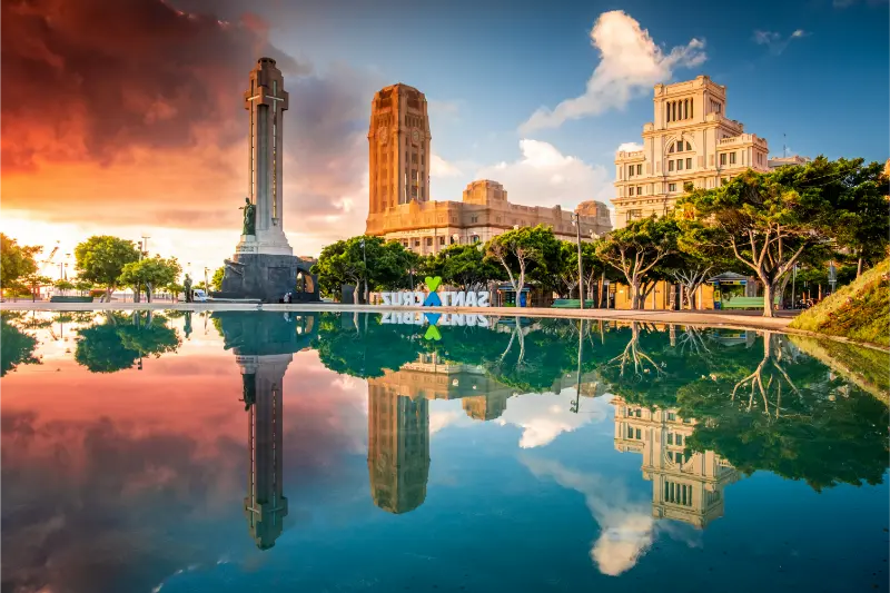
    Plaza de España reflecting pool and civic buildings in Santa Cruz de Tenerife
    Plaza de España, Santa Cruz de Tenerife.

    A simple half-day structure

    If I only had half a day, I would make Parque García Sanabria the anchor rather than the excuse for a complicated circuit. I would arrive early enough to avoid feeling rushed, spend time on the part that genuinely interests me, then add one nearby walk or food stop. I keep the final hour loose so a longer conversation, exhibition, view or lunch does not create stress. This is the way I prefer to travel in Tenerife: the plan has a shape, but it is not a timetable that punishes me for enjoying a place.

    What I would do on a repeat visit

    On a repeat trip, I would use Parque García Sanabria as a reason to look at the surrounding area in more detail. First visits naturally concentrate on Teide, major beaches and the most famous towns. Later trips are where smaller museums, municipal centres, gardens and quieter streets become especially rewarding. I would check for temporary events, seasonal planting, a new exhibition or a local festival and let that determine the exact timing rather than repeating the same route from the first visit.

  • Tenerife Food Souvenirs Guide: Mojo, Gofio, Honey, Cheese and Wine

    Tenerife Food Souvenirs Guide: Mojo, Gofio, Honey, Cheese and Wine

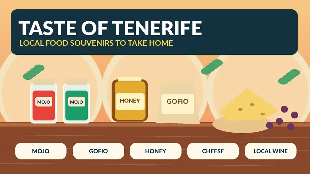
    The best Tenerife food souvenirs are the ones that still make sense when I get home. I would rather carry a small bottle of good local mojo, a packet of gofio, a jar of honey or a carefully chosen cheese than fill a suitcase with generic “Canary Islands” products that could have come from anywhere.

    Food shopping is also a way to understand the island. Tenerife’s volcanic soils, altitude differences and long agricultural history show up in wine, potatoes, honey, cheese and traditional pantry ingredients. I use markets, specialist shops and producers to learn what I am actually buying.

    Mojo: the easiest flavour to take home

    Mojo rojo and mojo verde are among the most recognisable Canarian sauces. Recipes vary: red versions often use peppers or paprika, while green versions may lean on coriander or parsley. I check the label rather than assuming every jar tastes the same.

    For air travel, commercially sealed jars or bottles are simpler than homemade containers. If travelling with hand luggage, I remember airport liquid rules. Powdered spice mixes can be an alternative if I want to recreate mojo at home.

    Gofio

    Gofio is roasted grain flour and one of the most culturally meaningful foods I can buy. It is used in both savoury and sweet preparations and has deep roots in Canarian food history. A sealed packet is easy to transport and gives me something I can actually use in a kitchen after the trip.

    I would ask how locals use the specific grain blend instead of buying it as a novelty. Some versions are based on maize, others on wheat or mixed cereals.

    Tenerife honey

    Honey is a compact souvenir with strong connection to local landscapes. Different floral sources and altitude zones can create noticeably different flavours. I buy from a reputable producer or market stall with clear origin information and keep the jar protected inside luggage.

    Cheese

    Canarian cheeses can be excellent souvenirs, but transport needs more thought. I prefer vacuum-packed products from a reputable seller and ask how long they can safely remain unrefrigerated. For long journeys, I would not guess: I follow the producer’s storage advice and destination-country import rules.

    Goat cheese is particularly associated with island traditions, and smoked or cured styles may travel more easily than very fresh cheese. Again, packaging and customs rules matter.

    Wine from Tenerife

    Tenerife has several wine regions and volcanic soils that make local bottles an obvious gift. I choose wine after tasting rather than buying only because the label says Tenerife. My Tenerife wine guide explains the island’s main wine areas and tasting strategy.

    If flying, I protect bottles carefully in checked luggage and verify airline baggage limits. Shipping from the winery can sometimes be easier, especially for several bottles, but I compare cost and customs requirements first.

    Sea salt and seasoning products

    Salt, herb blends and spice products are lightweight and useful. I check whether the product is genuinely made or packed in the Canary Islands rather than buying something with only tourist branding. Small labels can tell me much more than the front of the package.

    Traditional sweets

    Almond sweets, biscuits and local pastries can work well when packaged for travel. Fresh bakery products are best eaten during the trip, while sealed sweets are easier to carry. I ask about shelf life instead of assuming every traditional dessert will survive a warm suitcase.

    Coffee and local roasting

    The Canary Islands have a growing specialty-coffee scene, and a bag roasted in Tenerife can be a good souvenir even when the beans were grown elsewhere. I distinguish between “roasted locally” and “grown locally” so I understand what I am buying.

    Where I shop

    Municipal markets, farmers’ markets, wine shops and producer stores are my first choices. In Santa Cruz, Mercado Nuestra Señora de África is useful because I can compare fruit, cheese, fish and packaged products in one place. My market guide explains how I approach a visit.

    Supermarkets are also useful, especially for ordinary brands locals actually buy. A good souvenir does not need boutique packaging; sometimes a familiar sauce or biscuit is more authentic precisely because it is everyday food.

    What I check on the label

    • Where the product was made or produced.
    • Ingredients and allergens.
    • Storage instructions.
    • Best-before date.
    • Whether refrigeration is required.
    • Bottle or jar size if I am flying with hand luggage.
    • Any protected-origin or producer information that helps verify authenticity.

    Customs and airline rules

    Food that is legal to buy in Tenerife is not automatically legal to import into every destination. Meat, dairy, fresh fruit, seeds and plant products can face restrictions. I check the rules for the country I am entering, especially if travelling outside the EU.

    For flights, liquid restrictions apply to sauces, honey and wine in hand luggage. I pack breakable items in checked baggage only when allowed and use sealed bags around anything that could leak.

    Souvenirs I would skip

    I skip products with unclear origin, damaged seals or no ingredient information. I also avoid buying large quantities of fragile food on the first day of a trip. Heat in a parked car or hotel room can ruin something long before the flight home.

    A simple food-souvenir shopping list

    • One mojo that you tasted and genuinely liked.
    • A packet of gofio for cooking at home.
    • A small jar of Tenerife honey.
    • A vacuum-packed cured cheese if storage and import rules allow it.
    • One bottle of local wine if baggage space makes sense.
    • A lightweight sweet or biscuit for sharing.

    How I make the souvenir more meaningful

    I write down where I bought it and what I ate with it. A jar of mojo is more interesting when I remember the papas arrugadas served beside it; a bottle of wine means more when I remember the valley or bodega. Food becomes a travel memory when I connect it to a place.

    Frequently asked questions

    Can I take mojo in hand luggage?

    It is generally treated as a liquid or paste for airport-security purposes, so container-size rules can apply. I check the latest airport rules for my route.

    Is gofio easy to transport?

    Yes. A sealed dry packet is one of the simplest Tenerife food products to pack.

    Can I bring cheese home?

    Possibly, but storage and import rules depend on destination. I buy sealed cheese and check customs rules before travelling.

    Where should I buy Tenerife wine?

    A winery, specialist wine shop or good market is ideal because I can ask questions and choose based on taste rather than label design.

    My final take

    The food souvenirs I value most are small, usable and connected to a real experience on the island. Mojo, gofio, honey, cheese and wine tell a better Tenerife story than generic gift-shop products, especially when I know where they came from and how to use them at home.

    Tenerife Seafront Restaurant Terrace

    Buying directly from producers

    When possible I ask the seller where the product was made, how it is normally eaten and how it should be stored. Those questions quickly separate a meaningful local purchase from a generic souvenir. They also give me ideas for using the product at home instead of leaving it unopened in a cupboard.

    Packing strategy

    I buy fragile jars near the end of the trip, wrap them in clothing and place them inside a sealed bag before putting them in checked luggage. Dry products go in the middle of the suitcase where packaging is less likely to tear. I keep receipts for expensive items and photograph labels if I want to find the producer again later.

    Tasting before buying

    Whenever possible I taste a product first. Tenerife has enough variation in mojo, honey, cheese and wine that the most famous category is not automatically the flavour I will enjoy most. A quick tasting also gives me language to ask better questions about ingredients, sweetness, smoke, ageing or spice. That makes the purchase more personal and reduces the chance of bringing home something chosen only for packaging.

    Gifts for people with dietary restrictions

    If I am buying for someone else, I read the ingredient list rather than assuming a traditional product is simple. Sauces can contain nuts or gluten-containing thickeners, sweets may include dairy or eggs, and flavoured products can have additives I was not expecting. Clear labelling matters more than a decorative box when the gift is meant to be eaten safely.

    Keeping quality intact until home

    I protect food from heat during the rest of the holiday. A bottle of wine or jar of honey can sit safely in a room, while cheese and some sweets may need cooler conditions. I never leave sensitive food for hours in a parked car. The last stage of the trip is part of the purchase: good storage preserves the quality I paid for.

    A final planning check before I leave

    The evening before this day, I verify the weather, current access information, transport, opening details where relevant and the amount of daylight I have. I save essential information offline and tell someone in my group what the main plan is. I also decide in advance what would make me switch to the backup plan. That small amount of preparation lets me enjoy Tenerife more spontaneously once I am actually there, because the important risks and logistics have already been considered.

  • Tenerife Ferry Guide: La Gomera, Gran Canaria, La Palma and Island Hopping

    Tenerife Ferry Guide: La Gomera, Gran Canaria, La Palma and Island Hopping

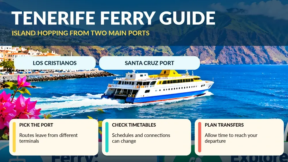
    Tenerife is one of the best Canary Islands for building an island-hopping trip because ferries connect it directly with several neighbours. The important detail is that not every route uses the same Tenerife port. Los Cristianos is central for La Gomera and La Palma on major services, while Santa Cruz is important for Gran Canaria and longer connections.

    Current Fred. Olsen route information lists direct fast-ferry links from Tenerife to La Gomera in about 50 minutes, Gran Canaria in about 80 minutes and La Palma in about 150 minutes. Schedules, ships and operators can change, so I treat those as current planning figures rather than permanent promises.

    The two Tenerife ports I plan around

    Los Cristianos

    For travellers staying in the south, Los Cristianos is extremely convenient. Major fast-ferry services connect it with San Sebastián de La Gomera and Santa Cruz de La Palma. I still arrive early because the port area can be busy and boarding deadlines matter.

    Santa Cruz de Tenerife

    Santa Cruz is the main port for Gran Canaria fast-ferry services to Agaete and for some longer routes. If I am staying in Costa Adeje, I factor the cross-island transfer into the total journey rather than looking only at sailing time.

    Tenerife to La Gomera

    This is the easiest island-hopping add-on for many south-Tenerife visitors. Current Fred. Olsen information lists the direct Los Cristianos–San Sebastián crossing at around 50 minutes. That makes a day trip possible, although I prefer an overnight stay if I want to experience Garajonay and multiple parts of La Gomera without rushing.

    My La Gomera day trip guide explains the trade-off between independent ferry travel and organised tours.

    Tenerife to Gran Canaria

    Current fast-ferry information lists Santa Cruz de Tenerife to Agaete at around 80 minutes. The sailing is short enough for island hopping, but a same-day sightseeing trip becomes less simple once I add transfers from Agaete to Las Palmas or other parts of Gran Canaria.

    Illustrated guide: Tenerife Ferry, with practical visitor tips
    Illustrated guide: Tenerife Ferry.

    If I am moving hotels between islands, the ferry can be excellent because I can take more luggage and, on eligible sailings, a rental or private vehicle subject to the rental company’s rules. I never assume a rental car may leave Tenerife without explicit permission.

    Tenerife to La Palma

    Current Fred. Olsen route information lists Los Cristianos to Santa Cruz de La Palma at about 150 minutes. I see this as an overnight or multi-day connection rather than a casual day trip. La Palma deserves time, and the sailing itself uses a meaningful part of the day.

    Tenerife to El Hierro and other islands

    Connections to El Hierro and some farther islands can be direct or involve specific schedules and operators. I check both Fred. Olsen Express and Naviera Armas for the exact date. Routes and frequency can change seasonally, so I avoid publishing a rigid timetable inside my personal plan.

    Ferry with a car

    Taking a car can be useful for island hopping, but I check three separate things: ferry vehicle availability, rental-company permission and insurance conditions. A cheap rental rate means nothing if the contract prohibits inter-island transport.

    I also arrive earlier with a vehicle because check-in and loading take more time than travelling as a foot passenger.

    Foot passenger or car?

    For La Gomera, a car is helpful if I want independent access to mountain roads, but an organised day tour can be easier for a single day. For Gran Canaria or La Palma, I decide based on where I will sleep and how much of the island I want to explore.

    Seasickness

    Fast ferries are comfortable for many people, but Atlantic conditions vary. If I am prone to motion sickness, I choose a seat where movement feels more manageable, avoid a heavy meal immediately before departure and ask a pharmacist or doctor about appropriate medication rather than relying on random travel advice.

    How early I arrive

    I follow the operator’s current check-in rules and add a buffer, especially with a car or during holiday periods. Port parking and traffic can be the real source of stress, not the sailing itself. I never schedule an airport arrival and ferry departure so tightly that a small flight delay ruins the connection.

    Luggage

    Ferries can be easier than flights for luggage, but each operator still has rules. I label bags, keep medicines and valuables with me and avoid packing something I cannot move comfortably through a terminal.

    Booking strategy

    • Check both main operators for the date and route.
    • Compare the total door-to-door journey, not only sailing time.
    • Book earlier if travelling with a vehicle or during busy holiday periods.
    • Read fare-change and refund conditions before paying.
    • Save the booking offline and verify the departure port carefully.

    A common Tenerife port mistake

    The biggest planning error is assuming every ferry leaves from Los Cristianos. A route to Gran Canaria may use Santa Cruz, while La Gomera services commonly use Los Cristianos. Those ports are far apart. I confirm the exact terminal before booking accommodation, buses or transfers.

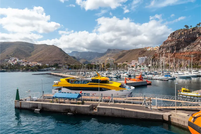
    Port Of San Sebastian De La Gomera

    Combining ferry and airport travel

    I leave a large margin if a ferry connects with a same-day flight. Wind, sea conditions, traffic and baggage all add uncertainty. If missing the flight would be expensive, an overnight buffer is often worth more than squeezing out one extra holiday evening.

    Common mistakes

    • Looking only at crossing time and ignoring transfer time.
    • Going to the wrong Tenerife port.
    • Assuming a rental car can travel between islands.
    • Booking a very tight ferry-to-flight connection.
    • Ignoring vehicle check-in deadlines.
    • Treating a distant island as a comfortable day trip just because the sailing looks short.

    Frequently asked questions

    How long is Tenerife to La Gomera by fast ferry?

    Current Fred. Olsen information lists the direct Los Cristianos to San Sebastián crossing at about 50 minutes.

    How long is Tenerife to Gran Canaria?

    Current Fred. Olsen information lists Santa Cruz de Tenerife to Agaete at around 80 minutes.

    How long is Tenerife to La Palma?

    Current route information lists Los Cristianos to Santa Cruz de La Palma at around 150 minutes.

    Can I take a rental car?

    Only if the rental contract allows it. I obtain explicit permission before booking a vehicle space on the ferry.

    My final take

    Ferries turn Tenerife from a single-island holiday into a flexible Canary Islands journey. I compare ports, schedules and total travel time, then choose the route that fits the trip. The key is simple: plan the ferry as a transport day, not just a crossing time.

    Aerial View Of Santa Cruz De La Palma

    Building margin into transport days

    I leave more time than the timetable suggests whenever a connection matters. A bus can meet traffic, a ferry can board earlier than I expected, and finding the correct stop or terminal can take time in an unfamiliar place. Extra margin feels inefficient on paper but makes the day calmer and protects expensive connections.

    When I would pay for a taxi instead

    Public transport is excellent when it fits the route. I switch to a taxi or prebooked transfer when I arrive very late, have heavy luggage, travel with a tired child, need to reach a remote accommodation or face a connection whose cost is much higher than the taxi fare. The cheapest option is not always the best value when missed time and stress are included.

    Tickets, screenshots and offline backups

    I keep the booking reference, ticket or travelcard information available offline. Ports, airports and rural stops are exactly the places where I do not want my plan to depend on a weak signal. For bus days I save stop names and the latest return time; for ferries I save the terminal, check-in deadline and booking locator. A few screenshots remove a surprising amount of stress.

    What I do when transport changes

    If a service is delayed or cancelled, I first protect the most important connection rather than trying to preserve every sightseeing plan. I check the operator, identify the next realistic option and only then decide what to do with the spare time. This prevents a small disruption from becoming a chain of rushed decisions across the rest of the day.

    Budgeting transport honestly

    I compare total cost, not just the headline fare. A cheap ticket can require a taxi to the terminal, luggage storage, a long transfer or an extra hotel night. Sometimes public transport remains clearly cheaper; sometimes a direct taxi or organised excursion is better value for two or three people. I include time and convenience in the calculation because holiday hours have value too.

    A final planning check before I leave

    The evening before this day, I verify the weather, current access information, transport, opening details where relevant and the amount of daylight I have. I save essential information offline and tell someone in my group what the main plan is. I also decide in advance what would make me switch to the backup plan. That small amount of preparation lets me enjoy Tenerife more spontaneously once I am actually there, because the important risks and logistics have already been considered.

    Practical details I confirm on the day

    Before leaving my accommodation I recheck the latest official information that could affect the plan: weather, road conditions, trail or beach access, public-transport times and any temporary restrictions. Tenerife changes quickly between coast, forest and high mountains, so yesterday’s conditions are not enough. I also make sure the phone is charged, essential addresses are saved offline and everyone in the group knows the backup plan. If the main activity depends on sea state, cloud, wind or a connection, I keep one nearby alternative that does not require a complicated detour. This simple routine helps me avoid turning a small change into a stressful day and makes the itinerary more resilient without removing spontaneity.

  • Jardín Botánico Puerto de la Cruz Guide: History, Plants and Visit Tips

    Jardín Botánico Puerto de la Cruz Guide: History, Plants and Visit Tips

    The Jardín de Aclimatación de La Orotava is one of those Tenerife names that confuses first-time visitors: despite the historic name, the famous botanical garden is in Puerto de la Cruz.

    Why the name says La Orotava but the garden is in Puerto de la Cruz

    The garden was created by royal order of Carlos III in 1788 to acclimatise tropical plants before possible transfer to mainland royal gardens. Its historic name refers to the wider Orotava Valley; administratively the garden is in Puerto de la Cruz. Knowing that prevents a very practical navigation mistake.

    A genuinely historic botanical garden

    Government sources describe it as the second-oldest botanical garden currently existing in Spain after Madrid’s Real Jardín Botánico. The historic enclosure is around 20,000 square metres and holds mature tropical and subtropical collections developed over more than two centuries. The sense of age is one of its strongest qualities.

    The plants I slow down for

    I look for the monumental figs and other mature specimens rather than trying to identify everything. Collections include palms, bromeliads, aroids, mulberries and many tropical trees. The famous Ficus macrophylla subsp. columnaris is especially memorable for its aerial-root architecture. Barriers around major specimens are there to protect both roots and visitors, so I never step beyond them for photographs.

    Current opening time

    A recent Government of the Canary Islands visitor sheet lists daily opening from 09:00 to 18:00. Because institutional hours can change for works, holidays or operational reasons, I still confirm the current information before the visit rather than treating 18:00 as permanent.

    How long I would spend

    For a casual visitor, about 60–90 minutes can be enough to walk slowly and enjoy the strongest specimens. A plant enthusiast can easily stay much longer. I would not combine the garden with a tightly timed attraction immediately afterward; the pleasure is in stopping when a canopy, root system or flowering plant catches my attention.

    Where it fits in a Puerto de la Cruz day

    I pair the garden with my Puerto de la Cruz guide, choosing one other major stop rather than every attraction in town. It works particularly well on a cloudy north-coast day when a long beach session is less appealing.

    Historic atmosphere versus the Palmetum

    The Jardín Botánico feels older, denser and more enclosed than the Palmetum. The Palmetum tells a modern regeneration story and specialises in palms from islands; this garden is about acclimatisation history and mature tropical specimens. Plant lovers can justify both.

    View from the Palmetum towards the Auditorio and Santa Cruz waterfront

    How much time I would allow

    I would not rush the Jardín Botánico. For a focused visit I allow enough time to look rather than only photograph, and I add a buffer for the entrance, orientation and any temporary display or guided element. The right duration depends on interest: a specialist can spend much longer than someone adding it to a broader city day. I plan the rest of the day around one or two nearby places, not around an unrealistic chain of timed attractions.

    How I fit it into the surrounding city

    the Jardín Botánico works best when it is part of a coherent local route. I use my Puerto de la Cruz guide to decide what belongs before and after it, keeping lunch and transport on the same side of town whenever possible. This is especially useful in Santa Cruz, where several major cultural sites sit within a relatively compact urban area but traffic and parking can still waste time if I keep moving the car.

    Tickets, opening hours and the one rule I never skip

    Anything operational can change, so I verify the official website shortly before the visit. I do not build a trip around an opening time copied months earlier from a travel article. Temporary exhibitions, guided tours, holiday closures and special events can all alter normal access. When a timed activity matters, I book it; when the visit is flexible, I still save the official page on my phone.

    Getting there and parking

    For the Jardín Botánico, I decide whether public transport is simpler than driving. In central Santa Cruz and Puerto de la Cruz, walking from another attraction or using urban transport can remove the stress of finding a space. If I drive, I choose a public car park first rather than searching for free kerbside parking immediately beside the entrance. The wider transport picture is covered in my getting around Tenerife guide.

    Accessibility and comfort

    Most of the experience is a garden walk, so surface condition, route gradients and accessible toilets are more important than step-free access to one building. I verify current arrangements if mobility is a priority. I still verify the exact access route if step-free movement, seating, adapted toilets or assistance is essential. Accessibility can be affected by temporary works or by the route between the car park and entrance, not only by the building itself. My accessible Tenerife guide covers the broader island context.

    Visiting with children

    For children, the giant roots, unusual leaves and shaded paths can be more engaging than botanical labels. I set a short “find the strangest tree” challenge rather than turning the visit into a lesson. I avoid assuming that a place is either “for children” or “not for children”; the age, attention span and interests matter. A shorter visit with one clear objective often works better than forcing a family to complete every room or garden path. I combine cultural stops with an outdoor break, snack or nearby park when that helps the day feel balanced.

    Photography without losing the experience

    I take photographs at the Jardín Botánico where permitted, but I do not let the phone dictate the visit. I look for context — architecture, planting, light, material and scale — rather than photographing every information panel. In galleries, museums or performance spaces I respect any restrictions on flash, video or specific rooms. If a guided visit has special rules, the guide’s instructions take priority.

    A rainy-day and hot-day advantage

    the Jardín Botánico can be useful when Tenerife weather does not match a beach plan, but I still check conditions around the journey. On a very hot day, an indoor or shaded cultural stop can be a welcome reset; on a wet north-coast day it can rescue an itinerary. I keep the day flexible rather than moving across the island purely to chase a forecast.

    Where I would stay

    I would not choose a hotel solely for the Jardín Botánico, but if several nearby attractions matter, staying in the same urban area can be efficient. I compare current accommodation nearby with my where to stay in Tenerife guide, paying more attention to walkability, evening atmosphere and parking than to being a few hundred metres closer to one entrance.

    Who I think will get the most from it

    the Jardín Botánico is strongest for travellers who enjoy understanding Tenerife beyond beaches and viewpoints. I would include it when the subject genuinely interests me, not because every attraction needs to be checked off. A well-chosen museum, garden or cultural building can add more depth to a trip than another rushed stop, especially when it explains the island’s landscape, history or contemporary life.

    What I check immediately before going

    Before leaving, I check the official page for opening hours, ticketing, closures and temporary programming. I also check the route from my current location and one nearby alternative. This takes only a few minutes and is the best protection against outdated information. If the Jardín Botánico is the main reason for the day, I save proof of any reservation offline.

    Official information I use before visiting

    For current access, opening information and notices, I use Government/ICIA information about the Jardín de Aclimatación. I recheck it close to the visit because practical details can change after this article is published.

    A simple half-day structure

    If I only had half a day, I would make Jardín Botánico Puerto de la Cruz the anchor rather than the excuse for a complicated circuit. I would arrive early enough to avoid feeling rushed, spend time on the part that genuinely interests me, then add one nearby walk or food stop. I keep the final hour loose so a longer conversation, exhibition, view or lunch does not create stress. This is the way I prefer to travel in Tenerife: the plan has a shape, but it is not a timetable that punishes me for enjoying a place.

    What I would do on a repeat visit

    On a repeat trip, I would use Jardín Botánico Puerto de la Cruz as a reason to look at the surrounding area in more detail. First visits naturally concentrate on Teide, major beaches and the most famous towns. Later trips are where smaller museums, municipal centres, gardens and quieter streets become especially rewarding. I would check for temporary events, seasonal planting, a new exhibition or a local festival and let that determine the exact timing rather than repeating the same route from the first visit.

    Responsible visiting

    I try to leave Jardín Botánico Puerto de la Cruz and its surrounding neighbourhood exactly as I found them. In natural or planted spaces that means staying on paths, not collecting material and respecting barriers. In museums and historic areas it means following photography rules, keeping noise appropriate and treating residential streets as places where people live. Buying a coffee, lunch, local product or ticket where relevant is also a simple way to let some of the value of tourism remain in the area.

  • Taborno Tenerife Guide: Roque de Taborno, Anaga Walks and Practical Tips

    Taborno Tenerife Guide: Roque de Taborno, Anaga Walks and Practical Tips

    Taborno is one of the Anaga settlements I would choose when I want mountain scenery and a real walk rather than a quick roadside viewpoint. The village sits high in the massif with dramatic ridges around it, and the nearby Roque de Taborno gives the landscape a distinctive profile that has led travellers to compare it loosely with a miniature Matterhorn.

    I would keep that nickname in perspective. The reason to come is not to chase a comparison with the Alps; it is to experience Anaga’s steep volcanic relief, small rural settlements and paths that move between cloud forest, ridges and deep valleys.

    Why Taborno is worth a dedicated stop

    Many visitors drive through Anaga focusing only on famous viewpoints and the coast. Taborno rewards a slower approach. It is small enough that I do not need a long sightseeing checklist, but the setting invites walking and gives a better sense of how people live in the interior of the massif.

    Official trail context

    Tenerife’s official tourism information describes the PR-TF 2 route from Taborno toward Pico del Inglés and Valleseco as about 10 km, around 4 hours 30 minutes, with medium difficulty and substantial descent. That is a useful reminder that apparently short mountain distances in Anaga can involve serious elevation change.

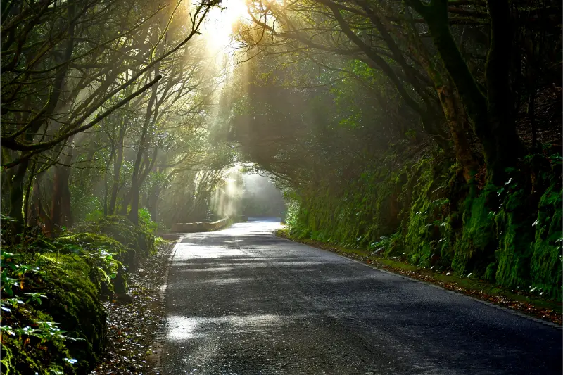
    Anaga Forest Tenerife

    I check the current trail status before departure. A route description is not a guarantee that every section is open after rain, maintenance or conservation measures.

    Roque de Taborno: viewpoints and caution

    The roque dominates the local landscape, and several paths provide views around the area. I do not encourage scrambling on exposed ground simply for a photograph. Anaga rock can be slippery when damp, and cloud can reduce visibility quickly. I stay on established paths and turn around if the terrain feels beyond my comfort level.

    Getting to Taborno

    Driving requires patience. The road network in Anaga is narrow and winding, and local traffic may need space to pass. I do not use roadside lay-bys as photo studios if they are needed for passing or access.

    Public transport can be a good choice for walkers because a linear route becomes easier when I do not need to return to a parked car. The trade-off is that I must know the current bus timetable and build a generous margin for the return.

    Weather

    Taborno can sit in or near the cloud layer. A clear morning can become misty and cool; a grey ridge can open suddenly to huge views. I carry a light waterproof, sun protection and enough water for the full outing. I also expect paths to be muddy after wet weather.

    A realistic first visit

    • Arrive in the morning before the roads and parking feel busy.
    • Spend a few minutes orienting yourself in the village.
    • Choose a signed walk that fits your available daylight and fitness.
    • Stop often for views instead of treating the route as a speed challenge.
    • Return with enough energy for the drive or bus journey out of Anaga.

    Taborno versus Chinamada

    Both places offer rural Anaga, but I experience them differently. Chinamada is especially interesting for its inhabited cave-house tradition and the route toward Punta del Hidalgo. Taborno feels more immediately dominated by ridge scenery and the roque. If I have two Anaga days, I would give each its own space rather than rushing both.

    My Chinamada guide explains that alternative in more detail.

    Food and services

    I do not assume a small mountain village will have the same opening patterns as a resort. I bring water and a snack even if I plan to eat locally. If a bar or restaurant is open, I see it as part of the experience rather than something guaranteed by a fixed itinerary.

    Photography

    Wide-angle views work well, but the strongest images often include the relationship between houses, paths and volcanic relief. I avoid drones unless I have confirmed all current rules and restrictions; protected landscapes and aviation zones can make drone use complicated.

    Who I recommend Taborno to

    It is excellent for hikers, photographers and repeat visitors who already know Tenerife’s main attractions. It is less suitable for someone who wants a flat, accessible walk or a large concentration of restaurants and shops.

    Common mistakes

    • Underestimating elevation change on Anaga routes.
    • Starting too late in the day.
    • Relying on summer coast temperatures when choosing clothing.
    • Parking where local vehicles cannot pass.
    • Walking onto exposed terrain for a better photo.
    • Assuming every online GPX track is currently recommended.

    Frequently asked questions

    Is Taborno a good day trip?

    Yes, particularly as part of an Anaga hiking day. I would combine it with only one or two other stops so the mountain roads do not dominate the schedule.

    Is the PR-TF 2 easy?

    Official information rates the route as medium difficulty and notes significant elevation change. I would not describe it as an effortless sightseeing walk.

    Can I visit without hiking?

    Yes, but the strongest reason to come is the landscape and walking environment. A short stop is still possible if I am driving through the area.

    My final take

    Taborno is the kind of place that makes Anaga feel inhabited rather than merely scenic. I would go with time, proper shoes and a flexible route, letting the ridges, cloud and village scale define the day instead of chasing a long list of attractions.

    How I judge whether the day is going well

    In mountain areas I pay attention to pace, visibility, energy and the time needed to return. A good Tenerife hiking day does not have to end at the planned destination. Turning around early can be the correct decision if cloud thickens, shoes become uncomfortable or the group is moving more slowly than expected. I keep enough food and water in reserve for the return, and I do not let a saved route on my phone become a promise I feel forced to complete.

    Navigation habits that help

    I download the relevant map before leaving Wi-Fi, carry a power bank on longer walks and note the name of the bus stop or car park where I started. In protected landscapes I follow official signs and barriers even when another path looks shorter. Erosion is a serious issue on popular trails, and shortcuts can damage vegetation as well as put me on unstable ground.

    How I pace a mountain day

    I plan the first hour conservatively and reassess after the group has warmed up. Steep terrain can feel easy when excitement is high, then much harder on the return. I keep a steady pace that still allows conversation, stop before anyone is exhausted and eat or drink before I feel depleted. In Anaga especially, I also watch the clock because cloud and forest can make the end of the day feel darker earlier than an open coastal route.

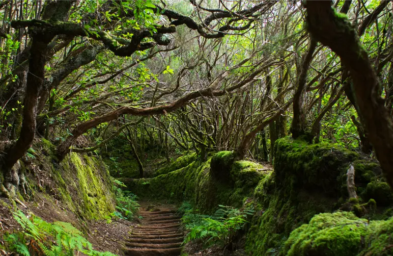
    Anaga Laurel Forest Path Tenerife

    What I do if visibility collapses

    If thick cloud arrives, I slow down and simplify the plan. I do not continue onto exposed ground merely because the viewpoint is supposed to be impressive. A forest walk can remain enjoyable in mist, but route-finding and road driving need more attention. I would rather turn the day into a shorter nature experience than force a ridge walk when I cannot see enough of the terrain ahead.

    Food, water and comfort

    I carry enough water for the whole walk, plus a small snack with salt or carbohydrates. Small villages may have cafés, but I never build safety around a business being open. I also carry blister protection and a light layer in the daypack. Those small items weigh little and can turn an uncomfortable return into a manageable one.

    A final planning check before I leave

    The evening before this day, I verify the weather, current access information, transport, opening details where relevant and the amount of daylight I have. I save essential information offline and tell someone in my group what the main plan is. I also decide in advance what would make me switch to the backup plan. That small amount of preparation lets me enjoy Tenerife more spontaneously once I am actually there, because the important risks and logistics have already been considered.

    Why I prefer a slower itinerary

    Tenerife rewards time. Distances can look short on a map while mountain roads, parking, viewpoints and meals make the real day much longer. I therefore leave unscheduled space instead of treating every hour as an appointment. That gives me room to stop at an unexpected viewpoint, wait for cloud to clear, spend longer over lunch or simply leave early if conditions are not right. In practice, the slower version usually produces better memories and fewer transport mistakes.

    Anaga Laurel Forest Tenerife

    Practical details I confirm on the day

    Before leaving my accommodation I recheck the latest official information that could affect the plan: weather, road conditions, trail or beach access, public-transport times and any temporary restrictions. Tenerife changes quickly between coast, forest and high mountains, so yesterday’s conditions are not enough. I also make sure the phone is charged, essential addresses are saved offline and everyone in the group knows the backup plan. If the main activity depends on sea state, cloud, wind or a connection, I keep one nearby alternative that does not require a complicated detour. This simple routine helps me avoid turning a small change into a stressful day and makes the itinerary more resilient without removing spontaneity.

  • Playa de Antequera Guide: Remote Anaga Beach by Boat or Hike

    Playa de Antequera Guide: Remote Anaga Beach by Boat or Hike

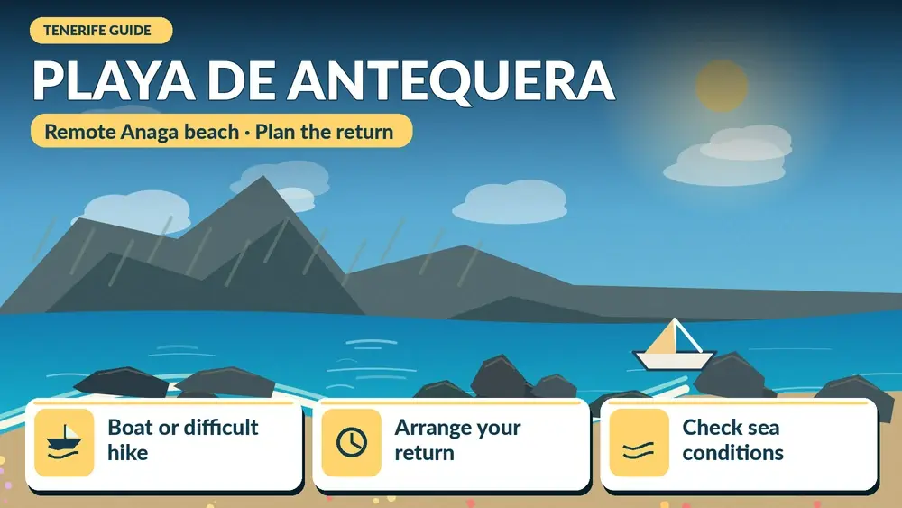
    Playa de Antequera is one of those Tenerife beaches where the journey is part of the experience. There is no normal road-and-car-park arrival. Official Tenerife tourism information says the beach is reached either by a difficult hiking route or by sea, and that boat excursions are the easier option for most visitors.

    That remoteness is exactly why I would not treat Antequera like a spontaneous beach stop. I plan transport, tides, water, sun protection and the return before setting out. The reward is a quiet grey-black beach beneath the cliffs of Anaga, with a sense of isolation that is rare on a popular holiday island.

    What makes Antequera special

    The beach sits below the eastern Anaga cliffs, far from resort infrastructure. Official information gives a length of around 400 metres and notes that at high tide the sea can cover much of the sand. That means timing matters not just for comfort but for how much beach actually exists when I arrive.

    The appeal is landscape and remoteness rather than services. There are no normal facilities, no car park and no bus stop at the beach. I carry out everything I bring in and assume I will need to be self-sufficient for the duration of the visit.

    Boat or hike: which way would I choose?

    For most travellers, I would choose a legitimate boat service from the Santa Cruz or San Andrés area when available. The official tourism page explicitly describes the hiking access as difficult and requiring good physical condition and experience. That is enough for me to reject the idea of recommending the trail casually to every reader.

    A boat also reduces the risk of underestimating Anaga terrain. However, sea conditions can cancel or modify trips, so I keep the day flexible and confirm departure details directly with the operator.

    Why I would be cautious with the hiking route

    Remote Anaga routes combine steep ground, exposure, heat or humidity, limited shade and sections where a wrong turn can be serious. Even if a GPX track exists online, I do not assume it represents current trail status. I check official information and only attempt the route if it matches my real experience level.

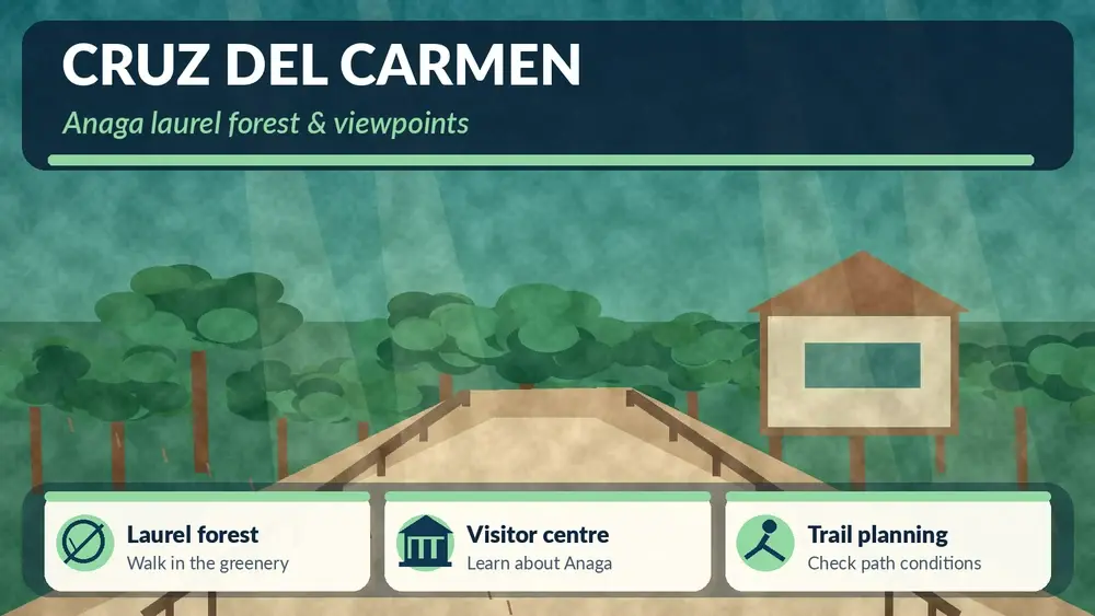
    If I want a scenic but more manageable Anaga walk, I would rather choose a signed route around Cruz del Carmen or another established trail. My best hikes in Tenerife guide gives alternatives across difficulty levels.

    Tides change the beach

    The official tourism description specifically says Antequera is best appreciated at low tide because high tide can cover the beach. I therefore check a reliable tide table for the exact date and understand that wave conditions still matter. Low tide does not automatically mean calm water.

    Swimming

    I do not arrive with the assumption that I must swim. A remote beach without lifeguards or easy road access deserves extra caution. If the sea is rough, if I am alone, or if entry and exit look uncertain, I stay on land. Remote beauty is not worth turning a day trip into an emergency.

    What I bring

    • More water than I expect to need.
    • Sun protection and a hat.
    • Food or snacks because there are no services.
    • Secure footwear if any walking is involved.
    • A dry bag for electronics on a boat transfer.
    • A charged phone, while accepting that signal may be limited.
    • A small rubbish bag so nothing is left behind.

    Nudism and beach etiquette

    Official tourism information notes that nudism is common at Antequera. I treat that simply as part of the beach culture: I give people space, avoid intrusive photography and do not behave as if other visitors are part of the scenery.

    How I would build the day

    If travelling by boat, I would base the day around the confirmed departure and return rather than adding too many activities. San Andrés and Las Teresitas make natural before-or-after stops. My San Andrés guide is useful for food and local context.

    If the boat is cancelled, I would switch to Las Teresitas, a walk in Anaga or Santa Cruz instead of trying to improvise a difficult hike at the last minute.

    Who Antequera is for

    I recommend it to travellers who value remote landscapes, are comfortable with limited facilities and understand that access can depend on weather and logistics. It is not my first choice for families needing easy facilities, travellers with reduced mobility or anyone who wants a simple beach day.

    Environmental responsibility

    A remote beach stays special only if visitors behave lightly. I take all rubbish away, avoid disturbing wildlife and do not leave food scraps. I also avoid creating cairns or moving stones for photographs. Small interventions become visible when many visitors repeat them.

    Common mistakes

    • Treating the hiking route as an ordinary beach path.
    • Ignoring tide timing.
    • Relying on phone signal for navigation.
    • Arriving without enough water.
    • Booking another fixed activity immediately after a weather-dependent boat trip.
    • Assuming no lifeguard means the sea is harmless because the beach is quiet.

    Frequently asked questions

    Can I drive to Playa de Antequera?

    No normal road reaches the beach. Official tourism information lists access on foot via a difficult trail or by boat.

    Is the hike easy?

    No. The official description specifically characterises the trail access as difficult and suitable for people with good fitness and experience.

    Is there food or a beach bar?

    No. I plan to be fully self-sufficient.

    Does high tide matter?

    Yes. Much of the sand can disappear at high tide, so I check tide timing before the trip.

    My final take

    Antequera is not a convenience beach, and that is the point. I would visit only with a clear access plan, sensible sea judgement and enough time to enjoy the isolation. Done responsibly, it offers one of Tenerife’s strongest feelings of arriving somewhere genuinely remote.

    How I read an exposed beach

    Before putting down my bag, I spend time watching the sea. I look for where waves are breaking, whether water is moving sideways along the shore and whether swimmers are struggling to return to the same place. I also check flags and local warnings. Ten quiet minutes of observation tell me more than a photograph taken on a different day.

    What I keep in the car

    For remote-coast days I keep spare water, dry clothes, a light layer and shoes that can handle steps or rough ground. I also keep a simple backup plan: another beach, a village meal or a viewpoint. That prevents me from forcing a swim when the Atlantic conditions are not suitable.

    How I choose whether to swim

    I make the decision only after I arrive. Photos, forecasts and even yesterday’s conditions are not enough. I compare wave size, current, flags, local behaviour and my own swimming ability. If I feel uncertain, I switch the goal of the visit from swimming to walking, photography or lunch nearby. That is not a failed beach day; it is a sensible response to an ocean that changes constantly.

    Sun, shade and hydration

    Exposed beaches can feel cooler because of wind while the sun is still strong. I use sunscreen, reapply it and drink water even when I am not sweating heavily. On beaches with little natural shade, I avoid spending the entire middle of the day in direct sun. A short break in a café or village can make the second half of the visit much more comfortable.

    Leaving the coast safely

    I keep enough energy for the return to the road or car, especially where stairs or rough paths separate the beach from parking. Wet feet and sand make steps more tiring than they looked on arrival. If sunset is part of the plan, I know exactly how long the climb back takes and carry a small light rather than relying on a phone battery.

    A final planning check before I leave

    The evening before this day, I verify the weather, current access information, transport, opening details where relevant and the amount of daylight I have. I save essential information offline and tell someone in my group what the main plan is. I also decide in advance what would make me switch to the backup plan. That small amount of preparation lets me enjoy Tenerife more spontaneously once I am actually there, because the important risks and logistics have already been considered.

    Why I prefer a slower itinerary

    Tenerife rewards time. Distances can look short on a map while mountain roads, parking, viewpoints and meals make the real day much longer. I therefore leave unscheduled space instead of treating every hour as an appointment. That gives me room to stop at an unexpected viewpoint, wait for cloud to clear, spend longer over lunch or simply leave early if conditions are not right. In practice, the slower version usually produces better memories and fewer transport mistakes.

    Practical details I confirm on the day

    Before leaving my accommodation I recheck the latest official information that could affect the plan: weather, road conditions, trail or beach access, public-transport times and any temporary restrictions. Tenerife changes quickly between coast, forest and high mountains, so yesterday’s conditions are not enough. I also make sure the phone is charged, essential addresses are saved offline and everyone in the group knows the backup plan. If the main activity depends on sea state, cloud, wind or a connection, I keep one nearby alternative that does not require a complicated detour. This simple routine helps me avoid turning a small change into a stressful day and makes the itinerary more resilient without removing spontaneity.

  • Playa de Almáciga Guide: Wild Black Sand, Surf and Anaga Coast

    Playa de Almáciga Guide: Wild Black Sand, Surf and Anaga Coast

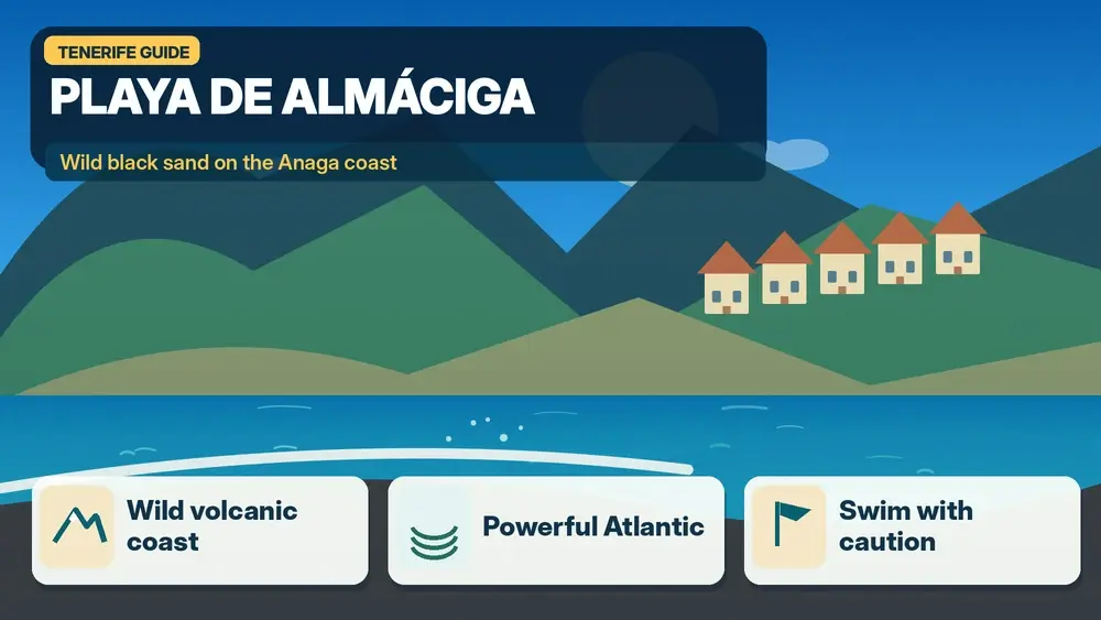
    Playa de Almáciga is the Anaga beach I would choose for wild scenery and Atlantic character, not for a guaranteed calm swim. It sits below the small settlement of Almáciga on the north coast, between the landscapes of Taganana and Benijo, with black volcanic sand, steep green slopes and the Roques de Anaga offshore.

    Official Tenerife tourism information describes Almáciga as roughly 300 metres long, with rock and sand, road access, limited parking and waves that are often strong throughout the year. That last point shapes my entire visit. I am happy to spend time here without entering the water when the sea looks powerful.

    Why Almáciga feels different from resort beaches

    There are no rows of large hotels behind the sand and no protected harbour turning the ocean into a pool. The setting feels exposed to the Atlantic. Surfers value that energy, but casual swimmers need to be more conservative. I look at the water for several minutes before deciding whether even shallow paddling makes sense.

    If I want calm water and easy facilities, I choose a different beach. If I want to understand the raw coastal side of Anaga, Almáciga is excellent. My best beaches in Tenerife guide explains how I match beaches to the type of day rather than ranking them on scenery alone.

    Quick facts

    Location Almáciga, Taganana area, Santa Cruz de Tenerife
    Beach type Black volcanic sand and rock
    Length About 300 m according to official tourism information
    Swimming Can be rough; assess conditions carefully
    Surf Popular because of regular waves
    Parking Limited
    Facilities Basic; more food options around Roque de las Bodegas

    Swimming and ocean safety

    I never use the presence of other people in the water as proof that conditions are safe for me. Atlantic currents, shore break and changing sets can make a beach dangerous even when the surface looks attractive. If red flags or local warnings are present, I stay out. If there are no flags, I still use my own judgement and remain conservative.

    For families with young children or weak swimmers, I would choose a more protected beach elsewhere. My Tenerife safety guide covers the practical signs I look for before swimming on exposed beaches.

    Surfing at Almáciga

    Almáciga is known for surf, and official tourism information specifically notes surf activity. I would not treat that as an invitation for a first independent attempt. Beginners are better with a reputable school that chooses conditions appropriate to ability. Experienced surfers will still want local knowledge because rocks, currents and wave direction matter.

    How to get there

    The drive through Anaga is part of the day. Roads are narrow and winding, and I budget more time than the kilometre count suggests. From Santa Cruz or La Laguna, I would combine the beach with a forest stop or Taganana rather than making a rushed return journey.

    Public transport is possible, but I verify the current TITSA timetable before leaving. Rural frequencies can be limited, so I always know the time of the last practical return connection before walking down to the beach.

    Parking

    Official information indicates fewer than 50 spaces. On popular days, that is not much. I arrive early, avoid blocking the road and never create an improvised parking place on a bend. If parking is impossible, Roque de las Bodegas, Taganana or another Anaga stop can become the main plan instead.

    Facilities and food

    Almáciga itself is simple. I bring water and whatever I need for a low-service beach visit. For a meal, the nearby coastal area around Roque de las Bodegas has more options. I like stopping for local fish or Canarian food after the beach rather than carrying a full picnic down to the sand.

    Best light and photography

    Cloudy Anaga weather can create dramatic photographs because the black sand and green slopes gain texture without harsh contrast. Around lower light, the offshore roques become strong silhouettes. I keep my camera away from spray and never walk backward toward the water while framing a shot.

    A half-day itinerary

    • Morning forest stop at Cruz del Carmen or another Anaga viewpoint.
    • Continue through Taganana at an unhurried pace.
    • Spend time at Almáciga for scenery, photography or surfing if conditions suit.
    • Eat around Roque de las Bodegas or Taganana.
    • Add Benijo only if parking, daylight and sea conditions make the extra stop comfortable.

    Almáciga versus Benijo

    The two beaches are close but feel slightly different. Benijo is often chosen for the iconic view toward offshore rocks and sunset atmosphere, while Almáciga has a strong surf identity and easier visual connection to the small settlement above it. I would not force both if one is already busy; a slower visit to one beach is often better.

    Who I would recommend it to

    I recommend Almáciga to photographers, surfers, repeat Tenerife visitors and travellers who appreciate wild coastlines. I would not make it my first recommendation for toddlers, mobility limitations or anyone whose main priority is easy swimming with full services.

    Common mistakes

    • Assuming black-sand beauty means easy swimming.
    • Arriving at the busiest time with no parking alternative.
    • Underestimating the slow Anaga road.
    • Expecting resort-level facilities.
    • Ignoring changing waves because the beach looked calm on arrival.

    Frequently asked questions

    Is Almáciga good for swimming?

    It can be swimmable on suitable days, but the beach is exposed and often wavy. I judge the sea conservatively and stay out when conditions are rough.

    Is Almáciga good for surfing?

    Yes, it is a recognised surf beach. Beginners should use a qualified school rather than choosing the spot independently.

    Can I reach it by car?

    Yes. The official tourism page lists road access and parking, though spaces are limited.

    Are there restaurants on the beach?

    Services are basic at Almáciga itself; I look toward nearby Roque de las Bodegas and Taganana for a meal.

    My final take

    Playa de Almáciga is memorable because it still feels exposed to the landscape around it. I go for black sand, surf energy and Anaga scenery, not because I need a perfect swimming beach. With that expectation, it is one of the coast’s most atmospheric stops.

    How I read an exposed beach

    Before putting down my bag, I spend time watching the sea. I look for where waves are breaking, whether water is moving sideways along the shore and whether swimmers are struggling to return to the same place. I also check flags and local warnings. Ten quiet minutes of observation tell me more than a photograph taken on a different day.

    What I keep in the car

    For remote-coast days I keep spare water, dry clothes, a light layer and shoes that can handle steps or rough ground. I also keep a simple backup plan: another beach, a village meal or a viewpoint. That prevents me from forcing a swim when the Atlantic conditions are not suitable.

    How I choose whether to swim

    I make the decision only after I arrive. Photos, forecasts and even yesterday’s conditions are not enough. I compare wave size, current, flags, local behaviour and my own swimming ability. If I feel uncertain, I switch the goal of the visit from swimming to walking, photography or lunch nearby. That is not a failed beach day; it is a sensible response to an ocean that changes constantly.

    Sun, shade and hydration

    Exposed beaches can feel cooler because of wind while the sun is still strong. I use sunscreen, reapply it and drink water even when I am not sweating heavily. On beaches with little natural shade, I avoid spending the entire middle of the day in direct sun. A short break in a café or village can make the second half of the visit much more comfortable.

    Leaving the coast safely

    I keep enough energy for the return to the road or car, especially where stairs or rough paths separate the beach from parking. Wet feet and sand make steps more tiring than they looked on arrival. If sunset is part of the plan, I know exactly how long the climb back takes and carry a small light rather than relying on a phone battery.

    A final planning check before I leave

    The evening before this day, I verify the weather, current access information, transport, opening details where relevant and the amount of daylight I have. I save essential information offline and tell someone in my group what the main plan is. I also decide in advance what would make me switch to the backup plan. That small amount of preparation lets me enjoy Tenerife more spontaneously once I am actually there, because the important risks and logistics have already been considered.

    Why I prefer a slower itinerary

    Tenerife rewards time. Distances can look short on a map while mountain roads, parking, viewpoints and meals make the real day much longer. I therefore leave unscheduled space instead of treating every hour as an appointment. That gives me room to stop at an unexpected viewpoint, wait for cloud to clear, spend longer over lunch or simply leave early if conditions are not right. In practice, the slower version usually produces better memories and fewer transport mistakes.

    Practical details I confirm on the day

    Before leaving my accommodation I recheck the latest official information that could affect the plan: weather, road conditions, trail or beach access, public-transport times and any temporary restrictions. Tenerife changes quickly between coast, forest and high mountains, so yesterday’s conditions are not enough. I also make sure the phone is charged, essential addresses are saved offline and everyone in the group knows the backup plan. If the main activity depends on sea state, cloud, wind or a connection, I keep one nearby alternative that does not require a complicated detour. This simple routine helps me avoid turning a small change into a stressful day and makes the itinerary more resilient without removing spontaneity.

  • Palmetum Santa Cruz Guide: Tickets, Palm Collections, Views and Visit Tips

    Palmetum Santa Cruz Guide: Tickets, Palm Collections, Views and Visit Tips

    The Palmetum is one of the places in Santa Cruz that changes the way I see the city: a botanical garden on a former landfill, with palms, sea views and a story of ecological transformation.

    What makes the Palmetum unusual

    The Palmetum covers about 12 hectares and specialises in the palm family. Its most distinctive story is the site itself: land that had been used as a rubbish dump was transformed into a botanical garden. That makes the visit interesting even before I start comparing species. The project links urban regeneration, plant conservation and a high viewpoint above the coast.

    The palm collection

    The official Palmetum describes its collection as the best palm collection in Europe and the largest botanical collection of palms from tropical islands. I do not try to memorise every species. I follow the geographic planting logic and look at how palms from different island environments vary in form, leaf structure and habitat.

    Current ticket prices I would verify again

    At the time of this update, the official tariff lists €6 for a non-resident adult and €2.80 for a non-resident child, with lower resident rates and free entry for children under three. A private one-hour guide for groups under 30 is listed separately. Because prices can change, I still check the official tariff page before travelling.

    Views are part of the experience

    The elevated position gives the garden a broader city-and-ocean role. I pause at viewpoints rather than treating the Palmetum as a flat collection of labelled plants. The contrast between dense tropical planting, the Atlantic, port infrastructure and the nearby Auditorio is one of the reasons the visit feels specifically Santa Cruz rather than interchangeable with another botanical garden.

    Heat, shade and the best time of day

    Much of the visit is outdoors, so midday sun can make a slow botanical walk tiring. I prefer morning or later afternoon when possible, carry water and use sun protection. Shade varies by section. Wind can also be noticeable on exposed viewpoints even when the lower city feels still.

    How I combine it with the Auditorio and waterfront

    The Palmetum pairs naturally with the Auditorio de Tenerife and a waterfront walk. I would not drive between them unless mobility requires it. Keeping the car parked and walking makes the architectural and landscape contrast much easier to appreciate.

    View from the Palmetum towards the Auditorio and Santa Cruz waterfront

    Palmetum versus García Sanabria

    The Palmetum and Parque García Sanabria are not duplicates. The Palmetum is a specialised botanical destination with an admission ticket and geographic collections; García Sanabria is a central urban park used as everyday city space. I would visit both on different parts of a Santa Cruz day if gardens are a real interest.

    How much time I would allow

    I would not rush the Palmetum. For a focused visit I allow enough time to look rather than only photograph, and I add a buffer for the entrance, orientation and any temporary display or guided element. The right duration depends on interest: a specialist can spend much longer than someone adding it to a broader city day. I plan the rest of the day around one or two nearby places, not around an unrealistic chain of timed attractions.

    How I fit it into the surrounding city

    the Palmetum works best when it is part of a coherent local route. I use my Santa Cruz de Tenerife guide to decide what belongs before and after it, keeping lunch and transport on the same side of town whenever possible. This is especially useful in Santa Cruz, where several major cultural sites sit within a relatively compact urban area but traffic and parking can still waste time if I keep moving the car.

    Tickets, opening hours and the one rule I never skip

    Anything operational can change, so I verify the official website shortly before the visit. I do not build a trip around an opening time copied months earlier from a travel article. Temporary exhibitions, guided tours, holiday closures and special events can all alter normal access. When a timed activity matters, I book it; when the visit is flexible, I still save the official page on my phone.

    Getting there and parking

    For the Palmetum, I decide whether public transport is simpler than driving. In central Santa Cruz and Puerto de la Cruz, walking from another attraction or using urban transport can remove the stress of finding a space. If I drive, I choose a public car park first rather than searching for free kerbside parking immediately beside the entrance. The wider transport picture is covered in my getting around Tenerife guide.

    Accessibility and comfort

    The Palmetum promotes inclusive visits and has developed accessibility initiatives, but gradients and outdoor surfaces still make it worth checking the current access information. I still verify the exact access route if step-free movement, seating, adapted toilets or assistance is essential. Accessibility can be affected by temporary works or by the route between the car park and entrance, not only by the building itself. My accessible Tenerife guide covers the broader island context.

    Visiting with children

    Children who like plants, lizards, viewpoints and open-air exploration can enjoy it, but I keep the route selective rather than demanding attention to every label. I avoid assuming that a place is either “for children” or “not for children”; the age, attention span and interests matter. A shorter visit with one clear objective often works better than forcing a family to complete every room or garden path. I combine cultural stops with an outdoor break, snack or nearby park when that helps the day feel balanced.

    Photography without losing the experience

    I take photographs at the Palmetum where permitted, but I do not let the phone dictate the visit. I look for context — architecture, planting, light, material and scale — rather than photographing every information panel. In galleries, museums or performance spaces I respect any restrictions on flash, video or specific rooms. If a guided visit has special rules, the guide’s instructions take priority.

    A rainy-day and hot-day advantage

    the Palmetum can be useful when Tenerife weather does not match a beach plan, but I still check conditions around the journey. On a very hot day, an indoor or shaded cultural stop can be a welcome reset; on a wet north-coast day it can rescue an itinerary. I keep the day flexible rather than moving across the island purely to chase a forecast.

    Where I would stay

    I would not choose a hotel solely for the Palmetum, but if several nearby attractions matter, staying in the same urban area can be efficient. I compare current accommodation nearby with my where to stay in Tenerife guide, paying more attention to walkability, evening atmosphere and parking than to being a few hundred metres closer to one entrance.

    Who I think will get the most from it

    the Palmetum is strongest for travellers who enjoy understanding Tenerife beyond beaches and viewpoints. I would include it when the subject genuinely interests me, not because every attraction needs to be checked off. A well-chosen museum, garden or cultural building can add more depth to a trip than another rushed stop, especially when it explains the island’s landscape, history or contemporary life.

    What I check immediately before going

    Before leaving, I check the official page for opening hours, ticketing, closures and temporary programming. I also check the route from my current location and one nearby alternative. This takes only a few minutes and is the best protection against outdated information. If the Palmetum is the main reason for the day, I save proof of any reservation offline.

    Official information I use before visiting

    For current access, opening information and notices, I use official Palmetum website. I recheck it close to the visit because practical details can change after this article is published.

    A simple half-day structure

    If I only had half a day, I would make Palmetum Santa Cruz the anchor rather than the excuse for a complicated circuit. I would arrive early enough to avoid feeling rushed, spend time on the part that genuinely interests me, then add one nearby walk or food stop. I keep the final hour loose so a longer conversation, exhibition, view or lunch does not create stress. This is the way I prefer to travel in Tenerife: the plan has a shape, but it is not a timetable that punishes me for enjoying a place.

    What I would do on a repeat visit

    On a repeat trip, I would use Palmetum Santa Cruz as a reason to look at the surrounding area in more detail. First visits naturally concentrate on Teide, major beaches and the most famous towns. Later trips are where smaller museums, municipal centres, gardens and quieter streets become especially rewarding. I would check for temporary events, seasonal planting, a new exhibition or a local festival and let that determine the exact timing rather than repeating the same route from the first visit.

    Responsible visiting

    I try to leave Palmetum Santa Cruz and its surrounding neighbourhood exactly as I found them. In natural or planted spaces that means staying on paths, not collecting material and respecting barriers. In museums and historic areas it means following photography rules, keeping noise appropriate and treating residential streets as places where people live. Buying a coffee, lunch, local product or ticket where relevant is also a simple way to let some of the value of tourism remain in the area.

  • Cruz del Carmen Tenerife Guide: Visitor Centre, Viewpoint and Anaga Walks

    Cruz del Carmen Tenerife Guide: Visitor Centre, Viewpoint and Anaga Walks

    Cruz del Carmen is one of the most useful places in Anaga for understanding the landscape before you start walking. I see it less as a single attraction and more as a practical gateway: there is a viewpoint, a visitor-information point, forest trails and connections toward small settlements such as Las Carboneras and Chinamada. For a first visit to Anaga, that combination makes it one of the easiest places to build a half-day around.

    The setting is high in the humid part of the massif, where trade winds often bring cloud and mist into the laurel forest. That is part of the experience. A sunny beach forecast in the south does not tell me what Cruz del Carmen will feel like, so I always bring a layer and treat the mountain weather as its own microclimate.

    Why I would start an Anaga day here

    Anaga can feel confusing on a map because viewpoints, tiny villages and trails sit on narrow mountain roads. Cruz del Carmen simplifies the first hour. I can stop, orient myself, check current trail information and choose between a short forest walk or a longer route. The official Tenerife tourism information identifies Cruz del Carmen as a starting point for routes toward Las Carboneras and Punta del Hidalgo, with a visitor centre, viewpoint and services in the area.

    For the wider area, I would pair this article with my Anaga Rural Park guide and Sendero de los Sentidos guide. Together they help separate a simple first-time forest stop from a more demanding hiking day.

    Quick planning facts

    AreaAnaga Rural Park, northeast Tenerife
    Best forLaurisilva forest, viewpoints, short walks and trail orientation
    WeatherOften cooler, cloudier and more humid than the coast
    CarUseful, but parking can fill at popular times
    Public transportPossible with TITSA; check the current timetable
    Best approachArrive early and keep the route flexible

    The viewpoint and the forest atmosphere

    The viewpoint is a simple stop, but the atmosphere around Cruz del Carmen is what stays with me. When cloud moves through the ridge, branches drip with moisture and the forest becomes quiet and almost cinematic. I do not need a long hike to understand why Anaga is so different from Tenerife’s dry southern coast.

    Visibility can change minute by minute. If the viewpoint is completely in cloud, I do not assume the day is ruined. The forest can be at its most beautiful in mist, while a lower viewpoint or coastal village may be clear later. I plan Anaga as a sequence of landscapes rather than a checklist that depends on perfect panoramas.

    Short walks versus longer routes

    For a gentle introduction, I would choose a short signed path near the visitor area and keep my expectations modest. For a longer outing, official trail information describes routes descending toward Las Carboneras and beyond. A descent in Anaga can feel easy at first, but the return climb or the need to arrange transport at the far end changes the difficulty dramatically.

    Anaga Laurel Forest Tenerife

    Before setting out, I check the official trail status and any temporary restrictions. Weather, maintenance and conservation measures can change access. My Tenerife hiking permits and trail rules guide explains why I never rely on an old blog post for protected routes.

    How I would get there

    By car, I would approach Cruz del Carmen slowly and expect bends, cyclists, hikers and changing visibility. The TF-12 is scenic, but this is not a road where I want to chase a tight schedule. I leave extra time and avoid stopping in unsafe places just because a view appears around a corner.

    By bus, the visit can work very well for travellers who do not want to drive mountain roads. I check TITSA on the day because frequencies and connections matter. If I am travelling without a car, I build the day around one main walk and one village rather than trying to hop between many remote stops.

    Parking strategy

    Parking is one of the details that can shape the entire Anaga experience. I prefer an early arrival, especially on weekends and good-weather days. If the immediate area is full, I do not park on verges where I might block traffic or damage vegetation. Turning back and changing the order of the day is better than forcing a space.

    Illustrated guide: Cruz del Carmen Tenerife, with practical visitor tips
    Illustrated guide: Cruz del Carmen Tenerife.

    What I would wear

    Closed shoes with grip, a light waterproof or windproof layer, water and sun protection are my baseline. Anaga can be damp and cool even when the coast is warm. I also carry a small offline map because mobile coverage can be uneven once I leave the main roads and visitor areas.

    Best time of day

    Morning is my favourite because parking is easier and I can adapt the rest of the day. A morning in the forest can flow naturally into lunch in Taganana or a coastal stop at Benijo or Almáciga. Late afternoon can be beautiful too, but I do not start an unfamiliar trail close to sunset.

    A realistic half-day plan

    • Arrive early at Cruz del Carmen and check trail information.
    • Spend time at the viewpoint and visitor area.
    • Walk a short forest route rather than immediately committing to a long descent.
    • Continue toward a village or coastal stop only if weather and time remain comfortable.
    • Keep enough daylight for the drive back through the mountains.

    Combining Cruz del Carmen with other places

    La Laguna is an excellent partner because it sits at the natural gateway to Anaga. I could spend the morning in the forest and the late afternoon in the UNESCO-listed historic centre. On another day, I would combine Cruz del Carmen with Taganana and the north coast, accepting that the road itself is part of the experience.

    For a beach finish, my Playa de Benijo guide explains why I treat the ocean there cautiously. The Anaga coast is dramatic, but it is not a place where I assume swimming will be safe every day.

    Who I think will enjoy it most

    Cruz del Carmen suits first-time Anaga visitors, photographers, walkers who want flexible route choices and families who prefer a shorter nature experience. It is less suitable for anyone expecting guaranteed sunshine, a flat promenade or a completely predictable schedule. The charm is precisely that the ridge weather and forest atmosphere change constantly.

    Anaga Laurel Forest Trail Tenerife

    Common mistakes I would avoid

    • Arriving in beach clothes with no extra layer.
    • Starting a long descent without planning the return.
    • Assuming cloud means the whole day is a failure.
    • Parking irresponsibly when the main area is full.
    • Using an old trail description without checking current access.
    • Trying to fit Cruz del Carmen, every Anaga village and several beaches into one rushed day.

    Frequently asked questions

    Is Cruz del Carmen worth visiting without hiking?

    Yes. I would still go for the forest atmosphere, viewpoint and orientation, especially if I am driving through Anaga. A short stop can be worthwhile even without a long trail.

    Do I need a car?

    No, but a car gives more flexibility. Public transport can work if I plan around current TITSA schedules and limit the number of stops.

    Is it colder than the coast?

    Often yes. The ridge is higher, windier and frequently affected by cloud, so I carry a layer even on warm island days.

    Can I combine it with Taganana?

    Yes, and that is one of my favourite combinations. I allow generous time because the mountain roads are slow and scenic.

    My final take

    Cruz del Carmen works best when I treat it as Anaga’s orientation point rather than a box to tick. I arrive early, accept changing weather, choose a walk that matches the day and let the forest set the pace. That approach makes the experience calmer and much more memorable.

    Anaga Tenerife

    How I judge whether the day is going well

    In mountain areas I pay attention to pace, visibility, energy and the time needed to return. A good Tenerife hiking day does not have to end at the planned destination. Turning around early can be the correct decision if cloud thickens, shoes become uncomfortable or the group is moving more slowly than expected. I keep enough food and water in reserve for the return, and I do not let a saved route on my phone become a promise I feel forced to complete.

    Navigation habits that help

    I download the relevant map before leaving Wi-Fi, carry a power bank on longer walks and note the name of the bus stop or car park where I started. In protected landscapes I follow official signs and barriers even when another path looks shorter. Erosion is a serious issue on popular trails, and shortcuts can damage vegetation as well as put me on unstable ground.

    How I pace a mountain day

    I plan the first hour conservatively and reassess after the group has warmed up. Steep terrain can feel easy when excitement is high, then much harder on the return. I keep a steady pace that still allows conversation, stop before anyone is exhausted and eat or drink before I feel depleted. In Anaga especially, I also watch the clock because cloud and forest can make the end of the day feel darker earlier than an open coastal route.

    What I do if visibility collapses

    If thick cloud arrives, I slow down and simplify the plan. I do not continue onto exposed ground merely because the viewpoint is supposed to be impressive. A forest walk can remain enjoyable in mist, but route-finding and road driving need more attention. I would rather turn the day into a shorter nature experience than force a ridge walk when I cannot see enough of the terrain ahead.