Tag: Los Gigantes

  • Mirador de Archipenque Guide: Los Gigantes Views, Sunset and Parking Tips

    Mirador de Archipenque Guide: Los Gigantes Views, Sunset and Parking Tips

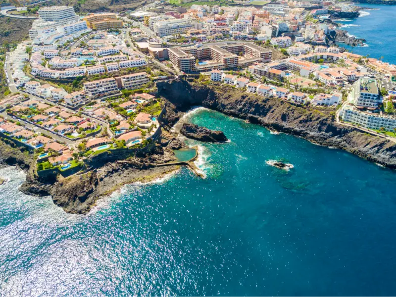
    Mirador de Archipenque is the west-coast viewpoint I use to understand Los Gigantes before seeing the cliffs from sea level. The roadside platform looks across Puerto de Santiago toward the giant basalt walls, with La Gomera often visible on the horizon.

    It is especially popular around sunset, but the practical details matter: official tourism information lists parking and adapted access, while noting that there is no bus stop directly at the viewpoint.

    Quick planning facts

    LocationTF-454, Santiago del Teide
    Best viewLos Gigantes cliffs and Puerto de Santiago
    SunsetExcellent on clear evenings
    ParkingYes
    Bus stop at viewpointNo
    Adapted accessYes
    Interpretation panelYes
    Combine withLos Gigantes, Puerto de Santiago, Playa de la Arena

    Why the viewpoint matters

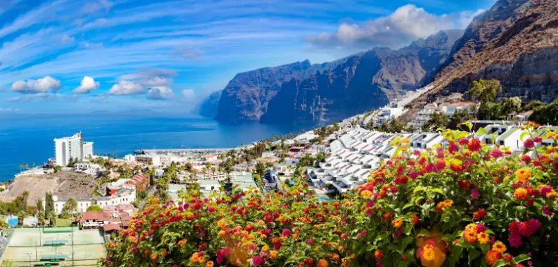
    Mirador de Archipenque is one of the easiest places to understand the scale of Los Gigantes before going down to the coast. From the roadside platform I can see the cliffs, Puerto de Santiago, the marina and, in clear conditions, La Gomera across the channel.

    The viewpoint is especially strong near sunset, when the western light reaches the cliffs and La Gomera often appears as a dark silhouette. I still prefer to arrive early because sunset is also when parking pressure increases.

    Official access details

    Turismo de Tenerife places the viewpoint on the TF-454 around kilometre 6 in Santiago del Teide. The official listing indicates parking, adapted access and an interpretation panel, but no bus stop directly at the viewpoint.

    That last point matters for no-car travellers. I would not build a public-transport plan around being dropped at the exact platform; instead I use nearby Puerto de Santiago as the practical base.

    Sunset planning

    I arrive well before sunset, not at the final minute. That gives me time to park legally, choose a safe position and watch the changing light rather than creating stress on a busy road.

    I never stop outside designated spaces or stand in the carriageway for a photograph. The view is not worth creating a traffic hazard.

    What I can see

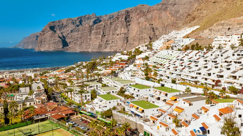
    The main subject is the Acantilado de Los Gigantes, rising dramatically from the sea. Below, Puerto de Santiago and its marina provide scale, while Punta de Teno and its lighthouse can be visible farther along the coast.

    On exceptionally clear days the view across to La Gomera is one of the best reminders that Tenerife is part of an archipelago rather than an isolated island.

    Combining the viewpoint with Los Gigantes

    I use Archipenque as the overview before or after spending time at sea level. My Los Gigantes guide covers the harbour, boat trips, beaches and practical planning.

    If I am whale watching, I prefer the viewpoint after the boat trip when I can recognise the coastline from above.

    Photography without overcomplicating it

    A phone or normal travel lens is enough. I expose for the sky at sunset and accept that the cliffs may become darker silhouettes rather than trying to force every detail into one frame.

    I also take a wider image that includes the town and sea because it explains scale better than a tight cliff crop.

    Official source

    I use the official Mirador de Archipenque page for road location, parking, accessibility and interpretation facilities.

    I check local traffic and weather separately, especially around sunset and peak holiday periods.

    How I fit it into a realistic Tenerife day

    I treat Mirador de Archipenque as part of a wider Santiago del Teide and the west coast day rather than as an isolated pin on the map. Tenerife is compact on paper, but steep roads, parking, microclimates and slow village streets can make a short distance take longer than expected. I choose one priority experience and let the rest of the day support it.

    My usual pairing is Los Gigantes harbour, Puerto de Santiago, Playa de la Arena or a whale-watching trip. I avoid building a six-stop checklist because the best small places on Tenerife reward unhurried time: a coffee, a coastal walk, a viewpoint or simply watching local life for half an hour often adds more than another rushed attraction.
    Los Gigantes Cliffs And Resort View Tenerife

    Weather and microclimates I plan for

    I never use a single island-wide weather forecast. The east coast can be bright while the north is under cloud, and a village at 300 or 500 metres can feel much cooler than a beach only a few kilometres away. Before leaving I check the exact municipality, wind and, for swimming, sea conditions.

    I carry water, sun protection and a light layer even on apparently simple days. Tenerife rewards flexibility: if cloud blocks a viewpoint, I move lower; if the sea becomes rough, I turn the day into a walk, lunch or village visit instead of forcing a swim.

    Driving, parking and public transport

    For smaller places I zoom into the road layout before departure and identify where I can legally leave the car. I never block house entrances, farm tracks, bus stops or emergency access. If the available spaces are full, I continue to my backup stop rather than circling narrow residential streets.

    When I use buses, I verify the current TITSA timetable on the day. Frequencies away from the main tourist corridors can be limited, and the last useful connection may be earlier than expected. My Tenerife bus guide explains the planning method I use for rural and coastal stops.

    A slower way to experience the area

    The places in this guide make more sense when I pay attention to landscape rather than only attractions. Terraces, old roads, lava, ravines, traditional houses and the relationship between coast and mid-altitude settlements explain why Tenerife developed the way it did.

    I also try to spend locally: a bakery, small café, market purchase or family restaurant creates a better connection with the area than a generic souvenir. I remain respectful around homes and churches, keep noise low in residential lanes and take all rubbish away.

    What I would combine nearby

    I keep the day geographically coherent. Around Santiago del Teide and the west coast, I would combine Mirador de Archipenque with Los Gigantes harbour, Puerto de Santiago, Playa de la Arena or a whale-watching trip, choosing only two or three substantial stops. This keeps driving time under control and makes it easier to adapt when weather or access changes.

    If I am staying elsewhere on the island, I group several places in the same zone rather than crossing Tenerife repeatedly. That is one of the simplest ways to make a one-week or two-week itinerary feel calmer and more local.

    My backup plan

    Every Tenerife day has a Plan B. For a beach I choose a nearby town or café; for a viewpoint I identify a lower-elevation stop; for a hike I choose a short signed walk or cultural visit. This matters because wind, surf, cloud, closures and parking can change without making the whole day a failure.

    I also save offline maps and enough information to navigate without a signal. In rural areas I do not rely on the assumption that mobile coverage will be perfect at every bend in the road.

    Frequently asked questions

    Is Archipenque good for sunset?

    Yes. It is one of the classic west-coast sunset viewpoints, especially when La Gomera is visible.

    Is there parking?

    Yes, official information lists parking, but spaces can be busy around sunset.

    Can I reach it directly by bus?

    The official listing says there is no bus stop at the viewpoint itself.

    Is the viewpoint accessible?

    Adapted access is listed by Turismo de Tenerife.

    What can I see?

    The main views are the Los Gigantes cliffs, Puerto de Santiago and, in clear weather, La Gomera and the far western coast.

    How I decide whether this stop belongs in my itinerary

    I ask whether the place adds something different from the previous day. Tenerife can easily become a sequence of similar viewpoints or beaches if I plan from a list instead of from geography. I prefer contrast: coast after forest, heritage after a hike, or a quiet village after a major attraction.
    Los Gigantes Resort Panoramic View Tenerife

    I also compare the detour with the experience. A small stop that sits naturally on my route can be excellent; the same stop may not justify a two-hour cross-island drive. This is why I group days by area and protect time for unplanned discoveries.

    Small mistakes I try to avoid

    I do not trust travel times that ignore parking, mountain bends or finding the correct entrance. I do not leave water in the hotel because the plan looks short. I do not assume a café, toilet or ticket office will be open simply because an old article mentions it. And I never turn a closed gate or warning barrier into a challenge to get around.

    Another common mistake is trying to reproduce a photograph exactly. Light, tide, cloud, vegetation and access all change. I use images for orientation, then accept the conditions I actually find. That approach is safer and usually creates a more genuine travel experience.

    What I save on my phone before leaving

    I save the exact destination, an offline map, the official information page and one backup stop in the same area. For a hike I also save the route file or map, emergency information and the latest access notice. For a beach I check sea conditions and identify a nearby non-swimming alternative.

    This simple preparation matters most in rural Tenerife, where a weak signal or a closed road can otherwise turn a small change into a long detour. It also lets me spend less time looking at my phone once I arrive.

    Responsible travel details that matter

    I stay on marked paths, never collect volcanic rocks or plants in protected areas, keep drones subject to current rules and avoid photographing people at close range without permission. In villages I remember that the photogenic doorway is somebody’s home and the narrow lane may be the only access for residents.

    On the coast I keep away from unstable edges and do not approach blowholes or outer rocks during swell. I take rubbish away, avoid feeding wildlife and use established access rather than creating shortcuts through vegetation. These are small decisions, but repeated by many visitors they determine how well places cope with tourism.

    My final take

    Archipenque is a short stop with a huge visual payoff. I arrive early, park legally and use it to place Los Gigantes in context before exploring the harbour and coast below.
  • Playa de Los Guíos Guide: Black Sand, Los Gigantes Cliffs and Swimming Tips

    Playa de Los Guíos Guide: Black Sand, Los Gigantes Cliffs and Swimming Tips

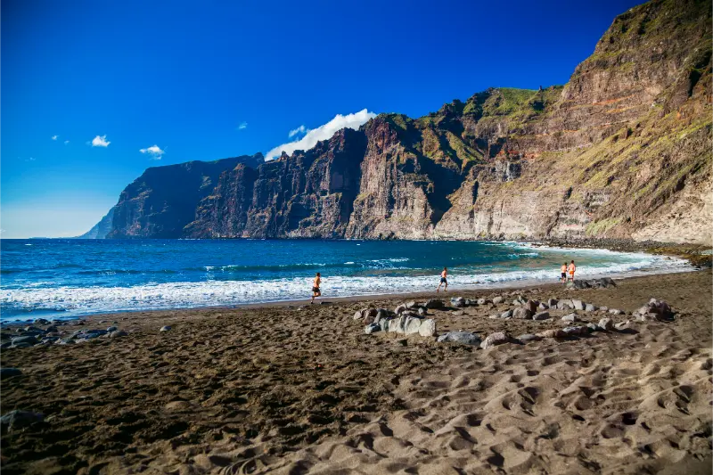
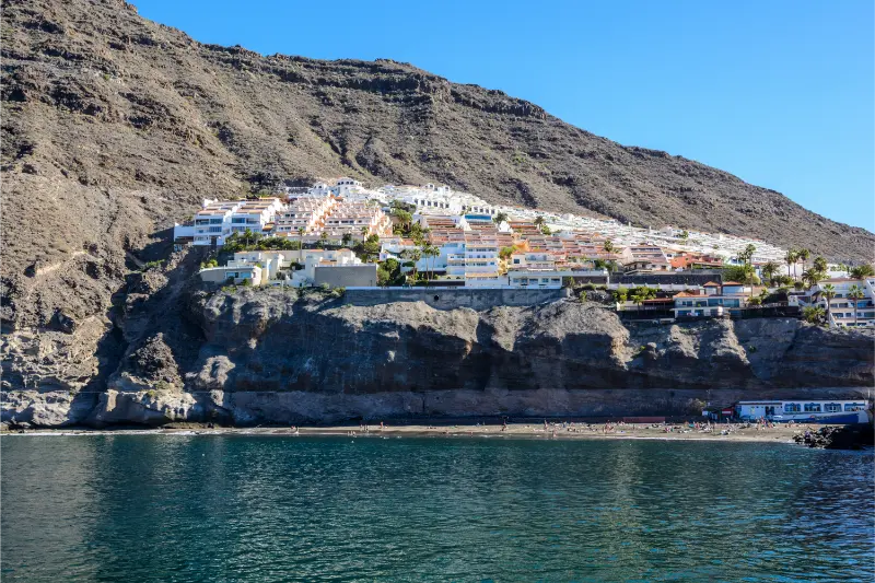
    Playa de Los Guíos is the small black-sand beach that makes the scale of the Los Gigantes cliffs feel real. It sits at the foot of the cliffs beside the marina, so this is not a remote beach day: it is a compact urban stop where swimming, boat trips, lunch and a walk around Los Gigantes can fit into the same half-day. I like it most when I treat the beach as part of the wider Los Gigantes experience rather than expecting a huge resort beach.

    The official Tenerife tourism page describes Los Guíos as a roughly 180-metre black-sand beach with generally calm water, easy pedestrian access, restaurants and boat activities nearby. The setting is its strongest feature. From the sand, the cliffs rise abruptly above the coast and give the beach a sense of enclosure that is completely different from the broad beaches of Costa Adeje or El Médano.

    Quick planning facts

    LocationLos Gigantes, Santiago del Teide
    Beach typeUrban black-sand beach
    Official lengthAbout 180 m
    Best forCliff views, a short swim, combining with marina activities
    ParkingNo dedicated beach parking; use nearby public/paid options
    BusYes; Los Gigantes is served by TITSA
    AccessibilityOfficial beach listing does not classify it as accessible
    Best approachArrive early, check sea conditions, combine with Los Gigantes

    What Los Guíos is really like

    Los Guíos is narrow and visually dramatic rather than spacious. The cliffs are so close that the landscape dominates the experience, especially if I have already seen them from a boat and then return to the beach to look upward from sea level. The sand is volcanic and dark, and the shoreline can change character with swell and tide.

    I do not choose Los Guíos when my priority is a long, flat promenade behind a wide beach with rows of loungers. I choose it because it is one of the easiest places to combine the ocean with the cliffs, marina and old resort centre. For a broader overview of the area, my Los Gigantes guide explains the viewpoints, boat trips and where I would stay.

    Swimming and sea conditions

    The water is often described as relatively calm, but “calm” is never a guarantee on an Atlantic island. I watch the beach flags, ask lifeguards or local staff when available, and look at what the shore break is doing before entering. Dark volcanic sand can also make the waterline feel steeper than on some southern resort beaches.

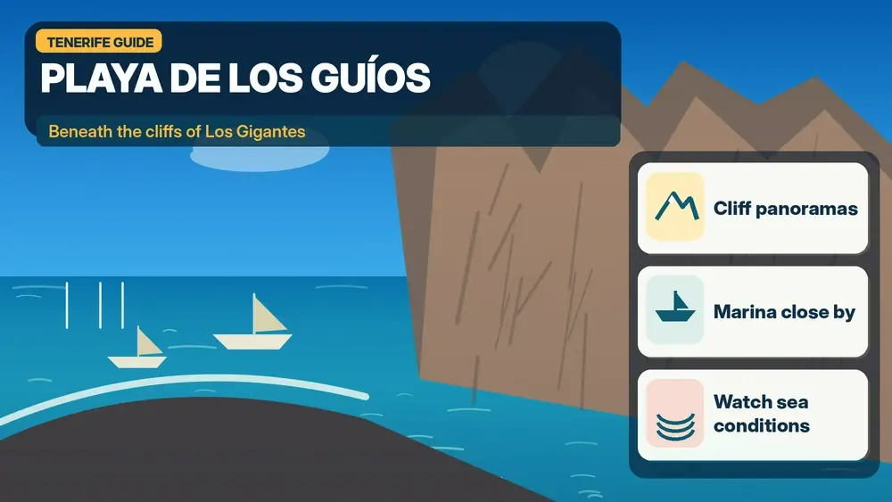
    Illustrated guide: Playa de Los Guíos and the Los Gigantes Cliffs, with practical visitor tips
    Illustrated guide: Playa de Los Guíos and the Los Gigantes Cliffs.

    If the sea is rough, I turn Los Guíos into a scenic stop rather than forcing a swim. That flexibility is one of the reasons I prefer to combine it with lunch, a marina walk or a boat excursion. My Tenerife safety guide covers the ocean habits I use everywhere on the island.

    The best time of day

    I prefer morning for the easiest logistics. The beach and marina can feel busy later, especially when excursion boats are departing and returning. Morning light also makes the cliffs particularly impressive from several angles, while late afternoon can be beautiful if the beach is not crowded.

    The cliff setting means light and shade change through the day. I do not assume that a forecast of full sun means the beach will feel identical to an open south-coast bay. If photography matters, I walk around the marina and nearby streets too rather than staying in one fixed position.

    How to get there without stress

    By car, the difficult part is not finding Los Gigantes but finding a convenient place to leave the car at a busy time. I avoid circling the waterfront repeatedly. If the closest spaces are full, I would rather park farther away legally and walk downhill than squeeze into an awkward roadside space.

    By bus, Los Gigantes is one of the easier west-coast bases to reach compared with remote Teno villages. I check the current TITSA timetable and build in time for the uphill walk back to a stop if necessary. The practical details in my Tenerife bus guide help if I am planning the whole day without a car.

    Parking strategy

    There is no dedicated beach car park listed for Los Guíos, so parking should be part of the plan rather than an afterthought. On a busy day I aim to arrive before the main excursion-boat rush. I also keep in mind that streets around Los Gigantes are steep; a parking place that looks close on the map can involve a noticeable climb on the way back.

    If I am travelling with small children, older relatives or lots of beach equipment, I would drop the group near a safe access point only where stopping is permitted and then park. I never block the marina approaches or private access because the area is compact and working traffic needs room.

    Combining the beach with a boat trip

    Los Gigantes marina is one of the island’s classic departure points for whale-watching and coastal excursions. I like the idea of seeing the cliffs from the water and then spending time on Los Guíos afterward, because the two perspectives make each other more memorable. I choose responsible operators and avoid any experience that promises touching or chasing wildlife.

    Playa De Los Guios Beach Los Gigantes Tenerife

    My whale-watching guide explains what I look for in an operator, while the kayaking guide is useful if I prefer a more active outing near the cliffs.

    Food, cafés and facilities

    One advantage of Los Guíos is that I am not isolated. The surrounding area has cafés, restaurants and marina services, so I do not need to carry a full day of supplies. I still bring water and sun protection because shade on the sand can be limited and the black sand becomes hot.

    For lunch, I usually prefer to walk a little away from the immediate excursion departure points and compare menus. A waterfront location can be convenient, but I care more about fresh food, clear pricing and whether the place feels busy with both visitors and residents.

    Who I think will enjoy it most

    Los Guíos works especially well for travellers who want scenery without a long hike. It can also suit couples and families who are already spending time in Los Gigantes. For people whose main goal is a full day of easy swimming with lots of beach space, I would compare it with Playa de La Arena or the southern resort beaches.

    The beach is less suitable for travellers who need a formally accessible beach setup, because the official listing does not mark it as accessible. In that case I would use my accessible Tenerife guide to identify better-equipped options.

    Where I would stay nearby

    Los Gigantes and Puerto de Santiago are practical west-coast bases if I want cliffs, boat trips and a quieter evening atmosphere than Playa de las Américas. Staying nearby also lets me visit Los Guíos early, before day visitors arrive. I can compare accommodation around Los Gigantes on Booking.com.

    I would not choose the west coast solely for this beach, but I would choose it for the combination of Los Gigantes, Playa de La Arena, Santiago del Teide, Teno and boat excursions. That is a much stronger reason to base myself here.

    Los Gigantes Cliffs Coastal Panorama Tenerife

    A realistic half-day plan

    • Arrive in Los Gigantes early enough to park without rushing.
    • Walk to Los Guíos and spend 60–90 minutes on the beach if sea conditions are suitable.
    • Explore the marina and confirm any boat-trip departure details.
    • Have lunch in Los Gigantes or Puerto de Santiago.
    • Finish at a viewpoint or continue to Playa de La Arena for a second coastal stop.

    I keep this plan deliberately loose. If the sea is rough or the beach feels crowded, the cliffs and marina still make the trip worthwhile.

    Useful official information

    For beach characteristics I use the official Tenerife tourism page for Playa de Los Guíos. For buses I check TITSA directly on the day of travel because routes and frequencies can change.

    I also check the weather and sea state rather than relying only on an island-wide forecast. Conditions around the cliffs can feel different from Costa Adeje even on the same afternoon.

    Mistakes I would avoid

    • Assuming there will be easy parking beside the sand.
    • Entering the water just because other people are swimming.
    • Planning only the beach and missing the cliffs, marina and viewpoints.
    • Carrying too much beach equipment down steep streets.
    • Booking a boat trip with no buffer before or after transport connections.

    The best Los Guíos visit is simple: good timing, realistic expectations and enough flexibility to enjoy the whole Los Gigantes setting.

    Frequently asked questions

    Is Playa de Los Guíos sandy?

    Yes. It is a volcanic black-sand beach.

    Can I park directly at the beach?

    The official tourism listing does not list beach parking. I plan to use nearby public or paid parking and walk.

    Is Los Guíos good for swimming?

    It can be, and the water is often relatively calm, but I always follow current flags and sea conditions.

    Can I combine it with whale watching?

    Yes. The nearby marina makes this one of the easiest beach-and-boat combinations on the west coast.

    How long would I spend there?

    For most travellers, one to two hours on the beach plus time for the marina or lunch is realistic.

    My final take

    Los Guíos is not Tenerife’s biggest or most luxurious beach, and that is exactly why I like it. The reason to come is the relationship between black sand, the marina and the immense Los Gigantes cliffs. I would build it into a west-coast day rather than travel across the island only for a sunbathing session.

  • Best Day Trips from Costa Adeje: Teide, Masca, Anaga, La Gomera and More

    Best Day Trips from Costa Adeje: Teide, Masca, Anaga, La Gomera and More

    Costa Adeje is a comfortable base, but I would never spend an entire Tenerife trip only on its seafront. The island’s strongest experiences are scattered across the highlands, north coast, Anaga and Teno. The good news is that many work as day trips if I group places logically and accept that mountain roads are slower than the map suggests.

    This guide starts from the assumptions in my Costa Adeje guide. I focus on realistic day trips rather than “see the whole island in a day” routes. Some excursions are easiest with a rental car, others make more sense as organised tours or by ferry.

    Teide National Park: the essential first day trip

    Mount Teide is the day trip I would prioritise on a first visit. From Costa Adeje the drive climbs through Vilaflor or another mountain route into a landscape of lava, caldera walls and high-altitude viewpoints. Even without the cable car, the national park is extraordinary.

    I leave early, bring warm layers and check both road and weather conditions. If I plan to hike regulated high-mountain trails, I also verify permits on Tenerife ON. A cable-car reservation should have enough margin for the drive, because mountain traffic and viewpoint stops can easily slow me down.

    Masca and Teno: dramatic roads and mountain villages

    Masca is a beautiful excursion, but I separate “visiting the village” from “hiking the gorge.” The gorge is regulated and requires advance planning. A simple road trip can combine Santiago del Teide, Masca viewpoints and parts of Teno.

    Masca Village Tenerife

    The road is winding, and parking/access rules around Masca matter. I avoid creating a day that depends on finding a spontaneous parking space. For nervous drivers, an organised excursion can be more relaxing.

    Los Gigantes and whale watching

    Los Gigantes is an easy day trip from Costa Adeje and works especially well with a responsible whale-watching trip. The cliffs are impressive from land but even more dramatic from the water.

    I book the boat as the fixed anchor and keep the rest of the day flexible. A late-afternoon return to Costa Adeje is simple, or I stay for sunset around Puerto Santiago. This is one of the least tiring day trips on the list.

    La Laguna and Anaga: the best culture-and-nature combination

    The combination of La Laguna and Anaga gives the strongest contrast with Costa Adeje. I start in the UNESCO-listed historic centre, then drive into laurel forest and mountain viewpoints.

    I do not try to add Taganana, Benijo, every mirador and a long hike to the same day unless I start very early. Anaga roads are slow. A better plan is one short forest walk, two or three viewpoints and either Taganana or the La Laguna centre as the main second focus.

    Illustrated guide: Best Day Trips from Costa Adeje, with practical visitor tips
    Illustrated guide: Best Day Trips from Costa Adeje.

    Garachico, Icod and the northwest

    A classic northwest day combines Garachico with Icod de los Vinos. Icod brings the Drago Milenario and historic centre; Garachico adds volcanic history and natural pools. If time remains, I continue toward Buenavista rather than adding distant La Orotava.

    This route involves a longer motorway drive from Costa Adeje, but it is straightforward compared with Anaga mountain roads. I leave swimming in Garachico dependent on sea conditions and keep a walking alternative ready.

    La Orotava and Puerto de la Cruz

    La Orotava and Puerto de la Cruz fit naturally together. I spend the morning among La Orotava’s historic streets and gardens, then descend to the coast for lunch, Lago Martiánez, the seafront or Playa Jardín.

    This is a gentler day than a long mountain hike and works well when the south is hot. North-coast weather can be cloudier, so I pack a light layer and treat that contrast as part of the experience rather than a problem.

    Santa Cruz and Las Teresitas

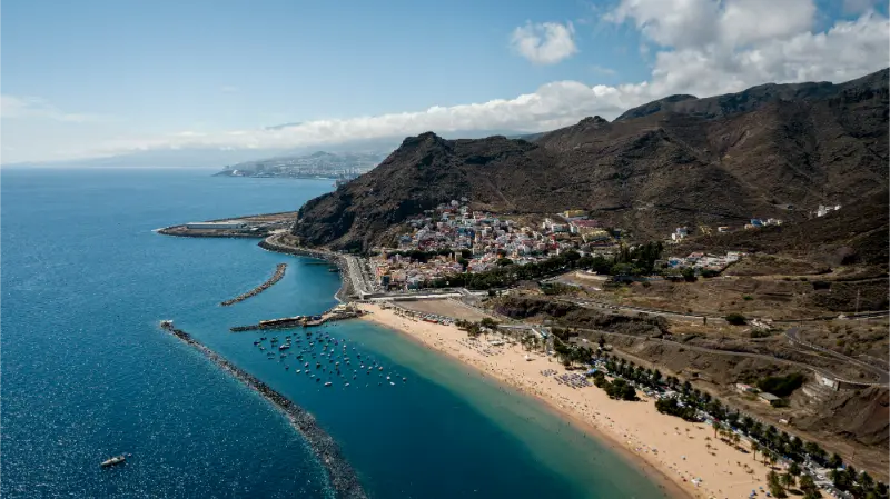
    For shopping, architecture and an urban day, I go to Santa Cruz. After the market, Auditorio area and city centre, I continue to Las Teresitas for a swim or sunset.

    This trip works well by car or public transport. It also makes sense for travellers who do not want mountain driving. If Carnival is taking place, normal traffic and transport arrangements change considerably, so I plan around the event rather than treating it as a regular city day.

    The crescent of Las Teresitas and its breakwater below the Anaga mountains

    La Gomera: the island-to-island day trip

    Ferries from Los Cristianos make La Gomera possible as a long day trip. The attraction is not simply “another island”; Garajonay National Park, deep ravines and San Sebastián create a landscape and cultural history distinct from Tenerife.

    Because ferry times are fixed, I prefer an organised island tour or a very carefully planned rental-car day. I never book the last ferry connection as if delays were impossible. For a relaxed trip, one night on La Gomera is better than trying to see everything in a few hours.

    El Médano and the south-east coast

    For an easy half-day or low-stress day trip, El Médano offers a completely different south-coast atmosphere. The town has cafés, windsurfing culture and access to the Montaña Roja landscape and La Tejita beach.

    I choose it when I want less driving and more time outdoors. Wind is part of the local character, so beach conditions may be breezier than Costa Adeje. That is good for watersports and less ideal for a calm sunbathing day.

    Which day trips work without a car?

    Los Gigantes, Santa Cruz, La Laguna, El Médano and Puerto de la Cruz are all possible using public transport, though journey times vary. Teide is more complicated without a car and often easier as an organised excursion. My Tenerife without a car guide explains the basics.

    I compare the real door-to-door time, not just the distance. A tour can be better value than multiple buses when it includes remote viewpoints; public transport is better when I want a city day with no fixed programme.

    Masca Mountain Valley Tenerife

    How many day trips would I do in one week?

    On a seven-night Costa Adeje stay, I usually plan three substantial excursions and leave the other days for beaches, local walks and flexible plans. Teide, one north/northwest day and one Anaga or La Gomera day create plenty of variety.

    Doing a full-day road trip every day defeats the reason for staying in Costa Adeje. I like using the resort comfort as a recovery base, not merely a place to sleep between twelve-hour drives.

    Renting a car for day trips

    A rental car gives the most freedom for Teide, Teno and the northwest. My Tenerife by car guide covers mountain-road habits, parking and route planning. I book a vehicle only for the days I genuinely need it if the rest of the holiday is resort-based.

    Fuel distances are modest, but driving hours add up. I avoid planning Teide, Masca and Anaga on consecutive days if I am the only driver. A rest day by the beach makes the next excursion more enjoyable.

    Organised tours: when they make sense

    Tours are particularly useful for Teide without a car, a first visit to Masca, and La Gomera when I want transport logistics handled. They also let everyone in the group enjoy mountain scenery instead of one person concentrating on hairpin bends.

    Masca Valley Panoramic View Tenerife

    I read the itinerary carefully. Some “island tours” spend most of the day in a bus and only minutes at each stop. I prefer fewer stops with meaningful time over a long list of place names.

    Practical planning notes

    Before I build a day around best day trips from Costa Adeje, I check opening or access conditions, the weather in the exact part of the island, transport for the return journey and how much walking the day really involves. Tenerife rewards flexible planning because coast, mountain and urban conditions can differ sharply. I keep one alternative nearby instead of replacing a cancelled plan with a long drive to the opposite side of the island.

    I also leave more time for meals and parking than a map suggests. Historic centres, beach promenades and mountain trailheads all become slower at popular times. An itinerary with some empty space usually produces better travel experiences than one that requires every transfer to work perfectly. When official restrictions or warning signs conflict with my original plan, I change the plan rather than looking for a workaround.

    For accommodation, I pay attention to the real route from the property to the places I expect to use every day. Tenerife has steep streets, large resort zones and rural roads where a short straight-line distance can hide a significant climb or an inconvenient walk. Reading the map at neighbourhood level is one of the simplest ways to avoid a poor base.

    Final thoughts

    Costa Adeje is one of Tenerife’s easiest bases precisely because so much of the island is reachable from it. The key is choosing a few day trips that are genuinely different rather than repeating similar coastal stops.

    For a first trip I would choose Teide, a north or northwest route, and either Anaga or La Gomera. That combination shows volcanic highland, historic Tenerife and a completely different landscape without turning the holiday into a race.

  • Los Gigantes Tenerife Guide: Cliffs, Whale Watching, Beaches and Where to Stay

    Los Gigantes Tenerife Guide: Cliffs, Whale Watching, Beaches and Where to Stay

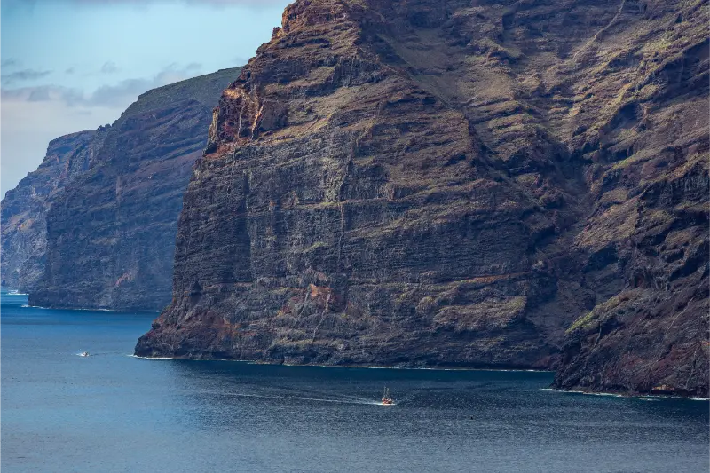
    Los Gigantes is one of the best places in Tenerife to experience the island from the sea. The resort itself is small and easy to understand, but the reason I come is the enormous wall of the Teno cliffs rising beyond the harbour. From land they dominate the horizon; from a boat their scale becomes much more convincing. In places the cliffs reach around 600 metres above the Atlantic.

    The area works as a day trip from Costa Adeje, but it can also be a very good base for travellers who prefer a quieter west-coast atmosphere. Puerto de Santiago and Playa de la Arena sit nearby, creating a broader resort zone with beaches, apartments and restaurants. I would choose Los Gigantes for sunsets, boat trips and access to Teno rather than for nightlife.

    The cliffs: what makes them special

    The Acantilados de Los Gigantes form part of the dramatic western edge of Teno Rural Park. Their near-vertical faces are the product of Tenerife’s old volcanic terrain and long erosion. Viewpoints on land are useful, but the perspective from the water shows how abruptly the mountains meet the ocean.

    If you have only a few hours, see the harbour and one good viewpoint. If you have half a day, add a boat trip. I would not spend the whole visit driving between minor viewpoints because parking and steep streets can consume more time than expected.

    Whale and dolphin watching

    Southwest Tenerife is one of the island’s main areas for cetacean-watching excursions. Los Gigantes harbour has authorised operators, and the combination of wildlife observation with cliff views makes it especially attractive. I choose companies that follow the island’s regulations and treat animal welfare as more important than guaranteeing close encounters.

    Illustrated guide: Playa de Los Guíos and the Los Gigantes Cliffs, with practical visitor tips
    Illustrated guide: Playa de Los Guíos and the Los Gigantes Cliffs.

    The official Tenerife tourism site publishes information about authorised whale-watching companies and boats. Use that as a filter before comparing price, vessel size and trip duration. Wildlife sightings can be frequent, but they remain wildlife sightings—not a performance.

    Boat trips beneath the cliffs

    Even travellers who are less interested in wildlife may enjoy a shorter scenic trip because the cliffs themselves are the attraction. Sea conditions determine comfort, so check the forecast if you are sensitive to motion. A small fast boat and a large catamaran provide very different experiences; choose based on comfort as much as duration.

    Some trips include swimming stops when conditions permit. Treat those as optional, follow crew instructions and remember that open-ocean conditions are different from a sheltered beach.

    Playa de los Guíos

    The small dark-sand beach near the cliffs gives you an easy way to combine sea time with the harbour. Its scale and facilities are more limited than the large southern beaches, but the setting is unique. I would choose it for scenery and convenience rather than expect a full resort-beach infrastructure day.

    For a more substantial beach nearby, Playa de la Arena in the Puerto de Santiago area is another option. My Tenerife beach guide compares west-coast stops with other parts of the island.

    Natural pools and ocean safety

    The west coast has rocky bathing areas and natural pools, but conditions can become dangerous when swell increases. Never enter because other people are doing so or because a photo makes the water look calm. Follow closures, barriers and local warnings.

    Los Gigantes Cliffs From The Sea Tenerife

    Los Gigantes and Masca

    Los Gigantes is closely associated with Masca because the cliffs form the coastal edge of the Teno landscape and the regulated Masca Gorge descent currently exits by boat from Masca Bay toward the Los Gigantes area. If you are hiking, the logistics need to be booked under the official system rather than improvised at the harbour.

    Read my Masca guide for the 2026 access rules before connecting the two experiences.

    A west-coast day without the Masca hike

    My easier west-coast day would start with a morning boat trip from Los Gigantes, continue with lunch near the harbour or Puerto de Santiago, then finish at a beach or viewpoint. If you have a car and enough daylight, add Santiago del Teide or a Teno viewpoint—but not every stop on the map.

    This version works well after a major Teide or Anaga day because it gives you scenery without another demanding hike.

    Where to stay

    BaseBest forCharacter
    Los GigantesHarbour and cliff viewsCompact, quiet resort
    Puerto de SantiagoApartments and local servicesMore spread out
    Playa de la ArenaBeach-focused stayRelaxed and practical
    Costa AdejeMore resort choice, day trip to westBusier and farther away

    Los Gigantes can feel wonderfully calm in the evening compared with the main southern resorts. If you value that, compare accommodation in Los Gigantes and check the exact gradient between the hotel and harbour; streets can be steep.

    Getting there

    Driving from the south is straightforward for much of the route, but parking becomes the main practical issue near the harbour. Arrive before a booked boat trip with a generous buffer. TITSA buses serve the area, and organised excursions are another option if you do not want to drive.

    For transport across the island, use my Tenerife transport guide.

    Food and sunset

    I would save time for a proper lunch or early dinner rather than eat quickly between activities. Fish and Canarian dishes make sense on the west coast, and sunset can be excellent when the horizon is clear. The light on La Gomera and the cliffs is often more memorable than another attraction.

    Los Gigantes with children

    Families can enjoy a short boat trip and beach time, but vessel choice matters. Shade, toilet access, trip length, seasickness and the age of the children are more important than marketing claims. Do not schedule a long boat excursion immediately after a winding mountain drive if someone in the family is prone to motion sickness.

    Los Gigantes Resort And Marina Tenerife

    For family pacing, see Tenerife with kids.

    When to visit

    The west and southwest are generally sunny, making Los Gigantes viable year-round. Boat conditions still depend on wind and swell, and summer heat can make midday walks on steep streets tiring. I prefer to book the sea activity first and keep the land portion flexible.

    My ideal Los Gigantes visit

    I would arrive early enough to park without stress, take a responsible whale- or cliff-watching trip, have lunch near the harbour, walk to a viewpoint and then choose either Playa de los Guíos or Playa de la Arena. If sunset is important, stay rather than racing back across the island before the best light.

    For current background on the cliffs and visitor information, see the official Tenerife tourism page for Los Gigantes cliffs.

    Choosing the right boat

    Look beyond duration and price. Ask how much shade there is, how many passengers the boat carries, whether there is a toilet, how wildlife viewing is managed and what happens if conditions change. Smaller boats can feel more intimate but also more exposed to motion; larger vessels can be more comfortable for some travellers. The best choice depends on your group, not on one universal ranking.

    Accessibility and steep streets

    Los Gigantes is compact but not flat. Some accommodation sits well above the harbour, so travellers with mobility limitations should inspect the route carefully. A spectacular cliff view from a balcony may come with a steep return walk. When the harbour is central to your plans, proximity at the same elevation can be more useful than a panoramic hotel high on the slope.

    Los Gigantes Cliffs And Resort Tenerife

    Practical planning notes I would save before the trip

    For Los Gigantes Tenerife guide, I save the accommodation address, parking or bus information, one official information link and the route back to my base before leaving. Tenerife is easy to travel around, but mountain roads, microclimates and busy coastal areas can turn a simple day into a slower one. I therefore keep one optional stop that can be removed without losing the main purpose of the day.

    I also carry water, sun protection and a light layer whenever the day leaves the immediate coast. Even short journeys can move from warm sunshine to wind, cloud or cooler high ground. That small amount of preparation makes it easier to respond to the island as it actually is rather than force a schedule created before arrival.

    Finally, I avoid judging a destination by the busiest thirty minutes of the day. Arriving earlier, staying later, walking one street beyond the obvious viewpoint and sitting down for a proper meal often changes the experience completely. My goal with these guides is not to collect attractions but to make each place easier to understand and enjoy at a realistic pace.

    I also keep the final hour of the day deliberately open. Traffic, parking, weather and a meal that lasts longer than expected are normal parts of travel in Tenerife, not problems to solve by rushing. Leaving that margin means I can stop at an unexpected viewpoint, wait for safer sea conditions, or simply stay longer in a town that I am enjoying. It also makes the return drive more comfortable because I am not trying to recover time lost earlier in the itinerary. For me, that flexibility is one of the most useful habits on an island where short distances can hide very different roads and conditions.