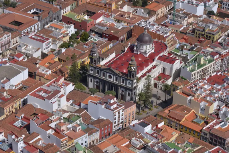
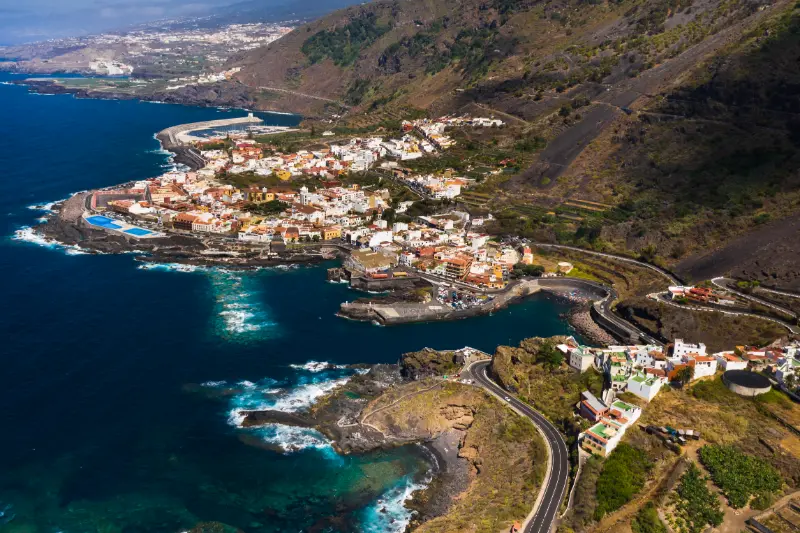
Category: Nature & Hiking

Practical guides to Mount Teide, Anaga, Teno and Tenerife hiking, landscapes and protected natural areas.

  • Botanical Gardens & Parks in Tenerife: Puerto de la Cruz, Palmetum, La Orotava and Teide

    Botanical Gardens & Parks in Tenerife: Puerto de la Cruz, Palmetum, La Orotava and Teide

    Quick summary: Tenerife’s gardens are not just rainy-day fillers. They explain the island’s subtropical climate, colonial plant history, Canarian endemics and the contrast between coast and high mountain. My core list is the historic Botanical Garden in Puerto de la Cruz, the Palmetum in Santa Cruz, Hijuela del Botánico in La Orotava, García Sanabria for an urban walk and the El Portillo botanical garden inside Teide National Park.

    Historic classicJardín de Aclimatación de La Orotava, Puerto de la Cruz
    Best modern projectPalmetum, Santa Cruz
    Free small gardenHijuela del Botánico, La Orotava
    High-altitude floraEl Portillo botanical garden, Teide National Park

    Puerto de la Cruz Botanical Garden

    The Jardín de Aclimatación de La Orotava was founded in the late eighteenth century as a place to acclimatise tropical plants. Despite the name, it is in Puerto de la Cruz and remains one of the easiest ways to see mature subtropical trees and plant collections without a long hike.

    Turismo de Tenerife currently lists daily garden hours and a modest entry fee, with closures on selected public holidays. I still check the official page before going because opening details can change.

    Palmetum: from landfill to botanical landmark

    The Palmetum is one of the island’s most unusual urban projects: a former landfill transformed into a 12-hectare botanical garden focused on palms and tropical/subtropical plants. Turismo de Tenerife says the collection includes more than 2,000 plant species and over 500 palm species.

    It also works for visitors who need easier mobility: the official listing describes ramps and a lift, and the sea/city views make the visit feel different from a traditional enclosed botanical garden. I allow at least a couple of hours rather than treating it as a quick photo stop.

    La Orotava: Hijuela and Victoria Gardens

    Hijuela del Botánico sits behind La Orotava’s town hall and offers a compact historic garden with a broad plant collection. Turismo de Tenerife lists it as free and describes it as a complementary garden to the Puerto de la Cruz botanical collection.

    The nearby Jardines Victoria add architecture and terraced views, so I combine gardens with the old town rather than making a separate car journey for each small site.

    García Sanabria and city parks

    Parque García Sanabria gives Santa Cruz a green centre and is easy to pair with shopping, public art, cafés and the city’s historic streets. Urban parks are especially useful for travellers who want shade, benches and a flexible stop between fixed attractions.

    For families, a city park can reset the day after a museum or long lunch. For photographers, early morning gives softer light and fewer people.

    El Portillo botanical garden

    The El Portillo visitor-centre garden inside Teide National Park is about native high-mountain flora rather than tropical plants. Turismo de Tenerife says the four-hectare garden represents more than 75% of the higher plant species found in the national park.

    It is an excellent alternative or addition to a strenuous hike because visitors can learn the ecology without chasing rare plants off-trail. The altitude still matters: sun, wind and temperature are different from the coast.

    How I plan a garden day

    I group gardens geographically. Puerto de la Cruz and La Orotava combine well; Palmetum fits a Santa Cruz day; El Portillo belongs with Teide. This avoids turning a slow botanical day into hours of driving.

    Puerto De La Cruz City And Atlantic Ocean Tenerife

    I also check accessibility, shade and toilets if travelling with older relatives or toddlers. Gardens are ideal multi-generational attractions precisely because the pace can be adjusted easily.

    Go early for atmosphere

    Gardens feel completely different before midday crowds and strong sun; early visits also leave the afternoon free for a town or beach.

    I would verify this point close to the travel date because a small operational change can affect the whole day. My preference is to keep one workable backup rather than build a complicated Plan B: a second document copy, another transport option, a nearby supermarket, a lower-effort activity or enough time to ask staff for help. That approach is especially useful in Tenerife because the island offers many alternatives within a relatively short distance.

    Read labels instead of collecting only photos

    Learning the origin and ecology of a few plants gives the visit much more value than trying to photograph every species.

    I would verify this point close to the travel date because a small operational change can affect the whole day. My preference is to keep one workable backup rather than build a complicated Plan B: a second document copy, another transport option, a nearby supermarket, a lower-effort activity or enough time to ask staff for help. That approach is especially useful in Tenerife because the island offers many alternatives within a relatively short distance.

    How I would use this guide on a real Tenerife trip

    I treat Tenerife botanical gardens as a practical layer of the holiday rather than something that should dominate every day. I verify the few details that can create a real problem—documents, opening times, transport, medical or legal requirements—and keep the rest flexible. Tenerife changes quickly between the south coast, the north, the metropolitan area and the high mountains, so geography and timing are often more important than adding more activities.

    I also save the key official link, booking reference or emergency contact offline before I leave the hotel. Mobile data is generally easy to arrange, but the moment I most need a detail is often when I am at an airport counter, inside a police station, on a mountain road or trying to make a connection. A screenshot and a small time buffer are simple habits that make the trip calmer.

    Useful related guides on My Tenerife Experience

    Where I would stay

    I choose a base according to the hardest part of the itinerary. Costa Adeje and Los Cristianos are convenient for many family and resort services, Puerto de la Cruz works well for the greener north, while Santa Cruz and La Laguna are useful for city services and public transport. I compare accommodation in Tenerife and then read the newest reviews for details that matter to this specific trip rather than relying only on the headline score.
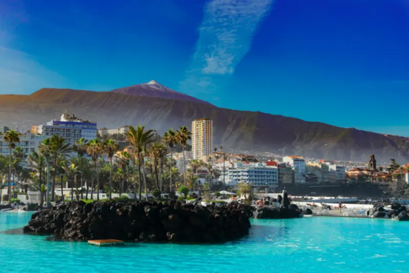
    Puerto De La Cruz Skyline Tenerife

    Official information to recheck

    Frequently asked questions

    Which is the main botanical garden in Tenerife?

    The historic Jardín de Aclimatación de La Orotava is in Puerto de la Cruz and is the classic botanical-garden visit.

    Is the Palmetum accessible?

    Turismo de Tenerife describes it as fully transitable for people with reduced mobility, with ramps and a lift.

    Is there a botanical garden at Teide?

    Yes. El Portillo has a garden focused on native national-park flora.

    Final thoughts

    Tenerife’s gardens make the island’s climate and biodiversity much easier to understand. I use them as slow-travel anchors between bigger sightseeing days, not as leftover time fillers.
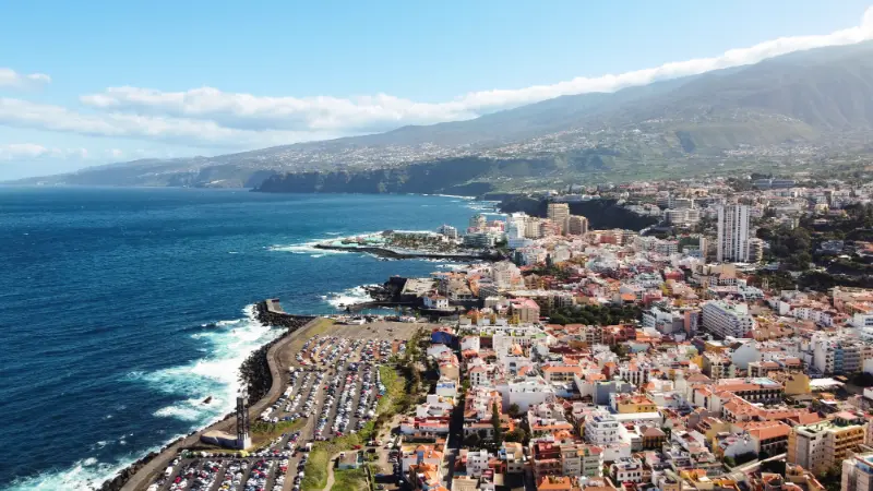
    Aerial View Of Puerto De La Cruz City Tenerife

    Practical planning checkpoint 1

    Before I lock this part of the trip in, I check the exact date, location and operator rather than relying on a screenshot from months earlier. Tenerife is easy to travel around, but opening hours, transport frequency, weather, service availability and access conditions can change between municipalities and seasons. I keep one alternative in the same area so a small change does not force a cross-island detour.

    I also think about who is actually travelling. A plan that works for a solo adult can be poor for a toddler, a teenager, a pregnant traveller, an older relative or someone working remotely. The useful question is not “Is Tenerife suitable?” but “What would make this particular day comfortable and realistic?” That usually produces better choices about timing, accommodation, food stops and transport.

    Practical planning checkpoint 2

    Before I lock this part of the trip in, I check the exact date, location and operator rather than relying on a screenshot from months earlier. Tenerife is easy to travel around, but opening hours, transport frequency, weather, service availability and access conditions can change between municipalities and seasons. I keep one alternative in the same area so a small change does not force a cross-island detour.

    I also think about who is actually travelling. A plan that works for a solo adult can be poor for a toddler, a teenager, a pregnant traveller, an older relative or someone working remotely. The useful question is not “Is Tenerife suitable?” but “What would make this particular day comfortable and realistic?” That usually produces better choices about timing, accommodation, food stops and transport.

    Practical planning checkpoint 3

    Before I lock this part of the trip in, I check the exact date, location and operator rather than relying on a screenshot from months earlier. Tenerife is easy to travel around, but opening hours, transport frequency, weather, service availability and access conditions can change between municipalities and seasons. I keep one alternative in the same area so a small change does not force a cross-island detour.

    I also think about who is actually travelling. A plan that works for a solo adult can be poor for a toddler, a teenager, a pregnant traveller, an older relative or someone working remotely. The useful question is not “Is Tenerife suitable?” but “What would make this particular day comfortable and realistic?” That usually produces better choices about timing, accommodation, food stops and transport.
  • Teide Altitude & Altitude Sickness: 3,718 m, Cable Car, Symptoms and Safer Planning

    Teide Altitude & Altitude Sickness: 3,718 m, Cable Car, Symptoms and Safer Planning

    Quick summary: Teide rises from sea-level resorts to 3,718 metres, and the rapid change in altitude is one of the reasons I take the mountain seriously even on a short sightseeing day. Most visitors have no major problem, but headache, nausea, dizziness or unusual fatigue should never be dismissed simply because the cable car makes high altitude easy to reach.

    Tenerife creates a travel pattern that is unusual in Europe: breakfast at sea level, a drive through pine forest and then a cable-car ride to around 3,550 metres within a few hours. The landscape is accessible, but the body still experiences lower oxygen pressure, colder air, stronger ultraviolet exposure and drier conditions.

    Teide summit3,718 m
    La Rambleta / upper cable-car areaabout 3,550 m
    Risk increasesWith rapid ascent, exertion and individual susceptibility
    Key responseDo not go higher when feeling unwell; descend if symptoms worsen
    Emergency112 for serious symptoms or an emergency

    Why altitude can affect a Tenerife day trip

    Altitude illness is associated with lower oxygen pressure. The NHS notes that altitude sickness can occur above roughly 2,500 metres, while the CDC treats rapid ascent above about 2,450–2,750 metres as a meaningful risk context for unacclimatised travellers. Teide’s upper cable-car station and summit are well above those levels.

    I use the official Tenerife trail page for the mountain facts: the Telesforo Bravo path starts around 3,550 m and reaches 3,718 m. For health background I use the CDC high-altitude guidance rather than treating a travel blog as medical advice.

    Symptoms I do not ignore

    A headache alone can have many causes on Tenerife—dehydration, strong sun, poor sleep or caffeine withdrawal among them—but headache with nausea, dizziness, unusual tiredness or loss of appetite after rapid ascent deserves attention. Severe confusion, loss of coordination, breathlessness at rest or worsening symptoms are not “push through it” situations.

    I do not diagnose myself from a checklist. My practical rule is simpler: if I feel significantly unwell at high altitude, I stop ascending. If symptoms worsen, descending is the priority and medical help may be necessary.

    Fitness does not make anyone immune

    A strong runner can still be affected by altitude. Physical fitness is useful for the trail, but it does not guarantee protection from altitude illness. This matters because Teide attracts hikers who may otherwise be comfortable with steep terrain and assume effort is the only challenge.

    Cable car visitors versus summit hikers

    A cable-car sightseeing visit exposes me to high altitude quickly but usually for a shorter time and without sleeping high. A summit hike adds exertion and can keep me high for longer. The two experiences therefore need different levels of preparation, even though both use the same mountain infrastructure.

    My Mount Teide guide covers permits, transport and route planning. This page focuses on how I adjust pace and expectations once altitude is part of the day.

    Teide Cable Car Tenerife

    What I do before going up

    • Sleep normally and avoid starting dehydrated.
    • Eat a normal meal rather than arriving hungry after an early flight.
    • Carry water and sun protection.
    • Dress for wind and cold even if the coast is warm.
    • Avoid turning the first minutes at altitude into a sprint for photographs.
    • Discuss high-altitude travel with a clinician in advance if I have relevant heart, lung or other medical conditions.

    Alcohol, medication and medical conditions

    I do not use alcohol as part of a high-altitude day. Anyone with significant heart or lung disease, pregnancy concerns or a history of altitude problems should seek personalised medical advice before a high-altitude visit. Prescription prevention medicines exist for some itineraries, but they are not something I self-prescribe from an internet article.

    Children and older travellers

    Children can be affected by altitude too, and young children may not describe symptoms clearly. With families I keep the high-altitude portion short, watch behaviour and appetite and make it easy to turn around. For older travellers, general fitness, medication and underlying conditions matter more than age alone.

    Cold, UV and dehydration can mimic or worsen discomfort

    High altitude also means colder temperatures, low humidity and stronger UV exposure. A person who is shivering, sunburned or dehydrated can feel terrible without classic altitude illness. I prepare for all of those factors rather than blaming every symptom on oxygen.

    How I fit this into a real Tenerife trip

    I treat high altitude on Teide as a planning layer rather than the main reason to cross the island. Tenerife is compact on a map but not in practice: mountain roads, resort traffic, parking searches and different microclimates can make a short distance feel much longer. I decide what part of the day is fixed, what can move and what I will drop if conditions change.

    My preferred itinerary has one main commitment, one nearby secondary stop and enough unplanned time for food, parking and weather. That structure is especially useful when the subject involves an official rule, a seasonal event, a beach condition or a transport product that can change after an article is published.

    What I recheck shortly before travelling

    I recheck only the details that can genuinely change: opening hours, official alerts, event dates, road or trail status, municipal rules, public-transport timetables and the terms of anything I have booked. I save the relevant official page or screenshot offline so I am not dependent on mobile coverage at the exact moment I need it.

    If a sign, lifeguard, police officer, accommodation rule or current official notice conflicts with an older travel article, I follow the current instruction. That sounds obvious, but it is one of the simplest ways to avoid turning a small misunderstanding into a fine, a missed reservation or an unsafe decision.

    Useful related guides already on this site

    For the wider trip, I connect this subject with Mount Teide guide, Tenerife packing list, best time to visit Tenerife. Those guides cover the surrounding logistics so this article can stay focused instead of repeating the same airport, weather and accommodation advice in every page.

    Where accommodation changes the experience

    Location can remove more friction than an extra hotel facility. I look at walking gradients, late-night transport, parking, reception hours and how easy it is to reach the places that matter to the trip. A room that is slightly more expensive but avoids repeated taxis or cross-island drives can be better value overall.

    Check current Tenerife accommodation on Booking.com.

    Tours and bookable experiences

    I use an organised tour when it solves a real problem: transport, specialist equipment, limited access, interpretation or a weather-dependent activity that is easier with a local operator. I still read the meeting point, cancellation conditions, age limits, accessibility notes and exact inclusions before paying.

    A final rule I use

    The most useful approach to high altitude on Teide is to understand the principle, verify the current detail and keep enough flexibility to respond to what is actually happening on the island. Tenerife rewards preparation, but it rewards adaptable preparation even more.

    Teide National Park Desert Landscape Tenerife

    Frequently asked questions

    Can you get altitude sickness on Teide?

    Yes, it is possible. The upper mountain is above the altitude where acute altitude illness can occur, especially after rapid ascent from sea level.

    Should I continue to the summit with a headache?

    I would not ascend higher while feeling unwell. If symptoms worsen, descend and seek medical help when necessary.

    Does the cable car eliminate the physical risk?

    No. It reduces walking but increases the speed of ascent, so I still take the altitude seriously.

    What number do I call in an emergency?

    112 is the general emergency number in the Canary Islands and Spain.

    Final thoughts

    Teide is accessible enough to feel easy and high enough to demand respect. I plan the permits and parking, but I also plan to move slowly, notice how I feel and turn around without hesitation if the mountain stops being enjoyable.

    A practical scenario I would plan before the trip

    Before I rely on Teide altitude sickness in a real itinerary, I picture the most ordinary version of the problem rather than the dramatic one. I ask what information I would need if the phone battery were low, if the first business were closed, if one person in the group moved more slowly than expected or if the weather changed after breakfast. This kind of scenario planning takes only a few minutes and usually reveals whether the itinerary has too many dependencies.

    Teide National Park Sunset From Alto De Guajara

    I also separate facts I can know in advance from decisions that belong to the day itself. Dates, legal frameworks, addresses and booking conditions can be checked before travel. Weather, queues, sea state, individual energy and temporary closures must be judged close to the activity. Mixing those two categories is how travellers either over-plan months in advance or improvise things that should have been settled at home.

    How I keep the information useful after the trip begins

    I save a short note rather than a giant folder: the official source, one contact number, the relevant booking reference and the backup option. That gives me enough information to act without spending the holiday rereading research. If I am travelling as a family or group, I share the note with one other adult so the plan does not depend on a single phone.

    Tenerife is particularly well suited to flexible planning because very different experiences sit relatively close together. A mountain day can become a historic-town day; a rough-sea morning can become a market or museum visit; a crowded resort afternoon can become a rural meal. The backup does not need to imitate the original plan to be successful.

    Responsible travel and local context

    I remember that most visitor rules exist inside places where people live and work. Roads serve residents, beaches are public spaces, vineyards are farms, apartment buildings are homes and emergency systems are designed first to protect life. Acting as a temporary neighbour rather than a consumer of scenery produces better decisions almost automatically.

    That also means I do not use “everyone else is doing it” as evidence that something is allowed. A parked car can still be illegal, a swimmer can still be ignoring a red flag and a loud balcony can still be disturbing the building. Current signs and official instructions are a better guide than copying the nearest tourist.

    What I would change for a short break

    On a three- or four-night trip I simplify more aggressively. I choose a base that reduces transfers, protect one or two high-priority experiences and avoid any plan that requires perfect traffic, weather and opening hours on the same day. The shorter the trip, the more valuable a flexible half-day becomes.

    On a two-week stay I do the opposite: I spread high-demand activities across the holiday, use poor-weather days for practical errands and let local routines become part of the experience. More time does not mean I add more commitments; it means I can wait for the right conditions.

  • Forest Bathing in Tenerife: Anaga, Laurel Forest, Pine Woods and Slow Nature Walks

    Forest Bathing in Tenerife: Anaga, Laurel Forest, Pine Woods and Slow Nature Walks

    Forest bathing is a useful way to think about Tenerife’s forests if you want nature without turning every outing into a hike. The idea is simple: move slowly, pay attention to sound, light, smell and texture, and let the forest be the purpose rather than a route to complete. You do not need a special ceremony or a long distance.

    Tenerife is particularly suited to this kind of slow nature time because its forests are so distinctive. Anaga’s laurel forest can feel cool, damp and ancient, while the pine forest at higher elevations is brighter, drier and more open. The experience changes with altitude, cloud and season.

    I use the term “forest bathing” in a travel and wellbeing sense, not as a medical treatment. If you have a health condition, anxiety disorder or mobility limitation, choose an environment and walk that suit you rather than assuming nature replaces professional care.

    Forest bathing in Tenerife at a glance

    Best atmosphereAnaga laurel forest
    Best easy forest walkPista de Las Hiedras
    Best short accessible experienceSelected sections around Cruz del Carmen / Sendero de los Sentidos
    Best contrasting forestCanarian pine zones at higher elevation
    Main planning issueFog, damp surfaces, parking and trail rules

    Why Anaga is the natural starting point

    Anaga’s laurel forest gives the strongest sense of immersion. Cloud can hang in the canopy, moss covers surfaces and the light changes constantly. I would not wait only for a blue-sky day; soft fog can be part of what makes the forest memorable.

    The Anaga Rural Park guide explains the wider region. For forest bathing, choose a short route and give yourself permission not to complete a large hiking objective.

    Pista de Las Hiedras

    Pista de Las Hiedras is one of the best options for a gentle forest-focused outing. Official Tenerife tourism describes a low-difficulty route of about 4.48 kilometres through laurel forest and fayal-brezal vegetation, with relatively modest changes in elevation for Anaga.

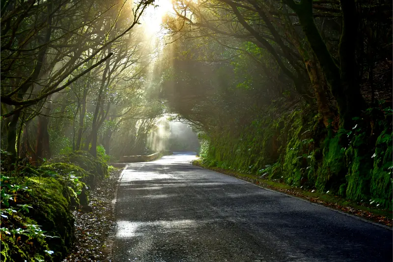
    Anaga Laurel Forest Tenerife

    My Pista de Las Hiedras guide covers the route. You do not have to walk the entire distance for a slow forest experience. A shorter out-and-back can be enough if conditions are damp or your goal is quiet time rather than exercise.

    Cruz del Carmen and Sendero de los Sentidos

    Cruz del Carmen is convenient because it combines a visitor area, viewpoints and short forest paths. The Sendero de los Sentidos was designed around sensory engagement and is therefore a natural fit for travellers who want to slow down rather than hike hard.

    Use the Sendero de los Sentidos guide for practical details. Parts of the area can become busy at popular times, so early morning or a quieter weekday often feels more peaceful.

    Canarian pine forest

    Pine forest produces a different kind of calm. The trees are taller and more widely spaced, the ground is often dry with needles, and sunlight reaches the forest floor more easily. After rain, the smell can be particularly strong.

    I would use a pine-forest stop as part of a Teide or mid-altitude day, but I would not wander away from established routes. Tenerife’s forests are managed landscapes with fire risk, protected zones and occasional closures.

    How to practise forest bathing without making it complicated

    Walk more slowly than normal. Put the phone on silent but keep it available for navigation and emergencies. Stop at a safe point and notice five things you can see, four you can hear, three physical sensations, two smells and one detail you would normally pass without noticing.

    You do not need to force relaxation. Some people immediately enjoy stillness; others feel restless. The purpose is simply to spend time paying attention rather than measuring distance or speed.

    Go alone or with a guide?

    A self-guided experience is easy on familiar, well-marked short routes. A guide can add value if you want botanical interpretation, local ecology or a structured mindfulness session. Check credentials and be cautious with anyone making medical claims about guaranteed health outcomes.

    If you book an organised nature activity, choose an operator who explains group size, route difficulty and cancellation rules clearly.

    Weather in the forest

    Anaga can be much cooler and wetter than the south coast. Bring a light waterproof layer even when your hotel is sunny. Paths and wooden surfaces can become slippery in mist or after rain, so shoes with grip are more important than fashion trainers.

    Cloud does not necessarily spoil forest bathing, but strong wind, storms or official closures should change the plan immediately.

    Silence and other visitors

    You are sharing the forest with hikers, residents and wildlife. Avoid playing music through speakers. If you stop for a long period, choose a place where others can pass without stepping off the trail.

    Quiet behaviour also improves your own experience because birds, leaves and distant water become easier to hear.

    Children and forest bathing

    With children, I would not call it a mindfulness exercise. Turn it into a simple noticing game: find three different leaf shapes, listen for two bird sounds, or identify the roughest and smoothest textures without picking living plants. Keep the session short and end before boredom turns into frustration.

    This can be a useful calmer contrast to the activity-heavy ideas in the Tenerife with kids guide.

    Responsible forest behaviour

    Stay on established paths, do not collect plants, keep food waste with you and follow fire restrictions. “Connecting with nature” should not mean leaving cairns, tying ribbons to trees or moving natural objects for photographs.

    If you plan a longer walk, read the Tenerife hiking permits and trail rules guide.

    Official route information

    The official Pista de Las Hiedras page provides route details and current context for one of the best gentle laurel-forest walks. Check official trail information before travelling after severe weather or wildfire alerts.

    Anaga Laurel Forest Trail Tenerife

    Frequently asked questions

    What is forest bathing?

    In travel terms, it means spending slow, attentive time in a forest rather than focusing on distance, speed or a destination.

    Do I need a guide?

    No for a simple short walk on a known route, though a good guide can add ecology or structured mindfulness.

    Where is the best place in Tenerife?

    Anaga’s laurel forest is the most atmospheric starting point, especially around Cruz del Carmen and Las Hiedras.

    Laurel Forest Trail Tenerife

    Is it suitable for children?

    Yes if you keep it short and playful rather than expecting long silence.

    Can I do it when it is cloudy?

    Yes. Mist can enhance the forest atmosphere, but avoid dangerous weather and respect any closures.

    How I would plan this experience

    I would first decide whether this is the main purpose of the day or one element in a wider itinerary. Tenerife is compact on a map but travel time can grow quickly because of mountain roads, parking, one-way streets and the temptation to combine places that sit on opposite sides of the island. A realistic plan usually groups two or three stops in the same area rather than chasing a long checklist.

    I save the exact parking point or bus stop, the return route and one nearby alternative before leaving accommodation. That simple preparation matters on Tenerife because coast, forest and highland weather can differ dramatically on the same day. It also makes it easier to abandon a plan without wasting the whole day if wind, cloud, traffic or access rules change.

    For any activity that involves a provider, I read the cancellation terms, language, meeting point and what is included before paying. For self-guided days, I download offline maps and avoid relying on a single social-media pin. The island is easy to enjoy independently, but many of the best landscapes are protected places where access, parking and behaviour matter.

    What to bring

    • Water and a small snack, even for a short outing.
    • Sun protection; UV exposure can be strong in every season.
    • A light layer for wind, cloud, air-conditioned interiors or higher elevations.
    • A charged phone with offline maps and screenshots of reservations or directions.
    • Footwear suited to the real surface rather than only to resort walking.
    • A little flexibility: weather, traffic and local events can change the best order of the day.

    Where to stay

    For a first Tenerife trip, I choose accommodation according to the activities I will do most rather than only the lowest room price. Costa Adeje and Los Cristianos are convenient for the south; Puerto de la Cruz and La Orotava work well for the north; Santa Cruz and La Laguna are stronger for an urban and cultural stay. Compare accommodation across Tenerife on Booking.com and then check actual road or bus times to the places you expect to visit.

    Final planning advice

    My main rule is to leave space between activities. Tenerife rewards travellers who allow time for an unplanned viewpoint, a long lunch, a swim, a change in cloud cover or simply a slower road than expected. A slightly shorter itinerary often produces a better day because you can adapt instead of spending the holiday watching the clock.

    A few practical details that make the day easier

    I normally check three things the evening before: the local weather rather than the island-wide forecast, the exact route from accommodation, and whether the first stop has a realistic place to park or a useful bus connection. Tenerife’s microclimates mean that a generic forecast can be misleading, and a route that looks short can become slow when it crosses a mountain area or a busy resort.

    I also keep cashless payment plus a small amount of cash, save important numbers offline and avoid putting all essential items in one bag. If the day includes coast or forest, I carry more water than I would for a normal city outing. If it includes a timed booking, I aim to arrive early enough that parking or a wrong turn does not become stressful.

    The best Tenerife days usually combine one planned highlight with one flexible extra. That leaves room for a viewpoint, café, swim or short walk when conditions are good and makes it easy to change direction when they are not.

    Find current tours and experiences

    For bookable Tenerife experiences, I use the widget below to compare current options, meeting points and cancellation conditions rather than relying on an old price or timetable.

  • Camino Histórico de Candelaria Guide: Pilgrimage Route Through El Rosario

    Camino Histórico de Candelaria Guide: Pilgrimage Route Through El Rosario

    The Camino Histórico de Candelaria is one of those Tenerife routes where walking makes sense only if you understand why the path exists. Long before modern roads, this corridor was important for communication across the island, and its historical and ethnographic value led to Bien de Interés Cultural protection in 2008. The route remains culturally active because pilgrims still use it on the way to Candelaria. Around the path are threshing floors, the Casa del Pirata and the Ermita de Nuestra Señora del Rosario, so the landscape reads like a chain of practical and devotional stops rather than a single monument.

    At a glance

    PlaceEl Rosario to the Candelaria pilgrimage landscape
    Address / accessOfficial reference point: Plaza Gabriel Cruz, 38291 El Rosario
    Best forHistoric walking, pilgrimage culture and ethnographic landscapes
    Time to allowAllow a half-day for a selected section; verify the exact route and return plan
    Planning ruleCheck current access/conditions and group nearby places rather than crossing the island for one small stop

    Why this place deserves its own page

    For me, the strength of the Camino is that it connects movement, agriculture, religion and settlement. A historic path is easy to reduce to kilometres and elevation, but the real story lies in why people crossed the terrain, where they sheltered, what they cultivated and how the annual pilgrimage kept the route socially meaningful.

    History and context: what the official record confirms

    The Camino Histórico de Candelaria was declared a Bien de Interés Cultural in 2008 for its historical and ethnographic value.

    Official tourism information describes it as a route that was vital to island communications in earlier centuries.

    Old threshing floors can be seen around the route, linking the path with agricultural life.

    The Casa del Pirata and Ermita de Nuestra Señora del Rosario are key heritage landmarks associated with the route.

    Pilgrims continue to use the historic way during journeys to the Villa de Candelaria.

    Basilica Of Our Lady Of Candelaria Tenerife Canary Islands Spain

    The official tourism page uses Plaza Gabriel Cruz in El Rosario as an access reference.

    What I would pay attention to

    Choose a section, not a vague idea of “the old road”

    Historic ways can have variants, road crossings and locally signed sections. I decide exactly which segment I am walking before departure and use current official mapping rather than improvising from a general web description.

    Look for working-landscape clues

    Threshing floors and rural structures matter because they reveal that this was not only a ceremonial pilgrimage line. People moved through a productive landscape. I pay attention to old surfaces, walls, field boundaries and settlement patterns as much as to the better-known landmarks.

    The chapel and Casa del Pirata form a natural heritage cluster

    Around Machado, the Ermita de Nuestra Señora del Rosario and the Casa del Pirata give the route a concentrated historical stop. The chapel is linked to the needs of pilgrims, while the ruined country house adds a different layer of local history and legend.

    Respect pilgrimage days

    When the route is busy with pilgrims, I do not treat the event as an obstacle to a private hike. The living tradition is part of the heritage. I give groups space, avoid blocking narrow sections and expect transport or road arrangements to differ from an ordinary day.

    Do not invent a time estimate from a map

    Because travellers may walk different sections, I avoid giving one universal duration. I plan a half-day for a meaningful segment and confirm distance, elevation and return transport for the exact section I have chosen.

    How I would build it into a Tenerife day

    I would build the day around one geographical area and one main outdoor objective. Tenerife’s road map can make places look close even when elevation changes, mountain roads and parking add considerable time. A short walk is more enjoyable when I am not watching the clock for a reservation on the opposite side of the island.

    For a mixed itinerary, I add one nearby village or cultural stop before or after the walk. That creates contrast without turning the day into a chain of car journeys. If weather changes, the cultural stop can also become the fallback plan.

    Safety and responsible planning

    Tenerife’s short-looking walks can be deceptive because volcanic ground, steep gradients, cloud, heat and wind all change the effort required. I check the official trail page and weather before leaving, carry more water than I expect to need, and use proper footwear rather than relying on distance alone as a measure of difficulty.

    If an official authority closes a trail or section, I treat that as a hard stop. Detours around barriers can enter fragile habitat, private land or unstable terrain. I also download the route or keep an offline map because mobile coverage can vary in ravines and forested areas.

    What to bring

    My minimum kit is supportive footwear, water, sun protection, a light insulating layer and a charged phone. For longer walks I add food, a compact rain shell and a small first-aid kit. Cloud in the north can make the air feel cool while ultraviolet exposure remains strong, so sunscreen still matters.

    Walking with children

    I judge a family walk by terrain, exposure and the return logistics, not only by kilometres. A linear route needs a transport plan at the end, and a steep descent can be harder on knees and concentration than a gentle climb. With younger children I choose a shorter section or use the place as a nature stop rather than forcing completion of the full route.

    Leave the landscape as you found it

    I stay on established paths, carry out all rubbish and avoid collecting plants, rocks or archaeological material. In rural areas, gates and tracks may serve farms and residents; I leave access clear and respect signs even when a shortcut looks obvious.

    Nearby guides to keep open

    Where to stay nearby

    If this area is more than a day trip, I compare accommodation in the same municipality or nearby north/west base rather than automatically returning to the southern resorts. Staying locally can make early walks and evening village time much easier. Check accommodation around Candelaria on Booking.com.

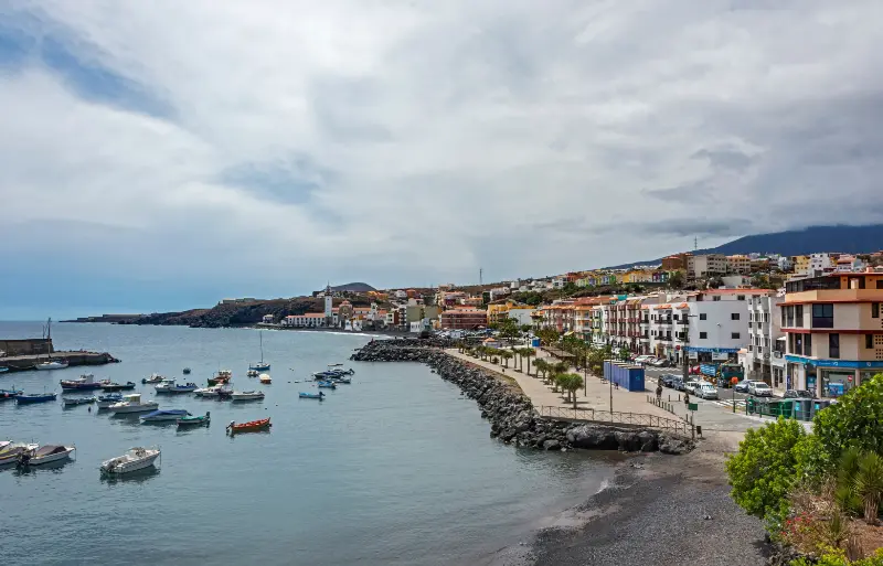
    Candelaria Harbor Tenerife

    Practical checklist before you go

    • Check the latest official access, trail or municipal information on the day of travel.
    • Use legal parking and avoid blocking residents, farm tracks, gates or emergency access.
    • Carry water and sun protection even when the north of Tenerife is cloudy.
    • Use footwear suited to the actual surface, especially after rain.
    • Keep the plan geographically compact so a closure does not ruin the whole day.
    • Respect religious services, private property, barriers and conservation signs.

    Frequently asked questions

    Why is the Camino Histórico de Candelaria important?

    It was a major communication route and has strong ethnographic and pilgrimage value. That combined significance led to BIC protection in 2008.

    Is it still used?

    Yes. Official tourism information notes that pilgrims continue to walk it toward Candelaria.

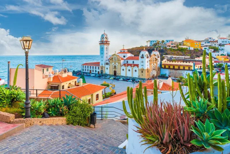
    Candelaria Tenerife Basilica And Coast

    What can I see along the route?

    Depending on the section, historic threshing floors, rural landscapes, the Casa del Pirata and the Ermita de Nuestra Señora del Rosario are key points.

    How long does it take?

    There is no single useful answer without defining the exact section. I plan a half-day for a selected segment and verify current mapping and return logistics first.

    Do I need hiking shoes?

    For historic paths with uneven volcanic or rural surfaces, supportive footwear is a safer choice than city shoes, especially after rain.

    Can I combine it with Candelaria?

    Yes, especially if you are interested in the pilgrimage story, but build the transport plan first so the walk does not leave you stranded far from your car or accommodation.

    Official information

    For the documented historical or route details used in this guide, see the official Tenerife or municipal information page. I always re-check the source shortly before travelling because access, events and trail conditions can change.

    Final thoughts

    This is the kind of Tenerife experience that works best when the route itself is the point. I would rather walk slowly, understand the landscape and finish with enough daylight and energy than chase a distance target. Combined with one nearby town or heritage stop, it adds depth to an island itinerary without competing with Teide, Anaga or the major beaches.

  • Bosque del Adelantado Guide: Laurisilva Walk in La Esperanza

    Bosque del Adelantado Guide: Laurisilva Walk in La Esperanza

    The Bosque del Adelantado is a small remnant of laurisilva beside La Esperanza, and that scale is exactly why I find it useful. You do not need to commit to a full Anaga day to experience a pocket of humid Canarian woodland. Official tourism information gives the forest an area of 25,397 square metres and places it between roughly 850 and 875 metres above sea level. It survived historic timber exploitation and grazing in part because its ravine location offered protection.

    At a glance

    PlaceLa Esperanza, El Rosario
    Address / accessNear Calle Pedro Juan García Hernández, 38290 El Rosario
    Best forA short laurisilva stop, families and a green break near La Esperanza
    Time to allow30–60 minutes for an easy visit; longer if linked to surrounding walks
    Planning ruleCheck current access/conditions and group nearby places rather than crossing the island for one small stop

    Why this place deserves its own page

    I would not present this forest as a substitute for Anaga or Monte del Agua. Its value is different: it is accessible from a town, compact enough for a short stop and directly connected to the historical landscape of El Rosario. That makes it ideal on a mixed day with La Esperanza, the TF-24 or the metropolitan area.

    History and context: what the official record confirms

    The forest lies very close to the historic centre of La Esperanza.

    Official tourism information describes it as a small surviving area of laurisilva in a ravine.

    Its location helped it survive the timber extraction and livestock pressure that affected El Rosario after the conquest.

    The documented area is 25,397 square metres.

    Its altitude is approximately 850–875 metres above sea level.

    The official access reference is around Calle Pedro Juan García Hernández in El Rosario.

    What I would pay attention to

    Think of it as a remnant, not a wilderness expedition

    The most interesting idea here is survival. A small ravine held onto humid-forest vegetation while surrounding land use changed. I walk slowly and look for the difference in shade, leaf texture and moisture rather than expecting dramatic viewpoints.

    Anaga Forest Tenerife

    Why the ravine matters

    Topography can create microclimates and refuges. In this case, the ravine also made intensive exploitation less straightforward. The result is a pocket of vegetation that helps explain what parts of the island’s northern slopes looked like before centuries of land-use change.

    Combine it with La Esperanza rather than making a special cross-island drive

    Because the forest is close to town, the best plan is a compact circuit: church and streets first, then the woodland, or the reverse. That produces a more balanced visit than driving a long distance for a single small green space.

    Anaga Laurel Forest Path Tenerife

    Expect cloud to be part of the experience

    At this elevation, mist and low cloud can be normal. I do not treat that automatically as poor weather; moisture is part of why this vegetation exists. I do, however, change plans if wind, heavy rain or official warnings make conditions unsafe.

    How I would build it into a Tenerife day

    I would build the day around one geographical area and one main outdoor objective. Tenerife’s road map can make places look close even when elevation changes, mountain roads and parking add considerable time. A short walk is more enjoyable when I am not watching the clock for a reservation on the opposite side of the island.

    For a mixed itinerary, I add one nearby village or cultural stop before or after the walk. That creates contrast without turning the day into a chain of car journeys. If weather changes, the cultural stop can also become the fallback plan.

    Safety and responsible planning

    Tenerife’s short-looking walks can be deceptive because volcanic ground, steep gradients, cloud, heat and wind all change the effort required. I check the official trail page and weather before leaving, carry more water than I expect to need, and use proper footwear rather than relying on distance alone as a measure of difficulty.

    If an official authority closes a trail or section, I treat that as a hard stop. Detours around barriers can enter fragile habitat, private land or unstable terrain. I also download the route or keep an offline map because mobile coverage can vary in ravines and forested areas.

    What to bring

    My minimum kit is supportive footwear, water, sun protection, a light insulating layer and a charged phone. For longer walks I add food, a compact rain shell and a small first-aid kit. Cloud in the north can make the air feel cool while ultraviolet exposure remains strong, so sunscreen still matters.

    Walking with children

    I judge a family walk by terrain, exposure and the return logistics, not only by kilometres. A linear route needs a transport plan at the end, and a steep descent can be harder on knees and concentration than a gentle climb. With younger children I choose a shorter section or use the place as a nature stop rather than forcing completion of the full route.

    Leave the landscape as you found it

    I stay on established paths, carry out all rubbish and avoid collecting plants, rocks or archaeological material. In rural areas, gates and tracks may serve farms and residents; I leave access clear and respect signs even when a shortcut looks obvious.

    Nearby guides to keep open

    Where to stay nearby

    If this area is more than a day trip, I compare accommodation in the same municipality or nearby north/west base rather than automatically returning to the southern resorts. Staying locally can make early walks and evening village time much easier. Check accommodation around La Esperanza on Booking.com.

    Practical checklist before you go

    • Check the latest official access, trail or municipal information on the day of travel.
    • Use legal parking and avoid blocking residents, farm tracks, gates or emergency access.
    • Carry water and sun protection even when the north of Tenerife is cloudy.
    • Use footwear suited to the actual surface, especially after rain.
    • Keep the plan geographically compact so a closure does not ruin the whole day.
    • Respect religious services, private property, barriers and conservation signs.

    Frequently asked questions

    How large is Bosque del Adelantado?

    Official tourism information gives an area of 25,397 square metres.

    What altitude is it at?

    Approximately 850–875 metres above sea level.

    Is this the same experience as hiking in Anaga?

    No. It is much smaller and more urban-adjacent. I see it as a short laurisilva stop, not a replacement for an Anaga hiking day.

    Anaga Laurel Forest Tenerife

    How much time do I need?

    For a relaxed short visit, around 30–60 minutes is usually enough, depending on the path section you choose and conditions.

    Can I visit with children?

    It can work well for families if the chosen path is suitable that day. After rain, roots and damp surfaces can be slippery, so footwear and supervision matter.

    What should I combine it with?

    La Esperanza’s church, the wider El Rosario guide and a carefully planned TF-24/Teide day all fit geographically.

    Official information

    For the documented historical or route details used in this guide, see the official Tenerife or municipal information page. I always re-check the source shortly before travelling because access, events and trail conditions can change.

    Final thoughts

    This is the kind of Tenerife experience that works best when the route itself is the point. I would rather walk slowly, understand the landscape and finish with enough daylight and energy than chase a distance target. Combined with one nearby town or heritage stop, it adds depth to an island itinerary without competing with Teide, Anaga or the major beaches.

  • Mesa Mota La Laguna Guide: Park, Views, Access and Picnic Tips

    Mesa Mota La Laguna Guide: Park, Views, Access and Picnic Tips

    Mesa Mota is one of the green escapes I would use when I want a break from La Laguna’s stone streets without driving deep into Anaga. The park sits on high ground between La Laguna and Tegueste, overlooking the Vega de Aguere and giving access toward nearby forest landscapes. The City Council lists the Parque de la Mesa Mota with seasonal opening hours, while 2026 public works have also focused on improving the access road, safety and accessibility. Because those works can affect how the park is reached, this is a place where I always check the latest municipal notice before setting out.

    Quick visit facts

    LocationHigh ground north of La Laguna, near the La Laguna–Tegueste boundary
    TypePeri-urban recreational park and viewpoint area
    Municipal hoursSpring/summer 09:00–21:30; autumn/winter 09:00–20:00 on current council listing
    FacilitiesRecreational / picnic areas and paths; facilities can change with works
    2026 contextAccess-road and accessibility improvement works have been announced

    Why Mesa Mota is useful

    The attraction is not one single monument. It is the combination of open space, views, picnic potential and proximity to La Laguna. I can spend an hour for the panorama or several hours if I bring food and make it a slow family stop.

    Its position also helps explain the relationship between the historic city, the agricultural plain and the first forested slopes toward Anaga. On a clear day the geography is easier to understand from above than from the streets below.

    Current access deserves a check

    In May 2026 the Cabildo announced funding for remodelling the access road, with the stated aim of improving road safety, accessibility and conservation. The municipality has also published temporary access restrictions at different times. I therefore do not treat an old map pin as proof that normal vehicle access is available on the day.

    My practical approach is simple: check the current La Laguna municipal notice, follow any closure signs and keep a backup such as Parque de la Vega or a historic-centre walk if works or weather make Mesa Mota inconvenient.

    Picnic and family use

    Mesa Mota has long been used by local families for recreation. I bring my own food, water and rubbish bag and follow current fire restrictions rather than assuming cooking facilities are always available. Rules can tighten during hot, dry or windy periods.

    With children I prefer the park in daylight and keep them close near slopes and road areas. A recreational park is not a fenced theme attraction, and weather can change quickly at this elevation.

    Weather and views

    Low cloud can wrap the ridge even when central La Laguna is merely grey. That can reduce the view but create a completely different atmosphere. I check local cloud and wind rather than only the forecast for the south-coast resorts.

    Aerial View Of La Laguna Tenerife

    After rain, paths and grass can be wet. Shoes with decent grip are more useful than sandals, even if I am not planning a formal hike.

    How I plan this stop without overloading the day

    I get more from small Tenerife attractions when I place them inside a compact area rather than drive across the island for a single doorway, garden or viewpoint. My rule is one anchor attraction, two nearby secondary stops and enough unscheduled time for a café, a market or an unexpected street. That is especially useful in historic towns, where the best details are often between the official sights.

    I also separate permanent facts from operational information. Architecture, landscape and historical context change slowly; opening hours, ticket prices, access rules and temporary works can change quickly. I therefore recheck the official page close to the visit, particularly if entry to an interior is essential to the day.

    Getting there and parking

    In historic centres I normally park once and walk. Narrow streets, one-way systems and limited spaces can make repeated short car moves slower than simply continuing on foot. For rural or edge-of-town attractions I check the final approach on a map before leaving, because the closest bus stop or parking pin can still involve a short walk on uneven ground.

    When I use public transport, I look at the return connection before I arrive rather than when the attraction closes. This matters most on weekends and around rural sites where frequency may be lower. I keep a little margin between the official closing time and the last practical connection.

    Accessibility, children and pace

    I never assume a heritage building is step-free because the entrance looks level in photographs. Old thresholds, internal staircases, steep garden terraces and cobbled streets can all matter. If wheelchair access or a pushchair route is essential, I confirm it directly with the venue. For families, I shorten the historical explanation to one strong story and alternate indoor stops with a garden, square or snack break.

    What I bring

    Even for an urban visit I carry water, sun protection and a light layer. North Tenerife can change from bright sun to cloud surprisingly quickly, while south-coast agricultural visits can feel hot even in winter. Comfortable footwear matters more than it seems because a day of short museum and church stops can still add up to several kilometres of walking.

    Common mistakes I avoid

    • Trusting an old review instead of the current official source.
    • Assuming every protected historic building has regular interior access.
    • Driving between attractions that are only a few minutes apart on foot.
    • Scheduling too many similar interiors in a row.
    • Arriving just before closing when the site needs at least 45–60 minutes.
    • Forgetting that religious buildings remain active places of worship.

    What I would combine nearby

    These combinations keep the day geographically coherent and reduce unnecessary driving. I prefer a route where each stop adds a different layer—architecture, landscape, local food or everyday culture—rather than repeating the same type of attraction several times.

    Where I would stay

    If I wanted more than a quick day trip, I would compare accommodation in La Laguna. Staying locally is useful when I want early streets, a slower dinner and enough time to see several nearby places without turning the day into a motorway itinerary.

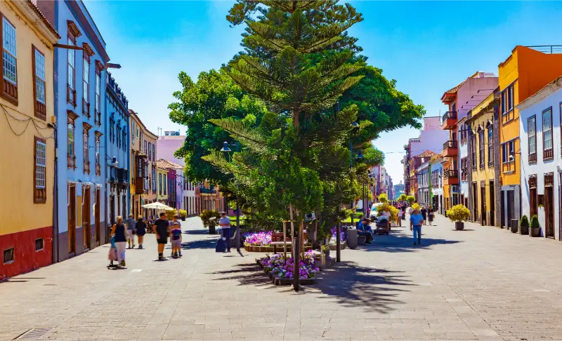
    San Cristobal De La Laguna Historic Center Tenerife

    Official information

    For current access, opening times, temporary closures and event information I check La Laguna municipal parks page shortly before travelling. I treat this as the final word for operational details because schedules can change after publication.

    Frequently asked questions

    What are the current park hours?

    The municipal parks page currently lists 09:00–21:30 in spring/summer and 09:00–20:00 in autumn/winter.

    Can access be affected by works?

    Yes. 2026 projects have included access-road and accessibility improvements, so I check current municipal notices before driving up.

    Is Mesa Mota good with children?

    It can be a good picnic and open-space stop, but normal outdoor supervision and current fire/access rules still matter.

    Is it a hiking destination?

    It can connect with walking routes, but I also use it simply as a viewpoint and peri-urban park near La Laguna.

    San Cristobal De La Laguna Panoramic View Tenerife

    How I photograph and observe the place

    I try not to make photography the only purpose of the stop. I first walk through once without constantly raising the phone, then return to the details that best explain the site: a façade seen from across the street, a change of level in a garden, the relationship between a church and its square, or the working structure of an agricultural property. This usually produces better pictures and a better memory of the visit.

    When people are worshipping, working or guiding a group, I give them priority. I do not use flash in religious interiors unless it is explicitly permitted, and on farms I stay on marked routes rather than stepping into planted areas for a cleaner composition.

    How this stop fits different travel styles

    For a first-time visitor, I would use the place as part of a broad introduction to the area rather than build an entire day around one small attraction. Repeat visitors can go deeper, pairing it with specialist museums, neighbourhood streets or local food. Travellers without a car should prioritise clusters where several worthwhile stops are reachable on foot, while drivers can use the attraction as a bridge between towns.

    On a short Tenerife trip I keep the schedule selective. On a two-week stay I am much more willing to spend a morning on small museums, gardens and heritage buildings because they reveal the island beyond the headline sights. That slower layer is often what makes a second or third visit feel genuinely different.

    Weather and seasonal considerations

    Tenerife’s microclimates matter even for culture days. La Orotava, Icod and La Laguna can be cooler or cloudier than the southern resorts, so I carry a light layer. Outdoor gardens and viewpoints are more rewarding in clear weather, while museums and churches become useful alternatives when cloud or showers move in.

    During local festivals, religious celebrations and school holidays, normal access can change. A closed street is not necessarily a problem—it may be part of a valuable local event—but I allow extra time and avoid assuming parking or interior access will work exactly as on an ordinary weekday.

    Final thoughts

    Mesa Mota La Laguna is most rewarding when I use it to understand a wider part of Tenerife rather than treat it as another box to tick. I would give the place enough time for its context to emerge, connect it with nearby stops and keep the practical plan flexible enough to respond to weather, access or local events.

  • PR-TF 43 Garachico to Chinyero Hiking Guide: Lava, Forest and Big Ascent

    PR-TF 43 Garachico to Chinyero Hiking Guide: Lava, Forest and Big Ascent

    PR-TF 43 is one of the strongest mountain-to-volcano hiking lines in northwest Tenerife. It begins almost at Atlantic level in historic Garachico and climbs through lava-shaped slopes, rural land and pine forest until the Chinyero volcanic landscape takes over. The headline number is not the distance but the ascent: roughly 1,680 metres in 17.7 kilometres, which makes this a serious full-day effort rather than a casual add-on to a sightseeing day.

    The technical figures below come from the current Turismo de Tenerife route information that I checked while preparing this guide. I still verify the live page before setting out, because status notices and temporary restrictions can change faster than an article.

    Quick route facts

    StartGarachico
    FinishCircular Chinyero
    TypeLinear
    Distance17.7 km
    Official duration7 hr
    DifficultyHigh
    Maximum altitude1,521 m
    Minimum altitude46 m
    Accumulated ascent1,680 m
    Accumulated descent287.52 m
    Protected areasAcantilados de La Culata Protected Landscape; Chinyero Special Nature Reserve
    PermitNo

    Why this route is worth understanding

    What makes this route unusual is the vertical story. Garachico is inseparable from the 1706 eruption of Trevejo, and the walk gradually leaves the coast behind before reaching the younger Chinyero landscape associated with Tenerife’s 1909 eruption. I would choose it when the goal is to understand how volcanic history and settlement geography fit together, not simply to collect another summit.

    For wider context I connect this route with Garachico guide Chinyero Volcano guide Arenas Negras trail Tenerife hiking permits and trail rules. I prefer building one coherent regional day rather than crossing the island between unrelated stops.

    How the route unfolds

    1. Garachico and the first sustained climb

    The route leaves one of Tenerife’s most attractive historic towns and immediately asks for respect. The early ascent is where I deliberately keep the pace slow, because the legs are still fresh and it is easy to spend energy too quickly. Looking back toward the coast gives a clear sense of how rapidly the route gains height.

    Garachico Historic Town Tenerife

    2. San Juan del Reparo and old lava terrain

    The path climbs through the area of San Juan del Reparo and crosses terrain shaped by historical lava. This is not a smooth promenade: stone, uneven surfaces and steep gradients matter. I use this middle section to settle into a steady rhythm rather than chasing the official time.

    3. La Montañeta and Arenas Negras

    Higher up, the character becomes more rural and forested. The route approaches La Montañeta and the Arenas Negras area, where pines and volcanic soils replace the lower agricultural feel. My separate Arenas Negras guide is useful if I want a shorter alternative rather than committing to the entire PR-TF 43.

    4. The Chinyero volcanic landscape

    The final objective is the Chinyero area, where dark lava, pines and volcanic cones create one of Tenerife’s most distinctive hiking environments. I stay on the marked route because the reserve protects fragile terrain and because loose lava is much less stable than it can look from a distance.

    Difficulty: how I read the official grade

    The official difficulty label is useful, but I never use it alone. I combine it with distance, vertical gain or loss, altitude, exposure, trail surface and the amount of transport planning required. A short steep route can punish knees; a long descent can be exhausting; a high-altitude path can feel hard even when the gradient is moderate.

    I also compare the route with my recent activity rather than with what I managed on a holiday years ago. If I have not been hiking regularly, I choose a shorter alternative first and learn how my body reacts to Tenerife’s heat, altitude and volcanic footing.

    Navigation and route status

    I use the current official route sheet as the baseline, then save an offline map before leaving. Waymarks matter more than a downloaded user track because old GPX files can preserve shortcuts, outdated diversions or sections that have since closed. At a junction I stop, confirm the marker and only then continue; following another group is not navigation.

    Trail status can change after fire, heavy rain, maintenance or conservation work. I recheck the official page shortly before the hike. If a closure or prohibition is posted, I change plans rather than looking for a way around it. Tenerife has enough excellent alternatives that ignoring a closure is never necessary.

    Getting there and getting back

    Because the route is linear and finishes high in the Chinyero network rather than back in Garachico, I arrange the return before I start. A two-car shuttle, pre-arranged taxi or carefully checked bus plan is far safer than assuming transport will be easy after seven hours of climbing.

    When buses form part of the plan I check the current TITSA timetable on the day itself. Rural services can be infrequent, and missing one bus after a long hike can turn a good day into a logistical problem. If I drive, I park legally and keep forest gates, farm access and emergency routes clear.

    Weather and the best conditions

    The route crosses several climate zones. Garachico can feel warm while the upper forest is cool, cloudy or windy. I carry a light insulating layer even on a sunny coastal morning and I avoid using the coast forecast as a proxy for conditions around 1,500 metres.

    I check AEMET or another current mountain forecast rather than relying on the weather shown for a coastal resort. Calima, heat alerts, high wind, wildfire restrictions and rain are all valid reasons to change the route. Flexibility is one of the most useful pieces of hiking equipment I have.

    What I carry

    • Enough water for the route plus a reserve.
    • Food that is easy to eat while walking, including something salty on longer days.
    • Trail or hiking shoes with reliable grip.
    • Sun protection: hat, sunscreen and sunglasses.
    • A light windproof or insulating layer appropriate to the altitude.
    • Offline map, charged phone and power bank for long routes.
    • Small first-aid kit and any personal medication.

    I adjust quantities to heat, altitude and duration rather than copying one packing list for every Tenerife walk. A five-kilometre route with 600 metres of ascent can require more water and recovery time than a flatter ten-kilometre walk.

    Safety: the points I take seriously

    I manage descents as carefully as climbs. Loose volcanic gravel, polished stone and tired legs are a common combination on Tenerife. I shorten my stride on steep ground, leave space between hikers and never hurry because someone behind me is moving faster. If I use trekking poles, I use them because I am already comfortable with them, not because the route suddenly feels difficult.

    I stay away from cliff edges, ravine drops and unstable lava. I do not climb walls, cones or rock formations for photographs. During heat, calima, strong wind or heavy rain I shorten or cancel the walk. In an emergency the number in Spain is 112; I also tell someone where I am going and when I expect to finish.

    Who this route suits

    I think in terms of skills rather than labels such as “beginner” or “experienced”. The route is a good match only if everyone in the group is comfortable with its longest climb or descent, expected duration and surface. For families, I consider each child’s real walking experience and attention span rather than age alone.

    If anyone is uncertain, I choose an easier route and keep this one for another day. Tenerife’s trail network is broad enough that scaling down does not mean wasting the trip.

    Respecting the landscape

    Many of these routes cross protected areas, working rural land or both. I stay on the signed path, close gates if the local system requires it, keep noise low near homes and never pick plants or collect volcanic rock. I carry out all rubbish, including organic waste, because food scraps can attract animals and change behaviour.

    I also avoid creating social-media shortcuts. A line across loose lava or vegetation may look harmless when one person does it, but repeated footsteps can become a visible scar. The established route is part of the conservation system, not an obstacle to a better photograph.

    Photography without compromising safety

    I take photographs from stable, legal ground. Tenerife’s volcanic terrain creates strong foregrounds without needing to step beyond a barrier or onto a fragile slope. On exposed routes I secure loose items before taking out a phone or camera, especially in gusty wind.

    I prefer a few deliberate stops to constant filming while walking. That improves both safety and the quality of the images: I can look at the route, notice geology and vegetation, and avoid turning every junction into a distraction.

    How I would fit it into a Tenerife itinerary

    I make the hike the main event of the day. Beforehand I keep breakfast and transport simple; afterwards I choose a nearby town, viewpoint or relaxed meal rather than another major attraction. This gives me margin for a slower pace, weather delays and the possibility that the trail takes longer than the official estimate.

    For visitors staying far away, I would rather change accommodation for a night than add hours of driving before and after a demanding route. I compare accommodation around Garachico, Tenerife when the hike is one of the priorities of the trip.

    Garachico Town And Coast Tenerife

    Pacing, food and recovery

    I eat before I am hungry and drink before I feel dehydrated. On long climbs I use small, regular snacks rather than a heavy meal. I also keep some food for the final hour; tiredness near the finish is exactly when concentration can drop.

    After the hike I change out of wet layers if necessary, rehydrate and eat something substantial before driving a long distance. If the route has involved more than a thousand metres of ascent or descent, I avoid planning another demanding activity that evening.

    Official information I check before leaving

    The route page I use is Turismo de Tenerife’s official route information. I look for current status notices, closures, permit requirements and manager advice. If the route enters a national park or another managed protected area, I also check the relevant Cabildo or Tenerife ON information where applicable.

    Aerial View Of Garachico Tenerife

    Common mistakes I avoid

    • Starting late because the route looks short on a map.
    • Using a beach forecast for a mountain or forest route.
    • Assuming a linear trail will have simple transport at the finish.
    • Following another hiking group instead of checking my own waymarks.
    • Underestimating long descent and knee fatigue.
    • Depending on mobile signal instead of saving maps offline.
    • Leaving the marked trail for a shortcut or photograph.
    • Ignoring a closure because an old blog or GPX shows the route as open.

    Frequently asked questions

    How long is the route?

    The current official sheet lists 17.7 km. I use the official duration only as a reference and add time for breaks, navigation, photography and the pace of the slowest person in the group.

    Do I need a permit?

    The current route information shown in the table above is my starting point, but a permit and an opening status are different things. A route can require no permit and still be temporarily closed. I always check the live status immediately before the hike.

    Can I hike it in ordinary trainers?

    I prefer trail or hiking shoes with useful grip. Tenerife routes can combine loose volcanic material, polished stone, forest soil and rough steps. Heavy boots are not mandatory for every trail, but smooth urban soles remove a useful margin of safety.

    What if the weather changes?

    I use a turnaround point and a backup plan. If wind, heat, rain, cloud or fatigue materially reduces my safety margin, I turn back or switch plans. Completing a named route is never more important than returning with enough daylight and energy.

    Is the official hiking time realistic?

    It is a planning benchmark, not a promise. Fitness, photography, heat, route-finding and group size can all change the time. On demanding routes I add generous margin and avoid booking a fixed activity immediately after the expected finish.

    Final thoughts

    I see PR-TF 43 as a route for hikers who specifically want a large vertical day. Its reward is the transition from historic coast to volcanic highland, but that same transition creates the main challenge: sustained ascent, changing weather and complicated finish logistics.

    The most useful approach is simple: check the official status, understand the vertical profile, plan the return before starting and keep enough margin to change the day when conditions are not right. That makes the route safer and usually more enjoyable.

  • PR-TF 59 Las Portelas–Masca Hiking Guide: Historic Teno Ridge Route

    PR-TF 59 Las Portelas–Masca Hiking Guide: Historic Teno Ridge Route

    PR-TF 59 Las Portelas – Masca is a historic ridge connection that shows the sharp climatic divide between humid northern Teno and the drier Masca side. I like this route because the landscape tells the geography lesson for me: the greener north and the drier Masca side can feel like different islands even though the walking distance is short.

    I use the current Turismo de Tenerife route sheet as my technical baseline because trail status, closures and management advice can change. The official sheet currently lists 3.7 km, 2 hr, low difficulty and no as the permit requirement. I still check the page again on the morning of the hike rather than assuming a saved article is enough.

    Quick route facts

    Official routePR-TF 59 Las Portelas – Masca
    StartLas Portelas
    FinishMasca
    TypeLinear
    Distance3.7 km
    Official duration2 hr
    DifficultyLow
    Maximum altitude912 m
    Minimum altitude657 m
    Accumulated ascent276.50 m
    Accumulated descent309.05 m
    Protected areaTeno Rural Park
    PermitNo

    The wet-to-dry transition

    PR-TF 59 sits near a climatic boundary. Cloud can cling to the Las Portelas side while Masca opens into warmer, drier air. I do not guarantee that contrast on every day, but when it happens the route becomes a compact lesson in Tenerife microclimates.

    The wider setting is Las Portelas to Masca. I plan the hike as part of that region, not as an isolated pin. Useful companion articles on this site include Masca guide Teno Rural Park guide Masca Road TF-436 guide Monte del Agua guide. That gives me backup options if cloud, wind, heat or a closure makes the original route a poor choice.

    How the route unfolds

    1. The departure from portela baja on village lanes and track

    At the beginning, the departure from Portela Baja on village lanes and track. I deliberately start slower than my normal walking pace while I check the waymarking and how the ground feels. Tenerife trails can change from lane to stone path to forest track in a short distance, and the first ten minutes are the best time to correct a navigation mistake.

    2. The crossing of barranco las lubes and the climb toward the ridge

    Next, the crossing of Barranco Las Lubes and the climb toward the ridge. This is where I pay more attention to junctions. I do not follow another group automatically; people on the same path may be doing a different branch. I compare the painted PR marks, official map and the direction I saved before leaving.

    3. The high section where cloud and landscape can change within a short distance

    Higher or farther along, the high section where cloud and landscape can change within a short distance. The change in altitude usually becomes more obvious here through temperature, vegetation and views. I take a short food and water break before I feel tired rather than waiting until energy has already dropped.

    4. The descent into masca with increasingly dramatic ravine views

    For the final section, the descent into Masca with increasingly dramatic ravine views. I keep enough time and energy for the finish. A route is not complete when the best viewpoint is reached; it is complete when I am safely at the planned endpoint with transport still available.

    Masca Mountain Valley Tenerife

    Navigation: what I trust

    I treat official waymarks and the current route description as primary. A phone map is useful, but downloaded user tracks can contain shortcuts, old closures or private crossings. Before setting out I save the official page, an offline map and the names of the start and finish in Spanish so I can ask for help clearly if needed.

    At ambiguous junctions I stop rather than walking “just another ten minutes” in the hope that a marker appears. Ten wrong minutes downhill can become thirty tiring minutes when I have to climb back. This habit matters especially in laurel forest and cloud, where landmarks disappear quickly.

    Weather and microclimates

    Tenerife is small on a map but not climatically simple. I check the forecast for the actual altitude of the route, not only the nearest beach resort. North-facing forests can be cool and wet under trade-wind cloud while the south coast is sunny; exposed Teno ridges can be windy even when villages below feel calm.

    I also take calima seriously. Dust, heat and reduced visibility can turn an otherwise moderate route into a poor choice. After heavy rain, stone paths and steep descents deserve extra caution. When an official warning or closure is active, I change the plan instead of trying to “beat” the conditions.

    What I carry

    • Water with a reserve rather than the exact amount I expect to drink.
    • Food that is easy to eat in small portions while moving.
    • Closed hiking shoes or trail shoes with useful grip.
    • Sun protection even when the start is cloudy.
    • A light windproof or waterproof layer.
    • Offline map, charged phone and a small power bank on longer routes.
    • Basic first-aid items and any personal medication.

    I adjust the load to the route. A short two-hour trail does not need expedition gear, but a long day with major elevation deserves more water, insulation and contingency planning. I never let a light pack become an excuse to omit essentials.

    Transport and linear-route logistics

    This is a linear route, so I decide the return plan before starting. My preferred options are a verified bus connection, a pre-arranged taxi, two-car shuttle with experienced companions, or walking the route only when the return distance and daylight are realistic. I do not rely on finding a taxi signal at an isolated finish without checking coverage and local service first.

    TITSA timetables can change, and a route that looks easy on a map may involve infrequent rural services. I use my Tenerife bus guide for the system basics, then confirm the current timetable on the official operator site on the day of travel.

    Safety on stone paths, descents and exposed ground

    My main rule is to manage the descent as carefully as the climb. Loose gravel, polished stone and tired legs are a bad combination. I shorten my stride, keep space between hikers and never rush because someone behind me is faster. Trekking poles can help on long descents if I already know how to use them.

    I keep away from cliff edges and do not climb walls, roques or unstable volcanic features for photographs. If the signed route passes a road, I assume drivers may not expect hikers. I cross only where visibility is good and I do not stand in the carriageway while checking my phone.

    Nature and cultural landscape

    I try to read the route rather than treating it as exercise only. Tenerife paths often pass old terraces, water infrastructure, stone paving, pine forest, monteverde or volcanic terrain that records how people adapted to steep land. I leave walls, stones, plants and abandoned structures exactly as I find them.

    Protected status also affects behaviour. I stay on the route, do not pick flowers, do not stack stones and carry out every piece of rubbish. If I hike with a dog, I check the specific protected-area rules first rather than assuming the same rules apply everywhere on the island.

    Photography without slowing the route too much

    I prefer a few planned stops to constant phone checking. Wide views usually work best from signed viewpoints or safe open sections; forest scenes benefit from looking for layers, trunks and changing light rather than a single dramatic panorama. In cloud, I protect the phone or camera from moisture and keep moving if the temperature is dropping.

    I never step beyond a barrier or onto a fragile slope to remove foreground vegetation. The trail itself often gives a stronger sense of scale in the photograph, and keeping people on the path protects both the landscape and the image from becoming another invitation to trespass.

    Who I think this route suits

    The official difficulty grade is a starting point, not a guarantee. I compare it with distance, accumulated ascent and descent, exposure, altitude, surface and my recent activity level. A “low” difficulty route can still feel hard in heat; a “medium” route with large descent can punish knees; and a very high difficulty route needs specific endurance rather than general holiday fitness.

    For families I also consider whether every child is comfortable with the terrain and duration. I never use age alone as proof that a route is suitable. If the group is uncertain, I choose one of Tenerife’s shorter easy hikes and save the bigger trail for another day.

    My realistic day plan

    I eat before the start, arrive with water already filled and spend a few minutes confirming the first waymark. I walk the first third conservatively, take a short break before the main climb or descent, and keep the final third free of unnecessary detours. If I am ahead of schedule, I use the extra time for a safe viewpoint or café after the hike rather than extending onto an unsigned path.

    After finishing, I change out of wet clothing if needed, drink, eat something salty or substantial and only then decide whether another stop makes sense. Hiking days are better when the second half is flexible. A town walk or early dinner usually adds more than another rushed trail.

    Where I would stay

    For an early start I prefer a base in the same part of Tenerife rather than driving across the island before dawn. That reduces fatigue and makes it easier to react to local weather. I compare accommodation around Santiago del Teide, Tenerife when this trail is one of the main reasons for the trip.

    Official information I check before leaving

    The route page I use is Turismo de Tenerife’s official PR-TF 59 Las Portelas – Masca page. I check it again for status notices and then look at current Cabildo or Tenerife ON information if the route crosses a managed protected area. A blog article is useful for planning, but live access information always wins.

    Masca Valley Panoramic View Tenerife

    Common mistakes I avoid

    • Starting late because the distance looks short.
    • Using a coastal forecast for a mountain or forest route.
    • Assuming a linear trail will have easy transport at the finish.
    • Following another hiking group instead of reading my own waymarks.
    • Underestimating descent and knee fatigue.
    • Leaving the signed path for a photo or shortcut.
    • Depending on mobile signal instead of saving the route offline.
    • Ignoring a closure because an older GPX still shows the path.

    Frequently asked questions

    How long is PR-TF 59 Las Portelas – Masca?

    The current official route sheet lists 3.7 km and an estimated 2 hr. I use that time only as a planning reference and add margin for photographs, navigation, weather and the pace of the slowest person in the group.

    Do I need a permit?

    The current official route sheet lists no general hiking permit for this route. I still check for temporary closures, fire restrictions and protected-area notices before setting out.

    Can I do it in ordinary trainers?

    I prefer trail or hiking shoes with grip. Tenerife paths can include loose volcanic gravel, wet forest soil, stone paving and steep steps in the same outing. Footwear does not need to be heavy, but smooth soles make the route less forgiving.

    What if the weather turns?

    I use a predefined turnaround point and a local Plan B. If visibility, heat, rain or wind makes the route materially less safe, I turn back or switch plans. Finishing a particular trail is never more important than keeping enough margin to return safely.

    Final thoughts

    I like this route because the landscape tells the geography lesson for me: the greener north and the drier Masca side can feel like different islands even though the walking distance is short.

    Masca Village And Gorge Tenerife

    What I value most is not ticking off another PR number. It is understanding a different layer of Tenerife—forest, old roads, volcanic relief, rural settlements or the transition from mountain to coast. With current route information, sensible pacing and a flexible finish, this hike can add far more to a trip than a rushed list of viewpoints.

  • PR-TF 35 La Caldera–Mamio Hiking Guide: Easy Forest Loop in La Orotava

    PR-TF 35 La Caldera–Mamio Hiking Guide: Easy Forest Loop in La Orotava

    PR-TF 35 La Caldera – Mamio – La Caldera is a gentle forest route that mixes broad forestry track, cultivated slopes and Canarian pine without committing to a high-altitude Teide day. This is one of the routes I choose when I want forest atmosphere without the scale, exposure or logistics of a summit hike.

    I use the current Turismo de Tenerife route sheet as my technical baseline because trail status, closures and management advice can change. The official sheet currently lists 5.7 km, 2 hr 30 min, low difficulty and no as the permit requirement. I still check the page again on the morning of the hike rather than assuming a saved article is enough.

    Quick route facts

    Official routePR-TF 35 La Caldera – Mamio – La Caldera
    StartLa Caldera recreation area
    FinishLa Caldera recreation area
    TypeCircular
    Distance5.7 km
    Official duration2 hr 30 min
    DifficultyLow
    Maximum altitude1,200 m
    Minimum altitude1,000 m
    Accumulated ascent215.10 m
    Accumulated descent215.10 m
    Protected areaCorona Forestal Natural Park
    PermitNo

    Why I like this route

    PR-TF 35 gives me a useful middle ground between a paved viewpoint and a serious mountain objective. The route starts high enough to feel cool and forested, but it never asks me to manage extreme altitude. The gentle forestry track at the beginning also gives me time to settle into the day before the path becomes more varied around Mamio and the cultivated slopes.

    The wider setting is La Orotava and the upper Orotava Valley. I plan the hike as part of that region, not as an isolated pin. Useful companion articles on this site include Orotava Valley guide Corona Forestal guide La Orotava travel guide GR-131 La Caldera to El Portillo guide. That gives me backup options if cloud, wind, heat or a closure makes the original route a poor choice.

    La Orotava Historic Center And Mountains Tenerife

    How the route unfolds

    1. The easy departure from la caldera on the mamio forest track

    At the beginning, the easy departure from La Caldera on the Mamio forest track. I deliberately start slower than my normal walking pace while I check the waymarking and how the ground feels. Tenerife trails can change from lane to stone path to forest track in a short distance, and the first ten minutes are the best time to correct a navigation mistake.

    2. The casa del agua area, where several signed routes meet

    Next, the Casa del Agua area, where several signed routes meet. This is where I pay more attention to junctions. I do not follow another group automatically; people on the same path may be doing a different branch. I compare the painted PR marks, official map and the direction I saved before leaving.

    3. The descent toward mamio through a more agricultural landscape

    Higher or farther along, the descent toward Mamio through a more agricultural landscape. The change in altitude usually becomes more obvious here through temperature, vegetation and views. I take a short food and water break before I feel tired rather than waiting until energy has already dropped.

    4. The climb beside barranco de los llanos and the return through forest

    For the final section, the climb beside Barranco de Los Llanos and the return through forest. I keep enough time and energy for the finish. A route is not complete when the best viewpoint is reached; it is complete when I am safely at the planned endpoint with transport still available.

    Navigation: what I trust

    I treat official waymarks and the current route description as primary. A phone map is useful, but downloaded user tracks can contain shortcuts, old closures or private crossings. Before setting out I save the official page, an offline map and the names of the start and finish in Spanish so I can ask for help clearly if needed.

    At ambiguous junctions I stop rather than walking “just another ten minutes” in the hope that a marker appears. Ten wrong minutes downhill can become thirty tiring minutes when I have to climb back. This habit matters especially in laurel forest and cloud, where landmarks disappear quickly.

    Weather and microclimates

    Tenerife is small on a map but not climatically simple. I check the forecast for the actual altitude of the route, not only the nearest beach resort. North-facing forests can be cool and wet under trade-wind cloud while the south coast is sunny; exposed Teno ridges can be windy even when villages below feel calm.

    I also take calima seriously. Dust, heat and reduced visibility can turn an otherwise moderate route into a poor choice. After heavy rain, stone paths and steep descents deserve extra caution. When an official warning or closure is active, I change the plan instead of trying to “beat” the conditions.

    What I carry

    • Water with a reserve rather than the exact amount I expect to drink.
    • Food that is easy to eat in small portions while moving.
    • Closed hiking shoes or trail shoes with useful grip.
    • Sun protection even when the start is cloudy.
    • A light windproof or waterproof layer.
    • Offline map, charged phone and a small power bank on longer routes.
    • Basic first-aid items and any personal medication.

    I adjust the load to the route. A short two-hour trail does not need expedition gear, but a long day with major elevation deserves more water, insulation and contingency planning. I never let a light pack become an excuse to omit essentials.

    Transport and linear-route logistics

    Because this route is circular, logistics are simpler: I can normally return to the same parking or bus area. That does not mean parking is guaranteed. I avoid blocking rural entrances or forest gates and I arrive with a backup place to park legally if the obvious spaces are full.

    TITSA timetables can change, and a route that looks easy on a map may involve infrequent rural services. I use my Tenerife bus guide for the system basics, then confirm the current timetable on the official operator site on the day of travel.

    Safety on stone paths, descents and exposed ground

    My main rule is to manage the descent as carefully as the climb. Loose gravel, polished stone and tired legs are a bad combination. I shorten my stride, keep space between hikers and never rush because someone behind me is faster. Trekking poles can help on long descents if I already know how to use them.

    I keep away from cliff edges and do not climb walls, roques or unstable volcanic features for photographs. If the signed route passes a road, I assume drivers may not expect hikers. I cross only where visibility is good and I do not stand in the carriageway while checking my phone.

    Nature and cultural landscape

    I try to read the route rather than treating it as exercise only. Tenerife paths often pass old terraces, water infrastructure, stone paving, pine forest, monteverde or volcanic terrain that records how people adapted to steep land. I leave walls, stones, plants and abandoned structures exactly as I find them.

    Protected status also affects behaviour. I stay on the route, do not pick flowers, do not stack stones and carry out every piece of rubbish. If I hike with a dog, I check the specific protected-area rules first rather than assuming the same rules apply everywhere on the island.

    Photography without slowing the route too much

    I prefer a few planned stops to constant phone checking. Wide views usually work best from signed viewpoints or safe open sections; forest scenes benefit from looking for layers, trunks and changing light rather than a single dramatic panorama. In cloud, I protect the phone or camera from moisture and keep moving if the temperature is dropping.

    I never step beyond a barrier or onto a fragile slope to remove foreground vegetation. The trail itself often gives a stronger sense of scale in the photograph, and keeping people on the path protects both the landscape and the image from becoming another invitation to trespass.

    Who I think this route suits

    The official difficulty grade is a starting point, not a guarantee. I compare it with distance, accumulated ascent and descent, exposure, altitude, surface and my recent activity level. A “low” difficulty route can still feel hard in heat; a “medium” route with large descent can punish knees; and a very high difficulty route needs specific endurance rather than general holiday fitness.

    For families I also consider whether every child is comfortable with the terrain and duration. I never use age alone as proof that a route is suitable. If the group is uncertain, I choose one of Tenerife’s shorter easy hikes and save the bigger trail for another day.

    My realistic day plan

    I eat before the start, arrive with water already filled and spend a few minutes confirming the first waymark. I walk the first third conservatively, take a short break before the main climb or descent, and keep the final third free of unnecessary detours. If I am ahead of schedule, I use the extra time for a safe viewpoint or café after the hike rather than extending onto an unsigned path.

    After finishing, I change out of wet clothing if needed, drink, eat something salty or substantial and only then decide whether another stop makes sense. Hiking days are better when the second half is flexible. A town walk or early dinner usually adds more than another rushed trail.

    Where I would stay

    For an early start I prefer a base in the same part of Tenerife rather than driving across the island before dawn. That reduces fatigue and makes it easier to react to local weather. I compare accommodation around La Orotava, Tenerife when this trail is one of the main reasons for the trip.

    La Orotava Historic Center Panorama Tenerife

    Official information I check before leaving

    The route page I use is Turismo de Tenerife’s official PR-TF 35 La Caldera – Mamio – La Caldera page. I check it again for status notices and then look at current Cabildo or Tenerife ON information if the route crosses a managed protected area. A blog article is useful for planning, but live access information always wins.

    Common mistakes I avoid

    • Starting late because the distance looks short.
    • Using a coastal forecast for a mountain or forest route.
    • Assuming a linear trail will have easy transport at the finish.
    • Following another hiking group instead of reading my own waymarks.
    • Underestimating descent and knee fatigue.
    • Leaving the signed path for a photo or shortcut.
    • Depending on mobile signal instead of saving the route offline.
    • Ignoring a closure because an older GPX still shows the path.

    Frequently asked questions

    How long is PR-TF 35 La Caldera – Mamio – La Caldera?

    The current official route sheet lists 5.7 km and an estimated 2 hr 30 min. I use that time only as a planning reference and add margin for photographs, navigation, weather and the pace of the slowest person in the group.

    Do I need a permit?

    The current official route sheet lists no general hiking permit for this route. I still check for temporary closures, fire restrictions and protected-area notices before setting out.

    Jardines Victoria Fountain La Orotava Tenerife

    Can I do it in ordinary trainers?

    I prefer trail or hiking shoes with grip. Tenerife paths can include loose volcanic gravel, wet forest soil, stone paving and steep steps in the same outing. Footwear does not need to be heavy, but smooth soles make the route less forgiving.

    What if the weather turns?

    I use a predefined turnaround point and a local Plan B. If visibility, heat, rain or wind makes the route materially less safe, I turn back or switch plans. Finishing a particular trail is never more important than keeping enough margin to return safely.

    Final thoughts

    This is one of the routes I choose when I want forest atmosphere without the scale, exposure or logistics of a summit hike.

    What I value most is not ticking off another PR number. It is understanding a different layer of Tenerife—forest, old roads, volcanic relief, rural settlements or the transition from mountain to coast. With current route information, sensible pacing and a flexible finish, this hike can add far more to a trip than a rushed list of viewpoints.

  • Mirador de Garachico Guide: Volcanic History and North Tenerife Panorama

    Mirador de Garachico Guide: Volcanic History and North Tenerife Panorama

    Mirador de Garachico is a viewpoint I would include when I want to understand this part of Tenerife rather than simply collect another photo stop. It sits in San Juan del Reparo above Garachico, on or close to the road between Icod de los Vinos and Guía de Isora, and the official or municipal tourism information highlights a broad panorama over Garachico, the Atlantic coast and the ravine-like channels through which lava descended during the 1706 eruption.

    Few viewpoints explain Garachico’s history as directly: the height makes it easier to see how volcanic terrain, cliffs and settlement fit together. I plan the stop as part of Garachico, San Juan del Reparo and the TF-436/TF-82 mountain roads, not as a reason to cross the whole island for ten minutes. That keeps the day realistic and leaves time to respond to cloud, traffic and changing light.

    Quick planning facts

    ViewpointMirador de Garachico
    AreaSan Juan del Reparo above Garachico
    Road / positionthe road between Icod de los Vinos and Guía de Isora
    Landscapearound 460 metres above the north coast according to the municipal tourism description
    Main viewsa broad panorama over Garachico, the Atlantic coast and the ravine-like channels through which lava descended during the 1706 eruption
    ParkingI use only designated or clearly legal parking because the road is also a working mountain connection
    BusI check current TITSA options rather than assuming a stop directly at the viewpoint
    Accessibilityconditions can change with the venue and road, so I verify before relying on step-free access

    Why I would stop here

    The best Tenerife viewpoints do more than provide a wide angle. They explain the island. At Mirador de Garachico, I can compare elevation, vegetation, roads, towns and volcanic shapes in one frame. That makes the stop useful before visiting the places below because I arrive with a clearer mental map rather than following turn-by-turn navigation without understanding the landscape.

    I normally stay longer than the few minutes suggested by a quick road itinerary. Ten minutes is enough to photograph the view, but twenty to forty minutes gives cloud and light time to change. On Tenerife, a ridge hidden at arrival can appear suddenly, while a clear panorama can disappear behind cloud just as quickly.

    What I can see

    The main panorama includes a broad panorama over Garachico, the Atlantic coast and the ravine-like channels through which lava descended during the 1706 eruption. I look for layers instead of trying to identify every landmark immediately: foreground vegetation or rock, middle-distance towns and ridges, then the highest peaks or distant coast. This approach makes the view easier to understand and usually creates better photographs than zooming straight toward the most famous feature.

    Visibility is never guaranteed. Trade-wind cloud can cover the north and northeast, haze can soften the south, and calima can reduce long-distance contrast across the island. I treat a cloudy visit as a different landscape rather than automatically a failed one, but if the entire purpose of the stop is photography I check current weather, webcams where available and mountain conditions before driving up.

    Getting there

    Mirador de Garachico is associated with the road between Icod de los Vinos and Guía de Isora. Tenerife road distances can be misleading because bends, elevation and slower local traffic matter more than kilometres. I add margin to the navigation estimate and avoid scheduling a fixed attraction immediately after the viewpoint. On narrow or mountain roads I keep attention on driving and let passengers enjoy the scenery until I am safely parked.

    Garachico Coast Aerial View Tenerife

    I use only designated or clearly legal parking because the road is also a working mountain connection. Even when parking is provided, I do not stop outside marked or obviously legal areas if the car park is full. Blocking a mountain road, farm entrance or bus movement for a photograph creates unnecessary risk. If the stop is busy, I either wait briefly or continue to another planned viewpoint.

    Public transport and no-car planning

    I check current titsa options rather than assuming a stop directly at the viewpoint. Where a bus stop exists, I still check the current TITSA timetable and the direction of the stop before relying on it. Mountain and rural services can be much less frequent than resort routes, and a missed connection can turn a short stop into a long wait.

    If there is no convenient stop, I do not improvise by walking along a road without a pavement. For a no-car trip, I would rather choose viewpoints connected to established trails or frequent bus corridors. The goal is not to prove that every place is possible without a car; it is to build a safe route around the places that genuinely work.

    Accessibility

    Conditions can change with the venue and road, so i verify before relying on step-free access. I treat this as a starting point, not a guarantee for every traveller. Gradients, kerbs, the distance from parking to the rail, toilet availability and the surface itself can determine whether a viewpoint is comfortable for someone using a wheelchair, walker or cane.

    Before travelling specifically for accessibility, I verify current conditions with the official site or local authority. Temporary works, parked vehicles or a closed terrace can change a visit even when the permanent infrastructure is described as adapted.

    Using the view to read Garachico’s volcanic history

    The 1706 eruption is central to Garachico’s story, but the useful part of this stop is spatial understanding. From above, I can better imagine lava descending from higher ground toward a coastal settlement and changing its harbour and urban geography. I avoid turning a destructive historical event into spectacle; the point is to connect the physical terrain with what happened to people, trade and the town.

    Best time of day

    I choose timing according to the direction of the view rather than repeating a generic “sunset is best” rule. Morning can bring cleaner air and quieter roads; afternoon can warm colours on ridges; sunset may be dramatic but can also put key features into silhouette. For valley and mountain viewpoints, cloud development is often more important than the clock.

    If photography matters, I would rather visit twice on a longer stay than wait hours for perfect light on a single day. Tenerife has strong microclimates. A disappointing first stop does not mean the viewpoint is overrated; it may simply mean the air mass and cloud level were wrong at that moment.

    Photography tips that actually help

    I start with a wide composition to show scale, then use a moderate zoom for layers of ridges, towns or volcanic cones. A polarising filter can sometimes help with glare, but it can also create uneven skies with very wide lenses, so I use it carefully. On a phone, I avoid excessive digital zoom and instead make several clean compositions that I can crop later.

    I keep the camera strap secure in strong wind and never cross a barrier to remove a foreground object. A railing or pine branch can become part of the composition. The best photograph is not worth standing on an unstable edge, stepping into the road or damaging vegetation.

    Weather, wind and cloud

    Conditions at around 460 metres above the north coast according to the municipal tourism description can differ sharply from the coast. I carry a light layer even when the beach is warm, and in winter I add something more substantial if the route climbs high. Wind is often the most noticeable factor because a temperature that seems mild can feel cold after several minutes in an exposed position.

    Cloud is equally important. Northern slopes frequently interact with the trade-wind layer, producing the famous sea of clouds at some elevations while covering lower valleys at others. In the south and east, haze or calima can be the bigger issue. I check the forecast for the actual elevation rather than using only a resort forecast.

    How long I would stay

    For a simple road stop I allow twenty to forty minutes. That is enough to park without rushing, read any interpretation, take photographs and actually look at the landscape. If there is a café, short trail or historical element, I extend the stop to an hour or more.

    I do not build a day around visiting ten viewpoints. After the third or fourth, the landscapes begin to blur together. My preference is two or three contrasting stops linked to towns, a walk, a meal or a museum. That produces stronger memories and much less driving.

    How I combine it with the rest of the day

    I would pair Mirador de Garachico with Garachico, San Juan del Reparo and the TF-436/TF-82 mountain roads. The important thing is geographical logic: I continue in the same area instead of zigzagging across Tenerife because another attraction looked close on a map.

    Garachico Coast And Natural Pools Tenerife

    If the weather changes, the viewpoint becomes the flexible part of the itinerary. I can shorten it, move it later or replace it with a town stop. This is one reason I like viewpoints: they add a high-value experience without requiring a fixed entrance slot.

    Food, toilets and practical stops

    I never assume a viewpoint has toilets, drinking water or an open café unless current information specifically confirms it. I use facilities in the nearest town before a long mountain section and carry water in the car. If a café is part of the site, I still check opening hours rather than treating it as guaranteed.

    For food, I prefer to connect the stop with a local town or market rather than eating only at roadside places. This turns the view into part of a broader regional day and spreads visitor spending more naturally across the communities I pass through.

    Safety at viewpoints

    Barriers, marked paths and parking rules are part of the experience, not obstacles to a photograph. I stay behind rails, keep children close near drops, and do not sit on walls above cliffs. Strong wind can affect balance and can also pull hats, phones or loose objects from my hands.

    I am especially careful when leaving a parking area. Some viewpoints sit on roads where traffic accelerates immediately after a bend. I look both ways, avoid standing in the carriageway and wait for a safe gap rather than trying to photograph from the road itself.

    Responsible visiting

    I take all rubbish away, keep noise low and avoid trampling vegetation to create a private photo spot. At rural viewpoints I also respect houses, farms and access tracks nearby. A viewpoint may be on a tourist map, but the surrounding area is often part of someone’s everyday working landscape.

    Drone use deserves extra caution because protected areas, airports, wildlife and local restrictions can make a seemingly empty viewpoint unsuitable or illegal for flying. I check current Spanish aviation rules and protected-area restrictions before bringing a drone into the plan.

    Common mistakes I would avoid

    • Driving across the island only for a five-minute stop.
    • Using a coastal weather forecast for a high-elevation viewpoint.
    • Parking on the road when the designated area is full.
    • Assuming a visible beach or trail is automatically safe or accessible.
    • Crossing barriers for an unobstructed photograph.
    • Trying to visit too many viewpoints in one day.

    Is Mirador de Garachico worth it?

    For me, yes when it fits the route. The value comes from context: Few viewpoints explain Garachico’s history as directly: the height makes it easier to see how volcanic terrain, cliffs and settlement fit together. I would not make a long cross-island detour solely to tick it off, but as part of Garachico, San Juan del Reparo and the TF-436/TF-82 mountain roads it adds perspective that a beach, town street or hiking trail cannot provide on its own.

    Garachico Historic Town Tenerife

    My final rule is to let conditions decide the length of the stop. If the view is clear and the light is changing, I stay. If cloud closes in completely or parking is chaotic, I move on without forcing the experience. Tenerife rewards flexible travel more than rigid checklists.

    Final planning checklist

    Before I leave, I check the road, weather at the correct elevation, daylight, any local closures and the next stop in the route. I carry water, sun protection and a layer, download the map in case coverage drops and keep enough fuel for mountain driving. That small amount of preparation lets me enjoy Mirador de Garachico as a landscape experience rather than another logistical problem.