Category: Nature & Hiking

Practical guides to Mount Teide, Anaga, Teno and Tenerife hiking, landscapes and protected natural areas.

  • Mirador de Chipeque Guide: Teide, Sea of Clouds and Sunset Views

    Mirador de Chipeque Guide: Teide, Sea of Clouds and Sunset Views

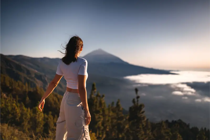
    Mirador de Chipeque is one of the Tenerife viewpoints I would choose when the journey itself matters as much as the photograph. Officially known as Mirador de Cumbres del Norte or Chipeque, it sits by the TF-24 in the high forest above Santa Úrsula. On a clear day the viewpoint looks across the Orotava Valley toward Teide; when the trade-wind cloud layer fills the valley, the scene can become a broad white “sea of clouds”. Turismo de Tenerife lists parking and adapted access at the viewpoint but no bus stop, so I plan it primarily as a driving stop.

    What I can see from Chipeque

    The classic view looks toward Teide over the northern slope, often with cloud below. Official tourism information also notes visibility toward the Teno Massif and, in clear conditions, the silhouette of La Palma. I do not expect all of those elements on every visit; mountain visibility changes quickly.

    The uncertainty is part of the appeal. Chipeque is a place I visit because conditions can transform the same landscape from one hour to the next.

    The sea of clouds

    The cloud layer forms when moist trade-wind air meets Tenerife’s terrain and is capped by warmer, drier air above. From the coast this can feel like a grey day; from Chipeque I may be standing in sunshine above the clouds. That inversion is one of the island’s defining climate experiences.

    I never treat it as guaranteed. If the cloud level is too high, the viewpoint may sit inside mist; if it is too low or absent, the valley may be completely clear. Both can be beautiful.

    Driving the TF-24

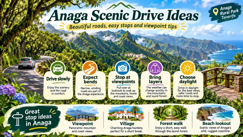
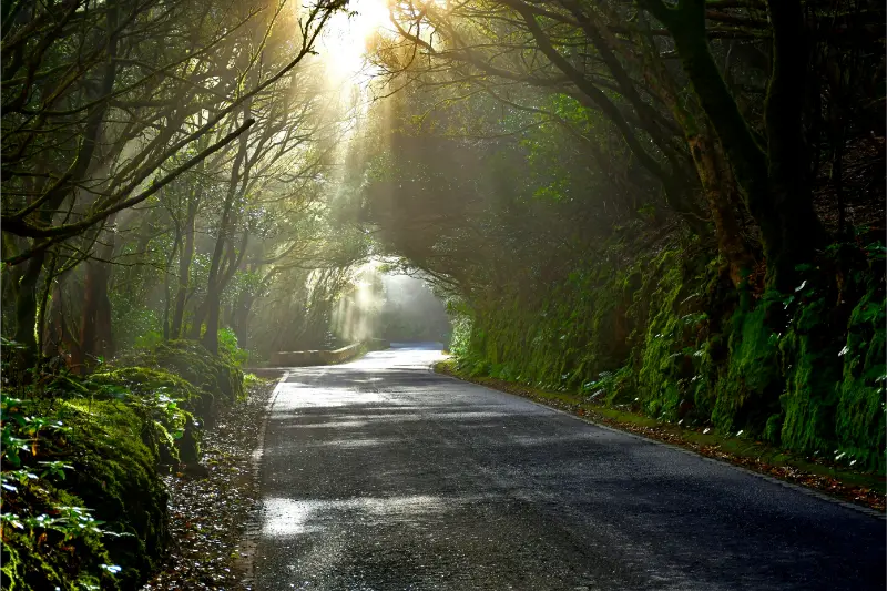
    Chipeque is reached from the high ridge roads rather than from a town-centre promenade. The TF-24 is scenic but can be winding, foggy and dark after sunset. I allow extra time and avoid driving it when tired.

    There is no regular bus stop listed at the viewpoint, which makes a rental car the practical choice for most visitors. My Tenerife driving guide covers mountain-road habits and parking in more detail.
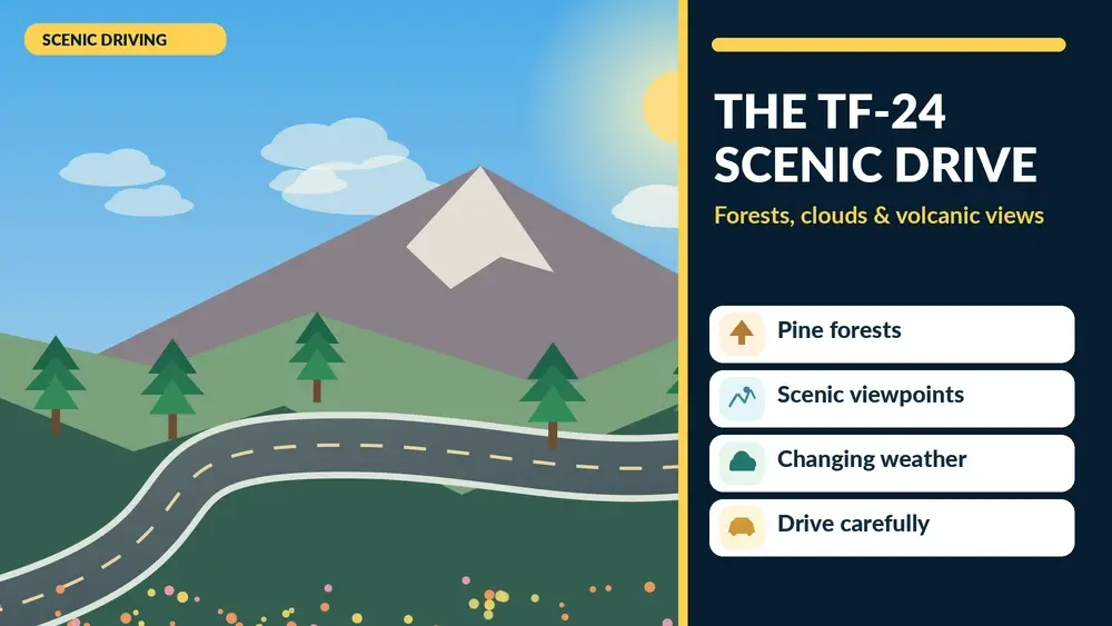
    Illustrated guide: TF-24 Tenerife Scenic Drive, with practical visitor tips
    Illustrated guide: TF-24 Tenerife Scenic Drive.

    Parking and roadside safety

    Turismo de Tenerife lists parking at the viewpoint. I use the formal space and keep children close because the environment remains roadside and mountainous even though access is easy. I do not stop in the traffic lane when the car park is full.

    Popular sunset times can create pressure. Arriving earlier is more enjoyable than chasing the last light and then searching for a space.

    Sunset at Chipeque

    Sunset can be spectacular when Teide catches warm light above cloud, but it also means the return drive happens in darkness. I bring a warm layer, because temperature drops quickly once the sun disappears, and I have the route home saved before phone signal becomes inconsistent.

    I stay only as long as I am comfortable driving afterward. A viewpoint should not turn into a risky descent simply because the sky remained colourful for another ten minutes.

    Photography tips

    A telephoto lens compresses Teide and the cloud layer beautifully, while a wider lens includes pines and foreground. I expose carefully because bright cloud can fool automatic metering. A small tripod is useful after sunset if wind is moderate and space allows.

    I keep equipment inside the viewpoint area and never step beyond barriers for an unobstructed composition. My Tenerife photography guide covers similar decisions at other mountain viewpoints.

    Weather and clothing

    Chipeque can be much colder and windier than Puerto de la Cruz or Santa Cruz on the same day. I carry a jacket even if I left the coast in shorts. In wet or foggy conditions, road visibility matters more to me than whether the viewpoint might clear later.

    After storms or unusual weather, I check road and official alerts before driving high into the forest.

    Combining Chipeque with other stops

    I would combine it with La Esperanza, another high-ridge viewpoint or a Teide day rather than with distant southwest resorts. If I am coming from the north, La Orotava or Puerto de la Cruz can fit naturally before or after.

    Mount Teide And Volcanic Landscape Tenerife

    My best viewpoints in Tenerife helps build a route without turning the day into a sequence of car parks.

    How I would plan it

    For sunset I arrive well before golden hour, enjoy the changing cloud rather than chasing a single photograph, then descend before fatigue sets in.

    I use the official Chipeque viewpoint page for the current location and facilities information.

    When a disappointing forecast can still work

    A cloudy forecast for Puerto de la Cruz does not necessarily mean Chipeque will be cloudy. The viewpoint can sit above the inversion layer. I check mountain forecasts and webcams where available, but I still accept that the final few kilometres may reveal conditions no app predicted perfectly.

    A quiet alternative to attraction-heavy days

    Chipeque works well when I want a memorable evening without tickets or a long hike. For accommodation on the northern side, I compare La Orotava accommodation with Puerto de la Cruz depending on whether mountain access or nightlife matters more.

    What I would check before leaving

    Before setting out for Mirador de Chipeque, I check the current weather, any trail or beach alerts, road access and the amount of daylight I realistically have left. Tenerife can change character quickly between the coast and higher ground, so I do not assume that conditions at my hotel describe the place I am about to visit. I save the route offline, carry more water than I expect to need and keep one nearby alternative in mind rather than relying on a single perfect plan.

    How I fit it into a wider Tenerife itinerary

    I would place Mirador de Chipeque on a day that already focuses on the same part of the island. That sounds obvious, but it prevents a lot of unnecessary driving. I prefer one strong natural experience plus a nearby town, viewpoint or meal rather than trying to cross Tenerife for a second headline attraction. This approach leaves enough time to stop when the light is good, deal with parking calmly and follow local instructions without feeling that the schedule is collapsing.

    The pace I recommend for a first visit

    For a first visit to Mirador de Chipeque, I deliberately allow more time than the minimum duration shown on a map. Natural places are enjoyable because I can slow down, look at the terrain and adapt to wind, cloud or sea state. Rushing encourages poor decisions, especially near exposed coasts or on volcanic ground. If the visit ends earlier than expected, I use the spare time for a café, a short village walk or another nearby stop rather than adding a distant attraction.

    What I would avoid

    I would avoid treating Mirador de Chipeque as a location that has to work in every condition. Strong sun, wind, swell, low cloud or a temporary closure can change the experience completely. I also avoid leaving marked routes for a better photograph, parking where access is clearly restricted and assuming that quiet places have no rules. Tenerife’s most memorable landscapes are often protected precisely because they are fragile, so the best visit is the one that leaves the setting looking unchanged.

    A useful backup plan

    My backup plan for Mirador de Chipeque stays geographically close. If the weather or access is wrong, I choose a nearby village, museum, promenade, sheltered beach or viewpoint rather than driving across the island. This makes the day more resilient and keeps the trip enjoyable even when the original idea has to change. Tenerife offers enough variety within each region that a cancelled walk or rough sea does not need to become a wasted day.

    Why I verify operational details again

    Conditions connected with Mirador de Chipeque can change after any article is published. Trail status, parking arrangements, lifeguard services, road restrictions and weather warnings are operational details rather than permanent facts. I use this guide to understand the place, then check the relevant official source shortly before going. That final check is especially important after storms, heat alerts, wildfires or periods of heavy swell.

    A note on footwear and small practical details

    For Mirador de Chipeque, small practical choices usually matter more than specialist equipment. I wear footwear that matches the surface, carry sun protection and keep hands free on rough ground. I also avoid bringing more gear than I need. A lighter bag makes climbs, steps and beach access easier, and it reduces the temptation to leave belongings unattended while I move closer to water or viewpoints.

    Why I leave room for the unexpected

    One of the reasons I enjoy Mirador de Chipeque is that the best moment is not always the one I planned. A cloud may lift, the light may improve, wildlife may appear or a quiet corner may simply deserve more time. I therefore avoid booking the next activity too tightly. Leaving an hour of margin is often what lets a natural place feel like an experience rather than another appointment on the itinerary.

    My final rule for a better visit

    My final rule for Mirador de Chipeque is simple: I would rather leave with one strong memory than with proof that I visited every nearby stop. I keep the route realistic, respect the setting and change plans when conditions suggest it. That approach usually produces better photographs, safer decisions and a much more relaxed day, while also leaving a reason to return to this part of Tenerife on a future trip.
  • Roques de García Trail Guide: Easy Teide Walk with Iconic Volcanic Views

    Roques de García Trail Guide: Easy Teide Walk with Iconic Volcanic Views

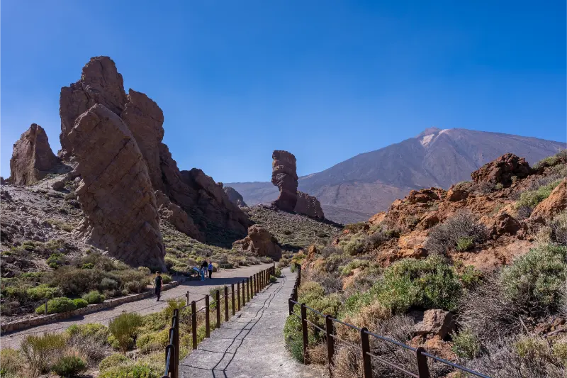
    Roques de García is the Teide walk I recommend when someone wants a genuine volcanic trail without committing to a summit-style hike. Trail 03 begins and ends at Mirador de La Ruleta beside the famous rock formations, and Turismo de Tenerife currently lists it as a 3.5 km circular route of low difficulty taking about two hours, with roughly 211 metres of ascent. The numbers are modest, but the entire walk sits above 2,000 metres, so altitude, sun and fast-changing mountain weather still deserve respect.

    Why this trail works so well for a first Teide visit

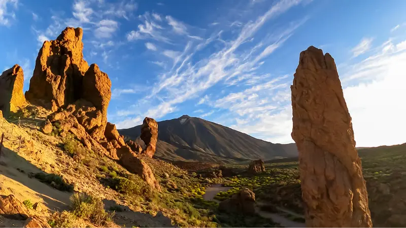
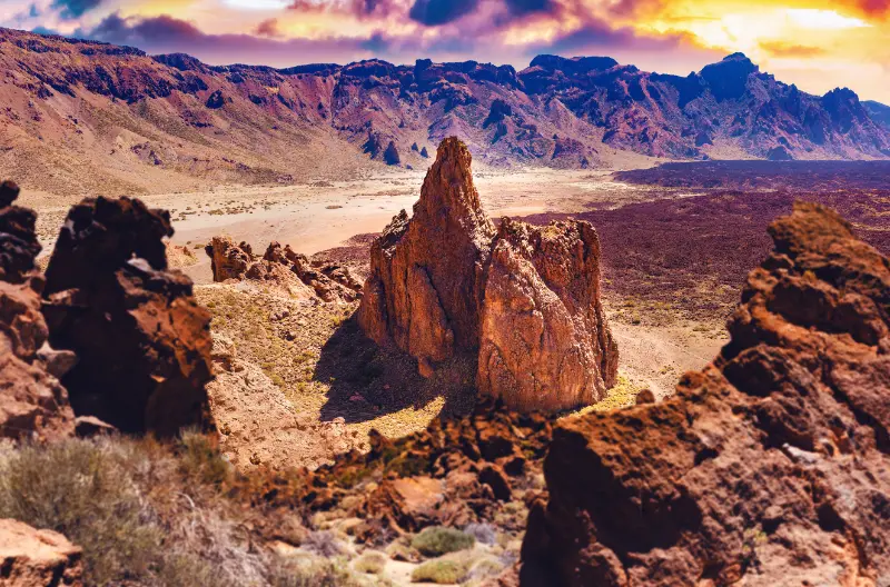
    The route starts in one of the national park’s most recognisable settings. Roque Cinchado and the surrounding formations rise beside the road, but walking the loop reveals how different they look from behind and below. The trail also opens views toward Llano de Ucanca, where the scale of the caldera becomes much easier to understand.

    I prefer this to spending the entire Teide visit moving between car parks. Even a short walk gives me silence, texture and distance from the road.

    Official distance and difficulty

    Trail 03 is currently listed at 3.5 km, about two hours, with a high point around 2,187 metres and a low point around 2,025 metres. The official rating is low difficulty, but the route includes a descent and climb rather than remaining flat throughout.

    I use the two-hour estimate as a planning minimum. Photo stops, crowding near the start and the effects of altitude can easily stretch the outing. There is no prize for finishing quickly.

    Altitude changes how an easy walk feels

    At more than 2,000 metres, I may feel breathless sooner than expected, especially if I have driven directly from sea level. I slow the first twenty minutes, drink water and do not compare my pace with hikers who have already spent several days at altitude.

    Sun exposure is also stronger while wind can make the air feel cold. I carry a layer and sunscreen regardless of what the temperature was in Costa Adeje. My Mount Teide guide covers the wider high-altitude planning in more detail.

    Roque Cinchado Trail Teide National Park Tenerife

    Parking at La Ruleta

    The main practical challenge is often parking rather than the path. Roques de García is one of Teide’s most popular roadside stops, so spaces near La Ruleta can fill quickly. I arrive earlier in the day and keep the itinerary flexible instead of circling aggressively for a space.

    I never park outside marked areas or on vegetation. A few extra minutes of walking are preferable to damaging protected ground or narrowing the road.

    Walking direction and terrain

    The official description circles the formations and descends toward the plain before returning. The surface is volcanic, uneven and exposed, so shoes with grip make the walk more comfortable. I stay on the trail even where footprints suggest shortcuts.

    Because the route is circular, navigation is straightforward in clear conditions, but fog or poor visibility can make landmarks disappear. I check the forecast before committing.

    No permit for Trail 03, but rules still matter

    Turismo de Tenerife currently states that no authorisation is required for Trail 03. That is different from some regulated Teide routes, especially those connected with summit access. I do not generalise one trail’s rules to the entire national park.

    My hiking permits and trail rules guide explains why checking the exact trail number is essential in Teide.

    Photography and the famous Roque Cinchado

    Roque Cinchado is an obvious subject, but I also photograph the plain, layered lava and the way Teide changes position as I move around the formations. Morning and late afternoon usually give more texture than the harshest midday light.

    Roque Cinchado Roques De Garcia Tenerife

    I avoid blocking the trail at narrow points for photos. Popular landscapes work better when everyone gives other walkers space to pass.

    Who I recommend this trail to

    Roques de García suits first-time visitors, families with walking experience, photographers and travellers who have limited time in the national park. It is a meaningful walk without the logistics of the cable car or summit permit.

    Anyone with mobility limitations can still enjoy the initial viewpoint area, and the park has an accessible section nearby. I cover those options in my accessible Tenerife guide.

    How I would plan it

    I would arrive early, walk Trail 03 at an unhurried pace, spend time at the viewpoints and then continue through the national park without trying to add another demanding hike.

    The official Trail 03 page is where I confirm current status and route information before the trip.

    Combining the trail with a scenic drive

    Roques de García fits naturally into a Teide driving day because it sits beside the main national-park road. I still limit the number of additional stops. My Tenerife by car guide explains why mountain driving times are easier when I leave margin rather than building a minute-by-minute loop.

    Where to stay for an early Teide day

    Vilaflor is convenient from the south, while La Orotava works from the north. Resort bases are perfectly possible, but an inland night can make sunrise or early-morning access calmer. I compare Vilaflor accommodation when a mountain-focused day is the priority.

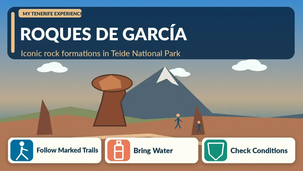
    Illustrated guide: Roques de García Trail, with practical visitor tips
    Illustrated guide: Roques de García Trail.

    What I would check before leaving

    Before setting out for Roques de García trail, I check the current weather, any trail or beach alerts, road access and the amount of daylight I realistically have left. Tenerife can change character quickly between the coast and higher ground, so I do not assume that conditions at my hotel describe the place I am about to visit. I save the route offline, carry more water than I expect to need and keep one nearby alternative in mind rather than relying on a single perfect plan.

    How I fit it into a wider Tenerife itinerary

    I would place Roques de García trail on a day that already focuses on the same part of the island. That sounds obvious, but it prevents a lot of unnecessary driving. I prefer one strong natural experience plus a nearby town, viewpoint or meal rather than trying to cross Tenerife for a second headline attraction. This approach leaves enough time to stop when the light is good, deal with parking calmly and follow local instructions without feeling that the schedule is collapsing.

    The pace I recommend for a first visit

    For a first visit to Roques de García trail, I deliberately allow more time than the minimum duration shown on a map. Natural places are enjoyable because I can slow down, look at the terrain and adapt to wind, cloud or sea state. Rushing encourages poor decisions, especially near exposed coasts or on volcanic ground. If the visit ends earlier than expected, I use the spare time for a café, a short village walk or another nearby stop rather than adding a distant attraction.

    Mount Teide And Volcanic Landscape Tenerife

    What I would avoid

    I would avoid treating Roques de García trail as a location that has to work in every condition. Strong sun, wind, swell, low cloud or a temporary closure can change the experience completely. I also avoid leaving marked routes for a better photograph, parking where access is clearly restricted and assuming that quiet places have no rules. Tenerife’s most memorable landscapes are often protected precisely because they are fragile, so the best visit is the one that leaves the setting looking unchanged.

    A useful backup plan

    My backup plan for Roques de García trail stays geographically close. If the weather or access is wrong, I choose a nearby village, museum, promenade, sheltered beach or viewpoint rather than driving across the island. This makes the day more resilient and keeps the trip enjoyable even when the original idea has to change. Tenerife offers enough variety within each region that a cancelled walk or rough sea does not need to become a wasted day.

    Why I verify operational details again

    Conditions connected with Roques de García trail can change after any article is published. Trail status, parking arrangements, lifeguard services, road restrictions and weather warnings are operational details rather than permanent facts. I use this guide to understand the place, then check the relevant official source shortly before going. That final check is especially important after storms, heat alerts, wildfires or periods of heavy swell.

    A note on footwear and small practical details

    For Roques de García trail, small practical choices usually matter more than specialist equipment. I wear footwear that matches the surface, carry sun protection and keep hands free on rough ground. I also avoid bringing more gear than I need. A lighter bag makes climbs, steps and beach access easier, and it reduces the temptation to leave belongings unattended while I move closer to water or viewpoints.

    Why I leave room for the unexpected

    One of the reasons I enjoy Roques de García trail is that the best moment is not always the one I planned. A cloud may lift, the light may improve, wildlife may appear or a quiet corner may simply deserve more time. I therefore avoid booking the next activity too tightly. Leaving an hour of margin is often what lets a natural place feel like an experience rather than another appointment on the itinerary.

  • Camping in Tenerife: Campsites, Permits, Bivouac Rules and Tenerife ON

    Camping in Tenerife: Campsites, Permits, Bivouac Rules and Tenerife ON

    Camping in Tenerife is possible, but I would never treat the island as a place where I can pitch a tent wherever a scenic road happens to end. Tenerife’s protected landscapes are actively managed, and the official Tenerife ON system lists camping areas, nature camps, caravan camping and authorised overnight bivouac zones. Some facilities require advance reservations; certain high-mountain areas have separate permits; temporary fire-risk restrictions can change access at short notice. For me, the attraction is sleeping close to pine forest or starting a mountain day early, but the experience works only when I plan around the rules rather than around a romantic idea of wild camping.

    Start with Tenerife ON, not with an old camping blog

    Tenerife ON is the official planning platform for the island’s natural areas and is where I check current facilities, alerts and reservation requirements. Its facility directory distinguishes recreational areas, camping areas, nature camps, caravan camping and authorised bivouac areas. That distinction matters because a picnic area is not automatically a legal overnight campsite. I search the exact facility and date, read its current information sheet and reserve when the system requires it.

    I also check alerts on the day of travel. Fire risk, maintenance, weather or environmental measures can affect access after a trip has already been planned. My Tenerife hiking permits guide explains the same principle for trails: official current information overrides an older itinerary.

    Forest camping areas and nature camps

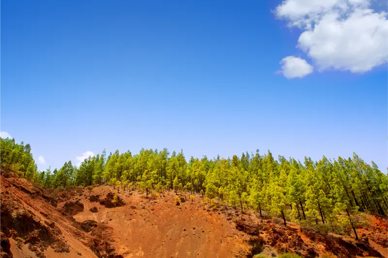
    The island has managed facilities in forest areas, including sites shown by Tenerife ON in zones such as La Esperanza and the northern pine forests. Facilities vary, so I never assume drinking water, showers, electricity or a shop will be available simply because the word “camping” appears on a map. I read the resource sheet line by line and bring enough water and food for the specific stay.

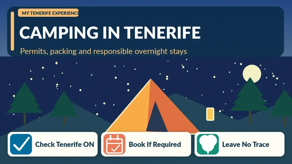
    Illustrated guide: Camping in Tenerife, with practical visitor tips
    Illustrated guide: Camping in Tenerife.

    Forest camping is particularly appealing in warm months because the altitude can be cooler than the coast, but that same elevation creates cold nights. I pack for the overnight low rather than the daytime temperature at my beach accommodation.

    Camping is not the same as using a recreational area

    Tenerife has many recreational picnic areas, but the Cabildo’s general rules state that ordinary recreational-area use is tied to daylight hours unless a specific overnight facility or authorisation applies. This is why I do not decide to sleep at a picnic table after a late barbecue. I separate daytime picnic planning from overnight accommodation and check the status of each site.

    Fire rules also deserve special attention. Restrictions can tighten during hot or dry periods, and summer measures may limit cooking or close facilities entirely. I prefer a cold-meal backup so dinner does not depend on being allowed to light a stove or use a barbecue.

    Teide bivouac: a very different experience

    Authorised bivouac near Teide is not standard tent camping. Tenerife ON describes designated overnight bivouac zones on high routes where prior booking is compulsory. In the Teide authorised bivouac area, tents and similar shelters are prohibited; the concept is sleeping or resting in the open with a sleeping bag or bivvy-type protection without altering the environment. Separate trail permission may also be required for the approach.

    At more than 2,500 metres, temperature, wind and sun exposure can be severe. I would only attempt this with mountain experience, suitable equipment and a conservative weather forecast. It is not an inexpensive substitute for a hotel. It is a high-altitude activity with genuine consequences if equipment or judgement is poor.

    View Of Mount Teide From Pine Forest Tenerife

    Campervans and motorhomes

    A campervan does not automatically create permission to sleep anywhere a vehicle can park. Tenerife ON distinguishes caravan-camping resources, and municipal or protected-area rules can affect overnight use. I check the exact legal status of the intended stop rather than relying on the presence of other vans. A crowded roadside pull-off may simply mean several people are making the same assumption.

    I also plan waste and water responsibly. Grey water, toilets and rubbish need proper facilities. The freedom of a van holiday only works if overnight behaviour does not turn viewpoints and beaches into informal campsites.

    What I pack for a Tenerife camping night

    My packing list changes with altitude. On the coast I prioritise ventilation, sun protection and wind stability; in pine forest I add warmer layers; near Teide I prepare for mountain cold, strong UV and rapid weather change. A sleeping mat matters as much as a sleeping bag because volcanic or compacted ground can draw heat quickly.

    I carry a headlamp, enough water, power bank, rubbish bags and offline directions. I also save the booking confirmation locally in case reception is poor. For any remote site, someone outside the group knows where I intend to stay.

    A couple sitting beside a campervan with a guitar

    Food, fire and leave-no-trace habits

    I plan food that can be eaten without flame. Even when cooking is normally permitted, temporary fire restrictions can make a stove unusable. I keep all food contained, pack out rubbish and never leave organic waste because it can alter wildlife behaviour. I use toilets where provided and follow the site’s rules when they are not.

    The goal is to leave no evidence that I slept there. That includes noise and light: forest camps are not resort entertainment areas, and bright lights or music affect both other campers and wildlife.

    Who camping in Tenerife suits best

    I recommend managed camping to hikers, cyclists and nature-focused travellers who are comfortable with simple facilities and changing weather. I would not choose it simply to save money on a first family holiday unless the group already enjoys camping. The island has enough affordable apartments and rural stays that discomfort is unnecessary if outdoor sleeping is not part of the experience itself.

    For a mixed trip, one or two legal camping nights can be more enjoyable than trying to camp every night. I like combining a forest stay with a normal base where I can shower, recharge equipment and adapt if the weather changes.

    How I would plan it

    Before every overnight stay I would check the exact facility on Tenerife ON facilities and verify current alerts and reservation conditions.

    For nights when camping is not practical, I compare Tenerife accommodation rather than improvising an unauthorised roadside stay.

    Reservations and last-minute changes

    I save both the reservation and the cancellation rules. If wind, heat or a forest alert makes the original site unsuitable, I would rather lose part of a plan than force an overnight stay in poor conditions. This is one of the advantages of treating camping as a nature activity rather than as fixed accommodation.

    How camping fits a longer Tenerife itinerary

    A forest night pairs naturally with hiking, stargazing or a cycling route, but I keep the following morning light. Packing camp, driving mountain roads and beginning a long trail before breakfast can create an unnecessarily demanding day. I build recovery time into the itinerary just as I would after a hard Teide hike.

    Planning camping in Tenerife around the rest of the trip

    I would not let camping in Tenerife dominate every day of the holiday. Tenerife works best when active or detailed plans are balanced with a slower meal, a short walk or time by the sea. I group nearby places together, leave a realistic margin for parking and changing conditions, and avoid crossing the island simply to add one more stop. That makes this part of the trip feel intentional rather than squeezed between unrelated attractions.

    What I check the evening before

    The evening before this part of the trip, I confirm weather, access, opening information and the exact route from my accommodation. For camping in Tenerife, small practical changes can matter more than they appear on a static itinerary. I save essential information offline, charge the phone and keep a nearby alternative in mind. That preparation means a closure, stronger wind or slower traffic changes the plan without ruining the day.

    How I keep the day geographically sensible

    I build this day around one section of Tenerife. Even when camping in tenerife: campsites, permits, bivouac rules and tenerife on sounds easy to combine with several famous attractions, mountain roads and elevation can turn short map distances into long travel times. I prefer adding one nearby village, beach, viewpoint or lunch stop. The result is less time in the car and more time actually experiencing the area.

    The pace I recommend for a first visit

    For a first experience of camping in Tenerife, I deliberately leave more time than the minimum suggested by a map or booking page. I want room to stop, understand the setting and adapt to local conditions. Tenerife rewards that slower approach because weather, light and atmosphere change quickly. Finishing with spare energy is more useful than proving that I managed to fit another distant attraction into the same day.

    A useful backup plan

    My backup plan for camping in Tenerife is always something close by and simple: a town centre, sheltered café, promenade, museum, market or viewpoint that does not depend on the same conditions. I do not choose an alternative on the opposite coast. Keeping the backup local prevents a weather change or closure from becoming an exhausting cross-island drive and makes the itinerary much more resilient.

  • Teno Rural Park Guide: Masca, Teno Alto, Hiking and Northwest Tenerife

    Teno Rural Park Guide: Masca, Teno Alto, Hiking and Northwest Tenerife

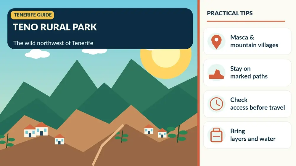
    Teno Rural Park is the Tenerife landscape I recommend when someone wants to understand the island beyond beaches and Teide. In the northwest, deep ravines, old volcanic massifs, laurel forest, farming hamlets and cliffs exist within a compact area that feels far more remote than the map suggests.

    The park covers more than 8,000 hectares across parts of Buenavista del Norte, Los Silos, El Tanque and Santiago del Teide. Famous Masca is only one piece of the landscape. I get more from Teno when I also think about Teno Alto, El Palmar, Monte del Agua, Punta de Teno and the traditional paths connecting the villages.

    Why Teno feels different

    Official Tenerife tourism information describes Teno as one of the island’s best-preserved natural and cultural areas, shaped partly by its historic isolation. The park contains cliffs, valleys, laurel forest and traditional architecture. I use the official Teno Rural Park page as a starting point for current information.

    The geography explains why driving times feel long. Roads cross ridges and ravines rather than following straight lines, and viewpoints constantly tempt me to stop. I plan fewer destinations than I would on the motorway coast.

    Masca village

    Masca is the best-known settlement, dramatically positioned among steep mountains. I visit for the landscape and village setting, but I do not assume I can descend the gorge spontaneously. The Barranco de Masca has a regulated access system and transport requirements described in my Masca guide.

    Even if I am not hiking, parking pressure and road conditions make public transport worth considering. Arriving by bus also lets the driver enjoy the views instead of concentrating on every bend.

    Illustrated guide: Teno Rural Park, with practical visitor tips
    Illustrated guide: Teno Rural Park.

    Teno Alto

    Teno Alto feels much more rural and less visited than Masca. The area preserves farming and livestock traditions, and it is associated with local cheese and old paths across the massif. I come for quiet landscapes rather than a long list of attractions.

    When I stop in a small hamlet, I park carefully, respect private property and avoid treating doorways or agricultural land as photo sets. These communities are lived-in places inside a protected landscape.

    El Palmar and the visitor centre

    El Palmar is one of the practical gateways into the park. The Los Pedregales visitor centre area is useful for information about trails and the cultural landscape. If I am unsure about a route, I would rather ask locally than rely on an old GPS track.

    The valley around El Palmar also shows a softer agricultural side of Teno, a contrast with the dramatic cliffs that dominate photographs of Masca and Punta de Teno.

    Monte del Agua

    Monte del Agua is one of the forest landscapes I include when I want laurel vegetation without focusing only on Anaga. Trails connect areas such as Erjos and Las Portelas, and the atmosphere can be cool and humid even when the coast is sunny.

    Masca Village Tenerife

    I check official trail status before setting out because weather, maintenance or fire risk can affect access. Forest cloud is part of the experience, but poor visibility can make navigation harder on unfamiliar routes.

    Punta de Teno

    Punta de Teno marks the island’s western edge and offers extraordinary views toward the Los Gigantes cliffs. Access rules can change, and current restrictions related to the road mean I never assume I can drive a private car to the lighthouse area. My Punta de Teno guide contains the latest planning context I have used for the site.

    The important principle is simple: I check the current official access arrangement before leaving Buenavista. Old articles showing unrestricted car access can be misleading.

    The 355 bus through Teno

    The official park information identifies TITSA line 355 as an important public-transport link between Buenavista del Norte, Masca and Santiago del Teide. For visitors nervous about the TF-436 mountain road, the bus can be a very good choice.

    I verify the timetable in both directions before starting the day. Rural service frequency means missing a bus can create a long wait, and mobile coverage should not be the only place I have saved the schedule.

    Driving the TF-436

    The road between Buenavista and Santiago del Teide via Masca is scenic but demanding for drivers who dislike narrow, winding mountain routes. I pull over only in legal designated places, let faster local traffic pass when safe and avoid sunset return drives if I am uncomfortable after dark. My driving guide has broader mountain-road advice.

    Masca Mountain Valley Tenerife

    The driver should be looking at the road, not the ravine. If everyone wants to admire the scenery, the bus or a guided excursion is a genuine upgrade, not a compromise.

    Hiking options

    Teno has more than 100 kilometres of signposted or established walking routes according to official tourism information. One example, PR-TF 59 between Las Portelas and Masca, is listed at about 3.7 km and around two hours, with low difficulty on the official page. Difficulty labels are only a starting point; weather, footing and personal experience still matter.

    For a broader comparison, I use my Tenerife hiking guide and then verify each selected route on the current official source.

    Masca Gorge is not a normal park trail

    I separate Barranco de Masca from ordinary hiking plans because it has specific booking, access and exit arrangements. I do not arrive at the village expecting to decide at the trailhead. The regulated system exists because the gorge is a sensitive and demanding environment.

    If I cannot obtain the required booking, Teno still has enough villages, viewpoints and other walks to justify the day. I never make one sold-out trail the measure of whether the entire region is worth visiting.

    Food and local products

    Teno is a good place to look for simple Canarian food and local cheese, particularly in rural settlements where agriculture remains part of everyday life. I check opening days because small restaurants may not follow the continuous hours of a resort.

    I also avoid drinking alcohol if I am driving the TF-436 afterward. The combination of narrow roads and unfamiliar bends deserves full attention.

    Where to stay for Teno

    Buenavista del Norte, Los Silos, Garachico and Santiago del Teide are practical bases for exploring different sides of the park. Los Gigantes and Puerto de Santiago work if I want more tourist services while remaining close to the western cliffs. You can compare accommodation around Teno and northwest Tenerife by exact map location.

    A rural stay inside or near the park is ideal for quiet evenings, but I check restaurant access and road lighting before assuming I can walk everywhere after dark.

    My one-day Teno plan

    For a first visit I start near Buenavista, stop around El Palmar, choose one short walk or village, use the legal current access plan for Punta de Teno if it fits, and cross toward Masca only if time and road conditions are comfortable. I do not try to visit every hamlet.

    If Masca is the main priority, I reverse the day around its bus or hiking reservation. Teno rewards focus more than coverage.

    A two-day Teno plan

    With two days, I separate the western coast from the highland villages. Day one can focus on Buenavista, Punta de Teno and the Isla Baja; day two can focus on El Palmar, Teno Alto, Masca and a selected hike. This gives weather flexibility and removes pressure from the road.

    Masca Valley Panoramic View Tenerife

    I combine the stay with my Garachico guide or Los Gigantes guide rather than driving back to the far south every night.

    Frequently asked questions

    Where is Teno Rural Park?

    It is in northwest Tenerife and extends across parts of Buenavista del Norte, Los Silos, El Tanque and Santiago del Teide.

    Is Masca inside Teno Rural Park?

    Yes. Masca is one of the park’s best-known settlements, but the park includes many other villages, forests, cliffs and trails.

    Can I visit Teno without a car?

    Yes. TITSA line 355 is important for the Buenavista–Masca–Santiago del Teide corridor, and other services can support parts of the trip.

    Can I drive to Punta de Teno?

    Access rules can be restricted or changed. I check the current official arrangement before travelling and do not rely on old articles.

    How many days does Teno need?

    One day gives an introduction, while two days is much better if you want both coastal and highland areas without rushing.

    Weather and microclimates in Teno

    Teno can move from cloud and damp forest to bright coastal sun within the same day. I pack for both conditions and never judge the entire park by the weather at my hotel. On exposed ridges, wind is as important as temperature; in forest, damp paths can change footing.

    I check alerts before leaving and keep an alternative lower-level plan. A cancelled hike can become a very good day in Buenavista, Garachico or Los Gigantes without forcing unsafe conditions.

    Respecting the rural character of Teno

    The park is not an empty scenic reserve: people live and work in its hamlets. I keep noise down, never block agricultural access, close gates only if I found them closed and buy food or local products from legitimate businesses when possible. On narrow lanes I give priority patiently rather than treating every bend as a photo stop. These small habits matter in places where visitor numbers are concentrated in tiny settlements such as Masca and where daily life continues around the tourism.

  • Masca Tenerife Guide: Village, Gorge Hike, 2026 Access Rules and Practical Tips

    Masca Tenerife Guide: Village, Gorge Hike, 2026 Access Rules and Practical Tips

    Masca is one of Tenerife’s most photographed mountain settlements, but it is also one of the places where planning matters most. The hamlet sits in the Teno Rural Park among steep ridges and ravines, reached by narrow mountain roads. Many visitors come only for the viewpoint and village; others want to hike the famous Masca Gorge. Those are now two very different experiences, and I would decide which one you want before leaving your hotel.

    The gorge is regulated for conservation and safety. As of September 2026, the official Masca trail system is operating a descent-only pilot format with advance booking, mandatory access from Santiago del Teide using TITSA route 355, security checks, required equipment and a separately booked boat departure from Masca Bay. These rules can change, so the official Masca website—not an old itinerary—is the final reference.

    Visiting Masca village without hiking the gorge

    You can appreciate Masca without doing the gorge. The approach road, mountain walls, traditional houses and viewpoints make it worthwhile for travellers who are not prepared for a demanding hike. I would arrive with patience, keep the visit compact and avoid expecting unlimited parking. The hamlet is small and carries a heavy visitor load.

    Walk only where access is appropriate, have a drink or meal if local businesses are open and respect residential areas. The goal is to experience a mountain settlement, not to treat every doorway and terrace as a photo set.

    The Masca Gorge trail in 2026

    The current official booking page describes the trail as high difficulty and approximately four hours for the descent experience. The booked trail ticket covers access controls, safety monitoring, helmet loan and insurance, but it does not include the required TITSA transfer from Santiago del Teide or the boat ticket needed to leave Masca Bay.

    Illustrated guide: Masca Tenerife, with practical visitor tips
    Illustrated guide: Masca Tenerife.

    From December 2025, hikers have been required to use TITSA route 355 from Santiago del Teide and show proof of that transport to access the trail. Private-vehicle arrival is not accepted for the hike. The official instructions also require you to be at the Santiago del Teide pickup point well before your descent slot so you can complete the transfer and security process.

    Boat connection from Masca Bay

    Under the current descent-only arrangement, you leave the gorge by boat from Masca Bay. That means the hiking reservation and the boat booking are two linked parts of the same plan. I would book them as a single logistical task and verify the allowed timing between trail entry and boat departure.

    Do not assume you can improvise the boat at the bottom. Sea conditions can affect the jetty, and closures are possible. The official system allows changes or refunds in specified closure situations, but you need to follow the current terms attached to your booking.

    Who should hike Masca Gorge?

    A famous trail is not automatically the right trail for every traveller. The gorge involves uneven and potentially slippery surfaces, rockfall risk, sustained descent and the physical stress of a long mountain walk. I would not choose it for someone with poor mobility, inadequate footwear or little hiking experience simply because it appears on a ‘must-do’ list.

    Masca Valley Panoramic View Tenerife

    If you want an easier nature day, Anaga has shorter options and Teide offers remarkable scenery without a full gorge descent. See my Tenerife hiking guide for alternatives.

    Equipment and preparation

    Follow the official equipment list exactly. Good closed hiking footwear and water are not optional details. A helmet is currently provided as part of the trail service, but other required personal equipment remains your responsibility. Heat in the gorge and exposure near the coast can feel very different from the temperature in Santiago del Teide.

    I download confirmations, transport information and contact details before leaving. In mountain terrain, I never want access to depend on a perfect mobile signal.

    Weather and closures

    Masca is especially sensitive to weather because both the trail and the jetty need to be safe. Heavy rain, rockfall risk, rough sea, maintenance or conservation needs can close part of the experience. Check the official ‘Masca today’ status on the morning of your visit even if your reservation is confirmed.

    If the gorge closes, Teno still offers viewpoints, villages and other walking possibilities. A backup plan prevents the day from feeling ruined.

    Driving the Masca road

    If you are visiting only the village, the mountain road is part of the experience but demands concentration. Curves are tight, buses need space and viewpoints can become congested. Do not stop in the road for photographs. If you are uncomfortable with mountain driving, use public transport or an organised excursion.

    For the regulated gorge hike, current rules make the public-transport connection from Santiago del Teide mandatory anyway. That is a good example of why I check the latest access rules before renting a car for every excursion.

    Masca Village And Gorge Tenerife

    Masca and Los Gigantes

    The two places are naturally linked by geography and, under the current trail system, by the boat exit from Masca Bay toward the Los Gigantes area. Even without hiking, Los Gigantes makes a good second stop for a west-coast day because the cliffs reveal the scale of Teno from the sea.

    Use my Los Gigantes guide if you want to combine cliff viewpoints, a boat trip and an easier coastal afternoon.

    Masca with children

    I would separate visiting the village from hiking the gorge. A scenic village visit can work with children who tolerate winding roads, but the regulated gorge is a high-difficulty activity and should only be considered when age, ability, equipment and current rules clearly make it appropriate. Never let the popularity of the trail override the actual capability of your group.

    For general family planning, see Tenerife with kids.

    Where to stay

    Most travellers do not need to sleep in Masca itself. Santiago del Teide is practical for hikers because the current transport system starts there, while Los Gigantes works well if you want a coastal base after the hike. For a broader west-coast stay, compare Los Gigantes, Puerto de Santiago and Playa de la Arena.

    You can compare accommodation around Santiago del Teide once your hiking date is fixed.

    A Masca planning checklist

    • Decide whether you are visiting the hamlet or hiking the gorge.
    • For the gorge, book only through the current official system or approved partners.
    • Reserve the required boat connection under the rules in force for your date.
    • Plan the mandatory transport from Santiago del Teide exactly as instructed.
    • Check required equipment and arrive early for security control.
    • Check trail, jetty and weather status again on the day.
    • Have a Teno backup plan in case conditions close the route.

    My advice for a first visit

    If you are not a regular hiker, visit Masca for the scenery first and decide later whether the gorge belongs on a future trip. If you are an experienced hiker and the regulated descent appeals to you, treat it as a booked outdoor activity with transport, equipment and weather dependencies—not as a spontaneous stop between sightseeing attractions.

    Masca Village Tenerife

    Before hiking, read the official Masca Gorge booking and access information and check the current Masca trail and jetty status on the day of your visit.

    Why the rules are strict

    Masca Gorge combines fragile habitat, steep terrain, rockfall risk and a confined route where rescue is complicated. Capacity limits, equipment checks and transport controls can feel restrictive compared with an ordinary trail, but they address real conservation and safety problems. I would rather plan around those rules than see the gorge return to unmanaged crowding.

    Do not book tight connections

    I leave a large buffer around Masca. A mountain bus, security control, a four-hour hike, sea conditions and a boat transfer create several dependencies. I would not put an airport transfer, important dinner reservation or another paid excursion immediately after the experience. A free evening in Los Gigantes or Santiago del Teide is a much safer way to finish the day.

    Practical planning notes I would save before the trip

    For Masca Tenerife guide, I save the accommodation address, parking or bus information, one official information link and the route back to my base before leaving. Tenerife is easy to travel around, but mountain roads, microclimates and busy coastal areas can turn a simple day into a slower one. I therefore keep one optional stop that can be removed without losing the main purpose of the day.

    I also carry water, sun protection and a light layer whenever the day leaves the immediate coast. Even short journeys can move from warm sunshine to wind, cloud or cooler high ground. That small amount of preparation makes it easier to respond to the island as it actually is rather than force a schedule created before arrival.

    Finally, I avoid judging a destination by the busiest thirty minutes of the day. Arriving earlier, staying later, walking one street beyond the obvious viewpoint and sitting down for a proper meal often changes the experience completely. My goal with these guides is not to collect attractions but to make each place easier to understand and enjoy at a realistic pace.

  • Anaga Rural Park Guide: Laurisilva Forest, Hikes, Villages and Practical Tips

    Anaga Rural Park Guide: Laurisilva Forest, Hikes, Villages and Practical Tips

    Anaga is the part of Tenerife that most completely breaks the stereotype of a dry volcanic holiday island. In the northeast, steep ridges fall into deep ravines, laurel forest catches mist and small settlements cling to slopes above the Atlantic. On the same trip you can see Teide’s high volcanic desert and Anaga’s green woodland, and that contrast is one of the reasons I think Tenerife deserves more than a beach weekend.

    The Parque Rural de Anaga covers roughly 14,500 hectares across parts of Santa Cruz de Tenerife, La Laguna and Tegueste. It was recognised as a UNESCO Biosphere Reserve in 2015. The area is ecologically sensitive, and some trails or zones have access controls. I plan Anaga around official trail information first, weather second and scenic ambition third—not the other way around.

    What makes Anaga special?

    Anaga is one of the geologically oldest parts of Tenerife. Erosion has carved the massif into sharp ridges and ravines, while humid trade-wind conditions help support laurel forest that feels almost prehistoric. The scenery changes quickly: forest viewpoints on the ridge, agricultural hamlets, exposed coastal roads and black-sand beaches can all appear in one day.

    The temptation is to drive everywhere because the map looks small. That is exactly what I would avoid. Roads are slow and winding, parking is limited at popular points and repeated stops create more fatigue than the kilometres suggest. Choose one side of Anaga and explore it properly.

    Illustrated guide: Anaga Rural Park, with practical visitor tips
    Illustrated guide: Anaga Rural Park.

    Cruz del Carmen: the easiest introduction

    Cruz del Carmen is one of the most practical starting points from La Laguna. It gives access to viewpoints, visitor information and several walking options. On a misty day the forest can be atmospheric rather than disappointing, but if the cloud is thick enough to remove every view, I shorten the drive and focus on woodland instead of chasing the coast.

    A short walk near Cruz del Carmen is often enough for a first-time visitor who is not a serious hiker. If hiking is a priority, use my Tenerife hiking guide as an overview and then confirm the exact route on Tenerife ON.

    El Pijaral and restricted areas

    Some of Anaga’s most sensitive trails, including routes in the El Pijaral Integral Nature Reserve, are subject to access restrictions or reservations. Do not rely on an old blog post or a saved map. The official Tenerife ON platform is the reference I use for current authorisations, closures and route status.

    This matters for conservation as much as convenience. Anaga’s popularity puts pressure on narrow roads, fragile vegetation and small rural communities. A trip that respects access rules is also usually more enjoyable because you arrive with realistic expectations.

    Taganana, Almáciga and Benijo

    The drive down toward Taganana reveals Anaga’s dramatic scale. Taganana is one of the area’s historic settlements, while the coast around Almáciga and Benijo gives you wild Atlantic scenery and dark volcanic beaches. I treat the coast as a landscape experience first and a swimming destination second because currents and waves can be powerful.

    Anaga Tenerife

    Benijo is especially beautiful near the end of the day, but sunset planning requires caution. Mountain roads are slower after dark, parking is limited and the beach involves steps. I would never let a photograph deadline force me into unsafe swimming or rushed night driving.

    Hiking in Anaga

    Routes range from short forest walks to demanding paths that descend through ravines and connect remote hamlets. Distance alone does not define difficulty. Mud, steep gradients, exposed sections, heat on the coast and fog on the ridge can change the effort substantially. Wear proper footwear and carry more water than a city walk would require.

    Download route information before leaving because reception can be inconsistent in mountain terrain. Tell someone your plan for longer hikes, avoid closed routes and turn back if conditions no longer match your equipment.

    Getting to Anaga without a car

    Public transport is possible and can be a smart choice for some routes. Official tourism information lists buses from Santa Cruz and La Laguna to different parts of the massif. Frequencies are more limited than in the main urban areas, so build the day around the timetable rather than assuming a bus will appear when you finish.

    A car gives flexibility but adds parking pressure. If you drive, avoid stopping where you block local traffic or narrow roads. For general island transport choices, see getting around Tenerife.

    Can you combine Anaga with La Laguna?

    Yes, and this is one of my favourite first-trip combinations. Spend the morning walking La Laguna’s UNESCO-listed centre, have an early lunch and then choose a short Anaga route or viewpoint sequence. The combination works because the two places are close but completely different.

    Playa De Las Teresitas Beach And Anaga Mountains Tenerife

    Read my La Laguna guide if you want to build that day. If you are a serious hiker, give Anaga a full day instead.

    Anaga and Santa Cruz

    Santa Cruz also makes a logical gateway, particularly for the coastal road toward San Andrés, Taganana and the eastern approaches. A city morning followed by Las Teresitas is easy; a city morning plus a deep Anaga hike is not. Choose between sightseeing and hiking rather than stacking both.

    My Santa Cruz guide includes a practical city-and-coast version.

    Where to eat

    Small restaurants in Anaga’s villages can be one of the pleasures of the day, but opening hours are not as continuous as in the resorts. I keep water and a simple snack in the car even when lunch is planned. Look for local fish near the coast and traditional Canarian dishes inland.

    Do not turn every rural restaurant into a social-media stop. These are small communities where tourism shares roads, parking and public space with residents.

    Weather and what to pack

    ConditionWhat it means for the day
    Mist on the ridgeForest can still be beautiful; viewpoints may disappear
    Rain or wet trailRoots and stone become slippery; shorten or change route
    Strong sun on coastHeat exposure rises quickly away from forest
    WindExposed ridges and beaches may feel much harsher

    I carry a light waterproof or windproof layer, water, sun protection and closed footwear. The fact that you left a sunny southern resort in shorts does not mean the Anaga ridge will feel the same.

    Where to stay for Anaga

    For repeated Anaga exploration, La Laguna is my favourite practical base because you have restaurants, transport and quick mountain access. Santa Cruz also works well, particularly for the eastern coast. Rural accommodation inside or near the park can be memorable for slow travel, but I would confirm access and parking carefully before booking.

    If you want an urban base, compare accommodation in La Laguna; for a full island comparison use where to stay in Tenerife.

    My first-time Anaga plan

    I would start from La Laguna, stop around Cruz del Carmen, choose one short legal trail, then continue only as far as the weather and daylight comfortably allow. If visibility is good and roads are quiet, I might descend toward Taganana and the coast. If the ridge is soaked in cloud, I would enjoy the forest, return to La Laguna and save the coastal drive for another day.

    Before every visit, check the official Tenerife ON platform for trail status, restrictions and reservations, and use the official tourism overview of Anaga Rural Park for destination background.

    Low-impact visiting

    The simplest way to reduce pressure on Anaga is to do less. Do not stop at every viewpoint, do not park on verges, avoid loud behaviour near villages and stay on legal trails. Carry out every piece of rubbish and use established businesses rather than treating rural communities as scenery. The park’s value depends on the same small settlements and ecosystems that tourism can easily overwhelm.

    Navigation and offline planning

    I save the exact route, official status page and return plan before entering the mountains. A generic map app may show paths that are unsuitable, private or restricted. Tenerife ON should be the reference for official trails. On longer walks I carry a power bank and do not depend on streaming navigation for the whole day.

    Practical planning notes I would save before the trip

    For Anaga Rural Park guide, I save the accommodation address, parking or bus information, one official information link and the route back to my base before leaving. Tenerife is easy to travel around, but mountain roads, microclimates and busy coastal areas can turn a simple day into a slower one. I therefore keep one optional stop that can be removed without losing the main purpose of the day.

    I also carry water, sun protection and a light layer whenever the day leaves the immediate coast. Even short journeys can move from warm sunshine to wind, cloud or cooler high ground. That small amount of preparation makes it easier to respond to the island as it actually is rather than force a schedule created before arrival.

    Finally, I avoid judging a destination by the busiest thirty minutes of the day. Arriving earlier, staying later, walking one street beyond the obvious viewpoint and sitting down for a proper meal often changes the experience completely. My goal with these guides is not to collect attractions but to make each place easier to understand and enjoy at a realistic pace.

  • Best Hikes in Tenerife: Anaga, Teide, Teno and Volcanic Trails

    Best Hikes in Tenerife: Anaga, Teide, Teno and Volcanic Trails

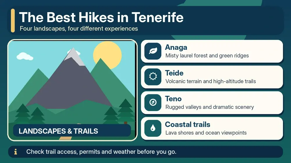
    Tenerife is a hiking destination disguised as a beach island. Within one trip you can walk through humid laurel forest, traverse volcanic highlands, follow pine-covered ridges and descend toward black-sand coves. The variety is exceptional, but so is the range of difficulty. A route that looks short on a map can involve steep elevation change, exposed terrain or regulated access.

    This guide is not a substitute for current trail information. Conditions, closures and reservation rules can change. I use it to decide which landscape I want to explore, then I verify the exact route on Tenerife ON and other official sources before setting out.

    Anaga Rural Park: laurel forest and dramatic ridges

    Anaga in northeastern Tenerife is the place I would choose for lush forest and atmospheric mountain scenery. Trade-wind moisture supports ancient laurel forest, and roads climb through cloud before opening onto ridge and coast views. The contrast with southern Tenerife is remarkable.

    For a first Anaga day, I prefer a short or moderate marked walk combined with viewpoints and La Laguna. Some trail areas have access controls, and weather can make paths slippery. Mist is part of the experience but can reduce visibility and make navigation more serious than the trail description suggests.

    Teide National Park: volcanic high-altitude hiking

    Teide is the island’s most iconic hiking environment and the one that deserves the most respect. Altitude, sun, cold, wind and terrain can all affect the same route. Several high-mountain paths have reservation requirements, and Trail 10 Telesforo Bravo to the summit is specifically controlled.

    View Of Mount Teide From Pine Forest Tenerife

    Do not choose a Teide hike solely from a social-media photo. Read current regulations, required equipment and route difficulty on Tenerife ON. My separate Mount Teide guide explains the cable car, summit access and altitude in more detail.

    Roques de García: accessible volcanic scenery

    If you want volcanic walking without a summit objective, the Roques de García area is one of the best introductions. The landscape is open, dry and highly exposed to sun, with views across the Teide caldera. Even relatively easy routes here feel very different from coastal walks.

    I bring more water than I think I need and start earlier on hot days. There is limited natural shade, and the high altitude can make exertion feel harder. This is an example of a walk where ‘not technical’ does not mean ‘effortless’.

    Teno Rural Park: rugged western Tenerife

    Teno offers steep ravines, remote hamlets and some of the island’s most dramatic relief. Masca is the name most travellers know, but Teno is larger than one gorge. Roads themselves can be part of the challenge, with bends, elevation and limited stopping places.

    The Masca route has had controlled access and transport arrangements, so never arrive expecting to hike simply because you saw an old itinerary. Verify the current system and permitted direction of travel. If reservations are unavailable, enjoy Teno’s viewpoints and villages without trying to improvise an unofficial alternative.

    Masca Village And Gorge Tenerife

    Coastal walking around El Médano and Montaña Roja

    For a lower-altitude option, the Montaña Roja area near El Médano combines volcanic terrain, sea views and a very different feel from Anaga. Wind is a defining feature. The walk may be easier logistically than a high-mountain route, but exposure to sun and wind still requires preparation.

    This is one of my favourite types of ‘travel day’ walk because it can fit around a beach or lunch in El Médano without taking over the entire itinerary.

    Pine forest walks

    Tenerife’s Canarian pine forest creates another distinct hiking environment between the coast and high volcanic zone. Trails around the upper slopes can offer shade, fragrant forest and occasional viewpoints toward Teide or the ocean. After the stark national park, the forest feels almost like a separate island.

    Fire risk and temporary closures matter here. Follow current restrictions, never light fires outside permitted conditions and do not assume a track is open because it appears in an old GPS file.

    How I choose a Tenerife hike

    QuestionWhy it matters
    What altitude?Changes temperature, oxygen and exposure
    How much ascent/descent?Distance alone can be misleading
    Is access regulated?Some routes require reservations
    What is the weather on that side?North, south and summit can differ
    How will I return?Linear routes may need transport planning
    When does darkness fall?Mountain roads and trails take longer than expected

    I compare elevation profile and terrain before distance. Ten kilometres on a coastal promenade is not the same as ten kilometres in Anaga or above 2,000 metres. If the route is near the limit of my ability, I choose a shorter alternative rather than hoping motivation will compensate for terrain.

    Reservations and trail closures

    Tenerife has expanded reservation and control systems in popular natural areas. These measures can protect fragile environments and improve safety, but they mean old blog posts become outdated quickly. Before every significant hike, check official information close to the date, not only when you book the flight.

    For high-altitude Teide routes, official resolutions specify mandatory reservations for certain paths and can require particular clothing or equipment. Access can also close because of snow, ice, fire risk or maintenance. A reservation does not override a closure.

    What I carry on Tenerife hikes

    • More water than a city walk would require
    • Sun protection even under cloud
    • Layered clothing; a windproof layer for exposed areas
    • Proper walking shoes with grip
    • Charged phone plus offline map
    • Small first-aid kit
    • Food appropriate to the route length
    • Identification and permit/reservation when required
    • Headlamp on longer mountain days, especially where regulations require it

    Weather: why Tenerife hikers need flexibility

    The south can be bright while Anaga is inside cloud, and the coast can be warm while Teide is cold. That microclimate is one of Tenerife’s beauties and one of its planning challenges. I keep at least one hiking day movable and avoid booking every restaurant or attraction around it.

    For seasonal conditions, see the best time to visit Tenerife guide. Official tourism information confirms the broad pattern: the north is generally more humid and the south sunnier, while high elevations have true mountain conditions.

    Hiking without a car

    Some trail areas can be reached by bus, and linear hikes can sometimes be easier when public transport solves the return problem. But timetables must be checked carefully. In remote areas I do not build a plan around the final bus of the day without a backup.

    Guided hiking is worth considering for high mountain routes, unfamiliar terrain or travellers who want local interpretation rather than navigation responsibility. My transport guide covers the broader car-versus-bus decision.

    Hiking with children

    With children, I choose short routes that deliver scenery quickly. Forest paths, volcanic viewpoints and easy coastal walks can be more successful than a famous route with hours of ascent. I avoid exposed edges and high-altitude objectives that require adult-level stamina or complicated permits.

    Volcanic Landscape Near Mount Teide Tenerife

    The family guide, Tenerife with kids, explains how I balance nature days with easier beach days.

    Leave no trace in volcanic and forest landscapes

    Stay on marked routes, do not remove rocks or plants, carry out all rubbish and respect barriers even when a shortcut is visible. Volcanic soils and endemic vegetation can be more fragile than they look. In popular areas, stepping around other walkers to create a parallel path gradually widens erosion.

    Three hiking styles for a first trip

    1. Forest: choose an Anaga walk with a realistic distance and current access information.
    2. Volcanic: walk around Teide National Park without making the summit compulsory.
    3. Coastal: add a lower-altitude route such as Montaña Roja or another signed coastal walk.

    Those three experiences show Tenerife’s range without requiring every day to be a major expedition. Add Teno only if you have enough time and are comfortable with the current access system.

    My biggest hiking mistake to avoid

    Do not confuse popularity with suitability. The route that appears most often online may be full, closed, beyond your fitness or simply wrong for that day’s weather. Tenerife has enough landscapes that changing route is not a failure; it is good mountain judgment.

    For a first week, I would combine one Anaga walk and one Teide-area walk, then use the rest of the trip for beaches, towns and food. That balance lets hiking deepen your experience of Tenerife instead of turning the entire holiday into a series of early alarms and sore legs.

    Illustrated guide: Best Hikes in Tenerife, with practical visitor tips
    Illustrated guide: Best Hikes in Tenerife.

    Route planning the night before

    • Check the official access status and reservation conditions.
    • Look at wind, temperature and precipitation for the actual altitude.
    • Confirm sunset time and realistic driving time back to your base.
    • Download the route offline and tell someone where you are going.
    • Carry enough water even if a café appears on an old map.
    • Choose a shorter backup route in the same area.

    Why turning around is part of hiking

    Cloud, wind, heat, fatigue or a closed section can make the original plan a bad idea. Turning around early is not a failed hike. Tenerife offers so many alternative landscapes that conservative decisions rarely ruin a holiday. The objective is to return safely with enough energy to enjoy the next day.

  • Mount Teide Guide: Cable Car, Permits, Hiking and Practical Tips

    Mount Teide Guide: Cable Car, Permits, Hiking and Practical Tips

    Mount Teide dominates Tenerife physically and visually, but visiting it well takes more planning than simply driving toward the highest point on the island. The national park sits at high altitude, the weather can be completely different from the coast, parking and access can be busy, cable-car operation depends on conditions, and some trails require advance reservations. I treat a Teide day as a mountain excursion, even when the plan is mostly sightseeing.

    This guide explains how I would organise a first visit: the scenic drive, the best type of stops, cable car versus hiking, summit permits, clothing, altitude, children and the mistakes that can turn an extraordinary day into a stressful one.

    Why Teide deserves a full day

    Teide is Spain’s highest mountain and the centrepiece of a volcanic landscape that feels far removed from Tenerife’s beaches. The experience starts before you reach the cable car. Roads climb through changing vegetation, pine forest and eventually open high-altitude terrain. Once inside the caldera, wide lava fields, layered rock and the cone of Teide create views that change constantly with light and cloud.

    I would resist the temptation to schedule only a cable-car time and then drive back to the coast. The national park itself is the attraction. Scenic stops around Roques de García, viewpoints along the TF-21 and TF-24, and the contrast between different lava formations deserve time.

    How to reach Teide National Park

    Most independent visitors arrive by car from the south through Vilaflor or from the north through La Orotava, while the TF-24 route from the northeast can be especially scenic. Which road is best depends on your starting point and current conditions. Do not assume the fastest route in a navigation app will be the most enjoyable; on a first visit I often prefer to enter one way and leave another if daylight and weather allow.

    Public transport options exist but are more restrictive because schedules determine how long you can stay. If you are not comfortable with mountain driving, an organised excursion can be a sensible alternative. Whatever your transport choice, check official road, weather and park information before departure.

    Teide cable car: what it actually gives you

    The official cable car runs from a base station at roughly 2,356 metres to the upper station at La Rambleta, around 3,555 metres. The ride is short, but the altitude gain is huge. From the upper station, visitors can enjoy high-level viewpoints and permitted trails depending on current conditions. Reaching the upper station does not automatically mean you can walk to the summit.

    Teide Cable Car Tenerife

    The operator sells timed tickets online and warns that operation can be interrupted by weather, particularly wind. I would book in advance during busy periods but keep the wider day flexible. Do not build a flight, ferry or non-refundable evening event around the assumption that the cable car will operate exactly as planned.

    Check the current timetable and ticket conditions on the official Teide Cable Car website.

    Do you need a permit for the summit?

    Yes, access rules matter. The final route to the summit, Trail 10 Telesforo Bravo, is controlled and requires specific authorisation. In addition, Tenerife introduced reservation requirements for several high-altitude routes used by people ascending on foot toward La Rambleta. Rules, quotas and required equipment can change, so I would never rely on an old travel blog for this part of the trip.

    Before choosing a hiking plan, check Tenerife ON and the current National Park reservation system. Carry the required identification and confirmation, and read the equipment requirements attached to your specific route. A reservation is not just bureaucracy: the upper mountain can expose visitors to cold, wind, strong sun and difficult terrain.

    Cable car or hiking?

    OptionBest forMain consideration
    Scenic drive onlyMost visitorsNo altitude commitment beyond viewpoints
    Cable carBig views with less physical effortWeather-dependent; high altitude
    High-mountain hikeExperienced hikersReservations, equipment and fitness
    Guided experienceVisitors wanting structureHigher cost but simpler logistics

    There is no need to hike the summit to have a meaningful Teide experience. For many travellers, the scenic drive, Roques de García and a cable-car ride are more than enough. Hikers should choose a route because they are prepared for it, not because reaching the summit sounds like a box that must be ticked.

    Altitude: the part many visitors underestimate

    The upper cable-car station is above 3,500 metres. Even fit travellers can notice the altitude: breathlessness, headache, light-headedness or unusual fatigue. Walk slowly, avoid racing up steps for photographs and pay attention to how you feel. People with health concerns should seek appropriate medical advice before high-altitude activity.

    Children are another reason to plan carefully. The cable-car operator applies age and health restrictions to certain products and activities, and mountain conditions are not comparable with a beach excursion. For a family trip, I prefer a shorter, flexible Teide visit rather than trying to reproduce an adult hiking itinerary. More ideas are in my Tenerife with kids guide.

    Mount Teide Cable Car Tenerife

    What to wear and carry

    I always plan Teide clothing as if I am visiting a mountain in a different season from the coast. A warm or windproof layer, closed footwear, water, sunglasses and high-SPF sunscreen are basic items. If your reservation specifies technical equipment, that requirement overrides any generic packing list. Winter conditions can include ice or snow at altitude even when people are swimming on the coast.

    • Water and a snack, even for a mostly sightseeing day
    • Warm layer and wind protection
    • Sun protection: hat, sunglasses and sunscreen
    • Closed shoes with good grip
    • Phone with battery; offline maps are useful
    • Permit/reservation and identification when required
    • Any route-specific mandatory mountain equipment

    Roques de García and easy sightseeing

    Roques de García is one of the easiest ways to appreciate Teide’s geology without committing to the summit. The viewpoint area gives wide views of the caldera and distinctive rock formations. It can become crowded, so early or later daylight often creates a more pleasant experience. Even a short walk here can involve strong sun and uneven ground, so I would still carry water and proper shoes.

    If the cable car is closed, do not consider the day ruined. This is exactly why I build the itinerary around the landscape rather than one piece of infrastructure. Scenic viewpoints, short accessible stops and the drive itself can still make Teide one of the best days of the trip.

    Mount Teide Landscape Tenerife

    Sunset and stargazing

    Teide’s altitude and dark skies make the highlands attractive around sunset and after dark. The temperature drops quickly, traffic patterns change and you need to be more conservative with driving and walking. If stargazing is a priority, a guided experience can reduce the stress of choosing a safe location and understanding access rules.

    I would not combine a demanding high-altitude hike, sunset and a long night drive unless everyone in the group is comfortable with that schedule. It is better to choose the main goal of the day and leave enough energy for the descent.

    Best time of day

    There is no universal best hour because clouds, wind, season and reservations matter. Early starts can reduce crowds at popular stops, while later light can be beautiful for photography. Midday can be intensely bright. In winter, daylight is shorter and mountain conditions deserve extra attention. I check conditions the evening before and again in the morning rather than locking the plan weeks in advance beyond the reservations I actually need.

    Driving and parking strategy

    Parking around popular Teide stops is finite. Arrive with patience and never create your own parking space on protected ground or in unsafe road areas. If a viewpoint is full, continue to another legal stop and return later. On the way down, use lower gears where appropriate and do not let the scenery distract from mountain driving.

    If you are deciding whether to rent a car mainly for this day, read my getting around Tenerife guide. A car offers excellent freedom in the park, but only if the driver is comfortable with long climbs, bends and changing visibility.

    A Teide day I would recommend for a first visit

    1. Leave the coast after checking weather, road and cable-car status.
    2. Climb through a scenic route and stop at one or two legal viewpoints rather than every turnout.
    3. Spend time around the national park landscape before your booked cable-car slot.
    4. Use the cable car if operating and suitable for your group; follow only the trails allowed by your booking and current conditions.
    5. After descending, visit Roques de García or another major viewpoint.
    6. Return by a different route if practical and if you have enough daylight.
    7. Keep the evening light: altitude and driving can make the day more tiring than expected.

    Common mistakes I would avoid

    • Assuming the coast forecast describes Teide conditions
    • Buying a cable-car ticket and assuming it includes summit access
    • Arriving without the reservation or equipment required for a high-altitude trail
    • Wearing sandals because the day started at the beach
    • Planning too many attractions after Teide
    • Ignoring signs of altitude discomfort
    • Parking illegally when popular viewpoints are full

    How Teide fits into a Tenerife itinerary

    I normally place Teide near the start of a week-long trip but not on the first morning after a late flight. That leaves room to move the day if conditions are poor. In my 7-day Tenerife itinerary, the mountain is a major day rather than a short stop between unrelated attractions.

    The best Teide visit is not necessarily the one that reaches the highest point. It is the one that matches your fitness, reservations and weather while giving you time to understand the extraordinary volcanic landscape around you. Plan conservatively, use official information and let the mountain—not a checklist—set the pace.