Category: Food & Culture

Tenerife food, Canarian dishes, wine, markets and cultural experiences for curious travellers.

  • Casa Palacio de los Condes de La Gomera Garachico Guide: Casa de Piedra and 1706 Restoration

    Casa Palacio de los Condes de La Gomera Garachico Guide: Casa de Piedra and 1706 Restoration

    Casa Palacio de los Condes de La Gomera is a useful stop for travellers who want to understand Tenerife beyond beaches and headline attractions. I would not cross the whole island only for this one place, but I would absolutely use it to add historical and local context to a day in Garachico.

    In this guide I separate documented facts from practical planning. Dates, dimensions, artistic details and historical associations come from official tourism or municipal heritage sources. My suggestions about timing, route order, photography and combinations are travel-planning advice. I avoid inventing fixed opening hours, prices or guaranteed access when current official information is uncertain.

    At a glance

    PlaceCasa Palacio de los Condes de La Gomera
    WhereFrancisco Montesdeoca y García, 1, 38460 Garachico
    Best forstone architecture, volcanic-history context and old-town photography
    Time to allow15–30 minutes as part of a historic-centre walk
    Planning ruleCombine it with nearby sights, verify current access and keep the route flexible.

    Why I would include Casa Palacio de los Condes de La Gomera in a Tenerife itinerary

    One of the easiest mistakes on Tenerife is to jump from one major attraction to another without understanding the towns between them. Places like Casa Palacio de los Condes de La Gomera slow the trip down in a useful way. They show how local history, religion, trade, architecture, geology or landscape developed at the level of an individual community.

    I also value stops that work inside a compact cluster. In Garachico, I can usually combine several worthwhile places without repeated driving. That gives me more time to notice details, stop for coffee, change plans if access is closed and still finish the day without feeling that I have been chasing a checklist.

    My rule is simple: a small site earns its place when it helps explain the destination. I would rather spend thirty attentive minutes somewhere meaningful than add three generic viewpoints just to increase the number of stops.

    What the official record confirms

    • The palace is also known as Casa de Piedra, or the Stone House.
    • Its ashlar-stone façade is the feature highlighted by the official tourism description.
    • The building was commissioned between the 16th and 17th centuries.
    • It required restoration after Garachico’s volcanic eruption of 1706.

    Why “Casa de Piedra” is the clue to what to notice

    The official heritage description singles out the building’s stone façade, which explains the alternative name Casa de Piedra. In a town where whitewashed walls, timber and volcanic stone often work together, an imposing ashlar façade immediately communicates status and craftsmanship. I would spend a few minutes looking at proportions, masonry joints, openings and the way the façade meets the street rather than taking a single front-on photograph and moving on.

    Stonework also makes a useful comparison with nearby religious buildings and defensive architecture. The same volcanic island supplied materials for homes, churches, fortifications and infrastructure, but the level of finish and the social meaning varied. That is why I like architectural walks in Garachico: the town is compact enough to compare materials directly rather than reading about them in abstraction.

    A building that survived through restoration rather than untouched preservation

    Tourism de Tenerife says the palace was commissioned between the sixteenth and seventeenth centuries and restored after the 1706 eruption. That distinction matters. I do not describe it as a perfectly intact pre-eruption house, because the volcanic disaster became part of the building’s physical history. Restoration is not a footnote here; it is evidence of the decision to rebuild a town whose economic centre had been transformed.

    When I later walk toward the lava-shaped coast, the connection becomes clearer. The eruption did not erase every monument, nor did every surviving building remain unchanged. Garachico is a patchwork of survival, repair, reconstruction and new uses. Casa de Piedra is a concise example of that process and makes the famous eruption story less simplistic.

    The best way to photograph and contextualise the palace

    Narrow streets can make monumental façades difficult to photograph symmetrically. I prefer a slightly angled composition that includes paving, neighbouring buildings and some sense of scale. Early or late light can soften contrast on the stone, but I would not delay an entire itinerary for perfect conditions. The most useful image is the one that shows how the palace belongs to the street.

    I then connect the stop with Casa de los Molinos and the waterfront. One explains elite architecture, another everyday technology and the coast explains the volcanic turning point. Together they produce a more balanced picture of Garachico than a route focused only on churches or natural pools.

    What to combine with it nearby

    I would build the visit around nearby pages already covered on this site rather than create an isolated detour. Good combinations include Mirador de Garachico, El Caletón, Casa de los Molinos. For a broader planning option, I also keep Isla Baja guide in the same cluster.

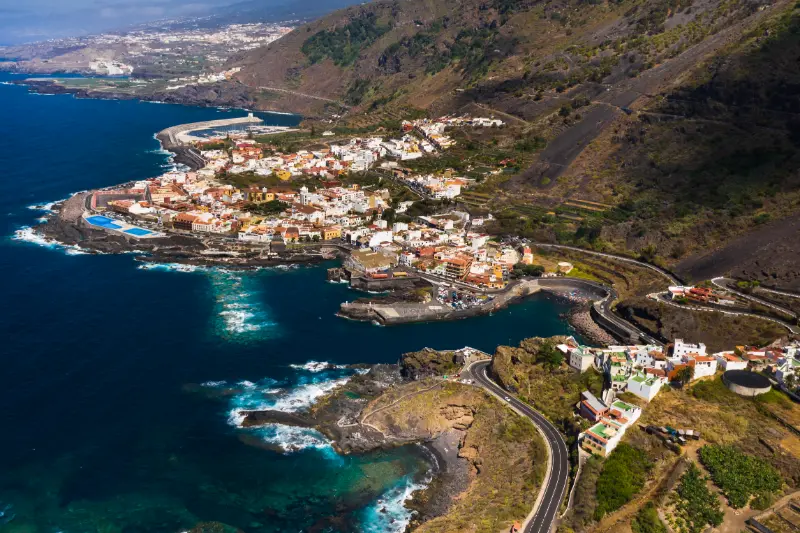
    Garachico Coast Aerial View Tenerife

    How I plan the visit

    I start by deciding whether Casa Palacio de los Condes de La Gomera is the anchor of the outing or a supporting stop. For a small heritage or nature site, the second option is usually better. I allow enough time to read information, look at details and take a few photographs, but I do not turn a short visit into half a day simply because the itinerary has empty space.

    I then check the official source shortly before travelling. Religious services, conservation work, local events, sea conditions, trail restrictions, seasonal timetables or staffing can change access. If one element is unavailable, I want the surrounding route to remain worthwhile.

    1. Start with the most time-sensitive stop, such as a museum, church interior or safe coastal window.
    2. Continue on foot to exterior heritage, public squares, paths or viewpoints.
    3. Keep lunch or coffee flexible so a delay does not break the itinerary.
    4. Leave the final stop optional, especially if traffic, weather or a local event changes the pace.

    This style of planning works particularly well in Tenerife’s northern towns. Short map distances can hide steep streets, difficult parking, wet paths or strong Atlantic conditions, while a compact regional loop often reveals much more than several rushed car stops.

    How I read the history without oversimplifying it

    Heritage sites often mix documented facts, later restoration, local tradition and popular legend. I try to keep those layers separate. A date recorded by an official heritage inventory is not the same kind of evidence as a story passed through generations, even though both can be valuable for understanding the place.

    I also avoid treating Tenerife’s colonial period as a neutral backdrop. Conquest, Indigenous Guanche history, Atlantic trade, migration, agriculture and religious institutions all shaped the island. Where one of those themes is relevant to Casa Palacio de los Condes de La Gomera, I name it directly rather than reducing the story to decorative architecture.

    What I look for on site

    Before reaching for my phone, I look at materials and relationships: volcanic stone, timber, limewashed walls, ironwork, paving, water channels, old trees, surf patterns or the way a building faces a square. These details usually tell me more than a single façade photograph.

    I also pay attention to later changes. Historic places are rarely frozen in one century. Fires, floods, new roads, restorations, changing religious use, domestic water systems and civic adaptation can all become part of the story. I find a place more interesting when I can see those layers rather than searching for an imaginary “original” version.

    Getting there and moving around

    For Garachico, I compare driving with public transport according to the rest of the day. A car is helpful when I am continuing to rural viewpoints or another municipality, but it can be inconvenient in older streets with limited parking. If I am concentrating on a historic centre or marked coastal area, I prefer to park once and walk.

    TITSA serves the main towns and tourist areas of Tenerife. I check the current journey planner instead of hard-coding a bus number into an evergreen article, because routes and stops can change. Travellers with a pushchair, luggage or limited mobility should also inspect the final approach: gradients, cobbles, steps and natural rock often matter more than the intercity journey.

    Best time of day

    For architecture and street photography, morning or late afternoon usually gives softer light. For a church or museum, access arrangements matter more than the angle of the sun. For beaches, natural pools and exposed paths, tide, swell, wind and rain matter more than a fixed clock time.

    Garachico Coast And Natural Pools Tenerife

    Weekends, feast days and local events can transform a quiet place into a busy community space. That can be a highlight if I want atmosphere, but it can also affect parking and access. I check local notices when travelling around major religious, municipal or coastal events.

    Practical tips that make the stop better

    Comfortable shoes are my default even for short visits. Historic paving can be uneven, north-Tenerife towns often have steeper streets than a map suggests and volcanic coastal rock can be slippery. I carry water and a light layer because cloud, breeze and sun can change quickly across short distances.

    I do not assume that a public-looking heritage building has toilets, step-free access or continuous opening. Travellers who need specific accessibility features should verify them directly with the venue or municipality. At natural sites I also check whether the final approach is suitable for the whole group.

    For churches and devotional spaces, I dress respectfully and keep noise low. For schools or working cultural sites, I follow access instructions. On beaches, pools and protected volcanic terrain, I stay within legal access and never treat calm-looking water as proof that swimming is safe.

    Photography without missing the place itself

    I take one wide establishing image, then look for details: stonework, wood, metal, inscriptions, paving, water infrastructure, vegetation or the relationship between geology and human use. That produces a more useful visual record than ten almost identical front-on photographs.

    I never assume drone use is legal simply because a place looks quiet. Tenerife has controlled airspace, protected areas and populated zones. A travel guide cannot replace current aviation rules or local restrictions.

    Where to eat and how I fit meals into the route

    I prefer eating near the area I am already exploring instead of driving across the island for a single restaurant. In Garachico, that might mean a café in the historic centre, a traditional Canarian lunch or a longer meal after the walking portion of the day. I check recent opening information because weekly closing days and kitchen hours change.

    Garachico Historic Town Tenerife

    Local food makes more sense when connected to the place: papas arrugadas, mojo, gofio, cheeses, fish and Tenerife wines all reflect agriculture, trade and everyday island life. I would rather choose a simple meal that fits the route than interrupt the day for a famous restaurant far away.

    Where to stay

    If I want to explore this part of Tenerife over more than one day, I compare current accommodation on Booking.com. I pay attention to the exact map position, parking, elevation and recent guest comments rather than relying only on the property name.

    For a first visit, I choose a base according to the majority of the itinerary. A good location saves more time over a week than staying next to one small attraction that I will visit only once.

    Activities and tours

    A heritage or nature stop can pair well with one organised experience elsewhere on the island. I use the widget below to compare current options, but I avoid stacking a long excursion immediately before or after a dense driving day.

    Who will enjoy this stop most?

    Casa Palacio de los Condes de La Gomera is best for travellers who enjoy context rather than only headline attractions. Couples and solo travellers can fold it into a slow regional day; families can use it as a short educational stop when access and terrain are suitable; repeat visitors may appreciate it because it reveals a layer of Tenerife that is easy to miss on a first trip.

    It may be less useful for someone with only a few hours on the island who is still trying to prioritise Teide, Anaga or a major beach. I would rather say that clearly than label every place a “must-see”. A good guide should help readers decide what fits their interests.

    Common mistakes I would avoid

    • Driving across Tenerife only for this single stop without combining it with the surrounding area.
    • Assuming old opening hours, trail information or sea conditions are still valid.
    • Underestimating gradients, parking limitations, wet rock or narrow historic streets.
    • Treating local legends as proven history without saying they are traditions.
    • Ignoring services, worship, school security, safety signs, closures or private boundaries because a place appears visitor-oriented.

    Frequently asked questions

    Why is the palace called Casa de Piedra?

    The nickname refers to its prominent stone or ashlar façade, highlighted by the official tourism description.

    How old is the building?

    It was commissioned between the 16th and 17th centuries.

    Did the 1706 eruption affect it?

    Yes. Official information states that the palace had to be restored after the eruption.

    How long do I need?

    For an exterior heritage stop, 15–30 minutes is usually enough before continuing through the historic centre.

    Official information

    For the documented background used in this guide and for any current operational information, I check the official visitor or heritage information for Casa Palacio de los Condes de La Gomera shortly before travelling. Same-day signs, staff instructions, parish notices, municipal updates, sea warnings and safety restrictions always take priority over an evergreen article.

    Final thoughts

    I would include Casa Palacio de los Condes de La Gomera when it strengthens the story of a day in Garachico. Its value is not measured by how many hours it occupies. A short stop can be meaningful when it explains architecture, faith, trade, geology, water, landscape or everyday life.

    My preferred approach is simple: know the key facts before arriving, stay flexible about access, respect the place as part of local life and connect it with nearby sights. Done that way, it becomes one more piece of a Tenerife itinerary that feels coherent rather than crowded.

  • Casa del Marqués de la Quinta Roja Garachico Guide: Noble House and Rural Hotel

    Casa del Marqués de la Quinta Roja Garachico Guide: Noble House and Rural Hotel

    Casa del Marqués de la Quinta Roja is a useful stop for travellers who want to understand Tenerife beyond beaches and headline attractions. I would not cross the whole island only for this one place, but I would absolutely use it to add historical and local context to a day in Garachico.

    In this guide I separate documented facts from practical planning. Dates, dimensions, artistic details and historical associations come from official tourism or municipal heritage sources. My suggestions about timing, route order, photography and combinations are travel-planning advice. I avoid inventing fixed opening hours, prices or guaranteed access when current official information is uncertain.

    At a glance

    PlaceCasa del Marqués de la Quinta Roja
    WhereGlorieta San Francisco, 38450 Garachico
    Best fornoble architecture, Franciscan history and a compact Garachico heritage route
    Time to allow15–30 minutes from the public exterior unless current hotel access applies
    Planning ruleCombine it with nearby sights, verify current access and keep the route flexible.

    Why I would include Casa del Marqués de la Quinta Roja in a Tenerife itinerary

    One of the easiest mistakes on Tenerife is to jump from one major attraction to another without understanding the towns between them. Places like Casa del Marqués de la Quinta Roja slow the trip down in a useful way. They show how local history, religion, trade, architecture, geology or landscape developed at the level of an individual community.

    I also value stops that work inside a compact cluster. In Garachico, I can usually combine several worthwhile places without repeated driving. That gives me more time to notice details, stop for coffee, change plans if access is closed and still finish the day without feeling that I have been chasing a checklist.

    My rule is simple: a small site earns its place when it helps explain the destination. I would rather spend thirty attentive minutes somewhere meaningful than add three generic viewpoints just to increase the number of stops.

    What the official record confirms

    • Official tourism information dates the origins of the building to the late 16th century.
    • It was rebuilt in the 17th century by the first Marqués de la Quinta Roja.
    • The house served as temporary accommodation for Franciscan nuns.
    • Today the historic property functions as a rural hotel.

    A house whose story crosses nobility and religious life

    The Casa del Marqués de la Quinta Roja is useful because its history is not confined to one social role. Tourism de Tenerife places its origins in the late sixteenth century and notes a seventeenth-century rebuilding by the first marquis. It also records that Franciscan nuns used the property as temporary accommodation. In a few facts, the building therefore links elite domestic life with the religious institutions that were deeply embedded in Garachico’s early-modern society.

    I would not try to turn those facts into a romantic story about aristocratic life without evidence. What I can say is that the property’s changing uses reveal how adaptable large houses were. They were residences, symbols of status, emergency or temporary spaces and, in the present, part of the tourism economy. That sequence is more interesting to me than treating the building as a frozen noble mansion.

    Why the location near San Francisco matters

    The Glorieta San Francisco setting makes this an easy stop inside one of Garachico’s most coherent heritage clusters. Within a short walk I can connect convent architecture, civic space, noble houses and the commercial streets leading toward the old port. This is exactly the kind of place where walking is more informative than driving from monument to monument.

    I would approach the house after visiting the former Franciscan complex or Plaza de la Libertad, then continue toward Puerta de Tierra or the waterfront. The short distances make it possible to read how institutions and elite residences were positioned relative to one another. Even if the interior is not available, the building still contributes to the streetscape and to the story of how Garachico rebuilt and adapted over centuries.

    Present-day hotel use: what that means for visitors

    The official page says the property now operates as a rural hotel. That makes current access dependent on the business rather than on museum-style public opening hours. I never assume that a heritage listing gives me the right to enter guest areas. If I am not staying or using a public service, I am content to appreciate the exterior and the surrounding urban context.

    For travellers choosing accommodation, staying in a historic building can be a way to experience the centre after day visitors leave. I still compare practical factors such as parking, stairs, noise, air conditioning and accessibility because old architecture can impose compromises. Heritage character is a benefit only when it fits the way I actually travel.

    What to combine with it nearby

    I would build the visit around nearby pages already covered on this site rather than create an isolated detour. Good combinations include Mirador de Garachico, El Caletón, Casa de los Ponte. For a broader planning option, I also keep Isla Baja guide in the same cluster.

    Aerial View Of Garachico Tenerife

    How I plan the visit

    I start by deciding whether Casa del Marqués de la Quinta Roja is the anchor of the outing or a supporting stop. For a small heritage or nature site, the second option is usually better. I allow enough time to read information, look at details and take a few photographs, but I do not turn a short visit into half a day simply because the itinerary has empty space.

    I then check the official source shortly before travelling. Religious services, conservation work, local events, sea conditions, trail restrictions, seasonal timetables or staffing can change access. If one element is unavailable, I want the surrounding route to remain worthwhile.

    1. Start with the most time-sensitive stop, such as a museum, church interior or safe coastal window.
    2. Continue on foot to exterior heritage, public squares, paths or viewpoints.
    3. Keep lunch or coffee flexible so a delay does not break the itinerary.
    4. Leave the final stop optional, especially if traffic, weather or a local event changes the pace.

    This style of planning works particularly well in Tenerife’s northern towns. Short map distances can hide steep streets, difficult parking, wet paths or strong Atlantic conditions, while a compact regional loop often reveals much more than several rushed car stops.

    How I read the history without oversimplifying it

    Heritage sites often mix documented facts, later restoration, local tradition and popular legend. I try to keep those layers separate. A date recorded by an official heritage inventory is not the same kind of evidence as a story passed through generations, even though both can be valuable for understanding the place.

    I also avoid treating Tenerife’s colonial period as a neutral backdrop. Conquest, Indigenous Guanche history, Atlantic trade, migration, agriculture and religious institutions all shaped the island. Where one of those themes is relevant to Casa del Marqués de la Quinta Roja, I name it directly rather than reducing the story to decorative architecture.

    What I look for on site

    Before reaching for my phone, I look at materials and relationships: volcanic stone, timber, limewashed walls, ironwork, paving, water channels, old trees, surf patterns or the way a building faces a square. These details usually tell me more than a single façade photograph.

    I also pay attention to later changes. Historic places are rarely frozen in one century. Fires, floods, new roads, restorations, changing religious use, domestic water systems and civic adaptation can all become part of the story. I find a place more interesting when I can see those layers rather than searching for an imaginary “original” version.

    Getting there and moving around

    For Garachico, I compare driving with public transport according to the rest of the day. A car is helpful when I am continuing to rural viewpoints or another municipality, but it can be inconvenient in older streets with limited parking. If I am concentrating on a historic centre or marked coastal area, I prefer to park once and walk.

    Garachico Coast Aerial View Tenerife

    TITSA serves the main towns and tourist areas of Tenerife. I check the current journey planner instead of hard-coding a bus number into an evergreen article, because routes and stops can change. Travellers with a pushchair, luggage or limited mobility should also inspect the final approach: gradients, cobbles, steps and natural rock often matter more than the intercity journey.

    Best time of day

    For architecture and street photography, morning or late afternoon usually gives softer light. For a church or museum, access arrangements matter more than the angle of the sun. For beaches, natural pools and exposed paths, tide, swell, wind and rain matter more than a fixed clock time.

    Weekends, feast days and local events can transform a quiet place into a busy community space. That can be a highlight if I want atmosphere, but it can also affect parking and access. I check local notices when travelling around major religious, municipal or coastal events.

    Practical tips that make the stop better

    Comfortable shoes are my default even for short visits. Historic paving can be uneven, north-Tenerife towns often have steeper streets than a map suggests and volcanic coastal rock can be slippery. I carry water and a light layer because cloud, breeze and sun can change quickly across short distances.

    I do not assume that a public-looking heritage building has toilets, step-free access or continuous opening. Travellers who need specific accessibility features should verify them directly with the venue or municipality. At natural sites I also check whether the final approach is suitable for the whole group.

    For churches and devotional spaces, I dress respectfully and keep noise low. For schools or working cultural sites, I follow access instructions. On beaches, pools and protected volcanic terrain, I stay within legal access and never treat calm-looking water as proof that swimming is safe.

    Photography without missing the place itself

    I take one wide establishing image, then look for details: stonework, wood, metal, inscriptions, paving, water infrastructure, vegetation or the relationship between geology and human use. That produces a more useful visual record than ten almost identical front-on photographs.

    I never assume drone use is legal simply because a place looks quiet. Tenerife has controlled airspace, protected areas and populated zones. A travel guide cannot replace current aviation rules or local restrictions.

    Where to eat and how I fit meals into the route

    I prefer eating near the area I am already exploring instead of driving across the island for a single restaurant. In Garachico, that might mean a café in the historic centre, a traditional Canarian lunch or a longer meal after the walking portion of the day. I check recent opening information because weekly closing days and kitchen hours change.

    Garachico Coast And Natural Pools Tenerife

    Local food makes more sense when connected to the place: papas arrugadas, mojo, gofio, cheeses, fish and Tenerife wines all reflect agriculture, trade and everyday island life. I would rather choose a simple meal that fits the route than interrupt the day for a famous restaurant far away.

    Where to stay

    If I want to explore this part of Tenerife over more than one day, I compare current accommodation on Booking.com. I pay attention to the exact map position, parking, elevation and recent guest comments rather than relying only on the property name.

    For a first visit, I choose a base according to the majority of the itinerary. A good location saves more time over a week than staying next to one small attraction that I will visit only once.

    Activities and tours

    A heritage or nature stop can pair well with one organised experience elsewhere on the island. I use the widget below to compare current options, but I avoid stacking a long excursion immediately before or after a dense driving day.

    Who will enjoy this stop most?

    Casa del Marqués de la Quinta Roja is best for travellers who enjoy context rather than only headline attractions. Couples and solo travellers can fold it into a slow regional day; families can use it as a short educational stop when access and terrain are suitable; repeat visitors may appreciate it because it reveals a layer of Tenerife that is easy to miss on a first trip.

    It may be less useful for someone with only a few hours on the island who is still trying to prioritise Teide, Anaga or a major beach. I would rather say that clearly than label every place a “must-see”. A good guide should help readers decide what fits their interests.

    Common mistakes I would avoid

    • Driving across Tenerife only for this single stop without combining it with the surrounding area.
    • Assuming old opening hours, trail information or sea conditions are still valid.
    • Underestimating gradients, parking limitations, wet rock or narrow historic streets.
    • Treating local legends as proven history without saying they are traditions.
    • Ignoring services, worship, school security, safety signs, closures or private boundaries because a place appears visitor-oriented.

    Frequently asked questions

    When was Casa del Marqués de la Quinta Roja built?

    Its origins are in the late 16th century, with a 17th-century rebuilding by the first marquis according to official tourism information.

    What connection does it have with Franciscan nuns?

    The official heritage description says the house served as temporary accommodation for Franciscan nuns.

    What is the building used for today?

    It currently functions as a rural hotel.

    Can I include it in a walking tour?

    Yes. Its central location near San Francisco makes it easy to combine with several major Garachico heritage stops.

    Official information

    For the documented background used in this guide and for any current operational information, I check the official visitor or heritage information for Casa del Marqués de la Quinta Roja shortly before travelling. Same-day signs, staff instructions, parish notices, municipal updates, sea warnings and safety restrictions always take priority over an evergreen article.

    Final thoughts

    I would include Casa del Marqués de la Quinta Roja when it strengthens the story of a day in Garachico. Its value is not measured by how many hours it occupies. A short stop can be meaningful when it explains architecture, faith, trade, geology, water, landscape or everyday life.

    My preferred approach is simple: know the key facts before arriving, stay flexible about access, respect the place as part of local life and connect it with nearby sights. Done that way, it becomes one more piece of a Tenerife itinerary that feels coherent rather than crowded.

  • Casa de los Ponte Garachico Guide: Founding Family, 18th-Century Palace and Historic Centre

    Casa de los Ponte Garachico Guide: Founding Family, 18th-Century Palace and Historic Centre

    Casa de los Ponte is a useful stop for travellers who want to understand Tenerife beyond beaches and headline attractions. I would not cross the whole island only for this one place, but I would absolutely use it to add historical and local context to a day in Garachico.

    In this guide I separate documented facts from practical planning. Dates, dimensions, artistic details and historical associations come from official tourism or municipal heritage sources. My suggestions about timing, route order, photography and combinations are travel-planning advice. I avoid inventing fixed opening hours, prices or guaranteed access when current official information is uncertain.

    At a glance

    PlaceCasa de los Ponte
    WhereEsteban de Ponte, 31, 38450 Garachico
    Best forhistoric architecture, Garachico’s founding story and an easy old-town walk
    Time to allow15–30 minutes from the exterior, longer if visiting as a hotel guest or customer
    Planning ruleCombine it with nearby sights, verify current access and keep the route flexible.

    Why I would include Casa de los Ponte in a Tenerife itinerary

    One of the easiest mistakes on Tenerife is to jump from one major attraction to another without understanding the towns between them. Places like Casa de los Ponte slow the trip down in a useful way. They show how local history, religion, trade, architecture, geology or landscape developed at the level of an individual community.

    I also value stops that work inside a compact cluster. In Garachico, I can usually combine several worthwhile places without repeated driving. That gives me more time to notice details, stop for coffee, change plans if access is closed and still finish the day without feeling that I have been chasing a checklist.

    My rule is simple: a small site earns its place when it helps explain the destination. I would rather spend thirty attentive minutes somewhere meaningful than add three generic viewpoints just to increase the number of stops.

    What the official record confirms

    • The official tourism page identifies the Ponte family as the founders of Garachico.
    • The present palatial residence dates from the 18th century.
    • It was built on the site of an earlier family house that had been destroyed by fire.
    • The historic building has been rehabilitated for hotel use.

    The Ponte name is central to the story of Garachico

    Understanding Casa de los Ponte starts with the family rather than the façade. Official tourism material identifies the Ponte family with the foundation of Garachico, so this building connects directly to the origins of the settlement and to the people who shaped its early commercial importance. The present house is eighteenth-century, but it occupies the site of an older family residence lost to fire. That sequence is useful because it reminds me that the historic centre is not a perfectly preserved sixteenth-century stage set; it is a town repeatedly rebuilt after disaster and change.

    When I walk Esteban de Ponte street, I therefore pay attention to names as well as architecture. The family’s presence appears across Garachico’s historical narrative, and seeing the house in context makes nearby monuments feel less isolated. I would use the exterior as a short stop, read about the family beforehand and then continue through the centre rather than expecting a conventional museum visit.

    A heritage building that still has a contemporary function

    The current use as a hotel is an important practical detail. Adaptive reuse can help preserve large historic buildings, but it also means travellers should not assume every interior is freely open as a public monument. I treat the street façade and urban setting as the guaranteed part of the visit and verify any interior access through the business itself. That avoids the common mistake of walking into a working hotel because a tourism page lists the building as a place of interest.

    For me, the interesting question is how the conversion balances historic character with modern hospitality. Even when I only see the exterior, the building illustrates how Garachico’s old houses continue to participate in the present-day economy. This is particularly relevant in a town where heritage tourism is one of the reasons so much architecture remains visible and valued.

    How I connect Casa de los Ponte with Garachico’s disaster-and-recovery story

    Garachico’s identity is often reduced to one eruption, but fire, storms, economic change and rebuilding also affected the town. Casa de los Ponte adds a smaller-scale example: the current palace replaced an earlier family house destroyed by fire. I like that detail because it makes the idea of resilience tangible at the level of a single property rather than only at the level of the whole port.

    I would pair the stop with Puerta de Tierra and the waterfront, where the lost port story becomes clearer, then with the Casa de los Molinos for infrastructure and everyday life. Together, those places show different kinds of continuity: family influence, urban reconstruction, water technology and the town’s changing relationship with the sea. That makes a compact walk feel much richer than simply collecting photographs of balconies.

    What to combine with it nearby

    I would build the visit around nearby pages already covered on this site rather than create an isolated detour. Good combinations include El Caletón, Mirador de Garachico, Casa de los Molinos. For a broader planning option, I also keep Isla Baja guide in the same cluster.

    Garachico Town And Coast Tenerife

    How I plan the visit

    I start by deciding whether Casa de los Ponte is the anchor of the outing or a supporting stop. For a small heritage or nature site, the second option is usually better. I allow enough time to read information, look at details and take a few photographs, but I do not turn a short visit into half a day simply because the itinerary has empty space.

    I then check the official source shortly before travelling. Religious services, conservation work, local events, sea conditions, trail restrictions, seasonal timetables or staffing can change access. If one element is unavailable, I want the surrounding route to remain worthwhile.

    1. Start with the most time-sensitive stop, such as a museum, church interior or safe coastal window.
    2. Continue on foot to exterior heritage, public squares, paths or viewpoints.
    3. Keep lunch or coffee flexible so a delay does not break the itinerary.
    4. Leave the final stop optional, especially if traffic, weather or a local event changes the pace.

    This style of planning works particularly well in Tenerife’s northern towns. Short map distances can hide steep streets, difficult parking, wet paths or strong Atlantic conditions, while a compact regional loop often reveals much more than several rushed car stops.

    How I read the history without oversimplifying it

    Heritage sites often mix documented facts, later restoration, local tradition and popular legend. I try to keep those layers separate. A date recorded by an official heritage inventory is not the same kind of evidence as a story passed through generations, even though both can be valuable for understanding the place.

    I also avoid treating Tenerife’s colonial period as a neutral backdrop. Conquest, Indigenous Guanche history, Atlantic trade, migration, agriculture and religious institutions all shaped the island. Where one of those themes is relevant to Casa de los Ponte, I name it directly rather than reducing the story to decorative architecture.

    What I look for on site

    Before reaching for my phone, I look at materials and relationships: volcanic stone, timber, limewashed walls, ironwork, paving, water channels, old trees, surf patterns or the way a building faces a square. These details usually tell me more than a single façade photograph.

    I also pay attention to later changes. Historic places are rarely frozen in one century. Fires, floods, new roads, restorations, changing religious use, domestic water systems and civic adaptation can all become part of the story. I find a place more interesting when I can see those layers rather than searching for an imaginary “original” version.

    Getting there and moving around

    For Garachico, I compare driving with public transport according to the rest of the day. A car is helpful when I am continuing to rural viewpoints or another municipality, but it can be inconvenient in older streets with limited parking. If I am concentrating on a historic centre or marked coastal area, I prefer to park once and walk.

    Aerial View Of Garachico Tenerife

    TITSA serves the main towns and tourist areas of Tenerife. I check the current journey planner instead of hard-coding a bus number into an evergreen article, because routes and stops can change. Travellers with a pushchair, luggage or limited mobility should also inspect the final approach: gradients, cobbles, steps and natural rock often matter more than the intercity journey.

    Best time of day

    For architecture and street photography, morning or late afternoon usually gives softer light. For a church or museum, access arrangements matter more than the angle of the sun. For beaches, natural pools and exposed paths, tide, swell, wind and rain matter more than a fixed clock time.

    Weekends, feast days and local events can transform a quiet place into a busy community space. That can be a highlight if I want atmosphere, but it can also affect parking and access. I check local notices when travelling around major religious, municipal or coastal events.

    Practical tips that make the stop better

    Comfortable shoes are my default even for short visits. Historic paving can be uneven, north-Tenerife towns often have steeper streets than a map suggests and volcanic coastal rock can be slippery. I carry water and a light layer because cloud, breeze and sun can change quickly across short distances.

    I do not assume that a public-looking heritage building has toilets, step-free access or continuous opening. Travellers who need specific accessibility features should verify them directly with the venue or municipality. At natural sites I also check whether the final approach is suitable for the whole group.

    For churches and devotional spaces, I dress respectfully and keep noise low. For schools or working cultural sites, I follow access instructions. On beaches, pools and protected volcanic terrain, I stay within legal access and never treat calm-looking water as proof that swimming is safe.

    Photography without missing the place itself

    I take one wide establishing image, then look for details: stonework, wood, metal, inscriptions, paving, water infrastructure, vegetation or the relationship between geology and human use. That produces a more useful visual record than ten almost identical front-on photographs.

    I never assume drone use is legal simply because a place looks quiet. Tenerife has controlled airspace, protected areas and populated zones. A travel guide cannot replace current aviation rules or local restrictions.

    Where to eat and how I fit meals into the route

    I prefer eating near the area I am already exploring instead of driving across the island for a single restaurant. In Garachico, that might mean a café in the historic centre, a traditional Canarian lunch or a longer meal after the walking portion of the day. I check recent opening information because weekly closing days and kitchen hours change.

    Local food makes more sense when connected to the place: papas arrugadas, mojo, gofio, cheeses, fish and Tenerife wines all reflect agriculture, trade and everyday island life. I would rather choose a simple meal that fits the route than interrupt the day for a famous restaurant far away.

    Where to stay

    If I want to explore this part of Tenerife over more than one day, I compare current accommodation on Booking.com. I pay attention to the exact map position, parking, elevation and recent guest comments rather than relying only on the property name.

    For a first visit, I choose a base according to the majority of the itinerary. A good location saves more time over a week than staying next to one small attraction that I will visit only once.

    Activities and tours

    A heritage or nature stop can pair well with one organised experience elsewhere on the island. I use the widget below to compare current options, but I avoid stacking a long excursion immediately before or after a dense driving day.

    Who will enjoy this stop most?

    Casa de los Ponte is best for travellers who enjoy context rather than only headline attractions. Couples and solo travellers can fold it into a slow regional day; families can use it as a short educational stop when access and terrain are suitable; repeat visitors may appreciate it because it reveals a layer of Tenerife that is easy to miss on a first trip.

    It may be less useful for someone with only a few hours on the island who is still trying to prioritise Teide, Anaga or a major beach. I would rather say that clearly than label every place a “must-see”. A good guide should help readers decide what fits their interests.

    Common mistakes I would avoid

    • Driving across Tenerife only for this single stop without combining it with the surrounding area.
    • Assuming old opening hours, trail information or sea conditions are still valid.
    • Underestimating gradients, parking limitations, wet rock or narrow historic streets.
    • Treating local legends as proven history without saying they are traditions.
    • Ignoring services, worship, school security, safety signs, closures or private boundaries because a place appears visitor-oriented.

    Frequently asked questions

    Who were the Ponte family?

    Official tourism information identifies the Ponte family as the founders of Garachico.

    Garachico Coast Aerial View Tenerife

    How old is Casa de los Ponte?

    The present palatial house dates from the 18th century.

    Was there an older building on the site?

    Yes. The current house replaced an earlier family residence that had been destroyed by fire.

    Can visitors enter freely?

    The building has been rehabilitated as a hotel, so interior access should be checked with the current operator rather than assumed.

    Official information

    For the documented background used in this guide and for any current operational information, I check the official visitor or heritage information for Casa de los Ponte shortly before travelling. Same-day signs, staff instructions, parish notices, municipal updates, sea warnings and safety restrictions always take priority over an evergreen article.

    Final thoughts

    I would include Casa de los Ponte when it strengthens the story of a day in Garachico. Its value is not measured by how many hours it occupies. A short stop can be meaningful when it explains architecture, faith, trade, geology, water, landscape or everyday life.

    My preferred approach is simple: know the key facts before arriving, stay flexible about access, respect the place as part of local life and connect it with nearby sights. Done that way, it becomes one more piece of a Tenerife itinerary that feels coherent rather than crowded.

  • Casa de los Molinos Garachico Guide: Water Mills, Volcanology and Old-Town History

    Casa de los Molinos Garachico Guide: Water Mills, Volcanology and Old-Town History

    Casa de los Molinos is a useful stop for travellers who want to understand Tenerife beyond beaches and headline attractions. I would not cross the whole island only for this one place, but I would absolutely use it to add historical and local context to a day in Garachico.

    In this guide I separate documented facts from practical planning. Dates, dimensions, artistic details and historical associations come from official tourism or municipal heritage sources. My suggestions about timing, route order, photography and combinations are travel-planning advice. I avoid inventing fixed opening hours, prices or guaranteed access when current official information is uncertain.

    At a glance

    PlaceCasa de los Molinos
    WhereEsteban de Ponte, 64, 38450 Garachico
    Best forwater heritage, traditional industry, volcanology and a compact Garachico walking route
    Time to allow30–45 minutes, plus time for the surrounding historic centre
    Planning ruleCombine it with nearby sights, verify current access and keep the route flexible.

    Why I would include Casa de los Molinos in a Tenerife itinerary

    One of the easiest mistakes on Tenerife is to jump from one major attraction to another without understanding the towns between them. Places like Casa de los Molinos slow the trip down in a useful way. They show how local history, religion, trade, architecture, geology or landscape developed at the level of an individual community.

    I also value stops that work inside a compact cluster. In Garachico, I can usually combine several worthwhile places without repeated driving. That gives me more time to notice details, stop for coffee, change plans if access is closed and still finish the day without feeling that I have been chasing a checklist.

    My rule is simple: a small site earns its place when it helps explain the destination. I would rather spend thirty attentive minutes somewhere meaningful than add three generic viewpoints just to increase the number of stops.

    What the official record confirms

    • Official tourism information describes Casa de los Molinos as the only flour mill still standing in Garachico.
    • The surviving mill remains in its original setting, now below present street level because of later urban development.
    • The building contains an exhibition about Garachico’s volcanic activity.
    • Other mills in the former complex were powered by water running through channels and disappeared during the 19th century.

    Why a flour mill helps explain old Garachico

    Garachico is usually introduced through the 1706 eruption and the loss of its port, but the Casa de los Molinos opens a different window onto the town. Before electric machinery and modern distribution, grain processing depended on a carefully managed water system. The mill was one piece of a network in which channels carried water through the settlement and converted gravity into useful power. Official tourism information notes that the other mills in the group disappeared in the nineteenth century, which makes the surviving example especially useful for understanding everyday infrastructure rather than only monumental architecture.

    I like including the mill early in a walking route because it changes the way I read the rest of Garachico. Water, slope and street level suddenly matter. The fact that the building now sits below the modern street also shows how towns accumulate layers. Instead of treating that lower position as an oddity, I use it as a clue to later urban change and to the relationship between historic engineering and the town visitors see today.

    Garachico Historic Town Tenerife

    The volcanology exhibition belongs here more than it first appears

    At first, a volcanology display inside a flour mill may sound like two unrelated subjects. In Garachico they fit together. The town’s history is inseparable from volcanic processes, especially the eruption of 1706, while the mill itself belongs to an older landscape shaped by gradients, water courses and settlement patterns. The exhibition therefore gives useful context for why the town looks the way it does and why the coastline, port history and inland routes cannot be understood separately.

    I would not expect a huge science museum. I approach the visit as a compact interpretation stop that adds context before seeing lava-formed places outside. Afterwards, El Caletón and the higher viewpoints make more sense because I have a clearer picture of how volcanic activity affected both the built town and its economic history. For families, this sequence can also make a heritage walk more varied than moving from one church façade to another.

    How I build the mill into a half-day route

    My preferred order is to park once, explore the historic core on foot and use Casa de los Molinos as one of several short stops. I would pair it with the Puerta de Tierra area, Plaza de la Libertad, Santa Ana and the waterfront rather than planning a separate drive. If the weather is calm, El Caletón can finish the route; if the sea is rough, I keep the visit entirely cultural and add a viewpoint instead.

    The mill is also a good anchor for travellers interested in hiking history. Garachico’s steep relationship with the upper slopes becomes obvious when I later look toward the routes climbing inland. I would not combine a demanding PR-TF 43 hike and a dense old-town visit unless I had a full day and good fitness, but the mill provides a useful historical preface to the island’s network of water, agriculture, trade and mountain paths.

    What to combine with it nearby

    I would build the visit around nearby pages already covered on this site rather than create an isolated detour. Good combinations include El Caletón, Mirador de Garachico, PR-TF 43 Garachico–Chinyero. For a broader planning option, I also keep Isla Baja guide in the same cluster.

    How I plan the visit

    I start by deciding whether Casa de los Molinos is the anchor of the outing or a supporting stop. For a small heritage or nature site, the second option is usually better. I allow enough time to read information, look at details and take a few photographs, but I do not turn a short visit into half a day simply because the itinerary has empty space.

    I then check the official source shortly before travelling. Religious services, conservation work, local events, sea conditions, trail restrictions, seasonal timetables or staffing can change access. If one element is unavailable, I want the surrounding route to remain worthwhile.

    1. Start with the most time-sensitive stop, such as a museum, church interior or safe coastal window.
    2. Continue on foot to exterior heritage, public squares, paths or viewpoints.
    3. Keep lunch or coffee flexible so a delay does not break the itinerary.
    4. Leave the final stop optional, especially if traffic, weather or a local event changes the pace.

    This style of planning works particularly well in Tenerife’s northern towns. Short map distances can hide steep streets, difficult parking, wet paths or strong Atlantic conditions, while a compact regional loop often reveals much more than several rushed car stops.

    How I read the history without oversimplifying it

    Heritage sites often mix documented facts, later restoration, local tradition and popular legend. I try to keep those layers separate. A date recorded by an official heritage inventory is not the same kind of evidence as a story passed through generations, even though both can be valuable for understanding the place.

    I also avoid treating Tenerife’s colonial period as a neutral backdrop. Conquest, Indigenous Guanche history, Atlantic trade, migration, agriculture and religious institutions all shaped the island. Where one of those themes is relevant to Casa de los Molinos, I name it directly rather than reducing the story to decorative architecture.

    What I look for on site

    Before reaching for my phone, I look at materials and relationships: volcanic stone, timber, limewashed walls, ironwork, paving, water channels, old trees, surf patterns or the way a building faces a square. These details usually tell me more than a single façade photograph.

    I also pay attention to later changes. Historic places are rarely frozen in one century. Fires, floods, new roads, restorations, changing religious use, domestic water systems and civic adaptation can all become part of the story. I find a place more interesting when I can see those layers rather than searching for an imaginary “original” version.

    Getting there and moving around

    For Garachico, I compare driving with public transport according to the rest of the day. A car is helpful when I am continuing to rural viewpoints or another municipality, but it can be inconvenient in older streets with limited parking. If I am concentrating on a historic centre or marked coastal area, I prefer to park once and walk.

    Garachico Town And Coast Tenerife

    TITSA serves the main towns and tourist areas of Tenerife. I check the current journey planner instead of hard-coding a bus number into an evergreen article, because routes and stops can change. Travellers with a pushchair, luggage or limited mobility should also inspect the final approach: gradients, cobbles, steps and natural rock often matter more than the intercity journey.

    Best time of day

    For architecture and street photography, morning or late afternoon usually gives softer light. For a church or museum, access arrangements matter more than the angle of the sun. For beaches, natural pools and exposed paths, tide, swell, wind and rain matter more than a fixed clock time.

    Weekends, feast days and local events can transform a quiet place into a busy community space. That can be a highlight if I want atmosphere, but it can also affect parking and access. I check local notices when travelling around major religious, municipal or coastal events.

    Practical tips that make the stop better

    Comfortable shoes are my default even for short visits. Historic paving can be uneven, north-Tenerife towns often have steeper streets than a map suggests and volcanic coastal rock can be slippery. I carry water and a light layer because cloud, breeze and sun can change quickly across short distances.

    I do not assume that a public-looking heritage building has toilets, step-free access or continuous opening. Travellers who need specific accessibility features should verify them directly with the venue or municipality. At natural sites I also check whether the final approach is suitable for the whole group.

    For churches and devotional spaces, I dress respectfully and keep noise low. For schools or working cultural sites, I follow access instructions. On beaches, pools and protected volcanic terrain, I stay within legal access and never treat calm-looking water as proof that swimming is safe.

    Photography without missing the place itself

    I take one wide establishing image, then look for details: stonework, wood, metal, inscriptions, paving, water infrastructure, vegetation or the relationship between geology and human use. That produces a more useful visual record than ten almost identical front-on photographs.

    I never assume drone use is legal simply because a place looks quiet. Tenerife has controlled airspace, protected areas and populated zones. A travel guide cannot replace current aviation rules or local restrictions.

    Where to eat and how I fit meals into the route

    I prefer eating near the area I am already exploring instead of driving across the island for a single restaurant. In Garachico, that might mean a café in the historic centre, a traditional Canarian lunch or a longer meal after the walking portion of the day. I check recent opening information because weekly closing days and kitchen hours change.

    Local food makes more sense when connected to the place: papas arrugadas, mojo, gofio, cheeses, fish and Tenerife wines all reflect agriculture, trade and everyday island life. I would rather choose a simple meal that fits the route than interrupt the day for a famous restaurant far away.

    Where to stay

    If I want to explore this part of Tenerife over more than one day, I compare current accommodation on Booking.com. I pay attention to the exact map position, parking, elevation and recent guest comments rather than relying only on the property name.

    For a first visit, I choose a base according to the majority of the itinerary. A good location saves more time over a week than staying next to one small attraction that I will visit only once.

    Activities and tours

    A heritage or nature stop can pair well with one organised experience elsewhere on the island. I use the widget below to compare current options, but I avoid stacking a long excursion immediately before or after a dense driving day.

    Who will enjoy this stop most?

    Casa de los Molinos is best for travellers who enjoy context rather than only headline attractions. Couples and solo travellers can fold it into a slow regional day; families can use it as a short educational stop when access and terrain are suitable; repeat visitors may appreciate it because it reveals a layer of Tenerife that is easy to miss on a first trip.

    It may be less useful for someone with only a few hours on the island who is still trying to prioritise Teide, Anaga or a major beach. I would rather say that clearly than label every place a “must-see”. A good guide should help readers decide what fits their interests.

    Common mistakes I would avoid

    • Driving across Tenerife only for this single stop without combining it with the surrounding area.
    • Assuming old opening hours, trail information or sea conditions are still valid.
    • Underestimating gradients, parking limitations, wet rock or narrow historic streets.
    • Treating local legends as proven history without saying they are traditions.
    • Ignoring services, worship, school security, safety signs, closures or private boundaries because a place appears visitor-oriented.

    Frequently asked questions

    What is Casa de los Molinos in Garachico?

    It is the only surviving flour mill from Garachico’s former water-powered mill complex, according to the official tourism page.

    Aerial View Of Garachico Tenerife

    Why is it below street level?

    Official information explains that later urban development left the original mill site below the present level of the street.

    What can I learn there?

    The site combines traditional milling heritage with an exhibition about the municipality’s volcanic activity.

    Is it worth a special trip?

    I would visit it as part of a Garachico historic-centre walk rather than drive across Tenerife only for the mill.

    Official information

    For the documented background used in this guide and for any current operational information, I check the official visitor or heritage information for Casa de los Molinos shortly before travelling. Same-day signs, staff instructions, parish notices, municipal updates, sea warnings and safety restrictions always take priority over an evergreen article.

    Final thoughts

    I would include Casa de los Molinos when it strengthens the story of a day in Garachico. Its value is not measured by how many hours it occupies. A short stop can be meaningful when it explains architecture, faith, trade, geology, water, landscape or everyday life.

    My preferred approach is simple: know the key facts before arriving, stay flexible about access, respect the place as part of local life and connect it with nearby sights. Done that way, it becomes one more piece of a Tenerife itinerary that feels coherent rather than crowded.

  • Lavaderos de San Francisco La Orotava Guide: Water, Mills and Women’s History

    Lavaderos de San Francisco La Orotava Guide: Water, Mills and Women’s History

    Lavaderos de San Francisco is a useful stop for travellers who want to understand Tenerife beyond beaches and headline attractions. I would not cross the whole island only for this one place, but I would absolutely use it to add historical and local context to a day in La Orotava.

    In this guide I separate documented facts from practical planning. Dates, dimensions, artistic details and historical associations come from official tourism or municipal heritage sources. My suggestions about timing, route order, photography and combinations are travel-planning advice. I avoid inventing fixed opening hours, prices or guaranteed access when current official information is uncertain.

    At a glance

    PlaceLavaderos de San Francisco
    WhereDoctor Domingo González García / San Francisco area, La Orotava
    Best forsocial history, water heritage, ethnography and the Ruta de los Molinos
    Time to allow20–40 minutes as part of the Mill Route
    Planning ruleCombine it with nearby sights, verify current access and keep the route flexible.

    Why I would include Lavaderos de San Francisco in a Tenerife itinerary

    One of the easiest mistakes on Tenerife is to jump from one major attraction to another without understanding the towns between them. Places like Lavaderos de San Francisco slow the trip down in a useful way. They show how local history, religion, trade, architecture, geology or landscape developed at the level of an individual community.

    I also value stops that work inside a compact cluster. In La Orotava, I can usually combine several worthwhile places without repeated driving. That gives me more time to notice details, stop for coffee, change plans if access is closed and still finish the day without feeling that I have been chasing a checklist.

    My rule is simple: a small site earns its place when it helps explain the destination. I would rather spend thirty attentive minutes somewhere meaningful than add three generic viewpoints just to increase the number of stops.

    What the official record confirms

    • The San Francisco washhouse traces its origins to the 16th-century water channel serving La Orotava.
    • Of as many as five historic public washhouses in the town, this is the one that survives in its traditional location.
    • The site preserves traces of the older communal washing channel and a 1940s redesign with 24 individual basins.
    • Municipal history emphasises that the washhouse was an important social space for working-class women and professional laundresses until domestic running water made it obsolete.

    Why I think the washhouse is one of La Orotava’s most revealing small sites

    Grand houses explain wealth, but a public washhouse explains daily life. The San Francisco lavaderos were tied to the same water system that powered La Orotava’s mills and supplied the early town. Municipal history traces the washing site to the sixteenth century, when water descending from Aguamansa passed through channels that had to serve many competing needs.

    That makes the lavaderos a useful counterpoint to Casa de los Balcones or the Town Hall. Instead of elite architecture, I am looking at infrastructure used repeatedly by ordinary households. It is one of the best places on the mill route to think about who performed essential labour and how public space was divided by class and gender.

    From communal channel to 24 individual basins

    The surviving site shows two different periods. Earlier washing took place along the open channel, using stone slabs beside the flowing water. In 1945 architect Tomás Machado y Méndez Fernández de Lugo designed a modernised structure, completed in 1948, with twelve individual basins on each side of a central element—24 washing places in total.

    Municipal tourism material explains that use faded after running water reached homes, around two decades later. The restoration therefore preserves a technology that became obsolete surprisingly recently. I find that temporal closeness important: this is not remote medieval history but part of the lived memory of twentieth-century La Orotava.

    A women’s social space as well as a utility

    The official tourism description is unusually good at explaining the social dimension. Washing was traditionally women’s work, and the lavaderos brought domestic servants, lower-income housewives and professional laundresses together. Singing and conversation made the site one of the few regular social spaces available to many women outside the home.

    The same source also records an uncomfortable contrast: from the late eighteenth century women were expected to clear the area in the afternoon when men used it as a place for wine and card games. I would include that detail because heritage becomes more meaningful when it acknowledges social rules and inequalities rather than describing only stone and water.

    What to combine with it nearby

    I would build the visit around nearby pages already covered on this site rather than create an isolated detour. Good combinations include Ruta de los Molinos, Casa Lercaro, Iglesia de San Juan Bautista. For a broader planning option, I also keep La Orotava guide in the same cluster.

    How I plan the visit

    I start by deciding whether Lavaderos de San Francisco is the anchor of the outing or a supporting stop. For a small heritage or nature site, the second option is usually better. I allow enough time to read information, look at details and take a few photographs, but I do not turn a short visit into half a day simply because the itinerary has empty space.

    I then check the official source shortly before travelling. Religious services, conservation work, local events, sea conditions, trail restrictions, seasonal timetables or staffing can change access. If one element is unavailable, I want the surrounding route to remain worthwhile.

    1. Start with the most time-sensitive stop, such as a museum, church interior or safe coastal window.
    2. Continue on foot to exterior heritage, public squares, paths or viewpoints.
    3. Keep lunch or coffee flexible so a delay does not break the itinerary.
    4. Leave the final stop optional, especially if traffic, weather or a local event changes the pace.

    This style of planning works particularly well in Tenerife’s northern towns. Short map distances can hide steep streets, difficult parking, wet paths or strong Atlantic conditions, while a compact regional loop often reveals much more than several rushed car stops.

    How I read the history without oversimplifying it

    Heritage sites often mix documented facts, later restoration, local tradition and popular legend. I try to keep those layers separate. A date recorded by an official heritage inventory is not the same kind of evidence as a story passed through generations, even though both can be valuable for understanding the place.

    I also avoid treating Tenerife’s colonial period as a neutral backdrop. Conquest, Indigenous Guanche history, Atlantic trade, migration, agriculture and religious institutions all shaped the island. Where one of those themes is relevant to Lavaderos de San Francisco, I name it directly rather than reducing the story to decorative architecture.

    What I look for on site

    Before reaching for my phone, I look at materials and relationships: volcanic stone, timber, limewashed walls, ironwork, paving, water channels, old trees, surf patterns or the way a building faces a square. These details usually tell me more than a single façade photograph.

    I also pay attention to later changes. Historic places are rarely frozen in one century. Fires, floods, new roads, restorations, changing religious use, domestic water systems and civic adaptation can all become part of the story. I find a place more interesting when I can see those layers rather than searching for an imaginary “original” version.

    Getting there and moving around

    For La Orotava, I compare driving with public transport according to the rest of the day. A car is helpful when I am continuing to rural viewpoints or another municipality, but it can be inconvenient in older streets with limited parking. If I am concentrating on a historic centre or marked coastal area, I prefer to park once and walk.

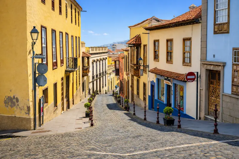
    Historic Street In La Orotava Tenerife

    TITSA serves the main towns and tourist areas of Tenerife. I check the current journey planner instead of hard-coding a bus number into an evergreen article, because routes and stops can change. Travellers with a pushchair, luggage or limited mobility should also inspect the final approach: gradients, cobbles, steps and natural rock often matter more than the intercity journey.

    Best time of day

    For architecture and street photography, morning or late afternoon usually gives softer light. For a church or museum, access arrangements matter more than the angle of the sun. For beaches, natural pools and exposed paths, tide, swell, wind and rain matter more than a fixed clock time.

    Weekends, feast days and local events can transform a quiet place into a busy community space. That can be a highlight if I want atmosphere, but it can also affect parking and access. I check local notices when travelling around major religious, municipal or coastal events.

    Practical tips that make the stop better

    Comfortable shoes are my default even for short visits. Historic paving can be uneven, north-Tenerife towns often have steeper streets than a map suggests and volcanic coastal rock can be slippery. I carry water and a light layer because cloud, breeze and sun can change quickly across short distances.

    I do not assume that a public-looking heritage building has toilets, step-free access or continuous opening. Travellers who need specific accessibility features should verify them directly with the venue or municipality. At natural sites I also check whether the final approach is suitable for the whole group.

    For churches and devotional spaces, I dress respectfully and keep noise low. For schools or working cultural sites, I follow access instructions. On beaches, pools and protected volcanic terrain, I stay within legal access and never treat calm-looking water as proof that swimming is safe.

    Photography without missing the place itself

    I take one wide establishing image, then look for details: stonework, wood, metal, inscriptions, paving, water infrastructure, vegetation or the relationship between geology and human use. That produces a more useful visual record than ten almost identical front-on photographs.

    I never assume drone use is legal simply because a place looks quiet. Tenerife has controlled airspace, protected areas and populated zones. A travel guide cannot replace current aviation rules or local restrictions.

    Where to eat and how I fit meals into the route

    I prefer eating near the area I am already exploring instead of driving across the island for a single restaurant. In La Orotava, that might mean a café in the historic centre, a traditional Canarian lunch or a longer meal after the walking portion of the day. I check recent opening information because weekly closing days and kitchen hours change.

    La Orotava Historic Center And Mountains Tenerife

    Local food makes more sense when connected to the place: papas arrugadas, mojo, gofio, cheeses, fish and Tenerife wines all reflect agriculture, trade and everyday island life. I would rather choose a simple meal that fits the route than interrupt the day for a famous restaurant far away.

    Where to stay

    If I want to explore this part of Tenerife over more than one day, I compare current accommodation on Booking.com. I pay attention to the exact map position, parking, elevation and recent guest comments rather than relying only on the property name.

    For a first visit, I choose a base according to the majority of the itinerary. A good location saves more time over a week than staying next to one small attraction that I will visit only once.

    Activities and tours

    A heritage or nature stop can pair well with one organised experience elsewhere on the island. I use the widget below to compare current options, but I avoid stacking a long excursion immediately before or after a dense driving day.

    Who will enjoy this stop most?

    Lavaderos de San Francisco is best for travellers who enjoy context rather than only headline attractions. Couples and solo travellers can fold it into a slow regional day; families can use it as a short educational stop when access and terrain are suitable; repeat visitors may appreciate it because it reveals a layer of Tenerife that is easy to miss on a first trip.

    It may be less useful for someone with only a few hours on the island who is still trying to prioritise Teide, Anaga or a major beach. I would rather say that clearly than label every place a “must-see”. A good guide should help readers decide what fits their interests.

    Common mistakes I would avoid

    • Driving across Tenerife only for this single stop without combining it with the surrounding area.
    • Assuming old opening hours, trail information or sea conditions are still valid.
    • Underestimating gradients, parking limitations, wet rock or narrow historic streets.
    • Treating local legends as proven history without saying they are traditions.
    • Ignoring services, worship, school security, safety signs, closures or private boundaries because a place appears visitor-oriented.

    Frequently asked questions

    How old are the San Francisco washhouses?

    Their origins are linked to La Orotava’s 16th-century public water system, although the visible site also includes major 20th-century alterations.

    La Orotava Historic Center Panorama Tenerife

    How many public washhouses did La Orotava once have?

    Municipal heritage information records as many as five public washhouses; San Francisco is the one that remains in its traditional location.

    How many individual basins are at the later washhouse?

    The 1940s redesign created 24 individual basins, arranged twelve on each side.

    Why is the site important socially?

    It was a major working and social space for women, including domestic servants, lower-income households and professional laundresses.

    Official information

    For the documented background used in this guide and for any current operational information, I check the official visitor or heritage information for Lavaderos de San Francisco shortly before travelling. Same-day signs, staff instructions, parish notices, municipal updates, sea warnings and safety restrictions always take priority over an evergreen article.

    Final thoughts

    I would include Lavaderos de San Francisco when it strengthens the story of a day in La Orotava. Its value is not measured by how many hours it occupies. A short stop can be meaningful when it explains architecture, faith, trade, geology, water, landscape or everyday life.

    My preferred approach is simple: know the key facts before arriving, stay flexible about access, respect the place as part of local life and connect it with nearby sights. Done that way, it becomes one more piece of a Tenerife itinerary that feels coherent rather than crowded.

  • Ruta de los Molinos La Orotava Guide: Water Mills, Gofio and Historic Streets

    Ruta de los Molinos La Orotava Guide: Water Mills, Gofio and Historic Streets

    Ruta de los Molinos is a useful stop for travellers who want to understand Tenerife beyond beaches and headline attractions. I would not cross the whole island only for this one place, but I would absolutely use it to add historical and local context to a day in La Orotava.

    In this guide I separate documented facts from practical planning. Dates, dimensions, artistic details and historical associations come from official tourism or municipal heritage sources. My suggestions about timing, route order, photography and combinations are travel-planning advice. I avoid inventing fixed opening hours, prices or guaranteed access when current official information is uncertain.

    At a glance

    PlaceRuta de los Molinos
    WhereVilla de Arriba to historic centre, La Orotava
    Best forindustrial heritage, walking, gofio culture and understanding La Orotava urban history
    Time to allow1.5–2.5 hours depending on stops and gradient
    Planning ruleCombine it with nearby sights, verify current access and keep the route flexible.

    Why I would include Ruta de los Molinos in a Tenerife itinerary

    One of the easiest mistakes on Tenerife is to jump from one major attraction to another without understanding the towns between them. Places like Ruta de los Molinos slow the trip down in a useful way. They show how local history, religion, trade, architecture, geology or landscape developed at the level of an individual community.

    I also value stops that work inside a compact cluster. In La Orotava, I can usually combine several worthwhile places without repeated driving. That gives me more time to notice details, stop for coffee, change plans if access is closed and still finish the day without feeling that I have been chasing a checklist.

    My rule is simple: a small site earns its place when it helps explain the destination. I would rather spend thirty attentive minutes somewhere meaningful than add three generic viewpoints just to increase the number of stops.

    What the official record confirms

    • Water from springs around Aguamansa was channelled toward La Orotava from the 16th century.
    • The steep urban slope allowed the same water flow to power a chain of hydraulic grain mills.
    • Municipal tourism material describes 13 historic mills, with 10 structures surviving and two still producing gofio using electricity.
    • The route is closely connected with the San Francisco public washhouse and the old open water channels that served residents and convents.

    The water system that helped shape the town

    La Orotava’s mill route is more than a line of old industrial structures. From the sixteenth century, water from Aguamansa was channelled downhill toward the growing settlement. The valley is not especially windy, so hydraulic power became the logical way to grind roasted grain. The strong urban gradient let the same flow drop from one mill to another, turning water infrastructure into an organising spine for Villa de Arriba.

    Municipal historical material describes a network of 13 mills. Ten mill structures survive, while two continue to make gofio with electric power. I like walking the route because the towers, channels and street slope make an invisible system visible: water once connected domestic supply, convents, washhouses, agriculture and food production through the same urban corridor.

    What a Canarian water mill actually did

    A typical mill used a masonry tower or cubo to create water pressure. Water descended through a narrow outlet to drive horizontal wheels below the mill house; those wheels transferred motion to the millstones on the upper level. The grain being processed was often already toasted, producing gofio, one of the most characteristic foods of the Canary Islands.

    I do not need every surviving structure to be open to understand the system. Exterior towers, changes in elevation and the relationship with nearby washhouses tell the story. Where an active gofio mill is operating, I treat it as a business rather than a museum and ask before photographing work areas.

    How I walk the route without turning it into a race

    The route passes through steep historic streets such as Cruz Verde, Cubo Alto, Rosa de Ara, Doctor Domingo González García and San Francisco before reaching the lower town. I prefer walking downhill when practical, especially in warm weather, but the best direction depends on where I park or arrive by bus. Good shoes matter more here than on a flat plaza walk.

    I would combine the mill route with San Juan Bautista and the Villa de Arriba streets, then finish toward Casa Lercaro and La Concepción. That produces a coherent half-day in which working-class, hydraulic and noble architecture all appear, rather than seeing La Orotava only through its grand mansions.

    What to combine with it nearby

    I would build the visit around nearby pages already covered on this site rather than create an isolated detour. Good combinations include Casa Lercaro, Iglesia de San Juan Bautista, La Orotava Town Hall. For a broader planning option, I also keep La Orotava guide in the same cluster.

    Jardines Victoria Fountain La Orotava Tenerife

    How I plan the visit

    I start by deciding whether Ruta de los Molinos is the anchor of the outing or a supporting stop. For a small heritage or nature site, the second option is usually better. I allow enough time to read information, look at details and take a few photographs, but I do not turn a short visit into half a day simply because the itinerary has empty space.

    I then check the official source shortly before travelling. Religious services, conservation work, local events, sea conditions, trail restrictions, seasonal timetables or staffing can change access. If one element is unavailable, I want the surrounding route to remain worthwhile.

    1. Start with the most time-sensitive stop, such as a museum, church interior or safe coastal window.
    2. Continue on foot to exterior heritage, public squares, paths or viewpoints.
    3. Keep lunch or coffee flexible so a delay does not break the itinerary.
    4. Leave the final stop optional, especially if traffic, weather or a local event changes the pace.

    This style of planning works particularly well in Tenerife’s northern towns. Short map distances can hide steep streets, difficult parking, wet paths or strong Atlantic conditions, while a compact regional loop often reveals much more than several rushed car stops.

    How I read the history without oversimplifying it

    Heritage sites often mix documented facts, later restoration, local tradition and popular legend. I try to keep those layers separate. A date recorded by an official heritage inventory is not the same kind of evidence as a story passed through generations, even though both can be valuable for understanding the place.

    I also avoid treating Tenerife’s colonial period as a neutral backdrop. Conquest, Indigenous Guanche history, Atlantic trade, migration, agriculture and religious institutions all shaped the island. Where one of those themes is relevant to Ruta de los Molinos, I name it directly rather than reducing the story to decorative architecture.

    What I look for on site

    Before reaching for my phone, I look at materials and relationships: volcanic stone, timber, limewashed walls, ironwork, paving, water channels, old trees, surf patterns or the way a building faces a square. These details usually tell me more than a single façade photograph.

    I also pay attention to later changes. Historic places are rarely frozen in one century. Fires, floods, new roads, restorations, changing religious use, domestic water systems and civic adaptation can all become part of the story. I find a place more interesting when I can see those layers rather than searching for an imaginary “original” version.

    Getting there and moving around

    For La Orotava, I compare driving with public transport according to the rest of the day. A car is helpful when I am continuing to rural viewpoints or another municipality, but it can be inconvenient in older streets with limited parking. If I am concentrating on a historic centre or marked coastal area, I prefer to park once and walk.

    Historic Center Of La Orotava Tenerife

    TITSA serves the main towns and tourist areas of Tenerife. I check the current journey planner instead of hard-coding a bus number into an evergreen article, because routes and stops can change. Travellers with a pushchair, luggage or limited mobility should also inspect the final approach: gradients, cobbles, steps and natural rock often matter more than the intercity journey.

    Best time of day

    For architecture and street photography, morning or late afternoon usually gives softer light. For a church or museum, access arrangements matter more than the angle of the sun. For beaches, natural pools and exposed paths, tide, swell, wind and rain matter more than a fixed clock time.

    Weekends, feast days and local events can transform a quiet place into a busy community space. That can be a highlight if I want atmosphere, but it can also affect parking and access. I check local notices when travelling around major religious, municipal or coastal events.

    Practical tips that make the stop better

    Comfortable shoes are my default even for short visits. Historic paving can be uneven, north-Tenerife towns often have steeper streets than a map suggests and volcanic coastal rock can be slippery. I carry water and a light layer because cloud, breeze and sun can change quickly across short distances.

    I do not assume that a public-looking heritage building has toilets, step-free access or continuous opening. Travellers who need specific accessibility features should verify them directly with the venue or municipality. At natural sites I also check whether the final approach is suitable for the whole group.

    For churches and devotional spaces, I dress respectfully and keep noise low. For schools or working cultural sites, I follow access instructions. On beaches, pools and protected volcanic terrain, I stay within legal access and never treat calm-looking water as proof that swimming is safe.

    Photography without missing the place itself

    I take one wide establishing image, then look for details: stonework, wood, metal, inscriptions, paving, water infrastructure, vegetation or the relationship between geology and human use. That produces a more useful visual record than ten almost identical front-on photographs.

    I never assume drone use is legal simply because a place looks quiet. Tenerife has controlled airspace, protected areas and populated zones. A travel guide cannot replace current aviation rules or local restrictions.

    Where to eat and how I fit meals into the route

    I prefer eating near the area I am already exploring instead of driving across the island for a single restaurant. In La Orotava, that might mean a café in the historic centre, a traditional Canarian lunch or a longer meal after the walking portion of the day. I check recent opening information because weekly closing days and kitchen hours change.

    Local food makes more sense when connected to the place: papas arrugadas, mojo, gofio, cheeses, fish and Tenerife wines all reflect agriculture, trade and everyday island life. I would rather choose a simple meal that fits the route than interrupt the day for a famous restaurant far away.

    Where to stay

    If I want to explore this part of Tenerife over more than one day, I compare current accommodation on Booking.com. I pay attention to the exact map position, parking, elevation and recent guest comments rather than relying only on the property name.

    For a first visit, I choose a base according to the majority of the itinerary. A good location saves more time over a week than staying next to one small attraction that I will visit only once.

    Activities and tours

    A heritage or nature stop can pair well with one organised experience elsewhere on the island. I use the widget below to compare current options, but I avoid stacking a long excursion immediately before or after a dense driving day.

    Who will enjoy this stop most?

    Ruta de los Molinos is best for travellers who enjoy context rather than only headline attractions. Couples and solo travellers can fold it into a slow regional day; families can use it as a short educational stop when access and terrain are suitable; repeat visitors may appreciate it because it reveals a layer of Tenerife that is easy to miss on a first trip.

    It may be less useful for someone with only a few hours on the island who is still trying to prioritise Teide, Anaga or a major beach. I would rather say that clearly than label every place a “must-see”. A good guide should help readers decide what fits their interests.

    Common mistakes I would avoid

    • Driving across Tenerife only for this single stop without combining it with the surrounding area.
    • Assuming old opening hours, trail information or sea conditions are still valid.
    • Underestimating gradients, parking limitations, wet rock or narrow historic streets.
    • Treating local legends as proven history without saying they are traditions.
    • Ignoring services, worship, school security, safety signs, closures or private boundaries because a place appears visitor-oriented.

    Frequently asked questions

    How many historic mills did La Orotava have?

    Municipal tourism material describes a chain of 13 mills associated with the historic water system.

    Historic Street In La Orotava Tenerife

    How many survive today?

    The municipal route says 10 mill structures survive and two still produce gofio using electric power.

    Why were water mills important here?

    The valley had abundant spring water and a steep gradient, while wind conditions made hydraulic power more practical than windmills.

    Is the Ruta de los Molinos steep?

    Yes. It follows the pronounced slope of Villa de Arriba, so comfortable footwear and route direction matter.

    Official information

    For the documented background used in this guide and for any current operational information, I check the official visitor or heritage information for Ruta de los Molinos shortly before travelling. Same-day signs, staff instructions, parish notices, municipal updates, sea warnings and safety restrictions always take priority over an evergreen article.

    Final thoughts

    I would include Ruta de los Molinos when it strengthens the story of a day in La Orotava. Its value is not measured by how many hours it occupies. A short stop can be meaningful when it explains architecture, faith, trade, geology, water, landscape or everyday life.

    My preferred approach is simple: know the key facts before arriving, stay flexible about access, respect the place as part of local life and connect it with nearby sights. Done that way, it becomes one more piece of a Tenerife itinerary that feels coherent rather than crowded.

  • Ermita del Calvario La Orotava Guide: 1917 Neo-Gothic Chapel and La Piedad

    Ermita del Calvario La Orotava Guide: 1917 Neo-Gothic Chapel and La Piedad

    Ermita del Calvario is a useful stop for travellers who want to understand Tenerife beyond beaches and headline attractions. I would not cross the whole island only for this one place, but I would absolutely use it to add historical and local context to a day in La Orotava.

    In this guide I separate documented facts from practical planning. Dates, dimensions, artistic details and historical associations come from official tourism or municipal heritage sources. My suggestions about timing, route order, photography and combinations are travel-planning advice. I avoid inventing fixed opening hours, prices or guaranteed access when current official information is uncertain.

    At a glance

    PlaceErmita del Calvario
    WherePlaza de la Paz, La Orotava, Tenerife
    Best forneo-Gothic architecture, religious art, romería traditions and historic-town walks
    Time to allow20–40 minutes, longer during local celebrations
    Planning ruleCombine it with nearby sights, verify current access and keep the route flexible.

    Why I would include Ermita del Calvario in a Tenerife itinerary

    One of the easiest mistakes on Tenerife is to jump from one major attraction to another without understanding the towns between them. Places like Ermita del Calvario slow the trip down in a useful way. They show how local history, religion, trade, architecture, geology or landscape developed at the level of an individual community.

    I also value stops that work inside a compact cluster. In La Orotava, I can usually combine several worthwhile places without repeated driving. That gives me more time to notice details, stop for coffee, change plans if access is closed and still finish the day without feeling that I have been chasing a checklist.

    My rule is simple: a small site earns its place when it helps explain the destination. I would rather spend thirty attentive minutes somewhere meaningful than add three generic viewpoints just to increase the number of stops.

    What the official record confirms

    • The present chapel was designed by architect Mariano Estanga and blessed in 1917.
    • The site’s devotional history goes back to a Calvary with three crosses erected before 1639.
    • An earlier chapel was rebuilt in the 1810s and demolished in 1914 before the current building was constructed nearby.
    • The interior preserves works linked to Fernando Estévez, including the 1814 group La Piedad or Cristo del Calvario, as well as an older painting of the Pietà attributed to Gaspar de Quevedo.

    The 1917 chapel is only the newest layer

    The building I see today is neo-Gothic, but the religious use of this edge of La Orotava is far older. Municipal tourism material traces the site to a walled Calvary with three crosses erected by members of the Third Order before 1639. A chapel followed, was rebuilt during the 1810s and was finally demolished in 1914. Architect Mariano Estanga designed the current structure a short distance from the old footprint, and it was blessed in 1917.

    I find that chronology useful because it prevents me from calling the place simply a twentieth-century chapel. The pointed arches and vertical historicist design are modern compared with many town churches, but they preserve a devotional tradition that had already existed here for centuries.

    Fernando Estévez and the art inside

    The chapel holds important works by La Orotava-born sculptor Fernando Estévez. The group known as La Piedad or Cristo del Calvario dates to 1814, and the patron saints San Isidro Labrador and Santa María de la Cabeza are also associated with the interior. Municipal heritage information additionally notes an older Pietà painting attributed to Gaspar de Quevedo around 1670.

    If the chapel is open, I would spend more time with those works than with photographing every corner. Estévez is one of the central figures of Canarian sculpture, and seeing his work in the town where he was born gives the visit more context than encountering the name only in a museum label.

    Plaza de la Paz and the romería connection

    The chapel presides over Plaza de la Paz, a name linked to the end of the First World War. It is also connected with La Orotava’s traditional romería because San Isidro and Santa María de la Cabeza are kept here. That gives the site a role in the town’s annual ceremonial geography rather than leaving it as an isolated monument at the edge of the historic centre.

    La Orotava Historic Center Panorama Tenerife

    I would start or finish a La Orotava walk here, then continue downhill toward Plaza de la Constitución, Jardines Victoria and La Concepción. The gradient is real, so travellers with limited mobility should plan the direction of the route instead of assuming a short map distance means an effortless walk.

    What to combine with it nearby

    I would build the visit around nearby pages already covered on this site rather than create an isolated detour. Good combinations include La Orotava Town Hall, Iglesia de La Concepción, Jardines Victoria. For a broader planning option, I also keep La Orotava guide in the same cluster.

    How I plan the visit

    I start by deciding whether Ermita del Calvario is the anchor of the outing or a supporting stop. For a small heritage or nature site, the second option is usually better. I allow enough time to read information, look at details and take a few photographs, but I do not turn a short visit into half a day simply because the itinerary has empty space.

    I then check the official source shortly before travelling. Religious services, conservation work, local events, sea conditions, trail restrictions, seasonal timetables or staffing can change access. If one element is unavailable, I want the surrounding route to remain worthwhile.

    1. Start with the most time-sensitive stop, such as a museum, church interior or safe coastal window.
    2. Continue on foot to exterior heritage, public squares, paths or viewpoints.
    3. Keep lunch or coffee flexible so a delay does not break the itinerary.
    4. Leave the final stop optional, especially if traffic, weather or a local event changes the pace.

    This style of planning works particularly well in Tenerife’s northern towns. Short map distances can hide steep streets, difficult parking, wet paths or strong Atlantic conditions, while a compact regional loop often reveals much more than several rushed car stops.

    How I read the history without oversimplifying it

    Heritage sites often mix documented facts, later restoration, local tradition and popular legend. I try to keep those layers separate. A date recorded by an official heritage inventory is not the same kind of evidence as a story passed through generations, even though both can be valuable for understanding the place.

    I also avoid treating Tenerife’s colonial period as a neutral backdrop. Conquest, Indigenous Guanche history, Atlantic trade, migration, agriculture and religious institutions all shaped the island. Where one of those themes is relevant to Ermita del Calvario, I name it directly rather than reducing the story to decorative architecture.

    What I look for on site

    Before reaching for my phone, I look at materials and relationships: volcanic stone, timber, limewashed walls, ironwork, paving, water channels, old trees, surf patterns or the way a building faces a square. These details usually tell me more than a single façade photograph.

    I also pay attention to later changes. Historic places are rarely frozen in one century. Fires, floods, new roads, restorations, changing religious use, domestic water systems and civic adaptation can all become part of the story. I find a place more interesting when I can see those layers rather than searching for an imaginary “original” version.

    Getting there and moving around

    For La Orotava, I compare driving with public transport according to the rest of the day. A car is helpful when I am continuing to rural viewpoints or another municipality, but it can be inconvenient in older streets with limited parking. If I am concentrating on a historic centre or marked coastal area, I prefer to park once and walk.

    Jardines Victoria Fountain La Orotava Tenerife

    TITSA serves the main towns and tourist areas of Tenerife. I check the current journey planner instead of hard-coding a bus number into an evergreen article, because routes and stops can change. Travellers with a pushchair, luggage or limited mobility should also inspect the final approach: gradients, cobbles, steps and natural rock often matter more than the intercity journey.

    Best time of day

    For architecture and street photography, morning or late afternoon usually gives softer light. For a church or museum, access arrangements matter more than the angle of the sun. For beaches, natural pools and exposed paths, tide, swell, wind and rain matter more than a fixed clock time.

    Weekends, feast days and local events can transform a quiet place into a busy community space. That can be a highlight if I want atmosphere, but it can also affect parking and access. I check local notices when travelling around major religious, municipal or coastal events.

    Practical tips that make the stop better

    Comfortable shoes are my default even for short visits. Historic paving can be uneven, north-Tenerife towns often have steeper streets than a map suggests and volcanic coastal rock can be slippery. I carry water and a light layer because cloud, breeze and sun can change quickly across short distances.

    I do not assume that a public-looking heritage building has toilets, step-free access or continuous opening. Travellers who need specific accessibility features should verify them directly with the venue or municipality. At natural sites I also check whether the final approach is suitable for the whole group.

    For churches and devotional spaces, I dress respectfully and keep noise low. For schools or working cultural sites, I follow access instructions. On beaches, pools and protected volcanic terrain, I stay within legal access and never treat calm-looking water as proof that swimming is safe.

    Photography without missing the place itself

    I take one wide establishing image, then look for details: stonework, wood, metal, inscriptions, paving, water infrastructure, vegetation or the relationship between geology and human use. That produces a more useful visual record than ten almost identical front-on photographs.

    I never assume drone use is legal simply because a place looks quiet. Tenerife has controlled airspace, protected areas and populated zones. A travel guide cannot replace current aviation rules or local restrictions.

    Where to eat and how I fit meals into the route

    I prefer eating near the area I am already exploring instead of driving across the island for a single restaurant. In La Orotava, that might mean a café in the historic centre, a traditional Canarian lunch or a longer meal after the walking portion of the day. I check recent opening information because weekly closing days and kitchen hours change.

    Historic Center Of La Orotava Tenerife

    Local food makes more sense when connected to the place: papas arrugadas, mojo, gofio, cheeses, fish and Tenerife wines all reflect agriculture, trade and everyday island life. I would rather choose a simple meal that fits the route than interrupt the day for a famous restaurant far away.

    Where to stay

    If I want to explore this part of Tenerife over more than one day, I compare current accommodation on Booking.com. I pay attention to the exact map position, parking, elevation and recent guest comments rather than relying only on the property name.

    For a first visit, I choose a base according to the majority of the itinerary. A good location saves more time over a week than staying next to one small attraction that I will visit only once.

    Activities and tours

    A heritage or nature stop can pair well with one organised experience elsewhere on the island. I use the widget below to compare current options, but I avoid stacking a long excursion immediately before or after a dense driving day.

    Who will enjoy this stop most?

    Ermita del Calvario is best for travellers who enjoy context rather than only headline attractions. Couples and solo travellers can fold it into a slow regional day; families can use it as a short educational stop when access and terrain are suitable; repeat visitors may appreciate it because it reveals a layer of Tenerife that is easy to miss on a first trip.

    It may be less useful for someone with only a few hours on the island who is still trying to prioritise Teide, Anaga or a major beach. I would rather say that clearly than label every place a “must-see”. A good guide should help readers decide what fits their interests.

    Common mistakes I would avoid

    • Driving across Tenerife only for this single stop without combining it with the surrounding area.
    • Assuming old opening hours, trail information or sea conditions are still valid.
    • Underestimating gradients, parking limitations, wet rock or narrow historic streets.
    • Treating local legends as proven history without saying they are traditions.
    • Ignoring services, worship, school security, safety signs, closures or private boundaries because a place appears visitor-oriented.

    Frequently asked questions

    When was the current Ermita del Calvario built?

    The present building was designed by Mariano Estanga and blessed in 1917.

    Was there a chapel here before 1917?

    Yes. The devotional site goes back to a Calvary before 1639, and earlier chapels occupied the area before the present structure.

    What important sculpture is inside?

    The chapel preserves Fernando Estévez’s 1814 group La Piedad, popularly known as Cristo del Calvario.

    Why is the chapel important during local festivals?

    It houses San Isidro Labrador and Santa María de la Cabeza and is connected with La Orotava’s traditional romería.

    Official information

    For the documented background used in this guide and for any current operational information, I check the official visitor or heritage information for Ermita del Calvario shortly before travelling. Same-day signs, staff instructions, parish notices, municipal updates, sea warnings and safety restrictions always take priority over an evergreen article.

    Final thoughts

    I would include Ermita del Calvario when it strengthens the story of a day in La Orotava. Its value is not measured by how many hours it occupies. A short stop can be meaningful when it explains architecture, faith, trade, geology, water, landscape or everyday life.

    My preferred approach is simple: know the key facts before arriving, stay flexible about access, respect the place as part of local life and connect it with nearby sights. Done that way, it becomes one more piece of a Tenerife itinerary that feels coherent rather than crowded.
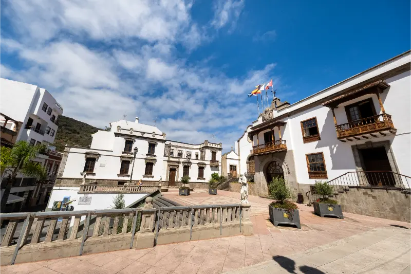
  • Museo de Los Alzados Guide: Traditional Music and Life in Icod el Alto

    Museo de Los Alzados Guide: Traditional Music and Life in Icod el Alto

    Museo de Los Alzados is a useful stop for travellers who want to understand Tenerife beyond beaches and headline attractions. I would not cross the whole island only for this one place, but I would absolutely use it to add historical and local context to a day in Los Realejos.

    In this guide I separate documented facts from practical planning. Dates, dimensions, artistic details and historical associations come from official tourism or municipal heritage sources. My suggestions about timing, route order, photography and combinations are travel-planning advice. I avoid inventing fixed opening hours, prices or guaranteed access when current official information is uncertain.

    At a glance

    PlaceMuseo de Los Alzados
    WhereC.E.O. La Pared, Icod el Alto, Los Realejos
    Best forethnography, traditional music, rural culture and repeat visitors
    Time to allow30–60 minutes when a visit is arranged
    Planning ruleCombine it with nearby sights, verify current access and keep the route flexible.

    Why I would include Museo de Los Alzados in a Tenerife itinerary

    One of the easiest mistakes on Tenerife is to jump from one major attraction to another without understanding the towns between them. Places like Museo de Los Alzados slow the trip down in a useful way. They show how local history, religion, trade, architecture, geology or landscape developed at the level of an individual community.

    I also value stops that work inside a compact cluster. In Los Realejos, I can usually combine several worthwhile places without repeated driving. That gives me more time to notice details, stop for coffee, change plans if access is closed and still finish the day without feeling that I have been chasing a checklist.

    My rule is simple: a small site earns its place when it helps explain the destination. I would rather spend thirty attentive minutes somewhere meaningful than add three generic viewpoints just to increase the number of stops.

    What the official record confirms

    • The museum is located inside the C.E.O. La Pared educational centre in Icod el Alto.
    • The Los Alzados initiative focused on recovering traditional music and everyday rural life from the area.
    • The collective received the Premio Canarias de Cultura Popular in 2012.
    • Because the museum is inside a school, local tourism information advises visiting during school hours or arranging access in advance.

    Why a school-based museum belongs in a travel itinerary

    Museo de Los Alzados is unusual because it is not a conventional municipal museum with a separate tourist building. It sits inside the C.E.O. La Pared school, where a cultural initiative grew around recovering the music and traditional life of Icod el Alto. That origin makes the museum especially interesting to me: heritage here was documented and transmitted through the community rather than packaged first as a visitor attraction.

    Icod De Los Vinos Tenerife City View

    The initiative received the Premio Canarias de Cultura Popular in 2012, which gives useful context to its regional importance. I would come here for ethnography and local identity, not for a large collection or polished interactive exhibition. It is the kind of stop that rewards travellers who have already seen Tenerife’s major museums and want to understand rural culture at a more local scale.

    What Icod el Alto adds to the story

    Icod el Alto sits high above the north coast, with potato cultivation, old caminos and viewpoints over the Orotava Valley and Atlantic. The municipality’s sensory route connects the museum with the Church of Nuestra Señora del Buen Viaje, the monument to traditional pig traders, Mirador de El Lance and the road toward La Corona. That setting matters because the objects and music represented in the museum came from a working rural landscape.

    I would therefore plan the museum as one stop in Icod el Alto rather than an isolated appointment. If access is arranged for the morning, I can continue to El Lance and La Corona afterward, then descend toward Realejo Alto or the coast. This makes the logistics worthwhile even if the museum visit itself is short.

    Access: the detail I would organise first

    The local tourism office explicitly notes that the museum is inside the school and can be visited during school hours or by arranging a time in advance. I would contact the relevant local tourism or school information before travelling, especially outside term time. I do not assume that a public listing means I can simply walk into an educational building whenever I want.

    That restriction is not a negative; it is part of the nature of the place. Respecting school security and teaching schedules is essential. If I cannot confirm access, I keep the Icod el Alto route but treat the museum as an optional stop rather than building the whole day around it.

    What to combine with it nearby

    I would build the visit around nearby pages already covered on this site rather than create an isolated detour. Good combinations include Mirador de El Lance, Mirador de La Corona, Casa de Viera y Clavijo. For a broader planning option, I also keep Los Realejos guide in the same cluster.

    How I plan the visit

    I start by deciding whether Museo de Los Alzados is the anchor of the outing or a supporting stop. For a small heritage or nature site, the second option is usually better. I allow enough time to read information, look at details and take a few photographs, but I do not turn a short visit into half a day simply because the itinerary has empty space.

    I then check the official source shortly before travelling. Religious services, conservation work, local events, sea conditions, trail restrictions, seasonal timetables or staffing can change access. If one element is unavailable, I want the surrounding route to remain worthwhile.

    1. Start with the most time-sensitive stop, such as a museum, church interior or safe coastal window.
    2. Continue on foot to exterior heritage, public squares, paths or viewpoints.
    3. Keep lunch or coffee flexible so a delay does not break the itinerary.
    4. Leave the final stop optional, especially if traffic, weather or a local event changes the pace.

    This style of planning works particularly well in Tenerife’s northern towns. Short map distances can hide steep streets, difficult parking, wet paths or strong Atlantic conditions, while a compact regional loop often reveals much more than several rushed car stops.

    How I read the history without oversimplifying it

    Heritage sites often mix documented facts, later restoration, local tradition and popular legend. I try to keep those layers separate. A date recorded by an official heritage inventory is not the same kind of evidence as a story passed through generations, even though both can be valuable for understanding the place.

    I also avoid treating Tenerife’s colonial period as a neutral backdrop. Conquest, Indigenous Guanche history, Atlantic trade, migration, agriculture and religious institutions all shaped the island. Where one of those themes is relevant to Museo de Los Alzados, I name it directly rather than reducing the story to decorative architecture.

    What I look for on site

    Before reaching for my phone, I look at materials and relationships: volcanic stone, timber, limewashed walls, ironwork, paving, water channels, old trees, surf patterns or the way a building faces a square. These details usually tell me more than a single façade photograph.

    I also pay attention to later changes. Historic places are rarely frozen in one century. Fires, floods, new roads, restorations, changing religious use, domestic water systems and civic adaptation can all become part of the story. I find a place more interesting when I can see those layers rather than searching for an imaginary “original” version.

    Getting there and moving around

    For Los Realejos, I compare driving with public transport according to the rest of the day. A car is helpful when I am continuing to rural viewpoints or another municipality, but it can be inconvenient in older streets with limited parking. If I am concentrating on a historic centre or marked coastal area, I prefer to park once and walk.

    Parque Del Drago Milenario Icod De Los Vinos Tenerife

    TITSA serves the main towns and tourist areas of Tenerife. I check the current journey planner instead of hard-coding a bus number into an evergreen article, because routes and stops can change. Travellers with a pushchair, luggage or limited mobility should also inspect the final approach: gradients, cobbles, steps and natural rock often matter more than the intercity journey.

    Best time of day

    For architecture and street photography, morning or late afternoon usually gives softer light. For a church or museum, access arrangements matter more than the angle of the sun. For beaches, natural pools and exposed paths, tide, swell, wind and rain matter more than a fixed clock time.

    Weekends, feast days and local events can transform a quiet place into a busy community space. That can be a highlight if I want atmosphere, but it can also affect parking and access. I check local notices when travelling around major religious, municipal or coastal events.

    Practical tips that make the stop better

    Comfortable shoes are my default even for short visits. Historic paving can be uneven, north-Tenerife towns often have steeper streets than a map suggests and volcanic coastal rock can be slippery. I carry water and a light layer because cloud, breeze and sun can change quickly across short distances.

    I do not assume that a public-looking heritage building has toilets, step-free access or continuous opening. Travellers who need specific accessibility features should verify them directly with the venue or municipality. At natural sites I also check whether the final approach is suitable for the whole group.

    For churches and devotional spaces, I dress respectfully and keep noise low. For schools or working cultural sites, I follow access instructions. On beaches, pools and protected volcanic terrain, I stay within legal access and never treat calm-looking water as proof that swimming is safe.

    Photography without missing the place itself

    I take one wide establishing image, then look for details: stonework, wood, metal, inscriptions, paving, water infrastructure, vegetation or the relationship between geology and human use. That produces a more useful visual record than ten almost identical front-on photographs.

    I never assume drone use is legal simply because a place looks quiet. Tenerife has controlled airspace, protected areas and populated zones. A travel guide cannot replace current aviation rules or local restrictions.

    Where to eat and how I fit meals into the route

    I prefer eating near the area I am already exploring instead of driving across the island for a single restaurant. In Los Realejos, that might mean a café in the historic centre, a traditional Canarian lunch or a longer meal after the walking portion of the day. I check recent opening information because weekly closing days and kitchen hours change.

    Local food makes more sense when connected to the place: papas arrugadas, mojo, gofio, cheeses, fish and Tenerife wines all reflect agriculture, trade and everyday island life. I would rather choose a simple meal that fits the route than interrupt the day for a famous restaurant far away.

    Where to stay

    If I want to explore this part of Tenerife over more than one day, I compare current accommodation on Booking.com. I pay attention to the exact map position, parking, elevation and recent guest comments rather than relying only on the property name.

    For a first visit, I choose a base according to the majority of the itinerary. A good location saves more time over a week than staying next to one small attraction that I will visit only once.

    Activities and tours

    A heritage or nature stop can pair well with one organised experience elsewhere on the island. I use the widget below to compare current options, but I avoid stacking a long excursion immediately before or after a dense driving day.

    Who will enjoy this stop most?

    Museo de Los Alzados is best for travellers who enjoy context rather than only headline attractions. Couples and solo travellers can fold it into a slow regional day; families can use it as a short educational stop when access and terrain are suitable; repeat visitors may appreciate it because it reveals a layer of Tenerife that is easy to miss on a first trip.

    It may be less useful for someone with only a few hours on the island who is still trying to prioritise Teide, Anaga or a major beach. I would rather say that clearly than label every place a “must-see”. A good guide should help readers decide what fits their interests.

    Common mistakes I would avoid

    • Driving across Tenerife only for this single stop without combining it with the surrounding area.
    • Assuming old opening hours, trail information or sea conditions are still valid.
    • Underestimating gradients, parking limitations, wet rock or narrow historic streets.
    • Treating local legends as proven history without saying they are traditions.
    • Ignoring services, worship, school security, safety signs, closures or private boundaries because a place appears visitor-oriented.

    Frequently asked questions

    Where is Museo de Los Alzados?

    It is inside the C.E.O. La Pared educational centre in Icod el Alto, Los Realejos.

    Church In Icod De Los Vinos Tenerife

    What does the museum focus on?

    Its purpose is to recover and present traditional music and everyday rural life from the local area.

    Did the project receive an award?

    Yes. The Los Alzados collective received the Premio Canarias de Cultura Popular in 2012.

    Can I visit without arranging anything?

    Because the museum is inside a school, the tourism office recommends school-hour access or reserving a visit in advance. Verify current arrangements first.

    Official information

    For the documented background used in this guide and for any current operational information, I check the official visitor or heritage information for Museo de Los Alzados shortly before travelling. Same-day signs, staff instructions, parish notices, municipal updates, sea warnings and safety restrictions always take priority over an evergreen article.

    Final thoughts

    I would include Museo de Los Alzados when it strengthens the story of a day in Los Realejos. Its value is not measured by how many hours it occupies. A short stop can be meaningful when it explains architecture, faith, trade, geology, water, landscape or everyday life.

    My preferred approach is simple: know the key facts before arriving, stay flexible about access, respect the place as part of local life and connect it with nearby sights. Done that way, it becomes one more piece of a Tenerife itinerary that feels coherent rather than crowded.
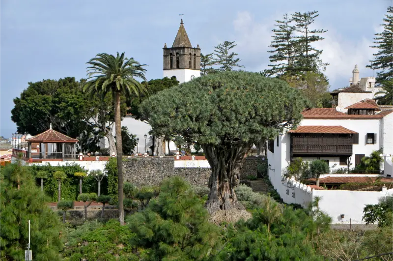
  • Pino Valois Icod Guide: Ancient Canary Pine, Wine History and Rural Viewpoint

    Pino Valois Icod Guide: Ancient Canary Pine, Wine History and Rural Viewpoint

    Pino Valois is a useful stop for travellers who want to understand Tenerife beyond beaches and headline attractions. I would not cross the whole island only for this one place, but I would absolutely use it to add historical and local context to a day in Icod de los Vinos.

    In this guide I separate documented facts from practical planning. Dates, dimensions, artistic details and historical associations come from official tourism or municipal heritage sources. My suggestions about timing, route order, photography and combinations are travel-planning advice. I avoid inventing fixed opening hours, prices or guaranteed access when current official information is uncertain.

    At a glance

    PlacePino Valois
    WhereCamino Pino Valois, 10, 38434 Icod de los Vinos
    Best formonumental trees, rural drives, wine history and quieter Icod landscapes
    Time to allow20–40 minutes, longer if combined with rural stops
    Planning ruleCombine it with nearby sights, verify current access and keep the route flexible.

    Why I would include Pino Valois in a Tenerife itinerary

    One of the easiest mistakes on Tenerife is to jump from one major attraction to another without understanding the towns between them. Places like Pino Valois slow the trip down in a useful way. They show how local history, religion, trade, architecture or landscape developed at the level of an individual community.

    I also value stops that work inside a compact cluster. In Icod de los Vinos, I can usually combine several worthwhile places without repeated driving. That gives me more time to notice details, stop for coffee, change plans if a door is closed and still finish the day without feeling that I have been chasing a checklist.

    My rule is simple: a small site earns its place when it helps explain the destination. I would rather spend thirty attentive minutes somewhere meaningful than add three generic viewpoints just to increase the number of stops.

    What the official record confirms

    • Municipal heritage information describes the tree as a large Canary Island pine around 30 metres tall.
    • Its trunk perimeter is given as roughly 760 centimetres.
    • It is considered the oldest pine in Icod and may be around a thousand years old.
    • The Valois name is linked to Bernardo Valois (1663–1727), an Irish wine merchant established in Tenerife.

    A different kind of ancient tree from the Drago

    Icod is so closely associated with the Drago Milenario that another monumental tree can easily be overlooked. Pino Valois offers a useful contrast. It is a Canary Island pine in a more rural setting, and municipal heritage information gives it an impressive scale of about 30 metres in height and roughly 7.6 metres in trunk perimeter.

    The municipality describes it as the oldest pine in Icod and suggests an age around a thousand years. Because age estimates for very old living trees can be approximate, I would repeat that wording carefully rather than presenting a precise birthday. The important point is that this is a genuinely ancient landscape feature.

    Bernardo Valois and the wine connection

    The place name adds a human layer to the tree. Municipal heritage material links Valois to Bernardo Valois, an Irishman who settled in Tenerife and participated in the wine business. He held property in the area and invested in vineyard land with the English merchant Gilbert Smith, later inheriting the estate after Smith’s death in 1721.

    That story makes Pino Valois a good companion to an Icod wine itinerary. Instead of seeing the tree only as botany, I can connect it to the international merchants who were drawn to Tenerife’s wine economy and left traces in local place names and estates.

    Planning the rural detour safely

    Unlike the compact historic centre, Pino Valois is a rural stop. I check the exact approach, road width and parking situation before going, and I avoid blocking local access or private entrances. I would not promise a formal visitor centre, toilets or large car park unless current municipal information confirms them.

    The stop makes most sense when paired with Cueva del Viento, wine-related places or a broader drive through the upper Icod countryside. That turns a short tree visit into a coherent half-day focused on volcanic terrain, agriculture and the island’s highland landscape.

    What to combine with it nearby

    I would build the visit around nearby pages already covered on this site rather than create an isolated detour. Good combinations include Icod de los Vinos guide, Cueva del Viento guide, Museo Malvasía Icod. For a broader planning option, I also keep Parque del Drago in the same cluster.

    Church In Icod De Los Vinos Tenerife

    How I plan the visit

    I start by deciding whether Pino Valois is the anchor of the outing or a supporting stop. For a small heritage site, the second option is usually better. I allow enough time to read information, look at details and take a few photographs, but I do not turn a short visit into half a day simply because the itinerary has empty space.

    I then check the official source shortly before travelling. Religious services, conservation work, local events, seasonal timetables or staffing can change access. If the interior is closed, I want the surrounding route to remain worthwhile.

    1. Start with the most time-sensitive stop, such as a museum or church interior.
    2. Continue on foot to exterior heritage, public squares and streets.
    3. Keep lunch or coffee flexible so a delay does not break the itinerary.
    4. Leave the final stop optional, especially if traffic, weather or a local event changes the pace.

    This style of planning works particularly well in Tenerife’s historic towns. Short map distances can hide steep streets, difficult parking and one-way systems, while a compact walking loop often reveals much more than several rushed car stops.

    How I read the history without oversimplifying it

    Heritage sites often mix documented facts, later restoration, local tradition and popular legend. I try to keep those layers separate. A date recorded by an official heritage inventory is not the same kind of evidence as a story passed through generations, even though both can be valuable for understanding the place.

    I also avoid treating Tenerife’s colonial period as a neutral backdrop. Conquest, Indigenous Guanche history, Atlantic trade, migration and religious institutions all shaped the island. Where one of those themes is relevant to Pino Valois, I name it directly rather than reducing the story to decorative architecture.

    What I look for on site

    Before reaching for my phone, I look at materials and relationships: volcanic stone, timber, limewashed walls, ironwork, paving, courtyards, altarpieces, old trees or the way a building faces a square. These details usually tell me more than a single façade photograph.

    I also pay attention to later changes. Historic buildings are rarely frozen in one century. Fires, floods, new roads, restorations, changing religious use and civic adaptation can all become part of the story. I find a place more interesting when I can see those layers rather than searching for an imaginary “original” version.

    Getting there and moving around

    For Icod de los Vinos, I compare driving with public transport according to the rest of the day. A car is helpful when I am continuing to rural viewpoints or another municipality, but it can be inconvenient in older streets with limited parking. If I am concentrating on the historic centre, I prefer to park once and walk.

    Dragon Tree In Icod De Los Vinos Tenerife

    TITSA serves the main towns and tourist areas of Tenerife. I check the current journey planner instead of hard-coding a bus number into an evergreen article, because routes and stops can change. Travellers with a pushchair, luggage or limited mobility should also inspect the final approach: gradients, cobbles and steps often matter more than the intercity journey.

    Best time of day

    For architecture and street photography, morning or late afternoon usually gives softer light. For a church or museum, access arrangements matter more than the angle of the sun. I prefer arriving early enough that a closed door does not create pressure to rush the rest of the route.

    Weekends, feast days and local events can transform a quiet square into a busy community space. That can be a highlight if I want atmosphere, but it can also affect parking and interior access. I check local notices when travelling around major religious or municipal celebrations.

    Practical tips that make the stop better

    Comfortable shoes are my default even for short urban visits. Historic paving can be uneven and north-Tenerife towns often have steeper streets than a map suggests. I carry water and a light layer because cloud, breeze and sun can change quickly across short distances.

    I do not assume that a public-looking heritage building has toilets, step-free access or continuous opening. Travellers who need specific accessibility features should verify them directly with the venue or municipality. The same applies to reserved parking and interior photography rules.

    For churches and devotional spaces, I dress respectfully and keep noise low. For historic houses, I respect private sections even when the façade looks museum-like. For monumental trees or rural heritage, I stay on public access and avoid trampling roots, crops or private land.

    Photography without missing the place itself

    I take one wide establishing image, then look for details: stonework, wood, metal, inscriptions, paving, vegetation or the relationship between a building and its square. That produces a more useful visual record than ten almost identical front-on photographs.

    I never assume drone use is legal simply because a place looks quiet. Tenerife has controlled airspace, protected areas and populated zones. A travel guide cannot replace current aviation rules or local restrictions.

    Where to eat and how I fit meals into the route

    I prefer eating near the area I am already exploring instead of driving across the island for a single restaurant. In Icod de los Vinos, that might mean a café in the historic centre, a traditional Canarian lunch or a longer meal after the walking portion of the day. I check recent opening information because weekly closing days and kitchen hours change.

    Icod De Los Vinos Tenerife City View

    Local food makes more sense when connected to the place: papas arrugadas, mojo, gofio, cheeses, fish and Tenerife wines all reflect agriculture, trade and everyday island life. I would rather choose a simple meal that fits the route than interrupt the day for a famous restaurant far away.

    Where to stay

    If I want to explore this part of Tenerife over more than one day, I compare current accommodation on Booking.com. I pay attention to the exact map position, parking, elevation and recent guest comments rather than relying only on the property name.

    For a first visit, I choose a base according to the majority of the itinerary. A good location saves more time over a week than staying next to one small attraction that I will visit only once.

    Activities and tours

    A heritage stop can pair well with one organised experience elsewhere on the island. I use the widget below to compare current options, but I avoid stacking a long excursion immediately before or after a dense driving day.

    Who will enjoy this stop most?

    Pino Valois is best for travellers who enjoy context rather than only headline attractions. Couples and solo travellers can fold it into a slow walking day; families can use it as a short educational stop; repeat visitors may appreciate it because it reveals a layer of Tenerife that is easy to miss on a first trip.

    It may be less useful for someone with only a few hours on the island who is still trying to prioritise Teide, Anaga or a major beach. I would rather say that clearly than label every place a “must-see”. A good guide should help readers decide what fits their interests.

    Common mistakes I would avoid

    • Driving across Tenerife only for this single stop without combining it with the surrounding area.
    • Assuming old opening hours are guaranteed for a church, museum or locally managed heritage site.
    • Underestimating gradients, parking limitations or narrow streets in historic centres.
    • Treating local legends as proven history without saying they are traditions.
    • Ignoring services, worship, safety signs or private boundaries because a place appears tourist-oriented.

    Frequently asked questions

    How tall is Pino Valois?

    Municipal heritage information gives a height of about 30 metres.

    How old is the tree?

    The municipality says it may be around a thousand years old and considers it the oldest pine in Icod.

    Why is it called Valois?

    The name is associated with Bernardo Valois, an Irish wine merchant established in Tenerife in the late 17th and early 18th centuries.

    Is it in Icod town centre?

    No. It is a rural stop near the Valois area, so I would combine it with other upper-Icod sights rather than walk there from the historic centre.

    Official information

    For the documented background used in this guide and for any current operational information, I check the official visitor or heritage information for Pino Valois shortly before travelling. Same-day signs, staff instructions, parish notices, municipal updates and safety restrictions always take priority over an evergreen article.

    Final thoughts

    I would include Pino Valois when it strengthens the story of a day in Icod de los Vinos. Its value is not measured by how many hours it occupies. A short stop can be meaningful when it explains architecture, faith, trade, landscape or everyday life.

    My preferred approach is simple: know the key facts before arriving, stay flexible about access, respect the place as part of local life and connect it with nearby sights. Done that way, it becomes one more piece of a Tenerife itinerary that feels coherent rather than crowded.
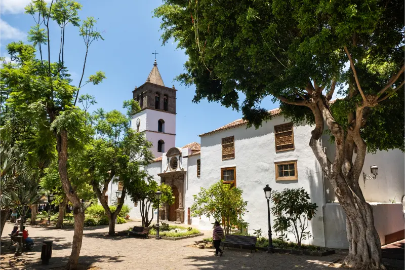
  • Museo de Arte Sacro Icod Guide: Silver Filigree Cross, Paintings and Vestments

    Museo de Arte Sacro Icod Guide: Silver Filigree Cross, Paintings and Vestments

    Museo de Arte Sacro is a useful stop for travellers who want to understand Tenerife beyond beaches and headline attractions. I would not cross the whole island only for this one place, but I would absolutely use it to add historical and local context to a day in Icod de los Vinos.

    In this guide I separate documented facts from practical planning. Dates, dimensions, artistic details and historical associations come from official tourism or municipal heritage sources. My suggestions about timing, route order, photography and combinations are travel-planning advice. I avoid inventing fixed opening hours, prices or guaranteed access when current official information is uncertain.

    At a glance

    PlaceMuseo de Arte Sacro
    WhereParque Lorenzo Cáceres, 38430 Icod de los Vinos
    Best forsacred art, silverwork, transatlantic history and museum visits
    Time to allow30–60 minutes when open
    Planning ruleCombine it with nearby sights, verify current access and keep the route flexible.

    Why I would include Museo de Arte Sacro in a Tenerife itinerary

    One of the easiest mistakes on Tenerife is to jump from one major attraction to another without understanding the towns between them. Places like Museo de Arte Sacro slow the trip down in a useful way. They show how local history, religion, trade, architecture or landscape developed at the level of an individual community.

    I also value stops that work inside a compact cluster. In Icod de los Vinos, I can usually combine several worthwhile places without repeated driving. That gives me more time to notice details, stop for coffee, change plans if a door is closed and still finish the day without feeling that I have been chasing a checklist.

    My rule is simple: a small site earns its place when it helps explain the destination. I would rather spend thirty attentive minutes somewhere meaningful than add three generic viewpoints just to increase the number of stops.

    What the official record confirms

    • The collection includes ecclesiastical vestments embroidered in gold and silver.
    • It also contains religious sculpture and painting.
    • The museum houses the Cruz de Filigrana, made in Havana in 1665.
    • The filigree cross is nearly two metres high and weighs about 45 kilograms.

    The 1665 Havana cross is the object I would build the visit around

    The Cruz de Filigrana is the museum’s standout object because it combines scale, craftsmanship and Atlantic history. The official tourism listing says it was made in Havana in 1665 at the request of the dean of Santiago de Cuba cathedral and later donated to San Marcos in Icod. At nearly two metres high and around 45 kilograms, it is much more imposing than the word ‘filigree’ might suggest.

    For me, its value is not only decorative. It physically links Tenerife with Cuba and shows how religious art, wealth and personal networks moved across the Atlantic. I would see the cross after visiting San Marcos so that its original ecclesiastical context is fresh in mind.

    Vestments, sculpture and painting beyond the headline piece

    The museum also preserves embroidered vestments, sculpture and paintings. I pay attention to materials because textiles and metalwork often reveal trade connections and workshop skills that are less obvious than large wooden retablos. Gold and silver embroidery, for example, can be both devotional and a statement of institutional prestige.

    A compact collection is often easier to absorb than a large museum. I choose a few objects, read what is available and compare techniques rather than trying to photograph every case. That usually gives me a clearer understanding of the parish’s artistic history.

    Practical planning for a small church museum

    Small ecclesiastical museums can have changing access arrangements, especially around services, holidays and conservation work. I therefore verify current information before setting out and avoid copying a timetable into a long-lived article unless it comes from a reliable current source.

    If the museum is closed, the surrounding cluster still works: San Marcos, Plaza Andrés de Lorenzo Cáceres, Plaza de la Pila and the Drago are all nearby. That redundancy is exactly why Icod is an easy destination to explore without a rigid minute-by-minute schedule.

    What to combine with it nearby

    I would build the visit around nearby pages already covered on this site rather than create an isolated detour. Good combinations include Iglesia de San Marcos, Plaza Andrés de Lorenzo Cáceres, Icod de los Vinos guide. For a broader planning option, I also keep Museo Malvasía Icod in the same cluster.

    Parque Del Drago Milenario Icod De Los Vinos Tenerife

    How I plan the visit

    I start by deciding whether Museo de Arte Sacro is the anchor of the outing or a supporting stop. For a small heritage site, the second option is usually better. I allow enough time to read information, look at details and take a few photographs, but I do not turn a short visit into half a day simply because the itinerary has empty space.

    I then check the official source shortly before travelling. Religious services, conservation work, local events, seasonal timetables or staffing can change access. If the interior is closed, I want the surrounding route to remain worthwhile.

    1. Start with the most time-sensitive stop, such as a museum or church interior.
    2. Continue on foot to exterior heritage, public squares and streets.
    3. Keep lunch or coffee flexible so a delay does not break the itinerary.
    4. Leave the final stop optional, especially if traffic, weather or a local event changes the pace.

    This style of planning works particularly well in Tenerife’s historic towns. Short map distances can hide steep streets, difficult parking and one-way systems, while a compact walking loop often reveals much more than several rushed car stops.

    How I read the history without oversimplifying it

    Heritage sites often mix documented facts, later restoration, local tradition and popular legend. I try to keep those layers separate. A date recorded by an official heritage inventory is not the same kind of evidence as a story passed through generations, even though both can be valuable for understanding the place.

    I also avoid treating Tenerife’s colonial period as a neutral backdrop. Conquest, Indigenous Guanche history, Atlantic trade, migration and religious institutions all shaped the island. Where one of those themes is relevant to Museo de Arte Sacro, I name it directly rather than reducing the story to decorative architecture.

    What I look for on site

    Before reaching for my phone, I look at materials and relationships: volcanic stone, timber, limewashed walls, ironwork, paving, courtyards, altarpieces, old trees or the way a building faces a square. These details usually tell me more than a single façade photograph.

    I also pay attention to later changes. Historic buildings are rarely frozen in one century. Fires, floods, new roads, restorations, changing religious use and civic adaptation can all become part of the story. I find a place more interesting when I can see those layers rather than searching for an imaginary “original” version.

    Getting there and moving around

    For Icod de los Vinos, I compare driving with public transport according to the rest of the day. A car is helpful when I am continuing to rural viewpoints or another municipality, but it can be inconvenient in older streets with limited parking. If I am concentrating on the historic centre, I prefer to park once and walk.

    Church In Icod De Los Vinos Tenerife

    TITSA serves the main towns and tourist areas of Tenerife. I check the current journey planner instead of hard-coding a bus number into an evergreen article, because routes and stops can change. Travellers with a pushchair, luggage or limited mobility should also inspect the final approach: gradients, cobbles and steps often matter more than the intercity journey.

    Best time of day

    For architecture and street photography, morning or late afternoon usually gives softer light. For a church or museum, access arrangements matter more than the angle of the sun. I prefer arriving early enough that a closed door does not create pressure to rush the rest of the route.

    Weekends, feast days and local events can transform a quiet square into a busy community space. That can be a highlight if I want atmosphere, but it can also affect parking and interior access. I check local notices when travelling around major religious or municipal celebrations.

    Practical tips that make the stop better

    Comfortable shoes are my default even for short urban visits. Historic paving can be uneven and north-Tenerife towns often have steeper streets than a map suggests. I carry water and a light layer because cloud, breeze and sun can change quickly across short distances.

    I do not assume that a public-looking heritage building has toilets, step-free access or continuous opening. Travellers who need specific accessibility features should verify them directly with the venue or municipality. The same applies to reserved parking and interior photography rules.

    For churches and devotional spaces, I dress respectfully and keep noise low. For historic houses, I respect private sections even when the façade looks museum-like. For monumental trees or rural heritage, I stay on public access and avoid trampling roots, crops or private land.

    Photography without missing the place itself

    I take one wide establishing image, then look for details: stonework, wood, metal, inscriptions, paving, vegetation or the relationship between a building and its square. That produces a more useful visual record than ten almost identical front-on photographs.

    I never assume drone use is legal simply because a place looks quiet. Tenerife has controlled airspace, protected areas and populated zones. A travel guide cannot replace current aviation rules or local restrictions.

    Where to eat and how I fit meals into the route

    I prefer eating near the area I am already exploring instead of driving across the island for a single restaurant. In Icod de los Vinos, that might mean a café in the historic centre, a traditional Canarian lunch or a longer meal after the walking portion of the day. I check recent opening information because weekly closing days and kitchen hours change.

    Dragon Tree In Icod De Los Vinos Tenerife

    Local food makes more sense when connected to the place: papas arrugadas, mojo, gofio, cheeses, fish and Tenerife wines all reflect agriculture, trade and everyday island life. I would rather choose a simple meal that fits the route than interrupt the day for a famous restaurant far away.

    Where to stay

    If I want to explore this part of Tenerife over more than one day, I compare current accommodation on Booking.com. I pay attention to the exact map position, parking, elevation and recent guest comments rather than relying only on the property name.

    For a first visit, I choose a base according to the majority of the itinerary. A good location saves more time over a week than staying next to one small attraction that I will visit only once.

    Activities and tours

    A heritage stop can pair well with one organised experience elsewhere on the island. I use the widget below to compare current options, but I avoid stacking a long excursion immediately before or after a dense driving day.

    Who will enjoy this stop most?

    Museo de Arte Sacro is best for travellers who enjoy context rather than only headline attractions. Couples and solo travellers can fold it into a slow walking day; families can use it as a short educational stop; repeat visitors may appreciate it because it reveals a layer of Tenerife that is easy to miss on a first trip.

    It may be less useful for someone with only a few hours on the island who is still trying to prioritise Teide, Anaga or a major beach. I would rather say that clearly than label every place a “must-see”. A good guide should help readers decide what fits their interests.

    Common mistakes I would avoid

    • Driving across Tenerife only for this single stop without combining it with the surrounding area.
    • Assuming old opening hours are guaranteed for a church, museum or locally managed heritage site.
    • Underestimating gradients, parking limitations or narrow streets in historic centres.
    • Treating local legends as proven history without saying they are traditions.
    • Ignoring services, worship, safety signs or private boundaries because a place appears tourist-oriented.

    Frequently asked questions

    What is the most important object in the museum?

    The Cruz de Filigrana is a major highlight: a large silver filigree cross made in Havana in 1665.

    How big is the filigree cross?

    The official tourism listing says it is nearly two metres high and weighs about 45 kilograms.

    What else can I see?

    The collection includes embroidered ecclesiastical vestments, religious sculpture and paintings.

    Should I check opening arrangements in advance?

    Yes. I would verify current access shortly before visiting because church museums can have variable schedules.

    Official information

    For the documented background used in this guide and for any current operational information, I check the official visitor or heritage information for Museo de Arte Sacro shortly before travelling. Same-day signs, staff instructions, parish notices, municipal updates and safety restrictions always take priority over an evergreen article.

    Final thoughts

    I would include Museo de Arte Sacro when it strengthens the story of a day in Icod de los Vinos. Its value is not measured by how many hours it occupies. A short stop can be meaningful when it explains architecture, faith, trade, landscape or everyday life.

    My preferred approach is simple: know the key facts before arriving, stay flexible about access, respect the place as part of local life and connect it with nearby sights. Done that way, it becomes one more piece of a Tenerife itinerary that feels coherent rather than crowded.