Category: Beaches & Coast

Tenerife beaches, natural pools and coastal experiences, with practical access and safety advice.

  • Rip Currents in Tenerife: Waves, Red Flags, Natural Pools and Ocean Safety

    Rip Currents in Tenerife: Waves, Red Flags, Natural Pools and Ocean Safety

    Quick summary: Tenerife’s Atlantic coast can look calm from a viewpoint and still have strong current, surge or shore break. I read the beach flags, choose lifeguarded water when possible and never treat a natural pool as automatically safe.

    TopicRip currents and ocean safety in Tenerife
    Best forSwimmers, families, snorkellers and anyone using beaches or natural pools around Tenerife
    My priorityRespect flags and local warnings, avoid unknown water in rough conditions and never fight a strong current head-on
    Key Tenerife factorNorth-coast swell, volcanic rock, shore break and local currents can change quickly with wind and tide

    What the Canary Islands authorities actually advise

    The Canary Islands emergency service notes that southern beaches are generally calmer than northern ones, where wind, waves and currents can make conditions more hazardous. Its sea-safety advice is available at Government of the Canary Islands – activities at sea.

    That is a useful regional pattern, not a guarantee. A protected northern bay can be calm while a south-coast beach has strong wind or shore break. I make the decision at the water’s edge using flags, lifeguard advice and the actual state of the sea.

    Beach flags are not decoration

    A red flag means bathing is prohibited. A yellow flag means caution, not “safe if I am a confident swimmer.” A green flag means conditions are considered suitable for bathing, but ordinary supervision and judgement still apply. I never use the absence of a lifeguard or flag as proof that an isolated beach is safe.

    When I arrive with children, I identify the lifeguard post, entry point, shallow area and a meeting point before anyone gets in. I also watch the sea for several minutes instead of entering immediately after parking.

    How I think about rip currents

    A rip current is a flow of water moving away from shore. The dangerous response is panic and an exhausting attempt to swim directly against a strong current. Canary Islands coastal-safety guidance advises remaining calm and not swimming against the current when being dragged by surf; coastal currents usually lose strength and the swimmer can then move toward safety.

    I prefer prevention: swim at a lifeguarded beach, stay inside the designated bathing area, avoid water beside rocks or structures when the sea is rough and ask the lifeguard about currents if anything looks uncertain. Being a strong pool swimmer does not make someone experienced in Atlantic surf.

    Natural pools need separate judgement

    Natural pools are visually inviting because walls and rock shelves create the impression of a protected swimming pool. During swell, however, waves can overtop those barriers, knock people from ladders, surge across platforms or create powerful water movement inside the pool. I check the sea before walking onto wet rocks and I leave immediately if waves begin reaching the access area.
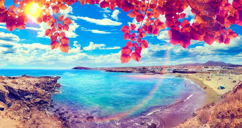
    Tenerife Volcanic Coast Natural Pool

    My Tenerife tides guide and rocky-shore safety guide cover the additional hazards of tide timing, slippery surfaces and marine injuries.

    Inflatables, SUPs and snorkelling

    Inflatable mattresses and toys can move offshore much faster than people expect. The official sea-safety guidance specifically warns that currents can carry inflatables away. I do not use a toy float as a safety device and I keep children within immediate reach rather than watching from a towel.

    For snorkelling I stay close to shore in conditions appropriate to my ability, use a visible setup when necessary and never assume a calm entry means the return will be equally easy. Wind direction matters, especially when using a paddleboard or inflatable craft.

    If someone is in trouble

    If a swimmer is struggling, I alert the lifeguard and call 112 rather than automatically entering dangerous water. The coastal-safety guidance recommends throwing a line, float or other object the person can hold if that can be done safely from land. An untrained rescuer can otherwise become a second casualty.

    After a difficult rescue or near-drowning I take symptoms seriously. Coughing, breathing difficulty, chest discomfort, extreme fatigue or altered consciousness after water aspiration needs medical assessment.

    The checks I make on the same day

    Conditions in Tenerife can change faster than a static travel article. Before a hike, forest drive, cave visit or coastal activity I reopen the official source, check current alerts and closures, and look at the forecast for the exact area rather than the island as a whole. A sunny hotel balcony in Costa Adeje says very little about wind on Teide, cloud in Anaga or swell on the north coast.

    I keep the official Tenerife trail and access information from Tenerife ON bookmarked. I also keep my Tenerife weather forecast guide and my general Tenerife safety guide available offline so I can quickly cross-check the basic plan.

    Why I do not treat rescue as a backup transport plan

    Rescue resources exist for genuine emergencies, but difficult access, wind, cloud and darkness can all slow a response. I plan as if I must complete the route safely under my own power: enough water, footwear that suits the surface, a charged phone, offline navigation, realistic turnaround time and a route shared with someone who is not on the walk. Calling 112 is the right action for an emergency, not a substitute for continuing into a closed or obviously unsuitable area.

    Families, older travellers and mixed-ability groups

    The safest group plan is based on the slowest or least confident person, not the strongest. I choose a shorter route with a good experience rather than extending the day until someone becomes exhausted. With children I pay special attention to exposed edges, loose volcanic gravel, heat and the long return journey after the exciting part of the outing is finished.
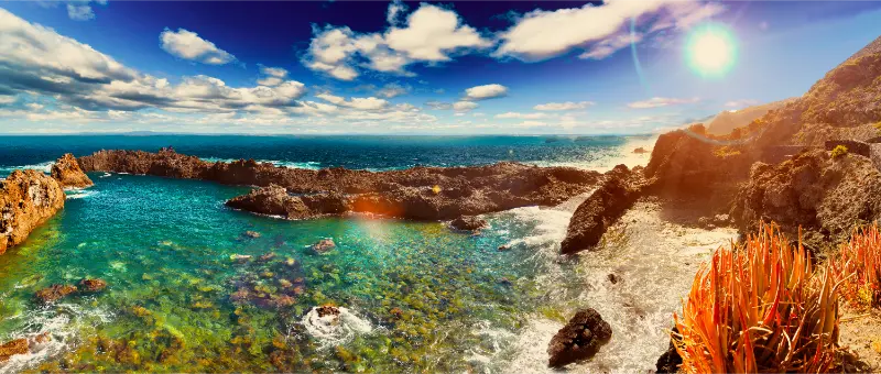
    Tenerife Volcanic Natural Pool

    Where I would stay

    For a nature-focused trip I compare accommodation in Tenerife on Booking.com. I prefer a base that reduces repeated cross-island driving and gives me an easy alternative plan if wind, fire risk, rain or a closure changes the day.

    Useful related Tenerife guides

    Official sources I check

    Frequently asked questions

    Are rip currents common in Tenerife?

    They can occur, and the north coast is often more exposed to swell and currents. Conditions vary by beach and day, so I use flags and lifeguard advice.

    What does a red flag mean?

    Bathing is prohibited. I do not enter the water even if other people ignore the flag.

    Should I swim against a rip current?

    Official coastal guidance advises not to fight a strong current directly. I stay calm, conserve energy and seek help, following lifeguard instructions where available.

    Are natural pools safer than beaches?

    Not automatically. Swell can overtop walls, wash across platforms and make ladders or rocks dangerous.
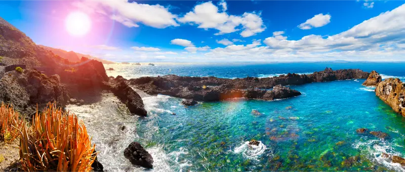
    Tenerife Volcanic Natural Pools At Sunset

    What number do I call for a sea emergency?

    112 is the emergency number in the Canary Islands.

    My final advice

    The best ocean-safety decision in Tenerife is often the least dramatic one: choose another beach, stay out of the water or wait for calmer conditions. The Atlantic does not become predictable because a location is popular on social media.

    I treat this guide as a planning framework, not a substitute for live information. Rules, opening hours, alerts and services can change after publication, so I recheck the official source when a detail can affect safety, health, access or a paid booking. That small habit makes a Tenerife trip much easier to adapt when conditions change.

    A realistic seven-day-trip approach

    I do not let rip currents and ocean safety in tenerife dominate the whole holiday. I solve the specific requirement, then build ordinary Tenerife days around it: one major activity, one flexible meal plan, realistic transport and a backup that works if weather or energy changes. The island rewards slower days because a short drive can move from hot coast to cloud, wind or altitude, and every transition adds time that a map does not show.

    I also avoid placing the most complicated day immediately after a late flight or immediately before departure. A spare half-day gives room for a delayed booking, a closure, tired children, an upset stomach or simply a place worth staying longer than expected. That buffer is one of the easiest ways to make a highly planned trip feel relaxed rather than fragile.

    What I save offline before leaving the hotel

    I save the accommodation address, insurance details, official alert page, relevant booking confirmation, a map of the day and the phone numbers I would need if mobile data fails. I also keep enough battery for the return journey. Tenerife has good connectivity in populated areas, but mountain terrain and underground or remote locations are exactly where I do not want every useful detail to depend on a live connection.

    For paid activities I screenshot the cancellation conditions and meeting-point instructions. For health or safety-sensitive plans I save the exact name of medication, allergies or key information in a form that can be shown to a professional. Preparation should make the day easier, not create a folder of documents nobody can find when needed.

    How I avoid overplanning

    My rule is to confirm the details that can create a real problem—health, safety, access, transport, opening times and paid reservations—and leave the rest open. I do not reserve every meal or minute. If the morning goes well, I extend it. If conditions are poor, I change area. Tenerife is much more enjoyable when the itinerary can respond to the island instead of fighting it.

  • Sea Urchins & Rocky Shore Safety in Tenerife: Water Shoes, Cuts, Spines and Natural Pools

    Sea Urchins & Rocky Shore Safety in Tenerife: Water Shoes, Cuts, Spines and Natural Pools

    Quick summary: Tenerife’s volcanic coast is beautiful, but sharp rock, slippery algae, surge and sea urchins can turn a casual scramble into an injury. I use proper access points, water shoes where appropriate and my hands for balance rather than grabbing unseen crevices. If I step on an urchin or receive a deep cut, I leave the water, clean the injury appropriately and seek medical advice when spines are deep, pain is severe, the wound is contaminated or I cannot remove a superficial fragment safely.

    Common hazardSharp volcanic rock and slippery wet surfaces
    Marine hazardSea urchin spines around rocky habitat
    Best preventionUse established entry points and suitable footwear
    Medical ruleSeek professional help for deep wounds, retained spines or concerning symptoms

    Before I commit money or time, I separate information into three levels: what is fixed by law or geography, what changes seasonally, and what can change from one day to the next. That simple distinction is especially useful in Tenerife, where weather, traffic, sea conditions, event programmes and transport availability can all change a plan without making the destination difficult. I keep the official source bookmarked, build a realistic buffer into the day, and avoid treating a single app, old forum post or social-media clip as a guarantee.

    Why rocky coasts need a different mindset

    A sandy resort beach encourages barefoot walking; a volcanic platform does not. Rock can be rough enough to cut skin and smooth enough to become dangerously slippery when wet. A calm-looking pool can receive a sudden surge through an opening. I therefore treat natural pools and wild coves as changing marine environments, not swimming pools with black walls. I watch how local swimmers enter, but I still make my own decision based on the conditions and official signs.

    Tenerife Rocky Coast And Natural Pool

    Where sea urchins fit into the risk

    Sea urchins live around rocky habitat and are easy to miss in cracks or dark water. Their spines are a defence, not an attack. Most problems happen because a swimmer steps, kneels or places a hand on them. I avoid standing on submerged rock when I cannot see clearly and never pick up an urchin for a photograph. If children are exploring rock pools, I supervise hands as carefully as feet.

    Water shoes: useful but not magic armour

    A good water shoe can improve grip and reduce small cuts, but it does not make every rocky entry safe. Thin soles may still be penetrated by sharp objects, and poor shoes can become slippery. I choose footwear that fits securely and is designed for wet rock. On a proper hiking approach I use hiking shoes and change near the water rather than walking kilometres in flimsy aqua shoes. Footwear is one layer of prevention, not permission to ignore waves.

    Cuts on volcanic rock

    Even a small cut can become messy when mixed with sand, salt water and continued swimming. I leave the water, control bleeding and clean the wound using appropriate first-aid supplies. Deep, gaping or heavily contaminated cuts deserve medical assessment. I keep a compact first-aid kit in the car or daypack because remote coves may not have a lifeguard. My aim is not to diagnose the wound on the beach; it is to stop turning a manageable injury into a bigger problem.

    What to do about urchin spines

    Spines can break and fragment. I do not dig aggressively into the skin with improvised tools, especially near joints, nerves or sensitive areas. A very superficial, easily accessible fragment is different from multiple deep spines. If pain persists, walking is difficult, the area becomes increasingly red or swollen, or I am unsure whether material remains, I seek professional medical advice. People with conditions that affect healing or infection risk should have a lower threshold for assessment.

    Natural pools and wave surge

    The most serious coastal risk can be the sea itself rather than the urchin. Waves can wash across a platform, push a swimmer against rock or make an exit impossible. I check flags and warnings, watch the water for several minutes and skip the swim if the pool is being overtopped strongly. The Tenerife ocean safety guide and jellyfish guide cover related hazards.

    Children and rock-pool exploring

    Rock pools are fascinating for children because every crack contains life, but I establish a simple rule: look, do not grab. Bare hands should not disappear under ledges where the child cannot see what is inside. I keep them away from exposed edges when swell is present and choose a safer beach if I want relaxed play rather than constant supervision. Wildlife stays in the pool; shells and animals are not souvenirs.

    My practical planning checklist

    • Use proper access points: A shortcut over wet rock can be much riskier than the marked stairs or ladder.
    • Wear suitable footwear: Choose grip and secure fit, while remembering shoes do not stop waves.
    • Look before placing hands or feet: Urchins and sharp rock are easier to avoid when visibility is good.
    • Carry basic first aid: Remote coves may have no lifeguard or nearby shop.
    • Do not dig at deep spines: Persistent or deep injuries deserve professional assessment.
    • Respect surge: If waves are overtopping the platform, skip the swim regardless of how many people are still in the water.

    How I build this into a Tenerife itinerary

    I keep the main purpose of the day simple and protect it with one backup. I do not schedule a fixed-time activity at one end of the island, a long lunch in the middle and another hard reservation at the other end unless the transport margin is genuinely comfortable. Tenerife rewards flexible planning because a motorway incident, cloud on a mountain road, sea conditions or an event can change the best order of the day. A backup is not a second full itinerary; it is one nearby option that still makes the day worthwhile.

    I also save screenshots or confirmations that matter when mobile coverage, battery or app login becomes inconvenient. For driving I keep the rental emergency contact; for an event I keep the ticket; for a wildlife activity I keep the meeting point; for a market or cultural venue I verify the official opening information before travelling. This is the difference between useful planning and overplanning: I prepare the few details that can stop the day, then leave the rest open enough to enjoy the island.

    Where I would stay

    The best base depends on how often this topic appears in the trip. For repeated city evenings I prefer Santa Cruz or La Laguna; for sea activities I usually favour the south or another coast close to the operator; for island touring I choose a base with easy road access rather than the prettiest address on paper. I compare places to stay in Tenerife and then check the exact location, recent reviews, parking or public-transport access before booking. A good base removes repeated friction from the holiday.

    Official information I would recheck

    Frequently asked questions

    Are sea urchins common around Tenerife rocks?

    They occur in rocky marine habitats, so swimmers using volcanic entries and natural pools should look before standing or placing hands.

    Tenerife Volcanic Coast Natural Pool

    Do water shoes prevent urchin injuries?

    They can reduce risk, but thin soles are not guaranteed protection and footwear does not make unsafe sea conditions safe.

    When should I see a doctor?

    Seek medical advice for deep or multiple spines, severe pain, difficulty walking, deep cuts, retained material, infection signs or any situation that worries you.

    Extra planning notes that make a real difference

    Use proper access points. A shortcut over wet rock can be much riskier than the marked stairs or ladder. I treat this as a decision point rather than a rigid rule. The exact answer can depend on the part of Tenerife, the season, the time of day and the people travelling with me. I would rather spend two minutes checking the current situation than lose an hour correcting a preventable mistake. When in doubt, I choose the safer and simpler option and keep the more ambitious plan for a day when conditions are clearer.

    Wear suitable footwear. Choose grip and secure fit, while remembering shoes do not stop waves. I treat this as a decision point rather than a rigid rule. The exact answer can depend on the part of Tenerife, the season, the time of day and the people travelling with me. I would rather spend two minutes checking the current situation than lose an hour correcting a preventable mistake. When in doubt, I choose the safer and simpler option and keep the more ambitious plan for a day when conditions are clearer.

    Look before placing hands or feet. Urchins and sharp rock are easier to avoid when visibility is good. I treat this as a decision point rather than a rigid rule. The exact answer can depend on the part of Tenerife, the season, the time of day and the people travelling with me. I would rather spend two minutes checking the current situation than lose an hour correcting a preventable mistake. When in doubt, I choose the safer and simpler option and keep the more ambitious plan for a day when conditions are clearer.

    Tenerife Volcanic Natural Pool

    Carry basic first aid. Remote coves may have no lifeguard or nearby shop. I treat this as a decision point rather than a rigid rule. The exact answer can depend on the part of Tenerife, the season, the time of day and the people travelling with me. I would rather spend two minutes checking the current situation than lose an hour correcting a preventable mistake. When in doubt, I choose the safer and simpler option and keep the more ambitious plan for a day when conditions are clearer.

    Do not dig at deep spines. Persistent or deep injuries deserve professional assessment. I treat this as a decision point rather than a rigid rule. The exact answer can depend on the part of Tenerife, the season, the time of day and the people travelling with me. I would rather spend two minutes checking the current situation than lose an hour correcting a preventable mistake. When in doubt, I choose the safer and simpler option and keep the more ambitious plan for a day when conditions are clearer.

    Respect surge. If waves are overtopping the platform, skip the swim regardless of how many people are still in the water. I treat this as a decision point rather than a rigid rule. The exact answer can depend on the part of Tenerife, the season, the time of day and the people travelling with me. I would rather spend two minutes checking the current situation than lose an hour correcting a preventable mistake. When in doubt, I choose the safer and simpler option and keep the more ambitious plan for a day when conditions are clearer.

    Final thoughts

    Sea urchins tenerife is easiest to handle when I replace assumptions with one or two current checks and then keep the plan proportionate. Tenerife does not need to feel complicated. The island is well set up for visitors, but local roads, marine conditions, events, infrastructure and wildlife are real rather than theme-park scenery. I get more from the trip when I respect those systems, leave enough time, and use official information for anything that can materially affect safety, access or money.

  • Tenerife Tides Guide: High Tide, Low Tide, Natural Pools and Coastal Safety

    Tenerife Tides Guide: High Tide, Low Tide, Natural Pools and Coastal Safety

    Quick summary: A practical guide to Tenerife tides for beach and natural-pool days, explaining why tide height matters but must always be considered together with swell, wind, waves and local closures.

    Tide planning is especially useful in Tenerife because volcanic coasts create natural pools, rock shelves and small beaches that can feel completely different a few hours apart. A low tide may expose more rock; a rising tide can refresh a pool; a high tide can also bring waves across walls that looked perfectly calm earlier.

    The key lesson is that tide is only one variable. Swell direction, wave period, wind and local geometry can make a place dangerous even at a tide state someone online described as ‘best’. I never use a tide app as permission to swim.

    At a glance

    Best forNatural-pool swimmers, photographers, coastal walkers and beach planners
    What matters mostCombine current tide data with swell, flags, closures and what you see on arrival
    My approachCheck official forecasts, then make the final decision at the coast
    Useful backupHave a conventional sheltered beach as backup when exposed pools are rough

    What high tide and low tide actually mean

    Tides are the regular rise and fall of sea level driven mainly by the gravitational effects of the Moon and Sun. High tide is the higher stage and low tide the lower stage within the cycle. The exact times shift each day.

    For travellers, the practical point is not memorising astronomy. It is understanding that the same pool, ladder, beach access or rock platform can sit at a different relationship to the sea depending on the hour.

    Tenerife has a meaningful tidal range

    Official port information for Santa Cruz de Tenerife and Los Cristianos has documented a maximum tidal range on the order of a few metres, enough to noticeably change many rocky shorelines. Exact daily levels vary, so historical figures are not a substitute for a current tide table.

    I use a current official or reputable tide forecast for the specific coast and date. A screenshot saved weeks earlier is poor planning because I may be looking at the wrong day or time zone.

    Natural pools and why tide matters

    Some natural pools are protected by walls or volcanic rock that reduces wave energy, but they remain connected to the ocean. At certain tide and swell combinations, water can wash over the edge violently.

    I watch the pool for several minutes before entering. If waves are repeatedly crossing the wall, people are being knocked around or lifeguards have closed access, I do not reinterpret the situation because an app says the tide should be favourable.

    Tenerife Rocky Coast And Natural Pool

    Swell is different from tide

    Swell describes waves travelling across the ocean, while tide describes the background sea level. A low tide with large long-period swell can be far more dangerous than a high tide on a calm day.

    This distinction explains many confusing travel posts. Someone may say a pool is ‘safe at low tide’, but that advice ignores the wave energy arriving that day.

    Wind, local shape and wave direction

    Tenerife’s coast faces different directions, so a north-coast pool and a sheltered south-coast bay can experience the same day very differently. Wind can also create chop or make exits difficult.

    I check the exact coast rather than an island-wide ‘sea conditions’ summary. Micro-location matters at the water as much as microclimate matters in the mountains.

    Beach size and access can change

    On some beaches, low tide exposes more sand or rock, while high tide narrows the usable beach. A path around a headland or access across rocks can become more difficult as water rises.

    I avoid leaving towels or bags on a patch that may be cut off later. If I need to cross rocks to return, I check the rising tide before committing.

    Photography and tide planning

    For photography, tide can transform reflections, rock textures and the amount of visible black volcanic shoreline. Low tide may reveal patterns; higher water may simplify the scene.

    I still keep a safe distance from wet rock ledges. A dramatic wave photograph is not worth standing in the impact zone, especially when a larger set can arrive after several quieter minutes.

    How I read a tide table

    I note the predicted high and low times plus heights, then look at the trend: rising or falling during my visit. I do not obsess over the exact minute because local water movement and waves are continuous.

    If I am unfamiliar with the coast, I arrive in daylight. Seeing access points, ladders, escape routes and wave behaviour is much easier than learning them after sunset.

    Red flags, closures and local instructions override the app

    Beach flags, barriers, lifeguard instructions and municipal closures are immediate local information. They always outweigh my personal interpretation of a tide graph.

    If a pool is closed, I do not climb around the barrier because other people are inside. A closure can reflect swell, contamination, damage or another hazard that a tide app cannot show.

    Before I go: my practical checklist

    Before I build a day around Tenerife tides, I check the exact date, location and access information again. Cultural programmes, market-style events, sea conditions and night-sky plans can all change for different reasons, so I save the current source rather than relying on a screenshot from an old article. I also save the address or meeting point offline in case mobile data is weak.

    I then look at transport in both directions. Getting somewhere is only half the plan: the last bus, evening road conditions, parking restrictions and walking distance back to the hotel can matter more after a late event or remote stop. If the day includes alcohol, darkness, mountain roads or swimming, I decide in advance who is driving—or remove driving from the plan completely.

    For anything outdoors, I check weather for the exact area rather than Tenerife as a whole. The island’s altitude and exposure create very different conditions between a south-coast resort, the north coast and Teide. I pack one extra layer, water and sun protection even when the activity itself seems easy.

    Finally, I keep the plan reversible. If the event is cancelled, the sea is rough, a venue is closed or cloud blocks the sky, I want an alternative nearby rather than an argument with reality. A museum, market, historic centre, sheltered beach or relaxed meal can rescue the day without turning it into a rushed cross-island chase.

    How I fit this into a real Tenerife holiday

    I check tides for one or two coastal days, not for every hour of the holiday. That is enough to improve natural-pool timing and photography without turning the trip into a spreadsheet.

    Tenerife Volcanic Coast Natural Pool

    If conditions are rough, I move the swim rather than the rule. Tenerife has enough beaches and inland activities that there is rarely a reason to force one exposed pool.

    Tenerife is compact, but the island is not flat and travel times can be deceptive. I group experiences by area rather than crossing from one end of the island to the other several times in the same day. That makes the cultural, food or nature stop feel like part of the trip instead of another box to tick.

    I also keep one flexible half-day. Weather, sea conditions, event schedules and local opening patterns can change. A free block gives me room to move an activity rather than forcing it into poor conditions.

    Where I would stay

    I choose a base for the wider itinerary, not for this single activity. South-coast resorts are convenient for dependable holiday infrastructure, while Santa Cruz, La Laguna, Puerto de la Cruz and smaller northern towns can make culture, food and local events easier to weave into everyday plans.

    I compare location, parking or public transport, cancellation terms and recent guest feedback before booking. Compare accommodation in Tenerife on Booking.com.

    Bookable Tenerife experiences

    For tours and activities I compare the meeting point, duration, cancellation terms and what is actually included. I do not assume that two products with similar titles offer the same route or level of guidance.

    Useful related Tenerife guides

    Official and specialist sources I would recheck

    For details that can change, I prefer primary or specialist sources over old screenshots and social-media posts. These are the pages I would reopen close to the trip.

    Frequently asked questions

    How often do tides change in Tenerife?

    There are regular high and low tides each day, with times shifting. I check the current date and coast rather than using a permanent schedule.

    Is low tide always safest for natural pools?

    No. Swell, waves, wind, pool design and closures matter just as much, sometimes more.

    Tenerife Volcanic Natural Pool

    Can I rely on a tide app for swimming safety?

    No. It is a planning tool, not a safety guarantee. Observe conditions and follow lifeguards and closures.

    Why does the same pool look different in photos?

    Tide height, swell, light and recent weather can change the water level and amount of exposed rock dramatically.

    Should I visit natural pools at night?

    I prefer first visits in daylight so I can see access, ladders, wet rocks and wave behaviour.

    My final advice

    I use tide information to improve timing, never to overrule the ocean in front of me. The safest plan is the one that is easy to abandon when the coast looks stronger than expected.

    The best Tenerife trips leave enough space to notice the island rather than rushing through it. I verify the details that can change, respect local rules and traditions, and then allow the experience itself to be the memorable part.

  • Playa de Las Gaviotas Tenerife Guide: Black Sand, Nudism and Anaga Coast Tips

    Playa de Las Gaviotas Tenerife Guide: Black Sand, Nudism and Anaga Coast Tips

    Playa de Las Gaviotas is one of the Tenerife places I plan around conditions rather than treating as a box to tick. Plan Playa de Las Gaviotas near Santa Cruz with fine black sand, Anaga cliffs, parking, bus access, nudism, no-dog rules and Atlantic swimming safety.

    My approach is simple: understand what makes Playa de Las Gaviotas distinctive, verify the practical details that can change, and then fit it into a geographically sensible day. That matters on Tenerife because a short distance on the map can involve mountain roads, limited parking, a completely different microclimate or an exposed Atlantic shore.

    Quick planning facts

    MunicipalitySanta Cruz de Tenerife
    LengthAbout 250 m
    WidthAbout 40 m
    SandFine black volcanic sand
    TypeIsolated beach
    ParkingYes, fewer than 50 spaces
    BusInterurban bus listed
    NaturismCommon/allowed
    DogsNot allowed according to official listing

    How Las Gaviotas differs from Las Teresitas

    These two beaches are geographically close but feel almost opposite. Las Teresitas is broad, golden, highly serviced and sheltered; Las Gaviotas is smaller, black, less developed and backed by the steep Anaga massif. I choose between them based on mood rather than asking which is universally better.

    If I have visitors who want an easy family beach, Las Teresitas often wins. If I want volcanic sand and a quieter natural setting, Las Gaviotas is more distinctive.

    Naturism and beach etiquette

    The official tourism page notes that nudism is practised here. I treat that as part of the beach’s culture and keep the atmosphere relaxed and respectful. I do not photograph strangers and I avoid making naturism the spectacle of the visit.

    The same basic etiquette applies to everyone: keep noise reasonable, take rubbish away and do not block the limited parking while waiting for a space.

    A small parking area changes how I plan the day

    Fewer than 50 official parking spaces means timing matters. I arrive earlier than I would for a large urban beach and keep a backup plan, usually Las Teresitas or San Andrés, so I never need to squeeze into unsafe roadside spaces.

    Using the bus can be a good alternative, but I verify the current timetable because coastal frequencies and stops can change.

    Access, parking and how I arrive

    The beach is reached by road and has parking directly nearby, but the official listing says fewer than 50 spaces. Interurban bus access is also listed. I check road status because the final approach sits below steep terrain.

    I check the route before leaving and save the location offline. Around Santa Cruz de Tenerife, beyond San Andrés, I avoid blocking driveways, farm tracks, bus stops or emergency access even if other cars are doing it. If the legal parking is full, I use my backup stop instead of turning a narrow local road into an improvised car park.

    For public transport I use the method in my Tenerife bus guide: I verify the current TITSA timetable on the day, identify the final useful return service and allow extra time for connections. Rural and coastal buses can be excellent, but they do not always run at resort-level frequency.

    Conditions, weather and the best time of day

    My preferred timing is A calm-sea morning before the small parking area fills. Tenerife’s microclimates are strong enough that I never rely on one island-wide forecast. I check the exact municipality, wind and, for coastal places, sea state; for mountain areas I also look at temperature and cloud at the relevant altitude.

    I keep the schedule flexible. A cloudy mountain morning can become a good coast afternoon, while rising wind at the beach may be a reason to switch to a village or museum. This is one of the easiest ways to enjoy Tenerife more: build alternatives into the route instead of forcing the original plan.

    My broader Tenerife weather by month guide explains why north, south, high mountain and trade-wind zones can feel like different destinations on the same day.

    Safety: what changes my decision on the day

    The tourism page says waves are not usually strong, yet it explicitly recommends caution depending on sea conditions. I watch the water for several minutes before entering and leave extra distance from the cliff if there are rockfall warnings or barriers.

    I also use the principles in my Tenerife safety guide. A place being popular on social media does not make it safe under every condition. I turn around for closed access, red flags, rockfall warnings, wildfire restrictions, strong wind or any situation that feels outside my experience.

    I tell someone my plan when I am walking alone, keep enough phone battery for navigation and emergency calls, and avoid depending on mobile coverage in ravines or remote mountain areas. For an emergency in Spain and the Canary Islands, 112 is the general emergency number.

    What I bring

    My basic Tenerife day kit is water, sun protection, a charged phone, a light layer and footwear suited to the actual surface. I add a windproof or waterproof layer for Anaga and higher ground, and water shoes only where rocky swimming access makes them useful. I never use flip-flops as hiking shoes just because the trail starts near a beach.

    Anaga Forest Tenerife

    I also carry a small bag for rubbish and enough food that I am not dependent on finding an open café at exactly the right time. In rural areas, opening hours can be limited or seasonal, and I prefer buying locally when I do stop.

    How I connect this stop with the rest of Tenerife

    I avoid crossing the island just for one short stop. Around Santa Cruz de Tenerife, beyond San Andrés, I build a small cluster and choose two or three substantial experiences. Useful related guides are San Andrés guide, Las Teresitas guide, Anaga Rural Park guide.

    This approach reduces driving, creates more time for food and unplanned viewpoints, and makes it easier to adapt to weather. On a one-week trip especially, a calm regional day is usually more satisfying than collecting distant pins from a map.

    Who I think will enjoy it most

    Playa de Las Gaviotas works best for travellers who appreciate a isolated fine black-sand beach below the Anaga cliffs and are willing to adapt to local conditions. I would not choose it simply because a photograph looks dramatic; I choose it when the access, weather and pace match the people I am travelling with.

    Anaga Laurel Forest Path Tenerife

    Families, older travellers, photographers and hikers can all enjoy Tenerife differently. I compare walking surface, shade, toilets, distance from the car and escape options before promising that a place suits everyone. That small bit of planning prevents a scenic stop from becoming an uncomfortable obligation.

    Photography without turning the place into a photo set

    I usually prefer early or late light, but I never step beyond barriers or onto unstable rock for a cleaner composition. Wide-angle views explain Tenerife’s scale, while details such as volcanic texture, vegetation, old paths and fishing infrastructure often tell a more original story than another posed viewpoint shot.

    When people are present, I respect privacy. On beaches where naturism is common, I am especially careful not to photograph strangers. In protected natural areas I do not move rocks, pick flowers or leave the trail to create a foreground.

    Responsible travel habits I use here

    Playa de Las Gaviotas is part of a lived landscape, not an attraction separated from local life. I keep noise low near homes, never block access, take all rubbish away and use toilets or bins where they exist. On protected land I stay on legal routes and do not collect plants, stones or archaeological material.

    I also try to spend something in the surrounding area when it makes sense: a coffee, meal, market purchase or locally run accommodation spreads the value of tourism beyond the most obvious resort businesses. Respectful travel is mostly a collection of ordinary decisions.

    Three mistakes I avoid

    First, I do not trust an old screenshot more than a current official notice. Beach access, hiking permits, road restrictions and protected-area rules can change. I check again close to the visit.

    Second, I do not assume “Tenerife weather” is one forecast. A sunny app icon for the airport tells me very little about Anaga cloud, north-coast swell or conditions above 2,000 metres.

    Third, I do not overfill the day. One good walk or beach, one cultural or food stop and one flexible extra usually produces a better memory than six rushed locations.

    Where I would stay for this area

    I choose accommodation for the wider itinerary, not only for one beach. If this part of the island is going to be a recurring base, I compare accommodation in the wider area on Booking.com and then check the exact walking route, parking situation and bus stop before booking.

    For a first trip I often prefer a base with restaurants and transport within walking distance, then use day trips for quieter coves. On repeat visits, a smaller village can make more sense if I value evenings without resort crowds.

    Official information I check before leaving

    I use the official Turismo de Tenerife Las Gaviotas page for the core facts in this guide. For permits, protected-area status, closures or trail conditions I also check the responsible public authority or Tenerife ON where applicable.

    I treat opening hours, access rules and transport times as live information. The article gives me a planning framework, but the final decision is based on the official notice closest to the date of travel.

    My realistic half-day or day plan

    I start with Playa de Las Gaviotas as the priority and give it enough time that I do not feel rushed. Afterwards I choose one nearby place from the same cluster rather than driving across Tenerife. Lunch or coffee becomes a natural pause, especially on mountain or coastal roads where concentration matters.

    If conditions are wrong, I switch early rather than waiting for the day to improve. I always have a Plan B that is safer and geographically close: a village, museum, promenade, market or more sheltered beach. That flexibility is one of the most useful habits I have developed for island travel.

    Frequently asked questions

    Is Las Gaviotas a black-sand beach?

    Yes. It has fine black volcanic sand below the Anaga cliffs.

    Anaga Laurel Forest Tenerife

    Is nudism allowed?

    The official tourism page notes that nudism is practised at the beach.

    Is there parking?

    Yes, but the official listing says fewer than 50 spaces.

    Can dogs go on the beach?

    The official listing says dogs are not allowed.

    What is the easiest nearby alternative?

    Las Teresitas is the obvious alternative if parking is full or I want more services and a more sheltered swimming environment.

    Final thoughts

    Playa de Las Gaviotas earns a place in my Tenerife plans because it adds a specific landscape or local experience rather than repeating something I can find anywhere on the island. I get the most from it when I respect the conditions, keep the day geographically simple and leave enough time to notice the surroundings instead of rushing onward.

    I would rather miss a stop because access is closed, the sea is rough or the weather is wrong than force an unsafe visit. Tenerife will still be there on another day, and the ability to change plans is part of travelling well on an island shaped by mountains, wind and the Atlantic.

  • Charco del Viento Tenerife Guide: Volcanic Pool, Snorkelling and Safety

    Charco del Viento Tenerife Guide: Volcanic Pool, Snorkelling and Safety

    Charco del Viento is one of the north Tenerife natural pools I visit for the volcanic setting as much as the swim. Lava flows reached the sea and formed two rocky arms that partly protect a small bay on the La Guancha coast.

    The shelter can make the water calmer than the open Atlantic, but I never treat a natural pool as risk-free. My decision to enter depends on the actual waves, access and warning signs I see on the day.

    Quick planning facts

    LocationSanta Catalina, La Guancha
    TypeNatural volcanic bathing area
    Best forSwimming and snorkelling in calm conditions
    Main hazardAtlantic swell and slippery volcanic rock
    FootwearWater shoes helpful
    Best timingCalm-sea mornings are my preference
    Combine withLa Guancha, San Juan de la Rambla, Icod

    How the natural pool was formed

    Charco del Viento is a volcanic bathing area in Santa Catalina, La Guancha. Ancient lava flows reached the sea, cooled rapidly and created two natural rock arms that partially shelter a small bay from the stronger Atlantic swell.

    Tenerife Volcanic Natural Pool

    That geology is what makes the place beautiful and what can make visitors overconfident. The lava barriers reduce wave energy but do not turn the ocean into a swimming pool with guaranteed conditions.

    Swimming and snorkelling

    On calm days the sheltered water can be clear enough for snorkelling, and Turismo de Tenerife specifically mentions swimming, fishing and snorkelling as common activities. I enter slowly because volcanic rock can be uneven and slippery.

    If waves are overtopping the outer rocks or the water is moving strongly through the pool, I stay out. I never stand on exposed edges to photograph incoming surf.

    Footwear and comfort

    Water shoes are useful for rough rock and entry points. I also bring a towel that I do not mind placing on volcanic ground, sun protection and enough water.

    There may be periods when access infrastructure changes after storms, so I judge the site in front of me rather than relying entirely on old images.

    Why I combine it with La Guancha

    The pool makes more sense as part of a wider La Guancha day. My La Guancha guide links the coast with the rural town, forest and other local landscapes.

    That also gives me a strong backup plan if the sea is too rough: I can turn the day inland instead of waiting for conditions to improve.

    Photography and wave safety

    The geometry of the lava arms and clear water is photogenic, but I use a zoom or phone from a safe position rather than approaching the outer edge during swell.

    North-coast waves can arrive in larger sets after several quiet minutes. I never let a photograph make me forget that pattern.

    Official source

    I use the official Charco del Viento page for location and geological description.

    For the actual decision to enter the water, I rely on current sea conditions, warning signs and any local closure.

    How I judge whether it is a swimming day

    At Charco del Viento I decide whether to swim only after seeing the sea in person. Beach descriptions are useful, but Atlantic conditions change with swell, wind, tide and local currents. A beach that looked easy yesterday can be completely different today.

    I look for warning flags, lifeguard instructions where present, local closures and the behaviour of experienced bathers. If the beach is not supervised, I become more conservative. My Tenerife safety guide explains the ocean-safety habits I use around the island.

    What I bring

    My basic beach kit is simple: water, reef-safe sun protection, a hat, sandals or water shoes for hot or rough surfaces, and a light layer for wind. On black sand I also remember that the surface can become surprisingly hot in strong sun.

    I do not leave valuables visible in the car, and I take all litter away. On beaches without services I assume there will be no shade, toilets, drinking water or food unless the official listing says otherwise.

    Best time of day

    Morning is my default for easier parking, gentler temperatures and a better chance of finding space. Late afternoon can be beautiful, but I keep enough daylight for walking back to the car or navigating coastal roads.

    For a family day I avoid arriving hungry at the busiest lunch hour. I either bring a simple picnic where appropriate or decide in advance which nearby village will be the food stop.

    Getting there and parking

    I check the final approach before driving to Charco del Viento, especially because small coastal settlements in La Guancha can have narrow streets. I use legal parking only and never convert a turning area, bus stop or resident access into an improvised space.

    If the official beach information lists bus access, I still verify the current route and timetable. My Tenerife without a car guide is useful when I am building a trip around public transport.

    What to combine nearby

    I combine Charco del Viento with La Guancha village, San Juan de la Rambla, Icod de los Vinos or other north-coast viewpoints rather than driving across the island after a beach stop. The goal is to understand one piece of Tenerife in depth: its coast, village streets, volcanic terrain and food.

    Tenerife Volcanic Natural Pools At Sunset

    This is also more resilient. If swimming is not sensible, I can still use the day for a walk, a viewpoint or a local meal without wasting hours in the car.

    Where I would stay

    I would choose accommodation in La Guancha only if the wider area fits the trip, not simply to be near one beach. For most first-time visitors I compare the convenience of a larger base with the atmosphere of a quieter local zone.

    When I want to stay close, I compare accommodation in the wider area on Booking.com and then verify the exact road, parking and walking access before booking.

    Frequently asked questions

    Is Charco del Viento safe for swimming?

    It can be enjoyable in calm conditions, but ocean swell can still affect the pool. I stay out when waves are overtopping the outer rocks or access is closed.

    Can I snorkel there?

    Yes, snorkelling is a popular activity when the sea is calm and visibility is good.

    Do I need water shoes?

    They are useful because volcanic rock can be rough and slippery.

    Is it a normal swimming pool?

    No. It is a natural volcanic bathing area connected to the Atlantic.

    Natural Pool Near Los Gigantes Puerto De Santiago Tenerife

    What should I combine it with?

    La Guancha village, San Juan de la Rambla or Icod de los Vinos make logical nearby stops.

    How I decide whether this stop belongs in my itinerary

    I ask whether the place adds something different from the previous day. Tenerife can easily become a sequence of similar viewpoints or beaches if I plan from a list instead of from geography. I prefer contrast: coast after forest, heritage after a hike, or a quiet village after a major attraction.

    I also compare the detour with the experience. A small stop that sits naturally on my route can be excellent; the same stop may not justify a two-hour cross-island drive. This is why I group days by area and protect time for unplanned discoveries.

    Small mistakes I try to avoid

    I do not trust travel times that ignore parking, mountain bends or finding the correct entrance. I do not leave water in the hotel because the plan looks short. I do not assume a café, toilet or ticket office will be open simply because an old article mentions it. And I never turn a closed gate or warning barrier into a challenge to get around.

    Another common mistake is trying to reproduce a photograph exactly. Light, tide, cloud, vegetation and access all change. I use images for orientation, then accept the conditions I actually find. That approach is safer and usually creates a more genuine travel experience.

    What I save on my phone before leaving

    I save the exact destination, an offline map, the official information page and one backup stop in the same area. For a hike I also save the route file or map, emergency information and the latest access notice. For a beach I check sea conditions and identify a nearby non-swimming alternative.

    This simple preparation matters most in rural Tenerife, where a weak signal or a closed road can otherwise turn a small change into a long detour. It also lets me spend less time looking at my phone once I arrive.

    Responsible travel details that matter

    I stay on marked paths, never collect volcanic rocks or plants in protected areas, keep drones subject to current rules and avoid photographing people at close range without permission. In villages I remember that the photogenic doorway is somebody’s home and the narrow lane may be the only access for residents.

    On the coast I keep away from unstable edges and do not approach blowholes or outer rocks during swell. I take rubbish away, avoid feeding wildlife and use established access rather than creating shortcuts through vegetation. These are small decisions, but repeated by many visitors they determine how well places cope with tourism.

    My final take

    Charco del Viento is beautiful because it remains part of the ocean. I enjoy the clear water and lava forms when conditions are calm, but I keep the same respect for swell that I would use on an exposed north-coast beach.

  • Playa del Ancón Tenerife Guide: Wild Black Sand Near La Orotava

    Playa del Ancón Tenerife Guide: Wild Black Sand Near La Orotava

    Playa del Ancón is a wild black-sand beach I choose when I want the north coast to feel genuinely untamed. It lies below El Rincón in La Orotava, framed by cliffs, banana-growing land and native vegetation, with no car park directly beside the sand.

    The local tourism office is unusually clear about the most important practical point: strong waves and currents require maximum caution even when the ocean appears calm. I therefore plan Ancón as a scenic walking beach first and a swimming beach only when conditions are unquestionably suitable.

    Quick planning facts

    MunicipalityLa Orotava
    Beach typeIsolated volcanic black-sand beach
    Official lengthAbout 200 m
    Official widthAbout 20 m
    SeaStrong wave exposure; currents require caution
    ParkingNo beach car park
    BusOfficial municipal information references interurban service
    Best forWild scenery, walking, photography

    The setting between El Rincón and the Atlantic

    Playa del Ancón sits below the agricultural landscape of El Rincón in La Orotava, where banana plantations and native coastal vegetation descend toward dark sand. The municipal tourism office lists a length of about 200 metres and describes it as isolated with strong wave action.

    The beach is separated from Los Patos by Punta del Ancón. That geography makes this stretch of coast feel wild even though towns and farms are close above the cliffs.

    Getting there on foot

    There is no beach car park at the sand, so I think of access as a short hike rather than a beach transfer. I use the recognised route from El Rincón and wear proper footwear because the approach can be dusty, uneven and slippery after rain.

    I also save energy for the return. A downhill path can feel easy when I am fresh, but the climb back is much warmer after several hours in the sun.

    Strong waves and currents

    The municipality explicitly warns visitors to take maximum precautions with the sea even when it appears calm because currents affect this coast. That warning shapes my whole visit. I do not enter just because other people are in the water.

    When swell is present, I stay well above the wet-sand line and use the beach for walking and photography instead. Tenerife has many easier swimming beaches, so there is no reason to gamble here.

    How it compares with El Bollullo and Los Patos

    Ancón belongs to the same dramatic north-coast landscape as El Bollullo and Los Patos, but it generally feels more isolated. El Bollullo is better known and has a clearer visitor flow, while Ancón appeals more to walkers who accept fewer facilities.

    My El Bollullo guide helps compare access and beach character if I want to choose only one.

    Facilities and summer lifeguard context

    The La Orotava tourism page notes lifeguard service in summer, but I never assume exact dates or daily staffing without checking locally. Outside those periods I plan as if there are no beach services.

    Jardines Victoria Fountain La Orotava Tenerife

    I bring my own water, food, sun protection and basic first-aid items, then carry everything back out. There are no reasons to leave rubbish in a place that is difficult to service.

    Who this beach suits

    Ancón is ideal for travellers who value a wild setting and do not mind a walking approach. It is less suitable for visitors who need step-free access, showers, easy parking or reliable food services beside the sand.

    For a more convenient black-sand day I would use Playa Jardín or Playa El Socorro, depending on sea conditions.

    Bus access and practical transport

    The municipal page lists interurban bus access and line 376, but route numbers can change. I always confirm TITSA before travel rather than building the day around an old timetable.

    If I am driving, I leave the vehicle legally in the upper area and never block agricultural tracks. This is working farmland as well as a visitor landscape.

    Official source

    I use the La Orotava tourism page for Playa del Ancón for the official beach description, dimensions and safety context. The wider Costa de Acentejo protected landscape page helps explain why this coastline remains so dramatic.

    I still check conditions on arrival because sea state and path condition are more time-sensitive than static beach information.

    How I fit it into a realistic Tenerife day

    I treat Playa del Ancón as part of a wider La Orotava and the Acentejo coast day rather than an isolated pin on the map. Tenerife looks compact, but mountain roads, parking searches and changing weather can turn short distances into slow travel. I decide in advance which stop is the priority and which stops are optional.

    My preferred approach is to pair it with El Bollullo, La Orotava historic centre, Puerto de la Cruz or a valley viewpoint. That creates a day with contrast without spending most of the time in the car. I also keep one backup plan nearby in case wind, cloud, surf or temporary access restrictions change the experience.

    Historic Center Of La Orotava Tenerife

    Weather, clothing and microclimates

    I never use a single Tenerife forecast for the whole island. North-coast cloud, Anaga mist, Teide sunshine and south-coast heat can all occur on the same day. I check the forecast for the exact municipality and, for mountain or coastal activities, I also look at wind and sea conditions.

    Even on warm days I carry sun protection, water and a light layer. At higher elevations I add a windproof layer, while on the coast I bring footwear with grip because volcanic rock, wet steps and black sand can all be slippery or hot.

    Responsible travel habits I use here

    Small beaches, villages, viewpoints and trailheads are shared local spaces. I park only where it is legal, keep access to homes and farm tracks clear, take rubbish away and avoid turning narrow roads into informal photo stops. In protected areas I stay on the marked route and never collect volcanic material, plants or other natural objects.

    I also prefer to support the area in a simple way: a coffee, lunch, market purchase or locally made product is often a better souvenir than something generic. Respectful travel is mostly about ordinary decisions that reduce pressure on places I want to remain enjoyable.

    My backup plan when conditions are wrong

    If the sea is rough, I do not force a swim. If a viewpoint is inside cloud, I move lower or switch to a village, museum or food stop. If parking is full, I continue to the next planned place rather than circling residential streets. This flexibility is especially useful in Tenerife because very different landscapes sit close together.

    I build the day around one must-do experience and several optional stops. That structure produces better trips than trying to complete a rigid checklist, and it makes it easier to respond to closures, weather and local events without feeling that the day has failed.

    Frequently asked questions

    Is Playa del Ancón easy to reach?

    No. I consider it a walking-access beach and wear proper shoes for the approach and return climb.

    Can I swim there?

    Sometimes, but the municipality warns about currents and strong waves even when the sea looks calm. I only enter in clearly safe conditions.

    Are there facilities?

    Facilities are limited. The municipality notes summer lifeguard service, but I verify current staffing locally.

    Is it similar to El Bollullo?

    The landscapes are related, but Ancón generally feels more isolated and less serviced.

    Should I visit with small children?

    I usually choose an easier-access beach with predictable facilities for young children.

    Historic Street In La Orotava Tenerife

    Questions I ask myself before I go

    I check four things before leaving: current access, exact weather, realistic travel time and what I will do if the first plan fails. Tenerife is an easy island to underestimate because distances look short on a map. A mountain road, coastal traffic or a full car park can add far more time than expected.

    I also decide whether the destination is the purpose of the day or simply one stop. When it is the main purpose, I leave enough time to experience it slowly. When it is secondary, I set a clear limit so the rest of the itinerary does not become rushed.

    What makes this worth adding to a longer Tenerife trip

    The strongest Tenerife itineraries mix famous landmarks with smaller places and experiences. Teide, Anaga and the main beaches explain the island at a large scale, while a local pool, rural trail, village festival or food tradition explains how people actually use and understand the landscape.

    I therefore do not judge a place only by the number of attractions. A short viewpoint can be valuable if it helps me read the geography; a small village can be memorable if I slow down for lunch; a modest trail can reveal volcanic history better than a long drive through the same area.

    Practical travel habits that improve the day

    I download maps or save the route before entering areas with weaker mobile coverage. I start with a full bottle of water, keep a layer in the car, carry some cash for small local businesses and avoid planning every meal at the most obvious tourist time. These are small habits, but they make rural Tenerife much easier.

    I also leave more space between stops than a navigation app suggests. That time absorbs photo stops, roadworks, wrong turns and simple curiosity. The best travel days on Tenerife often improve when I have enough margin to stop somewhere I had not planned.

    My final take

    Playa del Ancón is not a convenience beach, and that is exactly why I value it. The walk, black sand and agricultural cliff landscape make it memorable, but I respect the strong Atlantic and never treat swimming as guaranteed.

  • El Pris Tenerife Guide: Natural Pool, Fishing Village and Seafood

    El Pris Tenerife Guide: Natural Pool, Fishing Village and Seafood

    El Pris is one of the north-coast stops I choose when I want Tenerife to feel local rather than resort-like. The fishing village sits below Tacoronte on a steep Atlantic shoreline, with a small dark beach, a natural swimming pool and seafood restaurants gathered into a compact waterfront.

    Turismo de Tenerife highlights the pool’s ramps, handrails and family-friendly access, but I still treat it as an ocean pool: swell, spray and temporary closures matter. The best visit combines the water with a slow meal and the wider Acentejo coast rather than treating El Pris as a quick photo stop.

    Quick planning facts

    LocationEl Pris, Tacoronte
    Best forNatural pool, seafood, sunset, local atmosphere
    BeachSmall urban dark-sand/gravel beach with strong-wave exposure
    Pool accessSteps and ramps with handrails
    ParkingAvailable but limited at busy times
    Best timingMorning for swimming; late afternoon for food and sunset
    Combine withMesa del Mar, Tacoronte, El Sauzal

    Why El Pris feels different from Tenerife’s resort coast

    El Pris is a small fishing settlement below Tacoronte where the coast feels functional and local rather than designed around a resort promenade. Fishing boats, compact houses, a small dark beach, the natural pool and seafood restaurants sit close together on a steep volcanic shoreline.

    Tenerife Volcanic Natural Pool

    I like El Pris because it gives context to the north coast. The Atlantic is more exposed here, the landscape is greener above the cliffs, and the sunset can frame Teide in the distance. It is a useful counterpoint to the polished beaches of Costa Adeje.

    The natural pool: the main reason I stop here

    Turismo de Tenerife describes the natural pool as especially suitable for families and older visitors because it has steps and ramps with handrails that make entry easier. The pool sits directly beside an exposed ocean, so I still judge conditions before entering and never assume that a wall removes all wave risk.

    The contrast is striking on days with swell: the water inside can look relatively calm while waves break strongly outside. I stay away from the outer edge when the sea is energetic and obey any local closures or warning signs.

    El Pris beach and ocean safety

    The nearby urban beach is small, with dark sand, gravel and lava pebbles. Official tourism information lists strong waves as a characteristic of the area, which is why I see the beach as a place for atmosphere first and swimming second.

    If I want easier family swimming, I compare conditions with the pool or choose another beach entirely. My Tenerife safety guide explains the flag system, currents and the simple rule I follow: if locals and lifeguards are staying out, I stay out too.

    Where to eat and what I order

    Fresh fish is part of the identity of El Pris. I prefer simple preparations where I can ask what was landed recently, and I am happy with grilled fish, potatoes, salad and mojo rather than searching for a complicated tasting menu.

    I compare menus and prices before sitting down, especially at peak lunch time. My Tenerife food guide helps with fish names, papas arrugadas, mojo and other dishes I expect to see.

    Driving, parking and the steep approach

    The road drops sharply from the Tacoronte area to the coast, so I drive slowly and use lower gears rather than riding the brakes. Parking exists, but the settlement is compact and I avoid arriving at the busiest lunch or sunset time if I want an easy visit.

    If I am using buses, I check TITSA on the day because local frequencies can change. My Tenerife bus guide explains how I plan connections outside the main tourist corridors.

    Best time of day

    Morning is best when I care most about swimming and easy parking. Late afternoon is my choice for atmosphere, dinner and sunset, especially when the air is clear enough to see Teide behind the coast.

    I do not plan a sunset stop without leaving margin for the drive back up the hill. Narrow roads are easier when I am not rushing or driving hungry after dark.

    Where I would stay

    I would not choose El Pris as a first-time base unless I specifically wanted a very local, quiet coast. Tacoronte, La Laguna or Puerto de la Cruz give me more services while keeping El Pris within day-trip range.

    For a north-coast stay I compare accommodation around Tacoronte on Booking.com and then check the exact road and walking access before booking.

    Official information I check before going

    I use the official Tenerife tourism page for the El Pris natural pool for the basic facilities and location. For the beach, I also check current sea conditions rather than relying on old photographs.

    Because coastal infrastructure can be affected by storms, I treat barriers, closures and maintenance notices as current information even if a travel article says the place is normally open.

    How I fit it into a realistic Tenerife day

    I treat El Pris as part of a wider Tacoronte and Acentejo day rather than an isolated pin on the map. Tenerife looks compact, but mountain roads, parking searches and changing weather can turn short distances into slow travel. I decide in advance which stop is the priority and which stops are optional.

    My preferred approach is to pair it with Mesa del Mar, Tacoronte, El Sauzal or a winery stop. That creates a day with contrast without spending most of the time in the car. I also keep one backup plan nearby in case wind, cloud, surf or temporary access restrictions change the experience.

    Weather, clothing and microclimates

    I never use a single Tenerife forecast for the whole island. North-coast cloud, Anaga mist, Teide sunshine and south-coast heat can all occur on the same day. I check the forecast for the exact municipality and, for mountain or coastal activities, I also look at wind and sea conditions.

    Even on warm days I carry sun protection, water and a light layer. At higher elevations I add a windproof layer, while on the coast I bring footwear with grip because volcanic rock, wet steps and black sand can all be slippery or hot.

    Responsible travel habits I use here

    Small beaches, villages, viewpoints and trailheads are shared local spaces. I park only where it is legal, keep access to homes and farm tracks clear, take rubbish away and avoid turning narrow roads into informal photo stops. In protected areas I stay on the marked route and never collect volcanic material, plants or other natural objects.

    I also prefer to support the area in a simple way: a coffee, lunch, market purchase or locally made product is often a better souvenir than something generic. Respectful travel is mostly about ordinary decisions that reduce pressure on places I want to remain enjoyable.

    My backup plan when conditions are wrong

    If the sea is rough, I do not force a swim. If a viewpoint is inside cloud, I move lower or switch to a village, museum or food stop. If parking is full, I continue to the next planned place rather than circling residential streets. This flexibility is especially useful in Tenerife because very different landscapes sit close together.

    I build the day around one must-do experience and several optional stops. That structure produces better trips than trying to complete a rigid checklist, and it makes it easier to respond to closures, weather and local events without feeling that the day has failed.

    Frequently asked questions

    Is El Pris good for swimming?

    The natural pool can be suitable when conditions are safe, but the surrounding Atlantic coast is exposed and the beach itself can have strong waves.

    Tenerife Volcanic Natural Pools At Sunset

    Is El Pris good with children?

    The pool has access features that make it popular with families, but adults should still monitor sea conditions and children closely.

    Can I eat fresh fish there?

    Yes. The village is known for restaurants serving Canarian seafood and is a good place to build lunch into the visit.

    Is El Pris worth a special trip?

    Yes if you enjoy local coastal places, natural pools and seafood; I would combine it with other Tacoronte or Acentejo stops.

    Natural Pool Near Los Gigantes Puerto De Santiago Tenerife

    Can I reach El Pris without a car?

    Public transport is possible, but I check the current TITSA timetable because local service patterns can change.

    Questions I ask myself before I go

    I check four things before leaving: current access, exact weather, realistic travel time and what I will do if the first plan fails. Tenerife is an easy island to underestimate because distances look short on a map. A mountain road, coastal traffic or a full car park can add far more time than expected.

    I also decide whether the destination is the purpose of the day or simply one stop. When it is the main purpose, I leave enough time to experience it slowly. When it is secondary, I set a clear limit so the rest of the itinerary does not become rushed.

    What makes this worth adding to a longer Tenerife trip

    The strongest Tenerife itineraries mix famous landmarks with smaller places and experiences. Teide, Anaga and the main beaches explain the island at a large scale, while a local pool, rural trail, village festival or food tradition explains how people actually use and understand the landscape.

    I therefore do not judge a place only by the number of attractions. A short viewpoint can be valuable if it helps me read the geography; a small village can be memorable if I slow down for lunch; a modest trail can reveal volcanic history better than a long drive through the same area.

    Practical travel habits that improve the day

    I download maps or save the route before entering areas with weaker mobile coverage. I start with a full bottle of water, keep a layer in the car, carry some cash for small local businesses and avoid planning every meal at the most obvious tourist time. These are small habits, but they make rural Tenerife much easier.

    I also leave more space between stops than a navigation app suggests. That time absorbs photo stops, roadworks, wrong turns and simple curiosity. The best travel days on Tenerife often improve when I have enough margin to stop somewhere I had not planned.

    My final take

    I visit El Pris for the combination, not for one single attraction: ocean pool, fishing-village scale, seafood and a steep north-coast landscape. When the sea is safe and the weather is clear, it can be one of the most satisfying small stops around Tacoronte.

  • Mesa del Mar Guide: Playa de La Arena, Natural Pools and Tacoronte Coast

    Mesa del Mar Guide: Playa de La Arena, Natural Pools and Tacoronte Coast

    Mesa del Mar is one of those north-coast places that makes more sense when I stop thinking in terms of a single beach. The small coastal settlement below Tacoronte combines Playa de La Arena, volcanic cliffs, swimming infrastructure and a road that drops dramatically from the agricultural slopes above. I come here for the contrast: vineyards and towns at altitude, then a sudden descent to black sand and Atlantic water.

    The official tourism information lists Playa de La Arena at Mesa del Mar as a 350-metre black-sand beach with parking, toilets and a solarium. It also notes that Mesa del Mar has two pools, one seasonal and another available year-round. That combination makes the area more versatile than a remote north-coast cove, although ocean conditions still deserve respect.

    Quick planning facts

    MunicipalityTacoronte
    Main beachPlaya de La Arena, black sand
    Official lengthAbout 350 m
    FacilitiesSolarium, toilets and parking listed
    Public transportInterurban bus service
    RoadSteep, winding descent from Tacoronte
    Best forLocal atmosphere, black sand, swimming and north-coast scenery
    NearbyTacoronte, El Sauzal and Acentejo wine country

    Why Mesa del Mar feels different

    The geography does most of the work. The coast of Acentejo is steep and dramatic, so reaching Mesa del Mar feels like moving into a separate world below the towns and vineyards. The road descends in tight curves, and the ocean suddenly fills the view. I find that transition as memorable as the beach itself.

    This is not the manicured resort landscape of the south. Buildings sit close to the coast, cliffs rise behind them and the beach is used by local families as well as visitors. For the wider area, my Tacoronte and El Sauzal guide gives useful context on wine country, viewpoints and local food.

    Playa de La Arena: what to expect

    The beach is broad enough to feel like a real beach day rather than just a swimming spot. Its black sand absorbs heat quickly, so footwear is useful when the sun is strong. The official listing describes the water as calm, but I still judge conditions when I arrive because north-coast swell can change quickly.

    I prefer this beach when I want a local atmosphere and do not need the full resort service of Costa Adeje. The scenery is more rugged, and on some days the ocean is the dominant presence. My black-sand beaches guide helps compare it with El Bollullo, El Socorro and other volcanic beaches.

    The natural pools

    Mesa del Mar also has swimming pools built into the coastal setting. The official tourism page says there are two, with one operating only in summer and another available throughout the year. I treat opening and maintenance details as changeable and verify locally before relying on a pool as the main reason for the trip.

    Natural and coastal pools can feel safer than an exposed beach, but they are not immune to swell. Waves can overtop walls and wet surfaces become slippery. I use the same caution here that I explain in my Tenerife natural pools guide.

    Tenerife Volcanic Natural Pools At Sunset

    Driving the road down

    The descent is part of the experience and the main logistical challenge. The official tourism information specifically warns that the road has pronounced bends. I drive slowly, leave space for vehicles climbing uphill and avoid stopping for photos on the road itself.

    If I am uncomfortable with steep roads, I would consider the bus rather than turning the drive into a stressful obligation. My Tenerife driving guide covers mountain and coastal roads, while the bus guide helps with public transport planning.

    Parking and arrival strategy

    The official listing indicates parking, but capacity can still be a problem at popular times. I prefer weekday mornings or an early weekend arrival. Once parked, I keep the car in one place and explore on foot rather than moving it between the beach and pools.

    On hot days the climb back to a vehicle parked higher up can feel harder than expected. I pack light and do not bring equipment I will not actually use. If I am travelling with children, I keep water, hats and dry clothes immediately accessible.

    Swimming safely on the north coast

    The north coast is beautiful precisely because it is exposed to the Atlantic. I do not let a calm-looking moment at the shoreline override flags or local warnings. If waves are strong, I stay out and use the visit for walking, photography and lunch.

    For families, I decide where to swim based on conditions that day rather than on a fixed plan. A pool may be the better option on one visit; the beach may be perfect on another. My family beaches guide has easier alternatives when predictable swimming is the main priority.

    Food and supplies

    I do not assume the same level of choice I would find in a large resort. I bring water and a few snacks, then decide whether to eat locally or drive back toward Tacoronte. The advantage of being below a major wine-growing area is that a coastal stop can pair naturally with a later meal or wine-country visit inland.

    If I plan to drink wine, I do not combine that with driving the steep road. Either I keep the tasting alcohol-free, designate a driver or separate the experiences into different days.

    Who should choose Mesa del Mar

    I recommend it most to travellers who enjoy local beaches, volcanic scenery and places that do not feel designed exclusively for tourists. It is also useful for repeat visitors who already know the big southern beaches and want a different side of Tenerife.

    I would be more cautious recommending it to someone who wants step-free access, a huge choice of restaurants or a guaranteed calm-water beach. The official beach listing does not classify Playa de La Arena as accessible.

    A north-coast day I like

    • Start in Tacoronte or El Sauzal for coffee and a look at the vineyards.
    • Descend to Mesa del Mar before the busiest part of the day.
    • Swim only if beach or pool conditions are safe.
    • Have a relaxed lunch or return inland for local food.
    • Finish at an Acentejo viewpoint before sunset if visibility is good.

    This schedule respects the road instead of making me drive it repeatedly, and it shows why Mesa del Mar works best as part of a wider north-coast day.

    Where to stay

    Most first-time visitors do not need to sleep in Mesa del Mar itself. I would usually base in La Laguna, Puerto de la Cruz or another north-coast town and visit for the day. For a broad search I can compare Tenerife accommodation on Booking.com.

    If the purpose of the trip is slow travel and local coast rather than sightseeing efficiency, then a quieter apartment in the Tacoronte area can make sense. I would check the exact elevation and road access before booking because coastal and inland addresses can be very different.

    Official information I check

    I use the official Playa de La Arena page for beach characteristics and current destination information. I also check the weather and sea state before driving down, especially outside summer.

    The coast can change after storms or maintenance work, so I avoid writing a rigid plan around a single facility. The area is still worth seeing even if swimming is not possible.

    Mistakes I would avoid

    • Driving the descent too fast because a car is following closely.
    • Assuming the north-coast ocean is safe because it looks calm from above.
    • Arriving at peak time and expecting unlimited parking.
    • Planning an alcohol tasting before driving the steep road.
    • Visiting only for a quick photo and missing the beach-and-pool combination.

    Mesa del Mar rewards a slower pace. The experience is the descent, the volcanic coast and the change of atmosphere from the vineyards above.

    Frequently asked questions

    Is Mesa del Mar the same as Playa de La Arena?

    Mesa del Mar is the coastal settlement; Playa de La Arena is its main black-sand beach.

    Are there natural pools?

    Yes. Official tourism information mentions two pools, one seasonal and one normally available year-round; I still verify current opening conditions.

    Natural Pool Near Los Gigantes Puerto De Santiago Tenerife

    Can I reach Mesa del Mar by bus?

    Yes, the official beach listing indicates interurban bus access. I check the current TITSA schedule before travelling.

    Is the road difficult?

    It is steep and winding with pronounced bends, so I drive slowly and avoid rushing.

    Is it worth visiting in winter?

    Yes for scenery and local atmosphere, but swimming depends more heavily on sea conditions.

    How I decide whether this fits my itinerary

    Before adding Mesa del Mar Tenerife to a Tenerife plan, I ask what role it plays in the day. If it is the main experience, I leave enough time for weather, transport and an unhurried visit. If it is a secondary stop, I keep expectations smaller and avoid turning a flexible day into a chain of deadlines. This distinction sounds simple, but it is one of the most useful ways I have found to plan an island with mountain roads and very different microclimates.

    I also compare travel time with time actually spent at the destination. A place can look close on the map and still require slow roads, parking searches or bus connections. I would rather visit two places properly than spend the day moving between five. This is especially true in Anaga, Teno and the north coast, where the journey is often part of the experience.

    My practical backup plan

    I always choose a nearby alternative before leaving accommodation. If the sea is rough, I switch from swimming to a town, market or viewpoint. If cloud removes a mountain panorama, I walk in the forest or move to a different elevation. If parking is full, I do not wait indefinitely; I continue to the backup stop and return later only if it still makes sense.

    That flexibility is not a compromise. In Tenerife it is often the difference between a stressful day and a memorable one. The island is compact enough that several different landscapes may be available within the same region, so changing the plan does not mean losing the day.

    Responsible travel notes

    I treat small villages, beaches and natural areas as shared local spaces. I use legal parking, keep noise low near homes, stay on marked paths, take rubbish away and follow temporary closures even when other people ignore them. On the coast I avoid climbing barriers for photographs, and in protected landscapes I do not collect plants, rocks or other natural material.

    Tenerife Rocky Coast And Natural Pool

    I also try to spend some money locally when it is appropriate: a coffee, lunch, market purchase or small shop can make a visit more connected to the community. Responsible travel is not about making a performance of being perfect; it is mostly a series of ordinary decisions that reduce pressure on places I want to remain enjoyable.

    My final take

    Mesa del Mar is one of my favourite examples of how Tenerife’s north coast connects mountains, vineyards and ocean in a very small space. I would come for the whole setting, not just for a checklist beach stop. If conditions are good, Playa de La Arena and the pools make it an excellent half-day; if the sea is rough, the drive and landscape still justify the visit.

  • Playa de Los Guíos Guide: Black Sand, Los Gigantes Cliffs and Swimming Tips

    Playa de Los Guíos Guide: Black Sand, Los Gigantes Cliffs and Swimming Tips

    Playa de Los Guíos is the small black-sand beach that makes the scale of the Los Gigantes cliffs feel real. It sits at the foot of the cliffs beside the marina, so this is not a remote beach day: it is a compact urban stop where swimming, boat trips, lunch and a walk around Los Gigantes can fit into the same half-day. I like it most when I treat the beach as part of the wider Los Gigantes experience rather than expecting a huge resort beach.

    The official Tenerife tourism page describes Los Guíos as a roughly 180-metre black-sand beach with generally calm water, easy pedestrian access, restaurants and boat activities nearby. The setting is its strongest feature. From the sand, the cliffs rise abruptly above the coast and give the beach a sense of enclosure that is completely different from the broad beaches of Costa Adeje or El Médano.

    Quick planning facts

    LocationLos Gigantes, Santiago del Teide
    Beach typeUrban black-sand beach
    Official lengthAbout 180 m
    Best forCliff views, a short swim, combining with marina activities
    ParkingNo dedicated beach parking; use nearby public/paid options
    BusYes; Los Gigantes is served by TITSA
    AccessibilityOfficial beach listing does not classify it as accessible
    Best approachArrive early, check sea conditions, combine with Los Gigantes

    What Los Guíos is really like

    Los Guíos is narrow and visually dramatic rather than spacious. The cliffs are so close that the landscape dominates the experience, especially if I have already seen them from a boat and then return to the beach to look upward from sea level. The sand is volcanic and dark, and the shoreline can change character with swell and tide.

    I do not choose Los Guíos when my priority is a long, flat promenade behind a wide beach with rows of loungers. I choose it because it is one of the easiest places to combine the ocean with the cliffs, marina and old resort centre. For a broader overview of the area, my Los Gigantes guide explains the viewpoints, boat trips and where I would stay.

    Swimming and sea conditions

    The water is often described as relatively calm, but “calm” is never a guarantee on an Atlantic island. I watch the beach flags, ask lifeguards or local staff when available, and look at what the shore break is doing before entering. Dark volcanic sand can also make the waterline feel steeper than on some southern resort beaches.

    If the sea is rough, I turn Los Guíos into a scenic stop rather than forcing a swim. That flexibility is one of the reasons I prefer to combine it with lunch, a marina walk or a boat excursion. My Tenerife safety guide covers the ocean habits I use everywhere on the island.

    The best time of day

    I prefer morning for the easiest logistics. The beach and marina can feel busy later, especially when excursion boats are departing and returning. Morning light also makes the cliffs particularly impressive from several angles, while late afternoon can be beautiful if the beach is not crowded.

    The cliff setting means light and shade change through the day. I do not assume that a forecast of full sun means the beach will feel identical to an open south-coast bay. If photography matters, I walk around the marina and nearby streets too rather than staying in one fixed position.

    How to get there without stress

    By car, the difficult part is not finding Los Gigantes but finding a convenient place to leave the car at a busy time. I avoid circling the waterfront repeatedly. If the closest spaces are full, I would rather park farther away legally and walk downhill than squeeze into an awkward roadside space.

    By bus, Los Gigantes is one of the easier west-coast bases to reach compared with remote Teno villages. I check the current TITSA timetable and build in time for the uphill walk back to a stop if necessary. The practical details in my Tenerife bus guide help if I am planning the whole day without a car.

    Parking strategy

    There is no dedicated beach car park listed for Los Guíos, so parking should be part of the plan rather than an afterthought. On a busy day I aim to arrive before the main excursion-boat rush. I also keep in mind that streets around Los Gigantes are steep; a parking place that looks close on the map can involve a noticeable climb on the way back.

    If I am travelling with small children, older relatives or lots of beach equipment, I would drop the group near a safe access point only where stopping is permitted and then park. I never block the marina approaches or private access because the area is compact and working traffic needs room.

    Combining the beach with a boat trip

    Los Gigantes marina is one of the island’s classic departure points for whale-watching and coastal excursions. I like the idea of seeing the cliffs from the water and then spending time on Los Guíos afterward, because the two perspectives make each other more memorable. I choose responsible operators and avoid any experience that promises touching or chasing wildlife.

    My whale-watching guide explains what I look for in an operator, while the kayaking guide is useful if I prefer a more active outing near the cliffs.

    Food, cafés and facilities

    One advantage of Los Guíos is that I am not isolated. The surrounding area has cafés, restaurants and marina services, so I do not need to carry a full day of supplies. I still bring water and sun protection because shade on the sand can be limited and the black sand becomes hot.

    For lunch, I usually prefer to walk a little away from the immediate excursion departure points and compare menus. A waterfront location can be convenient, but I care more about fresh food, clear pricing and whether the place feels busy with both visitors and residents.

    Who I think will enjoy it most

    Los Guíos works especially well for travellers who want scenery without a long hike. It can also suit couples and families who are already spending time in Los Gigantes. For people whose main goal is a full day of easy swimming with lots of beach space, I would compare it with Playa de La Arena or the southern resort beaches.

    Playa De Los Guios Beach Los Gigantes Tenerife

    The beach is less suitable for travellers who need a formally accessible beach setup, because the official listing does not mark it as accessible. In that case I would use my accessible Tenerife guide to identify better-equipped options.

    Where I would stay nearby

    Los Gigantes and Puerto de Santiago are practical west-coast bases if I want cliffs, boat trips and a quieter evening atmosphere than Playa de las Américas. Staying nearby also lets me visit Los Guíos early, before day visitors arrive. I can compare accommodation around Los Gigantes on Booking.com.

    I would not choose the west coast solely for this beach, but I would choose it for the combination of Los Gigantes, Playa de La Arena, Santiago del Teide, Teno and boat excursions. That is a much stronger reason to base myself here.

    Los Gigantes Cliffs Coastal Panorama Tenerife

    A realistic half-day plan

    • Arrive in Los Gigantes early enough to park without rushing.
    • Walk to Los Guíos and spend 60–90 minutes on the beach if sea conditions are suitable.
    • Explore the marina and confirm any boat-trip departure details.
    • Have lunch in Los Gigantes or Puerto de Santiago.
    • Finish at a viewpoint or continue to Playa de La Arena for a second coastal stop.

    I keep this plan deliberately loose. If the sea is rough or the beach feels crowded, the cliffs and marina still make the trip worthwhile.

    Useful official information

    For beach characteristics I use the official Tenerife tourism page for Playa de Los Guíos. For buses I check TITSA directly on the day of travel because routes and frequencies can change.

    I also check the weather and sea state rather than relying only on an island-wide forecast. Conditions around the cliffs can feel different from Costa Adeje even on the same afternoon.

    Mistakes I would avoid

    • Assuming there will be easy parking beside the sand.
    • Entering the water just because other people are swimming.
    • Planning only the beach and missing the cliffs, marina and viewpoints.
    • Carrying too much beach equipment down steep streets.
    • Booking a boat trip with no buffer before or after transport connections.

    The best Los Guíos visit is simple: good timing, realistic expectations and enough flexibility to enjoy the whole Los Gigantes setting.

    Frequently asked questions

    Is Playa de Los Guíos sandy?

    Yes. It is a volcanic black-sand beach.

    Can I park directly at the beach?

    The official tourism listing does not list beach parking. I plan to use nearby public or paid parking and walk.

    Is Los Guíos good for swimming?

    It can be, and the water is often relatively calm, but I always follow current flags and sea conditions.

    Can I combine it with whale watching?

    Yes. The nearby marina makes this one of the easiest beach-and-boat combinations on the west coast.

    How long would I spend there?

    For most travellers, one to two hours on the beach plus time for the marina or lunch is realistic.

    My final take

    Los Guíos is not Tenerife’s biggest or most luxurious beach, and that is exactly why I like it. The reason to come is the relationship between black sand, the marina and the immense Los Gigantes cliffs. I would build it into a west-coast day rather than travel across the island only for a sunbathing session.

  • Playa de Antequera Guide: Remote Anaga Beach by Boat or Hike

    Playa de Antequera Guide: Remote Anaga Beach by Boat or Hike

    Playa de Antequera is one of those Tenerife beaches where the journey is part of the experience. There is no normal road-and-car-park arrival. Official Tenerife tourism information says the beach is reached either by a difficult hiking route or by sea, and that boat excursions are the easier option for most visitors.

    That remoteness is exactly why I would not treat Antequera like a spontaneous beach stop. I plan transport, tides, water, sun protection and the return before setting out. The reward is a quiet grey-black beach beneath the cliffs of Anaga, with a sense of isolation that is rare on a popular holiday island.

    What makes Antequera special

    The beach sits below the eastern Anaga cliffs, far from resort infrastructure. Official information gives a length of around 400 metres and notes that at high tide the sea can cover much of the sand. That means timing matters not just for comfort but for how much beach actually exists when I arrive.

    The appeal is landscape and remoteness rather than services. There are no normal facilities, no car park and no bus stop at the beach. I carry out everything I bring in and assume I will need to be self-sufficient for the duration of the visit.

    Boat or hike: which way would I choose?

    For most travellers, I would choose a legitimate boat service from the Santa Cruz or San Andrés area when available. The official tourism page explicitly describes the hiking access as difficult and requiring good physical condition and experience. That is enough for me to reject the idea of recommending the trail casually to every reader.

    A boat also reduces the risk of underestimating Anaga terrain. However, sea conditions can cancel or modify trips, so I keep the day flexible and confirm departure details directly with the operator.

    Why I would be cautious with the hiking route

    Remote Anaga routes combine steep ground, exposure, heat or humidity, limited shade and sections where a wrong turn can be serious. Even if a GPX track exists online, I do not assume it represents current trail status. I check official information and only attempt the route if it matches my real experience level.

    If I want a scenic but more manageable Anaga walk, I would rather choose a signed route around Cruz del Carmen or another established trail. My best hikes in Tenerife guide gives alternatives across difficulty levels.

    Anaga Tenerife

    Tides change the beach

    The official tourism description specifically says Antequera is best appreciated at low tide because high tide can cover the beach. I therefore check a reliable tide table for the exact date and understand that wave conditions still matter. Low tide does not automatically mean calm water.

    Swimming

    I do not arrive with the assumption that I must swim. A remote beach without lifeguards or easy road access deserves extra caution. If the sea is rough, if I am alone, or if entry and exit look uncertain, I stay on land. Remote beauty is not worth turning a day trip into an emergency.

    What I bring

    • More water than I expect to need.
    • Sun protection and a hat.
    • Food or snacks because there are no services.
    • Secure footwear if any walking is involved.
    • A dry bag for electronics on a boat transfer.
    • A charged phone, while accepting that signal may be limited.
    • A small rubbish bag so nothing is left behind.

    Nudism and beach etiquette

    Official tourism information notes that nudism is common at Antequera. I treat that simply as part of the beach culture: I give people space, avoid intrusive photography and do not behave as if other visitors are part of the scenery.

    How I would build the day

    If travelling by boat, I would base the day around the confirmed departure and return rather than adding too many activities. San Andrés and Las Teresitas make natural before-or-after stops. My San Andrés guide is useful for food and local context.

    If the boat is cancelled, I would switch to Las Teresitas, a walk in Anaga or Santa Cruz instead of trying to improvise a difficult hike at the last minute.

    Anaga Forest Tenerife

    Who Antequera is for

    I recommend it to travellers who value remote landscapes, are comfortable with limited facilities and understand that access can depend on weather and logistics. It is not my first choice for families needing easy facilities, travellers with reduced mobility or anyone who wants a simple beach day.

    Environmental responsibility

    A remote beach stays special only if visitors behave lightly. I take all rubbish away, avoid disturbing wildlife and do not leave food scraps. I also avoid creating cairns or moving stones for photographs. Small interventions become visible when many visitors repeat them.

    Common mistakes

    • Treating the hiking route as an ordinary beach path.
    • Ignoring tide timing.
    • Relying on phone signal for navigation.
    • Arriving without enough water.
    • Booking another fixed activity immediately after a weather-dependent boat trip.
    • Assuming no lifeguard means the sea is harmless because the beach is quiet.

    Frequently asked questions

    Can I drive to Playa de Antequera?

    No normal road reaches the beach. Official tourism information lists access on foot via a difficult trail or by boat.

    Is the hike easy?

    No. The official description specifically characterises the trail access as difficult and suitable for people with good fitness and experience.

    Is there food or a beach bar?

    No. I plan to be fully self-sufficient.

    Does high tide matter?

    Yes. Much of the sand can disappear at high tide, so I check tide timing before the trip.

    My final take

    Antequera is not a convenience beach, and that is the point. I would visit only with a clear access plan, sensible sea judgement and enough time to enjoy the isolation. Done responsibly, it offers one of Tenerife’s strongest feelings of arriving somewhere genuinely remote.

    How I read an exposed beach

    Before putting down my bag, I spend time watching the sea. I look for where waves are breaking, whether water is moving sideways along the shore and whether swimmers are struggling to return to the same place. I also check flags and local warnings. Ten quiet minutes of observation tell me more than a photograph taken on a different day.

    What I keep in the car

    For remote-coast days I keep spare water, dry clothes, a light layer and shoes that can handle steps or rough ground. I also keep a simple backup plan: another beach, a village meal or a viewpoint. That prevents me from forcing a swim when the Atlantic conditions are not suitable.

    How I choose whether to swim

    I make the decision only after I arrive. Photos, forecasts and even yesterday’s conditions are not enough. I compare wave size, current, flags, local behaviour and my own swimming ability. If I feel uncertain, I switch the goal of the visit from swimming to walking, photography or lunch nearby. That is not a failed beach day; it is a sensible response to an ocean that changes constantly.

    Sun, shade and hydration

    Exposed beaches can feel cooler because of wind while the sun is still strong. I use sunscreen, reapply it and drink water even when I am not sweating heavily. On beaches with little natural shade, I avoid spending the entire middle of the day in direct sun. A short break in a café or village can make the second half of the visit much more comfortable.

    Leaving the coast safely

    I keep enough energy for the return to the road or car, especially where stairs or rough paths separate the beach from parking. Wet feet and sand make steps more tiring than they looked on arrival. If sunset is part of the plan, I know exactly how long the climb back takes and carry a small light rather than relying on a phone battery.

    A final planning check before I leave

    The evening before this day, I verify the weather, current access information, transport, opening details where relevant and the amount of daylight I have. I save essential information offline and tell someone in my group what the main plan is. I also decide in advance what would make me switch to the backup plan. That small amount of preparation lets me enjoy Tenerife more spontaneously once I am actually there, because the important risks and logistics have already been considered.

    Why I prefer a slower itinerary

    Tenerife rewards time. Distances can look short on a map while mountain roads, parking, viewpoints and meals make the real day much longer. I therefore leave unscheduled space instead of treating every hour as an appointment. That gives me room to stop at an unexpected viewpoint, wait for cloud to clear, spend longer over lunch or simply leave early if conditions are not right. In practice, the slower version usually produces better memories and fewer transport mistakes.

    Practical details I confirm on the day

    Before leaving my accommodation I recheck the latest official information that could affect the plan: weather, road conditions, trail or beach access, public-transport times and any temporary restrictions. Tenerife changes quickly between coast, forest and high mountains, so yesterday’s conditions are not enough. I also make sure the phone is charged, essential addresses are saved offline and everyone in the group knows the backup plan. If the main activity depends on sea state, cloud, wind or a connection, I keep one nearby alternative that does not require a complicated detour. This simple routine helps me avoid turning a small change into a stressful day and makes the itinerary more resilient without removing spontaneity.

    Anaga Laurel Forest Path Tenerife