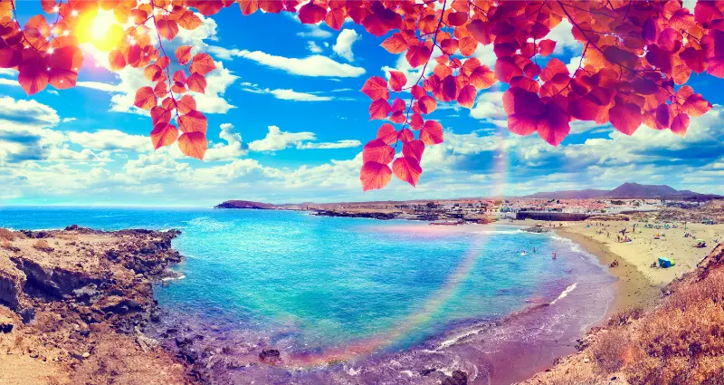
Charco del Viento is one of the north Tenerife natural pools I visit for the volcanic setting as much as the swim. Lava flows reached the sea and formed two rocky arms that partly protect a small bay on the La Guancha coast.
The shelter can make the water calmer than the open Atlantic, but I never treat a natural pool as risk-free. My decision to enter depends on the actual waves, access and warning signs I see on the day.
Quick planning facts
| Location | Santa Catalina, La Guancha |
|---|---|
| Type | Natural volcanic bathing area |
| Best for | Swimming and snorkelling in calm conditions |
| Main hazard | Atlantic swell and slippery volcanic rock |
| Footwear | Water shoes helpful |
| Best timing | Calm-sea mornings are my preference |
| Combine with | La Guancha, San Juan de la Rambla, Icod |
How the natural pool was formed
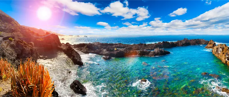
Charco del Viento is a volcanic bathing area in Santa Catalina, La Guancha. Ancient lava flows reached the sea, cooled rapidly and created two natural rock arms that partially shelter a small bay from the stronger Atlantic swell.
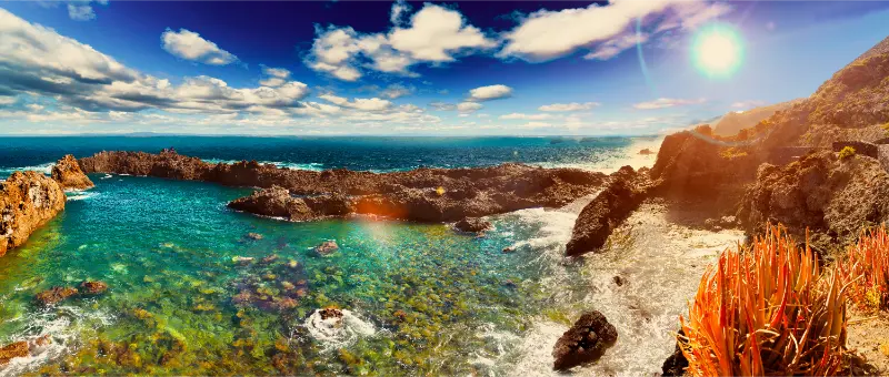
That geology is what makes the place beautiful and what can make visitors overconfident. The lava barriers reduce wave energy but do not turn the ocean into a swimming pool with guaranteed conditions.
Swimming and snorkelling
On calm days the sheltered water can be clear enough for snorkelling, and Turismo de Tenerife specifically mentions swimming, fishing and snorkelling as common activities. I enter slowly because volcanic rock can be uneven and slippery.
If waves are overtopping the outer rocks or the water is moving strongly through the pool, I stay out. I never stand on exposed edges to photograph incoming surf.
Footwear and comfort
Water shoes are useful for rough rock and entry points. I also bring a towel that I do not mind placing on volcanic ground, sun protection and enough water.
There may be periods when access infrastructure changes after storms, so I judge the site in front of me rather than relying entirely on old images.
Why I combine it with La Guancha
The pool makes more sense as part of a wider La Guancha day. My La Guancha guide links the coast with the rural town, forest and other local landscapes.
That also gives me a strong backup plan if the sea is too rough: I can turn the day inland instead of waiting for conditions to improve.
Photography and wave safety
The geometry of the lava arms and clear water is photogenic, but I use a zoom or phone from a safe position rather than approaching the outer edge during swell.
North-coast waves can arrive in larger sets after several quiet minutes. I never let a photograph make me forget that pattern.
Official source
I use the official Charco del Viento page for location and geological description.
For the actual decision to enter the water, I rely on current sea conditions, warning signs and any local closure.
How I judge whether it is a swimming day
At Charco del Viento I decide whether to swim only after seeing the sea in person. Beach descriptions are useful, but Atlantic conditions change with swell, wind, tide and local currents. A beach that looked easy yesterday can be completely different today.
I look for warning flags, lifeguard instructions where present, local closures and the behaviour of experienced bathers. If the beach is not supervised, I become more conservative. My Tenerife safety guide explains the ocean-safety habits I use around the island.
What I bring
My basic beach kit is simple: water, reef-safe sun protection, a hat, sandals or water shoes for hot or rough surfaces, and a light layer for wind. On black sand I also remember that the surface can become surprisingly hot in strong sun.
I do not leave valuables visible in the car, and I take all litter away. On beaches without services I assume there will be no shade, toilets, drinking water or food unless the official listing says otherwise.
Best time of day
Morning is my default for easier parking, gentler temperatures and a better chance of finding space. Late afternoon can be beautiful, but I keep enough daylight for walking back to the car or navigating coastal roads.
For a family day I avoid arriving hungry at the busiest lunch hour. I either bring a simple picnic where appropriate or decide in advance which nearby village will be the food stop.
Getting there and parking
I check the final approach before driving to Charco del Viento, especially because small coastal settlements in La Guancha can have narrow streets. I use legal parking only and never convert a turning area, bus stop or resident access into an improvised space.
If the official beach information lists bus access, I still verify the current route and timetable. My Tenerife without a car guide is useful when I am building a trip around public transport.
What to combine nearby
I combine Charco del Viento with La Guancha village, San Juan de la Rambla, Icod de los Vinos or other north-coast viewpoints rather than driving across the island after a beach stop. The goal is to understand one piece of Tenerife in depth: its coast, village streets, volcanic terrain and food.
This is also more resilient. If swimming is not sensible, I can still use the day for a walk, a viewpoint or a local meal without wasting hours in the car.
Where I would stay
I would choose accommodation in La Guancha only if the wider area fits the trip, not simply to be near one beach. For most first-time visitors I compare the convenience of a larger base with the atmosphere of a quieter local zone.
When I want to stay close, I compare accommodation in the wider area on Booking.com and then verify the exact road, parking and walking access before booking.
Frequently asked questions
Is Charco del Viento safe for swimming?
It can be enjoyable in calm conditions, but ocean swell can still affect the pool. I stay out when waves are overtopping the outer rocks or access is closed.
Can I snorkel there?
Yes, snorkelling is a popular activity when the sea is calm and visibility is good.
Do I need water shoes?
They are useful because volcanic rock can be rough and slippery.
Is it a normal swimming pool?
No. It is a natural volcanic bathing area connected to the Atlantic.

What should I combine it with?
La Guancha village, San Juan de la Rambla or Icod de los Vinos make logical nearby stops.
How I decide whether this stop belongs in my itinerary
I ask whether the place adds something different from the previous day. Tenerife can easily become a sequence of similar viewpoints or beaches if I plan from a list instead of from geography. I prefer contrast: coast after forest, heritage after a hike, or a quiet village after a major attraction.
I also compare the detour with the experience. A small stop that sits naturally on my route can be excellent; the same stop may not justify a two-hour cross-island drive. This is why I group days by area and protect time for unplanned discoveries.
Small mistakes I try to avoid
I do not trust travel times that ignore parking, mountain bends or finding the correct entrance. I do not leave water in the hotel because the plan looks short. I do not assume a café, toilet or ticket office will be open simply because an old article mentions it. And I never turn a closed gate or warning barrier into a challenge to get around.
Another common mistake is trying to reproduce a photograph exactly. Light, tide, cloud, vegetation and access all change. I use images for orientation, then accept the conditions I actually find. That approach is safer and usually creates a more genuine travel experience.
What I save on my phone before leaving
I save the exact destination, an offline map, the official information page and one backup stop in the same area. For a hike I also save the route file or map, emergency information and the latest access notice. For a beach I check sea conditions and identify a nearby non-swimming alternative.
This simple preparation matters most in rural Tenerife, where a weak signal or a closed road can otherwise turn a small change into a long detour. It also lets me spend less time looking at my phone once I arrive.
Responsible travel details that matter
I stay on marked paths, never collect volcanic rocks or plants in protected areas, keep drones subject to current rules and avoid photographing people at close range without permission. In villages I remember that the photogenic doorway is somebody’s home and the narrow lane may be the only access for residents.
On the coast I keep away from unstable edges and do not approach blowholes or outer rocks during swell. I take rubbish away, avoid feeding wildlife and use established access rather than creating shortcuts through vegetation. These are small decisions, but repeated by many visitors they determine how well places cope with tourism.
My final take
Charco del Viento is beautiful because it remains part of the ocean. I enjoy the clear water and lava forms when conditions are calm, but I keep the same respect for swell that I would use on an exposed north-coast beach.