El Pijaral is one of the Tenerife places I plan around conditions rather than treating as a box to tick. Plan a responsible visit to El Pijaral in Anaga, including the required authorization, laurisilva forest, weather, access strategy and nearby stops.
My approach is simple: understand what makes El Pijaral distinctive, verify the practical details that can change, and then fit it into a geographically sensible day. That matters on Tenerife because a short distance on the map can involve mountain roads, limited parking, a completely different microclimate or an exposed Atlantic shore.
Quick planning facts
| Protected status | Integral Nature Reserve inside Anaga Rural Park |
|---|---|
| Size | About 300.7 hectares |
| Landscape | Laurisilva forest, steep terrain, Roques de Anambro and Chinobre |
| Wildlife | Habitat for endemic laurel pigeons including rabiche and turqué |
| Authorization | Required in advance |
| Best for | Ancient forest, endemic nature, quiet hiking |
| Combine with | Cruz del Carmen, Pico del Inglés or Jardina |
Why El Pijaral feels different from a normal Anaga walk
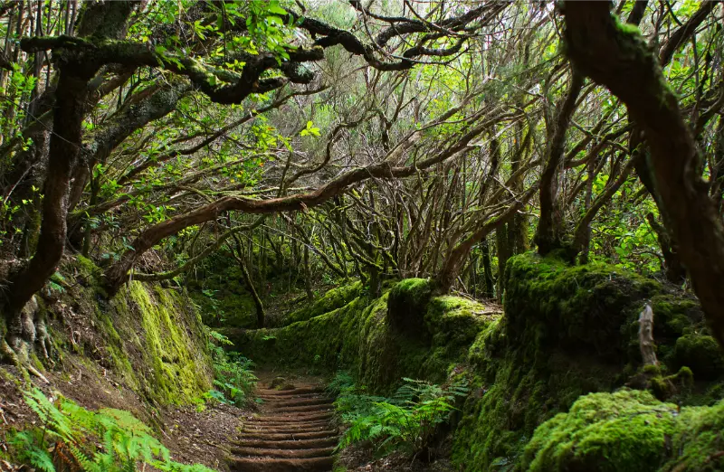
El Pijaral is not simply another green trail in the mountains. The protected reserve contains one of Tenerife’s best-preserved examples of laurisilva, the humid subtropical forest that survived in Macaronesia after disappearing from much of continental Europe. The steep slopes, giant ferns, moss and twisting trunks make the experience feel enclosed and ancient rather than panoramic.
That ecological value is exactly why I avoid describing the walk as a place to “discover hidden spots”. The goal is the opposite: stay on the authorized route, reduce disturbance and experience a fragile forest without turning it into an informal playground.
The permit is the first step, not an afterthought
Turismo de Tenerife explicitly states that prior authorization is necessary because of the fragility and singular characteristics of the ecosystem. I reserve before building the day around El Pijaral. If I cannot obtain a slot, I choose another signed Anaga walk rather than looking for an unofficial entrance.
I also check the status again close to the visit. Wind, fire risk, maintenance or conservation measures can affect mountain access. A screenshot of an old booking page is not a substitute for the current instructions shown by the competent authority.
What I notice inside the forest
I slow down in El Pijaral. The interest is in small details: moisture on leaves, layers of ferns, the change in light below the canopy and the way cloud condenses on vegetation. The reserve also shelters endemic birdlife such as the laurel pigeons, so I keep voices low and avoid playing music from a phone or speaker.
The Roques de Anambro and Chinobre add dramatic relief to the protected landscape. I treat viewpoints as a bonus because cloud can hide them quickly; the forest itself remains the main experience.
Access, parking and how I arrive
Access is controlled because this is an Integral Nature Reserve. I treat the authorization as part of the trip, not as an optional formality, and I check Tenerife ON immediately before departure for the current status and any closure.
I check the route before leaving and save the location offline. Around Anaga Rural Park, Santa Cruz de Tenerife, I avoid blocking driveways, farm tracks, bus stops or emergency access even if other cars are doing it. If the legal parking is full, I use my backup stop instead of turning a narrow local road into an improvised car park.
For public transport I use the method in my Tenerife bus guide: I verify the current TITSA timetable on the day, identify the final useful return service and allow extra time for connections. Rural and coastal buses can be excellent, but they do not always run at resort-level frequency.
Conditions, weather and the best time of day
My preferred timing is A dry, stable morning with good visibility and a valid reservation. Tenerife’s microclimates are strong enough that I never rely on one island-wide forecast. I check the exact municipality, wind and, for coastal places, sea state; for mountain areas I also look at temperature and cloud at the relevant altitude.
I keep the schedule flexible. A cloudy mountain morning can become a good coast afternoon, while rising wind at the beach may be a reason to switch to a village or museum. This is one of the easiest ways to enjoy Tenerife more: build alternatives into the route instead of forcing the original plan.
My broader Tenerife weather by month guide explains why north, south, high mountain and trade-wind zones can feel like different destinations on the same day.
Safety: what changes my decision on the day
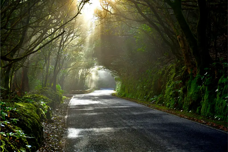
The forest can be wet, muddy and slippery even when the coast is sunny. I use proper walking shoes, carry a light waterproof layer and never leave the authorized path. Fog is part of the Anaga climate, so I do not rely on distant views as the only reason to go.

I also use the principles in my Tenerife safety guide. A place being popular on social media does not make it safe under every condition. I turn around for closed access, red flags, rockfall warnings, wildfire restrictions, strong wind or any situation that feels outside my experience.
I tell someone my plan when I am walking alone, keep enough phone battery for navigation and emergency calls, and avoid depending on mobile coverage in ravines or remote mountain areas. For an emergency in Spain and the Canary Islands, 112 is the general emergency number.
What I bring
My basic Tenerife day kit is water, sun protection, a charged phone, a light layer and footwear suited to the actual surface. I add a windproof or waterproof layer for Anaga and higher ground, and water shoes only where rocky swimming access makes them useful. I never use flip-flops as hiking shoes just because the trail starts near a beach.
I also carry a small bag for rubbish and enough food that I am not dependent on finding an open café at exactly the right time. In rural areas, opening hours can be limited or seasonal, and I prefer buying locally when I do stop.
How I connect this stop with the rest of Tenerife
I avoid crossing the island just for one short stop. Around Anaga Rural Park, Santa Cruz de Tenerife, I build a small cluster and choose two or three substantial experiences. Useful related guides are Anaga Rural Park guide, Tenerife hiking permits and trail rules, Cruz del Carmen guide.

This approach reduces driving, creates more time for food and unplanned viewpoints, and makes it easier to adapt to weather. On a one-week trip especially, a calm regional day is usually more satisfying than collecting distant pins from a map.
Who I think will enjoy it most
El Pijaral works best for travellers who appreciate a permit-controlled laurisilva reserve walk and are willing to adapt to local conditions. I would not choose it simply because a photograph looks dramatic; I choose it when the access, weather and pace match the people I am travelling with.
Families, older travellers, photographers and hikers can all enjoy Tenerife differently. I compare walking surface, shade, toilets, distance from the car and escape options before promising that a place suits everyone. That small bit of planning prevents a scenic stop from becoming an uncomfortable obligation.
Photography without turning the place into a photo set
I usually prefer early or late light, but I never step beyond barriers or onto unstable rock for a cleaner composition. Wide-angle views explain Tenerife’s scale, while details such as volcanic texture, vegetation, old paths and fishing infrastructure often tell a more original story than another posed viewpoint shot.
When people are present, I respect privacy. On beaches where naturism is common, I am especially careful not to photograph strangers. In protected natural areas I do not move rocks, pick flowers or leave the trail to create a foreground.
Responsible travel habits I use here
El Pijaral is part of a lived landscape, not an attraction separated from local life. I keep noise low near homes, never block access, take all rubbish away and use toilets or bins where they exist. On protected land I stay on legal routes and do not collect plants, stones or archaeological material.
I also try to spend something in the surrounding area when it makes sense: a coffee, meal, market purchase or locally run accommodation spreads the value of tourism beyond the most obvious resort businesses. Respectful travel is mostly a collection of ordinary decisions.
Three mistakes I avoid
First, I do not trust an old screenshot more than a current official notice. Beach access, hiking permits, road restrictions and protected-area rules can change. I check again close to the visit.
Second, I do not assume “Tenerife weather” is one forecast. A sunny app icon for the airport tells me very little about Anaga cloud, north-coast swell or conditions above 2,000 metres.
Third, I do not overfill the day. One good walk or beach, one cultural or food stop and one flexible extra usually produces a better memory than six rushed locations.
Where I would stay
I do not choose accommodation solely to be close to one trail or natural site. I decide which part of Tenerife I want to experience in the evenings, then check driving times to the day’s main walks. This keeps me from sleeping in an isolated place simply to save twenty minutes one morning.
For this zone I compare bases using my where to stay in Tenerife guide and then confirm the final road or bus connection to the trailhead.
Official information I check before leaving
I use the official Turismo de Tenerife El Pijaral page for the core facts in this guide. For permits, protected-area status, closures or trail conditions I also check the responsible public authority or Tenerife ON where applicable.
I treat opening hours, access rules and transport times as live information. The article gives me a planning framework, but the final decision is based on the official notice closest to the date of travel.
My realistic half-day or day plan
I start with El Pijaral as the priority and give it enough time that I do not feel rushed. Afterwards I choose one nearby place from the same cluster rather than driving across Tenerife. Lunch or coffee becomes a natural pause, especially on mountain or coastal roads where concentration matters.
If conditions are wrong, I switch early rather than waiting for the day to improve. I always have a Plan B that is safer and geographically close: a village, museum, promenade, market or more sheltered beach. That flexibility is one of the most useful habits I have developed for island travel.
Frequently asked questions
Do I need a permit for El Pijaral?
Yes. Official Tenerife tourism information states that prior authorization is required because the reserve is ecologically fragile.
Can I enter without a reservation if the trail looks empty?
No. I follow the authorization system and current closure notices rather than judging access by how busy the trail appears.
Is El Pijaral suitable in rain?
Light moisture is normal in Anaga, but heavy rain, wind or official closures can make the route inappropriate. I check conditions before leaving.
What should I combine with El Pijaral?
Cruz del Carmen, Pico del Inglés and Mirador de Jardina fit naturally into the same Anaga day if road and weather conditions are good.
Is this a good beach-and-hike combination?
It can be, but I keep the day flexible because the mountain forest can be cool and misty while the Anaga coast is sunnier or windier.
Final thoughts
El Pijaral earns a place in my Tenerife plans because it adds a specific landscape or local experience rather than repeating something I can find anywhere on the island. I get the most from it when I respect the conditions, keep the day geographically simple and leave enough time to notice the surroundings instead of rushing onward.
I would rather miss a stop because access is closed, the sea is rough or the weather is wrong than force an unsafe visit. Tenerife will still be there on another day, and the ability to change plans is part of travelling well on an island shaped by mountains, wind and the Atlantic.