Tag: Anaga Rural Park

  • PR-TF 10 Hiking Guide: Cruz del Carmen to Punta del Hidalgo

    PR-TF 10 Hiking Guide: Cruz del Carmen to Punta del Hidalgo

    PR-TF 10 is one of the most satisfying ways to understand the vertical geography of Anaga. Instead of driving from viewpoint to viewpoint, the trail drops from the laurel forest around Cruz del Carmen through Las Carboneras and Chinamada to the Atlantic at Punta del Hidalgo. The scenery changes continuously: humid forest, rural hamlets, exposed ridges, rock-cut paths and finally a dramatic coastal descent.

    According to Turismo de Tenerife, the full linear route is 10.4 km, takes about four hours, is graded medium difficulty and descends from a maximum elevation of 949 m to around 10 m. The official profile lists roughly 420.64 m of accumulated ascent and 1,300.38 m of descent, and no authorization is required. The numbers make the key challenge clear: this is not a flat 10 km walk. The long descent is what many legs feel the next day.

    PR-TF 10 at a glance

    StartCruz del Carmen
    FinishPunta del Hidalgo
    Distance10.4 km
    Official durationAbout 4 hours
    DifficultyMedium
    TypeLinear
    Maximum elevation949 m
    Minimum elevation10 m
    Accumulated ascent420.64 m
    Accumulated descent1,300.38 m
    PermitNot required on the official listing

    Why I prefer walking it downhill

    The official direction from Cruz del Carmen to Punta del Hidalgo makes logistical and physical sense. I begin in cool monteverde and finish by the sea, with most of the route trending downhill. Downhill does not mean easy: long descents load knees and quadriceps, and the final exposed sections can feel tiring after several hours. Trekking poles can be useful if I am comfortable using them.

    Walking the opposite way is possible for strong hikers, but it turns the route into a major climb from near sea level toward almost 1,000 metres. For a first attempt, I would follow the standard direction unless I had a specific training goal and a very clear transport plan.

    Stage 1: Cruz del Carmen and the laurel forest

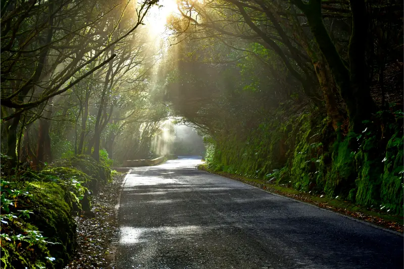
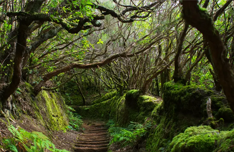
    Cruz del Carmen is an ideal start because it has the Anaga visitor centre, a viewpoint and immediate access to dense laurisilva. The first part of the route descends through faya-brezal and other monteverde vegetation. Roots, damp soil and stone steps can be slippery even when the coast is dry, so I start in hiking shoes rather than casual trainers.

    Anaga Laurel Forest Trail Tenerife

    If I have never visited the area, I arrive early enough to spend a few minutes at the visitor centre. My Cruz del Carmen guide explains the facilities and short walks around the trailhead.

    Stage 2: Las Carboneras

    The route gradually leaves the enclosed forest and reaches the rural landscape around Las Carboneras. This is where I feel the cultural side of Anaga most strongly: homes, terraces, small roads and restaurants appear among steep slopes. I do not treat the village as a refuelling guarantee; I carry my own water and food because rural opening hours can change.

    If the full hike is too much, the village is also connected to PR-TF 10.1. My Las Carboneras guide is useful for turning this section into a shorter day.

    Stage 3: Chinamada and the cave-house landscape

    Chinamada is one of the most distinctive stops on the route. Traditional cave houses are integrated into the rock and the settlement sits high above the north coast. I move quietly, because these are lived-in homes rather than an open-air museum. The village is also a natural place to reassess weather, water and daylight before the final descent.

    For background on the settlement and its cave-house tradition, I use my Chinamada guide. If visibility is poor or the trail has become slippery, this is also where I would be willing to change plans instead of forcing the coastal descent.

    Stage 4: the descent to Punta del Hidalgo

    The final section is visually dramatic. The path cuts through rocky slopes with wide views of the Atlantic and the north coast. Exposure to sun and wind increases as the forest disappears. I keep water in reserve for this stage and do not assume the sea breeze means the sun is weak.

    Punta del Hidalgo is a satisfying finish because there are services, buses and the possibility of a meal or swim if conditions are appropriate. I never plan the swim as guaranteed; after a long hike I check the flags and sea state rather than entering the water simply because I am hot.

    Transport logistics: the part I plan first

    Because PR-TF 10 is linear, transport is not a detail. I normally plan the return connection before deciding the start time. A common strategy is to use public transport so I do not have to retrieve a car from the mountains. Exact bus routes and frequencies can change, so I verify TITSA on the day and build margin around the final service I am willing to take.

    My Tenerife bus guide explains ten+ cards, transfers and why I save the return timetable offline. With two cars, a shuttle is possible, but I avoid leaving vehicles in informal roadside spaces at either end.

    Weather, footwear and water

    PR-TF 10 crosses several microclimates in one walk. Cruz del Carmen can be cool, damp and foggy while Punta del Hidalgo is sunny and warm. I carry a light waterproof or windproof layer, sun protection, enough water for the full route and food that is easy to eat on the move. I also keep one dry layer inside the pack because sweat and cloud can make the upper section surprisingly chilly.

    I check trail status after any period of heavy rain or strong wind. Fallen branches, slippery sections and maintenance closures matter more than a perfect weather icon.

    Official source and live status

    The core technical data in this guide comes from Turismo de Tenerife’s official PR-TF 10 listing. I also check Tenerife ON immediately before hiking for closures, restrictions or alerts. The official listing explicitly reminds hikers to respect signs, check weather and carry suitable equipment.

    Who I would recommend this hike to

    I recommend PR-TF 10 to walkers comfortable with several hours on uneven mountain paths and a sustained descent. It is not the route I would choose for someone testing hiking shoes for the first time, for travellers with unstable knees, or for a group that wants to stop repeatedly for long lunches. For easier forest walking, the Sendero de los Sentidos is a much gentler introduction to Anaga.
    Anaga Tenerife

    My pacing strategy

    I divide the route mentally into four sections and avoid rushing the first forest kilometres. I take a proper break around Las Carboneras or Chinamada, then keep enough energy for the exposed descent. Photographing every bend can quietly add a surprising amount of time, so I compare progress with daylight rather than with the official four-hour estimate.

    Frequently asked questions

    Do I need a permit?

    The official Turismo de Tenerife listing says no authorization is required for PR-TF 10. I still check the current status because temporary closures can apply.

    Can I do only part of the route?

    Yes. Cruz del Carmen to Las Carboneras and the PR-TF 10.1 connection around Las Carboneras and Chinamada allow shorter plans, but transport still needs thought.

    Is it suitable after rain?

    I am cautious after rain because roots, stone and clay-like sections can become slippery. If authorities advise against walking or a section is closed, I choose another day.

    Final thoughts

    PR-TF 10 is more than a viewpoint hike. It shows how forest, village and coast fit together in Anaga. I think the route is at its best when I treat logistics as seriously as scenery: start early, plan the bus, carry proper gear and leave enough time to enjoy Las Carboneras and Chinamada rather than racing downhill to the sea.

    Anaga Forest Tenerife

    A slower way to experience the area

    I leave room for unplanned time because the best part of rural Tenerife is often not the named attraction. A cloud opening over a ridge, a short conversation in a bar, a view from a legal pull-out or the smell of wet forest can become the memory of the day. If every fifteen minutes is assigned to a stop, I end up watching the clock instead of the place.

    I also avoid building two demanding mountain objectives into the same day. Even if each route looks short, the combination of driving, elevation, parking and changing weather creates fatigue. One main walk plus one village or viewpoint is usually my preferred balance.

    Navigation and phone coverage

    I download the route and essential map area before leaving accommodation. Mountain valleys can have patchy mobile coverage, and battery drains faster when a phone searches constantly for signal. I carry a power bank on longer days and keep the official trail name or destination written down so I can ask for help clearly if needed.

    For hikes, I use official signed routes as the primary reference and treat community GPX tracks as secondary information. A line on a mapping app may cross private land, an old path or a closed section. If signage and the downloaded track disagree, I stop and reassess rather than force the digital route.

    Food, water and toilets

    Small villages are not guaranteed service stations. I carry enough water to complete the main activity even if the local bar is closed, and I use toilets when I have a legitimate opportunity rather than assuming the next viewpoint will have facilities. I also bring a small rubbish bag because bins are limited on many rural routes.

    When a village restaurant is open, I prefer to eat there rather than carry an elaborate picnic into a fragile landscape. It supports a local business and gives the day a natural pause. I still carry emergency snacks so a closed kitchen never becomes a safety problem.
  • Las Carboneras Tenerife Guide: Anaga Village, Trails and Local Food

    Las Carboneras Tenerife Guide: Anaga Village, Trails and Local Food

    Las Carboneras is one of the Anaga villages I would choose when I want to experience the massif as a lived-in rural landscape rather than only as a sequence of viewpoints. The hamlet belongs to the municipality of La Laguna and sits among steep green slopes, traditional houses and paths that historically connected the scattered communities of Anaga. It is small, quiet and best visited with realistic expectations: the appeal is the village setting, local food and access to walking routes, not a long list of monuments.

    Turismo de Tenerife groups Las Carboneras with Chinamada and Los Batanes among the rural hamlets of Anaga, highlighting examples of traditional Canarian architecture, the village square and chapel, local restaurants and trails into the surrounding landscape. That combination makes it a useful stop for travellers who already know the famous Cruz del Carmen viewpoints and want to see how people have lived in these mountains.

    Quick planning facts

    MunicipalitySan Cristóbal de La Laguna
    AreaAnaga Rural Park
    Best forRural atmosphere, traditional food, hiking connections
    Key nearby villagesChinamada and Taborno
    Main trail connectionPR-TF 10 and PR-TF 10.1
    Permit for PR-TF 10.1No, according to the official trail listing
    Ideal visit2–4 hours, or longer with a hike

    What Las Carboneras feels like

    The first thing I would notice is scale. Las Carboneras is compact, but the surrounding terrain is huge: ridges rise abruptly, ravines cut through the landscape and roads curve around slopes that make straight-line distances meaningless. The village is a reminder that Anaga is not empty wilderness. It is a cultural landscape shaped by agriculture, livestock, footpaths and small settlements that adapted to isolation for generations.

    I would walk slowly around the square and chapel area, look at the relationship between houses and terraces, and resist the urge to hunt for a single “must-see” angle. The value is in the whole setting. For a broader introduction to the massif, my Anaga Rural Park guide explains laurisilva, roads, weather and the main hiking zones.

    Traditional food and where lunch fits into the day

    One reason Las Carboneras works well in an Anaga itinerary is that the official tourism page specifically points visitors toward local restaurants serving traditional island food. I would use lunch as the anchor of the visit rather than squeezing it between two long drives. Simple dishes, local cheese, meat, potatoes with mojo or seasonal preparations make more sense here than chasing a fashionable restaurant far away.

    I do not assume every small restaurant opens every day or all afternoon. In rural Tenerife, hours can be narrower than in resort areas, so I check before building the itinerary around a meal. My what to eat in Tenerife guide gives context for the dishes and ingredients I look for.

    Walking from Las Carboneras

    Las Carboneras is linked to the PR-TF 10 network. The official PR-TF 10.1 route runs from Las Escaleras through Las Carboneras toward Chinamada. Turismo de Tenerife lists that route as 3.1 km, linear, about one hour, low difficulty, with no authorization required. Those numbers make it look easy, but I still treat wet stone, mud and steep edges with respect because Anaga weather can change quickly.

    Anaga Laurel Forest Tenerife

    For a longer day, the main PR-TF 10 links Cruz del Carmen with Punta del Hidalgo and passes through Las Carboneras and Chinamada. I would not improvise this as a casual extension after lunch; it is a proper linear hike with transport logistics. I have a separate PR-TF 10 hiking guide for that route.

    Las Carboneras or Chinamada?

    I see the two villages as complementary. Chinamada is especially known for its cave houses and the descent toward Punta del Hidalgo, while Las Carboneras feels more like a traditional roadside-rural stop with an easy connection into the same trail network. If I have half a day, I can see both without rushing, provided I keep parking and meal times under control.

    If cave-house heritage is the priority, I would give more time to Chinamada. If rural architecture, lunch and a shorter walk matter more, Las Carboneras can be the better centre of the outing.

    Best time of day and light

    I like morning in Anaga because traffic is generally easier and I have more flexibility if cloud moves in. Midday can be atmospheric in the village even when ridgelines disappear into mist. Late afternoon can be beautiful, but I do not start an unfamiliar trail too late because shaded valleys lose light quickly and roads require concentration after dark.

    Anaga Laurel Forest Trail Tenerife

    Official information I check before going

    For village context I use Turismo de Tenerife’s page on Las Carboneras and nearby hamlets. For hiking status I check the current PR-TF route listing and Tenerife ON close to the visit. Trail status always matters more than an old GPX file.

    How I fit it into a Tenerife itinerary

    I would not cross the island just to collect a quick photograph of Las Carboneras. I place it inside a coherent Anaga day, give it enough time to understand the setting and then add only one or two nearby stops. This approach matters in Tenerife because mountain roads, parking and microclimates can turn a short distance into a slow journey. It also makes small villages and local neighbourhoods feel less like attractions and more like places with their own rhythm.

    A sensible cluster is Cruz del Carmen, Chinamada and Taborno. I check the route before leaving, save the main parking or bus information offline and keep one optional stop that can be removed. For the wider area, I use my Cruz del Carmen guide so the day has a clear geographic logic instead of zig-zagging across the island.

    Driving, buses and parking strategy

    On rural roads I assume the final kilometres will take longer than navigation apps suggest. I keep to my lane, use safe pull-outs only, and never stop on a bend simply because a viewpoint looks attractive. If the destination has limited parking, arriving earlier is usually more useful than trying to find a “secret” space. I also avoid blocking house entrances, agricultural tracks, bus stops and emergency access.

    Public transport can be a good option for some Anaga days, but I verify the current TITSA timetable rather than relying on an old screenshot or blog. I identify the final practical return service before starting a walk. My Tenerife bus guide explains the ten+ system and the planning habits I use when I travel without a car.

    Weather and what I carry

    I pack for the exact environment rather than for the temperature at my hotel. In the north and in Anaga, cloud, wind and light rain can appear even when the south is sunny. On the coast, the Atlantic can be rough despite warm air temperatures. My basic kit is water, sun protection, a charged phone, a light layer and footwear appropriate to the surface. For rural walks I add a thin waterproof layer and a little more water than I think I will need.

    The island-wide forecast is only a starting point. I compare the coast, the hills and higher elevations separately and use my Tenerife weather by month guide to understand why the same day can feel very different across the island.

    Responsible travel in a lived-in place

    Las Carboneras is not a theme park. I keep noise low near homes, stay on marked paths, take rubbish away and ask before photographing people at close range. In agricultural areas I never enter terraces or fields to improve a photograph. Small decisions like buying a coffee, lunch or local product from an open business can also make the visit more connected to the community without turning local life into a performance for visitors.

    I also treat closures and temporary restrictions as part of the destination, not an inconvenience to bypass. Fire risk, storm damage, rockfall or maintenance can change access. If a road, beach or trail is closed, I use the backup plan and move on.

    Frequently asked questions

    Is Las Carboneras worth visiting without hiking?

    Yes, if you enjoy small villages, rural architecture and a slow lunch. I would not travel there expecting a large attraction, but as part of an Anaga day it adds a human dimension that viewpoints alone cannot provide.

    Anaga Tenerife

    Do I need a permit for the short PR-TF 10.1 connection?

    The official Turismo de Tenerife listing states that authorization is not required for PR-TF 10.1. I still check the live trail status before setting out because weather or maintenance can create temporary closures.

    Can I combine Las Carboneras with Taborno?

    Yes, but I keep the day simple. The roads are slow and parking is limited in small hamlets. I would choose either a longer walk or several village stops, not try to do both at maximum intensity.

    Final thoughts

    Las Carboneras is the kind of Tenerife place that becomes more interesting when I stop measuring it by the number of attractions. A village square, traditional houses, a plate of local food and a path disappearing into Anaga are enough to make a memorable half-day. I would visit with time, respect the people who live there and let the landscape set the pace.

  • El Pijaral Tenerife Guide: Permit, Laurisilva Forest and Anaga Planning

    El Pijaral Tenerife Guide: Permit, Laurisilva Forest and Anaga Planning

    El Pijaral is one of the Tenerife places I plan around conditions rather than treating as a box to tick. Plan a responsible visit to El Pijaral in Anaga, including the required authorization, laurisilva forest, weather, access strategy and nearby stops.

    My approach is simple: understand what makes El Pijaral distinctive, verify the practical details that can change, and then fit it into a geographically sensible day. That matters on Tenerife because a short distance on the map can involve mountain roads, limited parking, a completely different microclimate or an exposed Atlantic shore.

    Quick planning facts

    Protected statusIntegral Nature Reserve inside Anaga Rural Park
    SizeAbout 300.7 hectares
    LandscapeLaurisilva forest, steep terrain, Roques de Anambro and Chinobre
    WildlifeHabitat for endemic laurel pigeons including rabiche and turqué
    AuthorizationRequired in advance
    Best forAncient forest, endemic nature, quiet hiking
    Combine withCruz del Carmen, Pico del Inglés or Jardina

    Why El Pijaral feels different from a normal Anaga walk

    El Pijaral is not simply another green trail in the mountains. The protected reserve contains one of Tenerife’s best-preserved examples of laurisilva, the humid subtropical forest that survived in Macaronesia after disappearing from much of continental Europe. The steep slopes, giant ferns, moss and twisting trunks make the experience feel enclosed and ancient rather than panoramic.

    That ecological value is exactly why I avoid describing the walk as a place to “discover hidden spots”. The goal is the opposite: stay on the authorized route, reduce disturbance and experience a fragile forest without turning it into an informal playground.

    The permit is the first step, not an afterthought

    Turismo de Tenerife explicitly states that prior authorization is necessary because of the fragility and singular characteristics of the ecosystem. I reserve before building the day around El Pijaral. If I cannot obtain a slot, I choose another signed Anaga walk rather than looking for an unofficial entrance.

    I also check the status again close to the visit. Wind, fire risk, maintenance or conservation measures can affect mountain access. A screenshot of an old booking page is not a substitute for the current instructions shown by the competent authority.

    What I notice inside the forest

    I slow down in El Pijaral. The interest is in small details: moisture on leaves, layers of ferns, the change in light below the canopy and the way cloud condenses on vegetation. The reserve also shelters endemic birdlife such as the laurel pigeons, so I keep voices low and avoid playing music from a phone or speaker.

    The Roques de Anambro and Chinobre add dramatic relief to the protected landscape. I treat viewpoints as a bonus because cloud can hide them quickly; the forest itself remains the main experience.

    Access, parking and how I arrive

    Access is controlled because this is an Integral Nature Reserve. I treat the authorization as part of the trip, not as an optional formality, and I check Tenerife ON immediately before departure for the current status and any closure.

    I check the route before leaving and save the location offline. Around Anaga Rural Park, Santa Cruz de Tenerife, I avoid blocking driveways, farm tracks, bus stops or emergency access even if other cars are doing it. If the legal parking is full, I use my backup stop instead of turning a narrow local road into an improvised car park.

    For public transport I use the method in my Tenerife bus guide: I verify the current TITSA timetable on the day, identify the final useful return service and allow extra time for connections. Rural and coastal buses can be excellent, but they do not always run at resort-level frequency.

    Conditions, weather and the best time of day

    My preferred timing is A dry, stable morning with good visibility and a valid reservation. Tenerife’s microclimates are strong enough that I never rely on one island-wide forecast. I check the exact municipality, wind and, for coastal places, sea state; for mountain areas I also look at temperature and cloud at the relevant altitude.

    I keep the schedule flexible. A cloudy mountain morning can become a good coast afternoon, while rising wind at the beach may be a reason to switch to a village or museum. This is one of the easiest ways to enjoy Tenerife more: build alternatives into the route instead of forcing the original plan.

    My broader Tenerife weather by month guide explains why north, south, high mountain and trade-wind zones can feel like different destinations on the same day.

    Safety: what changes my decision on the day

    The forest can be wet, muddy and slippery even when the coast is sunny. I use proper walking shoes, carry a light waterproof layer and never leave the authorized path. Fog is part of the Anaga climate, so I do not rely on distant views as the only reason to go.

    Anaga Laurel Forest Tenerife

    I also use the principles in my Tenerife safety guide. A place being popular on social media does not make it safe under every condition. I turn around for closed access, red flags, rockfall warnings, wildfire restrictions, strong wind or any situation that feels outside my experience.

    I tell someone my plan when I am walking alone, keep enough phone battery for navigation and emergency calls, and avoid depending on mobile coverage in ravines or remote mountain areas. For an emergency in Spain and the Canary Islands, 112 is the general emergency number.

    What I bring

    My basic Tenerife day kit is water, sun protection, a charged phone, a light layer and footwear suited to the actual surface. I add a windproof or waterproof layer for Anaga and higher ground, and water shoes only where rocky swimming access makes them useful. I never use flip-flops as hiking shoes just because the trail starts near a beach.

    I also carry a small bag for rubbish and enough food that I am not dependent on finding an open café at exactly the right time. In rural areas, opening hours can be limited or seasonal, and I prefer buying locally when I do stop.

    How I connect this stop with the rest of Tenerife

    I avoid crossing the island just for one short stop. Around Anaga Rural Park, Santa Cruz de Tenerife, I build a small cluster and choose two or three substantial experiences. Useful related guides are Anaga Rural Park guide, Tenerife hiking permits and trail rules, Cruz del Carmen guide.

    Anaga Laurel Forest Trail Tenerife

    This approach reduces driving, creates more time for food and unplanned viewpoints, and makes it easier to adapt to weather. On a one-week trip especially, a calm regional day is usually more satisfying than collecting distant pins from a map.

    Who I think will enjoy it most

    El Pijaral works best for travellers who appreciate a permit-controlled laurisilva reserve walk and are willing to adapt to local conditions. I would not choose it simply because a photograph looks dramatic; I choose it when the access, weather and pace match the people I am travelling with.

    Families, older travellers, photographers and hikers can all enjoy Tenerife differently. I compare walking surface, shade, toilets, distance from the car and escape options before promising that a place suits everyone. That small bit of planning prevents a scenic stop from becoming an uncomfortable obligation.

    Photography without turning the place into a photo set

    I usually prefer early or late light, but I never step beyond barriers or onto unstable rock for a cleaner composition. Wide-angle views explain Tenerife’s scale, while details such as volcanic texture, vegetation, old paths and fishing infrastructure often tell a more original story than another posed viewpoint shot.

    When people are present, I respect privacy. On beaches where naturism is common, I am especially careful not to photograph strangers. In protected natural areas I do not move rocks, pick flowers or leave the trail to create a foreground.

    Responsible travel habits I use here

    El Pijaral is part of a lived landscape, not an attraction separated from local life. I keep noise low near homes, never block access, take all rubbish away and use toilets or bins where they exist. On protected land I stay on legal routes and do not collect plants, stones or archaeological material.

    I also try to spend something in the surrounding area when it makes sense: a coffee, meal, market purchase or locally run accommodation spreads the value of tourism beyond the most obvious resort businesses. Respectful travel is mostly a collection of ordinary decisions.

    Three mistakes I avoid

    First, I do not trust an old screenshot more than a current official notice. Beach access, hiking permits, road restrictions and protected-area rules can change. I check again close to the visit.

    Second, I do not assume “Tenerife weather” is one forecast. A sunny app icon for the airport tells me very little about Anaga cloud, north-coast swell or conditions above 2,000 metres.

    Third, I do not overfill the day. One good walk or beach, one cultural or food stop and one flexible extra usually produces a better memory than six rushed locations.

    Where I would stay

    I do not choose accommodation solely to be close to one trail or natural site. I decide which part of Tenerife I want to experience in the evenings, then check driving times to the day’s main walks. This keeps me from sleeping in an isolated place simply to save twenty minutes one morning.

    For this zone I compare bases using my where to stay in Tenerife guide and then confirm the final road or bus connection to the trailhead.

    Official information I check before leaving

    I use the official Turismo de Tenerife El Pijaral page for the core facts in this guide. For permits, protected-area status, closures or trail conditions I also check the responsible public authority or Tenerife ON where applicable.

    I treat opening hours, access rules and transport times as live information. The article gives me a planning framework, but the final decision is based on the official notice closest to the date of travel.

    My realistic half-day or day plan

    I start with El Pijaral as the priority and give it enough time that I do not feel rushed. Afterwards I choose one nearby place from the same cluster rather than driving across Tenerife. Lunch or coffee becomes a natural pause, especially on mountain or coastal roads where concentration matters.

    If conditions are wrong, I switch early rather than waiting for the day to improve. I always have a Plan B that is safer and geographically close: a village, museum, promenade, market or more sheltered beach. That flexibility is one of the most useful habits I have developed for island travel.

    Frequently asked questions

    Do I need a permit for El Pijaral?

    Yes. Official Tenerife tourism information states that prior authorization is required because the reserve is ecologically fragile.

    Can I enter without a reservation if the trail looks empty?

    No. I follow the authorization system and current closure notices rather than judging access by how busy the trail appears.

    Is El Pijaral suitable in rain?

    Light moisture is normal in Anaga, but heavy rain, wind or official closures can make the route inappropriate. I check conditions before leaving.

    Anaga Tenerife

    What should I combine with El Pijaral?

    Cruz del Carmen, Pico del Inglés and Mirador de Jardina fit naturally into the same Anaga day if road and weather conditions are good.

    Is this a good beach-and-hike combination?

    It can be, but I keep the day flexible because the mountain forest can be cool and misty while the Anaga coast is sunnier or windier.

    Final thoughts

    El Pijaral earns a place in my Tenerife plans because it adds a specific landscape or local experience rather than repeating something I can find anywhere on the island. I get the most from it when I respect the conditions, keep the day geographically simple and leave enough time to notice the surroundings instead of rushing onward.

    I would rather miss a stop because access is closed, the sea is rough or the weather is wrong than force an unsafe visit. Tenerife will still be there on another day, and the ability to change plans is part of travelling well on an island shaped by mountains, wind and the Atlantic.

  • Mirador de Jardina Tenerife Guide: La Laguna and Teide Views

    Mirador de Jardina Tenerife Guide: La Laguna and Teide Views

    Mirador de Jardina is the viewpoint I use as the visual gateway between La Laguna and Anaga. From the edge of the monteverde, it looks across the historic city, cultivated valley and small settlements, with Teide appearing behind them on clear days.

    Turismo de Tenerife lists parking, adapted access for disabled visitors and an interpretation panel, but no bus stop. That combination makes Jardina a particularly useful scenic car stop and one of the easier viewpoints to include in a mixed-mobility Anaga day.

    Quick planning facts

    LocationTF-12, entrance to Anaga Rural Park
    Best forLa Laguna valley, Teide views, orientation
    ParkingYes
    Bus stopNo, according to official listing
    Adapted accessYes, according to official listing
    Interpretation panelYes
    Typical visit10–20 minutes
    Combine withLa Laguna, Cruz del Carmen, Pico del Inglés

    Why Jardina is a perfect first Anaga stop

    Jardina sits right where the landscape begins to change from the cultivated La Laguna valley toward Anaga’s monteverde. The viewpoint looks back over La Laguna, agricultural fields and small settlements, with Teide visible on clear days.

    I like stopping here before Cruz del Carmen because it creates a visual before-and-after: open valley below, laurel forest ahead.

    Accessibility advantage

    Turismo de Tenerife lists Mirador de Jardina as having adapted access for disabled visitors. That makes it especially useful when I am planning a scenic Anaga day for mixed mobility needs.

    I still check the exact current pavement and parking situation if accessibility is essential, because maintenance can change conditions temporarily.

    Parking but no official bus stop

    The official listing notes parking but no bus stop at the viewpoint. That means I treat Jardina primarily as a car or tour stop rather than a key public-transport objective.

    If travelling by bus, I focus on Cruz del Carmen and other stops with clearer service rather than creating an unsafe roadside walk.

    When Teide appears

    The classic Jardina view places the agricultural valley in the foreground and Teide in the distance. Cloud can hide the volcano quickly, especially as moist air builds around Anaga.

    I have the best chance by arriving earlier and checking the ridge weather, but I never consider the visit wasted if Teide disappears. The layered valley view remains worthwhile.

    How long I spend

    Jardina is usually a 10–20 minute stop for me, longer if the light is changing or I am travelling with someone who wants a slower, accessible viewpoint experience.

    I do not turn it into a picnic or long parking session when spaces are limited. Other visitors deserve the chance to stop too.

    Photography

    The foreground fields are what make Jardina more interesting than a simple distant mountain shot. I frame roads, villages and vegetation to show the transition from La Laguna to Anaga.

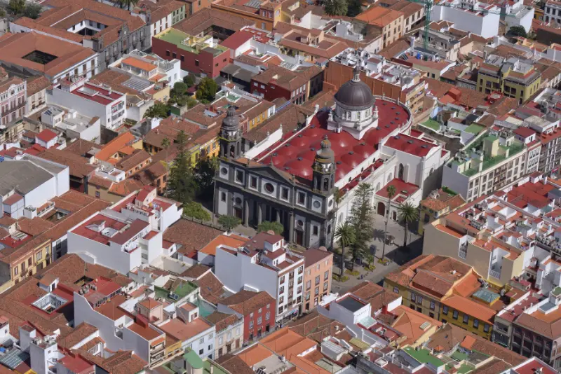
    Aerial View Of La Laguna Tenerife

    After rain or in low cloud, I protect camera gear because moisture can build quickly even when the city below looks dry.

    Pairing Jardina with La Laguna

    Jardina is one of the easiest ways to connect a morning in La Laguna with an afternoon in Anaga Rural Park. The drive is short, but the landscape changes dramatically.

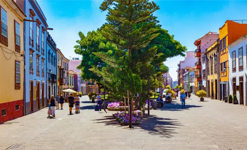
    I often reverse the plan too: forest first, then La Laguna for lunch and a walk through the UNESCO historic centre.

    Official source

    I use the official Mirador de Jardina page for access, parking and viewpoint details.

    Because there is no official bus stop listed, I do not recommend walking along the road casually just to reach the viewpoint.

    How I fit it into a realistic Tenerife day

    I treat Mirador de Jardina as part of a wider La Laguna and Anaga day rather than an isolated pin on the map. Tenerife looks compact, but mountain roads, parking searches and changing weather can turn short distances into slow travel. I decide in advance which stop is the priority and which stops are optional.

    My preferred approach is to pair it with La Laguna, Cruz del Carmen, Pico del Inglés or Sendero de los Sentidos. That creates a day with contrast without spending most of the time in the car. I also keep one backup plan nearby in case wind, cloud, surf or temporary access restrictions change the experience.

    Weather, clothing and microclimates

    I never use a single Tenerife forecast for the whole island. North-coast cloud, Anaga mist, Teide sunshine and south-coast heat can all occur on the same day. I check the forecast for the exact municipality and, for mountain or coastal activities, I also look at wind and sea conditions.

    Even on warm days I carry sun protection, water and a light layer. At higher elevations I add a windproof layer, while on the coast I bring footwear with grip because volcanic rock, wet steps and black sand can all be slippery or hot.

    Responsible travel habits I use here

    Small beaches, villages, viewpoints and trailheads are shared local spaces. I park only where it is legal, keep access to homes and farm tracks clear, take rubbish away and avoid turning narrow roads into informal photo stops. In protected areas I stay on the marked route and never collect volcanic material, plants or other natural objects.

    I also prefer to support the area in a simple way: a coffee, lunch, market purchase or locally made product is often a better souvenir than something generic. Respectful travel is mostly about ordinary decisions that reduce pressure on places I want to remain enjoyable.

    My backup plan when conditions are wrong

    If the sea is rough, I do not force a swim. If a viewpoint is inside cloud, I move lower or switch to a village, museum or food stop. If parking is full, I continue to the next planned place rather than circling residential streets. This flexibility is especially useful in Tenerife because very different landscapes sit close together.

    I build the day around one must-do experience and several optional stops. That structure produces better trips than trying to complete a rigid checklist, and it makes it easier to respond to closures, weather and local events without feeling that the day has failed.

    Frequently asked questions

    Can I see Teide from Mirador de Jardina?

    Yes on clear days. Teide forms the distant background to the La Laguna valley view.

    San Cristobal De La Laguna Historic Center Tenerife

    Is Jardina accessible?

    The official tourism page lists adapted access for disabled visitors.

    Is there parking?

    Yes.

    Can I go by bus?

    The official viewpoint listing says there is no bus stop, so I do not build a public-transport plan around Jardina.

    How long do I need?

    Usually 10–20 minutes, longer if visibility is changing or I want a slower photography stop.

    Questions I ask myself before I go

    I check four things before leaving: current access, exact weather, realistic travel time and what I will do if the first plan fails. Tenerife is an easy island to underestimate because distances look short on a map. A mountain road, coastal traffic or a full car park can add far more time than expected.

    I also decide whether the destination is the purpose of the day or simply one stop. When it is the main purpose, I leave enough time to experience it slowly. When it is secondary, I set a clear limit so the rest of the itinerary does not become rushed.

    What makes this worth adding to a longer Tenerife trip

    The strongest Tenerife itineraries mix famous landmarks with smaller places and experiences. Teide, Anaga and the main beaches explain the island at a large scale, while a local pool, rural trail, village festival or food tradition explains how people actually use and understand the landscape.

    I therefore do not judge a place only by the number of attractions. A short viewpoint can be valuable if it helps me read the geography; a small village can be memorable if I slow down for lunch; a modest trail can reveal volcanic history better than a long drive through the same area.

    Practical travel habits that improve the day

    I download maps or save the route before entering areas with weaker mobile coverage. I start with a full bottle of water, keep a layer in the car, carry some cash for small local businesses and avoid planning every meal at the most obvious tourist time. These are small habits, but they make rural Tenerife much easier.

    I also leave more space between stops than a navigation app suggests. That time absorbs photo stops, roadworks, wrong turns and simple curiosity. The best travel days on Tenerife often improve when I have enough margin to stop somewhere I had not planned.

    Questions I ask myself before I go

    I check four things before leaving: current access, exact weather, realistic travel time and what I will do if the first plan fails. Tenerife is an easy island to underestimate because distances look short on a map. A mountain road, coastal traffic or a full car park can add far more time than expected.

    I also decide whether the destination is the purpose of the day or simply one stop. When it is the main purpose, I leave enough time to experience it slowly. When it is secondary, I set a clear limit so the rest of the itinerary does not become rushed.

    What makes this worth adding to a longer Tenerife trip

    The strongest Tenerife itineraries mix famous landmarks with smaller places and experiences. Teide, Anaga and the main beaches explain the island at a large scale, while a local pool, rural trail, village festival or food tradition explains how people actually use and understand the landscape.

    I therefore do not judge a place only by the number of attractions. A short viewpoint can be valuable if it helps me read the geography; a small village can be memorable if I slow down for lunch; a modest trail can reveal volcanic history better than a long drive through the same area.

    Practical travel habits that improve the day

    I download maps or save the route before entering areas with weaker mobile coverage. I start with a full bottle of water, keep a layer in the car, carry some cash for small local businesses and avoid planning every meal at the most obvious tourist time. These are small habits, but they make rural Tenerife much easier.

    I also leave more space between stops than a navigation app suggests. That time absorbs photo stops, roadworks, wrong turns and simple curiosity. The best travel days on Tenerife often improve when I have enough margin to stop somewhere I had not planned.

    My final take

    Jardina is small, easy and strategically placed. I use it to understand the transition from La Laguna’s cultivated valley into Anaga’s forest, and I particularly value the officially listed adapted access.

    San Cristobal De La Laguna Panoramic View Tenerife
  • Mirador Pico del Inglés Guide: Anaga Views, Parking and Photo Tips

    Mirador Pico del Inglés Guide: Anaga Views, Parking and Photo Tips

    Mirador Pico del Inglés is one of the Anaga viewpoints I use to understand the whole northeastern corner of Tenerife in a single stop. From the ridge, clear-day views can reach from the Roques de Anaga across Santa Cruz and La Laguna toward the Güímar coast and Teide.

    The official tourism page confirms parking and bus access but notes that the viewpoint is not adapted for disabled visitors. The site is popular, so I plan around limited space, moving cloud and the reality that the best view may appear for only a few minutes.

    Quick planning facts

    LocationAnaga ridge, near Las Mercedes
    RoadTF-114 access area
    Best forPanoramas, forest atmosphere, photography
    ParkingYes, limited
    BusOfficial page lists line 073
    Adapted accessNo, according to official listing
    Best timingEarly or quieter periods
    Combine withCruz del Carmen, Jardina, Taganana

    What you can see

    Pico del Inglés looks across a remarkable amount of Tenerife. Turismo de Tenerife lists views toward the Roques de Anaga, Santa Cruz, La Laguna, the Güímar coast, the Pedro Gil ridge and Teide, with Tahodio ravine below and Afur behind.

    On a clear day it is one of the best places to understand how Anaga relates geographically to the rest of the island. On a cloudy day it can become a completely different experience, with mist moving through laurel forest around the road.

    Anaga Laurel Forest Trail Tenerife

    The famous old road cut

    Near the viewpoint, a narrow section of old road enclosed by mossy walls often appears in photographs. I treat it as a road environment, not a private photo studio. If vehicles or cyclists are using the area, I move out of the way immediately.

    I avoid standing in the carriageway for a photograph. The atmospheric forest is beautiful without creating a traffic risk.

    Parking and crowd management

    The official viewpoint page confirms parking, but the site is popular and can fill quickly. I prefer early morning or quieter weekday periods and never leave a car outside marked or safe spaces.

    If the parking area is full, I continue to another Anaga stop rather than stopping on a bend. The TF-12 and connecting roads require clear sight lines.

    Bus access

    Turismo de Tenerife lists bus service and line 073 in its current viewpoint information. I still check TITSA before travel because service details can change.

    For a public-transport Anaga day, I keep the itinerary simple and allow margin between connections. My Tenerife bus guide explains how I do that.

    Cloud and visibility

    Pico del Inglés can be clear while lower La Laguna is cloudy, or completely inside mist when the coast is sunny. I check mountain cloud but also accept uncertainty because Anaga’s moving weather is part of the atmosphere.

    If Teide views matter most, I keep a second viewpoint option such as Jardina. If forest mood matters more, low cloud can actually improve the visit.

    Accessibility note

    The official listing states that the viewpoint does not have adapted access for disabled visitors. That is useful to know before making it the centre of an accessibility-focused day.

    For a more accessible Anaga panorama I compare Mirador de Jardina, whose official page lists disabled access.

    Best photography approach

    I use a wide lens for the landscape and a longer focal length to isolate Teide or distant ridges. More importantly, I stay patient: breaks in cloud can transform the view in a few minutes.

    I avoid drones unless I have verified all current aviation and protected-area rules. Anaga is environmentally sensitive and airspace restrictions can be complex.

    Official source

    I use the official Pico del Inglés viewpoint page for parking, bus, access and the panorama description.

    I combine that with current road and weather information because fog, storms or maintenance can affect the practical experience.

    How I fit it into a realistic Tenerife day

    I treat Mirador Pico del Inglés as part of a wider Anaga Rural Park day rather than an isolated pin on the map. Tenerife looks compact, but mountain roads, parking searches and changing weather can turn short distances into slow travel. I decide in advance which stop is the priority and which stops are optional.

    My preferred approach is to pair it with Cruz del Carmen, Jardina, Taganana or a short forest walk. That creates a day with contrast without spending most of the time in the car. I also keep one backup plan nearby in case wind, cloud, surf or temporary access restrictions change the experience.

    Weather, clothing and microclimates

    I never use a single Tenerife forecast for the whole island. North-coast cloud, Anaga mist, Teide sunshine and south-coast heat can all occur on the same day. I check the forecast for the exact municipality and, for mountain or coastal activities, I also look at wind and sea conditions.

    Anaga Tenerife

    Even on warm days I carry sun protection, water and a light layer. At higher elevations I add a windproof layer, while on the coast I bring footwear with grip because volcanic rock, wet steps and black sand can all be slippery or hot.

    Responsible travel habits I use here

    Small beaches, villages, viewpoints and trailheads are shared local spaces. I park only where it is legal, keep access to homes and farm tracks clear, take rubbish away and avoid turning narrow roads into informal photo stops. In protected areas I stay on the marked route and never collect volcanic material, plants or other natural objects.

    I also prefer to support the area in a simple way: a coffee, lunch, market purchase or locally made product is often a better souvenir than something generic. Respectful travel is mostly about ordinary decisions that reduce pressure on places I want to remain enjoyable.

    My backup plan when conditions are wrong

    If the sea is rough, I do not force a swim. If a viewpoint is inside cloud, I move lower or switch to a village, museum or food stop. If parking is full, I continue to the next planned place rather than circling residential streets. This flexibility is especially useful in Tenerife because very different landscapes sit close together.

    I build the day around one must-do experience and several optional stops. That structure produces better trips than trying to complete a rigid checklist, and it makes it easier to respond to closures, weather and local events without feeling that the day has failed.

    Frequently asked questions

    Can I see Teide from Pico del Inglés?

    Yes on clear days. The official viewpoint description includes Teide among the visible landmarks.

    Is there parking?

    Yes, but the viewpoint is popular and spaces can fill.

    Can I reach it by bus?

    The official page lists bus line 073; I verify the current TITSA timetable before travelling.

    Is the viewpoint accessible?

    The official listing states that it is not adapted for disabled access.

    What if it is cloudy?

    Cloud can hide the panorama, but the laurel-forest atmosphere can still be beautiful. I keep Jardina or another stop as a backup.

    Anaga Forest Tenerife

    Questions I ask myself before I go

    I check four things before leaving: current access, exact weather, realistic travel time and what I will do if the first plan fails. Tenerife is an easy island to underestimate because distances look short on a map. A mountain road, coastal traffic or a full car park can add far more time than expected.

    I also decide whether the destination is the purpose of the day or simply one stop. When it is the main purpose, I leave enough time to experience it slowly. When it is secondary, I set a clear limit so the rest of the itinerary does not become rushed.

    What makes this worth adding to a longer Tenerife trip

    The strongest Tenerife itineraries mix famous landmarks with smaller places and experiences. Teide, Anaga and the main beaches explain the island at a large scale, while a local pool, rural trail, village festival or food tradition explains how people actually use and understand the landscape.

    I therefore do not judge a place only by the number of attractions. A short viewpoint can be valuable if it helps me read the geography; a small village can be memorable if I slow down for lunch; a modest trail can reveal volcanic history better than a long drive through the same area.

    Practical travel habits that improve the day

    I download maps or save the route before entering areas with weaker mobile coverage. I start with a full bottle of water, keep a layer in the car, carry some cash for small local businesses and avoid planning every meal at the most obvious tourist time. These are small habits, but they make rural Tenerife much easier.

    I also leave more space between stops than a navigation app suggests. That time absorbs photo stops, roadworks, wrong turns and simple curiosity. The best travel days on Tenerife often improve when I have enough margin to stop somewhere I had not planned.

    My final take

    Pico del Inglés is a short stop with an unusually large visual payoff. I go early, park responsibly and accept Anaga’s cloud as part of the experience rather than expecting a guaranteed postcard view.

  • Igueste de San Andrés Guide: Coastal Village, El Semáforo Walk and Anaga Access

    Igueste de San Andrés Guide: Coastal Village, El Semáforo Walk and Anaga Access

    Igueste de San Andrés is a small coastal village that I would visit for the relationship between sea, ravine and mountain paths rather than for conventional sightseeing. It lies beyond San Andrés on the eastern edge of Anaga, close enough to Santa Cruz for a half-day but remote enough to feel very different from the capital.

    Two official routes give Igueste special importance for walkers. PR-TF 5 arrives from Chamorga, while PR-TF 5.1 climbs from Igueste toward El Semáforo. Turismo de Tenerife lists the El Semáforo route as about 2.2 km, roughly one hour, low difficulty, with around 347 metres of ascent. That is a useful reminder that “short” does not mean flat.

    Quick planning facts

    AreaIgueste de San Andrés, Santa Cruz de Tenerife
    SettingCoastal village at the edge of Anaga
    Key short trailPR-TF 5.1 to El Semáforo
    DistanceAbout 2.2 km one way
    Official timeAbout 1 hour
    DifficultyLow
    AscentAbout 347 m
    Best forViews, short hike, local village atmosphere, Anaga access

    Why I include Igueste in an Anaga itinerary

    Igueste offers something different from forest-centred Anaga. Here the sea is always part of the geography, and the village sits beneath steep slopes that make even a short walk feel dramatic. It works well for travellers who want a taste of Anaga without driving all the way to the remote northern hamlets.

    Anaga Laurel Forest Tenerife

    I often think of it together with San Andrés and Las Teresitas. The three places create an easy progression from beach and fishing-village atmosphere to a more rugged coastal settlement.

    Walking to El Semáforo

    PR-TF 5.1 begins in Igueste and climbs toward El Semáforo on a path that the official description says is largely cut into the rock. The distance is short, but almost 350 metres of ascent is significant over 2.2 km. I pace the climb and avoid comparing it with a flat coastal walk.

    The route is listed as low difficulty, yet heat and sun exposure can make it harder. I carry water, wear proper shoes and turn around if conditions become uncomfortable. The return adds more time and effort than the one-way figure suggests.

    Connection with Chamorga

    Igueste is also the endpoint of PR-TF 5 from Chamorga. That creates a useful long-distance option for experienced walkers, but it introduces transport complexity because the route is linear. My Chamorga guide explains how I plan that crossing.

    I do not combine the Chamorga route and the El Semáforo climb on the same day unless I have a very specific reason. More kilometres are not automatically a better experience, especially in Anaga where elevation and road logistics already make days long.

    The village itself

    Igueste is residential and small. I walk quietly, look at the way houses follow the ravine and slopes, and avoid treating private stairways or terraces as viewpoints. The village is part of the attraction precisely because it still feels lived-in rather than curated for visitors.

    I plan for limited services. If I need a guaranteed meal, I eat in San Andrés or Santa Cruz before or after the visit rather than expecting a specific village business to be open.

    Road and parking

    The approach beyond San Andrés is narrower and more winding than the main urban roads. I drive slowly and leave room for buses and residents. Parking space can be constrained, so I arrive with a backup plan and never block the turning space or access of local homes.

    If the village feels busy, I would rather change the order of the day than force a parking solution. Anaga road etiquette is one of the easiest ways to reduce friction between visitors and residents.

    Bus access

    Igueste can be more practical by bus than some remote Anaga hamlets because it is connected to the Santa Cruz/San Andrés side. I still check the current TITSA schedule, especially if a hike will determine when I return.

    The Tenerife bus guide explains cards, passes and how I handle rural timetable gaps. For a linear Chamorga hike, I treat the bus as part of the route plan, not as an optional detail.

    Weather, sun and exposure

    Igueste can feel sunnier and drier than the cloud forest around Cruz del Carmen, but the surrounding slopes still create local weather effects. On exposed paths I protect myself from sun even when a breeze makes the temperature feel comfortable.

    After rain, rock-cut paths can be slippery. I check official trail status and do not assume that “low difficulty” means all-weather. The terrain is still mountain terrain beside the ocean.

    Playa de Antequera connection

    Igueste is also associated with remote Playa de Antequera, which can be reached by difficult hiking routes or by sea. I keep that as a separate adventure because it requires more planning than a village-and-El Semáforo day. My Playa de Antequera guide explains why boat access is often the simpler choice.

    Trying to combine every nearby trail usually creates a rushed itinerary. I prefer one primary walk and one secondary coastal stop.

    A realistic half-day plan

    • Start with coffee or supplies in San Andrés.
    • Drive or take the bus to Igueste de San Andrés.
    • Walk PR-TF 5.1 toward El Semáforo if weather and trail status are suitable.
    • Return to the village with enough time to avoid rushing.
    • Finish at Las Teresitas or in Santa Cruz for food.

    This plan works especially well outside the hottest part of the day. If I am visiting in summer, I would consider an early start.

    Where I would stay

    Santa Cruz is the most practical base if I want repeated trips to San Andrés, Igueste and eastern Anaga. I can compare Santa Cruz accommodation on Booking.com.

    La Laguna is better if I want to mix eastern and high-ridge Anaga. The choice depends on whether my itinerary is more coastal or more focused on forest and mountain roads.

    Anaga Laurel Forest Trail Tenerife

    Official route information

    I use the official PR-TF 5.1 page for the route statistics and safety advice. It specifically recommends checking trail status before walking.

    I also review the weather and daylight. A short trail is still not the place to be caught without light, water or suitable shoes.

    Mistakes I would avoid

    • Calling the El Semáforo walk flat because it is only 2.2 km.
    • Parking in a way that blocks residents or buses.
    • Assuming services will be open whenever I arrive.
    • Combining too many Anaga trails in one day.
    • Walking after rain without considering slippery rock.

    Igueste works best when I keep the plan simple: village, one good walk and a nearby coastal or city stop.

    Frequently asked questions

    Is Igueste de San Andrés inside Anaga?

    Yes. It sits on the coastal side of the Anaga massif within the municipality of Santa Cruz de Tenerife.

    How long is the El Semáforo walk?

    The official PR-TF 5.1 route is about 2.2 km one way with an estimated time of around one hour.

    Is the trail flat?

    No. The official data shows about 347 metres of ascent, so it is a real climb despite the short distance.

    Can I reach Igueste by bus?

    Yes, but I always check current TITSA timetables before planning a hike around the service.

    Can I combine Igueste with Las Teresitas?

    Yes. That is one of the easiest and most logical combinations for a half-day on the Santa Cruz side of Anaga.

    Anaga Tenerife

    How I decide whether this fits my itinerary

    Before adding Igueste de San Andrés Tenerife to a Tenerife plan, I ask what role it plays in the day. If it is the main experience, I leave enough time for weather, transport and an unhurried visit. If it is a secondary stop, I keep expectations smaller and avoid turning a flexible day into a chain of deadlines. This distinction sounds simple, but it is one of the most useful ways I have found to plan an island with mountain roads and very different microclimates.

    I also compare travel time with time actually spent at the destination. A place can look close on the map and still require slow roads, parking searches or bus connections. I would rather visit two places properly than spend the day moving between five. This is especially true in Anaga, Teno and the north coast, where the journey is often part of the experience.

    My practical backup plan

    I always choose a nearby alternative before leaving accommodation. If the sea is rough, I switch from swimming to a town, market or viewpoint. If cloud removes a mountain panorama, I walk in the forest or move to a different elevation. If parking is full, I do not wait indefinitely; I continue to the backup stop and return later only if it still makes sense.

    That flexibility is not a compromise. In Tenerife it is often the difference between a stressful day and a memorable one. The island is compact enough that several different landscapes may be available within the same region, so changing the plan does not mean losing the day.

    Responsible travel notes

    I treat small villages, beaches and natural areas as shared local spaces. I use legal parking, keep noise low near homes, stay on marked paths, take rubbish away and follow temporary closures even when other people ignore them. On the coast I avoid climbing barriers for photographs, and in protected landscapes I do not collect plants, rocks or other natural material.

    I also try to spend some money locally when it is appropriate: a coffee, lunch, market purchase or small shop can make a visit more connected to the community. Responsible travel is not about making a performance of being perfect; it is mostly a series of ordinary decisions that reduce pressure on places I want to remain enjoyable.

    My final take

    Igueste de San Andrés is a small place, but it connects several layers of Tenerife: local village life, exposed coastal mountains and historic walking paths. I would choose it when I want an Anaga experience that feels adventurous without committing to the longest remote-road day. The El Semáforo climb gives the visit a clear purpose, while San Andrés and Las Teresitas keep the overall day flexible.

  • Afur Tenerife Guide: PR-TF 8, Tamadite and Rural Anaga

    Afur Tenerife Guide: PR-TF 8, Tamadite and Rural Anaga

    Afur is one of the best places in Anaga for travellers who want a real hiking day rather than a viewpoint-and-photo day. The hamlet sits in a dramatic ravine system, and the classic PR-TF 8 route links Afur, the coast near Tamadite and Taganana before climbing back through the mountains. It is beautiful, but the official numbers make clear that it is not a casual stroll.

    Turismo de Tenerife lists PR-TF 8 as a circular route of about 14.3 km, roughly seven hours, medium difficulty and around 1,546 metres of accumulated ascent and descent. That amount of vertical movement is the detail I pay attention to. A route can be “medium” in technical grading and still be a demanding full day for someone who is not used to long climbs.

    Quick planning facts

    AreaAnaga Rural Park
    VillageAfur
    Main routePR-TF 8 Afur–Taganana–Afur
    DistanceAbout 14.3 km
    Official durationAround 7 hours
    DifficultyMedium
    ElevationAbout 1,546 m ascent and descent
    PermitNo authorization listed; check current route status

    Why Afur stands out

    Afur combines a tiny rural settlement with immediate access to one of Anaga’s classic ravine-to-coast routes. Unlike a scenic stop where the experience happens beside the road, here the landscape opens only when I walk into it. Ravine walls, terraces, exposed coast and old paths make the day feel much larger than the map suggests.

    For a first Anaga visit I might still start with Cruz del Carmen. Afur is better when I already know I want a longer hike and I am comfortable dedicating most of the daylight to it.

    Understanding PR-TF 8

    The route begins and ends in Afur, which simplifies transport compared with a linear hike. The official description sends walkers down the Afur ravine toward the coast near Playa de Tamadite, then up toward Taganana and back through the mountains. The circular shape does not make it easy; the elevation gain is substantial.

    I read the route in segments rather than as a single number. Descending to the coast can feel deceptively easy, but every metre lost eventually has to be regained. On a warm day, the climb away from sea level is where pacing and water management matter most.

    Playa de Tamadite: a scenic point, not a guaranteed swim

    Tamadite is a spectacular coastal section, but I do not plan PR-TF 8 around swimming. The north Anaga coast is exposed and can be dangerous. If waves are strong, I stay well away from the water and use the beach area purely as a landscape stop.

    That mindset prevents one of the most common hiking mistakes on islands: assuming that reaching a beach means a safe cooling-off swim. I carry enough water to hike without needing the ocean.

    Taganana in the middle of the day

    The route’s connection with Taganana is one of the reasons I find it so interesting. The village provides cultural context after hours in ravines and coastal terrain. If I have enough time, I stop briefly for food or a drink, but I do not turn lunch into a long break if several hours of climbing remain.

    My Taganana guide is useful if I want a separate, easier day focused on the village, coast and nearby beaches rather than the full PR-TF 8 circuit.

    Weather and heat management

    Anaga is famous for mist and cloud, but exposed lower sections can also become hot. That contrast is easy to underestimate. I bring sun protection and a light rain layer on the same hike, because the route crosses different aspects and elevations.

    Anaga Laurel Forest Path Tenerife

    After heavy rain I am especially cautious in ravines and on old stone paths. I check official status and recent weather before leaving. A sunny morning does not erase the effects of rainfall from the previous day.

    How much water and food I carry

    For a seven-hour route I start with enough water for the whole day plus a reserve, adjusted for temperature and my own needs. I do not rely on finding an open bar or fountain at exactly the point when I need it. Food should be simple, salty enough for a long walk and easy to eat without a long stop.

    I also carry a small amount of emergency food that I do not plan to eat. The weight is minor compared with the value of having it if the route takes longer than expected.

    Shoes, poles and equipment

    Grip matters more to me than heavy boots. I use shoes I have already tested on uneven terrain. Trekking poles can be useful on the long descents and climbs, especially if my knees are sensitive. I also carry an offline route, charged phone and basic first-aid supplies.

    This is not the hike where I break in new shoes. My Tenerife packing list explains how I separate beach gear from mountain equipment on an island trip.

    Driving and parking in Afur

    The road to Afur is narrow and winding, and the village has limited space. I arrive early so I am not trying to solve parking after the main hiking wave has arrived. I never park in a way that blocks local traffic, agricultural access or bus movements.

    Because the route is long, I also remember where I left the car and save the location offline. At the end of a tiring hike, small organisational details matter more than they did in the morning.

    Public transport possibilities

    Bus travel can work in Anaga, but frequencies make planning important. For a full-day hike I would confirm both outbound and return options before leaving accommodation. The Tenerife bus guide explains how I build a buffer around rural services.

    If the bus schedule creates a tight deadline at the end of seven hours of walking, I consider a different route. I do not like hiking with the pressure of racing for the last connection.

    Afur for non-hikers

    The village can still be interesting without completing PR-TF 8, but I would not drive all the way there expecting a long list of attractions. A short walk into the ravine, quiet village atmosphere and the road itself are the experience.

    For travellers who want an easier Anaga walk, the Sendero de los Sentidos is a much better choice. Choosing the right difficulty is more important than choosing the most dramatic route.

    Anaga Laurel Forest Tenerife

    Official trail source

    I use the official PR-TF 8 page for the route statistics and safety guidance. It explicitly advises checking trail status before setting out.

    I also review my Tenerife trail rules guide because route management and permit systems can change across protected areas.

    Mistakes I would avoid

    • Calling PR-TF 8 “easy” because the official grade says medium.
    • Underestimating more than 1,500 metres of accumulated ascent.
    • Planning to swim at Tamadite regardless of sea conditions.
    • Starting late and finishing mountain roads after dark.
    • Relying on cafés for essential water.

    Afur is a place where good planning creates freedom. Once I know I have enough daylight, water and transport certainty, I can stop thinking about logistics and enjoy the landscape.

    Frequently asked questions

    Is PR-TF 8 a circular route?

    Yes. The official route begins and ends in Afur.

    How long is PR-TF 8?

    The official distance is about 14.3 km with an estimated duration of around seven hours.

    Is it difficult?

    It is officially graded medium, but the large accumulated ascent and descent make it physically demanding.

    Can I swim at Tamadite?

    I would not plan on it. Sea conditions on the exposed Anaga coast can be dangerous.

    Do I need a permit?

    The official page currently lists no authorization requirement, but I always check current trail status.

    How I decide whether this fits my itinerary

    Before adding Afur Tenerife to a Tenerife plan, I ask what role it plays in the day. If it is the main experience, I leave enough time for weather, transport and an unhurried visit. If it is a secondary stop, I keep expectations smaller and avoid turning a flexible day into a chain of deadlines. This distinction sounds simple, but it is one of the most useful ways I have found to plan an island with mountain roads and very different microclimates.

    I also compare travel time with time actually spent at the destination. A place can look close on the map and still require slow roads, parking searches or bus connections. I would rather visit two places properly than spend the day moving between five. This is especially true in Anaga, Teno and the north coast, where the journey is often part of the experience.

    My practical backup plan

    I always choose a nearby alternative before leaving accommodation. If the sea is rough, I switch from swimming to a town, market or viewpoint. If cloud removes a mountain panorama, I walk in the forest or move to a different elevation. If parking is full, I do not wait indefinitely; I continue to the backup stop and return later only if it still makes sense.

    Anaga Laurel Forest Trail Tenerife

    That flexibility is not a compromise. In Tenerife it is often the difference between a stressful day and a memorable one. The island is compact enough that several different landscapes may be available within the same region, so changing the plan does not mean losing the day.

    Responsible travel notes

    I treat small villages, beaches and natural areas as shared local spaces. I use legal parking, keep noise low near homes, stay on marked paths, take rubbish away and follow temporary closures even when other people ignore them. On the coast I avoid climbing barriers for photographs, and in protected landscapes I do not collect plants, rocks or other natural material.

    I also try to spend some money locally when it is appropriate: a coffee, lunch, market purchase or small shop can make a visit more connected to the community. Responsible travel is not about making a performance of being perfect; it is mostly a series of ordinary decisions that reduce pressure on places I want to remain enjoyable.

    My final take

    Afur is one of the strongest hiking bases in Anaga because the landscape unfolds from ravine to ocean to village and back into the mountains. I would choose it when I want a full physical day, not when I am trying to squeeze Anaga between other attractions. With an early start and realistic pacing, PR-TF 8 can be one of the island’s most rewarding long walks.

  • Chamorga Tenerife Guide: Remote Anaga Village, Trails and Practical Tips

    Chamorga Tenerife Guide: Remote Anaga Village, Trails and Practical Tips

    Chamorga is one of the places that shows me why Anaga deserves more than a quick viewpoint stop. It is a small, remote hamlet deep in the northeastern massif, reached by mountain roads and surrounded by ridges, ravines and old walking routes. I do not come here for a list of monuments. I come for the feeling of being at the far end of Tenerife’s road network, where the landscape sets the pace.

    One of the most important official routes connected with Chamorga is PR-TF 5 toward Igueste de San Andrés. Turismo de Tenerife lists it as a linear route of about 10.3 km, around five hours, medium difficulty, with substantial descent and more than 600 metres of accumulated ascent. That immediately tells me how to plan: Chamorga is not a place where I casually start a long trail without transport, daylight and weather checks.

    Quick planning facts

    AreaAnaga Rural Park, northeast Tenerife
    CharacterRemote mountain hamlet
    Main trail linkPR-TF 5 Chamorga–Igueste de San Andrés
    Official route distanceAbout 10.3 km
    Official route timeAbout 5 hours
    DifficultyMedium
    PermitNo permit listed for PR-TF 5; check current status
    Best forRural Anaga, hiking, landscapes and slow travel

    Why Chamorga is worth the drive

    Chamorga gives me a different scale of Anaga. Cruz del Carmen is an excellent introduction, but Chamorga feels deeper inside the mountains and farther from the urban edge. The road takes time, which naturally filters out travellers trying to collect many attractions in one day.

    I like to think of it as a destination for people who already understand that Anaga is about roads, weather and small settlements as much as about famous viewpoints. My Anaga Rural Park guide is the best starting point if this is your first day in the massif.

    The road to Chamorga

    The road is narrow, winding and exposed to changing cloud. I leave extra time and never pressure myself to match a map app’s optimistic estimate. Buses, local vehicles, cyclists and walkers can all appear around bends, so I drive defensively and use pull-outs only where stopping is clearly safe.

    If mountain driving makes me anxious, I would not use Chamorga as a test. Anaga has easier places to experience by bus or on broader roads. My driving guide explains how I judge whether a scenic road is actually a good fit for my trip.

    PR-TF 5: what the numbers mean

    The official route from Chamorga to Igueste de San Andrés is linear, not circular. That is the single most important planning detail. A five-hour walk does not end where the car started, so I need a transport solution at the far end. The route also loses much more elevation than it gains, which can be hard on knees even if the climbing figure looks manageable.

    I do not treat the stated duration as a promise. Photography, heat, cloud, wet rock and route-finding can all add time. Before leaving, I check the official trail status and any alerts. The route is listed as not requiring authorization, but status can still change.

    A shorter visit without the long hike

    Chamorga is still worthwhile if I do not want PR-TF 5. I can explore the hamlet respectfully, walk a short section on a clear trail, enjoy the mountain landscape and then return the same way. That makes the destination more accessible to travellers who are comfortable with the drive but not with a multi-hour linear hike.

    I avoid wandering onto private terraces or treating homes as attractions. Small Anaga settlements are living communities. Quiet behaviour and careful parking matter more here than in a resort town.

    Weather and microclimate

    Anaga can be cool, damp and cloudy while the south coast is bright sunshine. I carry a light waterproof layer even on warm days and I do not worry if cloud briefly hides the views. In the laurel-forest zone, mist is part of the landscape rather than automatically a sign of bad weather.

    Anaga Forest Tenerife

    What makes me cancel a long walk is not ordinary cloud but unsafe conditions: strong wind, heavy rain, poor visibility on exposed sections or official warnings. I use my best time to visit Tenerife guide only as seasonal context and check same-day conditions separately.

    Parking and local etiquette

    Parking capacity is limited in remote hamlets. I use only clear legal spaces and never leave a car where it narrows the road for buses or emergency vehicles. If the obvious area is full, I change the plan rather than inventing a parking space on a bend.

    I also keep noise low, take rubbish away and buy something locally when a small café or shop is open. Tourism works better in places like Chamorga when visitors act like guests rather than like the village is an outdoor set.

    What I bring for a Chamorga day

    • Closed walking shoes with reliable grip.
    • A light rain and wind layer even if the coast is sunny.
    • Enough water and food for the planned route.
    • Offline mapping and a charged phone.
    • Sun protection for exposed ridges.
    • Extra time and a backup plan if the trail is unsuitable.

    For a full hike, I add emergency basics and tell someone the route. For a simple village visit, I still carry more water than I would for a resort afternoon because services are limited.

    Combining Chamorga with other Anaga stops

    I keep the combinations modest. Cruz del Carmen, a viewpoint and Chamorga can already fill a day once road time is included. Trying to add Taganana, Benijo and multiple hikes often turns Anaga into a rushed driving exercise.

    For a more coastal day, I would pair Taganana with Almáciga instead. For a forest-focused day, Cruz del Carmen and the Sendero de los Sentidos are easier.

    Anaga Laurel Forest Path Tenerife

    Getting there without a car

    Public transport in remote Anaga requires more attention than urban routes. Services can be limited and seasonal or timetable changes matter. I use TITSA’s current journey planner, not an old screenshot from a blog.

    If I am planning a linear hike, the bus schedule becomes part of the safety plan. Missing the final connection is not a minor inconvenience when the route ends far from the starting point.

    Where to stay for a Chamorga day

    La Laguna is my favourite practical base for exploring Anaga because it keeps me close to the mountain roads while offering a full range of food and accommodation. I can compare La Laguna accommodation on Booking.com.

    Santa Cruz can also work well, especially if I am combining Anaga with San Andrés or the east side of the massif. I would not choose a distant southern resort if my main goal for several days is deep Anaga exploration.

    Official trail information

    I use the official PR-TF 5 route page for the route statistics and safety reminders. I also check current trail status before setting out because closures can follow weather or maintenance.

    My hiking permits and trail rules guide explains the wider Tenerife ON system and why “no permit required” does not mean “always open.”

    Mistakes I would avoid

    • Starting PR-TF 5 without a plan for the finish at Igueste.
    • Underestimating the drive because the distance looks short.
    • Parking on a narrow bend or in front of local access.
    • Assuming a south-coast weather forecast applies to Anaga.
    • Packing too little water because the route passes through settlements.

    Chamorga rewards preparation. Once logistics are handled, the day can feel wonderfully simple: road, mountains, walking and a tiny community at the edge of the island.

    Frequently asked questions

    Is Chamorga worth visiting without hiking?

    Yes, if you enjoy remote landscapes and scenic drives. I would still keep the visit respectful and simple.

    Does PR-TF 5 require a permit?

    The official route page currently lists no authorization requirement, but I check current status before walking.

    Is PR-TF 5 circular?

    No. It is a linear route from Chamorga to Igueste de San Andrés, so transport planning is essential.

    How long does the official route take?

    Turismo de Tenerife lists about five hours, but I allow extra time.

    Where would I stay?

    La Laguna is my preferred practical base for multiple Anaga days.

    How I decide whether this fits my itinerary

    Before adding Chamorga Tenerife to a Tenerife plan, I ask what role it plays in the day. If it is the main experience, I leave enough time for weather, transport and an unhurried visit. If it is a secondary stop, I keep expectations smaller and avoid turning a flexible day into a chain of deadlines. This distinction sounds simple, but it is one of the most useful ways I have found to plan an island with mountain roads and very different microclimates.

    I also compare travel time with time actually spent at the destination. A place can look close on the map and still require slow roads, parking searches or bus connections. I would rather visit two places properly than spend the day moving between five. This is especially true in Anaga, Teno and the north coast, where the journey is often part of the experience.

    My practical backup plan

    I always choose a nearby alternative before leaving accommodation. If the sea is rough, I switch from swimming to a town, market or viewpoint. If cloud removes a mountain panorama, I walk in the forest or move to a different elevation. If parking is full, I do not wait indefinitely; I continue to the backup stop and return later only if it still makes sense.

    Anaga Laurel Forest Tenerife

    That flexibility is not a compromise. In Tenerife it is often the difference between a stressful day and a memorable one. The island is compact enough that several different landscapes may be available within the same region, so changing the plan does not mean losing the day.

    Responsible travel notes

    I treat small villages, beaches and natural areas as shared local spaces. I use legal parking, keep noise low near homes, stay on marked paths, take rubbish away and follow temporary closures even when other people ignore them. On the coast I avoid climbing barriers for photographs, and in protected landscapes I do not collect plants, rocks or other natural material.

    I also try to spend some money locally when it is appropriate: a coffee, lunch, market purchase or small shop can make a visit more connected to the community. Responsible travel is not about making a performance of being perfect; it is mostly a series of ordinary decisions that reduce pressure on places I want to remain enjoyable.

    My final take

    Chamorga is not a place I would add merely to say I reached a remote corner of Tenerife. I go because the road, hamlet and walking landscape show Anaga at its most rural. The trip works best when I give it time, respect the community and treat trail logistics as seriously as the scenery.

  • Taborno Tenerife Guide: Roque de Taborno, Anaga Walks and Practical Tips

    Taborno Tenerife Guide: Roque de Taborno, Anaga Walks and Practical Tips

    Taborno is one of the Anaga settlements I would choose when I want mountain scenery and a real walk rather than a quick roadside viewpoint. The village sits high in the massif with dramatic ridges around it, and the nearby Roque de Taborno gives the landscape a distinctive profile that has led travellers to compare it loosely with a miniature Matterhorn.

    I would keep that nickname in perspective. The reason to come is not to chase a comparison with the Alps; it is to experience Anaga’s steep volcanic relief, small rural settlements and paths that move between cloud forest, ridges and deep valleys.

    Anaga Forest Tenerife

    Why Taborno is worth a dedicated stop

    Many visitors drive through Anaga focusing only on famous viewpoints and the coast. Taborno rewards a slower approach. It is small enough that I do not need a long sightseeing checklist, but the setting invites walking and gives a better sense of how people live in the interior of the massif.

    Official trail context

    Tenerife’s official tourism information describes the PR-TF 2 route from Taborno toward Pico del Inglés and Valleseco as about 10 km, around 4 hours 30 minutes, with medium difficulty and substantial descent. That is a useful reminder that apparently short mountain distances in Anaga can involve serious elevation change.

    I check the current trail status before departure. A route description is not a guarantee that every section is open after rain, maintenance or conservation measures.

    Roque de Taborno: viewpoints and caution

    The roque dominates the local landscape, and several paths provide views around the area. I do not encourage scrambling on exposed ground simply for a photograph. Anaga rock can be slippery when damp, and cloud can reduce visibility quickly. I stay on established paths and turn around if the terrain feels beyond my comfort level.

    Getting to Taborno

    Driving requires patience. The road network in Anaga is narrow and winding, and local traffic may need space to pass. I do not use roadside lay-bys as photo studios if they are needed for passing or access.

    Public transport can be a good choice for walkers because a linear route becomes easier when I do not need to return to a parked car. The trade-off is that I must know the current bus timetable and build a generous margin for the return.

    Weather

    Taborno can sit in or near the cloud layer. A clear morning can become misty and cool; a grey ridge can open suddenly to huge views. I carry a light waterproof, sun protection and enough water for the full outing. I also expect paths to be muddy after wet weather.

    A realistic first visit

    • Arrive in the morning before the roads and parking feel busy.
    • Spend a few minutes orienting yourself in the village.
    • Choose a signed walk that fits your available daylight and fitness.
    • Stop often for views instead of treating the route as a speed challenge.
    • Return with enough energy for the drive or bus journey out of Anaga.

    Taborno versus Chinamada

    Both places offer rural Anaga, but I experience them differently. Chinamada is especially interesting for its inhabited cave-house tradition and the route toward Punta del Hidalgo. Taborno feels more immediately dominated by ridge scenery and the roque. If I have two Anaga days, I would give each its own space rather than rushing both.

    My Chinamada guide explains that alternative in more detail.

    Food and services

    I do not assume a small mountain village will have the same opening patterns as a resort. I bring water and a snack even if I plan to eat locally. If a bar or restaurant is open, I see it as part of the experience rather than something guaranteed by a fixed itinerary.

    Photography

    Wide-angle views work well, but the strongest images often include the relationship between houses, paths and volcanic relief. I avoid drones unless I have confirmed all current rules and restrictions; protected landscapes and aviation zones can make drone use complicated.

    Who I recommend Taborno to

    It is excellent for hikers, photographers and repeat visitors who already know Tenerife’s main attractions. It is less suitable for someone who wants a flat, accessible walk or a large concentration of restaurants and shops.

    Common mistakes

    • Underestimating elevation change on Anaga routes.
    • Starting too late in the day.
    • Relying on summer coast temperatures when choosing clothing.
    • Parking where local vehicles cannot pass.
    • Walking onto exposed terrain for a better photo.
    • Assuming every online GPX track is currently recommended.

    Frequently asked questions

    Is Taborno a good day trip?

    Yes, particularly as part of an Anaga hiking day. I would combine it with only one or two other stops so the mountain roads do not dominate the schedule.

    Is the PR-TF 2 easy?

    Official information rates the route as medium difficulty and notes significant elevation change. I would not describe it as an effortless sightseeing walk.

    Can I visit without hiking?

    Yes, but the strongest reason to come is the landscape and walking environment. A short stop is still possible if I am driving through the area.

    My final take

    Taborno is the kind of place that makes Anaga feel inhabited rather than merely scenic. I would go with time, proper shoes and a flexible route, letting the ridges, cloud and village scale define the day instead of chasing a long list of attractions.

    How I judge whether the day is going well

    In mountain areas I pay attention to pace, visibility, energy and the time needed to return. A good Tenerife hiking day does not have to end at the planned destination. Turning around early can be the correct decision if cloud thickens, shoes become uncomfortable or the group is moving more slowly than expected. I keep enough food and water in reserve for the return, and I do not let a saved route on my phone become a promise I feel forced to complete.

    Navigation habits that help

    I download the relevant map before leaving Wi-Fi, carry a power bank on longer walks and note the name of the bus stop or car park where I started. In protected landscapes I follow official signs and barriers even when another path looks shorter. Erosion is a serious issue on popular trails, and shortcuts can damage vegetation as well as put me on unstable ground.

    How I pace a mountain day

    I plan the first hour conservatively and reassess after the group has warmed up. Steep terrain can feel easy when excitement is high, then much harder on the return. I keep a steady pace that still allows conversation, stop before anyone is exhausted and eat or drink before I feel depleted. In Anaga especially, I also watch the clock because cloud and forest can make the end of the day feel darker earlier than an open coastal route.

    Anaga Laurel Forest Path Tenerife

    What I do if visibility collapses

    If thick cloud arrives, I slow down and simplify the plan. I do not continue onto exposed ground merely because the viewpoint is supposed to be impressive. A forest walk can remain enjoyable in mist, but route-finding and road driving need more attention. I would rather turn the day into a shorter nature experience than force a ridge walk when I cannot see enough of the terrain ahead.

    Food, water and comfort

    I carry enough water for the whole walk, plus a small snack with salt or carbohydrates. Small villages may have cafés, but I never build safety around a business being open. I also carry blister protection and a light layer in the daypack. Those small items weigh little and can turn an uncomfortable return into a manageable one.

    A final planning check before I leave

    The evening before this day, I verify the weather, current access information, transport, opening details where relevant and the amount of daylight I have. I save essential information offline and tell someone in my group what the main plan is. I also decide in advance what would make me switch to the backup plan. That small amount of preparation lets me enjoy Tenerife more spontaneously once I am actually there, because the important risks and logistics have already been considered.

    Why I prefer a slower itinerary

    Tenerife rewards time. Distances can look short on a map while mountain roads, parking, viewpoints and meals make the real day much longer. I therefore leave unscheduled space instead of treating every hour as an appointment. That gives me room to stop at an unexpected viewpoint, wait for cloud to clear, spend longer over lunch or simply leave early if conditions are not right. In practice, the slower version usually produces better memories and fewer transport mistakes.

    Practical details I confirm on the day

    Before leaving my accommodation I recheck the latest official information that could affect the plan: weather, road conditions, trail or beach access, public-transport times and any temporary restrictions. Tenerife changes quickly between coast, forest and high mountains, so yesterday’s conditions are not enough. I also make sure the phone is charged, essential addresses are saved offline and everyone in the group knows the backup plan. If the main activity depends on sea state, cloud, wind or a connection, I keep one nearby alternative that does not require a complicated detour. This simple routine helps me avoid turning a small change into a stressful day and makes the itinerary more resilient without removing spontaneity.

    Anaga Laurel Forest Tenerife
  • Playa de Antequera Guide: Remote Anaga Beach by Boat or Hike

    Playa de Antequera Guide: Remote Anaga Beach by Boat or Hike

    Playa de Antequera is one of those Tenerife beaches where the journey is part of the experience. There is no normal road-and-car-park arrival. Official Tenerife tourism information says the beach is reached either by a difficult hiking route or by sea, and that boat excursions are the easier option for most visitors.

    That remoteness is exactly why I would not treat Antequera like a spontaneous beach stop. I plan transport, tides, water, sun protection and the return before setting out. The reward is a quiet grey-black beach beneath the cliffs of Anaga, with a sense of isolation that is rare on a popular holiday island.

    What makes Antequera special

    The beach sits below the eastern Anaga cliffs, far from resort infrastructure. Official information gives a length of around 400 metres and notes that at high tide the sea can cover much of the sand. That means timing matters not just for comfort but for how much beach actually exists when I arrive.

    The appeal is landscape and remoteness rather than services. There are no normal facilities, no car park and no bus stop at the beach. I carry out everything I bring in and assume I will need to be self-sufficient for the duration of the visit.

    Boat or hike: which way would I choose?

    For most travellers, I would choose a legitimate boat service from the Santa Cruz or San Andrés area when available. The official tourism page explicitly describes the hiking access as difficult and requiring good physical condition and experience. That is enough for me to reject the idea of recommending the trail casually to every reader.

    A boat also reduces the risk of underestimating Anaga terrain. However, sea conditions can cancel or modify trips, so I keep the day flexible and confirm departure details directly with the operator.

    Why I would be cautious with the hiking route

    Remote Anaga routes combine steep ground, exposure, heat or humidity, limited shade and sections where a wrong turn can be serious. Even if a GPX track exists online, I do not assume it represents current trail status. I check official information and only attempt the route if it matches my real experience level.

    If I want a scenic but more manageable Anaga walk, I would rather choose a signed route around Cruz del Carmen or another established trail. My best hikes in Tenerife guide gives alternatives across difficulty levels.

    Anaga Tenerife

    Tides change the beach

    The official tourism description specifically says Antequera is best appreciated at low tide because high tide can cover the beach. I therefore check a reliable tide table for the exact date and understand that wave conditions still matter. Low tide does not automatically mean calm water.

    Swimming

    I do not arrive with the assumption that I must swim. A remote beach without lifeguards or easy road access deserves extra caution. If the sea is rough, if I am alone, or if entry and exit look uncertain, I stay on land. Remote beauty is not worth turning a day trip into an emergency.

    What I bring

    • More water than I expect to need.
    • Sun protection and a hat.
    • Food or snacks because there are no services.
    • Secure footwear if any walking is involved.
    • A dry bag for electronics on a boat transfer.
    • A charged phone, while accepting that signal may be limited.
    • A small rubbish bag so nothing is left behind.

    Nudism and beach etiquette

    Official tourism information notes that nudism is common at Antequera. I treat that simply as part of the beach culture: I give people space, avoid intrusive photography and do not behave as if other visitors are part of the scenery.

    How I would build the day

    If travelling by boat, I would base the day around the confirmed departure and return rather than adding too many activities. San Andrés and Las Teresitas make natural before-or-after stops. My San Andrés guide is useful for food and local context.

    If the boat is cancelled, I would switch to Las Teresitas, a walk in Anaga or Santa Cruz instead of trying to improvise a difficult hike at the last minute.

    Anaga Forest Tenerife

    Who Antequera is for

    I recommend it to travellers who value remote landscapes, are comfortable with limited facilities and understand that access can depend on weather and logistics. It is not my first choice for families needing easy facilities, travellers with reduced mobility or anyone who wants a simple beach day.

    Environmental responsibility

    A remote beach stays special only if visitors behave lightly. I take all rubbish away, avoid disturbing wildlife and do not leave food scraps. I also avoid creating cairns or moving stones for photographs. Small interventions become visible when many visitors repeat them.

    Common mistakes

    • Treating the hiking route as an ordinary beach path.
    • Ignoring tide timing.
    • Relying on phone signal for navigation.
    • Arriving without enough water.
    • Booking another fixed activity immediately after a weather-dependent boat trip.
    • Assuming no lifeguard means the sea is harmless because the beach is quiet.

    Frequently asked questions

    Can I drive to Playa de Antequera?

    No normal road reaches the beach. Official tourism information lists access on foot via a difficult trail or by boat.

    Is the hike easy?

    No. The official description specifically characterises the trail access as difficult and suitable for people with good fitness and experience.

    Is there food or a beach bar?

    No. I plan to be fully self-sufficient.

    Does high tide matter?

    Yes. Much of the sand can disappear at high tide, so I check tide timing before the trip.

    My final take

    Antequera is not a convenience beach, and that is the point. I would visit only with a clear access plan, sensible sea judgement and enough time to enjoy the isolation. Done responsibly, it offers one of Tenerife’s strongest feelings of arriving somewhere genuinely remote.

    How I read an exposed beach

    Before putting down my bag, I spend time watching the sea. I look for where waves are breaking, whether water is moving sideways along the shore and whether swimmers are struggling to return to the same place. I also check flags and local warnings. Ten quiet minutes of observation tell me more than a photograph taken on a different day.

    What I keep in the car

    For remote-coast days I keep spare water, dry clothes, a light layer and shoes that can handle steps or rough ground. I also keep a simple backup plan: another beach, a village meal or a viewpoint. That prevents me from forcing a swim when the Atlantic conditions are not suitable.

    How I choose whether to swim

    I make the decision only after I arrive. Photos, forecasts and even yesterday’s conditions are not enough. I compare wave size, current, flags, local behaviour and my own swimming ability. If I feel uncertain, I switch the goal of the visit from swimming to walking, photography or lunch nearby. That is not a failed beach day; it is a sensible response to an ocean that changes constantly.

    Sun, shade and hydration

    Exposed beaches can feel cooler because of wind while the sun is still strong. I use sunscreen, reapply it and drink water even when I am not sweating heavily. On beaches with little natural shade, I avoid spending the entire middle of the day in direct sun. A short break in a café or village can make the second half of the visit much more comfortable.

    Leaving the coast safely

    I keep enough energy for the return to the road or car, especially where stairs or rough paths separate the beach from parking. Wet feet and sand make steps more tiring than they looked on arrival. If sunset is part of the plan, I know exactly how long the climb back takes and carry a small light rather than relying on a phone battery.

    A final planning check before I leave

    The evening before this day, I verify the weather, current access information, transport, opening details where relevant and the amount of daylight I have. I save essential information offline and tell someone in my group what the main plan is. I also decide in advance what would make me switch to the backup plan. That small amount of preparation lets me enjoy Tenerife more spontaneously once I am actually there, because the important risks and logistics have already been considered.

    Why I prefer a slower itinerary

    Tenerife rewards time. Distances can look short on a map while mountain roads, parking, viewpoints and meals make the real day much longer. I therefore leave unscheduled space instead of treating every hour as an appointment. That gives me room to stop at an unexpected viewpoint, wait for cloud to clear, spend longer over lunch or simply leave early if conditions are not right. In practice, the slower version usually produces better memories and fewer transport mistakes.

    Practical details I confirm on the day

    Before leaving my accommodation I recheck the latest official information that could affect the plan: weather, road conditions, trail or beach access, public-transport times and any temporary restrictions. Tenerife changes quickly between coast, forest and high mountains, so yesterday’s conditions are not enough. I also make sure the phone is charged, essential addresses are saved offline and everyone in the group knows the backup plan. If the main activity depends on sea state, cloud, wind or a connection, I keep one nearby alternative that does not require a complicated detour. This simple routine helps me avoid turning a small change into a stressful day and makes the itinerary more resilient without removing spontaneity.

    Anaga Laurel Forest Path Tenerife