
Afur is one of the best places in Anaga for travellers who want a real hiking day rather than a viewpoint-and-photo day. The hamlet sits in a dramatic ravine system, and the classic PR-TF 8 route links Afur, the coast near Tamadite and Taganana before climbing back through the mountains. It is beautiful, but the official numbers make clear that it is not a casual stroll.
Turismo de Tenerife lists PR-TF 8 as a circular route of about 14.3 km, roughly seven hours, medium difficulty and around 1,546 metres of accumulated ascent and descent. That amount of vertical movement is the detail I pay attention to. A route can be “medium” in technical grading and still be a demanding full day for someone who is not used to long climbs.
Quick planning facts
| Area | Anaga Rural Park |
|---|---|
| Village | Afur |
| Main route | PR-TF 8 Afur–Taganana–Afur |
| Distance | About 14.3 km |
| Official duration | Around 7 hours |
| Difficulty | Medium |
| Elevation | About 1,546 m ascent and descent |
| Permit | No authorization listed; check current route status |
Why Afur stands out
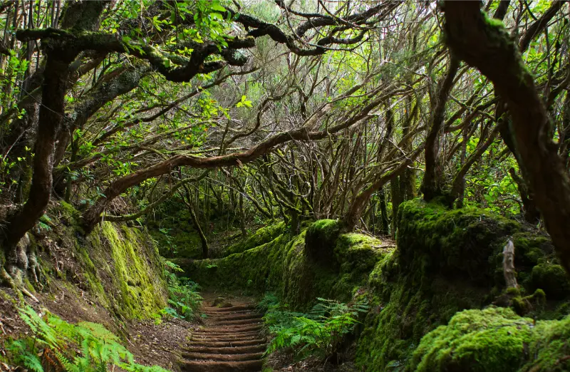
Afur combines a tiny rural settlement with immediate access to one of Anaga’s classic ravine-to-coast routes. Unlike a scenic stop where the experience happens beside the road, here the landscape opens only when I walk into it. Ravine walls, terraces, exposed coast and old paths make the day feel much larger than the map suggests.
For a first Anaga visit I might still start with Cruz del Carmen. Afur is better when I already know I want a longer hike and I am comfortable dedicating most of the daylight to it.
Understanding PR-TF 8
The route begins and ends in Afur, which simplifies transport compared with a linear hike. The official description sends walkers down the Afur ravine toward the coast near Playa de Tamadite, then up toward Taganana and back through the mountains. The circular shape does not make it easy; the elevation gain is substantial.
I read the route in segments rather than as a single number. Descending to the coast can feel deceptively easy, but every metre lost eventually has to be regained. On a warm day, the climb away from sea level is where pacing and water management matter most.
Playa de Tamadite: a scenic point, not a guaranteed swim
Tamadite is a spectacular coastal section, but I do not plan PR-TF 8 around swimming. The north Anaga coast is exposed and can be dangerous. If waves are strong, I stay well away from the water and use the beach area purely as a landscape stop.
That mindset prevents one of the most common hiking mistakes on islands: assuming that reaching a beach means a safe cooling-off swim. I carry enough water to hike without needing the ocean.
Taganana in the middle of the day
The route’s connection with Taganana is one of the reasons I find it so interesting. The village provides cultural context after hours in ravines and coastal terrain. If I have enough time, I stop briefly for food or a drink, but I do not turn lunch into a long break if several hours of climbing remain.
My Taganana guide is useful if I want a separate, easier day focused on the village, coast and nearby beaches rather than the full PR-TF 8 circuit.
Weather and heat management
Anaga is famous for mist and cloud, but exposed lower sections can also become hot. That contrast is easy to underestimate. I bring sun protection and a light rain layer on the same hike, because the route crosses different aspects and elevations.
After heavy rain I am especially cautious in ravines and on old stone paths. I check official status and recent weather before leaving. A sunny morning does not erase the effects of rainfall from the previous day.
How much water and food I carry
For a seven-hour route I start with enough water for the whole day plus a reserve, adjusted for temperature and my own needs. I do not rely on finding an open bar or fountain at exactly the point when I need it. Food should be simple, salty enough for a long walk and easy to eat without a long stop.
I also carry a small amount of emergency food that I do not plan to eat. The weight is minor compared with the value of having it if the route takes longer than expected.
Shoes, poles and equipment
Grip matters more to me than heavy boots. I use shoes I have already tested on uneven terrain. Trekking poles can be useful on the long descents and climbs, especially if my knees are sensitive. I also carry an offline route, charged phone and basic first-aid supplies.
This is not the hike where I break in new shoes. My Tenerife packing list explains how I separate beach gear from mountain equipment on an island trip.
Driving and parking in Afur
The road to Afur is narrow and winding, and the village has limited space. I arrive early so I am not trying to solve parking after the main hiking wave has arrived. I never park in a way that blocks local traffic, agricultural access or bus movements.
Because the route is long, I also remember where I left the car and save the location offline. At the end of a tiring hike, small organisational details matter more than they did in the morning.
Public transport possibilities
Bus travel can work in Anaga, but frequencies make planning important. For a full-day hike I would confirm both outbound and return options before leaving accommodation. The Tenerife bus guide explains how I build a buffer around rural services.
If the bus schedule creates a tight deadline at the end of seven hours of walking, I consider a different route. I do not like hiking with the pressure of racing for the last connection.
Afur for non-hikers
The village can still be interesting without completing PR-TF 8, but I would not drive all the way there expecting a long list of attractions. A short walk into the ravine, quiet village atmosphere and the road itself are the experience.
For travellers who want an easier Anaga walk, the Sendero de los Sentidos is a much better choice. Choosing the right difficulty is more important than choosing the most dramatic route.

Official trail source
I use the official PR-TF 8 page for the route statistics and safety guidance. It explicitly advises checking trail status before setting out.
I also review my Tenerife trail rules guide because route management and permit systems can change across protected areas.
Mistakes I would avoid
- Calling PR-TF 8 “easy” because the official grade says medium.
- Underestimating more than 1,500 metres of accumulated ascent.
- Planning to swim at Tamadite regardless of sea conditions.
- Starting late and finishing mountain roads after dark.
- Relying on cafés for essential water.
Afur is a place where good planning creates freedom. Once I know I have enough daylight, water and transport certainty, I can stop thinking about logistics and enjoy the landscape.
Frequently asked questions
Is PR-TF 8 a circular route?
Yes. The official route begins and ends in Afur.
How long is PR-TF 8?
The official distance is about 14.3 km with an estimated duration of around seven hours.
Is it difficult?
It is officially graded medium, but the large accumulated ascent and descent make it physically demanding.
Can I swim at Tamadite?
I would not plan on it. Sea conditions on the exposed Anaga coast can be dangerous.
Do I need a permit?
The official page currently lists no authorization requirement, but I always check current trail status.
How I decide whether this fits my itinerary
Before adding Afur Tenerife to a Tenerife plan, I ask what role it plays in the day. If it is the main experience, I leave enough time for weather, transport and an unhurried visit. If it is a secondary stop, I keep expectations smaller and avoid turning a flexible day into a chain of deadlines. This distinction sounds simple, but it is one of the most useful ways I have found to plan an island with mountain roads and very different microclimates.
I also compare travel time with time actually spent at the destination. A place can look close on the map and still require slow roads, parking searches or bus connections. I would rather visit two places properly than spend the day moving between five. This is especially true in Anaga, Teno and the north coast, where the journey is often part of the experience.
My practical backup plan
I always choose a nearby alternative before leaving accommodation. If the sea is rough, I switch from swimming to a town, market or viewpoint. If cloud removes a mountain panorama, I walk in the forest or move to a different elevation. If parking is full, I do not wait indefinitely; I continue to the backup stop and return later only if it still makes sense.

That flexibility is not a compromise. In Tenerife it is often the difference between a stressful day and a memorable one. The island is compact enough that several different landscapes may be available within the same region, so changing the plan does not mean losing the day.
Responsible travel notes
I treat small villages, beaches and natural areas as shared local spaces. I use legal parking, keep noise low near homes, stay on marked paths, take rubbish away and follow temporary closures even when other people ignore them. On the coast I avoid climbing barriers for photographs, and in protected landscapes I do not collect plants, rocks or other natural material.
I also try to spend some money locally when it is appropriate: a coffee, lunch, market purchase or small shop can make a visit more connected to the community. Responsible travel is not about making a performance of being perfect; it is mostly a series of ordinary decisions that reduce pressure on places I want to remain enjoyable.
My final take
Afur is one of the strongest hiking bases in Anaga because the landscape unfolds from ravine to ocean to village and back into the mountains. I would choose it when I want a full physical day, not when I am trying to squeeze Anaga between other attractions. With an early start and realistic pacing, PR-TF 8 can be one of the island’s most rewarding long walks.