
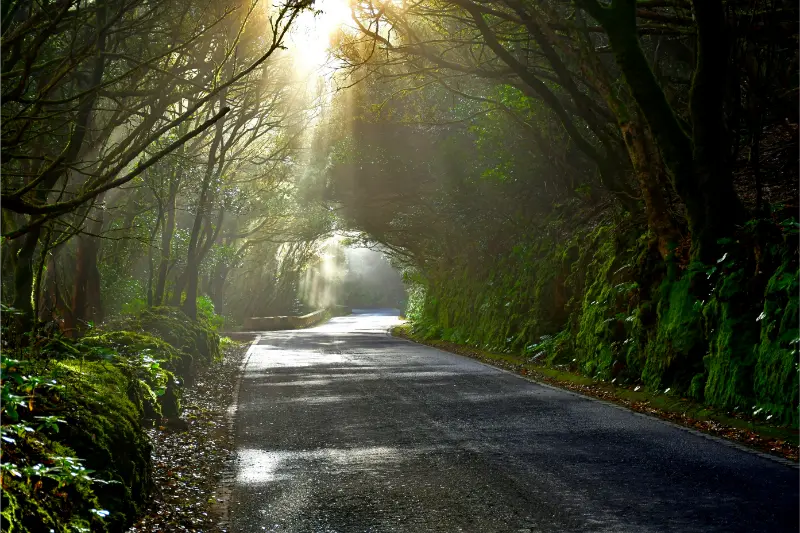
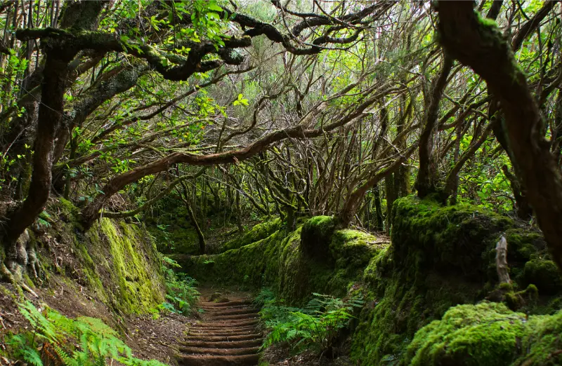
Agua García is one of the easiest places in north Tenerife to experience monteverde without committing to a long mountain hike. The forest lies in Tacoronte, within the protected Las Lagunetas landscape, and combines laurel-forest vegetation, short interpreted paths, old water infrastructure and the unusual Cuevas de Toledo. It is a very different experience from the dramatic ridges of Anaga: quieter, softer and more focused on the relationship between forest and water.
Turismo de Tenerife describes Agua García as one of the important surviving areas of laurisilva in the Canary Islands and notes its Heritage Information Centre. Tacoronte’s tourism site adds two especially useful routes: an accessible 500-metre trail and the circular Route of the Centennial Guardians, with short and long options of 1 km and 2 km.
Quick planning facts
| Municipality | Tacoronte |
|---|---|
| Protected landscape | Las Lagunetas |
| Main habitat | Monteverde / laurisilva |
| Accessible trail | 500 m on the current Tacoronte tourism page |
| Centennial Guardians route | 1 km short option / 2 km long option |
| Difficulty | Low on the municipal route descriptions |
| Interesting feature | Cuevas de Toledo and ancient viñátigo trees |
| Best for | Families, easy walking, forest atmosphere, natural history |
Why the forest matters
Monteverde is an evergreen cloud-forest system that depends on humid trade winds. The forest catches moisture from passing cloud and creates a cool environment of laurels, viñátigos, ferns, mosses and other species adapted to relatively stable moisture. In practical terms, this means Agua García can feel damp and fresh when the coast is bright and warm.
The forest is also culturally important because water shaped settlement and agriculture in the north. The Madre del Agua and old galleries remind me that the landscape is not only “natural”; it has been used, managed and negotiated by communities for centuries.
The Route of the Centennial Guardians
Tacoronte’s official tourism site lists a short 1 km and long 2 km version, both circular and low difficulty. The name refers to old viñátigo trees along the route. One of the best-known specimens is the Viñátigo de la Cuna, which the municipal site says may be between 800 and 1,000 years old.
I take the age estimate as a reason to slow down, not as an invitation to touch roots or climb around the tree. Ancient trees survive because people give them space. The route also reaches the Cuevas de Toledo, excavated from the sixteenth century for trachyte extraction associated with glass production.
The accessible path
The current Tacoronte Travel page describes the accessible Agua García trail as 500 metres long with four interpreted stops. That makes it useful for travellers who want a short forest experience without the climbs found in many Tenerife walks. “Accessible” still does not mean every mobility need is identical, so I verify surface conditions and facilities if travelling with a wheelchair or mobility device.
For a broader island overview, my accessible Tenerife guide helps compare beaches, attractions and transport as well as trails.
Cuevas de Toledo: history inside the forest
The Cuevas de Toledo, sometimes called glass caves, add an unexpected historical layer. The municipal tourism site explains that they were excavated in the sixteenth century to obtain trachyte. I would not enter any unapproved cavity or leave the signed route; the interest is in understanding how extraction and water management once shaped this forest.
Best conditions for a visit
I actually like Agua García when there is light cloud because the forest looks more atmospheric and the vegetation benefits from that humidity. Heavy rain is different: paths can become slippery and visibility on the approach can worsen. I check local conditions, not the forecast for Costa Adeje, before leaving.
Morning is my preferred time if I want quiet paths. The forest can also be a good backup when higher mountains are windy or the coast is too hot, provided there are no weather warnings affecting the north.
How to combine Agua García with Tacoronte
The easiest pairing is with Tacoronte’s historic centre, agricultural market or the Tacoronte-Acentejo wine landscape. This creates a day that connects forest, farming and food without long drives. My Tacoronte and El Sauzal guide gives the wider context.
I would not combine Agua García with a full Anaga hike on the same day unless hiking is the main objective. The forest deserves enough time to walk slowly and notice details rather than being treated as a 20-minute roadside stop.
Official information I check
For the protected forest overview I use Turismo de Tenerife’s Agua García page. For the Centennial Guardians and accessible routes, Tacoronte Travel provides the current municipal descriptions. I recheck them because trail maintenance can change short-route access.
How I fit it into a Tenerife itinerary
I would not cross the island just to collect a quick photograph of Agua García. I place it inside a coherent north Tenerife day, give it enough time to understand the setting and then add only one or two nearby stops. This approach matters in Tenerife because mountain roads, parking and microclimates can turn a short distance into a slow journey. It also makes small villages and local neighbourhoods feel less like attractions and more like places with their own rhythm.
A sensible cluster is Tacoronte historic centre, the farmers’ market and El Sauzal. I check the route before leaving, save the main parking or bus information offline and keep one optional stop that can be removed. For the wider area, I use my Tacoronte and El Sauzal guide so the day has a clear geographic logic instead of zig-zagging across the island.
Driving, buses and parking strategy
On rural roads I assume the final kilometres will take longer than navigation apps suggest. I keep to my lane, use safe pull-outs only, and never stop on a bend simply because a viewpoint looks attractive. If the destination has limited parking, arriving earlier is usually more useful than trying to find a “secret” space. I also avoid blocking house entrances, agricultural tracks, bus stops and emergency access.
Public transport can be a good option for some north Tenerife days, but I verify the current TITSA timetable rather than relying on an old screenshot or blog. I identify the final practical return service before starting a walk. My Tenerife bus guide explains the ten+ system and the planning habits I use when I travel without a car.
Weather and what I carry
I pack for the exact environment rather than for the temperature at my hotel. In the north and in Anaga, cloud, wind and light rain can appear even when the south is sunny. On the coast, the Atlantic can be rough despite warm air temperatures. My basic kit is water, sun protection, a charged phone, a light layer and footwear appropriate to the surface. For rural walks I add a thin waterproof layer and a little more water than I think I will need.
The island-wide forecast is only a starting point. I compare the coast, the hills and higher elevations separately and use my Tenerife weather by month guide to understand why the same day can feel very different across the island.
Responsible travel in a lived-in place
Agua García is not a theme park. I keep noise low near homes, stay on marked paths, take rubbish away and ask before photographing people at close range. In agricultural areas I never enter terraces or fields to improve a photograph. Small decisions like buying a coffee, lunch or local product from an open business can also make the visit more connected to the community without turning local life into a performance for visitors.
I also treat closures and temporary restrictions as part of the destination, not an inconvenience to bypass. Fire risk, storm damage, rockfall or maintenance can change access. If a road, beach or trail is closed, I use the backup plan and move on.
Frequently asked questions
Is Agua García suitable for children?
For families comfortable on forest paths, the short interpreted routes can be an excellent choice. I still supervise children around slopes, roots and any historic cavities.
Is it the same as Anaga?
No. Both contain monteverde vegetation, but Agua García is in Tacoronte within the Las Lagunetas protected landscape. It offers a quieter, compact forest experience compared with Anaga’s larger mountain network.

How long should I stay?
For the short route and a relaxed look around, I would allow 60–90 minutes. A longer visit can include both loops, the information centre and time in Tacoronte.
Final thoughts
Agua García is one of my favourite types of Tenerife stop: small in distance but rich in context. A few kilometres of forest reveal ancient trees, water history, old extraction sites and the cloud-dependent ecology of the north. I would come for the cool air and easy walking, then stay long enough to understand why the forest exists at all.
A slower way to experience the area
I leave room for unplanned time because the best part of rural Tenerife is often not the named attraction. A cloud opening over a ridge, a short conversation in a bar, a view from a legal pull-out or the smell of wet forest can become the memory of the day. If every fifteen minutes is assigned to a stop, I end up watching the clock instead of the place.
I also avoid building two demanding mountain objectives into the same day. Even if each route looks short, the combination of driving, elevation, parking and changing weather creates fatigue. One main walk plus one village or viewpoint is usually my preferred balance.
Navigation and phone coverage
I download the route and essential map area before leaving accommodation. Mountain valleys can have patchy mobile coverage, and battery drains faster when a phone searches constantly for signal. I carry a power bank on longer days and keep the official trail name or destination written down so I can ask for help clearly if needed.
For hikes, I use official signed routes as the primary reference and treat community GPX tracks as secondary information. A line on a mapping app may cross private land, an old path or a closed section. If signage and the downloaded track disagree, I stop and reassess rather than force the digital route.
Food, water and toilets
Small villages are not guaranteed service stations. I carry enough water to complete the main activity even if the local bar is closed, and I use toilets when I have a legitimate opportunity rather than assuming the next viewpoint will have facilities. I also bring a small rubbish bag because bins are limited on many rural routes.
When a village restaurant is open, I prefer to eat there rather than carry an elaborate picnic into a fragile landscape. It supports a local business and gives the day a natural pause. I still carry emergency snacks so a closed kitchen never becomes a safety problem.


