Tag: Tenerife hiking

  • Tenerife Hiking & Nature Itinerary: 7 Days Across Teide, Anaga and Teno

    Tenerife Hiking & Nature Itinerary: 7 Days Across Teide, Anaga and Teno

    Quick summary: A hiking week in Tenerife should not be seven hard hikes. The terrain, altitude, sun and long approach roads create cumulative fatigue, so I alternate big mountain days with shorter forest or coastal walks. I also keep one flexible day because Teide wind, Anaga rain, wildfire restrictions or trail closures can move the safest route to another part of the island.

    Who this itinerary is for

    This itinerary is for active travellers who are comfortable walking for several hours and who care more about landscapes than resort attractions. It is not a technical mountaineering plan and it does not assume the Teide summit. I choose official, established trails and treat protected-area rules as part of the trip rather than an inconvenience.

    The base I would choose

    For one week I would either stay around La Laguna/Puerto de la Cruz for northern access or use a central/north base plus a few long drives. A south resort is still possible, but it adds time to Anaga and Teno. If the main goal is hiking, reducing daily driving is more valuable than being beside a nightlife strip.

    Itinerary at a glance

    DayMain areaWhy it works
    Day 1Easy acclimatisation walkUse a coastal path, Malpaís de Güímar or a forest stroll. Check footwear, water needs and how the group handles the sun before a serious mountain day.
    Day 2Teide National ParkChoose Roques de García, Sámara or another appropriate trail. Summit access is a separate objective and requires current permit planning.
    Day 3Anaga laurel forestBase the day around Cruz del Carmen and a route that matches the weather. Cloud can make the forest atmospheric but exposed ridges need more caution.
    Day 4Recovery: La Laguna, botanical gardens or short coast walkRest the legs while still exploring. Use this as the weather-swap day if Teide or Anaga was unsuitable earlier.
    Day 5Teno Rural ParkChoose one Teno route rather than driving every mountain road. Erjos, El Palmar and Teno Alto offer different levels of commitment.
    Day 6Volcanic forest or ChinyeroWalk among pine and younger lava landscapes. Keep distance and ascent below the previous big day if fatigue is building.
    Day 7Short favourite route and flexible departureFinish with a route close to the base or a viewpoint walk. I do not schedule the week’s hardest hike before a flight.

    Day 1: Easy acclimatisation walk

    Use a coastal path, Malpaís de Güímar or a forest stroll. Check footwear, water needs and how the group handles the sun before a serious mountain day.

    I keep this day geographically compact. Tenerife rewards clustering because the hidden time is rarely the motorway itself; it is parking, mountain bends, finding the correct entrance and stopping at places that were not in the original plan. One area explored well usually feels richer than three areas photographed quickly.

    Day 2: Teide National Park

    Choose Roques de García, Sámara or another appropriate trail. Summit access is a separate objective and requires current permit planning.

    I check official Teide information and Tenerife ON before leaving. I separate the park experience from summit ambitions: viewpoints, lava landscapes and established walks are already a complete day. If a cable-car or controlled trail is part of the plan, I treat the reservation and current access rules as fixed, then keep the rest of the day flexible.

    Day 3: Anaga laurel forest

    Base the day around Cruz del Carmen and a route that matches the weather. Cloud can make the forest atmospheric but exposed ridges need more caution.

    In Anaga I plan for cloud, narrow roads and slower travel than the map suggests. Cruz del Carmen is a practical anchor because it gives me visitor information and access to shorter walks. I do not assume that a clear south-coast morning means a dry ridge in the northeast.

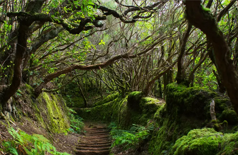
    Anaga Laurel Forest Tenerife

    Day 4: Recovery: La Laguna, botanical gardens or short coast walk

    Rest the legs while still exploring. Use this as the weather-swap day if Teide or Anaga was unsuitable earlier.

    On the coast I let sea conditions decide the swimming part of the day. I use the Tenerife safety guide and respect flags, lifeguards and local closures. A coastal day is still worthwhile when the ocean is too rough to swim: promenades, harbours, food and viewpoints remain available.

    Day 5: Teno Rural Park

    Choose one Teno route rather than driving every mountain road. Erjos, El Palmar and Teno Alto offer different levels of commitment.

    I keep this day geographically compact. Tenerife rewards clustering because the hidden time is rarely the motorway itself; it is parking, mountain bends, finding the correct entrance and stopping at places that were not in the original plan. One area explored well usually feels richer than three areas photographed quickly.

    Day 6: Volcanic forest or Chinyero

    Walk among pine and younger lava landscapes. Keep distance and ascent below the previous big day if fatigue is building.

    I keep this day geographically compact. Tenerife rewards clustering because the hidden time is rarely the motorway itself; it is parking, mountain bends, finding the correct entrance and stopping at places that were not in the original plan. One area explored well usually feels richer than three areas photographed quickly.

    Anaga Laurel Forest Trail Tenerife

    Day 7: Short favourite route and flexible departure

    Finish with a route close to the base or a viewpoint walk. I do not schedule the week’s hardest hike before a flight.

    I keep this day geographically compact. Tenerife rewards clustering because the hidden time is rarely the motorway itself; it is parking, mountain bends, finding the correct entrance and stopping at places that were not in the original plan. One area explored well usually feels richer than three areas photographed quickly.

    Permits and current access come before route ambition

    I start with Tenerife ON and my Tenerife hiking permits guide. Teide high routes, protected trails and closures can change the practical plan. I would rather downgrade a route than arrive at a gate expecting an old blog post to override the current system.

    How I manage altitude

    Teide is different from a coastal hike. I use the altitude guide, drink normally, take the first high day slowly and pay attention to headache, nausea or unusual fatigue. The view is not worth pushing through symptoms.

    Why the recovery day is part of the itinerary

    A rest day protects the second half of the week. It also gives me somewhere to move a cancelled trail without stacking two long hikes back-to-back. Good hiking holidays are built around recovery as deliberately as around summits.

    Transport: the decision that changes the whole itinerary

    I compare the route with my Tenerife by car guide and the no-car guide. A rental car is valuable for Teide, Anaga, Teno and multi-stop days, but it can be unnecessary on beaches, city walks and evenings. Selective rental often gives the best balance: drive when the car creates access, and leave it parked when it only creates a parking problem.

    I build extra margin around the first and last day. Airport pickup, baggage, fuel return and traffic are not sightseeing, but they consume real time. I would rather arrive at dinner early than turn a delayed flight into a rushed mountain drive. On departure day I work backward from the airline’s check-in and security requirements and then add the road or public-transport margin.

    Weather and microclimates: why I keep one day flexible

    Tenerife can place sun, cloud, wind and high-altitude cold inside the same itinerary. I use the Tenerife weather forecast guide and move the most weather-sensitive day when I can. Teide needs visibility and safe high-altitude conditions; Anaga can be wet or foggy; north-coast swimming depends on swell. A flexible day is not empty time—it is insurance for the experience I care about most.

    I pack layers even when the hotel forecast looks warm. A light jacket, water, sun protection and shoes suitable for the day are more useful than trying to predict one island-wide temperature. If an official alert, road closure or protected-area restriction changes the plan, I treat that as a reason to switch area, not as a challenge to find a shortcut.

    Where I would stay

    I choose accommodation by evening life and morning logistics, not only by star rating. For current availability I compare Tenerife accommodation on Booking.com. I check the exact map position, slope, parking or bus stop, reception hours and how long the first major day will take from the property. A good base can save more holiday time than a slightly cheaper room on the wrong side of the island.

    What I would book in advance—and what I would keep open

    I book the things where capacity or a fixed slot matters: accommodation, any controlled high-altitude or protected trail, a specific boat departure, a major attraction on a peak day and a restaurant that is genuinely central to the trip. I keep ordinary beaches, viewpoints, cafés and many town visits open. Tenerife is more enjoyable when weather and energy can still change the order of the week.

    For activities, I read the cancellation terms before paying and check whether transport, equipment or permits are actually included. A cheap headline price can be poor value if it requires a separate transfer or locks me into a weather-sensitive day. When a guided excursion solves real logistics, I am happy to use one.

    Food rhythm: how I avoid eating badly because the itinerary is too full

    I use my Tenerife food guide to choose a few local dishes, then keep meals close to the day’s geography. A long lunch in La Orotava makes sense on a north-coast day; a harbour fish meal belongs with the coast. I carry water and a small snack so hunger does not force an unnecessary detour just before a hike, boat or sunset.

    The planning mistakes I would avoid

    • Treating the driving time shown on a map as the total time needed for the stop.
    • Booking the most weather-sensitive experience on the only day that cannot move.
    • Changing hotels too often on a short itinerary and losing hours to packing and check-in.
    • Trying to combine Teide, Anaga, Masca and a beach simply because they fit on one island map.
    • Using old screenshots for trail, transport or attraction rules instead of checking the current operator or authority.
    • Saving every good restaurant for dinner after a long drive instead of using lunch to anchor the region I am already visiting.

    Frequently asked questions

    Can I hike every day in Tenerife?

    You can, but I would vary intensity. Seven demanding mountain days is unnecessary and increases fatigue and injury risk.

    Do I need hiking permits?

    Some routes and high-altitude access do. I check Tenerife ON and the competent authority for each trail shortly before the hike.

    Is Teide the hardest day?

    Not always. Altitude makes it demanding, but long Anaga or Teno routes can have more complex terrain and logistics.
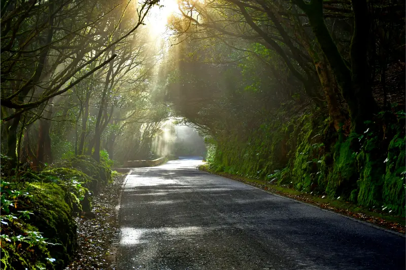
    Anaga Tenerife

    Do I need a car?

    A car helps with trailheads, but some Anaga and urban-linked hikes work by bus. A mixed approach can be excellent.

    What if there is a closure?

    I use the recovery day or switch geographic area. I never bypass a closure or improvise an unofficial route around it.

    My final advice

    The best tenerife hiking itinerary is the one I can still enjoy when one detail changes. I protect the big experiences with sensible geography, current information and enough margin, then leave the smaller choices open. Tenerife has too many good alternatives for a holiday to depend on one perfect sequence.

    I treat this itinerary as a framework rather than a promise that every road, trail, beach or timetable will behave exactly the same on the travel date. Before any activity where access, safety, weather or a paid booking matters, I recheck the official source. That habit lets me travel more freely because the important constraints are handled before the day begins.

  • Agua García Forest Guide: Ancient Laurisilva and Easy Walks in Tacoronte

    Agua García Forest Guide: Ancient Laurisilva and Easy Walks in Tacoronte

    Agua García is one of the easiest places in north Tenerife to experience monteverde without committing to a long mountain hike. The forest lies in Tacoronte, within the protected Las Lagunetas landscape, and combines laurel-forest vegetation, short interpreted paths, old water infrastructure and the unusual Cuevas de Toledo. It is a very different experience from the dramatic ridges of Anaga: quieter, softer and more focused on the relationship between forest and water.

    Turismo de Tenerife describes Agua García as one of the important surviving areas of laurisilva in the Canary Islands and notes its Heritage Information Centre. Tacoronte’s tourism site adds two especially useful routes: an accessible 500-metre trail and the circular Route of the Centennial Guardians, with short and long options of 1 km and 2 km.

    Quick planning facts

    MunicipalityTacoronte
    Protected landscapeLas Lagunetas
    Main habitatMonteverde / laurisilva
    Accessible trail500 m on the current Tacoronte tourism page
    Centennial Guardians route1 km short option / 2 km long option
    DifficultyLow on the municipal route descriptions
    Interesting featureCuevas de Toledo and ancient viñátigo trees
    Best forFamilies, easy walking, forest atmosphere, natural history

    Why the forest matters

    Monteverde is an evergreen cloud-forest system that depends on humid trade winds. The forest catches moisture from passing cloud and creates a cool environment of laurels, viñátigos, ferns, mosses and other species adapted to relatively stable moisture. In practical terms, this means Agua García can feel damp and fresh when the coast is bright and warm.

    The forest is also culturally important because water shaped settlement and agriculture in the north. The Madre del Agua and old galleries remind me that the landscape is not only “natural”; it has been used, managed and negotiated by communities for centuries.

    The Route of the Centennial Guardians

    Tacoronte’s official tourism site lists a short 1 km and long 2 km version, both circular and low difficulty. The name refers to old viñátigo trees along the route. One of the best-known specimens is the Viñátigo de la Cuna, which the municipal site says may be between 800 and 1,000 years old.

    I take the age estimate as a reason to slow down, not as an invitation to touch roots or climb around the tree. Ancient trees survive because people give them space. The route also reaches the Cuevas de Toledo, excavated from the sixteenth century for trachyte extraction associated with glass production.

    The accessible path

    The current Tacoronte Travel page describes the accessible Agua García trail as 500 metres long with four interpreted stops. That makes it useful for travellers who want a short forest experience without the climbs found in many Tenerife walks. “Accessible” still does not mean every mobility need is identical, so I verify surface conditions and facilities if travelling with a wheelchair or mobility device.

    For a broader island overview, my accessible Tenerife guide helps compare beaches, attractions and transport as well as trails.

    Cuevas de Toledo: history inside the forest

    The Cuevas de Toledo, sometimes called glass caves, add an unexpected historical layer. The municipal tourism site explains that they were excavated in the sixteenth century to obtain trachyte. I would not enter any unapproved cavity or leave the signed route; the interest is in understanding how extraction and water management once shaped this forest.

    Best conditions for a visit

    I actually like Agua García when there is light cloud because the forest looks more atmospheric and the vegetation benefits from that humidity. Heavy rain is different: paths can become slippery and visibility on the approach can worsen. I check local conditions, not the forecast for Costa Adeje, before leaving.

    Morning is my preferred time if I want quiet paths. The forest can also be a good backup when higher mountains are windy or the coast is too hot, provided there are no weather warnings affecting the north.

    How to combine Agua García with Tacoronte

    The easiest pairing is with Tacoronte’s historic centre, agricultural market or the Tacoronte-Acentejo wine landscape. This creates a day that connects forest, farming and food without long drives. My Tacoronte and El Sauzal guide gives the wider context.

    I would not combine Agua García with a full Anaga hike on the same day unless hiking is the main objective. The forest deserves enough time to walk slowly and notice details rather than being treated as a 20-minute roadside stop.

    Anaga Tenerife

    Official information I check

    For the protected forest overview I use Turismo de Tenerife’s Agua García page. For the Centennial Guardians and accessible routes, Tacoronte Travel provides the current municipal descriptions. I recheck them because trail maintenance can change short-route access.

    How I fit it into a Tenerife itinerary

    I would not cross the island just to collect a quick photograph of Agua García. I place it inside a coherent north Tenerife day, give it enough time to understand the setting and then add only one or two nearby stops. This approach matters in Tenerife because mountain roads, parking and microclimates can turn a short distance into a slow journey. It also makes small villages and local neighbourhoods feel less like attractions and more like places with their own rhythm.

    A sensible cluster is Tacoronte historic centre, the farmers’ market and El Sauzal. I check the route before leaving, save the main parking or bus information offline and keep one optional stop that can be removed. For the wider area, I use my Tacoronte and El Sauzal guide so the day has a clear geographic logic instead of zig-zagging across the island.

    Driving, buses and parking strategy

    On rural roads I assume the final kilometres will take longer than navigation apps suggest. I keep to my lane, use safe pull-outs only, and never stop on a bend simply because a viewpoint looks attractive. If the destination has limited parking, arriving earlier is usually more useful than trying to find a “secret” space. I also avoid blocking house entrances, agricultural tracks, bus stops and emergency access.

    Public transport can be a good option for some north Tenerife days, but I verify the current TITSA timetable rather than relying on an old screenshot or blog. I identify the final practical return service before starting a walk. My Tenerife bus guide explains the ten+ system and the planning habits I use when I travel without a car.

    Weather and what I carry

    I pack for the exact environment rather than for the temperature at my hotel. In the north and in Anaga, cloud, wind and light rain can appear even when the south is sunny. On the coast, the Atlantic can be rough despite warm air temperatures. My basic kit is water, sun protection, a charged phone, a light layer and footwear appropriate to the surface. For rural walks I add a thin waterproof layer and a little more water than I think I will need.

    The island-wide forecast is only a starting point. I compare the coast, the hills and higher elevations separately and use my Tenerife weather by month guide to understand why the same day can feel very different across the island.

    Responsible travel in a lived-in place

    Agua García is not a theme park. I keep noise low near homes, stay on marked paths, take rubbish away and ask before photographing people at close range. In agricultural areas I never enter terraces or fields to improve a photograph. Small decisions like buying a coffee, lunch or local product from an open business can also make the visit more connected to the community without turning local life into a performance for visitors.

    I also treat closures and temporary restrictions as part of the destination, not an inconvenience to bypass. Fire risk, storm damage, rockfall or maintenance can change access. If a road, beach or trail is closed, I use the backup plan and move on.

    Frequently asked questions

    Is Agua García suitable for children?

    For families comfortable on forest paths, the short interpreted routes can be an excellent choice. I still supervise children around slopes, roots and any historic cavities.

    Is it the same as Anaga?

    No. Both contain monteverde vegetation, but Agua García is in Tacoronte within the Las Lagunetas protected landscape. It offers a quieter, compact forest experience compared with Anaga’s larger mountain network.

    Anaga Forest Tenerife

    How long should I stay?

    For the short route and a relaxed look around, I would allow 60–90 minutes. A longer visit can include both loops, the information centre and time in Tacoronte.

    Final thoughts

    Agua García is one of my favourite types of Tenerife stop: small in distance but rich in context. A few kilometres of forest reveal ancient trees, water history, old extraction sites and the cloud-dependent ecology of the north. I would come for the cool air and easy walking, then stay long enough to understand why the forest exists at all.

    A slower way to experience the area

    I leave room for unplanned time because the best part of rural Tenerife is often not the named attraction. A cloud opening over a ridge, a short conversation in a bar, a view from a legal pull-out or the smell of wet forest can become the memory of the day. If every fifteen minutes is assigned to a stop, I end up watching the clock instead of the place.

    Anaga Laurel Forest Path Tenerife

    I also avoid building two demanding mountain objectives into the same day. Even if each route looks short, the combination of driving, elevation, parking and changing weather creates fatigue. One main walk plus one village or viewpoint is usually my preferred balance.

    Navigation and phone coverage

    I download the route and essential map area before leaving accommodation. Mountain valleys can have patchy mobile coverage, and battery drains faster when a phone searches constantly for signal. I carry a power bank on longer days and keep the official trail name or destination written down so I can ask for help clearly if needed.

    For hikes, I use official signed routes as the primary reference and treat community GPX tracks as secondary information. A line on a mapping app may cross private land, an old path or a closed section. If signage and the downloaded track disagree, I stop and reassess rather than force the digital route.

    Food, water and toilets

    Small villages are not guaranteed service stations. I carry enough water to complete the main activity even if the local bar is closed, and I use toilets when I have a legitimate opportunity rather than assuming the next viewpoint will have facilities. I also bring a small rubbish bag because bins are limited on many rural routes.

    When a village restaurant is open, I prefer to eat there rather than carry an elaborate picnic into a fragile landscape. It supports a local business and gives the day a natural pause. I still carry emergency snacks so a closed kitchen never becomes a safety problem.

  • PR-TF 10 Hiking Guide: Cruz del Carmen to Punta del Hidalgo

    PR-TF 10 Hiking Guide: Cruz del Carmen to Punta del Hidalgo

    PR-TF 10 is one of the most satisfying ways to understand the vertical geography of Anaga. Instead of driving from viewpoint to viewpoint, the trail drops from the laurel forest around Cruz del Carmen through Las Carboneras and Chinamada to the Atlantic at Punta del Hidalgo. The scenery changes continuously: humid forest, rural hamlets, exposed ridges, rock-cut paths and finally a dramatic coastal descent.

    According to Turismo de Tenerife, the full linear route is 10.4 km, takes about four hours, is graded medium difficulty and descends from a maximum elevation of 949 m to around 10 m. The official profile lists roughly 420.64 m of accumulated ascent and 1,300.38 m of descent, and no authorization is required. The numbers make the key challenge clear: this is not a flat 10 km walk. The long descent is what many legs feel the next day.

    PR-TF 10 at a glance

    StartCruz del Carmen
    FinishPunta del Hidalgo
    Distance10.4 km
    Official durationAbout 4 hours
    DifficultyMedium
    TypeLinear
    Maximum elevation949 m
    Minimum elevation10 m
    Accumulated ascent420.64 m
    Accumulated descent1,300.38 m
    PermitNot required on the official listing

    Why I prefer walking it downhill

    The official direction from Cruz del Carmen to Punta del Hidalgo makes logistical and physical sense. I begin in cool monteverde and finish by the sea, with most of the route trending downhill. Downhill does not mean easy: long descents load knees and quadriceps, and the final exposed sections can feel tiring after several hours. Trekking poles can be useful if I am comfortable using them.

    Walking the opposite way is possible for strong hikers, but it turns the route into a major climb from near sea level toward almost 1,000 metres. For a first attempt, I would follow the standard direction unless I had a specific training goal and a very clear transport plan.

    Stage 1: Cruz del Carmen and the laurel forest

    Cruz del Carmen is an ideal start because it has the Anaga visitor centre, a viewpoint and immediate access to dense laurisilva. The first part of the route descends through faya-brezal and other monteverde vegetation. Roots, damp soil and stone steps can be slippery even when the coast is dry, so I start in hiking shoes rather than casual trainers.

    Anaga Laurel Forest Trail Tenerife

    If I have never visited the area, I arrive early enough to spend a few minutes at the visitor centre. My Cruz del Carmen guide explains the facilities and short walks around the trailhead.

    Stage 2: Las Carboneras

    The route gradually leaves the enclosed forest and reaches the rural landscape around Las Carboneras. This is where I feel the cultural side of Anaga most strongly: homes, terraces, small roads and restaurants appear among steep slopes. I do not treat the village as a refuelling guarantee; I carry my own water and food because rural opening hours can change.

    If the full hike is too much, the village is also connected to PR-TF 10.1. My Las Carboneras guide is useful for turning this section into a shorter day.

    Stage 3: Chinamada and the cave-house landscape

    Chinamada is one of the most distinctive stops on the route. Traditional cave houses are integrated into the rock and the settlement sits high above the north coast. I move quietly, because these are lived-in homes rather than an open-air museum. The village is also a natural place to reassess weather, water and daylight before the final descent.

    For background on the settlement and its cave-house tradition, I use my Chinamada guide. If visibility is poor or the trail has become slippery, this is also where I would be willing to change plans instead of forcing the coastal descent.

    Stage 4: the descent to Punta del Hidalgo

    The final section is visually dramatic. The path cuts through rocky slopes with wide views of the Atlantic and the north coast. Exposure to sun and wind increases as the forest disappears. I keep water in reserve for this stage and do not assume the sea breeze means the sun is weak.

    Punta del Hidalgo is a satisfying finish because there are services, buses and the possibility of a meal or swim if conditions are appropriate. I never plan the swim as guaranteed; after a long hike I check the flags and sea state rather than entering the water simply because I am hot.

    Transport logistics: the part I plan first

    Because PR-TF 10 is linear, transport is not a detail. I normally plan the return connection before deciding the start time. A common strategy is to use public transport so I do not have to retrieve a car from the mountains. Exact bus routes and frequencies can change, so I verify TITSA on the day and build margin around the final service I am willing to take.

    My Tenerife bus guide explains ten+ cards, transfers and why I save the return timetable offline. With two cars, a shuttle is possible, but I avoid leaving vehicles in informal roadside spaces at either end.

    Weather, footwear and water

    PR-TF 10 crosses several microclimates in one walk. Cruz del Carmen can be cool, damp and foggy while Punta del Hidalgo is sunny and warm. I carry a light waterproof or windproof layer, sun protection, enough water for the full route and food that is easy to eat on the move. I also keep one dry layer inside the pack because sweat and cloud can make the upper section surprisingly chilly.

    I check trail status after any period of heavy rain or strong wind. Fallen branches, slippery sections and maintenance closures matter more than a perfect weather icon.

    Official source and live status

    The core technical data in this guide comes from Turismo de Tenerife’s official PR-TF 10 listing. I also check Tenerife ON immediately before hiking for closures, restrictions or alerts. The official listing explicitly reminds hikers to respect signs, check weather and carry suitable equipment.

    Who I would recommend this hike to

    I recommend PR-TF 10 to walkers comfortable with several hours on uneven mountain paths and a sustained descent. It is not the route I would choose for someone testing hiking shoes for the first time, for travellers with unstable knees, or for a group that wants to stop repeatedly for long lunches. For easier forest walking, the Sendero de los Sentidos is a much gentler introduction to Anaga.

    Anaga Tenerife

    My pacing strategy

    I divide the route mentally into four sections and avoid rushing the first forest kilometres. I take a proper break around Las Carboneras or Chinamada, then keep enough energy for the exposed descent. Photographing every bend can quietly add a surprising amount of time, so I compare progress with daylight rather than with the official four-hour estimate.

    Frequently asked questions

    Do I need a permit?

    The official Turismo de Tenerife listing says no authorization is required for PR-TF 10. I still check the current status because temporary closures can apply.

    Can I do only part of the route?

    Yes. Cruz del Carmen to Las Carboneras and the PR-TF 10.1 connection around Las Carboneras and Chinamada allow shorter plans, but transport still needs thought.

    Is it suitable after rain?

    I am cautious after rain because roots, stone and clay-like sections can become slippery. If authorities advise against walking or a section is closed, I choose another day.

    Final thoughts

    PR-TF 10 is more than a viewpoint hike. It shows how forest, village and coast fit together in Anaga. I think the route is at its best when I treat logistics as seriously as scenery: start early, plan the bus, carry proper gear and leave enough time to enjoy Las Carboneras and Chinamada rather than racing downhill to the sea.

    Anaga Forest Tenerife

    A slower way to experience the area

    I leave room for unplanned time because the best part of rural Tenerife is often not the named attraction. A cloud opening over a ridge, a short conversation in a bar, a view from a legal pull-out or the smell of wet forest can become the memory of the day. If every fifteen minutes is assigned to a stop, I end up watching the clock instead of the place.

    I also avoid building two demanding mountain objectives into the same day. Even if each route looks short, the combination of driving, elevation, parking and changing weather creates fatigue. One main walk plus one village or viewpoint is usually my preferred balance.

    Navigation and phone coverage

    I download the route and essential map area before leaving accommodation. Mountain valleys can have patchy mobile coverage, and battery drains faster when a phone searches constantly for signal. I carry a power bank on longer days and keep the official trail name or destination written down so I can ask for help clearly if needed.

    For hikes, I use official signed routes as the primary reference and treat community GPX tracks as secondary information. A line on a mapping app may cross private land, an old path or a closed section. If signage and the downloaded track disagree, I stop and reassess rather than force the digital route.

    Food, water and toilets

    Small villages are not guaranteed service stations. I carry enough water to complete the main activity even if the local bar is closed, and I use toilets when I have a legitimate opportunity rather than assuming the next viewpoint will have facilities. I also bring a small rubbish bag because bins are limited on many rural routes.

    When a village restaurant is open, I prefer to eat there rather than carry an elaborate picnic into a fragile landscape. It supports a local business and gives the day a natural pause. I still carry emergency snacks so a closed kitchen never becomes a safety problem.

  • Las Carboneras Tenerife Guide: Anaga Village, Trails and Local Food

    Las Carboneras Tenerife Guide: Anaga Village, Trails and Local Food

    Las Carboneras is one of the Anaga villages I would choose when I want to experience the massif as a lived-in rural landscape rather than only as a sequence of viewpoints. The hamlet belongs to the municipality of La Laguna and sits among steep green slopes, traditional houses and paths that historically connected the scattered communities of Anaga. It is small, quiet and best visited with realistic expectations: the appeal is the village setting, local food and access to walking routes, not a long list of monuments.

    Turismo de Tenerife groups Las Carboneras with Chinamada and Los Batanes among the rural hamlets of Anaga, highlighting examples of traditional Canarian architecture, the village square and chapel, local restaurants and trails into the surrounding landscape. That combination makes it a useful stop for travellers who already know the famous Cruz del Carmen viewpoints and want to see how people have lived in these mountains.

    Quick planning facts

    MunicipalitySan Cristóbal de La Laguna
    AreaAnaga Rural Park
    Best forRural atmosphere, traditional food, hiking connections
    Key nearby villagesChinamada and Taborno
    Main trail connectionPR-TF 10 and PR-TF 10.1
    Permit for PR-TF 10.1No, according to the official trail listing
    Ideal visit2–4 hours, or longer with a hike

    What Las Carboneras feels like

    The first thing I would notice is scale. Las Carboneras is compact, but the surrounding terrain is huge: ridges rise abruptly, ravines cut through the landscape and roads curve around slopes that make straight-line distances meaningless. The village is a reminder that Anaga is not empty wilderness. It is a cultural landscape shaped by agriculture, livestock, footpaths and small settlements that adapted to isolation for generations.

    I would walk slowly around the square and chapel area, look at the relationship between houses and terraces, and resist the urge to hunt for a single “must-see” angle. The value is in the whole setting. For a broader introduction to the massif, my Anaga Rural Park guide explains laurisilva, roads, weather and the main hiking zones.

    Traditional food and where lunch fits into the day

    One reason Las Carboneras works well in an Anaga itinerary is that the official tourism page specifically points visitors toward local restaurants serving traditional island food. I would use lunch as the anchor of the visit rather than squeezing it between two long drives. Simple dishes, local cheese, meat, potatoes with mojo or seasonal preparations make more sense here than chasing a fashionable restaurant far away.

    I do not assume every small restaurant opens every day or all afternoon. In rural Tenerife, hours can be narrower than in resort areas, so I check before building the itinerary around a meal. My what to eat in Tenerife guide gives context for the dishes and ingredients I look for.

    Walking from Las Carboneras

    Las Carboneras is linked to the PR-TF 10 network. The official PR-TF 10.1 route runs from Las Escaleras through Las Carboneras toward Chinamada. Turismo de Tenerife lists that route as 3.1 km, linear, about one hour, low difficulty, with no authorization required. Those numbers make it look easy, but I still treat wet stone, mud and steep edges with respect because Anaga weather can change quickly.

    Anaga Laurel Forest Tenerife

    For a longer day, the main PR-TF 10 links Cruz del Carmen with Punta del Hidalgo and passes through Las Carboneras and Chinamada. I would not improvise this as a casual extension after lunch; it is a proper linear hike with transport logistics. I have a separate PR-TF 10 hiking guide for that route.

    Las Carboneras or Chinamada?

    I see the two villages as complementary. Chinamada is especially known for its cave houses and the descent toward Punta del Hidalgo, while Las Carboneras feels more like a traditional roadside-rural stop with an easy connection into the same trail network. If I have half a day, I can see both without rushing, provided I keep parking and meal times under control.

    If cave-house heritage is the priority, I would give more time to Chinamada. If rural architecture, lunch and a shorter walk matter more, Las Carboneras can be the better centre of the outing.

    Best time of day and light

    I like morning in Anaga because traffic is generally easier and I have more flexibility if cloud moves in. Midday can be atmospheric in the village even when ridgelines disappear into mist. Late afternoon can be beautiful, but I do not start an unfamiliar trail too late because shaded valleys lose light quickly and roads require concentration after dark.

    Anaga Laurel Forest Trail Tenerife

    Official information I check before going

    For village context I use Turismo de Tenerife’s page on Las Carboneras and nearby hamlets. For hiking status I check the current PR-TF route listing and Tenerife ON close to the visit. Trail status always matters more than an old GPX file.

    How I fit it into a Tenerife itinerary

    I would not cross the island just to collect a quick photograph of Las Carboneras. I place it inside a coherent Anaga day, give it enough time to understand the setting and then add only one or two nearby stops. This approach matters in Tenerife because mountain roads, parking and microclimates can turn a short distance into a slow journey. It also makes small villages and local neighbourhoods feel less like attractions and more like places with their own rhythm.

    A sensible cluster is Cruz del Carmen, Chinamada and Taborno. I check the route before leaving, save the main parking or bus information offline and keep one optional stop that can be removed. For the wider area, I use my Cruz del Carmen guide so the day has a clear geographic logic instead of zig-zagging across the island.

    Driving, buses and parking strategy

    On rural roads I assume the final kilometres will take longer than navigation apps suggest. I keep to my lane, use safe pull-outs only, and never stop on a bend simply because a viewpoint looks attractive. If the destination has limited parking, arriving earlier is usually more useful than trying to find a “secret” space. I also avoid blocking house entrances, agricultural tracks, bus stops and emergency access.

    Public transport can be a good option for some Anaga days, but I verify the current TITSA timetable rather than relying on an old screenshot or blog. I identify the final practical return service before starting a walk. My Tenerife bus guide explains the ten+ system and the planning habits I use when I travel without a car.

    Weather and what I carry

    I pack for the exact environment rather than for the temperature at my hotel. In the north and in Anaga, cloud, wind and light rain can appear even when the south is sunny. On the coast, the Atlantic can be rough despite warm air temperatures. My basic kit is water, sun protection, a charged phone, a light layer and footwear appropriate to the surface. For rural walks I add a thin waterproof layer and a little more water than I think I will need.

    The island-wide forecast is only a starting point. I compare the coast, the hills and higher elevations separately and use my Tenerife weather by month guide to understand why the same day can feel very different across the island.

    Responsible travel in a lived-in place

    Las Carboneras is not a theme park. I keep noise low near homes, stay on marked paths, take rubbish away and ask before photographing people at close range. In agricultural areas I never enter terraces or fields to improve a photograph. Small decisions like buying a coffee, lunch or local product from an open business can also make the visit more connected to the community without turning local life into a performance for visitors.

    I also treat closures and temporary restrictions as part of the destination, not an inconvenience to bypass. Fire risk, storm damage, rockfall or maintenance can change access. If a road, beach or trail is closed, I use the backup plan and move on.

    Frequently asked questions

    Is Las Carboneras worth visiting without hiking?

    Yes, if you enjoy small villages, rural architecture and a slow lunch. I would not travel there expecting a large attraction, but as part of an Anaga day it adds a human dimension that viewpoints alone cannot provide.

    Anaga Tenerife

    Do I need a permit for the short PR-TF 10.1 connection?

    The official Turismo de Tenerife listing states that authorization is not required for PR-TF 10.1. I still check the live trail status before setting out because weather or maintenance can create temporary closures.

    Can I combine Las Carboneras with Taborno?

    Yes, but I keep the day simple. The roads are slow and parking is limited in small hamlets. I would choose either a longer walk or several village stops, not try to do both at maximum intensity.

    Final thoughts

    Las Carboneras is the kind of Tenerife place that becomes more interesting when I stop measuring it by the number of attractions. A village square, traditional houses, a plate of local food and a path disappearing into Anaga are enough to make a memorable half-day. I would visit with time, respect the people who live there and let the landscape set the pace.

  • El Pijaral Tenerife Guide: Permit, Laurisilva Forest and Anaga Planning

    El Pijaral Tenerife Guide: Permit, Laurisilva Forest and Anaga Planning

    El Pijaral is one of the Tenerife places I plan around conditions rather than treating as a box to tick. Plan a responsible visit to El Pijaral in Anaga, including the required authorization, laurisilva forest, weather, access strategy and nearby stops.

    My approach is simple: understand what makes El Pijaral distinctive, verify the practical details that can change, and then fit it into a geographically sensible day. That matters on Tenerife because a short distance on the map can involve mountain roads, limited parking, a completely different microclimate or an exposed Atlantic shore.

    Quick planning facts

    Protected statusIntegral Nature Reserve inside Anaga Rural Park
    SizeAbout 300.7 hectares
    LandscapeLaurisilva forest, steep terrain, Roques de Anambro and Chinobre
    WildlifeHabitat for endemic laurel pigeons including rabiche and turqué
    AuthorizationRequired in advance
    Best forAncient forest, endemic nature, quiet hiking
    Combine withCruz del Carmen, Pico del Inglés or Jardina

    Why El Pijaral feels different from a normal Anaga walk

    El Pijaral is not simply another green trail in the mountains. The protected reserve contains one of Tenerife’s best-preserved examples of laurisilva, the humid subtropical forest that survived in Macaronesia after disappearing from much of continental Europe. The steep slopes, giant ferns, moss and twisting trunks make the experience feel enclosed and ancient rather than panoramic.

    That ecological value is exactly why I avoid describing the walk as a place to “discover hidden spots”. The goal is the opposite: stay on the authorized route, reduce disturbance and experience a fragile forest without turning it into an informal playground.

    The permit is the first step, not an afterthought

    Turismo de Tenerife explicitly states that prior authorization is necessary because of the fragility and singular characteristics of the ecosystem. I reserve before building the day around El Pijaral. If I cannot obtain a slot, I choose another signed Anaga walk rather than looking for an unofficial entrance.

    I also check the status again close to the visit. Wind, fire risk, maintenance or conservation measures can affect mountain access. A screenshot of an old booking page is not a substitute for the current instructions shown by the competent authority.

    What I notice inside the forest

    I slow down in El Pijaral. The interest is in small details: moisture on leaves, layers of ferns, the change in light below the canopy and the way cloud condenses on vegetation. The reserve also shelters endemic birdlife such as the laurel pigeons, so I keep voices low and avoid playing music from a phone or speaker.

    The Roques de Anambro and Chinobre add dramatic relief to the protected landscape. I treat viewpoints as a bonus because cloud can hide them quickly; the forest itself remains the main experience.

    Access, parking and how I arrive

    Access is controlled because this is an Integral Nature Reserve. I treat the authorization as part of the trip, not as an optional formality, and I check Tenerife ON immediately before departure for the current status and any closure.

    I check the route before leaving and save the location offline. Around Anaga Rural Park, Santa Cruz de Tenerife, I avoid blocking driveways, farm tracks, bus stops or emergency access even if other cars are doing it. If the legal parking is full, I use my backup stop instead of turning a narrow local road into an improvised car park.

    For public transport I use the method in my Tenerife bus guide: I verify the current TITSA timetable on the day, identify the final useful return service and allow extra time for connections. Rural and coastal buses can be excellent, but they do not always run at resort-level frequency.

    Conditions, weather and the best time of day

    My preferred timing is A dry, stable morning with good visibility and a valid reservation. Tenerife’s microclimates are strong enough that I never rely on one island-wide forecast. I check the exact municipality, wind and, for coastal places, sea state; for mountain areas I also look at temperature and cloud at the relevant altitude.

    I keep the schedule flexible. A cloudy mountain morning can become a good coast afternoon, while rising wind at the beach may be a reason to switch to a village or museum. This is one of the easiest ways to enjoy Tenerife more: build alternatives into the route instead of forcing the original plan.

    My broader Tenerife weather by month guide explains why north, south, high mountain and trade-wind zones can feel like different destinations on the same day.

    Safety: what changes my decision on the day

    The forest can be wet, muddy and slippery even when the coast is sunny. I use proper walking shoes, carry a light waterproof layer and never leave the authorized path. Fog is part of the Anaga climate, so I do not rely on distant views as the only reason to go.

    Anaga Laurel Forest Tenerife

    I also use the principles in my Tenerife safety guide. A place being popular on social media does not make it safe under every condition. I turn around for closed access, red flags, rockfall warnings, wildfire restrictions, strong wind or any situation that feels outside my experience.

    I tell someone my plan when I am walking alone, keep enough phone battery for navigation and emergency calls, and avoid depending on mobile coverage in ravines or remote mountain areas. For an emergency in Spain and the Canary Islands, 112 is the general emergency number.

    What I bring

    My basic Tenerife day kit is water, sun protection, a charged phone, a light layer and footwear suited to the actual surface. I add a windproof or waterproof layer for Anaga and higher ground, and water shoes only where rocky swimming access makes them useful. I never use flip-flops as hiking shoes just because the trail starts near a beach.

    I also carry a small bag for rubbish and enough food that I am not dependent on finding an open café at exactly the right time. In rural areas, opening hours can be limited or seasonal, and I prefer buying locally when I do stop.

    How I connect this stop with the rest of Tenerife

    I avoid crossing the island just for one short stop. Around Anaga Rural Park, Santa Cruz de Tenerife, I build a small cluster and choose two or three substantial experiences. Useful related guides are Anaga Rural Park guide, Tenerife hiking permits and trail rules, Cruz del Carmen guide.

    Anaga Laurel Forest Trail Tenerife

    This approach reduces driving, creates more time for food and unplanned viewpoints, and makes it easier to adapt to weather. On a one-week trip especially, a calm regional day is usually more satisfying than collecting distant pins from a map.

    Who I think will enjoy it most

    El Pijaral works best for travellers who appreciate a permit-controlled laurisilva reserve walk and are willing to adapt to local conditions. I would not choose it simply because a photograph looks dramatic; I choose it when the access, weather and pace match the people I am travelling with.

    Families, older travellers, photographers and hikers can all enjoy Tenerife differently. I compare walking surface, shade, toilets, distance from the car and escape options before promising that a place suits everyone. That small bit of planning prevents a scenic stop from becoming an uncomfortable obligation.

    Photography without turning the place into a photo set

    I usually prefer early or late light, but I never step beyond barriers or onto unstable rock for a cleaner composition. Wide-angle views explain Tenerife’s scale, while details such as volcanic texture, vegetation, old paths and fishing infrastructure often tell a more original story than another posed viewpoint shot.

    When people are present, I respect privacy. On beaches where naturism is common, I am especially careful not to photograph strangers. In protected natural areas I do not move rocks, pick flowers or leave the trail to create a foreground.

    Responsible travel habits I use here

    El Pijaral is part of a lived landscape, not an attraction separated from local life. I keep noise low near homes, never block access, take all rubbish away and use toilets or bins where they exist. On protected land I stay on legal routes and do not collect plants, stones or archaeological material.

    I also try to spend something in the surrounding area when it makes sense: a coffee, meal, market purchase or locally run accommodation spreads the value of tourism beyond the most obvious resort businesses. Respectful travel is mostly a collection of ordinary decisions.

    Three mistakes I avoid

    First, I do not trust an old screenshot more than a current official notice. Beach access, hiking permits, road restrictions and protected-area rules can change. I check again close to the visit.

    Second, I do not assume “Tenerife weather” is one forecast. A sunny app icon for the airport tells me very little about Anaga cloud, north-coast swell or conditions above 2,000 metres.

    Third, I do not overfill the day. One good walk or beach, one cultural or food stop and one flexible extra usually produces a better memory than six rushed locations.

    Where I would stay

    I do not choose accommodation solely to be close to one trail or natural site. I decide which part of Tenerife I want to experience in the evenings, then check driving times to the day’s main walks. This keeps me from sleeping in an isolated place simply to save twenty minutes one morning.

    For this zone I compare bases using my where to stay in Tenerife guide and then confirm the final road or bus connection to the trailhead.

    Official information I check before leaving

    I use the official Turismo de Tenerife El Pijaral page for the core facts in this guide. For permits, protected-area status, closures or trail conditions I also check the responsible public authority or Tenerife ON where applicable.

    I treat opening hours, access rules and transport times as live information. The article gives me a planning framework, but the final decision is based on the official notice closest to the date of travel.

    My realistic half-day or day plan

    I start with El Pijaral as the priority and give it enough time that I do not feel rushed. Afterwards I choose one nearby place from the same cluster rather than driving across Tenerife. Lunch or coffee becomes a natural pause, especially on mountain or coastal roads where concentration matters.

    If conditions are wrong, I switch early rather than waiting for the day to improve. I always have a Plan B that is safer and geographically close: a village, museum, promenade, market or more sheltered beach. That flexibility is one of the most useful habits I have developed for island travel.

    Frequently asked questions

    Do I need a permit for El Pijaral?

    Yes. Official Tenerife tourism information states that prior authorization is required because the reserve is ecologically fragile.

    Can I enter without a reservation if the trail looks empty?

    No. I follow the authorization system and current closure notices rather than judging access by how busy the trail appears.

    Is El Pijaral suitable in rain?

    Light moisture is normal in Anaga, but heavy rain, wind or official closures can make the route inappropriate. I check conditions before leaving.

    Anaga Tenerife

    What should I combine with El Pijaral?

    Cruz del Carmen, Pico del Inglés and Mirador de Jardina fit naturally into the same Anaga day if road and weather conditions are good.

    Is this a good beach-and-hike combination?

    It can be, but I keep the day flexible because the mountain forest can be cool and misty while the Anaga coast is sunnier or windier.

    Final thoughts

    El Pijaral earns a place in my Tenerife plans because it adds a specific landscape or local experience rather than repeating something I can find anywhere on the island. I get the most from it when I respect the conditions, keep the day geographically simple and leave enough time to notice the surroundings instead of rushing onward.

    I would rather miss a stop because access is closed, the sea is rough or the weather is wrong than force an unsafe visit. Tenerife will still be there on another day, and the ability to change plans is part of travelling well on an island shaped by mountains, wind and the Atlantic.

  • Mirador Pico del Inglés Guide: Anaga Views, Parking and Photo Tips

    Mirador Pico del Inglés Guide: Anaga Views, Parking and Photo Tips

    Mirador Pico del Inglés is one of the Anaga viewpoints I use to understand the whole northeastern corner of Tenerife in a single stop. From the ridge, clear-day views can reach from the Roques de Anaga across Santa Cruz and La Laguna toward the Güímar coast and Teide.

    The official tourism page confirms parking and bus access but notes that the viewpoint is not adapted for disabled visitors. The site is popular, so I plan around limited space, moving cloud and the reality that the best view may appear for only a few minutes.

    Quick planning facts

    LocationAnaga ridge, near Las Mercedes
    RoadTF-114 access area
    Best forPanoramas, forest atmosphere, photography
    ParkingYes, limited
    BusOfficial page lists line 073
    Adapted accessNo, according to official listing
    Best timingEarly or quieter periods
    Combine withCruz del Carmen, Jardina, Taganana

    What you can see

    Pico del Inglés looks across a remarkable amount of Tenerife. Turismo de Tenerife lists views toward the Roques de Anaga, Santa Cruz, La Laguna, the Güímar coast, the Pedro Gil ridge and Teide, with Tahodio ravine below and Afur behind.

    On a clear day it is one of the best places to understand how Anaga relates geographically to the rest of the island. On a cloudy day it can become a completely different experience, with mist moving through laurel forest around the road.

    Anaga Laurel Forest Trail Tenerife

    The famous old road cut

    Near the viewpoint, a narrow section of old road enclosed by mossy walls often appears in photographs. I treat it as a road environment, not a private photo studio. If vehicles or cyclists are using the area, I move out of the way immediately.

    I avoid standing in the carriageway for a photograph. The atmospheric forest is beautiful without creating a traffic risk.

    Parking and crowd management

    The official viewpoint page confirms parking, but the site is popular and can fill quickly. I prefer early morning or quieter weekday periods and never leave a car outside marked or safe spaces.

    If the parking area is full, I continue to another Anaga stop rather than stopping on a bend. The TF-12 and connecting roads require clear sight lines.

    Bus access

    Turismo de Tenerife lists bus service and line 073 in its current viewpoint information. I still check TITSA before travel because service details can change.

    For a public-transport Anaga day, I keep the itinerary simple and allow margin between connections. My Tenerife bus guide explains how I do that.

    Cloud and visibility

    Pico del Inglés can be clear while lower La Laguna is cloudy, or completely inside mist when the coast is sunny. I check mountain cloud but also accept uncertainty because Anaga’s moving weather is part of the atmosphere.

    If Teide views matter most, I keep a second viewpoint option such as Jardina. If forest mood matters more, low cloud can actually improve the visit.

    Accessibility note

    The official listing states that the viewpoint does not have adapted access for disabled visitors. That is useful to know before making it the centre of an accessibility-focused day.

    For a more accessible Anaga panorama I compare Mirador de Jardina, whose official page lists disabled access.

    Best photography approach

    I use a wide lens for the landscape and a longer focal length to isolate Teide or distant ridges. More importantly, I stay patient: breaks in cloud can transform the view in a few minutes.

    I avoid drones unless I have verified all current aviation and protected-area rules. Anaga is environmentally sensitive and airspace restrictions can be complex.

    Official source

    I use the official Pico del Inglés viewpoint page for parking, bus, access and the panorama description.

    I combine that with current road and weather information because fog, storms or maintenance can affect the practical experience.

    How I fit it into a realistic Tenerife day

    I treat Mirador Pico del Inglés as part of a wider Anaga Rural Park day rather than an isolated pin on the map. Tenerife looks compact, but mountain roads, parking searches and changing weather can turn short distances into slow travel. I decide in advance which stop is the priority and which stops are optional.

    My preferred approach is to pair it with Cruz del Carmen, Jardina, Taganana or a short forest walk. That creates a day with contrast without spending most of the time in the car. I also keep one backup plan nearby in case wind, cloud, surf or temporary access restrictions change the experience.

    Weather, clothing and microclimates

    I never use a single Tenerife forecast for the whole island. North-coast cloud, Anaga mist, Teide sunshine and south-coast heat can all occur on the same day. I check the forecast for the exact municipality and, for mountain or coastal activities, I also look at wind and sea conditions.

    Anaga Tenerife

    Even on warm days I carry sun protection, water and a light layer. At higher elevations I add a windproof layer, while on the coast I bring footwear with grip because volcanic rock, wet steps and black sand can all be slippery or hot.

    Responsible travel habits I use here

    Small beaches, villages, viewpoints and trailheads are shared local spaces. I park only where it is legal, keep access to homes and farm tracks clear, take rubbish away and avoid turning narrow roads into informal photo stops. In protected areas I stay on the marked route and never collect volcanic material, plants or other natural objects.

    I also prefer to support the area in a simple way: a coffee, lunch, market purchase or locally made product is often a better souvenir than something generic. Respectful travel is mostly about ordinary decisions that reduce pressure on places I want to remain enjoyable.

    My backup plan when conditions are wrong

    If the sea is rough, I do not force a swim. If a viewpoint is inside cloud, I move lower or switch to a village, museum or food stop. If parking is full, I continue to the next planned place rather than circling residential streets. This flexibility is especially useful in Tenerife because very different landscapes sit close together.

    I build the day around one must-do experience and several optional stops. That structure produces better trips than trying to complete a rigid checklist, and it makes it easier to respond to closures, weather and local events without feeling that the day has failed.

    Frequently asked questions

    Can I see Teide from Pico del Inglés?

    Yes on clear days. The official viewpoint description includes Teide among the visible landmarks.

    Is there parking?

    Yes, but the viewpoint is popular and spaces can fill.

    Can I reach it by bus?

    The official page lists bus line 073; I verify the current TITSA timetable before travelling.

    Is the viewpoint accessible?

    The official listing states that it is not adapted for disabled access.

    What if it is cloudy?

    Cloud can hide the panorama, but the laurel-forest atmosphere can still be beautiful. I keep Jardina or another stop as a backup.

    Anaga Forest Tenerife

    Questions I ask myself before I go

    I check four things before leaving: current access, exact weather, realistic travel time and what I will do if the first plan fails. Tenerife is an easy island to underestimate because distances look short on a map. A mountain road, coastal traffic or a full car park can add far more time than expected.

    I also decide whether the destination is the purpose of the day or simply one stop. When it is the main purpose, I leave enough time to experience it slowly. When it is secondary, I set a clear limit so the rest of the itinerary does not become rushed.

    What makes this worth adding to a longer Tenerife trip

    The strongest Tenerife itineraries mix famous landmarks with smaller places and experiences. Teide, Anaga and the main beaches explain the island at a large scale, while a local pool, rural trail, village festival or food tradition explains how people actually use and understand the landscape.

    I therefore do not judge a place only by the number of attractions. A short viewpoint can be valuable if it helps me read the geography; a small village can be memorable if I slow down for lunch; a modest trail can reveal volcanic history better than a long drive through the same area.

    Practical travel habits that improve the day

    I download maps or save the route before entering areas with weaker mobile coverage. I start with a full bottle of water, keep a layer in the car, carry some cash for small local businesses and avoid planning every meal at the most obvious tourist time. These are small habits, but they make rural Tenerife much easier.

    I also leave more space between stops than a navigation app suggests. That time absorbs photo stops, roadworks, wrong turns and simple curiosity. The best travel days on Tenerife often improve when I have enough margin to stop somewhere I had not planned.

    My final take

    Pico del Inglés is a short stop with an unusually large visual payoff. I go early, park responsibly and accept Anaga’s cloud as part of the experience rather than expecting a guaranteed postcard view.

  • Arenas Negras Garachico Trail Guide: La Montañeta Forest Walk

    Arenas Negras Garachico Trail Guide: La Montañeta Forest Walk

    The La Montañeta–Arenas Negras walk is a short northwest Tenerife hike I use to connect pine forest with the volcanic landscapes above Garachico. It begins near the San Francisco chapel in La Montañeta and climbs to the Arenas Negras recreational area.

    Official Tenerife tourism information lists 2.8 km, about 50 minutes, low-to-medium difficulty and a climb from roughly 1,000 to 1,300 metres. The name can be confusing because Teide National Park has another trail called Arenas Negras, so I always specify “Garachico” when planning.

    Quick planning facts

    StartLa Montañeta, Garachico
    FinishArenas Negras recreational area
    Distance2.8 km
    Official durationAbout 50 min
    DifficultyLow–medium
    ElevationApprox. 1,000 m to 1,300 m
    Best timingCooler hours for the uphill walk
    Combine withGarachico, Icod, Chinyero

    Two “Arenas Negras” names visitors can confuse

    Tenerife has more than one hiking reference called Arenas Negras. This guide focuses on the La Montañeta–Arenas Negras route in Garachico, not the separate Arenas Negras trail inside Teide National Park near El Portillo.

    That distinction matters when using maps. I always include “Garachico” or “La Montañeta” in navigation so I do not end up planning the wrong trail.

    Official route facts

    Turismo de Tenerife lists the La Montañeta route at 2.8 km, around 50 minutes, and low-to-medium difficulty. It climbs from roughly 1,000 metres to about 1,300 metres above sea level.

    The route begins by the San Francisco chapel in La Montañeta and climbs toward the Arenas Negras recreational area. The official description notes that the uphill section is best tackled in cooler hours to reduce heat and sun exposure.

    The recreational area

    Arenas Negras recreational area has picnic infrastructure and is also associated with camping facilities subject to current rules and permissions. I never assume a camping right simply because a recreational area exists.

    For a day walk I use the area as a rest point, bring my own food and leave tables and fireplaces clean. During fire-risk restrictions, I follow every prohibition on cooking or flame use.

    Volcanic landscape and Chinyero context

    The upper zone sits near the volcanic landscapes associated with Chinyero, the island’s most recent historical eruption. Black lava, pine forest and younger volcanic surfaces make this part of northwest Tenerife visually different from the humid coast below.

    If I want a more extensive volcanic hike, I compare this route with my Chinyero hiking guide.

    Heat, shade and timing

    The official route description specifically recommends cooler hours for the ascent. I take that seriously, particularly from late spring through early autumn. Even with pine forest nearby, parts of the climb can feel hot and exposed.

    I carry water, sunscreen and a hat, then add a light layer because temperatures can change quickly around 1,300 metres.

    Getting there

    The route can be approached from La Montañeta, and official trail information also notes public-transport possibilities in the area. I verify current TITSA service before relying on a specific route number.

    By car, I park without blocking residents or forest access. Mountain fire roads need to remain open for emergency vehicles.

    Who I recommend it to

    I like this walk for travellers who want a short northwestern mountain outing without committing to a major Teide hike. It also pairs naturally with Garachico or Icod for a day that mixes forest and historic towns.

    Garachico Historic Town Tenerife

    For families, I judge suitability by each child’s experience with steady uphill walking rather than by the “low-medium” label alone.

    Official source

    I use the official La Montañeta–Arenas Negras trail page for distance, duration, elevation and route description.

    I check current forest alerts separately because fire risk, maintenance and storm damage can affect access even when the standard route information remains unchanged.

    How I fit it into a realistic Tenerife day

    I treat La Montañeta–Arenas Negras as part of a wider Garachico and northwest Tenerife day rather than an isolated pin on the map. Tenerife looks compact, but mountain roads, parking searches and changing weather can turn short distances into slow travel. I decide in advance which stop is the priority and which stops are optional.

    My preferred approach is to pair it with Garachico, Icod de los Vinos, Chinyero or El Tanque. That creates a day with contrast without spending most of the time in the car. I also keep one backup plan nearby in case wind, cloud, surf or temporary access restrictions change the experience.

    Garachico Town And Coast Tenerife

    Weather, clothing and microclimates

    I never use a single Tenerife forecast for the whole island. North-coast cloud, Anaga mist, Teide sunshine and south-coast heat can all occur on the same day. I check the forecast for the exact municipality and, for mountain or coastal activities, I also look at wind and sea conditions.

    Even on warm days I carry sun protection, water and a light layer. At higher elevations I add a windproof layer, while on the coast I bring footwear with grip because volcanic rock, wet steps and black sand can all be slippery or hot.

    Responsible travel habits I use here

    Small beaches, villages, viewpoints and trailheads are shared local spaces. I park only where it is legal, keep access to homes and farm tracks clear, take rubbish away and avoid turning narrow roads into informal photo stops. In protected areas I stay on the marked route and never collect volcanic material, plants or other natural objects.

    I also prefer to support the area in a simple way: a coffee, lunch, market purchase or locally made product is often a better souvenir than something generic. Respectful travel is mostly about ordinary decisions that reduce pressure on places I want to remain enjoyable.

    My backup plan when conditions are wrong

    If the sea is rough, I do not force a swim. If a viewpoint is inside cloud, I move lower or switch to a village, museum or food stop. If parking is full, I continue to the next planned place rather than circling residential streets. This flexibility is especially useful in Tenerife because very different landscapes sit close together.

    I build the day around one must-do experience and several optional stops. That structure produces better trips than trying to complete a rigid checklist, and it makes it easier to respond to closures, weather and local events without feeling that the day has failed.

    Frequently asked questions

    Is this the same Arenas Negras trail as the one in Teide?

    No. This guide covers La Montañeta–Arenas Negras in Garachico; Teide National Park has a separate trail with the same name.

    Aerial View Of Garachico Tenerife

    How long is the walk?

    The official route is 2.8 km with an estimated duration of about 50 minutes.

    Is it difficult?

    It is officially graded low to medium, but the route climbs around 300 vertical metres.

    Can I camp at Arenas Negras?

    Camping is associated with the recreational area, but I check current Tenerife ON rules and permissions before planning an overnight stay.

    When should I hike it?

    I prefer morning or cooler hours, especially in warm months, matching the official recommendation for the ascent.

    Questions I ask myself before I go

    I check four things before leaving: current access, exact weather, realistic travel time and what I will do if the first plan fails. Tenerife is an easy island to underestimate because distances look short on a map. A mountain road, coastal traffic or a full car park can add far more time than expected.

    I also decide whether the destination is the purpose of the day or simply one stop. When it is the main purpose, I leave enough time to experience it slowly. When it is secondary, I set a clear limit so the rest of the itinerary does not become rushed.

    What makes this worth adding to a longer Tenerife trip

    The strongest Tenerife itineraries mix famous landmarks with smaller places and experiences. Teide, Anaga and the main beaches explain the island at a large scale, while a local pool, rural trail, village festival or food tradition explains how people actually use and understand the landscape.

    I therefore do not judge a place only by the number of attractions. A short viewpoint can be valuable if it helps me read the geography; a small village can be memorable if I slow down for lunch; a modest trail can reveal volcanic history better than a long drive through the same area.

    Practical travel habits that improve the day

    I download maps or save the route before entering areas with weaker mobile coverage. I start with a full bottle of water, keep a layer in the car, carry some cash for small local businesses and avoid planning every meal at the most obvious tourist time. These are small habits, but they make rural Tenerife much easier.

    I also leave more space between stops than a navigation app suggests. That time absorbs photo stops, roadworks, wrong turns and simple curiosity. The best travel days on Tenerife often improve when I have enough margin to stop somewhere I had not planned.

    My final take

    This is a useful short hike when I want forest and volcanic terrain without turning the day into a major expedition. The key is choosing the correct Arenas Negras on the map, starting in cooler hours and pairing the walk with Garachico or another northwest stop.

  • Alto de Guajara Tenerife Hiking Guide: 2,715 m Teide Caldera Summit

    Alto de Guajara Tenerife Hiking Guide: 2,715 m Teide Caldera Summit

    Alto de Guajara is the high Teide hike I choose when I want a genuine mountain objective without climbing Pico del Teide itself. At 2,715 metres, Guajara is the highest point of the caldera wall and the third-highest elevation in Teide National Park.

    The official trail 15 segment runs 2.0 km from Degollada de Guajara to the summit, with about 357 metres of ascent and an estimated duration of 1 hour 30 minutes. That number is only the summit segment: I still need to reach Degollada de Guajara and return, so the complete outing is much longer.

    Quick planning facts

    Trail15 Alto de Guajara
    Official segmentDegollada de Guajara to Alto de Guajara
    Segment distance2.0 km one way
    Official segment durationAbout 1 h 30 min
    Maximum elevation2,715 m
    Segment ascentAbout 357 m
    DifficultyMedium
    AuthorisationNot normally required for trail 15

    Why Guajara is a serious step up

    Alto de Guajara reaches 2,715 metres and forms the highest point of the caldera wall. The official trail 15 section begins at Degollada de Guajara and climbs 2.0 km to the summit, with around 357 metres of ascent and an estimated 1 hour 30 minutes for that segment.

    The important planning detail is that most visitors must also reach Degollada de Guajara first and then return, so the full day is substantially longer than the 2 km summit segment. I never quote the official segment distance as if it represents the entire outing from a road-access point.

    Building the full route

    I connect trail 15 with the approach that fits current park access and my ability, commonly via the Siete Cañadas/Degollada area. Before walking I check the current official map because route status and permitted access can change.

    I calculate total distance, ascent and daylight for the exact combination I intend to walk. Guajara is not the place to improvise a route from screenshots after leaving the car.

    Altitude and physical demand

    At 2,715 metres, altitude is part of the challenge. I walk slower than I would at sea level, drink regularly and turn around if I develop significant headache, nausea, unusual dizziness or other concerning symptoms.

    The climb is officially graded medium for the trail segment, but the overall day can feel demanding because of exposure, altitude and the approach distance.

    Weather and visibility

    Guajara can deliver extraordinary views across the Teide caldera and, on clear days, toward other islands. It can also sit in wind, cloud or rapidly changing mountain conditions. I choose the day based on a mountain forecast, not simply a beach forecast from Costa Adeje.

    I carry a warm and windproof layer in every season. My Tenerife packing list covers how I layer for Teide.

    Why sunrise and sunset require extra caution

    Photographers are naturally drawn to high viewpoints at low light, but I only consider sunrise or sunset if I am experienced, equipped with a reliable headlamp and fully understand the route. Temperature drops quickly once the sun disappears.

    For most travellers I prefer a daylight hike and a separate roadside viewpoint for sunset. The safer plan usually produces a better overall day.

    No normal permit, but rules still matter

    The official Alto de Guajara trail page states that authorisation is not required for trail 15. That does not mean every connecting path is always open or that weather closures can be ignored.

    I check Tenerife ON and Teide National Park information before departure. My Tenerife hiking permits and trail rules guide explains the wider system.

    Teide National Park Sunset From Alto De Guajara

    Who should choose another trail

    I would choose a lower or shorter trail for travellers who are not comfortable with sustained climbing, exposed high-altitude terrain or several hours away from roadside services. Roques de García and Sámara offer excellent volcanic scenery with less commitment.

    Changing route is not a failure. Tenerife has enough hiking options that I can match the day to fitness and weather rather than forcing one summit.

    Official source and route verification

    I use the official Alto de Guajara trail page for the summit-segment facts. I then verify the entire approach route separately because the official 2 km figure begins at Degollada de Guajara, not at my car.

    That distinction is the most important practical detail in this guide and prevents a common planning mistake.

    How I fit it into a realistic Tenerife day

    I treat Alto de Guajara as part of a wider Teide National Park day rather than an isolated pin on the map. Tenerife looks compact, but mountain roads, parking searches and changing weather can turn short distances into slow travel. I decide in advance which stop is the priority and which stops are optional.

    Teide Observatory And Mount Teide Tenerife

    My preferred approach is to pair it with Siete Cañadas, Parador viewpoints or a lower-elevation stop after the hike. That creates a day with contrast without spending most of the time in the car. I also keep one backup plan nearby in case wind, cloud, surf or temporary access restrictions change the experience.

    Weather, clothing and microclimates

    I never use a single Tenerife forecast for the whole island. North-coast cloud, Anaga mist, Teide sunshine and south-coast heat can all occur on the same day. I check the forecast for the exact municipality and, for mountain or coastal activities, I also look at wind and sea conditions.

    Even on warm days I carry sun protection, water and a light layer. At higher elevations I add a windproof layer, while on the coast I bring footwear with grip because volcanic rock, wet steps and black sand can all be slippery or hot.

    Responsible travel habits I use here

    Small beaches, villages, viewpoints and trailheads are shared local spaces. I park only where it is legal, keep access to homes and farm tracks clear, take rubbish away and avoid turning narrow roads into informal photo stops. In protected areas I stay on the marked route and never collect volcanic material, plants or other natural objects.

    I also prefer to support the area in a simple way: a coffee, lunch, market purchase or locally made product is often a better souvenir than something generic. Respectful travel is mostly about ordinary decisions that reduce pressure on places I want to remain enjoyable.

    My backup plan when conditions are wrong

    If the sea is rough, I do not force a swim. If a viewpoint is inside cloud, I move lower or switch to a village, museum or food stop. If parking is full, I continue to the next planned place rather than circling residential streets. This flexibility is especially useful in Tenerife because very different landscapes sit close together.

    I build the day around one must-do experience and several optional stops. That structure produces better trips than trying to complete a rigid checklist, and it makes it easier to respond to closures, weather and local events without feeling that the day has failed.

    Frequently asked questions

    Do I need a permit for Alto de Guajara?

    The official trail page says authorisation is not required for trail 15, but temporary closures and connecting-route rules can still apply.

    Is the hike only 2 km?

    No. The official 2 km figure starts at Degollada de Guajara, which most hikers must first reach by another trail.

    How high is Guajara?

    The summit is 2,715 metres above sea level.

    Is altitude a problem?

    It can be. I slow down, hydrate and take symptoms seriously because the summit is well above 2,500 metres.

    Is Guajara harder than Sámara?

    Yes. Guajara is a more demanding high-altitude objective with a longer overall outing once the approach is included.

    Roque Cinchado Roques De Garcia Tenerife

    Questions I ask myself before I go

    I check four things before leaving: current access, exact weather, realistic travel time and what I will do if the first plan fails. Tenerife is an easy island to underestimate because distances look short on a map. A mountain road, coastal traffic or a full car park can add far more time than expected.

    I also decide whether the destination is the purpose of the day or simply one stop. When it is the main purpose, I leave enough time to experience it slowly. When it is secondary, I set a clear limit so the rest of the itinerary does not become rushed.

    What makes this worth adding to a longer Tenerife trip

    The strongest Tenerife itineraries mix famous landmarks with smaller places and experiences. Teide, Anaga and the main beaches explain the island at a large scale, while a local pool, rural trail, village festival or food tradition explains how people actually use and understand the landscape.

    I therefore do not judge a place only by the number of attractions. A short viewpoint can be valuable if it helps me read the geography; a small village can be memorable if I slow down for lunch; a modest trail can reveal volcanic history better than a long drive through the same area.

    Practical travel habits that improve the day

    I download maps or save the route before entering areas with weaker mobile coverage. I start with a full bottle of water, keep a layer in the car, carry some cash for small local businesses and avoid planning every meal at the most obvious tourist time. These are small habits, but they make rural Tenerife much easier.

    I also leave more space between stops than a navigation app suggests. That time absorbs photo stops, roadworks, wrong turns and simple curiosity. The best travel days on Tenerife often improve when I have enough margin to stop somewhere I had not planned.

    My final take

    Guajara is rewarding because it demands real planning. I treat the official 2 km summit segment as only one piece of the route, prepare for 2,715 metres and choose the day for stable mountain weather rather than trying to force the hike into a fixed itinerary.

  • Sámara Trail Tenerife Guide: Easy Volcanic Loop in Teide National Park

    Sámara Trail Tenerife Guide: Easy Volcanic Loop in Teide National Park

    The Sámara trail is one of the Teide National Park walks I recommend when I want volcanic drama without an all-day mountain objective. The circular route starts at Mirador de Sámara and crosses dark pyroclastic terrain between Canary pines, with broad views toward Teide, Pico Viejo and younger volcanic cones.

    Official Tenerife tourism information lists the loop at 5.1 km, about 2 hours 45 minutes, 308 metres of ascent and a maximum elevation of 2,103 metres. It is graded low difficulty and does not normally require authorisation, but altitude, sun and wind still deserve serious preparation.

    Quick planning facts

    Trail13 Sámara
    Start/finishMirador de Sámara
    Distance5.1 km circular
    Official durationAbout 2 h 45 min
    DifficultyLow
    Maximum elevation2,103 m
    AscentAbout 308 m
    AuthorisationNot normally required

    Why Sámara is one of my favourite short Teide walks

    The Sámara trail gives me three classic Tenerife landscapes in one manageable loop: dark volcanic cones, Canary pine forest and views toward Teide and Pico Viejo. The official trail page lists a 5.1 km circular route with about 308 metres of ascent and a typical duration of 2 hours 45 minutes.

    The difficulty is officially low, but altitude changes how a walk feels. The route runs between roughly 1,873 and 2,103 metres, so sun, wind and thinner air matter more than the modest distance suggests.

    Official route facts and terrain

    Turismo de Tenerife describes the trail as running over dark pyroclastic material, including lapilli and scoria, with small gradients that are generally easy to negotiate. The surface can still be loose, so I prefer hiking shoes over smooth-soled trainers.

    An official detail I like is that no authorisation is required for trail 13 Sámara. That does not remove the need to respect temporary closures, fire restrictions or protected-area rules.

    Starting at Mirador de Sámara

    The route starts and ends at Mirador de Sámara. I arrive early because roadside trailheads can become awkward when many cars appear at the same time, and I never create a new parking space on vegetation or soft volcanic ground.

    I take a few minutes at the viewpoint before walking. Seeing the line of cones and the scale of the western Teide landscape helps me understand what the trail is about.

    Altitude, sun and wind

    At more than 2,000 metres, UV exposure is intense even on cool days. I carry more water than I expect to drink, use sunscreen and bring a windproof layer. In winter I check for cold, ice or snow-related restrictions before driving up.

    My Mount Teide guide explains altitude and weather planning in more detail, while Tenerife weather by month helps with seasonal expectations.

    Photography and volcanic colours

    Sámara is especially photogenic because black and rust-coloured cones contrast with green Canary pines and the pale summit landscape. Morning and late afternoon give the terrain more shape, but I prioritise safe daylight over chasing a perfect image.

    I stay on the route even when a nearby cone looks easy to climb. Fragile volcanic surfaces recover slowly from repeated shortcuts.

    Who I recommend it to

    I recommend Sámara to travellers who want a real Teide National Park walk without committing to a summit-style day. It also works well for active families with older children who are comfortable on uneven ground and at altitude.

    Teide National Park Desert Landscape Tenerife

    For an even easier introduction I compare it with Roques de García. For a harder high-level hike I look toward Guajara.

    Official trail source

    I plan with the official Sámara trail page, which provides distance, duration, elevation and authorisation status. On the day, I also check Teide National Park alerts and weather.

    Protected-area rules can change temporarily because of fire risk, snow, maintenance or conservation. Current signage always outranks an older itinerary.

    A simple half-day plan

    • Drive up early and stop only at legal viewpoints.
    • Walk the Sámara loop at a steady pace with water breaks.
    • Have lunch or a picnic only where permitted.
    • Continue to a different Teide viewpoint rather than adding another long hike.
    • Descend before fatigue turns the mountain road into work.

    This leaves margin for weather and makes the trail the centre of the day rather than one item in a rushed checklist.

    How I fit it into a realistic Tenerife day

    I treat the Sámara trail as part of a wider Teide National Park day rather than an isolated pin on the map. Tenerife looks compact, but mountain roads, parking searches and changing weather can turn short distances into slow travel. I decide in advance which stop is the priority and which stops are optional.

    Teide National Park Sunset From Alto De Guajara

    My preferred approach is to pair it with Roques de García, western Teide viewpoints or Santiago del Teide. That creates a day with contrast without spending most of the time in the car. I also keep one backup plan nearby in case wind, cloud, surf or temporary access restrictions change the experience.

    Weather, clothing and microclimates

    I never use a single Tenerife forecast for the whole island. North-coast cloud, Anaga mist, Teide sunshine and south-coast heat can all occur on the same day. I check the forecast for the exact municipality and, for mountain or coastal activities, I also look at wind and sea conditions.

    Even on warm days I carry sun protection, water and a light layer. At higher elevations I add a windproof layer, while on the coast I bring footwear with grip because volcanic rock, wet steps and black sand can all be slippery or hot.

    Responsible travel habits I use here

    Small beaches, villages, viewpoints and trailheads are shared local spaces. I park only where it is legal, keep access to homes and farm tracks clear, take rubbish away and avoid turning narrow roads into informal photo stops. In protected areas I stay on the marked route and never collect volcanic material, plants or other natural objects.

    I also prefer to support the area in a simple way: a coffee, lunch, market purchase or locally made product is often a better souvenir than something generic. Respectful travel is mostly about ordinary decisions that reduce pressure on places I want to remain enjoyable.

    My backup plan when conditions are wrong

    If the sea is rough, I do not force a swim. If a viewpoint is inside cloud, I move lower or switch to a village, museum or food stop. If parking is full, I continue to the next planned place rather than circling residential streets. This flexibility is especially useful in Tenerife because very different landscapes sit close together.

    I build the day around one must-do experience and several optional stops. That structure produces better trips than trying to complete a rigid checklist, and it makes it easier to respond to closures, weather and local events without feeling that the day has failed.

    Frequently asked questions

    Do I need a permit for the Sámara trail?

    The official trail page states that authorisation is not required, although temporary closures or restrictions can still apply.

    Is Sámara suitable for beginners?

    It is officially graded low difficulty, but beginners should still be comfortable with loose volcanic terrain, sun and altitude.

    How long does it take?

    The official estimate is about 2 hours 45 minutes for the 5.1 km loop.

    Can I see Teide from the trail?

    Yes. The route offers broad views of Teide, Pico Viejo and surrounding volcanic cones.

    Teide Observatory And Mount Teide Tenerife

    What shoes should I wear?

    I use hiking shoes or trail shoes with grip because lapilli and scoria can be loose underfoot.

    Questions I ask myself before I go

    I check four things before leaving: current access, exact weather, realistic travel time and what I will do if the first plan fails. Tenerife is an easy island to underestimate because distances look short on a map. A mountain road, coastal traffic or a full car park can add far more time than expected.

    I also decide whether the destination is the purpose of the day or simply one stop. When it is the main purpose, I leave enough time to experience it slowly. When it is secondary, I set a clear limit so the rest of the itinerary does not become rushed.

    What makes this worth adding to a longer Tenerife trip

    The strongest Tenerife itineraries mix famous landmarks with smaller places and experiences. Teide, Anaga and the main beaches explain the island at a large scale, while a local pool, rural trail, village festival or food tradition explains how people actually use and understand the landscape.

    I therefore do not judge a place only by the number of attractions. A short viewpoint can be valuable if it helps me read the geography; a small village can be memorable if I slow down for lunch; a modest trail can reveal volcanic history better than a long drive through the same area.

    Practical travel habits that improve the day

    I download maps or save the route before entering areas with weaker mobile coverage. I start with a full bottle of water, keep a layer in the car, carry some cash for small local businesses and avoid planning every meal at the most obvious tourist time. These are small habits, but they make rural Tenerife much easier.

    I also leave more space between stops than a navigation app suggests. That time absorbs photo stops, roadworks, wrong turns and simple curiosity. The best travel days on Tenerife often improve when I have enough margin to stop somewhere I had not planned.

    My final take

    Sámara is my kind of Teide walk: short enough to fit a flexible day, but visually strong enough to feel like a genuine mountain experience. I give it respect for altitude and weather, stay on the route and let the volcanic landscape provide the drama.

  • Playa del Ancón Tenerife Guide: Wild Black Sand Near La Orotava

    Playa del Ancón Tenerife Guide: Wild Black Sand Near La Orotava

    Playa del Ancón is a wild black-sand beach I choose when I want the north coast to feel genuinely untamed. It lies below El Rincón in La Orotava, framed by cliffs, banana-growing land and native vegetation, with no car park directly beside the sand.

    The local tourism office is unusually clear about the most important practical point: strong waves and currents require maximum caution even when the ocean appears calm. I therefore plan Ancón as a scenic walking beach first and a swimming beach only when conditions are unquestionably suitable.

    Quick planning facts

    MunicipalityLa Orotava
    Beach typeIsolated volcanic black-sand beach
    Official lengthAbout 200 m
    Official widthAbout 20 m
    SeaStrong wave exposure; currents require caution
    ParkingNo beach car park
    BusOfficial municipal information references interurban service
    Best forWild scenery, walking, photography

    The setting between El Rincón and the Atlantic

    Playa del Ancón sits below the agricultural landscape of El Rincón in La Orotava, where banana plantations and native coastal vegetation descend toward dark sand. The municipal tourism office lists a length of about 200 metres and describes it as isolated with strong wave action.

    The beach is separated from Los Patos by Punta del Ancón. That geography makes this stretch of coast feel wild even though towns and farms are close above the cliffs.

    Getting there on foot

    There is no beach car park at the sand, so I think of access as a short hike rather than a beach transfer. I use the recognised route from El Rincón and wear proper footwear because the approach can be dusty, uneven and slippery after rain.

    I also save energy for the return. A downhill path can feel easy when I am fresh, but the climb back is much warmer after several hours in the sun.

    Strong waves and currents

    The municipality explicitly warns visitors to take maximum precautions with the sea even when it appears calm because currents affect this coast. That warning shapes my whole visit. I do not enter just because other people are in the water.

    When swell is present, I stay well above the wet-sand line and use the beach for walking and photography instead. Tenerife has many easier swimming beaches, so there is no reason to gamble here.

    How it compares with El Bollullo and Los Patos

    Ancón belongs to the same dramatic north-coast landscape as El Bollullo and Los Patos, but it generally feels more isolated. El Bollullo is better known and has a clearer visitor flow, while Ancón appeals more to walkers who accept fewer facilities.

    My El Bollullo guide helps compare access and beach character if I want to choose only one.

    Facilities and summer lifeguard context

    The La Orotava tourism page notes lifeguard service in summer, but I never assume exact dates or daily staffing without checking locally. Outside those periods I plan as if there are no beach services.

    Jardines Victoria Fountain La Orotava Tenerife

    I bring my own water, food, sun protection and basic first-aid items, then carry everything back out. There are no reasons to leave rubbish in a place that is difficult to service.

    Who this beach suits

    Ancón is ideal for travellers who value a wild setting and do not mind a walking approach. It is less suitable for visitors who need step-free access, showers, easy parking or reliable food services beside the sand.

    For a more convenient black-sand day I would use Playa Jardín or Playa El Socorro, depending on sea conditions.

    Bus access and practical transport

    The municipal page lists interurban bus access and line 376, but route numbers can change. I always confirm TITSA before travel rather than building the day around an old timetable.

    If I am driving, I leave the vehicle legally in the upper area and never block agricultural tracks. This is working farmland as well as a visitor landscape.

    Official source

    I use the La Orotava tourism page for Playa del Ancón for the official beach description, dimensions and safety context. The wider Costa de Acentejo protected landscape page helps explain why this coastline remains so dramatic.

    I still check conditions on arrival because sea state and path condition are more time-sensitive than static beach information.

    How I fit it into a realistic Tenerife day

    I treat Playa del Ancón as part of a wider La Orotava and the Acentejo coast day rather than an isolated pin on the map. Tenerife looks compact, but mountain roads, parking searches and changing weather can turn short distances into slow travel. I decide in advance which stop is the priority and which stops are optional.

    My preferred approach is to pair it with El Bollullo, La Orotava historic centre, Puerto de la Cruz or a valley viewpoint. That creates a day with contrast without spending most of the time in the car. I also keep one backup plan nearby in case wind, cloud, surf or temporary access restrictions change the experience.

    Historic Center Of La Orotava Tenerife

    Weather, clothing and microclimates

    I never use a single Tenerife forecast for the whole island. North-coast cloud, Anaga mist, Teide sunshine and south-coast heat can all occur on the same day. I check the forecast for the exact municipality and, for mountain or coastal activities, I also look at wind and sea conditions.

    Even on warm days I carry sun protection, water and a light layer. At higher elevations I add a windproof layer, while on the coast I bring footwear with grip because volcanic rock, wet steps and black sand can all be slippery or hot.

    Responsible travel habits I use here

    Small beaches, villages, viewpoints and trailheads are shared local spaces. I park only where it is legal, keep access to homes and farm tracks clear, take rubbish away and avoid turning narrow roads into informal photo stops. In protected areas I stay on the marked route and never collect volcanic material, plants or other natural objects.

    I also prefer to support the area in a simple way: a coffee, lunch, market purchase or locally made product is often a better souvenir than something generic. Respectful travel is mostly about ordinary decisions that reduce pressure on places I want to remain enjoyable.

    My backup plan when conditions are wrong

    If the sea is rough, I do not force a swim. If a viewpoint is inside cloud, I move lower or switch to a village, museum or food stop. If parking is full, I continue to the next planned place rather than circling residential streets. This flexibility is especially useful in Tenerife because very different landscapes sit close together.

    I build the day around one must-do experience and several optional stops. That structure produces better trips than trying to complete a rigid checklist, and it makes it easier to respond to closures, weather and local events without feeling that the day has failed.

    Frequently asked questions

    Is Playa del Ancón easy to reach?

    No. I consider it a walking-access beach and wear proper shoes for the approach and return climb.

    Can I swim there?

    Sometimes, but the municipality warns about currents and strong waves even when the sea looks calm. I only enter in clearly safe conditions.

    Are there facilities?

    Facilities are limited. The municipality notes summer lifeguard service, but I verify current staffing locally.

    Is it similar to El Bollullo?

    The landscapes are related, but Ancón generally feels more isolated and less serviced.

    Should I visit with small children?

    I usually choose an easier-access beach with predictable facilities for young children.

    Historic Street In La Orotava Tenerife

    Questions I ask myself before I go

    I check four things before leaving: current access, exact weather, realistic travel time and what I will do if the first plan fails. Tenerife is an easy island to underestimate because distances look short on a map. A mountain road, coastal traffic or a full car park can add far more time than expected.

    I also decide whether the destination is the purpose of the day or simply one stop. When it is the main purpose, I leave enough time to experience it slowly. When it is secondary, I set a clear limit so the rest of the itinerary does not become rushed.

    What makes this worth adding to a longer Tenerife trip

    The strongest Tenerife itineraries mix famous landmarks with smaller places and experiences. Teide, Anaga and the main beaches explain the island at a large scale, while a local pool, rural trail, village festival or food tradition explains how people actually use and understand the landscape.

    I therefore do not judge a place only by the number of attractions. A short viewpoint can be valuable if it helps me read the geography; a small village can be memorable if I slow down for lunch; a modest trail can reveal volcanic history better than a long drive through the same area.

    Practical travel habits that improve the day

    I download maps or save the route before entering areas with weaker mobile coverage. I start with a full bottle of water, keep a layer in the car, carry some cash for small local businesses and avoid planning every meal at the most obvious tourist time. These are small habits, but they make rural Tenerife much easier.

    I also leave more space between stops than a navigation app suggests. That time absorbs photo stops, roadworks, wrong turns and simple curiosity. The best travel days on Tenerife often improve when I have enough margin to stop somewhere I had not planned.

    My final take

    Playa del Ancón is not a convenience beach, and that is exactly why I value it. The walk, black sand and agricultural cliff landscape make it memorable, but I respect the strong Atlantic and never treat swimming as guaranteed.