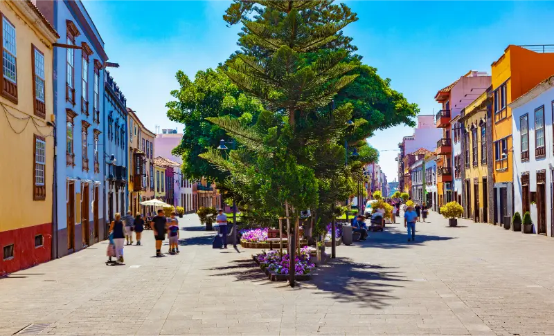
Tag: north Tenerife

  • North Tenerife Itinerary: 5 Days from La Laguna to Garachico

    North Tenerife Itinerary: 5 Days from La Laguna to Garachico

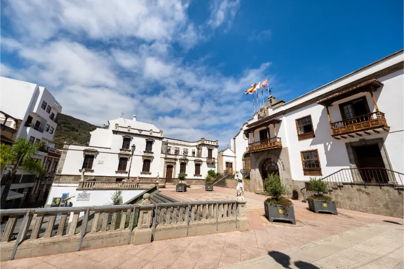
    Quick summary: North Tenerife deserves its own itinerary because it is not just “the cloudier side.” The north holds the historic university city of La Laguna, Anaga’s laurel forest, the Orotava Valley, Puerto de la Cruz, volcanic Garachico and the quieter Isla Baja. In five days I can connect those places without commuting from a southern resort every morning.

    Who this itinerary is for

    This route suits travellers who value historic streets, green landscapes, black-sand coast, local food and walking more than resort nightlife. It is also excellent for a second Tenerife trip. I still keep one Teide option available because the northern approach into the highlands is one of the island’s great landscape changes.

    The base I would choose

    Puerto de la Cruz is the easiest single base for this five-day route. La Laguna is better for Anaga and urban culture, while Garachico or Los Silos suits a deliberately slow northwest stay. A two-base plan can work: two nights near La Laguna, then three around Puerto de la Cruz or Isla Baja.

    Itinerary at a glance

    DayMain areaWhy it works
    Day 1La LagunaWalk the UNESCO centre, courtyards and churches, eat locally and use the afternoon for Tegueste or a short viewpoint rather than rushing into Anaga.
    Day 2Anaga Rural ParkStart at Cruz del Carmen, choose one walk, then add Taganana or the coast only if road and weather conditions make the day comfortable.
    Day 3Puerto de la Cruz + La OrotavaSplit the day between seafront Puerto de la Cruz and historic La Orotava. This works well without constant car movement.
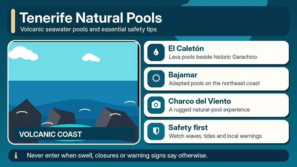
    Day 4Garachico + Icod or Los SilosUse the lava-coast history of Garachico as the anchor, then choose one neighbouring town. Swim in natural pools only when conditions are safe.
    Day 5Isla Baja or north-side Teide approachChoose Buenavista/El Tanque for a slow northwest finish, or climb toward Teide if weather is clear and the flight is not immediately afterwards.

    Day 1: La Laguna

    Walk the UNESCO centre, courtyards and churches, eat locally and use the afternoon for Tegueste or a short viewpoint rather than rushing into Anaga.

    I keep this day geographically compact. Tenerife rewards clustering because the hidden time is rarely the motorway itself; it is parking, mountain bends, finding the correct entrance and stopping at places that were not in the original plan. One area explored well usually feels richer than three areas photographed quickly.

    Day 2: Anaga Rural Park

    Start at Cruz del Carmen, choose one walk, then add Taganana or the coast only if road and weather conditions make the day comfortable.

    In Anaga I plan for cloud, narrow roads and slower travel than the map suggests. Cruz del Carmen is a practical anchor because it gives me visitor information and access to shorter walks. I do not assume that a clear south-coast morning means a dry ridge in the northeast.

    Light filtering through the laurel forest in Anaga

    Day 3: Puerto de la Cruz + La Orotava

    Split the day between seafront Puerto de la Cruz and historic La Orotava. This works well without constant car movement.

    I keep this day geographically compact. Tenerife rewards clustering because the hidden time is rarely the motorway itself; it is parking, mountain bends, finding the correct entrance and stopping at places that were not in the original plan. One area explored well usually feels richer than three areas photographed quickly.

    Day 4: Garachico + Icod or Los Silos

    Use the lava-coast history of Garachico as the anchor, then choose one neighbouring town. Swim in natural pools only when conditions are safe.

    I keep this day geographically compact. Tenerife rewards clustering because the hidden time is rarely the motorway itself; it is parking, mountain bends, finding the correct entrance and stopping at places that were not in the original plan. One area explored well usually feels richer than three areas photographed quickly.

    Day 5: Isla Baja or north-side Teide approach

    Choose Buenavista/El Tanque for a slow northwest finish, or climb toward Teide if weather is clear and the flight is not immediately afterwards.

    I check official Teide information and Tenerife ON before leaving. I separate the park experience from summit ambitions: viewpoints, lava landscapes and established walks are already a complete day. If a cable-car or controlled trail is part of the plan, I treat the reservation and current access rules as fixed, then keep the rest of the day flexible.

    Why I do not commute from Costa Adeje every day

    The motorway makes north-south travel possible, but a five-day north itinerary is much better when the evening base is actually in the region. I use Puerto de la Cruz, La Laguna and Isla Baja to decide which atmosphere I want after sightseeing.

    Weather in the north is part of the experience

    Cloud and humidity create the green landscapes visitors come to see. I pack a light layer and keep the coast, towns and forests interchangeable. A grey morning in Puerto de la Cruz does not mean the whole day is lost; Teide or another coast can be clear.

    How I connect Garachico without overloading the day

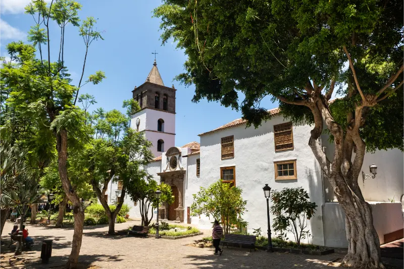
    Garachico can absorb several hours once I include the historic centre, volcanic story and lunch. I add either Icod, Los Silos or Buenavista, not all three. That gives me time to notice the northwest rather than simply photograph its town signs.
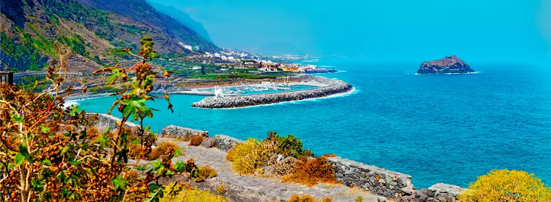
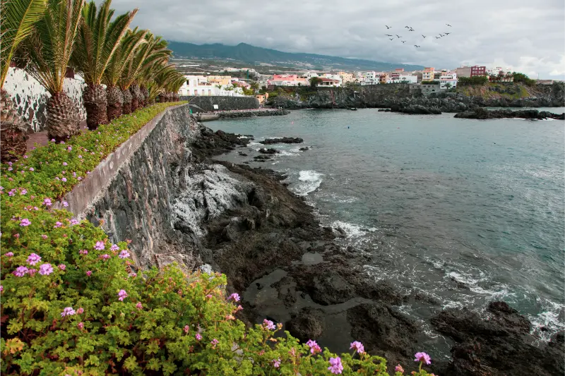
    The Garachico coastline and offshore Roque de Garachico

    Transport: the decision that changes the whole itinerary

    I compare the route with my Tenerife by car guide and the no-car guide. A rental car is valuable for Teide, Anaga, Teno and multi-stop days, but it can be unnecessary on beaches, city walks and evenings. Selective rental often gives the best balance: drive when the car creates access, and leave it parked when it only creates a parking problem.

    I build extra margin around the first and last day. Airport pickup, baggage, fuel return and traffic are not sightseeing, but they consume real time. I would rather arrive at dinner early than turn a delayed flight into a rushed mountain drive. On departure day I work backward from the airline’s check-in and security requirements and then add the road or public-transport margin.

    Weather and microclimates: why I keep one day flexible

    Tenerife can place sun, cloud, wind and high-altitude cold inside the same itinerary. I use the Tenerife weather forecast guide and move the most weather-sensitive day when I can. Teide needs visibility and safe high-altitude conditions; Anaga can be wet or foggy; north-coast swimming depends on swell. A flexible day is not empty time—it is insurance for the experience I care about most.

    I pack layers even when the hotel forecast looks warm. A light jacket, water, sun protection and shoes suitable for the day are more useful than trying to predict one island-wide temperature. If an official alert, road closure or protected-area restriction changes the plan, I treat that as a reason to switch area, not as a challenge to find a shortcut.

    San Cristobal De La Laguna Panoramic View Tenerife

    Where I would stay

    I choose accommodation by evening life and morning logistics, not only by star rating. For current availability I compare Tenerife accommodation on Booking.com. I check the exact map position, slope, parking or bus stop, reception hours and how long the first major day will take from the property. A good base can save more holiday time than a slightly cheaper room on the wrong side of the island.

    What I would book in advance—and what I would keep open

    I book the things where capacity or a fixed slot matters: accommodation, any controlled high-altitude or protected trail, a specific boat departure, a major attraction on a peak day and a restaurant that is genuinely central to the trip. I keep ordinary beaches, viewpoints, cafés and many town visits open. Tenerife is more enjoyable when weather and energy can still change the order of the week.

    For activities, I read the cancellation terms before paying and check whether transport, equipment or permits are actually included. A cheap headline price can be poor value if it requires a separate transfer or locks me into a weather-sensitive day. When a guided excursion solves real logistics, I am happy to use one.

    Food rhythm: how I avoid eating badly because the itinerary is too full

    I use my Tenerife food guide to choose a few local dishes, then keep meals close to the day’s geography. A long lunch in La Orotava makes sense on a north-coast day; a harbour fish meal belongs with the coast. I carry water and a small snack so hunger does not force an unnecessary detour just before a hike, boat or sunset.

    The planning mistakes I would avoid

    • Treating the driving time shown on a map as the total time needed for the stop.
    • Booking the most weather-sensitive experience on the only day that cannot move.
    • Changing hotels too often on a short itinerary and losing hours to packing and check-in.
    • Trying to combine Teide, Anaga, Masca and a beach simply because they fit on one island map.
    • Using old screenshots for trail, transport or attraction rules instead of checking the current operator or authority.
    • Saving every good restaurant for dinner after a long drive instead of using lunch to anchor the region I am already visiting.

    Frequently asked questions

    Is North Tenerife worth five days?

    Yes. Five days lets the north feel like a destination in its own right rather than a series of day trips from the south.

    Is Puerto de la Cruz the best base?

    It is the easiest all-round base for most visitors, but La Laguna is better for Anaga and Garachico/Los Silos is better for slow northwest travel.

    Does it rain all the time in the north?

    No. The north is generally greener and more humid, but conditions vary by altitude and day. I plan with microclimates rather than stereotypes.

    Do I need a car?

    A car is helpful for Anaga and Isla Baja, although La Laguna, Puerto de la Cruz and some major routes work well by public transport.

    Can I include Teide?

    Yes. I use the northern approach on the clearest day and avoid attaching it to a tight airport schedule.

    My final advice

    The best north tenerife itinerary is the one I can still enjoy when one detail changes. I protect the big experiences with sensible geography, current information and enough margin, then leave the smaller choices open. Tenerife has too many good alternatives for a holiday to depend on one perfect sequence.

    I treat this itinerary as a framework rather than a promise that every road, trail, beach or timetable will behave exactly the same on the travel date. Before any activity where access, safety, weather or a paid booking matters, I recheck the official source. That habit lets me travel more freely because the important constraints are handled before the day begins.
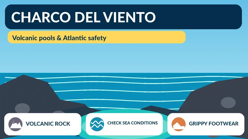
  • Charco del Viento Tenerife Guide: Volcanic Pool, Snorkelling and Safety

    Charco del Viento Tenerife Guide: Volcanic Pool, Snorkelling and Safety

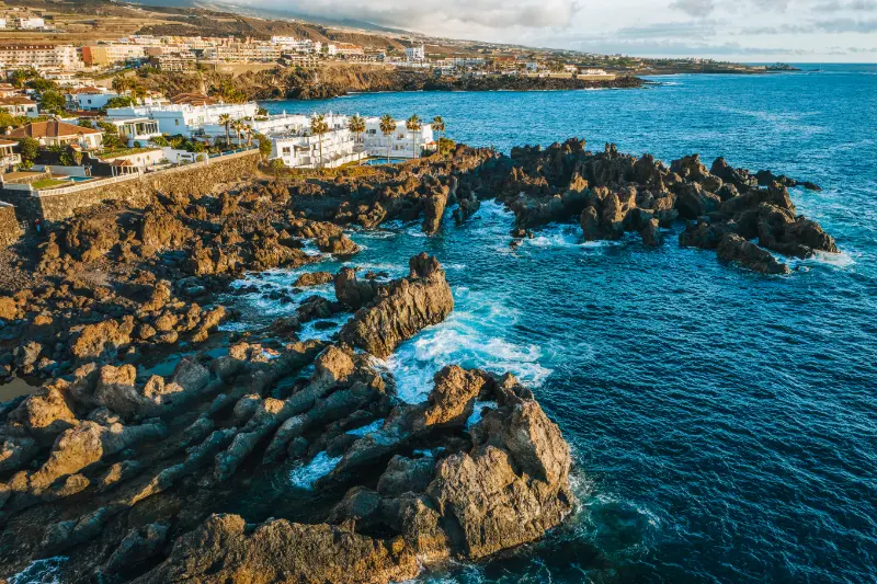
    Charco del Viento is one of the north Tenerife natural pools I visit for the volcanic setting as much as the swim. Lava flows reached the sea and formed two rocky arms that partly protect a small bay on the La Guancha coast.

    The shelter can make the water calmer than the open Atlantic, but I never treat a natural pool as risk-free. My decision to enter depends on the actual waves, access and warning signs I see on the day.

    Quick planning facts

    Location Santa Catalina, La Guancha
    Type Natural volcanic bathing area
    Best for Swimming and snorkelling in calm conditions
    Main hazard Atlantic swell and slippery volcanic rock
    Footwear Water shoes helpful
    Best timing Calm-sea mornings are my preference
    Combine with La Guancha, San Juan de la Rambla, Icod

    How the natural pool was formed

    Charco del Viento is a volcanic bathing area in Santa Catalina, La Guancha. Ancient lava flows reached the sea, cooled rapidly and created two natural rock arms that partially shelter a small bay from the stronger Atlantic swell.

    That geology is what makes the place beautiful and what can make visitors overconfident. The lava barriers reduce wave energy but do not turn the ocean into a swimming pool with guaranteed conditions.

    Swimming and snorkelling

    On calm days the sheltered water can be clear enough for snorkelling, and Turismo de Tenerife specifically mentions swimming, fishing and snorkelling as common activities. I enter slowly because volcanic rock can be uneven and slippery.

    If waves are overtopping the outer rocks or the water is moving strongly through the pool, I stay out. I never stand on exposed edges to photograph incoming surf.

    Footwear and comfort

    Water shoes are useful for rough rock and entry points. I also bring a towel that I do not mind placing on volcanic ground, sun protection and enough water.

    There may be periods when access infrastructure changes after storms, so I judge the site in front of me rather than relying entirely on old images.

    Why I combine it with La Guancha

    The pool makes more sense as part of a wider La Guancha day. My La Guancha guide links the coast with the rural town, forest and other local landscapes.

    That also gives me a strong backup plan if the sea is too rough: I can turn the day inland instead of waiting for conditions to improve.

    Photography and wave safety

    The geometry of the lava arms and clear water is photogenic, but I use a zoom or phone from a safe position rather than approaching the outer edge during swell.

    North-coast waves can arrive in larger sets after several quiet minutes. I never let a photograph make me forget that pattern.

    Official source

    I use the official Charco del Viento page for location and geological description.

    For the actual decision to enter the water, I rely on current sea conditions, warning signs and any local closure.

    How I judge whether it is a swimming day

    At Charco del Viento I decide whether to swim only after seeing the sea in person. Beach descriptions are useful, but Atlantic conditions change with swell, wind, tide and local currents. A beach that looked easy yesterday can be completely different today.

    I look for warning flags, lifeguard instructions where present, local closures and the behaviour of experienced bathers. If the beach is not supervised, I become more conservative. My Tenerife safety guide explains the ocean-safety habits I use around the island.

    What I bring

    My basic beach kit is simple: water, reef-safe sun protection, a hat, sandals or water shoes for hot or rough surfaces, and a light layer for wind. On black sand I also remember that the surface can become surprisingly hot in strong sun.

    I do not leave valuables visible in the car, and I take all litter away. On beaches without services I assume there will be no shade, toilets, drinking water or food unless the official listing says otherwise.

    Best time of day

    Morning is my default for easier parking, gentler temperatures and a better chance of finding space. Late afternoon can be beautiful, but I keep enough daylight for walking back to the car or navigating coastal roads.

    For a family day I avoid arriving hungry at the busiest lunch hour. I either bring a simple picnic where appropriate or decide in advance which nearby village will be the food stop.

    Getting there and parking

    I check the final approach before driving to Charco del Viento, especially because small coastal settlements in La Guancha can have narrow streets. I use legal parking only and never convert a turning area, bus stop or resident access into an improvised space.

    If the official beach information lists bus access, I still verify the current route and timetable. My Tenerife without a car guide is useful when I am building a trip around public transport.

    What to combine nearby

    I combine Charco del Viento with La Guancha village, San Juan de la Rambla, Icod de los Vinos or other north-coast viewpoints rather than driving across the island after a beach stop. The goal is to understand one piece of Tenerife in depth: its coast, village streets, volcanic terrain and food.

    This is also more resilient. If swimming is not sensible, I can still use the day for a walk, a viewpoint or a local meal without wasting hours in the car.

    Where I would stay

    I would choose accommodation in La Guancha only if the wider area fits the trip, not simply to be near one beach. For most first-time visitors I compare the convenience of a larger base with the atmosphere of a quieter local zone.

    When I want to stay close, I compare accommodation in the wider area on Booking.com and then verify the exact road, parking and walking access before booking.

    Frequently asked questions

    Is Charco del Viento safe for swimming?

    It can be enjoyable in calm conditions, but ocean swell can still affect the pool. I stay out when waves are overtopping the outer rocks or access is closed.

    Can I snorkel there?

    Yes, snorkelling is a popular activity when the sea is calm and visibility is good.

    Do I need water shoes?

    They are useful because volcanic rock can be rough and slippery.

    Is it a normal swimming pool?

    No. It is a natural volcanic bathing area connected to the Atlantic.

    What should I combine it with?

    La Guancha village, San Juan de la Rambla or Icod de los Vinos make logical nearby stops.

    How I decide whether this stop belongs in my itinerary

    I ask whether the place adds something different from the previous day. Tenerife can easily become a sequence of similar viewpoints or beaches if I plan from a list instead of from geography. I prefer contrast: coast after forest, heritage after a hike, or a quiet village after a major attraction.

    I also compare the detour with the experience. A small stop that sits naturally on my route can be excellent; the same stop may not justify a two-hour cross-island drive. This is why I group days by area and protect time for unplanned discoveries.

    Small mistakes I try to avoid

    I do not trust travel times that ignore parking, mountain bends or finding the correct entrance. I do not leave water in the hotel because the plan looks short. I do not assume a café, toilet or ticket office will be open simply because an old article mentions it. And I never turn a closed gate or warning barrier into a challenge to get around.

    Another common mistake is trying to reproduce a photograph exactly. Light, tide, cloud, vegetation and access all change. I use images for orientation, then accept the conditions I actually find. That approach is safer and usually creates a more genuine travel experience.

    What I save on my phone before leaving

    I save the exact destination, an offline map, the official information page and one backup stop in the same area. For a hike I also save the route file or map, emergency information and the latest access notice. For a beach I check sea conditions and identify a nearby non-swimming alternative.

    This simple preparation matters most in rural Tenerife, where a weak signal or a closed road can otherwise turn a small change into a long detour. It also lets me spend less time looking at my phone once I arrive.

    Responsible travel details that matter

    I stay on marked paths, never collect volcanic rocks or plants in protected areas, keep drones subject to current rules and avoid photographing people at close range without permission. In villages I remember that the photogenic doorway is somebody’s home and the narrow lane may be the only access for residents.

    On the coast I keep away from unstable edges and do not approach blowholes or outer rocks during swell. I take rubbish away, avoid feeding wildlife and use established access rather than creating shortcuts through vegetation. These are small decisions, but repeated by many visitors they determine how well places cope with tourism.

    My final take

    Charco del Viento is beautiful because it remains part of the ocean. I enjoy the clear water and lava forms when conditions are calm, but I keep the same respect for swell that I would use on an exposed north-coast beach.

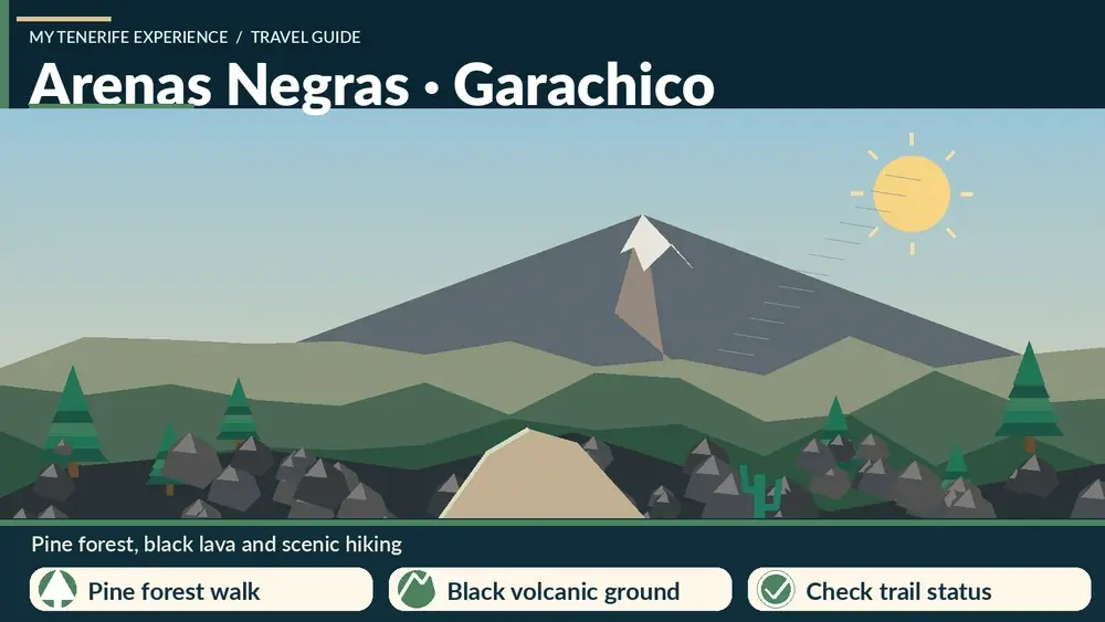
  • Arenas Negras Garachico Trail Guide: La Montañeta Forest Walk

    Arenas Negras Garachico Trail Guide: La Montañeta Forest Walk

    The La Montañeta–Arenas Negras walk is a short northwest Tenerife hike I use to connect pine forest with the volcanic landscapes above Garachico. It begins near the San Francisco chapel in La Montañeta and climbs to the Arenas Negras recreational area.

    Official Tenerife tourism information lists 2.8 km, about 50 minutes, low-to-medium difficulty and a climb from roughly 1,000 to 1,300 metres. The name can be confusing because Teide National Park has another trail called Arenas Negras, so I always specify “Garachico” when planning.

    Quick planning facts

    Start La Montañeta, Garachico
    Finish Arenas Negras recreational area
    Distance 2.8 km
    Official duration About 50 min
    Difficulty Low–medium
    Elevation Approx. 1,000 m to 1,300 m
    Best timing Cooler hours for the uphill walk
    Combine with Garachico, Icod, Chinyero

    Two “Arenas Negras” names visitors can confuse

    Tenerife has more than one hiking reference called Arenas Negras. This guide focuses on the La Montañeta–Arenas Negras route in Garachico, not the separate Arenas Negras trail inside Teide National Park near El Portillo.

    That distinction matters when using maps. I always include “Garachico” or “La Montañeta” in navigation so I do not end up planning the wrong trail.

    Official route facts

    Turismo de Tenerife lists the La Montañeta route at 2.8 km, around 50 minutes, and low-to-medium difficulty. It climbs from roughly 1,000 metres to about 1,300 metres above sea level.

    The route begins by the San Francisco chapel in La Montañeta and climbs toward the Arenas Negras recreational area. The official description notes that the uphill section is best tackled in cooler hours to reduce heat and sun exposure.

    The recreational area

    Arenas Negras recreational area has picnic infrastructure and is also associated with camping facilities subject to current rules and permissions. I never assume a camping right simply because a recreational area exists.

    For a day walk I use the area as a rest point, bring my own food and leave tables and fireplaces clean. During fire-risk restrictions, I follow every prohibition on cooking or flame use.

    Volcanic landscape and Chinyero context

    The upper zone sits near the volcanic landscapes associated with Chinyero, the island’s most recent historical eruption. Black lava, pine forest and younger volcanic surfaces make this part of northwest Tenerife visually different from the humid coast below.

    If I want a more extensive volcanic hike, I compare this route with my Chinyero hiking guide.

    Heat, shade and timing

    The official route description specifically recommends cooler hours for the ascent. I take that seriously, particularly from late spring through early autumn. Even with pine forest nearby, parts of the climb can feel hot and exposed.

    I carry water, sunscreen and a hat, then add a light layer because temperatures can change quickly around 1,300 metres.

    Getting there

    The route can be approached from La Montañeta, and official trail information also notes public-transport possibilities in the area. I verify current TITSA service before relying on a specific route number.

    By car, I park without blocking residents or forest access. Mountain fire roads need to remain open for emergency vehicles.

    Who I recommend it to

    I like this walk for travellers who want a short northwestern mountain outing without committing to a major Teide hike. It also pairs naturally with Garachico or Icod for a day that mixes forest and historic towns.

    For families, I judge suitability by each child’s experience with steady uphill walking rather than by the “low-medium” label alone.

    Official source

    I use the official La Montañeta–Arenas Negras trail page for distance, duration, elevation and route description.

    I check current forest alerts separately because fire risk, maintenance and storm damage can affect access even when the standard route information remains unchanged.

    How I fit it into a realistic Tenerife day

    I treat La Montañeta–Arenas Negras as part of a wider Garachico and northwest Tenerife day rather than an isolated pin on the map. Tenerife looks compact, but mountain roads, parking searches and changing weather can turn short distances into slow travel. I decide in advance which stop is the priority and which stops are optional.

    My preferred approach is to pair it with Garachico, Icod de los Vinos, Chinyero or El Tanque. That creates a day with contrast without spending most of the time in the car. I also keep one backup plan nearby in case wind, cloud, surf or temporary access restrictions change the experience.

    Weather, clothing and microclimates

    I never use a single Tenerife forecast for the whole island. North-coast cloud, Anaga mist, Teide sunshine and south-coast heat can all occur on the same day. I check the forecast for the exact municipality and, for mountain or coastal activities, I also look at wind and sea conditions.

    Even on warm days I carry sun protection, water and a light layer. At higher elevations I add a windproof layer, while on the coast I bring footwear with grip because volcanic rock, wet steps and black sand can all be slippery or hot.

    Responsible travel habits I use here

    Small beaches, villages, viewpoints and trailheads are shared local spaces. I park only where it is legal, keep access to homes and farm tracks clear, take rubbish away and avoid turning narrow roads into informal photo stops. In protected areas I stay on the marked route and never collect volcanic material, plants or other natural objects.

    I also prefer to support the area in a simple way: a coffee, lunch, market purchase or locally made product is often a better souvenir than something generic. Respectful travel is mostly about ordinary decisions that reduce pressure on places I want to remain enjoyable.

    My backup plan when conditions are wrong

    If the sea is rough, I do not force a swim. If a viewpoint is inside cloud, I move lower or switch to a village, museum or food stop. If parking is full, I continue to the next planned place rather than circling residential streets. This flexibility is especially useful in Tenerife because very different landscapes sit close together.

    I build the day around one must-do experience and several optional stops. That structure produces better trips than trying to complete a rigid checklist, and it makes it easier to respond to closures, weather and local events without feeling that the day has failed.

    Frequently asked questions

    Is this the same Arenas Negras trail as the one in Teide?

    No. This guide covers La Montañeta–Arenas Negras in Garachico; Teide National Park has a separate trail with the same name.

    How long is the walk?

    The official route is 2.8 km with an estimated duration of about 50 minutes.

    Is it difficult?

    It is officially graded low to medium, but the route climbs around 300 vertical metres.

    Can I camp at Arenas Negras?

    Camping is associated with the recreational area, but I check current Tenerife ON rules and permissions before planning an overnight stay.

    When should I hike it?

    I prefer morning or cooler hours, especially in warm months, matching the official recommendation for the ascent.

    Questions I ask myself before I go

    I check four things before leaving: current access, exact weather, realistic travel time and what I will do if the first plan fails. Tenerife is an easy island to underestimate because distances look short on a map. A mountain road, coastal traffic or a full car park can add far more time than expected.

    I also decide whether the destination is the purpose of the day or simply one stop. When it is the main purpose, I leave enough time to experience it slowly. When it is secondary, I set a clear limit so the rest of the itinerary does not become rushed.

    What makes this worth adding to a longer Tenerife trip

    The strongest Tenerife itineraries mix famous landmarks with smaller places and experiences. Teide, Anaga and the main beaches explain the island at a large scale, while a local pool, rural trail, village festival or food tradition explains how people actually use and understand the landscape.

    I therefore do not judge a place only by the number of attractions. A short viewpoint can be valuable if it helps me read the geography; a small village can be memorable if I slow down for lunch; a modest trail can reveal volcanic history better than a long drive through the same area.

    Practical travel habits that improve the day

    I download maps or save the route before entering areas with weaker mobile coverage. I start with a full bottle of water, keep a layer in the car, carry some cash for small local businesses and avoid planning every meal at the most obvious tourist time. These are small habits, but they make rural Tenerife much easier.

    I also leave more space between stops than a navigation app suggests. That time absorbs photo stops, roadworks, wrong turns and simple curiosity. The best travel days on Tenerife often improve when I have enough margin to stop somewhere I had not planned.

    My final take

    This is a useful short hike when I want forest and volcanic terrain without turning the day into a major expedition. The key is choosing the correct Arenas Negras on the map, starting in cooler hours and pairing the walk with Garachico or another northwest stop.

  • El Pris Tenerife Guide: Natural Pool, Fishing Village and Seafood

    El Pris Tenerife Guide: Natural Pool, Fishing Village and Seafood

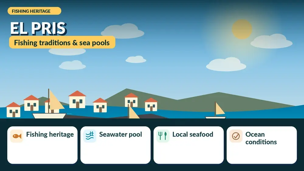
    El Pris is one of the north-coast stops I choose when I want Tenerife to feel local rather than resort-like. The fishing village sits below Tacoronte on a steep Atlantic shoreline, with a small dark beach, a natural swimming pool and seafood restaurants gathered into a compact waterfront.

    Turismo de Tenerife highlights the pool’s ramps, handrails and family-friendly access, but I still treat it as an ocean pool: swell, spray and temporary closures matter. The best visit combines the water with a slow meal and the wider Acentejo coast rather than treating El Pris as a quick photo stop.

    Quick planning facts

    Location El Pris, Tacoronte
    Best for Natural pool, seafood, sunset, local atmosphere
    Beach Small urban dark-sand/gravel beach with strong-wave exposure
    Pool access Steps and ramps with handrails
    Parking Available but limited at busy times
    Best timing Morning for swimming; late afternoon for food and sunset
    Combine with Mesa del Mar, Tacoronte, El Sauzal

    Why El Pris feels different from Tenerife’s resort coast

    El Pris is a small fishing settlement below Tacoronte where the coast feels functional and local rather than designed around a resort promenade. Fishing boats, compact houses, a small dark beach, the natural pool and seafood restaurants sit close together on a steep volcanic shoreline.

    I like El Pris because it gives context to the north coast. The Atlantic is more exposed here, the landscape is greener above the cliffs, and the sunset can frame Teide in the distance. It is a useful counterpoint to the polished beaches of Costa Adeje.

    The natural pool: the main reason I stop here

    Turismo de Tenerife describes the natural pool as especially suitable for families and older visitors because it has steps and ramps with handrails that make entry easier. The pool sits directly beside an exposed ocean, so I still judge conditions before entering and never assume that a wall removes all wave risk.

    The contrast is striking on days with swell: the water inside can look relatively calm while waves break strongly outside. I stay away from the outer edge when the sea is energetic and obey any local closures or warning signs.

    El Pris beach and ocean safety

    The nearby urban beach is small, with dark sand, gravel and lava pebbles. Official tourism information lists strong waves as a characteristic of the area, which is why I see the beach as a place for atmosphere first and swimming second.

    If I want easier family swimming, I compare conditions with the pool or choose another beach entirely. My Tenerife safety guide explains the flag system, currents and the simple rule I follow: if locals and lifeguards are staying out, I stay out too.

    Where to eat and what I order

    Fresh fish is part of the identity of El Pris. I prefer simple preparations where I can ask what was landed recently, and I am happy with grilled fish, potatoes, salad and mojo rather than searching for a complicated tasting menu.

    I compare menus and prices before sitting down, especially at peak lunch time. My Tenerife food guide helps with fish names, papas arrugadas, mojo and other dishes I expect to see.

    Driving, parking and the steep approach

    The road drops sharply from the Tacoronte area to the coast, so I drive slowly and use lower gears rather than riding the brakes. Parking exists, but the settlement is compact and I avoid arriving at the busiest lunch or sunset time if I want an easy visit.

    If I am using buses, I check TITSA on the day because local frequencies can change. My Tenerife bus guide explains how I plan connections outside the main tourist corridors.

    Best time of day

    Morning is best when I care most about swimming and easy parking. Late afternoon is my choice for atmosphere, dinner and sunset, especially when the air is clear enough to see Teide behind the coast.

    I do not plan a sunset stop without leaving margin for the drive back up the hill. Narrow roads are easier when I am not rushing or driving hungry after dark.

    Where I would stay

    I would not choose El Pris as a first-time base unless I specifically wanted a very local, quiet coast. Tacoronte, La Laguna or Puerto de la Cruz give me more services while keeping El Pris within day-trip range.

    For a north-coast stay I compare accommodation around Tacoronte on Booking.com and then check the exact road and walking access before booking.

    Official information I check before going

    I use the official Tenerife tourism page for the El Pris natural pool for the basic facilities and location. For the beach, I also check current sea conditions rather than relying on old photographs.

    Because coastal infrastructure can be affected by storms, I treat barriers, closures and maintenance notices as current information even if a travel article says the place is normally open.

    How I fit it into a realistic Tenerife day

    I treat El Pris as part of a wider Tacoronte and Acentejo day rather than an isolated pin on the map. Tenerife looks compact, but mountain roads, parking searches and changing weather can turn short distances into slow travel. I decide in advance which stop is the priority and which stops are optional.

    My preferred approach is to pair it with Mesa del Mar, Tacoronte, El Sauzal or a winery stop. That creates a day with contrast without spending most of the time in the car. I also keep one backup plan nearby in case wind, cloud, surf or temporary access restrictions change the experience.

    Weather, clothing and microclimates

    I never use a single Tenerife forecast for the whole island. North-coast cloud, Anaga mist, Teide sunshine and south-coast heat can all occur on the same day. I check the forecast for the exact municipality and, for mountain or coastal activities, I also look at wind and sea conditions.

    Even on warm days I carry sun protection, water and a light layer. At higher elevations I add a windproof layer, while on the coast I bring footwear with grip because volcanic rock, wet steps and black sand can all be slippery or hot.

    Responsible travel habits I use here

    Small beaches, villages, viewpoints and trailheads are shared local spaces. I park only where it is legal, keep access to homes and farm tracks clear, take rubbish away and avoid turning narrow roads into informal photo stops. In protected areas I stay on the marked route and never collect volcanic material, plants or other natural objects.

    I also prefer to support the area in a simple way: a coffee, lunch, market purchase or locally made product is often a better souvenir than something generic. Respectful travel is mostly about ordinary decisions that reduce pressure on places I want to remain enjoyable.

    My backup plan when conditions are wrong

    If the sea is rough, I do not force a swim. If a viewpoint is inside cloud, I move lower or switch to a village, museum or food stop. If parking is full, I continue to the next planned place rather than circling residential streets. This flexibility is especially useful in Tenerife because very different landscapes sit close together.

    I build the day around one must-do experience and several optional stops. That structure produces better trips than trying to complete a rigid checklist, and it makes it easier to respond to closures, weather and local events without feeling that the day has failed.

    Frequently asked questions

    Is El Pris good for swimming?

    The natural pool can be suitable when conditions are safe, but the surrounding Atlantic coast is exposed and the beach itself can have strong waves.

    Is El Pris good with children?

    The pool has access features that make it popular with families, but adults should still monitor sea conditions and children closely.

    Can I eat fresh fish there?

    Yes. The village is known for restaurants serving Canarian seafood and is a good place to build lunch into the visit.

    Is El Pris worth a special trip?

    Yes if you enjoy local coastal places, natural pools and seafood; I would combine it with other Tacoronte or Acentejo stops.

    Can I reach El Pris without a car?

    Public transport is possible, but I check the current TITSA timetable because local service patterns can change.

    Questions I ask myself before I go

    I check four things before leaving: current access, exact weather, realistic travel time and what I will do if the first plan fails. Tenerife is an easy island to underestimate because distances look short on a map. A mountain road, coastal traffic or a full car park can add far more time than expected.

    I also decide whether the destination is the purpose of the day or simply one stop. When it is the main purpose, I leave enough time to experience it slowly. When it is secondary, I set a clear limit so the rest of the itinerary does not become rushed.

    What makes this worth adding to a longer Tenerife trip

    The strongest Tenerife itineraries mix famous landmarks with smaller places and experiences. Teide, Anaga and the main beaches explain the island at a large scale, while a local pool, rural trail, village festival or food tradition explains how people actually use and understand the landscape.

    I therefore do not judge a place only by the number of attractions. A short viewpoint can be valuable if it helps me read the geography; a small village can be memorable if I slow down for lunch; a modest trail can reveal volcanic history better than a long drive through the same area.

    Practical travel habits that improve the day

    I download maps or save the route before entering areas with weaker mobile coverage. I start with a full bottle of water, keep a layer in the car, carry some cash for small local businesses and avoid planning every meal at the most obvious tourist time. These are small habits, but they make rural Tenerife much easier.

    I also leave more space between stops than a navigation app suggests. That time absorbs photo stops, roadworks, wrong turns and simple curiosity. The best travel days on Tenerife often improve when I have enough margin to stop somewhere I had not planned.

    My final take

    I visit El Pris for the combination, not for one single attraction: ocean pool, fishing-village scale, seafood and a steep north-coast landscape. When the sea is safe and the weather is clear, it can be one of the most satisfying small stops around Tacoronte.

  • Mesa del Mar Guide: Playa de La Arena, Natural Pools and Tacoronte Coast

    Mesa del Mar Guide: Playa de La Arena, Natural Pools and Tacoronte Coast

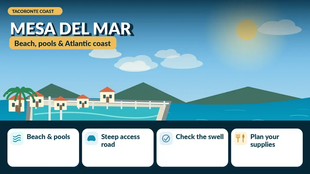
    Mesa del Mar is one of those north-coast places that makes more sense when I stop thinking in terms of a single beach. The small coastal settlement below Tacoronte combines Playa de La Arena, volcanic cliffs, swimming infrastructure and a road that drops dramatically from the agricultural slopes above. I come here for the contrast: vineyards and towns at altitude, then a sudden descent to black sand and Atlantic water.

    The official tourism information lists Playa de La Arena at Mesa del Mar as a 350-metre black-sand beach with parking, toilets and a solarium. It also notes that Mesa del Mar has two pools, one seasonal and another available year-round. That combination makes the area more versatile than a remote north-coast cove, although ocean conditions still deserve respect.

    Quick planning facts

    Municipality Tacoronte
    Main beach Playa de La Arena, black sand
    Official length About 350 m
    Facilities Solarium, toilets and parking listed
    Public transport Interurban bus service
    Road Steep, winding descent from Tacoronte
    Best for Local atmosphere, black sand, swimming and north-coast scenery
    Nearby Tacoronte, El Sauzal and Acentejo wine country

    Why Mesa del Mar feels different

    The geography does most of the work. The coast of Acentejo is steep and dramatic, so reaching Mesa del Mar feels like moving into a separate world below the towns and vineyards. The road descends in tight curves, and the ocean suddenly fills the view. I find that transition as memorable as the beach itself.

    This is not the manicured resort landscape of the south. Buildings sit close to the coast, cliffs rise behind them and the beach is used by local families as well as visitors. For the wider area, my Tacoronte and El Sauzal guide gives useful context on wine country, viewpoints and local food.

    Playa de La Arena: what to expect

    The beach is broad enough to feel like a real beach day rather than just a swimming spot. Its black sand absorbs heat quickly, so footwear is useful when the sun is strong. The official listing describes the water as calm, but I still judge conditions when I arrive because north-coast swell can change quickly.

    I prefer this beach when I want a local atmosphere and do not need the full resort service of Costa Adeje. The scenery is more rugged, and on some days the ocean is the dominant presence. My black-sand beaches guide helps compare it with El Bollullo, El Socorro and other volcanic beaches.

    The natural pools

    Mesa del Mar also has swimming pools built into the coastal setting. The official tourism page says there are two, with one operating only in summer and another available throughout the year. I treat opening and maintenance details as changeable and verify locally before relying on a pool as the main reason for the trip.

    Natural and coastal pools can feel safer than an exposed beach, but they are not immune to swell. Waves can overtop walls and wet surfaces become slippery. I use the same caution here that I explain in my Tenerife natural pools guide.

    Driving the road down

    The descent is part of the experience and the main logistical challenge. The official tourism information specifically warns that the road has pronounced bends. I drive slowly, leave space for vehicles climbing uphill and avoid stopping for photos on the road itself.

    If I am uncomfortable with steep roads, I would consider the bus rather than turning the drive into a stressful obligation. My Tenerife driving guide covers mountain and coastal roads, while the bus guide helps with public transport planning.

    Parking and arrival strategy

    The official listing indicates parking, but capacity can still be a problem at popular times. I prefer weekday mornings or an early weekend arrival. Once parked, I keep the car in one place and explore on foot rather than moving it between the beach and pools.

    On hot days the climb back to a vehicle parked higher up can feel harder than expected. I pack light and do not bring equipment I will not actually use. If I am travelling with children, I keep water, hats and dry clothes immediately accessible.

    Swimming safely on the north coast

    The north coast is beautiful precisely because it is exposed to the Atlantic. I do not let a calm-looking moment at the shoreline override flags or local warnings. If waves are strong, I stay out and use the visit for walking, photography and lunch.

    For families, I decide where to swim based on conditions that day rather than on a fixed plan. A pool may be the better option on one visit; the beach may be perfect on another. My family beaches guide has easier alternatives when predictable swimming is the main priority.

    Food and supplies

    I do not assume the same level of choice I would find in a large resort. I bring water and a few snacks, then decide whether to eat locally or drive back toward Tacoronte. The advantage of being below a major wine-growing area is that a coastal stop can pair naturally with a later meal or wine-country visit inland.

    If I plan to drink wine, I do not combine that with driving the steep road. Either I keep the tasting alcohol-free, designate a driver or separate the experiences into different days.

    Who should choose Mesa del Mar

    I recommend it most to travellers who enjoy local beaches, volcanic scenery and places that do not feel designed exclusively for tourists. It is also useful for repeat visitors who already know the big southern beaches and want a different side of Tenerife.

    I would be more cautious recommending it to someone who wants step-free access, a huge choice of restaurants or a guaranteed calm-water beach. The official beach listing does not classify Playa de La Arena as accessible.

    A north-coast day I like

    • Start in Tacoronte or El Sauzal for coffee and a look at the vineyards.
    • Descend to Mesa del Mar before the busiest part of the day.
    • Swim only if beach or pool conditions are safe.
    • Have a relaxed lunch or return inland for local food.
    • Finish at an Acentejo viewpoint before sunset if visibility is good.

    This schedule respects the road instead of making me drive it repeatedly, and it shows why Mesa del Mar works best as part of a wider north-coast day.

    Where to stay

    Most first-time visitors do not need to sleep in Mesa del Mar itself. I would usually base in La Laguna, Puerto de la Cruz or another north-coast town and visit for the day. For a broad search I can compare Tenerife accommodation on Booking.com.

    If the purpose of the trip is slow travel and local coast rather than sightseeing efficiency, then a quieter apartment in the Tacoronte area can make sense. I would check the exact elevation and road access before booking because coastal and inland addresses can be very different.

    Official information I check

    I use the official Playa de La Arena page for beach characteristics and current destination information. I also check the weather and sea state before driving down, especially outside summer.

    The coast can change after storms or maintenance work, so I avoid writing a rigid plan around a single facility. The area is still worth seeing even if swimming is not possible.

    Mistakes I would avoid

    • Driving the descent too fast because a car is following closely.
    • Assuming the north-coast ocean is safe because it looks calm from above.
    • Arriving at peak time and expecting unlimited parking.
    • Planning an alcohol tasting before driving the steep road.
    • Visiting only for a quick photo and missing the beach-and-pool combination.

    Mesa del Mar rewards a slower pace. The experience is the descent, the volcanic coast and the change of atmosphere from the vineyards above.

    Frequently asked questions

    Is Mesa del Mar the same as Playa de La Arena?

    Mesa del Mar is the coastal settlement; Playa de La Arena is its main black-sand beach.

    Are there natural pools?

    Yes. Official tourism information mentions two pools, one seasonal and one normally available year-round; I still verify current opening conditions.

    Can I reach Mesa del Mar by bus?

    Yes, the official beach listing indicates interurban bus access. I check the current TITSA schedule before travelling.

    Is the road difficult?

    It is steep and winding with pronounced bends, so I drive slowly and avoid rushing.

    Is it worth visiting in winter?

    Yes for scenery and local atmosphere, but swimming depends more heavily on sea conditions.

    How I decide whether this fits my itinerary

    Before adding Mesa del Mar Tenerife to a Tenerife plan, I ask what role it plays in the day. If it is the main experience, I leave enough time for weather, transport and an unhurried visit. If it is a secondary stop, I keep expectations smaller and avoid turning a flexible day into a chain of deadlines. This distinction sounds simple, but it is one of the most useful ways I have found to plan an island with mountain roads and very different microclimates.

    I also compare travel time with time actually spent at the destination. A place can look close on the map and still require slow roads, parking searches or bus connections. I would rather visit two places properly than spend the day moving between five. This is especially true in Anaga, Teno and the north coast, where the journey is often part of the experience.

    My practical backup plan

    I always choose a nearby alternative before leaving accommodation. If the sea is rough, I switch from swimming to a town, market or viewpoint. If cloud removes a mountain panorama, I walk in the forest or move to a different elevation. If parking is full, I do not wait indefinitely; I continue to the backup stop and return later only if it still makes sense.

    That flexibility is not a compromise. In Tenerife it is often the difference between a stressful day and a memorable one. The island is compact enough that several different landscapes may be available within the same region, so changing the plan does not mean losing the day.

    Responsible travel notes

    I treat small villages, beaches and natural areas as shared local spaces. I use legal parking, keep noise low near homes, stay on marked paths, take rubbish away and follow temporary closures even when other people ignore them. On the coast I avoid climbing barriers for photographs, and in protected landscapes I do not collect plants, rocks or other natural material.

    I also try to spend some money locally when it is appropriate: a coffee, lunch, market purchase or small shop can make a visit more connected to the community. Responsible travel is not about making a performance of being perfect; it is mostly a series of ordinary decisions that reduce pressure on places I want to remain enjoyable.

    My final take

    Mesa del Mar is one of my favourite examples of how Tenerife’s north coast connects mountains, vineyards and ocean in a very small space. I would come for the whole setting, not just for a checklist beach stop. If conditions are good, Playa de La Arena and the pools make it an excellent half-day; if the sea is rough, the drive and landscape still justify the visit.

  • Playa San Juan and Alcalá Guide: A Quieter Side of Southwest Tenerife

    Playa San Juan and Alcalá Guide: A Quieter Side of Southwest Tenerife

    Playa San Juan and Alcalá are two southwest Tenerife places I recommend when someone likes the climate of the south but not the intensity of the biggest resorts. They sit on the Guía de Isora coast, west of Costa Adeje, with fishing-harbour roots, black volcanic shoreline, long promenades and sunset views toward La Gomera.

    Neither is a “secret village.” Both have tourism, apartments and hotels. What they offer is a calmer scale: I can walk to dinner, swim from an urban beach when conditions are good and spend the evening by the sea without the same nightlife density as Playa de las Américas. They work as a day trip, but they can also be smart bases for a slower holiday.

    Playa San Juan: the practical beach town

    Tenerife’s official tourism page describes Playa San Juan as a sheltered black-sand and pebble beach beside the fishing harbour, protected by the breakwater and equipped with showers, parking, lifeguard services, accessible facilities and nearby restaurants. I check the official Playa San Juan beach page for current services.

    The protection from wind and waves makes it more approachable than many exposed north-coast beaches, though I still follow flags and local advice. The town’s scale is the main attraction for me: the beach, harbour, cafés and promenade sit close enough to create an easy day on foot.

    The Playa San Juan promenade

    The official tourism site notes a seafront walk of almost two kilometres, with cafés, restaurants and a historic lime kiln near the water. I use the promenade for an unstructured late afternoon: walk, stop for coffee, watch boats and stay for sunset.

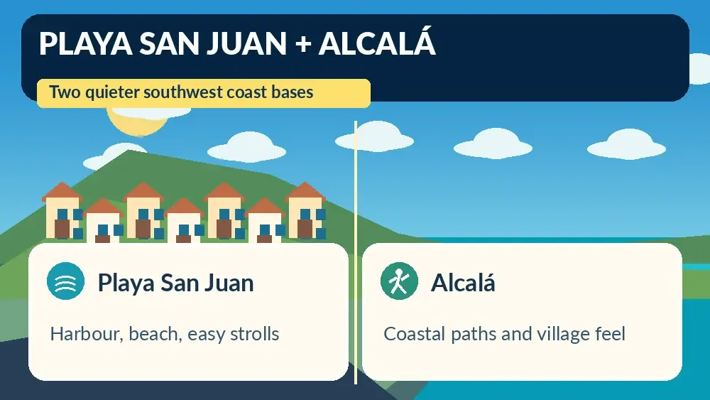
    Illustrated guide: Playa San Juan and Alcalá, with practical visitor tips
    Illustrated guide: Playa San Juan and Alcalá.

    This is not a place where I need a detailed sightseeing checklist. The pleasure is the everyday coastal rhythm. I bring a light layer after sunset in winter because the breeze can feel cooler once the sun drops.

    Alcalá: village atmosphere and sunsets

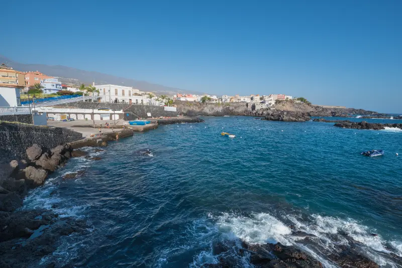
    Alcalá lies a short distance north and has a small fishing harbour, volcanic beach and attractive seafront. The official page describes a small urban beach of dark sand and gravel with restaurants around it. I like Alcalá most around late afternoon when the light faces La Gomera.

    The centre feels compact and walkable. I explore the square, waterfront and side streets rather than trying to turn it into a museum visit. It is a good place for travellers who enjoy watching local life as much as visiting attractions.

    La Jaquita and the Alcalá coastal walk

    The Alcalá–La Jaquita promenade includes small dark-sand beaches, natural pools, landscaped areas and space for walking or cycling. The official promenade page explains the seafront layout.

    I enjoy walking this stretch without needing to swim at every cove. Sea conditions can affect natural bathing areas, so I treat the pools as optional rather than guaranteed. The path itself is enough reason to come.

    Alcala Seafront Tenerife

    Playa de La Jaquita

    The official beach information describes La Jaquita as a roughly 700-metre coastal front divided into small black-sand bathing areas with adapted facilities, showers, changing rooms and a children’s area. This makes it one of the more practical volcanic-coast options for travellers who want services.

    I still check which section is open and best for the day because coastal maintenance and sea conditions can affect individual areas. I use water shoes if the entry looks stony and keep children close around lava edges.

    Where to eat

    Both Playa San Juan and Alcalá are good for fish, seafood and simple Canarian meals. I prefer restaurants that fit naturally into the harbour or promenade day rather than driving away for a famous name. My Tenerife food guide helps with dishes and ordering.

    At seafood restaurants I ask what is fresh and whether prices are per portion or by weight. For sunset dinner, I reserve if the restaurant is small or the date is busy, especially on weekends and holidays.

    Sunset toward La Gomera

    One reason I choose this coast is the west-facing horizon. On clear evenings La Gomera can sit sharply across the water, and the sky often changes long after the sun reaches the horizon. I stay for the afterglow rather than leaving immediately after sunset.

    I do not need a cliff-top Instagram spot. The normal seafront gives a safer and more relaxed view, with cafés and lighting nearby for the walk back.

    How the area compares with Costa Adeje

    Costa Adeje has more large resorts, polished beaches, shopping and excursion infrastructure. Playa San Juan and Alcalá feel smaller and less nightlife-focused. I choose Costa Adeje for maximum convenience and these Guía de Isora towns for a slower coastal routine.

    The trade-off is fewer attractions within walking distance. If I want Siam Park, nightlife and constant tour departures, I will travel more from Playa San Juan. If I want morning coffee, a swim and sunset on foot, that quieter scale is the advantage.

    How the area compares with Los Gigantes

    Los Gigantes is more dramatic visually because of the cliffs and has a strong boat-trip identity. Playa San Juan and Alcalá are gentler, flatter-feeling coastal bases with longer everyday promenades.

    I can visit all three in one west-coast day, but I prefer not to rush. A good plan is Los Gigantes in the morning and Alcalá at sunset, or Playa San Juan for lunch followed by a boat trip elsewhere.

    Alcala Tenerife Coastal Village

    Getting there by car

    The TF-1 makes the southwest coast easier to reach than it once was, and local roads connect the coastal settlements. Parking can still be limited around the oldest waterfront areas. My driving guide covers general road and parking habits.

    I save the exact accommodation or car-park pin because “Alcalá” or “Playa San Juan” can bring navigation into tight central streets. I would rather park slightly outside the core and walk.

    Getting there without a car

    TITSA buses serve the southwest corridor, making both towns realistic without a car, especially for travellers who plan a slow stay rather than daily remote hikes. My no-car Tenerife guide explains how I use the network and ten+ travelcards.

    I check late-evening return times before committing to sunset if I am staying elsewhere. The atmosphere is relaxed enough that waiting for a bus is not a problem, but missing the last convenient connection can turn a cheap day trip into an expensive taxi ride.

    Where to stay

    Playa San Juan suits travellers who want a slightly larger local centre with a sheltered beach and promenade. Alcalá suits those who prioritise village atmosphere, sunset and access to La Jaquita. I compare accommodation in Playa San Juan, Alcalá and Guía de Isora and pay attention to whether a listing is genuinely walkable to the sea.

    Large resort properties exist around this coast too, so I read the map rather than assuming every “Alcalá” hotel sits in the old village. The experience changes significantly when the property is isolated behind a long resort entrance.

    My ideal day

    I start with a swim or coffee in Playa San Juan, walk the promenade and have lunch by the harbour. In the afternoon I move to Alcalá, walk toward La Jaquita and stay for sunset. If I am based nearby, I split that into two separate slow days instead.

    I do not add Teide or Anaga to this plan. The point of the Guía de Isora coast is a day that requires very little performance: ocean, food, walking and light.

    Playa San Juan Tenerife With Traditional Boats

    Frequently asked questions

    Which is better, Playa San Juan or Alcalá?

    Playa San Juan has a more practical sheltered beach and longer town promenade; Alcalá feels smaller and is excellent for sunset and the La Jaquita coastal walk.

    Are the beaches black sand?

    Yes, the coast is volcanic and includes dark sand, gravel and pebble sections.

    Can I stay here without a car?

    Yes, especially for a relaxed coastal holiday. Buses connect the southwest, though a car is more useful for remote mountain trips.

    Is this area quieter than Costa Adeje?

    Generally yes. There are hotels and tourism, but nightlife and large-resort density are lower in the village centres.

    Can I see La Gomera from the coast?

    On clear days, La Gomera is visible across the water and is particularly attractive around sunset.

    Who will enjoy this coast most

    I recommend Playa San Juan and Alcalá to couples, repeat Tenerife visitors, families who prefer a quieter evening, and travellers who want to walk to the sea without living inside a nightlife district. I would choose somewhere else for a first trip focused mainly on clubs, large shopping centres or a packed schedule of major attractions.

    For remote hiking, a car is still useful. For everyday coastal life, however, the ability to walk for coffee, groceries, dinner and sunset makes these towns much more practical than their small size suggests.

    I would also consider them for a split stay: a few nights here after a busier Costa Adeje stay can change the pace without requiring a move to the far north. The west-coast location still keeps Los Gigantes, whale-watching departures and Teide approaches within reasonable reach, while evenings remain noticeably calmer.

  • Bajamar and Punta del Hidalgo Guide: Natural Pools and Tenerife’s Northeast Coast

    Bajamar and Punta del Hidalgo Guide: Natural Pools and Tenerife’s Northeast Coast

    Bajamar and Punta del Hidalgo are where I go when I want a Tenerife coast day built around ocean swimming, walking and seafood rather than a sandy beach. Both sit on the northeast edge of San Cristóbal de La Laguna municipality, with Anaga rising behind them and the Atlantic directly in front. The coast feels open, local and much less resort-like than the southwest.

    The headline attractions are the seawater pools, but I like the whole rhythm: a morning swim if conditions allow, a long promenade walk, lunch with a view and then an Anaga or La Laguna stop on the way back. I always keep the ocean in charge. A natural pool can be closed or unsafe when swell is strong, and no itinerary is worth ignoring that.

    Bajamar: easy-access seawater pools

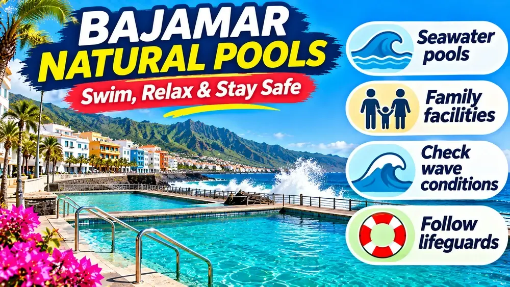
    Bajamar is known for developed ocean pools protected from much of the open sea. The area has changing rooms, places to sit and a seafront setting that makes it practical for families and travellers who prefer infrastructure. My broader natural pools guide compares Bajamar with other volcanic bathing areas around the island.

    I arrive earlier on sunny weekends because local residents use these pools too. I do not treat them as a private resort facility; I keep belongings compact, avoid occupying extra space and follow any posted closure or safety instructions.

    Punta del Hidalgo pools

    Tenerife’s official tourism page describes Punta del Hidalgo’s seawater pools as Blue Flag bathing facilities with surveillance, showers and adapted access for people with reduced mobility. The official Punta del Hidalgo page is worth checking before the day.

    The setting is more open and dramatic than an inland swimming pool, with mountains and ocean framing the water. Even in a protected pool, spray and surge can increase during rough seas, so I listen to lifeguards and never cross barriers.

    The coastal walk between sea and mountains

    One of the best reasons to visit is simply walking beside the Atlantic. The road and promenade sections around Punta del Hidalgo reveal the abrupt meeting of Anaga and the sea, and the light changes constantly as cloud moves across the mountains.

    I bring sun protection even when the hills are cloudy. Coastal wind can make the temperature feel mild while UV remains strong. For a longer walk, I carry water because cafés may be spaced farther apart than in a southern resort promenade.

    Swimming versus watching the ocean

    I decide whether to swim only after I arrive. If flags, lifeguards or closures indicate poor conditions, I switch to walking and lunch. The northeast is beautiful precisely because it is exposed to the Atlantic; that exposure can produce rough days.

    This approach removes disappointment. A trip to Bajamar and Punta del Hidalgo is still worthwhile for scenery, food and atmosphere even without entering the water. I prefer that mindset to taking risks simply because I brought a swimsuit.

    Where to eat

    Fresh fish and simple Canarian dishes fit this coast perfectly. I look for daily fish, grilled options, potatoes with mojo and local desserts rather than searching for elaborate fine dining. Punta del Hidalgo in particular has a strong association with seafood restaurants.

    My food guide explains common island dishes. I ask about the fish and price by weight when relevant so there are no surprises at the end of the meal.

    Combine the coast with La Laguna

    Bajamar and Punta del Hidalgo are natural extensions of a La Laguna day. I might spend the morning in the historic centre, have lunch near the coast and swim in the afternoon, or reverse the order in hot weather.

    Tree-lined pedestrian street in the historic centre of La Laguna

    The city and coast have noticeably different microclimates. I keep a light layer in the car or bag because La Laguna can feel cooler, especially later in the day, even when the seafront is pleasant.

    Combine the coast with Anaga

    Punta del Hidalgo sits at the edge of the Anaga landscape, so it can be paired with selected viewpoints or a hike. I use my Anaga guide to choose a realistic route rather than trying to cross the entire massif after swimming.

    A good combination is one substantial activity plus the coast. If I hike for four or five hours, I keep the pool stop simple. If I want a relaxed swim and long lunch, I choose only a short forest walk or viewpoint.

    Getting there by car

    From La Laguna, roads descend toward the northeast coast through Tejina and Bajamar. Driving is generally less dramatic than deep Anaga roads, but local streets and coastal parking can become busy. My Tenerife driving guide covers general parking habits.

    I avoid leaving valuables visible in the car and do not park where a narrow lane becomes harder for residents or buses. If the closest spaces are full, I would rather walk a few extra minutes than create a problem.

    Getting there by bus

    The coast is one of the easier non-resort areas to visit by public transport from La Laguna because TITSA services connect the city with Bajamar and Punta del Hidalgo. I check current schedules before leaving and save the return options, particularly in the evening. My no-car guide explains travelcards and route planning.

    I build extra time around the bus because a coastal day should not feel like a race. If I miss one connection, a coffee by the ocean is a better response than stressing through the final hour.

    Accessibility and comfort

    Developed pools are a better choice than wild lava charcos for travellers who need railings, showers and easier entries. Punta del Hidalgo’s official listing specifically notes adapted access. I still check the exact facility I plan to use because maintenance or temporary closures can change what is available.

    I bring non-slip sandals, a warm layer for after swimming and a dry bag for phone and wallet. Wet volcanic surfaces can be slippery even where the pool itself is well designed.

    Best time to visit

    I prefer a calm-weather morning, then use the afternoon for lunch and walking. Weekdays can feel quieter than sunny weekends. In winter, air temperatures are often mild, but the water and wind may feel cool when I get out.

    I check marine conditions rather than just the weather icon. A sunny day can still have strong swell. That distinction matters at every natural pool in Tenerife.

    Where to stay

    Punta del Hidalgo appeals to travellers who want a quiet edge-of-island base, walking access to the sea and proximity to Anaga rather than nightlife. Bajamar feels slightly more practical for pool-focused stays. I compare accommodation around Bajamar, Punta del Hidalgo and La Laguna and read recent comments about parking and road noise.

    For a first Tenerife holiday, I usually keep La Laguna or Puerto de la Cruz as the broader base and visit the northeast coast for the day. For a repeat trip, staying here can be wonderfully slow.

    My half-day and full-day plans

    For a half day, I choose one pool, take a coastal walk and have lunch. For a full day, I add La Laguna or a short Anaga walk. I do not add Santa Cruz, Las Teresitas and Taganana as well unless the purpose of the day is simply driving.

    The northeast feels best when there is time to sit by the ocean. I leave gaps in the plan because tide, swell and appetite decide the pace better than a minute-by-minute schedule.

    Frequently asked questions

    Are Bajamar and Punta del Hidalgo good for swimming?

    Yes, their developed seawater pools are popular, but ocean conditions still matter. I obey closures and lifeguard instructions.

    Which is better, Bajamar or Punta del Hidalgo?

    Bajamar is very convenient for pool time, while Punta del Hidalgo has a stronger edge-of-Anaga atmosphere and long coastal views. They are close enough to see both.

    Can I visit without a car?

    Yes. Public buses connect the area with La Laguna, making it one of the easier local coast trips without a car.

    Are the pools free?

    Public pool access is generally free, but I check current local information because services and maintenance arrangements can change.

    Can I combine the area with Anaga?

    Yes, but I choose a short Anaga element unless I am prepared for a long active day.

    What I bring for a natural-pool day

    My small kit is simple: swimsuit, towel, non-slip sandals, sunscreen, water, a light layer and a waterproof pouch for valuables. I do not bring inflatable toys into rough ocean pools unless local rules and conditions clearly allow them. Large inflatables can become dangerous when wind or surge increases.

    After swimming, I change into dry clothes before a long bus ride or drive. The northeast breeze can make wet swimwear surprisingly uncomfortable even on an otherwise warm day.

    I also keep a small snack in the bag because a pool morning can easily extend into a long coastal walk. If the cafés are busy, I do not let hunger push me into rushing the return journey. A relaxed natural-pool day works best when I have enough water, something simple to eat and no strict reservation immediately afterward.

  • Surfing in Tenerife: Best Areas, Beginner Lessons and Surf Etiquette

    Surfing in Tenerife: Best Areas, Beginner Lessons and Surf Etiquette

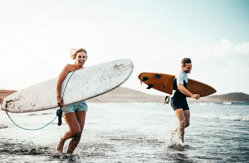
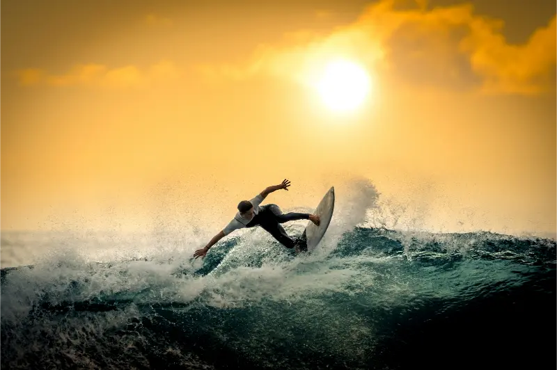
    Tenerife works for surfers because the island has several very different coasts in a compact area. Atlantic swell reaches the north and northwest with power, reef breaks shape the south around Las Américas, and the wind around El Médano creates a separate world of windsurfing, wingfoil and kitesurf. That variety is exciting, but it also means “surf in Tenerife” is not one beginner-friendly experience.

    I match the break to my level, use a reputable school when learning and never paddle out simply because the beach looks busy with boards. Volcanic reefs, currents, local line-ups and rapidly changing swell deserve respect. This guide is about choosing the right area and planning a surf trip responsibly.

    Why Tenerife has year-round surf potential

    Tenerife’s official tourism site describes a wide range of surf and bodyboard spots with sand, rock and volcanic reef bottoms, and notes that the strongest waves are generally on the north and northwest coasts. The official surf and bodyboard page is a good starting point for current operators and locations.

    Year-round potential does not mean identical conditions every month. Swell direction, wind and local exposure change what works on a given day. I check a reliable forecast and, when I am not familiar with the island, ask a local school rather than choosing a break from a generic “best surf spots” list.

    Illustrated guide: Surfing in Tenerife, with practical visitor tips
    Illustrated guide: Surfing in Tenerife.

    Playa de las Américas: the famous south-coast surf zone

    Las Américas is the most convenient surf base for many visitors because breaks sit next to hotels, restaurants and surf shops. The reef setups can produce excellent waves, but some are not beginner spots. My Playa de las Américas guide explains the neighbourhood beyond surfing.

    As a beginner, I book a lesson and let the instructor choose the appropriate section and tide. I do not paddle into the main peak because I watched a tutorial online. Reef breaks punish mistakes more severely than a forgiving sandy beach, and local etiquette matters in crowded line-ups.

    El Médano: wind sports first, surf depending on conditions

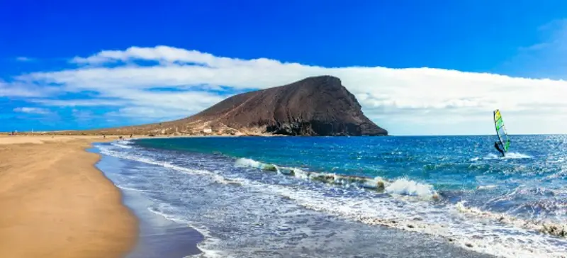
    El Médano is internationally known for windsurfing and other wind sports. Tenerife’s official tourism page notes that the beach’s outer section is especially suited to windsurf and kitesurf, while the area nearer the town is calmer and more family-oriented. The official site also highlights the approximately 300 windy days that support windsurf and wingfoil activity on the island.

    For classic surfing, conditions vary by spot and wind. I use my El Médano guide to understand the beach layout, then speak to a local school about the day. I do not treat windsurf, kitesurf and surf as interchangeable; each sport needs different space and conditions.

    Surfing In Tenerife

    Almáciga and the Anaga coast

    Almáciga is one of the northeast’s best-known surf beaches. The official beach description highlights strong waves throughout the year and notes that surf schools train there. The setting below Anaga is spectacular, but the remote feel should make me more cautious, not less.

    I combine the area with Taganana and watch conditions before entering. If I am a novice, I use an instructor who has chosen that beach for the day rather than assuming every school session happens there regardless of swell.

    El Socorro in Los Realejos

    El Socorro is a recognised north-coast surf beach with a strong local scene. It can suit intermediate and experienced surfers when conditions align, but the north coast is powerful and currents matter. I check flags and observe the line-up before entering.

    The beach works well as part of a Los Realejos day. My Los Realejos guide combines it with Rambla de Castro and the historic centre, which is useful if the surf becomes too large or messy.

    Beginner lessons: what I look for

    For a first lesson, I care more about instructor quality and beach selection than the cheapest price. I ask whether equipment, insurance and transport are included, how large the group will be and whether the school changes location based on conditions. A responsible school should be willing to cancel or relocate when the ocean is unsuitable.

    I tell the instructor honestly about swimming ability and previous experience. Surfing is safer and more enjoyable when the coach does not have to discover mid-session that a student is uncomfortable in deep water.

    Intermediate and advanced surfers

    Experienced surfers usually care about reef shape, swell direction, wind and crowd patterns. Tenerife offers serious waves, but visiting skill does not override local etiquette. I wait my turn, do not snake or drop in, and avoid paddling straight into a compact local peak without understanding how it works.

    Booties can be useful around volcanic rock, but protective gear does not remove the consequences of hitting reef. I inspect entry and exit points from shore first and ask locally if I am uncertain. On an unfamiliar reef, a conservative session is better than a heroic one.

    Surf etiquette in Tenerife

    The basic rules are universal: the surfer closest to the peak has priority, do not drop in, paddle around the breaking zone when possible, hold onto the board unless letting go is the safer emergency option, and apologise clearly if I make a mistake. Crowded holiday zones demand even more awareness because skill levels mix.

    I also respect people on the beach. I do not leave boards across promenades, rinse wax or gear where it creates a slippery surface, or change in doorways. Surf culture works best when the land side of the session is as considerate as the water side.

    Boards, wetsuits and water temperature

    The exact equipment depends on season, body temperature and session length. I ask the rental shop rather than packing based only on air temperature. Atlantic water can feel cool after an hour even when the beach is sunny, and wind increases heat loss.

    El Medano Beach And Montana Roja Tenerife

    For a short holiday, renting is usually simpler than flying with a board unless I am travelling specifically to surf. A good rental shop can also swap board volume or type as conditions change, which is more useful than being locked into one board all week.

    Where to stay for a surf-focused trip

    Las Américas is the easiest base for walking to reef breaks and having full resort infrastructure. El Médano suits wind-sport travellers and has a relaxed town atmosphere. The north can work for experienced surfers who want access to several exposures, though a car becomes more useful. I compare accommodation in Tenerife’s surf areas after deciding which coast matches the trip.

    I do not choose a hotel based on a surf-map pin alone. Secure board storage, parking, early breakfast, drying space and access to food after a session can matter more than being 200 metres closer to one break.

    Surfing without a car

    Las Américas is easiest without a car because shops, schools and breaks are concentrated in a walkable area. El Médano is also manageable once I am there, with public transport connecting it to the wider south. My no-car Tenerife guide explains buses and travelcards.

    For north-coast surf exploration, a car adds flexibility, but I never use a vehicle to chase every forecast model across the island in one day. Surfing tired after hours of driving is not a good trade.

    Non-surf days are part of a good surf trip

    Wind can be wrong, swell can be too small or too large, and the safest decision may be not to surf. Tenerife makes that easy because I can switch to Teide, La Laguna, a wine day or a coastal walk. My best things to do guide gives alternatives across the island.

    I actually like leaving one or two non-surf days in the plan from the start. They let the body recover and prevent the holiday from feeling disappointing when the ocean refuses to follow the forecast.

    Montana Roja At El Medano Tenerife

    Frequently asked questions

    Is Tenerife good for beginner surfers?

    Yes, with the right school and conditions. I would not choose a reef break independently as a beginner; I let an instructor select the safest beach and session.

    Where is the best surf in Tenerife?

    Las Américas is the most famous south-coast zone, while the north and northwest receive stronger swell. Almáciga and El Socorro are well known, but the best spot changes with conditions and ability.

    Do I need a wetsuit?

    It depends on season, session duration and personal comfort. Rental shops can advise on current water conditions and provide suitable equipment.

    Can I surf in Tenerife all year?

    There is year-round potential, but swell and wind patterns vary. Not every break works every day.

    Is El Médano mainly for surfing?

    It is especially famous for windsurfing, kitesurfing and wingfoil. Classic surf conditions depend on the specific spot and day.

    How I read a surf forecast as a visitor

    I look at swell height, period, direction and wind together, then compare that information with a local break description or school advice. A large number alone does not tell me whether a beach will be suitable. Reef orientation, tide and wind can transform the same forecast into completely different conditions around the island.

    When I am unfamiliar with a spot, I watch for at least fifteen minutes before entering. I identify where people paddle out, where waves break, where current seems to move and where the safe exit is. That small pause often tells me more than another hour of online forecasting.

  • Icod de los Vinos Guide: Drago Milenario, Cueva del Viento and Historic Centre

    Icod de los Vinos Guide: Drago Milenario, Cueva del Viento and Historic Centre

    Icod de los Vinos is one of the north Tenerife towns I would visit when I want history, a famous natural landmark and volcanic geology in the same day. Most first-time visitors come for the Drago Milenario, but I think the town is much more satisfying when you also walk the historic centre and, if you reserve ahead, add the Cueva del Viento lava-tube experience.

    Tenerife Tourism describes the celebrated Drago as around 800 years old and notes that the tree was declared a National Monument in 1917. The historic centre is compact, with squares, churches and traditional architecture close together, which makes Icod easy to combine with Garachico or another northwest stop without spending the whole day in the car.

    The Drago Milenario: what to expect

    The Drago is the visual symbol that pulls most people into Icod. You can see it from viewpoints around the historic centre, while the Parque del Drago offers a closer visit within a garden of Canary Islands flora and cultural interpretation. I would enter the park if I am genuinely interested in the tree and local botany rather than only trying to photograph it from every possible angle.

    Dragon Tree In Icod De Los Vinos Tenerife

    Current Tenerife Tourism information lists the park as open daily, with seasonal hours and a modest admission fee. Because those details can change, I check the official page on the day rather than print an old price into my itinerary. The tree will still be there; there is no reason to rush the logistics.

    Walking the historic centre

    I start around the traditional squares near the Drago and San Marcos church, then walk slowly rather than navigate from one pin to the next. Icod’s appeal is the relationship between old buildings, stone, wood balconies, small plazas and the steep green landscape around the town. The centre is compact enough that wandering is part of the visit.

    The official tourism route highlights places such as Plaza de la Pila, Iglesia Matriz de San Marcos, the former convent of San Francisco and Plaza Andrés de Lorenzo Cáceres. I do not need to enter every building. One interior, one long coffee and time in the streets usually gives me a stronger sense of place than a hurried museum sequence.

    Cueva del Viento

    Cueva del Viento is the experience that changes Icod from a short town stop into a potentially full day. It is a major volcanic tube system and visits are controlled and guided. I reserve in advance and follow the operator’s instructions about footwear, meeting time and physical conditions. I would never arrive assuming I can simply walk into a cave on my own.

    The cave visit is not an amusement-park tunnel. Uneven ground, darkness and geological conservation are part of the experience. Travellers with mobility concerns, very young children or claustrophobia should read the current accessibility and participation requirements before booking.

    How much time to spend in Icod

    PlanTimeWhat fits
    Quick stop1.5–2 hoursHistoric centre and Drago viewpoints
    Half day3–4 hoursAdd Parque del Drago and lunch
    Full day6+ hoursAdd reserved Cueva del Viento visit
    Northwest loopFull dayIcod plus Garachico with careful pacing

    I prefer half a day if I am not visiting the cave. That gives time to stop for food rather than turn the town into a bus-tour photo break.

    Food and wine

    The town’s name reflects its historic relationship with wine, and the wider northwest has a strong agricultural identity. I use lunch to look for local wine, cheese, grilled meats, fish and Canarian staples rather than automatically return to the coast for international food. If driving, only one person should be responsible for tasting decisions, and that person should stay alcohol-free.

    My Tenerife food guide explains papas arrugadas, mojo, gofio, local cheeses and the guachinche tradition in more detail.

    Playa de San Marcos

    Icod also reaches the coast at Playa de San Marcos, a sheltered bay below the town. I would not automatically add it to a packed historic day, but it works well when I want a slower finish or I am staying in the northwest. The road drops significantly from Icod’s centre, so it is not simply a flat walk to the sea.

    Combine Icod with Garachico

    Garachico is the most natural partner because the towns are close and their stories complement one another. Icod gives me the Drago and volcanic tube; Garachico adds a beautiful historic centre, natural pools and the visible memory of the 1706 volcanic eruption. My Garachico guide helps plan the second half of the day.

    The Garachico coastline and offshore Roque de Garachico

    I would not also add Masca unless the objective is simply to drive all day. The mountain roads deserve concentration and the places deserve time.

    Getting to Icod by bus

    Icod is one of the northwestern towns that can work without a car. Tenerife Tourism currently highlights TITSA connections including line 363 from Puerto de la Cruz and Buenavista, line 108 from the Santa Cruz/La Laguna direction and line 460 connecting via the southwest. Timetables change, so I verify the exact journey in TITSA before leaving.

    From Puerto de la Cruz, public transport is particularly practical. From Costa Adeje, a car may save time if I am building a multi-stop northwest day, but the bus can still work for a dedicated Icod visit. See my no-car Tenerife guide.

    Parking

    The historic core has narrow streets and visitor demand, so I prefer a signed public parking facility and then walk. Tenerife Tourism identifies the Parking del Drago as one commonly used option near the centre. I do not waste holiday time searching for a free space directly beside the Drago.

    Where to stay

    Icod can be a good overnight base for slow travel in the northwest, particularly if I want the cave, rural accommodation and early access to nearby towns. For a first Tenerife holiday, Puerto de la Cruz often provides more evening choice while keeping Icod within easy reach. If you want to stay locally, you can compare accommodation in Icod de los Vinos.

    My ideal Icod day

    I would arrive in the morning, walk the historic centre before the busiest period, visit the Drago park if it interests me and have lunch locally. If Cueva del Viento is reserved, I build the entire schedule around that fixed appointment. Without the cave, I continue to Garachico and end near the coast. I keep one stop optional so parking or lunch never becomes a crisis.

    Icod De Los Vinos Tenerife City View

    Official sources

    For town information I use the official Icod de los Vinos tourism page and the official Parque del Drago page for current opening and visitor details.

    Frequently asked questions

    Can I see the Drago without paying?

    There are public viewpoints from which the tree can be seen at a distance. Paying for the park gives a closer botanical and interpretive visit rather than simply a photograph.

    Is Cueva del Viento walk-in?

    I would never plan it that way. Visits are guided and capacity-controlled, so advance reservation and current instructions are essential.

    Is Icod worth visiting without the cave?

    Yes. The historic centre, Drago and a relaxed lunch make a good half-day, especially when combined with Garachico.

    Is it a good base?

    For quiet northwest exploration, yes. For a first-time traveller wanting nightlife, resort beaches and the broadest transport options, other bases may be easier.

    Why I would not reduce Icod to a single tree

    The Drago is famous enough that some itineraries allocate fifteen minutes: park, photograph, leave. I think that misses the relationship between the tree and the town. The squares, church, gardens and wine traditions explain why the landmark feels rooted in a living place rather than displayed in isolation. Even one extra hour changes the visit.

    Church In Icod De Los Vinos Tenerife

    The same applies to Cueva del Viento. The lava tube is not simply another attraction beside the Drago; it explains the volcanic processes that built the island. Together, botany, geology and architecture make Icod one of the most coherent educational stops in the north.

    A practical note about combining fixed reservations

    If I book Cueva del Viento, that appointment becomes the anchor of the day. I would not also buy a timed activity in Garachico with a tight connection, because parking, traffic and the cave check-in can create delays. I keep the Drago and historic-centre walk flexible around the fixed cave slot instead.

    This approach also leaves room for lunch. Northern Tenerife is more enjoyable when I can stop for local food without watching the clock every ten minutes. Icod is compact enough that a slower meal does not prevent me from seeing the essential centre; it often becomes one of the day’s best memories.

    Final planning advice

    For my own Icod de los Vinos guide planning, I keep the day flexible, verify the latest official information, avoid overloading the schedule and leave enough time for transport, food and weather changes. Tenerife rewards realistic pacing. The most memorable part of a day is often the unplanned coffee, viewpoint or conversation that only fits when the itinerary has margin. I also keep a simple backup plan so a closure, wind change or delayed bus does not turn one adjustment into a wasted day.

  • Best Natural Pools in Tenerife: Volcanic Charcos, Safety and Where to Swim

    Best Natural Pools in Tenerife: Volcanic Charcos, Safety and Where to Swim

    Tenerife’s natural pools and volcanic charcos are one of the best ways to understand the island’s coastline. Instead of a conventional sandy beach, you swim in seawater held between lava formations, sometimes in a carefully adapted pool with steps and facilities and sometimes in a much wilder rock basin shaped by the Atlantic. The photographs can make every charco look calm; reality is more nuanced, because waves, tides and local closures decide whether a place is suitable on a particular day.

    I therefore plan natural-pool days differently from beach days. I choose one or two places, check conditions, keep an alternative nearby and never assume that a rock barrier makes the water automatically safe. The official Tenerife tourism site maintains a useful overview of natural pools and charcos around the island.

    Why Tenerife has so many natural pools

    Volcanic eruptions created an irregular coast of lava flows, ledges and cavities. In many places the sea enters these formations and leaves behind protected or semi-protected pools. Some were later adapted with steps, terraces and changing facilities, while others remain almost completely natural. That distinction matters because the level of comfort and supervision varies enormously.

    I like natural pools because they combine swimming with geology. You can literally see how lava met the ocean. But I also respect them more than a hotel pool: a large wave can cross a wall that looked high a minute earlier. My rule is to observe the water before entering and follow any local signs, barriers or staff instructions.

    El Caletón in Garachico

    El Caletón is the natural-pool experience I recommend most often to a first-time visitor because it sits in the historic town of Garachico. The pools are formed in lava on the waterfront, so you can combine a swim with old streets, churches, cafés and viewpoints without dedicating the entire day to bathing.

    Illustrated guide: Best Natural Pools in Tenerife, with practical visitor tips
    Illustrated guide: Best Natural Pools in Tenerife.

    Garachico was dramatically reshaped by the 1706 Trevejo eruption, and the volcanic coast is part of the town’s identity. On a calm day, El Caletón can feel surprisingly accessible compared with wilder charcos. On a rough day, however, sections may be unsafe or closed. I never climb around barriers for a photograph. My Garachico guide covers the town in more detail.

    Bajamar pools

    Bajamar, on the north coast near La Laguna, has adapted seawater pools that are easier to understand for families than an undeveloped rock charco. The setting still feels strongly Atlantic, but there are structured bathing areas and a promenade. I like Bajamar when I want the natural-pool atmosphere without the same level of scrambling over rocks.

    The north coast is exposed, so waves can be impressive even when the pool itself looks protected. That is part of the visual drama, but it is also why local safety instructions matter. I check the sea first, then decide how long to stay rather than committing the entire afternoon in advance.

    Jóver and the northeast coast

    Jóver is another place I consider when exploring the northeast. It feels less like a major tourist attraction and more like a local coastal stop, which is exactly the appeal. The trade-off is that services and parking can be more limited, and a place that feels wonderfully quiet at one hour can become awkward if everyone arrives at once.

    I would combine Jóver with La Laguna, Bajamar or Punta del Hidalgo instead of driving from the south solely for the pool. That produces a richer day and gives me alternatives if the sea is not cooperative. For the cultural half of the itinerary, see my La Laguna guide.

    Charco del Viento and other north-coast rock pools

    The coast around La Guancha, Icod and neighboring municipalities contains beautiful volcanic bathing places, including Charco del Viento. These are the locations where I pay the closest attention to swell and access. A wild charco can look completely different depending on tide and ocean energy, so yesterday’s social-media video is not a safety forecast for today.

    If the sea is active, I switch the plan to viewpoints, towns or a conventional beach. There is no prize for entering a natural pool in marginal conditions. The north is full of alternatives: Icod de los Vinos, La Orotava, Puerto de la Cruz and Garachico all work well as backup sightseeing.

    Charco El Diablo Puerto De Santiago Tenerife

    Natural pools near Los Gigantes and the west

    Western Tenerife also has volcanic bathing areas and rock pools, although I choose carefully because exposed coastlines can receive strong swell. Around Los Gigantes and Puerto de Santiago, the cliffs are the main attraction, and I prefer to make swimming a bonus rather than the only purpose of the day. If conditions are wrong, a coastal walk or whale-watching trip can replace the swim.

    My Los Gigantes guide explains how I structure a west-coast day without overloading it. This is particularly useful if you also want to see Masca or Punta de Teno.

    How I check safety before swimming

    I look at the ocean for several minutes before approaching the water. I watch where waves break, whether water is washing across the pool edge and whether local swimmers are avoiding a section. I obey closure signs and do not assume that good swimmers are immune to impact from waves or slippery rock.

    Footwear matters too. Volcanic surfaces can be sharp, wet algae can be extremely slippery and access ladders may be exposed to surge. Water shoes can help in suitable places, but they do not make dangerous sea conditions safe. With children, I choose adapted pools, stay within arm’s reach where appropriate and avoid wild charcos in rough weather.

    What to bring

    • Secure footwear for wet volcanic surfaces.
    • A towel and dry layer, especially on the breezier north coast.
    • Water and sun protection.
    • A small waterproof bag for essentials, while leaving valuables at the accommodation.
    • A flexible itinerary with a nearby town or beach as Plan B.

    Natural pools versus beaches

    I do not see one as better than the other. Beaches such as Las Teresitas, El Médano or the southern resort bays are easier for long swimming and sunbathing days. Natural pools are more about landscape and the sensation of being inside Tenerife’s volcanic coast. On a one-week trip I would include both.

    Garachico Natural Pools And Coast Tenerife

    If you are choosing between locations, my best beaches in Tenerife article covers the conventional options, while this guide is for days when rock, lava and the Atlantic are the main attraction.

    Best natural-pool itinerary in the north

    A relaxed route could start in La Laguna, continue to Bajamar for a swim if conditions are good, then follow the north coast on another day toward Garachico and Icod. I would not try to visit six charcos in one day. The pleasure comes from staying long enough to swim, dry off and explore the surrounding town.

    For travellers using a rental car, I also avoid leaving bags visible in the vehicle while swimming. Natural pools often involve parking a short walk away, and a car full of luggage is unnecessary risk. My Tenerife by car guide includes broader road-trip and parking advice.

    Where to stay

    Puerto de la Cruz is a good base if north-coast pools are a priority because it puts several towns within manageable reach and gives you restaurants and evening life afterward. La Laguna is better for the northeast, while Garachico suits a slower rural-style trip. The south is still possible, but you will spend more time driving.

    You can compare Tenerife accommodation and then judge the route from the exact property rather than the resort name. On Tenerife, altitude and winding roads can make apparently short distances misleading.

    Frequently asked questions

    Are Tenerife’s natural pools free?

    Many are free public bathing areas, but facilities and access arrangements vary. I always check the current local information for the specific pool.

    Are they safe in winter?

    Safety depends on the sea on that day, not simply the season. Winter can bring energetic Atlantic swell to the north coast, so flexibility matters.

    Which pool is easiest for a first visit?

    I like El Caletón because it combines well with Garachico, and adapted complexes such as Bajamar are more straightforward than wild rock pools.

    Can children use them?

    Some adapted pools can work very well for families in calm conditions. Wild charcos require much more caution and are not places where I would relax supervision.

    What is the main rule?

    If the ocean looks wrong, do something else. Tenerife offers enough towns, beaches and viewpoints that there is never a reason to force a swim.

    How I choose a pool on the day

    I make the final choice in the morning rather than weeks in advance. I check the weather on the specific coast, look at sea conditions and then decide whether I want a structured pool such as Bajamar or a wilder charco. If I am travelling with older relatives or children, I give accessibility and easy entry far more weight than how photogenic the rocks look online.

    I also time the visit around the rest of the day. A natural pool is ideal after sightseeing because you can swim for an hour, dry off and continue to dinner without committing to a full beach day. On the north coast I keep a dry change of clothes in the car because wind can make wet swimwear uncomfortable quickly. This simple flexibility is what turns Tenerife’s charcos from a risky checklist into one of the island’s most enjoyable coastal experiences.