Author: Patricia

  • Parque Marítimo César Manrique Guide: 2026 Hours, Prices and Pools

    Parque Marítimo César Manrique Guide: 2026 Hours, Prices and Pools

    Parque Marítimo César Manrique is Santa Cruz’s large seawater-pool complex and one of the most practical places to combine César Manrique design, family swimming and an urban sightseeing day. It covers about 22,000 square metres beside the Auditorio and Palmetum.

    For September 2026 the official site lists winter-season hours of 10:00–18:00, with pools closing at 17:45. It also currently warns that only one pool is open during the winter period, while maintenance affects the children’s and cascade pools. Those operational details are exactly why I would check the official page on the day of the visit.

    Quick practical facts

    LocationAvenida de la Constitución 5, Santa Cruz de Tenerife
    Current winter hours10:00–18:00; pools close 17:45
    2026/27 winter seasonFrom 7 September 2026 to 19 June 2027
    Non-resident adult€7.50 including sunbed
    Non-resident under 12€4.00
    Under 3Free
    PoolsThree seawater pools in the complex; current opening can vary by maintenance/season
    AccessibilityRamps, adapted facilities, pool hoist and amphibious chair published by the operator

    Why I would give Parque Marítimo César Manrique its own stop

    A lot of Tenerife advice treats Santa Cruz as a culture-and-shopping day and assumes swimming belongs only in the resort south. Parque Marítimo is a good counterexample. It gives the capital a genuine pool day option without leaving the urban waterfront.

    The design matters too. Volcanic rock, white surfaces, palms, salt water, waterfalls and Manrique-style wind elements turn the complex into more than a municipal swimming pool.

    What to look for once you are there

    The seawater pools

    The complex has two main seawater pools and a children’s pool, although the number operating can change with season and maintenance. I check the live notice before paying.

    Manrique’s design language

    Volcanic rock, vegetation, water and sculptural elements create the familiar Canarian dialogue between nature and built leisure space. The park opened in 1995 as a posthumous Manrique project.

    Family infrastructure

    The operator lists changing rooms, showers, food outlets, play facilities and seasonal children’s programming. I still treat specific activities as date-dependent rather than guaranteed every day.

    Accessibility features

    The official facility page lists reserved parking, ramps, adapted toilets, a pool hoist and an amphibious chair. For a traveller who needs a specific device, I would confirm availability before arrival.
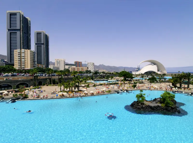
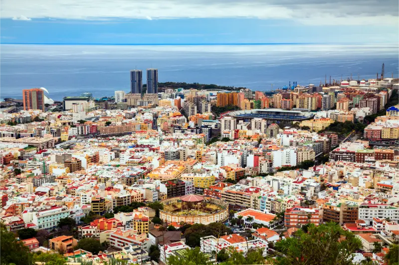
    Santa Cruz De Tenerife Skyline Across Parque Maritimo

    The context that makes the visit more interesting

    César Manrique’s influence in Tenerife is often associated with Lago Martiánez in Puerto de la Cruz, but Santa Cruz has its own major Manrique leisure landscape. Seeing both on one trip makes the similarities and differences much clearer.

    The maritime park belongs to a broader transformation of the southern city waterfront. Today the Auditorio, Palmetum, Castillo Negro and pools sit within a compact area that can be explored almost as one urban design district.

    Because this is an operating leisure facility, conditions are less static than at a monument. Pool maintenance, seasonal opening, children’s activities and tariffs can all change; I prefer a current official notice to a timeless-sounding blog promise.

    How I would plan the visit

    If swimming is the priority, I arrive soon after opening and then add the Auditorio or Palmetum later. If culture is the priority, I reverse the order and use the pools as the relaxing end of the day.

    I bring swimwear, sandals, sun protection and a light cover-up. Glass containers are prohibited by the facility rules, and the current website also states that smoking is prohibited inside.

    How much time to allow

    For a real swim-and-sun session I allow at least three hours. Entering for 45 minutes rarely makes sense once changing, finding a sunbed and drying off are included.

    For families, four to five hours is more realistic. If only one pool is open, I also adjust expectations about how much variety there will be inside the complex.

    Getting there without turning the visit into a transport problem

    The park is on the southern edge of central Santa Cruz near the Auditorio and Palmetum. It is accessible by public transport and the operator advertises a large parking area, but I do not build a peak-time plan around the assumption that parking will always be effortless.
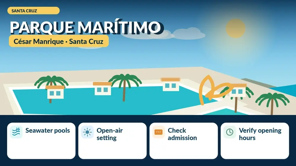
    Illustrated guide: Parque Marítimo César Manrique, with practical visitor tips
    Illustrated guide: Parque Marítimo César Manrique.

    For a city break, I may compare Santa Cruz accommodation and walk or use public transport for most central attractions.

    Accessibility and comfort

    This is one of the stronger accessibility stories in the city’s leisure offer. The operator lists ramps, adapted bathrooms, reserved parking, an elevator, a pool hoist and an amphibious chair.

    Specific equipment can be temporarily unavailable, so if access to the water depends on it I contact the park before travelling rather than assuming every listed service is ready at every moment.

    Is it worth visiting with children?

    Yes. The facility is designed for families, and summer programmes add activities for children. In the current winter period, however, the official website warns that only one pool is open and that some pools are closed for maintenance.

    That distinction matters. A family should decide whether a relaxed single-pool day still sounds worthwhile before arriving with expectations based on summer photos.

    Best time of day

    I prefer opening time or late morning, especially on warm days. It gives a better choice of space and leaves time to combine the visit with the surrounding seafront.

    In winter the earlier 18:00 closing makes a late-afternoon arrival poor value for most visitors. I check the seasonal timetable before fixing lunch reservations elsewhere.

    Photography and respectful visiting

    The best images use volcanic black, bright water and palms together. I also like compositions that include the Auditorio, because they show how the maritime park fits into Santa Cruz rather than making it look like an isolated resort.

    I keep photography considerate around swimmers and children. A public pool is not a location where strangers should become the foreground of a travel photo without consent.

    Useful nearby stops

    A realistic half-day plan

    A simple warm-weather half-day is maritime park first, then an early dinner or walk around the Auditorio. A culture-first version starts at Palmetum and uses the pool complex afterward.

    I do not try to add Las Teresitas to the same short half-day. The maritime park already solves the swimming need without a bus or car journey to San Andrés.

    Common mistakes I would avoid

    • Using summer photos to assume every pool is open in winter.
    • Arriving late without checking seasonal closing time.
    • Bringing glass containers despite the rules.
    • Assuming a listed accessibility device is guaranteed without confirmation.
    • Planning Santa Cruz as a beach-only day and overlooking the surrounding cultural cluster.

    Current information: what I would check again

    As of the official September 2026 update, winter hours are 10:00–18:00 with pool closure at 17:45. The non-resident adult ticket including sunbed is listed at €7.50 and under-12 at €4.00.

    The facility currently states that only one pool is open during the winter period and that the children’s and cascade pools are closed for maintenance. I would check the live notice immediately before visiting because this is operational information, not a permanent feature.

    Santa Cruz De Tenerife Skyline From Parque Maritimo

    Official source

    For current hours, tariffs and maintenance notices I use Parque Marítimo de Santa Cruz – official hours and tariffs.

    Frequently asked questions

    Is the water seawater?

    Yes. The complex is built around seawater swimming pools.

    How much is a non-resident adult ticket in September 2026?

    The official tariff page currently lists €7.50 including a sunbed. Check again because prices can change.

    Are all pools currently open?

    No. The official website currently states that only one pool is open in the winter season and that other pools are affected by maintenance.

    Is it accessible for reduced mobility?

    The operator publishes extensive accessibility features including ramps, adapted bathrooms, a pool hoist and an amphibious chair. Confirm specific equipment before travelling if it is essential.

    How I decide whether this stop belongs in my itinerary

    I do not add a place simply because it appears on a “top things to do” list. I ask what new layer it adds to the trip. Does it explain a part of Tenerife I have not understood yet? Does it fit naturally with places already on the route? Can I visit it without creating an hour of unnecessary driving? Those questions are especially useful on an island where a short distance on the map can still mean mountain roads, city parking or a change of microclimate.

    I also distinguish between a destination visit and a cluster visit. A destination visit is worth crossing the island for; a cluster visit becomes valuable because it sits beside two or three other strong stops. Many museums, churches, small forts and interpretation centres are at their best in the second category. That does not make them less important. It simply means the itinerary should respect their real scale.

    What I would verify on the morning of the visit

    Opening hours, temporary closures, road conditions and special events are the four details most likely to change. I save the official source rather than relying on a screenshot taken months earlier. For cultural buildings I also check whether a private event, religious service, renovation or guided group affects normal access. For Teide locations I add mountain weather and road status to that list.

    This last check takes only a few minutes and prevents the most common frustration in Tenerife planning: arriving with perfectly researched historical information but an outdated practical detail. I would rather change the order of a day than force an itinerary after the conditions have changed.

    What makes a good Tenerife visit different from a checklist

    The strongest days usually contain contrast. A museum works better when I can walk through the neighbourhood it explains; a volcanic trail means more after a visitor centre; a historic fort becomes clearer when modern city architecture surrounds it. I therefore build connections between places instead of treating every stop as an isolated review score.

    Santa Cruz De Tenerife Waterfront And Parque Maritimo

    I also leave blank space. Tenerife rewards unplanned pauses: a view of Teide appearing above cloud, a local café, a small plaza, or a change in light can become more memorable than the tenth scheduled attraction. A complete travel site should help a reader make those choices, not pressure them to “complete” the island.

    Final thoughts

    Parque Marítimo is useful because it makes Santa Cruz work for more kinds of traveller. A city day can include architecture, gardens and a proper swim without changing destination.

    I would just treat it like the operating pool complex it is: check the live opening notice first, especially outside summer, and then enjoy the Manrique design without assuming every brochure image matches today’s configuration.
  • Castillo Negro Santa Cruz Guide: History, Location and What to See

    Castillo Negro Santa Cruz Guide: History, Location and What to See

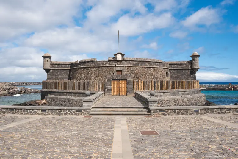
    Castillo de San Juan Bautista (Castillo Negro) is the compact circular fort that sits between some of Santa Cruz’s most modern landmarks. The contrast is the reason I like the stop: a seventeenth-century coastal defence beside the Auditorio, Parque Marítimo and Palmetum makes the city’s layers visible in a single walk.

    The Santa Cruz heritage service says construction began in the 1640s and that the fort took its present appearance after eighteenth-century remodelling. Turismo de Tenerife describes it as the best-preserved castle on the island. I would plan primarily for an exterior heritage stop unless an official event specifically advertises interior access.

    Quick practical facts

    Also known asCastillo Negro
    LocationAvenida de la Constitución, Santa Cruz de Tenerife
    Original construction1641–1643/44 period
    Major later remodelling1765–1767
    Heritage statusProtected historic monument / BIC context
    Best combined withAuditorio, Parque Marítimo César Manrique, Palmetum

    Why I would give Castillo de San Juan Bautista (Castillo Negro) its own stop

    Santa Cruz can feel like a city of twentieth- and twenty-first-century architecture when a visitor concentrates on the seafront. Castillo Negro interrupts that impression. Its low volcanic-stone form is evidence of the defensive coastline that existed long before the current avenues and cultural buildings.

    The stop is also efficient. I do not need a dedicated taxi ride or a half day; it belongs naturally in a walking route between the Auditorio, the maritime park and Palmetum.

    What to look for once you are there

    The circular military form

    The fort was designed for coastal defence rather than ceremony. Its compact round mass is especially striking against the sweeping forms of the Auditorio nearby.

    Volcanic masonry

    The dark stone helps explain the popular name visually, although the city heritage page notes that the name is also associated with the old place-name Caleta de los Negros.

    The seafront contrast

    This is one of the best places in Santa Cruz to photograph different periods of the city in one frame: fortification, modern cultural architecture, leisure pools and port infrastructure.

    The Nelson-era defensive story

    Santa Cruz’s forts belong to the wider military history of the port, including the failed British attack led by Admiral Nelson in 1797. I use Castillo Negro as a starting point and the Castillo de San Cristóbal interpretation centre for the deeper Nelson story.

    The context that makes the visit more interesting

    Santa Cruz grew around a strategic harbour. Coastal batteries and forts were not decorative architecture; they responded to the vulnerability of an Atlantic port connected to imperial trade routes.

    The city’s heritage service explains that San Juan Bautista was built to defend this section of coast and was financed and maintained within the island’s defensive system. Its later remodelling produced much of the appearance visitors see today.

    I avoid simplifying the name “Castillo Negro” into a certainty about black stone. Official local heritage material points to the historic toponym Caleta de los Negros as a likely origin, which is a good example of why place names deserve more care than a quick caption.

    Santa Cruz De Tenerife Skyline And Auditorium

    How I would plan the visit

    I would see the fort after the Auditorio de Tenerife and before or after the maritime park. The walking sequence makes the architecture itself part of the story.

    For the defensive history of central Santa Cruz, I would also add the Castillo de San Cristóbal guide under Plaza de España on the same or another day.

    How much time to allow

    Ten to twenty minutes is enough for a simple exterior stop. If a heritage event opens the interior, I would follow that event’s timetable rather than assume regular access.

    As part of a seafront architecture walk, I would allow two to four hours because Palmetum, the Auditorio and Parque Marítimo can each become a substantial visit.

    Getting there without turning the visit into a transport problem

    The fort is on Avenida de la Constitución in the modern seafront cultural zone. It is easier to treat this as a walking cluster than to move the car between each landmark.

    If I am staying in the capital, I may compare hotels in Santa Cruz and use tram/bus/walking for the city rather than keeping a rental car for every central stop.

    Accessibility and comfort

    Viewing the exterior is generally a low-effort urban stop, but I do not promise interior accessibility because regular interior opening is not the basis of this guide. If an event is announced, I check its specific access information.

    The surrounding seafront is exposed to sun and wind. Even on an urban day, a hat and water make the walk between the Auditorio, fort and Palmetum more comfortable.

    Is it worth visiting with children?

    Yes, especially if children enjoy forts, cannons or “spot the old building among the new ones” challenges. The short duration means it can add history without causing museum fatigue.

    I would not oversell a long list of dates. One simple story—why a port needed coastal defence—usually makes the building more memorable.

    Best time of day

    Morning gives softer light on parts of the seafront and makes it easy to continue into Palmetum or the maritime park. Late afternoon can create strong contrast with the modern architecture.

    At midday the exposed paved area can feel hot even when the Atlantic breeze is pleasant. I build in shade or an indoor stop rather than walking the entire waterfront continuously.

    Photography and respectful visiting

    My favourite composition is not an isolated fort. I deliberately include the Auditorio or the maritime park to show the time contrast that makes the location distinctive.

    I stay on public paths and never climb historic masonry for a better angle. A protected defensive structure is not a viewing platform.

    Useful nearby stops

    A realistic half-day plan

    A strong half-day starts at Palmetum or Parque Marítimo, walks past Castillo Negro and finishes at the Auditorio. If I still have energy, I continue toward the historic centre rather than adding another car journey.

    Aerial View Of Santa Cruz De Tenerife

    On a history-focused day I reverse the emphasis: Plaza de España and Castillo de San Cristóbal first, then the seafront fort as the final outdoor comparison.

    Common mistakes I would avoid

    • Expecting regular interior access without checking an event or official notice.
    • Driving between nearby seafront landmarks instead of walking the cluster.
    • Calling the building “black” only because of stone colour and ignoring the place-name history.
    • Climbing or sitting on protected masonry for photographs.
    • Visiting without linking it to Santa Cruz’s wider port-defence story.

    Current information: what I would check again

    The building is easy to identify from the public seafront, but interior access can depend on heritage programming. I therefore plan the visit so the exterior alone is worthwhile.

    For any special opening, reenactment or guided visit, I check the Santa Cruz cultural or heritage channels rather than relying on an old timetable.

    Official source

    For the fort’s history I use Santa Cruz de Tenerife – historic castles.

    Frequently asked questions

    Is Castillo Negro the same as Castillo de San Juan Bautista?

    Yes. Castillo Negro is the popular name for the coastal fort of San Juan Bautista.

    Can I go inside?

    Do not assume regular interior access. Plan for an exterior visit unless an official cultural event or guided opening is advertised.

    Is it far from the Auditorio?

    No. The fort sits in the same seafront zone and is very easy to combine with the Auditorio and Parque Marítimo.

    How long do I need?

    Around 10–20 minutes for the exterior, longer if a special guided opening is available.

    How I decide whether this stop belongs in my itinerary

    I do not add a place simply because it appears on a “top things to do” list. I ask what new layer it adds to the trip. Does it explain a part of Tenerife I have not understood yet? Does it fit naturally with places already on the route? Can I visit it without creating an hour of unnecessary driving? Those questions are especially useful on an island where a short distance on the map can still mean mountain roads, city parking or a change of microclimate.

    Auditorio De Tenerife Santa Cruz Coastline

    I also distinguish between a destination visit and a cluster visit. A destination visit is worth crossing the island for; a cluster visit becomes valuable because it sits beside two or three other strong stops. Many museums, churches, small forts and interpretation centres are at their best in the second category. That does not make them less important. It simply means the itinerary should respect their real scale.

    What I would verify on the morning of the visit

    Opening hours, temporary closures, road conditions and special events are the four details most likely to change. I save the official source rather than relying on a screenshot taken months earlier. For cultural buildings I also check whether a private event, religious service, renovation or guided group affects normal access. For Teide locations I add mountain weather and road status to that list.

    This last check takes only a few minutes and prevents the most common frustration in Tenerife planning: arriving with perfectly researched historical information but an outdated practical detail. I would rather change the order of a day than force an itinerary after the conditions have changed.

    What makes a good Tenerife visit different from a checklist

    The strongest days usually contain contrast. A museum works better when I can walk through the neighbourhood it explains; a volcanic trail means more after a visitor centre; a historic fort becomes clearer when modern city architecture surrounds it. I therefore build connections between places instead of treating every stop as an isolated review score.

    I also leave blank space. Tenerife rewards unplanned pauses: a view of Teide appearing above cloud, a local café, a small plaza, or a change in light can become more memorable than the tenth scheduled attraction. A complete travel site should help a reader make those choices, not pressure them to “complete” the island.

    Final thoughts

    Castillo Negro works because it is small, authentic and perfectly placed. In a few minutes it changes the waterfront from a collection of modern attractions into a timeline.

    I would see it slowly enough to notice the masonry and then turn around: the modern city surrounding it is part of the interpretation.

  • Cañada Blanca Visitor Centre Guide: Teide History, Hours and Roques de García

    Cañada Blanca Visitor Centre Guide: Teide History, Hours and Roques de García

    Cañada Blanca Visitor Centre is the Teide National Park visitor centre I would choose when I want to understand how people lived in Las Cañadas, not only how the volcanoes formed. It stands beside the Parador and faces the Roques de García, so it can add real context to one of the most photographed stops in Tenerife.

    The park authority currently lists daily opening from 09:00 to 16:00, with closure on 25 December and 1 and 6 January. Admission is presented as part of the public visitor infrastructure; I still check the official page immediately before going because opening arrangements, parking and works can change.

    Quick practical facts

    WhereLas Cañadas del Teide, beside the Parador and Roques de García
    Current hoursDaily 09:00–16:00
    Annual closures25 December; 1 and 6 January
    Main themeHuman life, land use and Guanche culture in Las Cañadas
    Best paired withRoques de García, Siete Cañadas, Parador area
    AltitudeHigh-mountain environment; dress for Teide, not the coast

    Why I would give Cañada Blanca Visitor Centre its own stop

    Many first-time visitors drive into Teide National Park, photograph Roque Cinchado and leave with a strong impression of geology but very little sense of human history. Cañada Blanca corrects that imbalance. Its interpretation focuses on the different ways people used this high landscape and how those uses shaped what visitors see today.

    I also like the location because the museum does not require a separate detour. If I am already planning the Roques de García area, I can turn a scenic stop into a more complete visit without adding another long drive.

    What to look for once you are there

    The human story of Las Cañadas

    The exhibition looks at ways of life in the highlands and the practical uses people made of the environment. That perspective helps explain why paths, grazing areas and historic structures appear where they do.

    Teide National Park Desert Landscape Tenerife

    Guanche culture

    The centre gives special space to Guanche culture. I would use it as context rather than treating any single display as the whole story of Tenerife’s Indigenous past; the MUNA and other archaeological collections can add depth later in the trip.

    The view from the Cañada Blanca area

    Outside, the setting itself is part of the visit: Teide, Roques de García and Guajara frame the centre. The official viewpoint information identifies Cañada Blanca as one of the park’s key panorama points.

    A useful indoor pause at altitude

    The centre can be especially valuable when wind, intense sun or a short weather change makes a long outdoor stop less appealing. It lets me keep learning instead of simply waiting in the car.

    The context that makes the visit more interesting

    Las Cañadas is not an empty volcanic bowl. Archaeology, pastoral history and historic travel routes show long-term human relationships with the highlands. The visitor centre helps put names and uses to a landscape that can otherwise look purely geological.

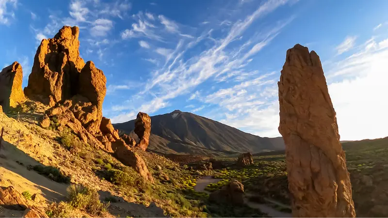
    The nearby Roques de García are the visual magnet, but I would resist the temptation to treat them as a backdrop only. The caldera wall, lava formations and broad floor of Ucanca make much more sense after a few minutes of interpretation.

    In 2026 the authorities have also been working on accessibility and parking improvements around La Ruleta and Cañada Blanca. That is another reason I verify the current parking layout rather than relying on an old photograph or map pin.

    How I would plan the visit

    I would arrive with a simple sequence: visitor centre first, then Roques de García if I am hiking, or the viewpoint platforms if I only want an easy scenic stop. Seeing the exhibition first changes what I notice outside.

    If I want a longer walking day, the Siete Cañadas guide explains the linear trail that connects the El Portillo side with Cañada Blanca. I do not add that 16.6 km route casually to a museum visit; it needs its own transport and daylight plan.

    How much time to allow

    For the centre alone I would allow around 45–75 minutes rather than rushing through in ten. The exact time depends on whether I watch audiovisual material, read the interpretation closely and use the viewpoint.

    For a combined Cañada Blanca and Roques de García stop, two to three hours is far more realistic. Parking, walking between areas and simply pausing for the landscape consume time that a map does not show.

    Getting there without turning the visit into a transport problem

    The centre is on the TF-21 at the Parador/Roques de García area. I plan the road approach according to where I am staying because Teide has several access roads and a route that looks short in kilometres can be slow through mountain bends and viewpoint traffic.

    For a mountain-focused overnight I may compare stays in La Orotava or check southern bases depending on the next day’s route. I do not choose a hotel purely because it appears closest in a straight line.

    Accessibility and comfort

    The visitor centre is designed as public park infrastructure and is a much easier way to experience Teide than a steep hike. The surrounding area has been the subject of 2026 accessibility and parking works, so I check the current arrangement for mobility needs before travel.

    Altitude still matters even when the building is accessible. Cold wind, sun and breathlessness can affect someone who would be perfectly comfortable at sea level, so I bring layers and take the walk from parking to the centre at an easy pace.

    Is it worth visiting with children?

    Yes. For families, this is one of the best ways to make Teide more than “a big volcano”. Displays about people, landscapes and Guanche culture give children specific things to look for once they step outside.

    I would pair it with a short outdoor element rather than a demanding hike. The Roques de García guide helps me judge whether the full loop suits the family; otherwise the viewpoints alone are worthwhile.

    Roque Cinchado Roques De Garcia Tenerife

    Best time of day

    Morning is my preference because it leaves more flexibility for a walk afterward and usually gives a calmer planning rhythm. The high plateau can be surprisingly bright, so the difference between indoor interpretation and outdoor glare is welcome.

    Late afternoon can be beautiful, but I do not arrive close to closing time expecting a full museum visit. I also keep enough daylight for the mountain drive back to the coast.

    Photography and respectful visiting

    Inside, I follow the centre’s current photography rules. Outside, the most useful photographs are often wide contextual frames showing Roques de García, Teide and the caldera relationship rather than only a close-up of one rock.

    I never walk onto fragile volcanic ground to remove people from a composition. The official paths and viewpoint platforms already give strong lines and scale without creating another informal track.

    Useful nearby stops

    A realistic half-day plan

    A strong half-day is Cañada Blanca Visitor Centre, the Roques de García viewpoints and a short walk around the Parador area. That gives geology, human history and scenery without overloading the schedule.

    If I am continuing toward Vilaflor or Boca Tauce, I add only one more viewpoint. Teide days become stressful when every lay-by becomes a compulsory stop.

    Common mistakes I would avoid

    • Arriving only for a photo of Roque Cinchado and skipping the interpretation.
    • Assuming coastal temperatures apply at Cañada Blanca.
    • Building a tight schedule around a specific parking space.
    • Starting Siete Cañadas without solving the linear-route return.
    • Relying on old parking photos during a period of access improvements.

    Current information: what I would check again

    The official park page currently lists the centre 09:00–16:00 daily, closed 25 December and 1 and 6 January. I treat those as current published details, not permanent promises.

    Parking and pedestrian arrangements can be affected by ongoing improvements or high visitor pressure. Before driving up I check the park website and road information rather than assuming a previous trip’s layout is unchanged.

    Teide Observatory And Mount Teide Tenerife

    Official source

    For opening hours and the visitor-centre description, I use Teide National Park – visitor centres and hours.

    Frequently asked questions

    Is Cañada Blanca the same as El Portillo Visitor Centre?

    No. They are separate visitor centres in different parts of Teide National Park and have different interpretive emphases.

    What is the main theme?

    The centre focuses strongly on human life and land use in Las Cañadas, including a section on Guanche culture.

    Can I combine it with Roques de García?

    Yes. They are in the same general Parador/Cañada Blanca area and make a natural combined visit.

    Do I need hiking gear just to visit the centre?

    Not for the exhibition itself, but I still dress for a high-altitude environment and use shoes suitable for outdoor viewpoints if I plan to walk around.

    Final thoughts

    Cañada Blanca is one of the easiest ways to turn a Teide sightseeing day into something more meaningful. It explains the people who used this landscape and then lets you step outside into the exact terrain the exhibits describe.

    I would not measure its value by the time spent indoors. The point is that an hour of context can improve every photograph, viewpoint and trail that follows.

  • PR-TF 43 Garachico to Chinyero Hiking Guide: Lava, Forest and Big Ascent

    PR-TF 43 Garachico to Chinyero Hiking Guide: Lava, Forest and Big Ascent

    PR-TF 43 is one of the strongest mountain-to-volcano hiking lines in northwest Tenerife. It begins almost at Atlantic level in historic Garachico and climbs through lava-shaped slopes, rural land and pine forest until the Chinyero volcanic landscape takes over. The headline number is not the distance but the ascent: roughly 1,680 metres in 17.7 kilometres, which makes this a serious full-day effort rather than a casual add-on to a sightseeing day.

    The technical figures below come from the current Turismo de Tenerife route information that I checked while preparing this guide. I still verify the live page before setting out, because status notices and temporary restrictions can change faster than an article.

    Quick route facts

    StartGarachico
    FinishCircular Chinyero
    TypeLinear
    Distance17.7 km
    Official duration7 hr
    DifficultyHigh
    Maximum altitude1,521 m
    Minimum altitude46 m
    Accumulated ascent1,680 m
    Accumulated descent287.52 m
    Protected areasAcantilados de La Culata Protected Landscape; Chinyero Special Nature Reserve
    PermitNo

    Why this route is worth understanding

    What makes this route unusual is the vertical story. Garachico is inseparable from the 1706 eruption of Trevejo, and the walk gradually leaves the coast behind before reaching the younger Chinyero landscape associated with Tenerife’s 1909 eruption. I would choose it when the goal is to understand how volcanic history and settlement geography fit together, not simply to collect another summit.

    For wider context I connect this route with Garachico guide Chinyero Volcano guide Arenas Negras trail Tenerife hiking permits and trail rules. I prefer building one coherent regional day rather than crossing the island between unrelated stops.

    How the route unfolds

    1. Garachico and the first sustained climb

    The route leaves one of Tenerife’s most attractive historic towns and immediately asks for respect. The early ascent is where I deliberately keep the pace slow, because the legs are still fresh and it is easy to spend energy too quickly. Looking back toward the coast gives a clear sense of how rapidly the route gains height.

    The Garachico coastline and offshore Roque de Garachico

    2. San Juan del Reparo and old lava terrain

    The path climbs through the area of San Juan del Reparo and crosses terrain shaped by historical lava. This is not a smooth promenade: stone, uneven surfaces and steep gradients matter. I use this middle section to settle into a steady rhythm rather than chasing the official time.

    3. La Montañeta and Arenas Negras

    Higher up, the character becomes more rural and forested. The route approaches La Montañeta and the Arenas Negras area, where pines and volcanic soils replace the lower agricultural feel. My separate Arenas Negras guide is useful if I want a shorter alternative rather than committing to the entire PR-TF 43.

    4. The Chinyero volcanic landscape

    The final objective is the Chinyero area, where dark lava, pines and volcanic cones create one of Tenerife’s most distinctive hiking environments. I stay on the marked route because the reserve protects fragile terrain and because loose lava is much less stable than it can look from a distance.

    Difficulty: how I read the official grade

    The official difficulty label is useful, but I never use it alone. I combine it with distance, vertical gain or loss, altitude, exposure, trail surface and the amount of transport planning required. A short steep route can punish knees; a long descent can be exhausting; a high-altitude path can feel hard even when the gradient is moderate.

    I also compare the route with my recent activity rather than with what I managed on a holiday years ago. If I have not been hiking regularly, I choose a shorter alternative first and learn how my body reacts to Tenerife’s heat, altitude and volcanic footing.

    Navigation and route status

    I use the current official route sheet as the baseline, then save an offline map before leaving. Waymarks matter more than a downloaded user track because old GPX files can preserve shortcuts, outdated diversions or sections that have since closed. At a junction I stop, confirm the marker and only then continue; following another group is not navigation.

    Trail status can change after fire, heavy rain, maintenance or conservation work. I recheck the official page shortly before the hike. If a closure or prohibition is posted, I change plans rather than looking for a way around it. Tenerife has enough excellent alternatives that ignoring a closure is never necessary.

    Getting there and getting back

    Because the route is linear and finishes high in the Chinyero network rather than back in Garachico, I arrange the return before I start. A two-car shuttle, pre-arranged taxi or carefully checked bus plan is far safer than assuming transport will be easy after seven hours of climbing.

    When buses form part of the plan I check the current TITSA timetable on the day itself. Rural services can be infrequent, and missing one bus after a long hike can turn a good day into a logistical problem. If I drive, I park legally and keep forest gates, farm access and emergency routes clear.

    Weather and the best conditions

    The route crosses several climate zones. Garachico can feel warm while the upper forest is cool, cloudy or windy. I carry a light insulating layer even on a sunny coastal morning and I avoid using the coast forecast as a proxy for conditions around 1,500 metres.

    I check AEMET or another current mountain forecast rather than relying on the weather shown for a coastal resort. Calima, heat alerts, high wind, wildfire restrictions and rain are all valid reasons to change the route. Flexibility is one of the most useful pieces of hiking equipment I have.

    What I carry

    • Enough water for the route plus a reserve.
    • Food that is easy to eat while walking, including something salty on longer days.
    • Trail or hiking shoes with reliable grip.
    • Sun protection: hat, sunscreen and sunglasses.
    • A light windproof or insulating layer appropriate to the altitude.
    • Offline map, charged phone and power bank for long routes.
    • Small first-aid kit and any personal medication.

    I adjust quantities to heat, altitude and duration rather than copying one packing list for every Tenerife walk. A five-kilometre route with 600 metres of ascent can require more water and recovery time than a flatter ten-kilometre walk.

    Safety: the points I take seriously

    I manage descents as carefully as climbs. Loose volcanic gravel, polished stone and tired legs are a common combination on Tenerife. I shorten my stride on steep ground, leave space between hikers and never hurry because someone behind me is moving faster. If I use trekking poles, I use them because I am already comfortable with them, not because the route suddenly feels difficult.

    I stay away from cliff edges, ravine drops and unstable lava. I do not climb walls, cones or rock formations for photographs. During heat, calima, strong wind or heavy rain I shorten or cancel the walk. In an emergency the number in Spain is 112; I also tell someone where I am going and when I expect to finish.

    Who this route suits

    I think in terms of skills rather than labels such as “beginner” or “experienced”. The route is a good match only if everyone in the group is comfortable with its longest climb or descent, expected duration and surface. For families, I consider each child’s real walking experience and attention span rather than age alone.

    If anyone is uncertain, I choose an easier route and keep this one for another day. Tenerife’s trail network is broad enough that scaling down does not mean wasting the trip.

    Respecting the landscape

    Many of these routes cross protected areas, working rural land or both. I stay on the signed path, close gates if the local system requires it, keep noise low near homes and never pick plants or collect volcanic rock. I carry out all rubbish, including organic waste, because food scraps can attract animals and change behaviour.

    I also avoid creating social-media shortcuts. A line across loose lava or vegetation may look harmless when one person does it, but repeated footsteps can become a visible scar. The established route is part of the conservation system, not an obstacle to a better photograph.

    Photography without compromising safety

    I take photographs from stable, legal ground. Tenerife’s volcanic terrain creates strong foregrounds without needing to step beyond a barrier or onto a fragile slope. On exposed routes I secure loose items before taking out a phone or camera, especially in gusty wind.

    I prefer a few deliberate stops to constant filming while walking. That improves both safety and the quality of the images: I can look at the route, notice geology and vegetation, and avoid turning every junction into a distraction.

    How I would fit it into a Tenerife itinerary

    I make the hike the main event of the day. Beforehand I keep breakfast and transport simple; afterwards I choose a nearby town, viewpoint or relaxed meal rather than another major attraction. This gives me margin for a slower pace, weather delays and the possibility that the trail takes longer than the official estimate.

    For visitors staying far away, I would rather change accommodation for a night than add hours of driving before and after a demanding route. I compare accommodation around Garachico, Tenerife when the hike is one of the priorities of the trip.

    Pacing, food and recovery

    I eat before I am hungry and drink before I feel dehydrated. On long climbs I use small, regular snacks rather than a heavy meal. I also keep some food for the final hour; tiredness near the finish is exactly when concentration can drop.

    After the hike I change out of wet layers if necessary, rehydrate and eat something substantial before driving a long distance. If the route has involved more than a thousand metres of ascent or descent, I avoid planning another demanding activity that evening.

    Official information I check before leaving

    The route page I use is Turismo de Tenerife’s official route information. I look for current status notices, closures, permit requirements and manager advice. If the route enters a national park or another managed protected area, I also check the relevant Cabildo or Tenerife ON information where applicable.

    Common mistakes I avoid

    • Starting late because the route looks short on a map.
    • Using a beach forecast for a mountain or forest route.
    • Assuming a linear trail will have simple transport at the finish.
    • Following another hiking group instead of checking my own waymarks.
    • Underestimating long descent and knee fatigue.
    • Depending on mobile signal instead of saving maps offline.
    • Leaving the marked trail for a shortcut or photograph.
    • Ignoring a closure because an old blog or GPX shows the route as open.

    Frequently asked questions

    How long is the route?

    The current official sheet lists 17.7 km. I use the official duration only as a reference and add time for breaks, navigation, photography and the pace of the slowest person in the group.

    Do I need a permit?

    The current route information shown in the table above is my starting point, but a permit and an opening status are different things. A route can require no permit and still be temporarily closed. I always check the live status immediately before the hike.

    Can I hike it in ordinary trainers?

    I prefer trail or hiking shoes with useful grip. Tenerife routes can combine loose volcanic material, polished stone, forest soil and rough steps. Heavy boots are not mandatory for every trail, but smooth urban soles remove a useful margin of safety.

    What if the weather changes?

    I use a turnaround point and a backup plan. If wind, heat, rain, cloud or fatigue materially reduces my safety margin, I turn back or switch plans. Completing a named route is never more important than returning with enough daylight and energy.

    Is the official hiking time realistic?

    It is a planning benchmark, not a promise. Fitness, photography, heat, route-finding and group size can all change the time. On demanding routes I add generous margin and avoid booking a fixed activity immediately after the expected finish.

    Final thoughts

    I see PR-TF 43 as a route for hikers who specifically want a large vertical day. Its reward is the transition from historic coast to volcanic highland, but that same transition creates the main challenge: sustained ascent, changing weather and complicated finish logistics.

    The most useful approach is simple: check the official status, understand the vertical profile, plan the return before starting and keep enough margin to change the day when conditions are not right. That makes the route safer and usually more enjoyable.

  • PR-TF 59 Las Portelas–Masca Hiking Guide: Historic Teno Ridge Route

    PR-TF 59 Las Portelas–Masca Hiking Guide: Historic Teno Ridge Route

    PR-TF 59 Las Portelas – Masca is a historic ridge connection that shows the sharp climatic divide between humid northern Teno and the drier Masca side. I like this route because the landscape tells the geography lesson for me: the greener north and the drier Masca side can feel like different islands even though the walking distance is short.

    I use the current Turismo de Tenerife route sheet as my technical baseline because trail status, closures and management advice can change. The official sheet currently lists 3.7 km, 2 hr, low difficulty and no as the permit requirement. I still check the page again on the morning of the hike rather than assuming a saved article is enough.

    Quick route facts

    Official routePR-TF 59 Las Portelas – Masca
    StartLas Portelas
    FinishMasca
    TypeLinear
    Distance3.7 km
    Official duration2 hr
    DifficultyLow
    Maximum altitude912 m
    Minimum altitude657 m
    Accumulated ascent276.50 m
    Accumulated descent309.05 m
    Protected areaTeno Rural Park
    PermitNo

    The wet-to-dry transition

    PR-TF 59 sits near a climatic boundary. Cloud can cling to the Las Portelas side while Masca opens into warmer, drier air. I do not guarantee that contrast on every day, but when it happens the route becomes a compact lesson in Tenerife microclimates.

    The wider setting is Las Portelas to Masca. I plan the hike as part of that region, not as an isolated pin. Useful companion articles on this site include Masca guide Teno Rural Park guide Masca Road TF-436 guide Monte del Agua guide. That gives me backup options if cloud, wind, heat or a closure makes the original route a poor choice.

    How the route unfolds

    1. The departure from portela baja on village lanes and track

    At the beginning, the departure from Portela Baja on village lanes and track. I deliberately start slower than my normal walking pace while I check the waymarking and how the ground feels. Tenerife trails can change from lane to stone path to forest track in a short distance, and the first ten minutes are the best time to correct a navigation mistake.

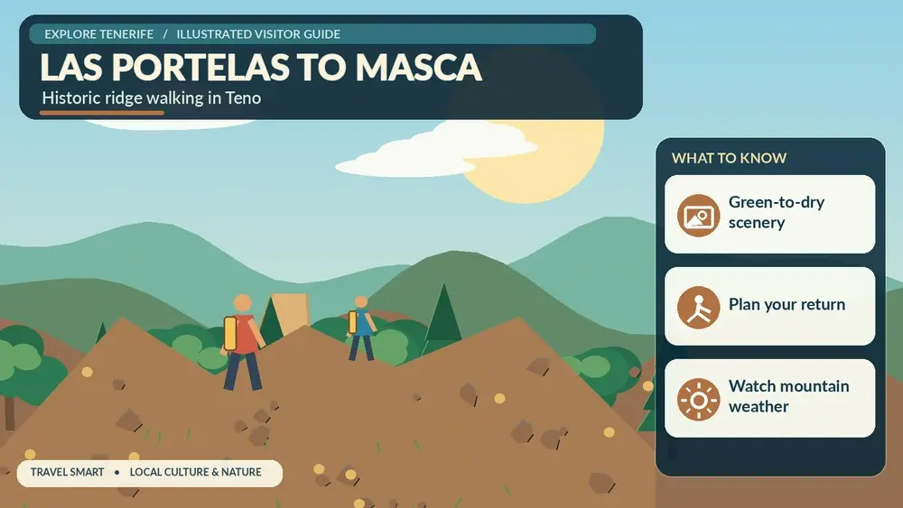
    Illustrated guide: PR-TF 59 Las Portelas–Masca Hiking, with practical visitor tips
    Illustrated guide: PR-TF 59 Las Portelas–Masca Hiking.

    2. The crossing of barranco las lubes and the climb toward the ridge

    Next, the crossing of Barranco Las Lubes and the climb toward the ridge. This is where I pay more attention to junctions. I do not follow another group automatically; people on the same path may be doing a different branch. I compare the painted PR marks, official map and the direction I saved before leaving.

    3. The high section where cloud and landscape can change within a short distance

    Higher or farther along, the high section where cloud and landscape can change within a short distance. The change in altitude usually becomes more obvious here through temperature, vegetation and views. I take a short food and water break before I feel tired rather than waiting until energy has already dropped.

    4. The descent into masca with increasingly dramatic ravine views

    For the final section, the descent into Masca with increasingly dramatic ravine views. I keep enough time and energy for the finish. A route is not complete when the best viewpoint is reached; it is complete when I am safely at the planned endpoint with transport still available.

    Navigation: what I trust

    I treat official waymarks and the current route description as primary. A phone map is useful, but downloaded user tracks can contain shortcuts, old closures or private crossings. Before setting out I save the official page, an offline map and the names of the start and finish in Spanish so I can ask for help clearly if needed.

    Masca Mountain Valley Tenerife

    At ambiguous junctions I stop rather than walking “just another ten minutes” in the hope that a marker appears. Ten wrong minutes downhill can become thirty tiring minutes when I have to climb back. This habit matters especially in laurel forest and cloud, where landmarks disappear quickly.

    Weather and microclimates

    Tenerife is small on a map but not climatically simple. I check the forecast for the actual altitude of the route, not only the nearest beach resort. North-facing forests can be cool and wet under trade-wind cloud while the south coast is sunny; exposed Teno ridges can be windy even when villages below feel calm.

    I also take calima seriously. Dust, heat and reduced visibility can turn an otherwise moderate route into a poor choice. After heavy rain, stone paths and steep descents deserve extra caution. When an official warning or closure is active, I change the plan instead of trying to “beat” the conditions.

    What I carry

    • Water with a reserve rather than the exact amount I expect to drink.
    • Food that is easy to eat in small portions while moving.
    • Closed hiking shoes or trail shoes with useful grip.
    • Sun protection even when the start is cloudy.
    • A light windproof or waterproof layer.
    • Offline map, charged phone and a small power bank on longer routes.
    • Basic first-aid items and any personal medication.

    I adjust the load to the route. A short two-hour trail does not need expedition gear, but a long day with major elevation deserves more water, insulation and contingency planning. I never let a light pack become an excuse to omit essentials.

    Transport and linear-route logistics

    This is a linear route, so I decide the return plan before starting. My preferred options are a verified bus connection, a pre-arranged taxi, two-car shuttle with experienced companions, or walking the route only when the return distance and daylight are realistic. I do not rely on finding a taxi signal at an isolated finish without checking coverage and local service first.

    TITSA timetables can change, and a route that looks easy on a map may involve infrequent rural services. I use my Tenerife bus guide for the system basics, then confirm the current timetable on the official operator site on the day of travel.

    Safety on stone paths, descents and exposed ground

    My main rule is to manage the descent as carefully as the climb. Loose gravel, polished stone and tired legs are a bad combination. I shorten my stride, keep space between hikers and never rush because someone behind me is faster. Trekking poles can help on long descents if I already know how to use them.

    I keep away from cliff edges and do not climb walls, roques or unstable volcanic features for photographs. If the signed route passes a road, I assume drivers may not expect hikers. I cross only where visibility is good and I do not stand in the carriageway while checking my phone.

    Nature and cultural landscape

    I try to read the route rather than treating it as exercise only. Tenerife paths often pass old terraces, water infrastructure, stone paving, pine forest, monteverde or volcanic terrain that records how people adapted to steep land. I leave walls, stones, plants and abandoned structures exactly as I find them.

    Protected status also affects behaviour. I stay on the route, do not pick flowers, do not stack stones and carry out every piece of rubbish. If I hike with a dog, I check the specific protected-area rules first rather than assuming the same rules apply everywhere on the island.

    Photography without slowing the route too much

    I prefer a few planned stops to constant phone checking. Wide views usually work best from signed viewpoints or safe open sections; forest scenes benefit from looking for layers, trunks and changing light rather than a single dramatic panorama. In cloud, I protect the phone or camera from moisture and keep moving if the temperature is dropping.

    I never step beyond a barrier or onto a fragile slope to remove foreground vegetation. The trail itself often gives a stronger sense of scale in the photograph, and keeping people on the path protects both the landscape and the image from becoming another invitation to trespass.

    Who I think this route suits

    The official difficulty grade is a starting point, not a guarantee. I compare it with distance, accumulated ascent and descent, exposure, altitude, surface and my recent activity level. A “low” difficulty route can still feel hard in heat; a “medium” route with large descent can punish knees; and a very high difficulty route needs specific endurance rather than general holiday fitness.

    For families I also consider whether every child is comfortable with the terrain and duration. I never use age alone as proof that a route is suitable. If the group is uncertain, I choose one of Tenerife’s shorter easy hikes and save the bigger trail for another day.

    My realistic day plan

    I eat before the start, arrive with water already filled and spend a few minutes confirming the first waymark. I walk the first third conservatively, take a short break before the main climb or descent, and keep the final third free of unnecessary detours. If I am ahead of schedule, I use the extra time for a safe viewpoint or café after the hike rather than extending onto an unsigned path.

    After finishing, I change out of wet clothing if needed, drink, eat something salty or substantial and only then decide whether another stop makes sense. Hiking days are better when the second half is flexible. A town walk or early dinner usually adds more than another rushed trail.

    Where I would stay

    For an early start I prefer a base in the same part of Tenerife rather than driving across the island before dawn. That reduces fatigue and makes it easier to react to local weather. I compare accommodation around Santiago del Teide, Tenerife when this trail is one of the main reasons for the trip.

    Official information I check before leaving

    The route page I use is Turismo de Tenerife’s official PR-TF 59 Las Portelas – Masca page. I check it again for status notices and then look at current Cabildo or Tenerife ON information if the route crosses a managed protected area. A blog article is useful for planning, but live access information always wins.

    Masca Valley Panoramic View Tenerife

    Common mistakes I avoid

    • Starting late because the distance looks short.
    • Using a coastal forecast for a mountain or forest route.
    • Assuming a linear trail will have easy transport at the finish.
    • Following another hiking group instead of reading my own waymarks.
    • Underestimating descent and knee fatigue.
    • Leaving the signed path for a photo or shortcut.
    • Depending on mobile signal instead of saving the route offline.
    • Ignoring a closure because an older GPX still shows the path.

    Frequently asked questions

    How long is PR-TF 59 Las Portelas – Masca?

    The current official route sheet lists 3.7 km and an estimated 2 hr. I use that time only as a planning reference and add margin for photographs, navigation, weather and the pace of the slowest person in the group.

    Do I need a permit?

    The current official route sheet lists no general hiking permit for this route. I still check for temporary closures, fire restrictions and protected-area notices before setting out.

    Can I do it in ordinary trainers?

    I prefer trail or hiking shoes with grip. Tenerife paths can include loose volcanic gravel, wet forest soil, stone paving and steep steps in the same outing. Footwear does not need to be heavy, but smooth soles make the route less forgiving.

    What if the weather turns?

    I use a predefined turnaround point and a local Plan B. If visibility, heat, rain or wind makes the route materially less safe, I turn back or switch plans. Finishing a particular trail is never more important than keeping enough margin to return safely.

    Masca Village And Gorge Tenerife

    Final thoughts

    I like this route because the landscape tells the geography lesson for me: the greener north and the drier Masca side can feel like different islands even though the walking distance is short.

    What I value most is not ticking off another PR number. It is understanding a different layer of Tenerife—forest, old roads, volcanic relief, rural settlements or the transition from mountain to coast. With current route information, sensible pacing and a flexible finish, this hike can add far more to a trip than a rushed list of viewpoints.

  • PR-TF 35 La Caldera–Mamio Hiking Guide: Easy Forest Loop in La Orotava

    PR-TF 35 La Caldera–Mamio Hiking Guide: Easy Forest Loop in La Orotava

    PR-TF 35 La Caldera – Mamio – La Caldera is a gentle forest route that mixes broad forestry track, cultivated slopes and Canarian pine without committing to a high-altitude Teide day. This is one of the routes I choose when I want forest atmosphere without the scale, exposure or logistics of a summit hike.

    I use the current Turismo de Tenerife route sheet as my technical baseline because trail status, closures and management advice can change. The official sheet currently lists 5.7 km, 2 hr 30 min, low difficulty and no as the permit requirement. I still check the page again on the morning of the hike rather than assuming a saved article is enough.

    Quick route facts

    Official route PR-TF 35 La Caldera – Mamio – La Caldera
    Start La Caldera recreation area
    Finish La Caldera recreation area
    Type Circular
    Distance 5.7 km
    Official duration 2 hr 30 min
    Difficulty Low
    Maximum altitude 1,200 m
    Minimum altitude 1,000 m
    Accumulated ascent 215.10 m
    Accumulated descent 215.10 m
    Protected area Corona Forestal Natural Park
    Permit No

    Why I like this route

    PR-TF 35 gives me a useful middle ground between a paved viewpoint and a serious mountain objective. The route starts high enough to feel cool and forested, but it never asks me to manage extreme altitude. The gentle forestry track at the beginning also gives me time to settle into the day before the path becomes more varied around Mamio and the cultivated slopes.

    The wider setting is La Orotava and the upper Orotava Valley. I plan the hike as part of that region, not as an isolated pin. Useful companion articles on this site include Orotava Valley guide Corona Forestal guide La Orotava travel guide GR-131 La Caldera to El Portillo guide. That gives me backup options if cloud, wind, heat or a closure makes the original route a poor choice.

    How the route unfolds

    1. The easy departure from la caldera on the mamio forest track

    At the beginning, the easy departure from La Caldera on the Mamio forest track. I deliberately start slower than my normal walking pace while I check the waymarking and how the ground feels. Tenerife trails can change from lane to stone path to forest track in a short distance, and the first ten minutes are the best time to correct a navigation mistake.

    2. The casa del agua area, where several signed routes meet

    Next, the Casa del Agua area, where several signed routes meet. This is where I pay more attention to junctions. I do not follow another group automatically; people on the same path may be doing a different branch. I compare the painted PR marks, official map and the direction I saved before leaving.

    3. The descent toward mamio through a more agricultural landscape

    Higher or farther along, the descent toward Mamio through a more agricultural landscape. The change in altitude usually becomes more obvious here through temperature, vegetation and views. I take a short food and water break before I feel tired rather than waiting until energy has already dropped.

    4. The climb beside barranco de los llanos and the return through forest

    For the final section, the climb beside Barranco de Los Llanos and the return through forest. I keep enough time and energy for the finish. A route is not complete when the best viewpoint is reached; it is complete when I am safely at the planned endpoint with transport still available.

    Navigation: what I trust

    I treat official waymarks and the current route description as primary. A phone map is useful, but downloaded user tracks can contain shortcuts, old closures or private crossings. Before setting out I save the official page, an offline map and the names of the start and finish in Spanish so I can ask for help clearly if needed.

    At ambiguous junctions I stop rather than walking “just another ten minutes” in the hope that a marker appears. Ten wrong minutes downhill can become thirty tiring minutes when I have to climb back. This habit matters especially in laurel forest and cloud, where landmarks disappear quickly.

    Weather and microclimates

    Tenerife is small on a map but not climatically simple. I check the forecast for the actual altitude of the route, not only the nearest beach resort. North-facing forests can be cool and wet under trade-wind cloud while the south coast is sunny; exposed Teno ridges can be windy even when villages below feel calm.

    I also take calima seriously. Dust, heat and reduced visibility can turn an otherwise moderate route into a poor choice. After heavy rain, stone paths and steep descents deserve extra caution. When an official warning or closure is active, I change the plan instead of trying to “beat” the conditions.

    What I carry

    • Water with a reserve rather than the exact amount I expect to drink.
    • Food that is easy to eat in small portions while moving.
    • Closed hiking shoes or trail shoes with useful grip.
    • Sun protection even when the start is cloudy.
    • A light windproof or waterproof layer.
    • Offline map, charged phone and a small power bank on longer routes.
    • Basic first-aid items and any personal medication.

    I adjust the load to the route. A short two-hour trail does not need expedition gear, but a long day with major elevation deserves more water, insulation and contingency planning. I never let a light pack become an excuse to omit essentials.

    Transport and linear-route logistics

    Because this route is circular, logistics are simpler: I can normally return to the same parking or bus area. That does not mean parking is guaranteed. I avoid blocking rural entrances or forest gates and I arrive with a backup place to park legally if the obvious spaces are full.

    TITSA timetables can change, and a route that looks easy on a map may involve infrequent rural services. I use my Tenerife bus guide for the system basics, then confirm the current timetable on the official operator site on the day of travel.

    Safety on stone paths, descents and exposed ground

    My main rule is to manage the descent as carefully as the climb. Loose gravel, polished stone and tired legs are a bad combination. I shorten my stride, keep space between hikers and never rush because someone behind me is faster. Trekking poles can help on long descents if I already know how to use them.

    I keep away from cliff edges and do not climb walls, roques or unstable volcanic features for photographs. If the signed route passes a road, I assume drivers may not expect hikers. I cross only where visibility is good and I do not stand in the carriageway while checking my phone.

    Nature and cultural landscape

    I try to read the route rather than treating it as exercise only. Tenerife paths often pass old terraces, water infrastructure, stone paving, pine forest, monteverde or volcanic terrain that records how people adapted to steep land. I leave walls, stones, plants and abandoned structures exactly as I find them.

    Protected status also affects behaviour. I stay on the route, do not pick flowers, do not stack stones and carry out every piece of rubbish. If I hike with a dog, I check the specific protected-area rules first rather than assuming the same rules apply everywhere on the island.

    Photography without slowing the route too much

    I prefer a few planned stops to constant phone checking. Wide views usually work best from signed viewpoints or safe open sections; forest scenes benefit from looking for layers, trunks and changing light rather than a single dramatic panorama. In cloud, I protect the phone or camera from moisture and keep moving if the temperature is dropping.

    I never step beyond a barrier or onto a fragile slope to remove foreground vegetation. The trail itself often gives a stronger sense of scale in the photograph, and keeping people on the path protects both the landscape and the image from becoming another invitation to trespass.

    Who I think this route suits

    The official difficulty grade is a starting point, not a guarantee. I compare it with distance, accumulated ascent and descent, exposure, altitude, surface and my recent activity level. A “low” difficulty route can still feel hard in heat; a “medium” route with large descent can punish knees; and a very high difficulty route needs specific endurance rather than general holiday fitness.

    For families I also consider whether every child is comfortable with the terrain and duration. I never use age alone as proof that a route is suitable. If the group is uncertain, I choose one of Tenerife’s shorter easy hikes and save the bigger trail for another day.

    My realistic day plan

    I eat before the start, arrive with water already filled and spend a few minutes confirming the first waymark. I walk the first third conservatively, take a short break before the main climb or descent, and keep the final third free of unnecessary detours. If I am ahead of schedule, I use the extra time for a safe viewpoint or café after the hike rather than extending onto an unsigned path.

    After finishing, I change out of wet clothing if needed, drink, eat something salty or substantial and only then decide whether another stop makes sense. Hiking days are better when the second half is flexible. A town walk or early dinner usually adds more than another rushed trail.

    Where I would stay

    For an early start I prefer a base in the same part of Tenerife rather than driving across the island before dawn. That reduces fatigue and makes it easier to react to local weather. I compare accommodation around La Orotava, Tenerife when this trail is one of the main reasons for the trip.

    Official information I check before leaving

    The route page I use is Turismo de Tenerife’s official PR-TF 35 La Caldera – Mamio – La Caldera page. I check it again for status notices and then look at current Cabildo or Tenerife ON information if the route crosses a managed protected area. A blog article is useful for planning, but live access information always wins.

    Common mistakes I avoid

    • Starting late because the distance looks short.
    • Using a coastal forecast for a mountain or forest route.
    • Assuming a linear trail will have easy transport at the finish.
    • Following another hiking group instead of reading my own waymarks.
    • Underestimating descent and knee fatigue.
    • Leaving the signed path for a photo or shortcut.
    • Depending on mobile signal instead of saving the route offline.
    • Ignoring a closure because an older GPX still shows the path.

    Frequently asked questions

    How long is PR-TF 35 La Caldera – Mamio – La Caldera?

    The current official route sheet lists 5.7 km and an estimated 2 hr 30 min. I use that time only as a planning reference and add margin for photographs, navigation, weather and the pace of the slowest person in the group.

    Do I need a permit?

    The current official route sheet lists no general hiking permit for this route. I still check for temporary closures, fire restrictions and protected-area notices before setting out.

    Can I do it in ordinary trainers?

    I prefer trail or hiking shoes with grip. Tenerife paths can include loose volcanic gravel, wet forest soil, stone paving and steep steps in the same outing. Footwear does not need to be heavy, but smooth soles make the route less forgiving.

    What if the weather turns?

    I use a predefined turnaround point and a local Plan B. If visibility, heat, rain or wind makes the route materially less safe, I turn back or switch plans. Finishing a particular trail is never more important than keeping enough margin to return safely.

    Final thoughts

    This is one of the routes I choose when I want forest atmosphere without the scale, exposure or logistics of a summit hike.

    What I value most is not ticking off another PR number. It is understanding a different layer of Tenerife—forest, old roads, volcanic relief, rural settlements or the transition from mountain to coast. With current route information, sensible pacing and a flexible finish, this hike can add far more to a trip than a rushed list of viewpoints.

  • Mirador de Garachico Guide: Volcanic History and North Tenerife Panorama

    Mirador de Garachico Guide: Volcanic History and North Tenerife Panorama

    Mirador de Garachico is a viewpoint I would include when I want to understand this part of Tenerife rather than simply collect another photo stop. It sits in San Juan del Reparo above Garachico, on or close to the road between Icod de los Vinos and Guía de Isora, and the official or municipal tourism information highlights a broad panorama over Garachico, the Atlantic coast and the ravine-like channels through which lava descended during the 1706 eruption.

    Few viewpoints explain Garachico’s history as directly: the height makes it easier to see how volcanic terrain, cliffs and settlement fit together. I plan the stop as part of Garachico, San Juan del Reparo and the TF-436/TF-82 mountain roads, not as a reason to cross the whole island for ten minutes. That keeps the day realistic and leaves time to respond to cloud, traffic and changing light.

    Quick planning facts

    ViewpointMirador de Garachico
    AreaSan Juan del Reparo above Garachico
    Road / positionthe road between Icod de los Vinos and Guía de Isora
    Landscapearound 460 metres above the north coast according to the municipal tourism description
    Main viewsa broad panorama over Garachico, the Atlantic coast and the ravine-like channels through which lava descended during the 1706 eruption
    ParkingI use only designated or clearly legal parking because the road is also a working mountain connection
    BusI check current TITSA options rather than assuming a stop directly at the viewpoint
    Accessibilityconditions can change with the venue and road, so I verify before relying on step-free access

    Why I would stop here

    The best Tenerife viewpoints do more than provide a wide angle. They explain the island. At Mirador de Garachico, I can compare elevation, vegetation, roads, towns and volcanic shapes in one frame. That makes the stop useful before visiting the places below because I arrive with a clearer mental map rather than following turn-by-turn navigation without understanding the landscape.

    I normally stay longer than the few minutes suggested by a quick road itinerary. Ten minutes is enough to photograph the view, but twenty to forty minutes gives cloud and light time to change. On Tenerife, a ridge hidden at arrival can appear suddenly, while a clear panorama can disappear behind cloud just as quickly.

    What I can see

    The main panorama includes a broad panorama over Garachico, the Atlantic coast and the ravine-like channels through which lava descended during the 1706 eruption. I look for layers instead of trying to identify every landmark immediately: foreground vegetation or rock, middle-distance towns and ridges, then the highest peaks or distant coast. This approach makes the view easier to understand and usually creates better photographs than zooming straight toward the most famous feature.

    Visibility is never guaranteed. Trade-wind cloud can cover the north and northeast, haze can soften the south, and calima can reduce long-distance contrast across the island. I treat a cloudy visit as a different landscape rather than automatically a failed one, but if the entire purpose of the stop is photography I check current weather, webcams where available and mountain conditions before driving up.

    Getting there

    Mirador de Garachico is associated with the road between Icod de los Vinos and Guía de Isora. Tenerife road distances can be misleading because bends, elevation and slower local traffic matter more than kilometres. I add margin to the navigation estimate and avoid scheduling a fixed attraction immediately after the viewpoint. On narrow or mountain roads I keep attention on driving and let passengers enjoy the scenery until I am safely parked.

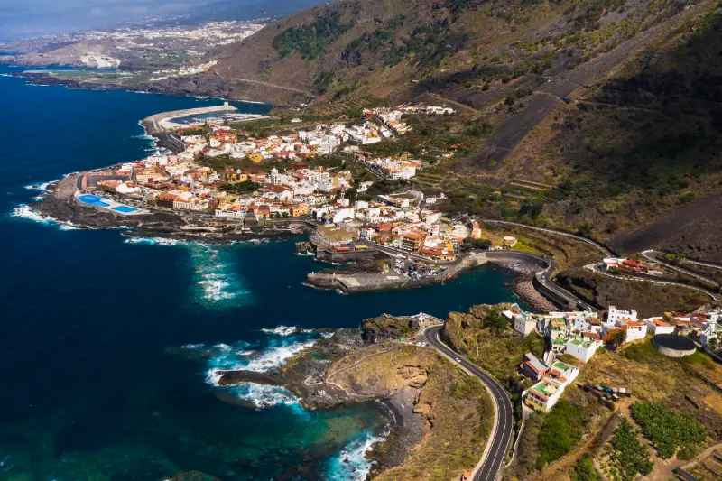
    Garachico Coast Aerial View Tenerife

    I use only designated or clearly legal parking because the road is also a working mountain connection. Even when parking is provided, I do not stop outside marked or obviously legal areas if the car park is full. Blocking a mountain road, farm entrance or bus movement for a photograph creates unnecessary risk. If the stop is busy, I either wait briefly or continue to another planned viewpoint.

    Public transport and no-car planning

    I check current titsa options rather than assuming a stop directly at the viewpoint. Where a bus stop exists, I still check the current TITSA timetable and the direction of the stop before relying on it. Mountain and rural services can be much less frequent than resort routes, and a missed connection can turn a short stop into a long wait.

    If there is no convenient stop, I do not improvise by walking along a road without a pavement. For a no-car trip, I would rather choose viewpoints connected to established trails or frequent bus corridors. The goal is not to prove that every place is possible without a car; it is to build a safe route around the places that genuinely work.

    Accessibility

    Conditions can change with the venue and road, so i verify before relying on step-free access. I treat this as a starting point, not a guarantee for every traveller. Gradients, kerbs, the distance from parking to the rail, toilet availability and the surface itself can determine whether a viewpoint is comfortable for someone using a wheelchair, walker or cane.

    Before travelling specifically for accessibility, I verify current conditions with the official site or local authority. Temporary works, parked vehicles or a closed terrace can change a visit even when the permanent infrastructure is described as adapted.

    Using the view to read Garachico’s volcanic history

    The 1706 eruption is central to Garachico’s story, but the useful part of this stop is spatial understanding. From above, I can better imagine lava descending from higher ground toward a coastal settlement and changing its harbour and urban geography. I avoid turning a destructive historical event into spectacle; the point is to connect the physical terrain with what happened to people, trade and the town.

    Best time of day

    I choose timing according to the direction of the view rather than repeating a generic “sunset is best” rule. Morning can bring cleaner air and quieter roads; afternoon can warm colours on ridges; sunset may be dramatic but can also put key features into silhouette. For valley and mountain viewpoints, cloud development is often more important than the clock.

    If photography matters, I would rather visit twice on a longer stay than wait hours for perfect light on a single day. Tenerife has strong microclimates. A disappointing first stop does not mean the viewpoint is overrated; it may simply mean the air mass and cloud level were wrong at that moment.

    Photography tips that actually help

    I start with a wide composition to show scale, then use a moderate zoom for layers of ridges, towns or volcanic cones. A polarising filter can sometimes help with glare, but it can also create uneven skies with very wide lenses, so I use it carefully. On a phone, I avoid excessive digital zoom and instead make several clean compositions that I can crop later.

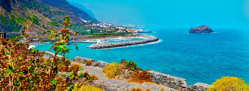
    Garachico’s volcanic shoreline and offshore rock seen from the viewpoint

    I keep the camera strap secure in strong wind and never cross a barrier to remove a foreground object. A railing or pine branch can become part of the composition. The best photograph is not worth standing on an unstable edge, stepping into the road or damaging vegetation.

    Weather, wind and cloud

    Conditions at around 460 metres above the north coast according to the municipal tourism description can differ sharply from the coast. I carry a light layer even when the beach is warm, and in winter I add something more substantial if the route climbs high. Wind is often the most noticeable factor because a temperature that seems mild can feel cold after several minutes in an exposed position.

    Cloud is equally important. Northern slopes frequently interact with the trade-wind layer, producing the famous sea of clouds at some elevations while covering lower valleys at others. In the south and east, haze or calima can be the bigger issue. I check the forecast for the actual elevation rather than using only a resort forecast.

    How long I would stay

    For a simple road stop I allow twenty to forty minutes. That is enough to park without rushing, read any interpretation, take photographs and actually look at the landscape. If there is a café, short trail or historical element, I extend the stop to an hour or more.

    I do not build a day around visiting ten viewpoints. After the third or fourth, the landscapes begin to blur together. My preference is two or three contrasting stops linked to towns, a walk, a meal or a museum. That produces stronger memories and much less driving.

    How I combine it with the rest of the day

    I would pair Mirador de Garachico with Garachico, San Juan del Reparo and the TF-436/TF-82 mountain roads. The important thing is geographical logic: I continue in the same area instead of zigzagging across Tenerife because another attraction looked close on a map.

    Garachico Coast And Natural Pools Tenerife

    If the weather changes, the viewpoint becomes the flexible part of the itinerary. I can shorten it, move it later or replace it with a town stop. This is one reason I like viewpoints: they add a high-value experience without requiring a fixed entrance slot.

    Food, toilets and practical stops

    I never assume a viewpoint has toilets, drinking water or an open café unless current information specifically confirms it. I use facilities in the nearest town before a long mountain section and carry water in the car. If a café is part of the site, I still check opening hours rather than treating it as guaranteed.

    For food, I prefer to connect the stop with a local town or market rather than eating only at roadside places. This turns the view into part of a broader regional day and spreads visitor spending more naturally across the communities I pass through.

    Safety at viewpoints

    Barriers, marked paths and parking rules are part of the experience, not obstacles to a photograph. I stay behind rails, keep children close near drops, and do not sit on walls above cliffs. Strong wind can affect balance and can also pull hats, phones or loose objects from my hands.

    I am especially careful when leaving a parking area. Some viewpoints sit on roads where traffic accelerates immediately after a bend. I look both ways, avoid standing in the carriageway and wait for a safe gap rather than trying to photograph from the road itself.

    Responsible visiting

    I take all rubbish away, keep noise low and avoid trampling vegetation to create a private photo spot. At rural viewpoints I also respect houses, farms and access tracks nearby. A viewpoint may be on a tourist map, but the surrounding area is often part of someone’s everyday working landscape.

    Drone use deserves extra caution because protected areas, airports, wildlife and local restrictions can make a seemingly empty viewpoint unsuitable or illegal for flying. I check current Spanish aviation rules and protected-area restrictions before bringing a drone into the plan.

    Common mistakes I would avoid

    • Driving across the island only for a five-minute stop.
    • Using a coastal weather forecast for a high-elevation viewpoint.
    • Parking on the road when the designated area is full.
    • Assuming a visible beach or trail is automatically safe or accessible.
    • Crossing barriers for an unobstructed photograph.
    • Trying to visit too many viewpoints in one day.

    Is Mirador de Garachico worth it?

    For me, yes when it fits the route. The value comes from context: Few viewpoints explain Garachico’s history as directly: the height makes it easier to see how volcanic terrain, cliffs and settlement fit together. I would not make a long cross-island detour solely to tick it off, but as part of Garachico, San Juan del Reparo and the TF-436/TF-82 mountain roads it adds perspective that a beach, town street or hiking trail cannot provide on its own.

    Garachico Historic Town Tenerife

    My final rule is to let conditions decide the length of the stop. If the view is clear and the light is changing, I stay. If cloud closes in completely or parking is chaotic, I move on without forcing the experience. Tenerife rewards flexible travel more than rigid checklists.

    Final planning checklist

    Before I leave, I check the road, weather at the correct elevation, daylight, any local closures and the next stop in the route. I carry water, sun protection and a layer, download the map in case coverage drops and keep enough fuel for mountain driving. That small amount of preparation lets me enjoy Mirador de Garachico as a landscape experience rather than another logistical problem.

  • Mirador de El Boquerón Guide: Valle Guerra, Tegueste and Anaga Views

    Mirador de El Boquerón Guide: Valle Guerra, Tegueste and Anaga Views

    Mirador de El Boquerón is a viewpoint I would include when I want to understand this part of Tenerife rather than simply collect another photo stop. It sits in San Cristóbal de La Laguna municipality, on or close to TF-156 around kilometre 2, and the official or municipal tourism information highlights Valle Guerra, Mesa de Tejina, Tejina, Tegueste, the Anaga massif, Punta del Hidalgo and its lighthouse.

    Recent volcanic features such as La Calderita and Valle Molina add a geological layer to what first looks like a purely agricultural panorama. I plan the stop as part of Tegueste, Valle Guerra and the Tacoronte-Acentejo wine area, not as a reason to cross the whole island for ten minutes. That keeps the day realistic and leaves time to respond to cloud, traffic and changing light.

    Quick planning facts

    ViewpointMirador de El Boquerón
    AreaSan Cristóbal de La Laguna municipality
    Road / positionTF-156 around kilometre 2
    Landscapethe agricultural northeast above Valle Guerra
    Main viewsValle Guerra, Mesa de Tejina, Tejina, Tegueste, the Anaga massif, Punta del Hidalgo and its lighthouse
    Parkingparking is available
    Busofficial tourism information does not list a bus stop at the viewpoint
    Accessibilityofficial tourism information lists adapted access

    Why I would stop here

    The best Tenerife viewpoints do more than provide a wide angle. They explain the island. At Mirador de El Boquerón, I can compare elevation, vegetation, roads, towns and volcanic shapes in one frame. That makes the stop useful before visiting the places below because I arrive with a clearer mental map rather than following turn-by-turn navigation without understanding the landscape.

    I normally stay longer than the few minutes suggested by a quick road itinerary. Ten minutes is enough to photograph the view, but twenty to forty minutes gives cloud and light time to change. On Tenerife, a ridge hidden at arrival can appear suddenly, while a clear panorama can disappear behind cloud just as quickly.

    What I can see

    The main panorama includes Valle Guerra, Mesa de Tejina, Tejina, Tegueste, the Anaga massif, Punta del Hidalgo and its lighthouse. I look for layers instead of trying to identify every landmark immediately: foreground vegetation or rock, middle-distance towns and ridges, then the highest peaks or distant coast. This approach makes the view easier to understand and usually creates better photographs than zooming straight toward the most famous feature.

    Anaga Laurel Forest Tenerife

    Visibility is never guaranteed. Trade-wind cloud can cover the north and northeast, haze can soften the south, and calima can reduce long-distance contrast across the island. I treat a cloudy visit as a different landscape rather than automatically a failed one, but if the entire purpose of the stop is photography I check current weather, webcams where available and mountain conditions before driving up.

    Getting there

    Mirador de El Boquerón is associated with TF-156 around kilometre 2. Tenerife road distances can be misleading because bends, elevation and slower local traffic matter more than kilometres. I add margin to the navigation estimate and avoid scheduling a fixed attraction immediately after the viewpoint. On narrow or mountain roads I keep attention on driving and let passengers enjoy the scenery until I am safely parked.

    Parking is available. Even when parking is provided, I do not stop outside marked or obviously legal areas if the car park is full. Blocking a mountain road, farm entrance or bus movement for a photograph creates unnecessary risk. If the stop is busy, I either wait briefly or continue to another planned viewpoint.

    Public transport and no-car planning

    Official tourism information does not list a bus stop at the viewpoint. Where a bus stop exists, I still check the current TITSA timetable and the direction of the stop before relying on it. Mountain and rural services can be much less frequent than resort routes, and a missed connection can turn a short stop into a long wait.

    If there is no convenient stop, I do not improvise by walking along a road without a pavement. For a no-car trip, I would rather choose viewpoints connected to established trails or frequent bus corridors. The goal is not to prove that every place is possible without a car; it is to build a safe route around the places that genuinely work.

    Accessibility

    Official tourism information lists adapted access. I treat this as a starting point, not a guarantee for every traveller. Gradients, kerbs, the distance from parking to the rail, toilet availability and the surface itself can determine whether a viewpoint is comfortable for someone using a wheelchair, walker or cane.

    Before travelling specifically for accessibility, I verify current conditions with the official site or local authority. Temporary works, parked vehicles or a closed terrace can change a visit even when the permanent infrastructure is described as adapted.

    Look beyond the scenery to the working landscape

    I do not treat the fields below as decorative background. The northeast has long been shaped by agriculture, and the mosaic of plots, villages and roads is part of the reason the panorama is interesting. I look for differences in elevation, crop patterns and settlement density. If I continue toward a market or winery, the viewpoint gives context to the produce I see later in the day.

    Best time of day

    I choose timing according to the direction of the view rather than repeating a generic “sunset is best” rule. Morning can bring cleaner air and quieter roads; afternoon can warm colours on ridges; sunset may be dramatic but can also put key features into silhouette. For valley and mountain viewpoints, cloud development is often more important than the clock.

    If photography matters, I would rather visit twice on a longer stay than wait hours for perfect light on a single day. Tenerife has strong microclimates. A disappointing first stop does not mean the viewpoint is overrated; it may simply mean the air mass and cloud level were wrong at that moment.

    Photography tips that actually help

    I start with a wide composition to show scale, then use a moderate zoom for layers of ridges, towns or volcanic cones. A polarising filter can sometimes help with glare, but it can also create uneven skies with very wide lenses, so I use it carefully. On a phone, I avoid excessive digital zoom and instead make several clean compositions that I can crop later.

    I keep the camera strap secure in strong wind and never cross a barrier to remove a foreground object. A railing or pine branch can become part of the composition. The best photograph is not worth standing on an unstable edge, stepping into the road or damaging vegetation.

    Weather, wind and cloud

    Conditions at the agricultural northeast above Valle Guerra can differ sharply from the coast. I carry a light layer even when the beach is warm, and in winter I add something more substantial if the route climbs high. Wind is often the most noticeable factor because a temperature that seems mild can feel cold after several minutes in an exposed position.

    Cloud is equally important. Northern slopes frequently interact with the trade-wind layer, producing the famous sea of clouds at some elevations while covering lower valleys at others. In the south and east, haze or calima can be the bigger issue. I check the forecast for the actual elevation rather than using only a resort forecast.

    How long I would stay

    For a simple road stop I allow twenty to forty minutes. That is enough to park without rushing, read any interpretation, take photographs and actually look at the landscape. If there is a café, short trail or historical element, I extend the stop to an hour or more.

    Anaga Laurel Forest Trail Tenerife

    I do not build a day around visiting ten viewpoints. After the third or fourth, the landscapes begin to blur together. My preference is two or three contrasting stops linked to towns, a walk, a meal or a museum. That produces stronger memories and much less driving.

    How I combine it with the rest of the day

    I would pair Mirador de El Boquerón with Tegueste, Valle Guerra and the Tacoronte-Acentejo wine area. The important thing is geographical logic: I continue in the same area instead of zigzagging across Tenerife because another attraction looked close on a map.

    If the weather changes, the viewpoint becomes the flexible part of the itinerary. I can shorten it, move it later or replace it with a town stop. This is one reason I like viewpoints: they add a high-value experience without requiring a fixed entrance slot.

    Food, toilets and practical stops

    I never assume a viewpoint has toilets, drinking water or an open café unless current information specifically confirms it. I use facilities in the nearest town before a long mountain section and carry water in the car. If a café is part of the site, I still check opening hours rather than treating it as guaranteed.

    For food, I prefer to connect the stop with a local town or market rather than eating only at roadside places. This turns the view into part of a broader regional day and spreads visitor spending more naturally across the communities I pass through.

    Safety at viewpoints

    Barriers, marked paths and parking rules are part of the experience, not obstacles to a photograph. I stay behind rails, keep children close near drops, and do not sit on walls above cliffs. Strong wind can affect balance and can also pull hats, phones or loose objects from my hands.

    Anaga Tenerife

    I am especially careful when leaving a parking area. Some viewpoints sit on roads where traffic accelerates immediately after a bend. I look both ways, avoid standing in the carriageway and wait for a safe gap rather than trying to photograph from the road itself.

    Responsible visiting

    I take all rubbish away, keep noise low and avoid trampling vegetation to create a private photo spot. At rural viewpoints I also respect houses, farms and access tracks nearby. A viewpoint may be on a tourist map, but the surrounding area is often part of someone’s everyday working landscape.

    Drone use deserves extra caution because protected areas, airports, wildlife and local restrictions can make a seemingly empty viewpoint unsuitable or illegal for flying. I check current Spanish aviation rules and protected-area restrictions before bringing a drone into the plan.

    Common mistakes I would avoid

    • Driving across the island only for a five-minute stop.
    • Using a coastal weather forecast for a high-elevation viewpoint.
    • Parking on the road when the designated area is full.
    • Assuming a visible beach or trail is automatically safe or accessible.
    • Crossing barriers for an unobstructed photograph.
    • Trying to visit too many viewpoints in one day.

    Is Mirador de El Boquerón worth it?

    For me, yes when it fits the route. The value comes from context: Recent volcanic features such as La Calderita and Valle Molina add a geological layer to what first looks like a purely agricultural panorama. I would not make a long cross-island detour solely to tick it off, but as part of Tegueste, Valle Guerra and the Tacoronte-Acentejo wine area it adds perspective that a beach, town street or hiking trail cannot provide on its own.

    My final rule is to let conditions decide the length of the stop. If the view is clear and the light is changing, I stay. If cloud closes in completely or parking is chaotic, I move on without forcing the experience. Tenerife rewards flexible travel more than rigid checklists.

    Final planning checklist

    Before I leave, I check the road, weather at the correct elevation, daylight, any local closures and the next stop in the route. I carry water, sun protection and a layer, download the map in case coverage drops and keep enough fuel for mountain driving. That small amount of preparation lets me enjoy Mirador de El Boquerón as a landscape experience rather than another logistical problem.

  • Roques de García Hiking Guide: Teide Trail 03 Loop

    Roques de García Hiking Guide: Teide Trail 03 Loop

    Roques de García Trail 03 is a route I choose when I want to experience Tenerife on foot rather than from a sequence of roadside viewpoints. The official trail information gives it a clear technical profile, but the real decision is whether the distance, altitude and logistics fit the day I actually have.

    Turismo de Tenerife currently lists the route at 3.5 km, about 2 hours, with low difficulty. The official profile reaches a maximum altitude of 2,187 m and a minimum of 2,025 m, with approximately about 211 m of accumulated ascent and about 215 m of descent. The current listing states the permit requirement as: No.

    Quick route facts

    RouteRoques de García Trail 03
    StartMirador de La Ruleta
    FinishMirador de La Ruleta
    Distance3.5 km
    Official durationabout 2 hours
    DifficultyLow
    Maximum altitude2,187 m
    Minimum altitude2,025 m
    Accumulated ascentabout 211 m
    Accumulated descentabout 215 m
    AuthorizationNo

    Why this trail is worth doing

    The interest goes beyond exercise. This route is connected with the classic loop around Roque Cinchado and the Roques de García formations. I like it because the landscape changes at walking speed, making volcanic textures, vegetation and relief much easier to understand than they are through a car window.

    Start and finish logistics

    It is circular, but parking and crowd levels still determine my start time.

    I save the official route page and an offline map before losing mobile signal. I never depend on finding a taxi at a remote finish without checking availability first.

    Difficulty in practical terms

    The official rating is low, but I translate that into conditions. Distance, cumulative ascent, altitude and exposure all matter. I would rather finish with energy left than choose a route only because the label sounds easy.

    Altitude and acclimatization

    Even routes that are technically straightforward can feel harder above 2,000 metres. I walk more slowly than at sea level, drink regularly and pay attention to headache, dizziness or unusual breathlessness. Persistent symptoms are a reason to descend.

    Best time of day

    I prefer an early start. Morning usually gives me more parking options, cooler conditions and a larger daylight margin. In Teide National Park I also avoid planning around sunset unless the return route and legal access conditions are completely clear.

    Official source and current status

    Before leaving I check the official Turismo de Tenerife trail page. The technical numbers above come from that listing, but temporary closures and restrictions can change after adverse weather or management work.

    Related guides on this site

    For broader planning I use my Mount Teide guide and Tenerife hiking permits and trail rules guide. Those pages cover the larger decisions that do not belong to one specific path.

    Mount Teide And Volcanic Landscape Tenerife

    How I would plan this route in a real Tenerife itinerary

    I would not treat Roques de García Trail 03 as an isolated line on a hiking map. The route makes most sense when I understand the wider Teide and Tenerife highland landscape, the direction of travel and what happens after the walk. I decide the start time from daylight and weather rather than from how early I can leave the hotel.

    The transport plan matters as much as the walking plan. It is circular, but parking and crowd levels still determine my start time. I save the route map offline, carry enough water for a delay and tell someone where I expect to finish. On Tenerife, a route can feel straightforward until cloud, wind or a closed access road changes the pace.

    What I pack

    • Shoes with reliable grip rather than smooth city trainers.
    • Water carried from the start, even when a visitor centre or cafe is nearby.
    • Sun protection: high-SPF sunscreen, hat and sunglasses.
    • A light warm or windproof layer because altitude can change conditions quickly.
    • Offline map, charged phone and a small power bank.
    • Food that does not depend on finding an open bar at the finish.

    The main risk I keep in mind here is altitude, sun exposure and loose volcanic surfaces. I do not use the official difficulty label as a substitute for judgement. A route classified as low or medium can still be a poor choice in strong wind, heat, fog or after a night of little sleep.

    Illustrated guide: Roques de García Hiking, with practical visitor tips
    Illustrated guide: Roques de García Hiking.

    How I avoid turning a good walk into an overpacked day

    After the route I usually choose one nearby stop rather than three. Cañada Blanca rather than another crowded roadside stop A relaxed meal, a viewpoint or a short museum visit is often a better finish than racing across the island for another major attraction.

    I also leave a buffer before sunset. Mountain roads are slower after dark, and the most exposed stretches can feel very different once the light disappears. If the route takes longer than expected, the buffer is what keeps the return calm.

    Trail etiquette and conservation

    I stay on the marked line, carry every piece of rubbish out and avoid cutting switchbacks. Volcanic soils and high-mountain vegetation recover slowly from trampling. I never collect stones, pumice, flowers or archaeological material, even when an object looks abundant.

    When I meet other walkers on a narrow section, I step aside only where doing so does not damage vegetation or create a fall risk. I keep music off and let the landscape remain the main experience.

    Weather checks I make on the same morning

    I check wind, temperature and cloud at the route altitude rather than relying on the forecast for the coast. Tenerife can be sunny at sea level while the high road is cold, cloudy or temporarily restricted. I also look for official closure notices after snow, wildfire, heavy rain or maintenance.

    If the official manager recommends avoiding the trail, I change the plan. A holiday itinerary is not a reason to override a closure or safety warning.

    Who I think this route suits

    I recommend Roques de García Trail 03 to travellers who enjoy walking as a way of understanding landscape rather than simply collecting viewpoints. The best pace leaves time to notice geology, plants and changes in altitude. I would choose a shorter alternative for anyone uncomfortable with the specific exposure or distance described above.

    My final planning rule

    I make the decision to turn around before I need to. If wind strengthens, visibility disappears, a walker in the group is struggling or water is being used faster than expected, I shorten the day. That judgement is part of good hiking, not a failed itinerary.

    What the landscape teaches me

    One of the best reasons to walk here is to see how quickly Tenerife changes with altitude. Lava flows of different ages, pumice, erosion surfaces and tough high-mountain plants create a landscape that can look empty from the road but becomes detailed on foot.

    I stop for photographs only where the path is wide enough to do so safely. I avoid stepping onto fragile plants or loose slopes for a better angle.

    Common mistakes I avoid

    • Starting too late because the distance looks short.
    • Carrying too little water because temperatures feel cool at the trailhead.
    • Treating a low technical rating as permission to ignore wind or altitude.
    • Assuming mobile signal will solve transport at the finish.
    • Leaving the marked trail to shorten a bend or reach a photo spot.
    • Failing to re-check the route after unusual weather.

    A realistic finish to the day

    After the hike I keep the rest of the schedule light. A visitor centre, meal or scenic drive back to the accommodation is enough. The mountains are more enjoyable when I do not spend the final hour racing the clock.

    Extra planning notes from experience

    I keep the itinerary flexible enough to react to Tenerife’s microclimates. A cloudy morning on one slope does not always mean the entire island is unsuitable, but I do not use that fact to justify ignoring a warning in the exact place I plan to visit. Local conditions always win over a generic forecast.

    I also distinguish between access being physically possible and access being officially open. Gates, signs and management notices take priority over an old blog post, saved map or social-media photo.

    What makes a visit feel less rushed

    I build in time for parking, toilets, a slow lunch and an unexpected viewpoint. These are not wasted minutes. They are what allow the day to remain enjoyable when a bus is late, a car park is full or the weather improves and I decide to stay longer.

    Roque Cinchado Trail Teide National Park Tenerife

    For families or mixed-ability groups I plan around the least experienced walker rather than the strongest. Splitting a group in unfamiliar terrain creates more problems than it solves.

    Responsible travel

    I use marked paths and public spaces, take litter away, keep noise low and support local businesses when I stop for food or supplies. In protected areas I treat every closure and conservation rule as part of the experience, not as an obstacle to it.

    That approach is one reason I prefer a smaller number of well-planned stops. Tenerife rewards attention. The island is far more memorable when I understand why a place looks and feels different instead of simply adding another pin to a map.

  • Teide Trail 39 Guide: Cable Car Base, Montaña Blanca and Minas de San José

    Teide Trail 39 Guide: Cable Car Base, Montaña Blanca and Minas de San José

    Teide Trail 39 Guide is a useful example of why I do not judge a Teide hike by distance alone. The official route is 7.05 km total (3.91 km + 3.14 km), but its real character comes from where it starts, what it connects to and the kind of volcanic ground it crosses.

    The feature that makes this trail worth a separate guide is a practical east–west connector that avoids walking on the TF-21 between the cable-car sector, Montaña Blanca and Minas de San José. I use the current information from the Parque Nacional del Teide managing authority as the technical baseline, then check it again close to the hiking date because access rules and temporary closures can change.

    Quick route facts

    Official routePNT 39 A + PNT 39 B
    StartMajúa opposite the Teide cable-car base
    FinishMinas de San José
    TypeLinear, two official sections
    Distance7.05 km total (3.91 km + 3.14 km)
    Official timeAbout 1 hr 40 min official section times combined
    DifficultyLow
    Maximum altitude2,365 m across the two sections
    Minimum altitudeabout 2,213 m across the two sections
    Accumulated ascentNot published as a combined figure on the current official sheets
    Accumulated descentNot published as a combined figure on the current official sheets
    Reservation / permitNo reservation for PNT 39 A or B

    Why this route deserves its own guide

    Section A crosses the Montaña Blanca lava landscape from Majúa, while section B continues around the base of the dome toward the former pumice-mining area at Minas de San José. Together they make more sense than either section viewed in isolation.

    This is also why I would not treat the route as “just another Teide trail”. Each numbered path answers a different practical question. Some give access to a viewpoint, some join two major routes, and others preserve an old island crossing that makes much more sense when you understand where people were travelling before the modern road network.

    For planning a wider day, useful related guides are Montaña Blanca Trail 07 guide; Sanatorio Trail 16 guide; Majúa Trail 19 guide; Los Valles Trail 30 guide. I prefer linking one main walk with a small number of compatible stops rather than stacking several trails simply because they appear close together on the map.

    The route step by step

    1. Majúa opposite the cable-car base

    At Majúa opposite the cable-car base, I would first confirm that the physical trail number matches the route saved offline. The Teide network has many junctions that are obvious on a map but visually subtle on open volcanic ground. I use the first ten minutes to settle into a deliberately easy pace, check wind exposure and make sure the surface matches what I expected.

    2. PNT 39 A across the lava toward Montaña Blanca

    The section around PNT 39 A across the lava toward Montaña Blanca is where the route begins to show its specific identity: a practical east–west connector that avoids walking on the TF-21 between the cable-car sector, Montaña Blanca and Minas de San José. I keep looking backwards as well as forwards because reverse views are useful for orientation, especially if the same line will form part of the return. I stay on the official tread even where footprints appear to cut across the volcanic surface.

    3. the Montaña Blanca junction zone

    By the Montaña Blanca junction zone, I make a second logistics check: remaining water, daylight and the exact exit plan. This is more useful than comparing my pace with an app. On short connector trails, it is easy to forget that most of the day may lie on the approach or the trail used after the official endpoint.

    4. PNT 39 B to Minas de San José

    Near PNT 39 B to Minas de San José, I slow down rather than rushing the finish. Junctions deserve full attention because the next trail can have very different difficulty or access rules. I confirm the route number before continuing and keep enough energy for whatever connection, return walk or road transfer is still needed.

    The single planning detail I would solve first

    PNT 39 itself is free-access, but connecting onto PNT 07 toward La Rambleta is a separate route with its own current access rules. Do not assume PNT 39 permission covers the upper mountain.

    I turn that point into a concrete plan before driving into the park. I save the start and finish as separate locations, note every connecting trail number and decide exactly how I will return to the vehicle or reach public transport. If the official endpoint is another trail rather than a road, the connection is part of the day even though it is not included in the distance in the table above.

    How difficult is it in practice?

    The managing authority rates this route Low. I read that grade together with altitude, exposure and surface. A low-rated trail at roughly 2,000–2,400 metres is still very different from an easy promenade at sea level: ultraviolet radiation is stronger, shade is scarce and a dry wind can make dehydration surprisingly fast.

    Roque Cinchado Roques De Garcia Tenerife

    The typical surface here is broad volcanic path, lava fields and pale pumice around Montaña Blanca. Loose picón and pumice can make a gentle slope more tiring, while rough lava demands attention even when the statistics look modest. I use trail footwear with grip, slow down on unstable sections and avoid creating a shortcut when the official path bends around fragile ground.

    Altitude, sun and wind

    I treat the highlands as mountain terrain even on the shortest trails. Before leaving the car I already have water in me, not only in the backpack. I carry a hat, sunglasses, sunscreen, a windproof layer and an insulating layer because conditions can change quickly once a cloud edge or stronger wind arrives.

    Headache, unusual breathlessness, dizziness, nausea or loss of coordination are not symptoms I would ignore just because the route is short. If someone feels progressively worse, I stop and reassess rather than trying to “finish the last kilometre”. Distance on the map does not cancel the effect of altitude.

    Weather: use a mountain forecast

    I never use the weather in Costa Adeje, Los Cristianos or Puerto de la Cruz as the forecast for this hike. The national park can sit above a sea of clouds, or it can be cold and windy while the coast is warm. Snow, ice, calima, heat and strong wind can all change the appropriate plan.

    Visibility matters as much as temperature. Some of these trails cross very open ground where landmarks normally make navigation obvious; cloud or blowing dust removes that advantage. If the official authority posts a closure or restriction, that overrides an old GPX track, review or social-media post.

    Access and permits

    Current access: No reservation for PNT 39 A or B. I still check the managing authority immediately before setting out. A free-access trail can close temporarily because of weather, wildfire risk, conservation work or other management measures, and a connecting trail can have different rules.

    I separate three questions: whether this numbered trail needs a reservation, whether the road or forest track used to reach it is open, and whether a connecting trail has its own controls. That distinction is especially important around Montaña Blanca, La Rambleta and summit routes, where adjacent paths can have different access systems.

    Getting there and finishing the walk

    Parking is one of the easiest parts of a Teide plan to underestimate. I use legal spaces only and avoid building a schedule that requires a specific roadside bay to be free. On linear routes I prefer a two-car plan, a confirmed bus/taxi arrangement where practical, or a route combination that naturally returns to the vehicle.

    If an early mountain start is important, I sometimes compare places to stay in Tenerife based on the road I need the next morning rather than simply choosing the nearest beach. A base on the wrong side of the island can add a long pre-dawn drive to an otherwise short hike.

    What to notice in the landscape

    Teide becomes much more interesting when I stop treating every dark rock as “lava”. Pumice fields, oxidised cones, scoria, compact flows and younger black volcanic materials tell different parts of the eruptive story. The colour and texture underfoot often explain why vegetation density changes within a few hundred metres.

    Mount Teide And Volcanic Landscape Tenerife

    I also look at scale. The same cone can appear small from the road and enormous once the route passes its base. Teide and Pico Viejo shift position through the day, and the caldera wall can feel like a continuous barrier until a trail reveals one of the old passes used by people moving between valleys.

    Conservation: the path is part of the protection

    I stay on the marked tread even when an informal line looks shorter. High-mountain plants grow slowly and footprints can remain visible for a long time in pumice or ash. I leave rocks, obsidian-like fragments, plants and volcanic material where they are and carry out every piece of food waste.

    Caves and lava tubes deserve extra care. If an official description says access is restricted, I treat that as a firm boundary rather than an invitation to look for another entrance. Protected subterranean habitats can be damaged by very little disturbance.

    What I pack for a short Teide trail

    • Water for the complete outing, not only the numbered section.
    • Sun hat, sunglasses and high-protection sunscreen.
    • Windproof shell and a warm layer.
    • Trail or hiking shoes with good grip.
    • Offline map and a screenshot of the official route information.
    • Charged phone and a small power bank on longer combinations.
    • Food and a reserve snack, with all packaging carried back out.

    Best time of day

    I generally prefer morning. It gives a larger daylight reserve, usually makes parking easier and provides cooler conditions on exposed volcanic ground. It also leaves time to change the plan if a road, trail or weather condition is not what I expected.

    Late afternoon can be excellent for low-angle light, especially on cones and the caldera wall, but I only choose it when the finish is simple and I know the legal parking or transport arrangement will still work. I do not chase sunset at the cost of returning in darkness on unfamiliar volcanic terrain.

    Can this work for families?

    The official grade is only one part of the answer. I think about altitude tolerance, experience on loose terrain, wind and whether the route is a simple out-and-back or one piece of a larger traverse. For a family’s first day at Teide, I would rather choose a short route with an easy exit and add a viewpoint than commit to a complicated linear itinerary.

    With children I plan more drink stops and carry extra warm clothing. I also keep the group especially close near roads and trail junctions, where the risk is often traffic or taking the wrong connection rather than a dramatic mountain obstacle.

    How I would combine it with other Teide sights

    One real hike plus one or two easy interpretive stops usually makes a better day than a checklist. El Portillo, Cañada Blanca, Roques de García, Minas de San José and selected roadside viewpoints can add context without requiring another full route. Which one fits depends on the side of the park where this trail finishes.

    Driving distances inside the national park are deceptive because traffic, viewpoint stops and slow vehicles can stretch the schedule. After a substantial trail I leave a generous margin for the descent from the mountains instead of booking a tightly timed attraction on the coast.

    Photography without leaving the route

    The best images often come from the official path because scale is the story. A person walking through a pumice field or beneath a cone communicates the size of the landscape better than stepping onto untouched ground for a cleaner foreground. A moderate telephoto lens is useful for isolating crater rims, lava fronts and layers of the caldera.

    I do not assume drone use is allowed simply because an area looks empty. Protected-area aviation and filming rules are separate from pedestrian trail access, so I would check them independently before carrying equipment for that purpose.

    Common mistakes to avoid

    • Reading the official distance but forgetting the approach and exit trails.
    • Using a beach forecast for a 2,000-metre hike.
    • Assuming “low difficulty” means no mountain preparation is needed.
    • Walking along a busy road because a linear route was not planned properly.
    • Following an old GPX track after official access rules have changed.
    • Parking outside marked areas when the preferred trailhead is full.
    • Taking pumice, lava or plants as souvenirs.
    • Entering restricted caves or leaving the marked path for photographs.

    Official sources to check before you go

    The technical data in this guide are based on the current managing-authority pages: Government of the Canary Islands – PNT 39 A; Government of the Canary Islands – PNT 39 B. Those pages are the first place I would check again for closures, access changes or updated technical figures immediately before a hike.

    Frequently asked questions

    Do I need a permit?

    No reservation for PNT 39 A or B. That answer applies to this trail itself; a connected route can have different rules.

    Is the official time a target?

    No. I use the official About 1 hr 40 min official section times combined as a planning reference, then add pauses, route checks and any approach or exit distance. Photography, wind and unfamiliar loose terrain can all lengthen the outing.

    Can I do it in trainers?

    Trail shoes are my preference. Even a short official path can contain pumice, loose scoria or sharp lava where smooth city shoes are uncomfortable and less secure.

    Is mobile coverage guaranteed?

    No. I download the route information and keep the phone charged rather than relying on live mapping. On a longer combination I also tell someone the planned start, finish and approximate return time.

    Final thoughts

    PNT 39 A + PNT 39 B is useful precisely because it shows a part of the park that the road alone cannot explain. The route becomes much more rewarding when its geology, historical connections and logistics are understood before setting out. I would keep the plan simple, respect the official network and leave enough time to look at the landscape rather than spending the day solving preventable transport or navigation problems.