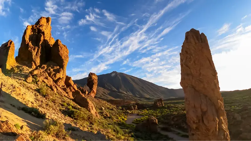
Roques de García Trail 03 is a route I choose when I want to experience Tenerife on foot rather than from a sequence of roadside viewpoints. The official trail information gives it a clear technical profile, but the real decision is whether the distance, altitude and logistics fit the day I actually have.
Turismo de Tenerife currently lists the route at 3.5 km, about 2 hours, with low difficulty. The official profile reaches a maximum altitude of 2,187 m and a minimum of 2,025 m, with approximately about 211 m of accumulated ascent and about 215 m of descent. The current listing states the permit requirement as: No.
Quick route facts
| Route | Roques de García Trail 03 |
|---|---|
| Start | Mirador de La Ruleta |
| Finish | Mirador de La Ruleta |
| Distance | 3.5 km |
| Official duration | about 2 hours |
| Difficulty | Low |
| Maximum altitude | 2,187 m |
| Minimum altitude | 2,025 m |
| Accumulated ascent | about 211 m |
| Accumulated descent | about 215 m |
| Authorization | No |
Why this trail is worth doing
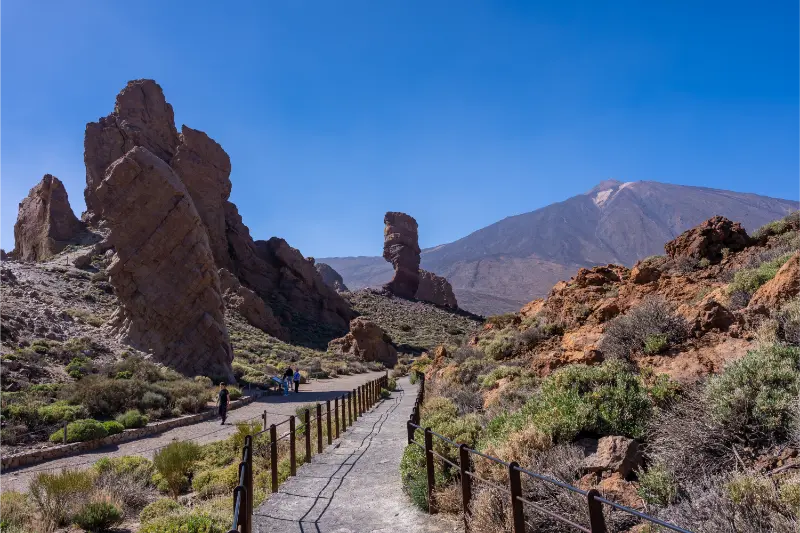
The interest goes beyond exercise. This route is connected with the classic loop around Roque Cinchado and the Roques de García formations. I like it because the landscape changes at walking speed, making volcanic textures, vegetation and relief much easier to understand than they are through a car window.
Start and finish logistics
It is circular, but parking and crowd levels still determine my start time.
I save the official route page and an offline map before losing mobile signal. I never depend on finding a taxi at a remote finish without checking availability first.
Difficulty in practical terms
The official rating is low, but I translate that into conditions. Distance, cumulative ascent, altitude and exposure all matter. I would rather finish with energy left than choose a route only because the label sounds easy.
Altitude and acclimatization
Even routes that are technically straightforward can feel harder above 2,000 metres. I walk more slowly than at sea level, drink regularly and pay attention to headache, dizziness or unusual breathlessness. Persistent symptoms are a reason to descend.
Best time of day
I prefer an early start. Morning usually gives me more parking options, cooler conditions and a larger daylight margin. In Teide National Park I also avoid planning around sunset unless the return route and legal access conditions are completely clear.
Official source and current status
Before leaving I check the official Turismo de Tenerife trail page. The technical numbers above come from that listing, but temporary closures and restrictions can change after adverse weather or management work.
Related guides on this site
For broader planning I use my Mount Teide guide and Tenerife hiking permits and trail rules guide. Those pages cover the larger decisions that do not belong to one specific path.

How I would plan this route in a real Tenerife itinerary
I would not treat Roques de García Trail 03 as an isolated line on a hiking map. The route makes most sense when I understand the wider Teide and Tenerife highland landscape, the direction of travel and what happens after the walk. I decide the start time from daylight and weather rather than from how early I can leave the hotel.
The transport plan matters as much as the walking plan. It is circular, but parking and crowd levels still determine my start time. I save the route map offline, carry enough water for a delay and tell someone where I expect to finish. On Tenerife, a route can feel straightforward until cloud, wind or a closed access road changes the pace.
What I pack
- Shoes with reliable grip rather than smooth city trainers.
- Water carried from the start, even when a visitor centre or cafe is nearby.
- Sun protection: high-SPF sunscreen, hat and sunglasses.
- A light warm or windproof layer because altitude can change conditions quickly.
- Offline map, charged phone and a small power bank.
- Food that does not depend on finding an open bar at the finish.
The main risk I keep in mind here is altitude, sun exposure and loose volcanic surfaces. I do not use the official difficulty label as a substitute for judgement. A route classified as low or medium can still be a poor choice in strong wind, heat, fog or after a night of little sleep.
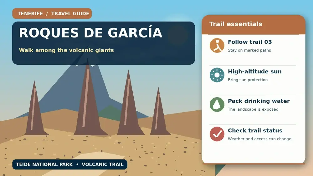
How I avoid turning a good walk into an overpacked day
After the route I usually choose one nearby stop rather than three. Cañada Blanca rather than another crowded roadside stop A relaxed meal, a viewpoint or a short museum visit is often a better finish than racing across the island for another major attraction.
I also leave a buffer before sunset. Mountain roads are slower after dark, and the most exposed stretches can feel very different once the light disappears. If the route takes longer than expected, the buffer is what keeps the return calm.
Trail etiquette and conservation
I stay on the marked line, carry every piece of rubbish out and avoid cutting switchbacks. Volcanic soils and high-mountain vegetation recover slowly from trampling. I never collect stones, pumice, flowers or archaeological material, even when an object looks abundant.
When I meet other walkers on a narrow section, I step aside only where doing so does not damage vegetation or create a fall risk. I keep music off and let the landscape remain the main experience.
Weather checks I make on the same morning
I check wind, temperature and cloud at the route altitude rather than relying on the forecast for the coast. Tenerife can be sunny at sea level while the high road is cold, cloudy or temporarily restricted. I also look for official closure notices after snow, wildfire, heavy rain or maintenance.
If the official manager recommends avoiding the trail, I change the plan. A holiday itinerary is not a reason to override a closure or safety warning.
Who I think this route suits
I recommend Roques de García Trail 03 to travellers who enjoy walking as a way of understanding landscape rather than simply collecting viewpoints. The best pace leaves time to notice geology, plants and changes in altitude. I would choose a shorter alternative for anyone uncomfortable with the specific exposure or distance described above.
My final planning rule
I make the decision to turn around before I need to. If wind strengthens, visibility disappears, a walker in the group is struggling or water is being used faster than expected, I shorten the day. That judgement is part of good hiking, not a failed itinerary.
What the landscape teaches me
One of the best reasons to walk here is to see how quickly Tenerife changes with altitude. Lava flows of different ages, pumice, erosion surfaces and tough high-mountain plants create a landscape that can look empty from the road but becomes detailed on foot.
I stop for photographs only where the path is wide enough to do so safely. I avoid stepping onto fragile plants or loose slopes for a better angle.
Common mistakes I avoid
- Starting too late because the distance looks short.
- Carrying too little water because temperatures feel cool at the trailhead.
- Treating a low technical rating as permission to ignore wind or altitude.
- Assuming mobile signal will solve transport at the finish.
- Leaving the marked trail to shorten a bend or reach a photo spot.
- Failing to re-check the route after unusual weather.
A realistic finish to the day
After the hike I keep the rest of the schedule light. A visitor centre, meal or scenic drive back to the accommodation is enough. The mountains are more enjoyable when I do not spend the final hour racing the clock.
Extra planning notes from experience
I keep the itinerary flexible enough to react to Tenerife’s microclimates. A cloudy morning on one slope does not always mean the entire island is unsuitable, but I do not use that fact to justify ignoring a warning in the exact place I plan to visit. Local conditions always win over a generic forecast.
I also distinguish between access being physically possible and access being officially open. Gates, signs and management notices take priority over an old blog post, saved map or social-media photo.
What makes a visit feel less rushed
I build in time for parking, toilets, a slow lunch and an unexpected viewpoint. These are not wasted minutes. They are what allow the day to remain enjoyable when a bus is late, a car park is full or the weather improves and I decide to stay longer.
For families or mixed-ability groups I plan around the least experienced walker rather than the strongest. Splitting a group in unfamiliar terrain creates more problems than it solves.
Responsible travel
I use marked paths and public spaces, take litter away, keep noise low and support local businesses when I stop for food or supplies. In protected areas I treat every closure and conservation rule as part of the experience, not as an obstacle to it.
That approach is one reason I prefer a smaller number of well-planned stops. Tenerife rewards attention. The island is far more memorable when I understand why a place looks and feels different instead of simply adding another pin to a map.