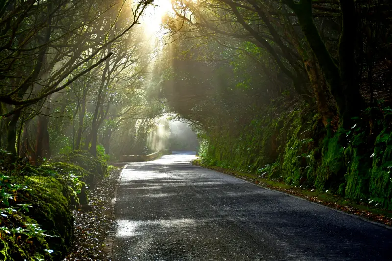
Taborno is one of the Anaga settlements I would choose when I want mountain scenery and a real walk rather than a quick roadside viewpoint. The village sits high in the massif with dramatic ridges around it, and the nearby Roque de Taborno gives the landscape a distinctive profile that has led travellers to compare it loosely with a miniature Matterhorn.
I would keep that nickname in perspective. The reason to come is not to chase a comparison with the Alps; it is to experience Anaga’s steep volcanic relief, small rural settlements and paths that move between cloud forest, ridges and deep valleys.
Why Taborno is worth a dedicated stop
Many visitors drive through Anaga focusing only on famous viewpoints and the coast. Taborno rewards a slower approach. It is small enough that I do not need a long sightseeing checklist, but the setting invites walking and gives a better sense of how people live in the interior of the massif.
Official trail context
Tenerife’s official tourism information describes the PR-TF 2 route from Taborno toward Pico del Inglés and Valleseco as about 10 km, around 4 hours 30 minutes, with medium difficulty and substantial descent. That is a useful reminder that apparently short mountain distances in Anaga can involve serious elevation change.

I check the current trail status before departure. A route description is not a guarantee that every section is open after rain, maintenance or conservation measures.
Roque de Taborno: viewpoints and caution
The roque dominates the local landscape, and several paths provide views around the area. I do not encourage scrambling on exposed ground simply for a photograph. Anaga rock can be slippery when damp, and cloud can reduce visibility quickly. I stay on established paths and turn around if the terrain feels beyond my comfort level.
Getting to Taborno
Driving requires patience. The road network in Anaga is narrow and winding, and local traffic may need space to pass. I do not use roadside lay-bys as photo studios if they are needed for passing or access.
Public transport can be a good choice for walkers because a linear route becomes easier when I do not need to return to a parked car. The trade-off is that I must know the current bus timetable and build a generous margin for the return.
Weather
Taborno can sit in or near the cloud layer. A clear morning can become misty and cool; a grey ridge can open suddenly to huge views. I carry a light waterproof, sun protection and enough water for the full outing. I also expect paths to be muddy after wet weather.
A realistic first visit
- Arrive in the morning before the roads and parking feel busy.
- Spend a few minutes orienting yourself in the village.
- Choose a signed walk that fits your available daylight and fitness.
- Stop often for views instead of treating the route as a speed challenge.
- Return with enough energy for the drive or bus journey out of Anaga.
Taborno versus Chinamada
Both places offer rural Anaga, but I experience them differently. Chinamada is especially interesting for its inhabited cave-house tradition and the route toward Punta del Hidalgo. Taborno feels more immediately dominated by ridge scenery and the roque. If I have two Anaga days, I would give each its own space rather than rushing both.
My Chinamada guide explains that alternative in more detail.
Food and services
I do not assume a small mountain village will have the same opening patterns as a resort. I bring water and a snack even if I plan to eat locally. If a bar or restaurant is open, I see it as part of the experience rather than something guaranteed by a fixed itinerary.
Photography
Wide-angle views work well, but the strongest images often include the relationship between houses, paths and volcanic relief. I avoid drones unless I have confirmed all current rules and restrictions; protected landscapes and aviation zones can make drone use complicated.
Who I recommend Taborno to
It is excellent for hikers, photographers and repeat visitors who already know Tenerife’s main attractions. It is less suitable for someone who wants a flat, accessible walk or a large concentration of restaurants and shops.
Common mistakes
- Underestimating elevation change on Anaga routes.
- Starting too late in the day.
- Relying on summer coast temperatures when choosing clothing.
- Parking where local vehicles cannot pass.
- Walking onto exposed terrain for a better photo.
- Assuming every online GPX track is currently recommended.
Frequently asked questions
Is Taborno a good day trip?
Yes, particularly as part of an Anaga hiking day. I would combine it with only one or two other stops so the mountain roads do not dominate the schedule.
Is the PR-TF 2 easy?
Official information rates the route as medium difficulty and notes significant elevation change. I would not describe it as an effortless sightseeing walk.
Can I visit without hiking?
Yes, but the strongest reason to come is the landscape and walking environment. A short stop is still possible if I am driving through the area.
My final take
Taborno is the kind of place that makes Anaga feel inhabited rather than merely scenic. I would go with time, proper shoes and a flexible route, letting the ridges, cloud and village scale define the day instead of chasing a long list of attractions.
How I judge whether the day is going well
In mountain areas I pay attention to pace, visibility, energy and the time needed to return. A good Tenerife hiking day does not have to end at the planned destination. Turning around early can be the correct decision if cloud thickens, shoes become uncomfortable or the group is moving more slowly than expected. I keep enough food and water in reserve for the return, and I do not let a saved route on my phone become a promise I feel forced to complete.
Navigation habits that help
I download the relevant map before leaving Wi-Fi, carry a power bank on longer walks and note the name of the bus stop or car park where I started. In protected landscapes I follow official signs and barriers even when another path looks shorter. Erosion is a serious issue on popular trails, and shortcuts can damage vegetation as well as put me on unstable ground.
How I pace a mountain day
I plan the first hour conservatively and reassess after the group has warmed up. Steep terrain can feel easy when excitement is high, then much harder on the return. I keep a steady pace that still allows conversation, stop before anyone is exhausted and eat or drink before I feel depleted. In Anaga especially, I also watch the clock because cloud and forest can make the end of the day feel darker earlier than an open coastal route.
What I do if visibility collapses
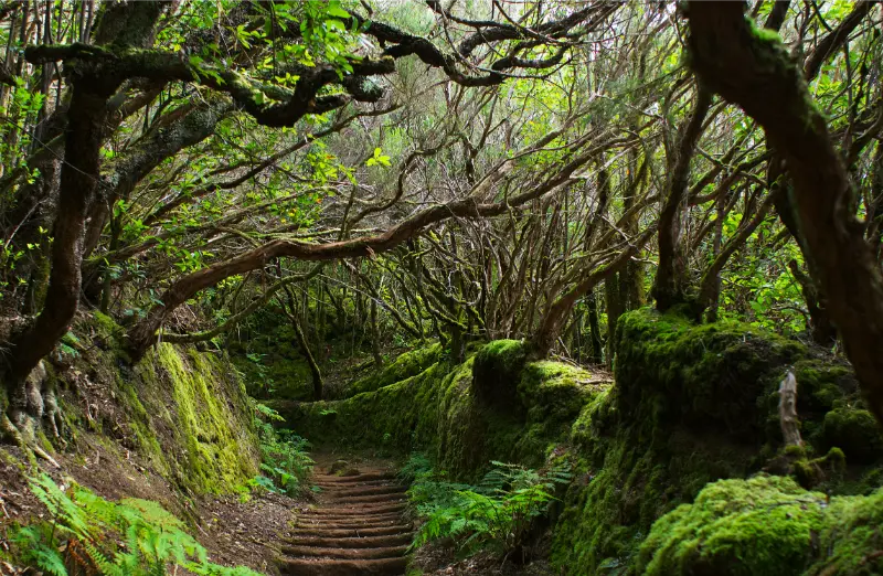
If thick cloud arrives, I slow down and simplify the plan. I do not continue onto exposed ground merely because the viewpoint is supposed to be impressive. A forest walk can remain enjoyable in mist, but route-finding and road driving need more attention. I would rather turn the day into a shorter nature experience than force a ridge walk when I cannot see enough of the terrain ahead.
Food, water and comfort
I carry enough water for the whole walk, plus a small snack with salt or carbohydrates. Small villages may have cafés, but I never build safety around a business being open. I also carry blister protection and a light layer in the daypack. Those small items weigh little and can turn an uncomfortable return into a manageable one.
A final planning check before I leave
The evening before this day, I verify the weather, current access information, transport, opening details where relevant and the amount of daylight I have. I save essential information offline and tell someone in my group what the main plan is. I also decide in advance what would make me switch to the backup plan. That small amount of preparation lets me enjoy Tenerife more spontaneously once I am actually there, because the important risks and logistics have already been considered.
Why I prefer a slower itinerary
Tenerife rewards time. Distances can look short on a map while mountain roads, parking, viewpoints and meals make the real day much longer. I therefore leave unscheduled space instead of treating every hour as an appointment. That gives me room to stop at an unexpected viewpoint, wait for cloud to clear, spend longer over lunch or simply leave early if conditions are not right. In practice, the slower version usually produces better memories and fewer transport mistakes.

Practical details I confirm on the day
Before leaving my accommodation I recheck the latest official information that could affect the plan: weather, road conditions, trail or beach access, public-transport times and any temporary restrictions. Tenerife changes quickly between coast, forest and high mountains, so yesterday’s conditions are not enough. I also make sure the phone is charged, essential addresses are saved offline and everyone in the group knows the backup plan. If the main activity depends on sea state, cloud, wind or a connection, I keep one nearby alternative that does not require a complicated detour. This simple routine helps me avoid turning a small change into a stressful day and makes the itinerary more resilient without removing spontaneity.