Tag: black sand beaches

  • Playa de Las Gaviotas Tenerife Guide: Black Sand, Nudism and Anaga Coast Tips

    Playa de Las Gaviotas Tenerife Guide: Black Sand, Nudism and Anaga Coast Tips

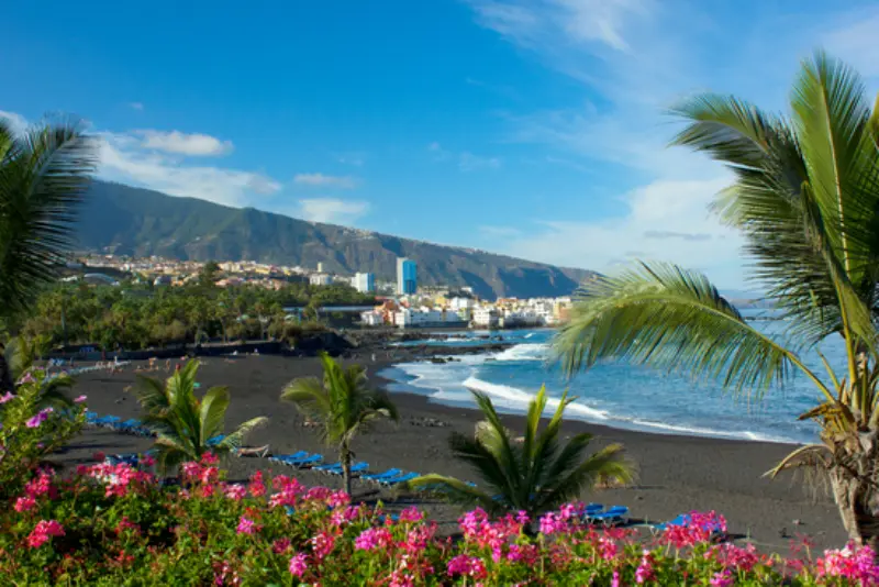
    Playa de Las Gaviotas is one of the Tenerife places I plan around conditions rather than treating as a box to tick. Plan Playa de Las Gaviotas near Santa Cruz with fine black sand, Anaga cliffs, parking, bus access, nudism, no-dog rules and Atlantic swimming safety.

    My approach is simple: understand what makes Playa de Las Gaviotas distinctive, verify the practical details that can change, and then fit it into a geographically sensible day. That matters on Tenerife because a short distance on the map can involve mountain roads, limited parking, a completely different microclimate or an exposed Atlantic shore.

    Quick planning facts

    Municipality Santa Cruz de Tenerife
    Length About 250 m
    Width About 40 m
    Sand Fine black volcanic sand
    Type Isolated beach
    Parking Yes, fewer than 50 spaces
    Bus Interurban bus listed
    Naturism Common/allowed
    Dogs Not allowed according to official listing

    How Las Gaviotas differs from Las Teresitas

    These two beaches are geographically close but feel almost opposite. Las Teresitas is broad, golden, highly serviced and sheltered; Las Gaviotas is smaller, black, less developed and backed by the steep Anaga massif. I choose between them based on mood rather than asking which is universally better.

    If I have visitors who want an easy family beach, Las Teresitas often wins. If I want volcanic sand and a quieter natural setting, Las Gaviotas is more distinctive.

    Naturism and beach etiquette

    The official tourism page notes that nudism is practised here. I treat that as part of the beach’s culture and keep the atmosphere relaxed and respectful. I do not photograph strangers and I avoid making naturism the spectacle of the visit.

    The same basic etiquette applies to everyone: keep noise reasonable, take rubbish away and do not block the limited parking while waiting for a space.

    A small parking area changes how I plan the day

    Fewer than 50 official parking spaces means timing matters. I arrive earlier than I would for a large urban beach and keep a backup plan, usually Las Teresitas or San Andrés, so I never need to squeeze into unsafe roadside spaces.

    Using the bus can be a good alternative, but I verify the current timetable because coastal frequencies and stops can change.

    Access, parking and how I arrive

    The beach is reached by road and has parking directly nearby, but the official listing says fewer than 50 spaces. Interurban bus access is also listed. I check road status because the final approach sits below steep terrain.

    I check the route before leaving and save the location offline. Around Santa Cruz de Tenerife, beyond San Andrés, I avoid blocking driveways, farm tracks, bus stops or emergency access even if other cars are doing it. If the legal parking is full, I use my backup stop instead of turning a narrow local road into an improvised car park.

    For public transport I use the method in my Tenerife bus guide: I verify the current TITSA timetable on the day, identify the final useful return service and allow extra time for connections. Rural and coastal buses can be excellent, but they do not always run at resort-level frequency.

    Conditions, weather and the best time of day

    My preferred timing is A calm-sea morning before the small parking area fills. Tenerife’s microclimates are strong enough that I never rely on one island-wide forecast. I check the exact municipality, wind and, for coastal places, sea state; for mountain areas I also look at temperature and cloud at the relevant altitude.

    I keep the schedule flexible. A cloudy mountain morning can become a good coast afternoon, while rising wind at the beach may be a reason to switch to a village or museum. This is one of the easiest ways to enjoy Tenerife more: build alternatives into the route instead of forcing the original plan.

    My broader Tenerife weather by month guide explains why north, south, high mountain and trade-wind zones can feel like different destinations on the same day.

    Safety: what changes my decision on the day

    The tourism page says waves are not usually strong, yet it explicitly recommends caution depending on sea conditions. I watch the water for several minutes before entering and leave extra distance from the cliff if there are rockfall warnings or barriers.

    I also use the principles in my Tenerife safety guide. A place being popular on social media does not make it safe under every condition. I turn around for closed access, red flags, rockfall warnings, wildfire restrictions, strong wind or any situation that feels outside my experience.

    I tell someone my plan when I am walking alone, keep enough phone battery for navigation and emergency calls, and avoid depending on mobile coverage in ravines or remote mountain areas. For an emergency in Spain and the Canary Islands, 112 is the general emergency number.

    What I bring

    My basic Tenerife day kit is water, sun protection, a charged phone, a light layer and footwear suited to the actual surface. I add a windproof or waterproof layer for Anaga and higher ground, and water shoes only where rocky swimming access makes them useful. I never use flip-flops as hiking shoes just because the trail starts near a beach.

    I also carry a small bag for rubbish and enough food that I am not dependent on finding an open café at exactly the right time. In rural areas, opening hours can be limited or seasonal, and I prefer buying locally when I do stop.

    How I connect this stop with the rest of Tenerife

    I avoid crossing the island just for one short stop. Around Santa Cruz de Tenerife, beyond San Andrés, I build a small cluster and choose two or three substantial experiences. Useful related guides are San Andrés guide, Las Teresitas guide, Anaga Rural Park guide.

    This approach reduces driving, creates more time for food and unplanned viewpoints, and makes it easier to adapt to weather. On a one-week trip especially, a calm regional day is usually more satisfying than collecting distant pins from a map.

    Who I think will enjoy it most

    Playa de Las Gaviotas works best for travellers who appreciate a isolated fine black-sand beach below the Anaga cliffs and are willing to adapt to local conditions. I would not choose it simply because a photograph looks dramatic; I choose it when the access, weather and pace match the people I am travelling with.

    Families, older travellers, photographers and hikers can all enjoy Tenerife differently. I compare walking surface, shade, toilets, distance from the car and escape options before promising that a place suits everyone. That small bit of planning prevents a scenic stop from becoming an uncomfortable obligation.

    Photography without turning the place into a photo set

    I usually prefer early or late light, but I never step beyond barriers or onto unstable rock for a cleaner composition. Wide-angle views explain Tenerife’s scale, while details such as volcanic texture, vegetation, old paths and fishing infrastructure often tell a more original story than another posed viewpoint shot.

    When people are present, I respect privacy. On beaches where naturism is common, I am especially careful not to photograph strangers. In protected natural areas I do not move rocks, pick flowers or leave the trail to create a foreground.

    Responsible travel habits I use here

    Playa de Las Gaviotas is part of a lived landscape, not an attraction separated from local life. I keep noise low near homes, never block access, take all rubbish away and use toilets or bins where they exist. On protected land I stay on legal routes and do not collect plants, stones or archaeological material.

    I also try to spend something in the surrounding area when it makes sense: a coffee, meal, market purchase or locally run accommodation spreads the value of tourism beyond the most obvious resort businesses. Respectful travel is mostly a collection of ordinary decisions.

    Three mistakes I avoid

    First, I do not trust an old screenshot more than a current official notice. Beach access, hiking permits, road restrictions and protected-area rules can change. I check again close to the visit.

    Second, I do not assume “Tenerife weather” is one forecast. A sunny app icon for the airport tells me very little about Anaga cloud, north-coast swell or conditions above 2,000 metres.

    Third, I do not overfill the day. One good walk or beach, one cultural or food stop and one flexible extra usually produces a better memory than six rushed locations.

    Where I would stay for this area

    I choose accommodation for the wider itinerary, not only for one beach. If this part of the island is going to be a recurring base, I compare accommodation in the wider area on Booking.com and then check the exact walking route, parking situation and bus stop before booking.

    For a first trip I often prefer a base with restaurants and transport within walking distance, then use day trips for quieter coves. On repeat visits, a smaller village can make more sense if I value evenings without resort crowds.

    Official information I check before leaving

    I use the official Turismo de Tenerife Las Gaviotas page for the core facts in this guide. For permits, protected-area status, closures or trail conditions I also check the responsible public authority or Tenerife ON where applicable.

    I treat opening hours, access rules and transport times as live information. The article gives me a planning framework, but the final decision is based on the official notice closest to the date of travel.

    My realistic half-day or day plan

    I start with Playa de Las Gaviotas as the priority and give it enough time that I do not feel rushed. Afterwards I choose one nearby place from the same cluster rather than driving across Tenerife. Lunch or coffee becomes a natural pause, especially on mountain or coastal roads where concentration matters.

    If conditions are wrong, I switch early rather than waiting for the day to improve. I always have a Plan B that is safer and geographically close: a village, museum, promenade, market or more sheltered beach. That flexibility is one of the most useful habits I have developed for island travel.

    Frequently asked questions

    Is Las Gaviotas a black-sand beach?

    Yes. It has fine black volcanic sand below the Anaga cliffs.

    Is nudism allowed?

    The official tourism page notes that nudism is practised at the beach.

    Is there parking?

    Yes, but the official listing says fewer than 50 spaces.

    Can dogs go on the beach?

    The official listing says dogs are not allowed.

    What is the easiest nearby alternative?

    Las Teresitas is the obvious alternative if parking is full or I want more services and a more sheltered swimming environment.

    Final thoughts

    Playa de Las Gaviotas earns a place in my Tenerife plans because it adds a specific landscape or local experience rather than repeating something I can find anywhere on the island. I get the most from it when I respect the conditions, keep the day geographically simple and leave enough time to notice the surroundings instead of rushing onward.

    I would rather miss a stop because access is closed, the sea is rough or the weather is wrong than force an unsafe visit. Tenerife will still be there on another day, and the ability to change plans is part of travelling well on an island shaped by mountains, wind and the Atlantic.
  • Playa del Ancón Tenerife Guide: Wild Black Sand Near La Orotava

    Playa del Ancón Tenerife Guide: Wild Black Sand Near La Orotava

    Playa del Ancón is a wild black-sand beach I choose when I want the north coast to feel genuinely untamed. It lies below El Rincón in La Orotava, framed by cliffs, banana-growing land and native vegetation, with no car park directly beside the sand.

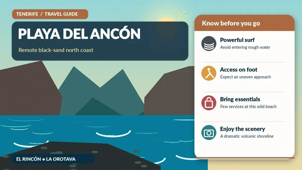
    The local tourism office is unusually clear about the most important practical point: strong waves and currents require maximum caution even when the ocean appears calm. I therefore plan Ancón as a scenic walking beach first and a swimming beach only when conditions are unquestionably suitable.

    Quick planning facts

    MunicipalityLa Orotava
    Beach typeIsolated volcanic black-sand beach
    Official lengthAbout 200 m
    Official widthAbout 20 m
    SeaStrong wave exposure; currents require caution
    ParkingNo beach car park
    BusOfficial municipal information references interurban service
    Best forWild scenery, walking, photography

    The setting between El Rincón and the Atlantic

    Playa del Ancón sits below the agricultural landscape of El Rincón in La Orotava, where banana plantations and native coastal vegetation descend toward dark sand. The municipal tourism office lists a length of about 200 metres and describes it as isolated with strong wave action.

    The beach is separated from Los Patos by Punta del Ancón. That geography makes this stretch of coast feel wild even though towns and farms are close above the cliffs.

    Getting there on foot

    There is no beach car park at the sand, so I think of access as a short hike rather than a beach transfer. I use the recognised route from El Rincón and wear proper footwear because the approach can be dusty, uneven and slippery after rain.

    I also save energy for the return. A downhill path can feel easy when I am fresh, but the climb back is much warmer after several hours in the sun.

    Strong waves and currents

    The municipality explicitly warns visitors to take maximum precautions with the sea even when it appears calm because currents affect this coast. That warning shapes my whole visit. I do not enter just because other people are in the water.

    When swell is present, I stay well above the wet-sand line and use the beach for walking and photography instead. Tenerife has many easier swimming beaches, so there is no reason to gamble here.

    How it compares with El Bollullo and Los Patos

    Ancón belongs to the same dramatic north-coast landscape as El Bollullo and Los Patos, but it generally feels more isolated. El Bollullo is better known and has a clearer visitor flow, while Ancón appeals more to walkers who accept fewer facilities.

    My El Bollullo guide helps compare access and beach character if I want to choose only one.

    Facilities and summer lifeguard context

    The La Orotava tourism page notes lifeguard service in summer, but I never assume exact dates or daily staffing without checking locally. Outside those periods I plan as if there are no beach services.

    I bring my own water, food, sun protection and basic first-aid items, then carry everything back out. There are no reasons to leave rubbish in a place that is difficult to service.

    Who this beach suits

    Ancón is ideal for travellers who value a wild setting and do not mind a walking approach. It is less suitable for visitors who need step-free access, showers, easy parking or reliable food services beside the sand.

    For a more convenient black-sand day I would use Playa Jardín or Playa El Socorro, depending on sea conditions.

    Bus access and practical transport

    The municipal page lists interurban bus access and line 376, but route numbers can change. I always confirm TITSA before travel rather than building the day around an old timetable.

    If I am driving, I leave the vehicle legally in the upper area and never block agricultural tracks. This is working farmland as well as a visitor landscape.

    Official source

    I use the La Orotava tourism page for Playa del Ancón for the official beach description, dimensions and safety context. The wider Costa de Acentejo protected landscape page helps explain why this coastline remains so dramatic.

    I still check conditions on arrival because sea state and path condition are more time-sensitive than static beach information.

    How I fit it into a realistic Tenerife day

    I treat Playa del Ancón as part of a wider La Orotava and the Acentejo coast day rather than an isolated pin on the map. Tenerife looks compact, but mountain roads, parking searches and changing weather can turn short distances into slow travel. I decide in advance which stop is the priority and which stops are optional.

    My preferred approach is to pair it with El Bollullo, La Orotava historic centre, Puerto de la Cruz or a valley viewpoint. That creates a day with contrast without spending most of the time in the car. I also keep one backup plan nearby in case wind, cloud, surf or temporary access restrictions change the experience.

    Historic Center Of La Orotava Tenerife

    Weather, clothing and microclimates

    I never use a single Tenerife forecast for the whole island. North-coast cloud, Anaga mist, Teide sunshine and south-coast heat can all occur on the same day. I check the forecast for the exact municipality and, for mountain or coastal activities, I also look at wind and sea conditions.

    Even on warm days I carry sun protection, water and a light layer. At higher elevations I add a windproof layer, while on the coast I bring footwear with grip because volcanic rock, wet steps and black sand can all be slippery or hot.

    Responsible travel habits I use here

    Small beaches, villages, viewpoints and trailheads are shared local spaces. I park only where it is legal, keep access to homes and farm tracks clear, take rubbish away and avoid turning narrow roads into informal photo stops. In protected areas I stay on the marked route and never collect volcanic material, plants or other natural objects.

    I also prefer to support the area in a simple way: a coffee, lunch, market purchase or locally made product is often a better souvenir than something generic. Respectful travel is mostly about ordinary decisions that reduce pressure on places I want to remain enjoyable.

    My backup plan when conditions are wrong

    If the sea is rough, I do not force a swim. If a viewpoint is inside cloud, I move lower or switch to a village, museum or food stop. If parking is full, I continue to the next planned place rather than circling residential streets. This flexibility is especially useful in Tenerife because very different landscapes sit close together.

    I build the day around one must-do experience and several optional stops. That structure produces better trips than trying to complete a rigid checklist, and it makes it easier to respond to closures, weather and local events without feeling that the day has failed.

    Frequently asked questions

    Is Playa del Ancón easy to reach?

    No. I consider it a walking-access beach and wear proper shoes for the approach and return climb.

    Can I swim there?

    Sometimes, but the municipality warns about currents and strong waves even when the sea looks calm. I only enter in clearly safe conditions.

    Are there facilities?

    Facilities are limited. The municipality notes summer lifeguard service, but I verify current staffing locally.

    Is it similar to El Bollullo?

    The landscapes are related, but Ancón generally feels more isolated and less serviced.

    Should I visit with small children?

    I usually choose an easier-access beach with predictable facilities for young children.

    Questions I ask myself before I go

    I check four things before leaving: current access, exact weather, realistic travel time and what I will do if the first plan fails. Tenerife is an easy island to underestimate because distances look short on a map. A mountain road, coastal traffic or a full car park can add far more time than expected.

    I also decide whether the destination is the purpose of the day or simply one stop. When it is the main purpose, I leave enough time to experience it slowly. When it is secondary, I set a clear limit so the rest of the itinerary does not become rushed.

    What makes this worth adding to a longer Tenerife trip

    The strongest Tenerife itineraries mix famous landmarks with smaller places and experiences. Teide, Anaga and the main beaches explain the island at a large scale, while a local pool, rural trail, village festival or food tradition explains how people actually use and understand the landscape.

    I therefore do not judge a place only by the number of attractions. A short viewpoint can be valuable if it helps me read the geography; a small village can be memorable if I slow down for lunch; a modest trail can reveal volcanic history better than a long drive through the same area.

    Practical travel habits that improve the day

    I download maps or save the route before entering areas with weaker mobile coverage. I start with a full bottle of water, keep a layer in the car, carry some cash for small local businesses and avoid planning every meal at the most obvious tourist time. These are small habits, but they make rural Tenerife much easier.

    I also leave more space between stops than a navigation app suggests. That time absorbs photo stops, roadworks, wrong turns and simple curiosity. The best travel days on Tenerife often improve when I have enough margin to stop somewhere I had not planned.

    My final take

    Playa del Ancón is not a convenience beach, and that is exactly why I value it. The walk, black sand and agricultural cliff landscape make it memorable, but I respect the strong Atlantic and never treat swimming as guaranteed.

  • Playa de Benijo Guide: Black Sand, Anaga Scenery, Access and Safety Tips

    Playa de Benijo Guide: Black Sand, Anaga Scenery, Access and Safety Tips

    Playa de Benijo is the Tenerife beach I think of when someone asks for dramatic scenery rather than an easy resort day. Black volcanic sand, the Roques de Anaga rising offshore and the steep green slopes of the Anaga massif give the place a raw character that feels very different from the manicured beaches of Costa Adeje. It is also a beach that deserves respect. Access involves steps, parking is limited and the Atlantic can be powerful, so I would never describe Benijo as a simple all-purpose swimming beach.

    For me, the best way to experience Benijo is as part of a wider day in northeastern Tenerife. I would combine it with Taganana, a viewpoint or short walk in Anaga and a meal in one of the small coastal settlements rather than driving across the island only for an hour on the sand. If you have not explored this side of Tenerife before, my Anaga Rural Park guide explains how the forests, mountain roads and coastal villages fit together.

    Why Playa de Benijo is special

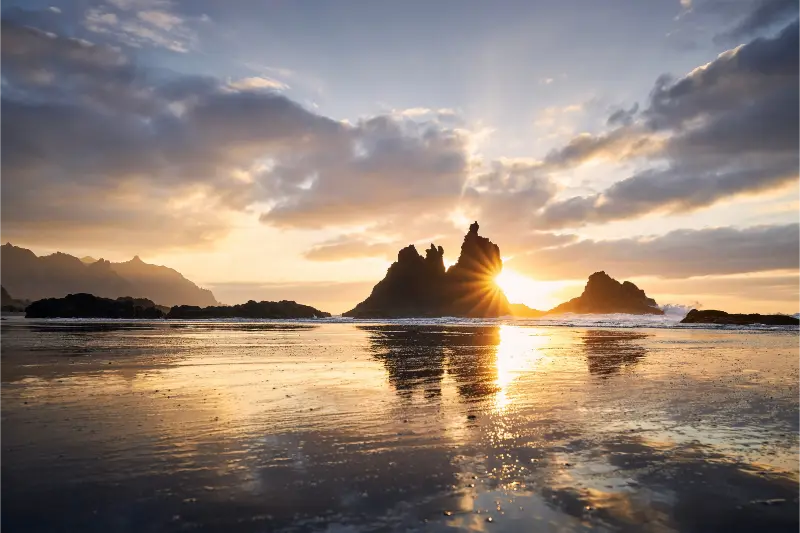
    Benijo is not famous because it has the calmest water or the largest list of services. Its appeal is the setting. The beach sits below a rugged section of the Anaga coast, with dark sand in the foreground and volcanic rock formations offshore. At low light, especially around sunset, the contrast between black sand, white surf and the silhouettes of the roques can be extraordinary.

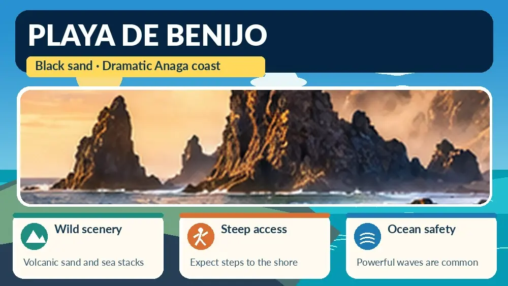
    Illustrated guide: Playa de Benijo, with practical visitor tips
    Illustrated guide: Playa de Benijo.

    The official Tenerife tourism information describes Benijo as an isolated beach near Taganana, around 300 metres long, reached on foot by a path with stairs. It also warns that the waves can be strong. I treat that warning as central to the visit, not as a footnote. On days with rough sea conditions, I am perfectly happy to enjoy Benijo from the shore without swimming. You can check the official Playa de Benijo information before setting out.

    How to get to Benijo

    By car, the route through Anaga is scenic but slower than the map distance suggests. The roads twist around steep slopes, visibility changes with cloud and there are sections where patient driving matters more than speed. If I am coming from Santa Cruz or La Laguna, I build generous time into the day and avoid creating a schedule that depends on arriving at an exact minute.

    Parking around Benijo is limited. The official tourism page indicates fewer than 50 parking spaces, which is another reason I avoid arriving at the busiest part of a sunny weekend afternoon. If the closest spaces are full, I do not improvise by blocking narrow roads or entrances. I would rather park legally farther away if possible, change the order of the day or return at another time.

    Public transport can also work, but I check the current TITSA route and timetable immediately before travelling because rural services are less frequent than buses in the main resorts. A bus-based Anaga day is entirely possible if you choose a small number of stops. For the wider network, see my Tenerife without a car guide.

    The stairs and beach access

    The final access is on foot using a path and stairs. That matters if you are travelling with a stroller, have reduced mobility or simply expect a flat promenade like the beaches of the south. Benijo is not the place I would choose for a visitor who needs step-free access. Good footwear is useful even if the plan is just to spend time on the sand, particularly if the steps are damp or you continue to viewpoints and village streets afterward.

    I also keep the return climb in mind. Descending to the beach can feel easy when you are excited by the view; climbing back after sunset, carrying beach gear, is another matter. I bring only what I really need and make sure I have enough daylight to return comfortably.

    Can you swim at Playa de Benijo?

    Sometimes people do, but I would never promise safe swimming conditions. The beach is exposed to Atlantic swell and currents, and the official guidance specifically urges caution because the waves are often strong. I judge the sea on the day, follow any local warnings and stay out when the conditions look uncertain. A beautiful beach does not become less worthwhile just because I decide not to enter the water.

    For families with young children, I generally prefer a sheltered beach with easier access and lifeguard infrastructure. My best beaches in Tenerife guide includes more practical options for swimming days. Benijo works better as a landscape experience for many families, with the beach visit kept short and flexible.

    Sunset at Benijo

    Sunset is the moment most people imagine when they see photographs of Benijo, and it can be magnificent. The mistake is to focus only on the sunset itself and forget the road out. Mountain roads in Anaga become more demanding after dark, especially if cloud or mist forms higher up. If I stay for the last light, I make sure the driver is comfortable with the return journey and I do not drink alcohol with dinner before driving.

    I arrive early enough to walk down without rushing, choose a safe place well above the reach of unexpected waves and keep an eye on the tide. I also bring a light layer. Even after a warm afternoon, wind and humidity can make the coast feel cooler once the sun disappears.

    Taganana, Almáciga and Roque de las Bodegas

    Benijo makes more sense when you treat it as part of the Taganana coast. Taganana itself has a traditional village atmosphere tucked into the Anaga landscape, while the coast around Roque de las Bodegas and Almáciga offers other views, beaches and places to eat. I like to stop for a simple Canarian lunch or fish rather than racing directly from one photo stop to another.

    If I have a full day, I might start with a forest viewpoint in the higher part of Anaga, descend toward Taganana, have lunch near the coast and finish at Benijo later in the afternoon. That route shows why Tenerife can feel like several islands in one: laurel forest, steep ravines, tiny villages and black-sand coastline all appear within a relatively small area.

    What to bring

    • Supportive shoes for the stairs and uneven surfaces.
    • Water, sunscreen and a hat even when the mountains are cloudy.
    • A light layer for wind or cooler conditions after sunset.
    • Only a small amount of beach gear; the return climb is easier when you travel light.
    • A charged phone, while remembering that mountain coverage can be less reliable than in resort areas.

    Best time of day

    There is no single perfect time. Morning can be quieter and makes the return drive simple. Late afternoon gives better light and the possibility of sunset. Midday works if the sea is calm and you are already touring the coast, but the harsh light can flatten the landscape in photographs and parking may be more difficult. I choose according to the weather and the rest of my Anaga plan rather than chasing a fixed formula.

    Season also changes the character of the beach. Tenerife is a year-round destination, but ocean conditions vary from day to day. My best time to visit Tenerife guide explains the island’s broader seasonal differences without pretending that any month guarantees calm seas.

    Where to stay for Benijo

    If Benijo and Anaga are priorities, I would consider Santa Cruz or La Laguna rather than the far southwest. You gain easier access to the northeast and can combine the coast with the capital, UNESCO streets and mountain walks. Travellers who want nightlife and resort beaches can still visit from Costa Adeje, but the driving day is much longer.

    You can compare accommodation across Tenerife and then check the exact map position rather than booking by town name alone. In mountain areas, a property that looks close in a straight line may involve a surprisingly long road journey.

    A realistic Benijo day plan

    My preferred plan is intentionally simple. I leave after breakfast, stop at one or two Anaga viewpoints, descend toward Taganana, have lunch, visit the coast and keep Benijo as the final major stop. If the sea is rough, I photograph and walk instead of swimming. If parking is impossible, I do not let that ruin the day; the Anaga coast has plenty of other beautiful places.

    I also resist the temptation to combine Benijo with Teide or the far west on the same day. Tenerife may look compact on a map, but mountain roads turn ambitious itineraries into hours behind the wheel. Benijo deserves a day that feels slow enough to notice the landscape.

    Frequently asked questions

    Is Playa de Benijo suitable for children?

    The scenery can be wonderful for a family outing, but the stairs, exposed water and limited services make it less convenient than Tenerife’s main family beaches. I would supervise children very closely and choose another beach for easy swimming.

    Is Benijo a nudist beach?

    The official tourism information notes that the beach is frequented by naturists. In practice, visitors should simply respect other beach users and the relaxed character of the place.

    Are there restaurants nearby?

    Yes, there are places to eat in the surrounding coastal area and around Taganana. Opening days and hours can vary, so I do not build a late remote meal around one specific restaurant without checking first.

    Do I need a full day?

    Not for the beach alone, but I strongly prefer a full Anaga day because the forest, viewpoints and villages are part of what makes Benijo memorable.

    What is the biggest mistake?

    Treating Benijo like a normal resort beach. The best visit comes from accepting limited parking, stairs, changing ocean conditions and a slower mountain-road journey.

  • Best Beaches in Tenerife: From Easy Family Bays to Wild Volcanic Shores

    Best Beaches in Tenerife: From Easy Family Bays to Wild Volcanic Shores

    Tenerife’s beaches are more varied than the classic image of a Canary Islands resort suggests. You can spend the morning on a pale, sheltered beach with sunbeds and cafés, then drive to a black-sand bay framed by volcanic cliffs or a windy stretch of coast where surfers and kitesurfers dominate the horizon. That variety is why I do not rank one beach as the single best on the island; I choose according to the kind of day I want.

    This guide focuses on beaches that are useful for real trip planning: family-friendly choices, scenic black-sand beaches, surf areas, beaches near major resorts and places that combine well with sightseeing. Always check local conditions and beach flags before swimming because Atlantic waves and currents can change quickly.

    Playa del Duque: polished and convenient

    Playa del Duque in Costa Adeje is one of the easiest beaches for travellers who want comfort. The surrounding area has hotels, restaurants, a promenade and extensive tourist services. The beach is attractive, organised and straightforward for a resort day, which is why it works especially well for couples and families who do not want complicated logistics.

    It is not the beach I would choose for a wild or local atmosphere. Its strength is convenience. If you are staying in Costa Adeje, I would use Playa del Duque for a relaxed half-day and save the rental car for beaches that are genuinely different rather than driving elsewhere simply because another name appears on a top-ten list.

    Playa de Las Vistas: one of the easiest family options

    Between Los Cristianos and Playa de las Américas, Las Vistas is broad, central and supported by a long promenade. It is useful for families because food, toilets and other services are close, and you can walk to a large range of accommodation. Conditions still vary, but it is a much simpler proposition than a remote natural beach.

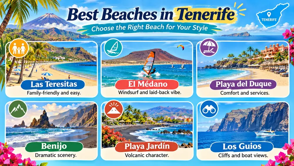
    Illustrated guide: Best Beaches in Tenerife, with practical visitor tips
    Illustrated guide: Best Beaches in Tenerife.

    I like Las Vistas on days when the goal is not adventure but an uncomplicated swim, lunch and walk. If you have children, that kind of easy day becomes more valuable after a long Teide or Anaga excursion.

    Playa de Las Teresitas: the classic beach near Santa Cruz

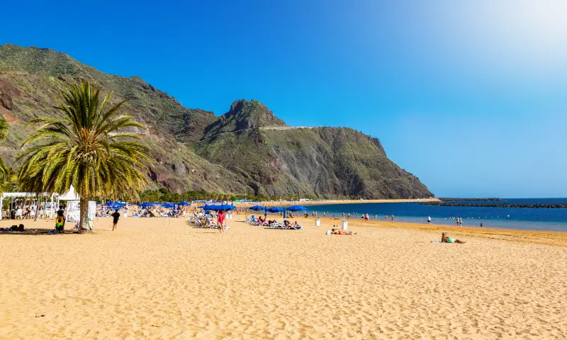
    Las Teresitas is one of Tenerife’s most recognisable beaches, a long arc of light-coloured sand near the village of San Andrés, northeast of Santa Cruz. It is a natural addition to a day in the capital or a scenic drive toward Anaga. The bay setting and mountain backdrop make it visually very different from the southern resort beaches.

    Because it is popular with residents as well as visitors, weekends and good-weather days can be busy. I prefer arriving earlier, then combining the beach with lunch in San Andrés or continuing into the northeast if the weather is suitable.

    El Médano and Playa de la Tejita: for wind, space and Montaña Roja

    El Médano is one of Tenerife’s best-known wind-sports areas. The beach merges with a relaxed town atmosphere, and the view toward Montaña Roja gives the coast a distinctive identity. It is a good place to watch windsurfing or kitesurfing even if you are not participating.

    On the other side of Montaña Roja, Playa de la Tejita feels more open and natural. Wind can be strong, and there is less resort-style shelter, so I see it as a beach for travellers who enjoy space and landscape rather than guaranteed calm water. Respect protected areas around the natural reserve and avoid leaving marked paths where restrictions apply.

    Playa Jardín and the Puerto de la Cruz coast

    The northern coast has a darker, more volcanic character. Beaches around Puerto de la Cruz are useful if you are staying in the north, but I choose them with conditions in mind. Waves can be stronger than at sheltered southern beaches. The value of the area is the combination: black sand, gardens, promenades, town life and easy access to La Orotava and other northern sights.

    Playa Jardin Puerto De La Cruz Tenerife

    A north-coast beach day also works well when the south is extremely hot or when you want a break from resort scenery. Just remember that the weather can be cloudier on the northern side even when the south is bright.

    Playa de Benijo: scenery first

    Benijo, beneath the Anaga mountains, is one of the most dramatic beaches on Tenerife. The attraction is the setting: dark sand, powerful Atlantic water and offshore rock formations. I treat it primarily as a landscape stop rather than promising myself a swim. Sea conditions can be serious, access involves steps, and the road through Anaga deserves time and concentration.

    For me, Benijo fits best into an Anaga day rather than a beach-hopping schedule. Arrive with proper footwear, check daylight, and never enter the water just because other people are swimming. The safest decision can be to enjoy the view from shore.

    Playa de Abama: beautiful but access needs planning

    The small beach below the Abama resort area is known for sheltered water and a photogenic setting. Public access to beaches in Spain is not the same as having easy resort-style access to every facility, so understand the walking route, parking situation and practical limitations before making a special trip. It can be pleasant, but I would not cross the island only for one small beach if your itinerary is already full.

    Black sand or golden sand?

    Tenerife’s volcanic beaches are part of the island’s identity. Black sand can become extremely hot under strong sun, so footwear is useful. Lighter beaches may feel more familiar, but colour tells you little about swimming conditions. Exposure, swell, wind, tide and local protection matter much more than sand colour.

    If you want…Try…Why
    Resort comfortPlaya del DuqueServices and promenade
    Family convenienceLas VistasCentral and easy facilities
    Scenery near Santa CruzLas TeresitasMountain-backed bay
    Wind sportsEl MédanoConsistent active atmosphere
    Wild volcanic sceneryBenijoDramatic Anaga setting
    North-coast characterPuerto de la Cruz beachesBlack sand and town access

    Natural pools: an alternative to the beach

    Tenerife also has natural swimming pools and volcanic bathing areas, especially around the north and west. Garachico is the most famous example, but access can be restricted when the sea is rough. These places should never be treated like ordinary hotel pools. Waves can wash across platforms and conditions can change rapidly. Follow closures and local instructions.

    Natural pools are especially useful on a sightseeing day because you can combine a short swim with historic towns and viewpoints. I would not promise children a swim until I have seen the conditions in person.

    Beach safety in Tenerife

    The Atlantic deserves respect. Flags, lifeguard instructions, barriers and local warnings are more important than any recommendation in a travel guide. A red flag means do not enter the water. Even on a sunny day, swell can produce strong shore break or currents. Remote beaches may not have lifeguards at all.

    Surfers On A Tenerife Beach
    • Check the flag and observe the water before swimming.
    • Keep children within immediate reach, not just within sight.
    • Avoid rocky entries when waves are breaking.
    • Do not swim after drinking alcohol.
    • Protect feet from hot dark sand and sharp volcanic rock.
    • Use reef-safe habits and take all rubbish away from natural beaches.
    • If locals leave the water because conditions worsen, pay attention.

    Best beaches without a car

    If you do not have a car, the easiest strategy is to stay in a coastal area with several beaches connected by promenade or bus. Costa Adeje, Los Cristianos and Playa de las Américas are obvious choices. Las Teresitas is reachable from Santa Cruz by public transport, while El Médano is connected by bus routes but requires more planning depending on your starting point.

    TITSA covers the island extensively, but a beach day becomes less relaxing if you are watching multiple transfers. Use the official journey planner and choose one good beach rather than trying to collect three in a day. My transport guide explains how I plan car-free days.

    Beaches with children

    For family days I prioritise easy access, toilets, food, shade options and lifeguard presence over dramatic scenery. Las Vistas and the main Costa Adeje beaches are usually more practical than remote northern coves. Even then, calm-looking water can change. Small children do not need a long list of beaches; they need one safe, convenient place where the adults are not stressed.

    For a broader family plan, see Tenerife with kids.

    When to go to the beach

    Tenerife can support beach days throughout much of the year, but the best coast may change with wind and cloud. The south generally receives more sunshine, while the north can be greener and cloudier. In summer, sand and exposed promenades can be very hot at midday. In winter, the sun may feel warm while the ocean remains refreshing and mountain air is much colder.

    That is why I keep beach plans flexible. A cloudy morning in the north can become a sunny afternoon in the south, and a windy day at El Médano may feel much calmer in a sheltered bay elsewhere. See my weather and best-time guide for the seasonal picture.

    My beach-planning rule

    I would choose two or three beaches for a week-long holiday, not ten. Pick one convenient beach near your accommodation, one beach that offers a completely different landscape and perhaps one that pairs naturally with sightseeing. This reduces driving, parking and the temptation to judge each place after twenty hurried minutes.

    If you stay in the south, a balanced combination could be Playa del Duque or Las Vistas for convenience, Las Teresitas on a Santa Cruz/Anaga day and Benijo purely for scenery if sea conditions and daylight are appropriate. That gives you three different sides of Tenerife’s coast without turning the holiday into a beach checklist.