Category: Towns & Places

Detailed guides to Tenerife towns, cities, resorts and villages, with practical travel advice and local context.

  • Tegueste Tenerife Guide: Traditional Town, Market, Vineyards and Anaga Gateway

    Tegueste Tenerife Guide: Traditional Town, Market, Vineyards and Anaga Gateway

    Tegueste is one of the places I recommend when someone asks for a Tenerife town that feels genuinely local without requiring an expedition into the most remote part of the island.

    Tegueste is unusual because it has no coast

    The municipality sits in northeast Tenerife and is surrounded by the municipality of La Laguna. Its landscape is inland: a broad agricultural basin, vineyards, cultivated land and hills leading toward Anaga. That immediately gives the visit a different rhythm from a beach town.

    The historic centre

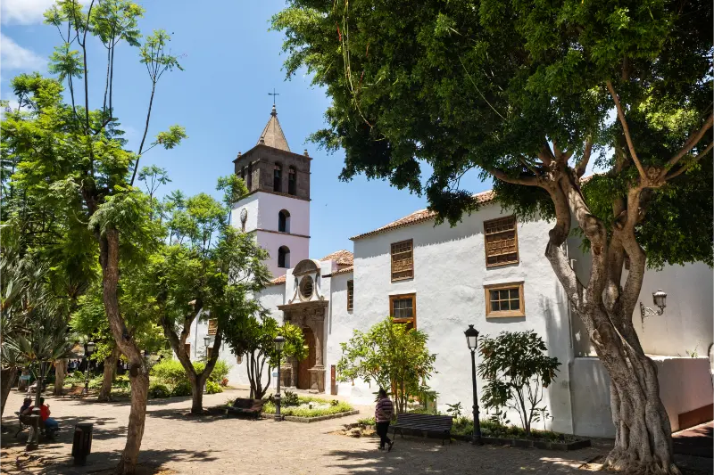
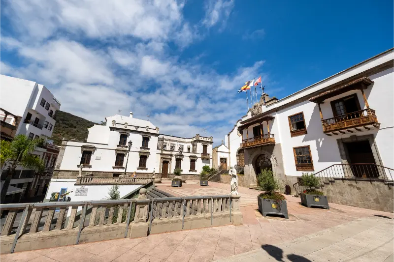
    I start around the traditional centre and the church area, then walk slowly through the surrounding streets. The appeal is the ensemble rather than one monumental building: Canarian architecture, small squares, residential streets and the sense that the town still functions primarily for local life.

    Market and local produce

    Tegueste is strongly associated with agriculture and local produce, so I like timing a visit with the current farmers-market opening when practical. I verify the schedule before travelling because market hours can change. My Tenerife markets guide helps put it in the wider island context.

    Wine country on the edge of town

    Tegueste lies within the Tacoronte-Acentejo wine area, one of Tenerife’s recognised denominations of origin. Vineyards are part of the landscape and make the town a natural companion to El Sauzal or Tacoronte. My Tenerife wine guide explains the island’s wine regions.

    Camino de los Laureles and nearby nature

    Official tourism information highlights Camino de los Laureles as one of the municipality’s nature experiences. I treat any walking route according to current trail conditions and footwear rather than assuming a short local path is always dry or easy after rain.

    Tegueste with La Laguna or Anaga

    Tegueste combines naturally with La Laguna or the edge of Anaga Rural Park. I would not combine all of Anaga’s remote beaches and viewpoints in the same day; Tegueste works better as the slower cultural element of a northeast itinerary.
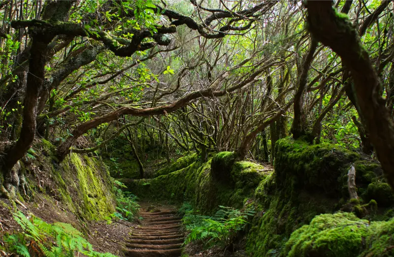
    Anaga Laurel Forest Path Tenerife

    How I would fit this into a Tenerife itinerary

    I would not build an entire holiday around visiting Tegueste in isolation. I use it as one layer of a wider Tenerife trip and pair it with places that make geographical sense. Tegueste is close enough to La Laguna and the northeast to build a compact regional day. That approach reduces unnecessary driving and gives me time to notice the ordinary details that often become the most memorable part of the day: a local bakery, a quiet square, changing cloud on the slopes or a small viewpoint I had not planned. For a first visit, I compare the day with my Tenerife travel guide and keep one or two priorities rather than turning the route into a checklist.

    Transport and parking: what I plan before leaving

    Before setting out for visiting Tegueste, I decide whether a car actually improves the day. Tenerife has good bus links on many corridors, but timetables, transfers and the last connection matter more once I move away from the major resorts. With a car, I save the exact parking area or central street before departure and avoid assuming that a historic centre or coastal village has unlimited parking beside the main attraction. My getting around Tenerife guide explains the broader car, bus and taxi trade-offs.

    Weather and microclimates can change the plan

    Tenerife is compact on a map but not climatically uniform. For visiting Tegueste, I check the forecast for the exact area rather than relying on the weather at my hotel. Cloud, trade winds, calima and altitude can make two parts of the island feel completely different on the same day. I carry sun protection and water even when the morning looks mild, and I add a light layer whenever the route moves inland or uphill. My best time to visit Tenerife guide gives the island-wide seasonal context.

    Food stops: I keep them local and realistic

    I prefer to make one meal part of the experience instead of squeezing food between attractions. Around visiting Tegueste, that means looking for a local restaurant, bakery, market or simple café that fits the area rather than driving back to a resort simply because I recognise the menu. I keep a second option saved because opening days and kitchen hours can vary. For regional dishes and ordering ideas, I use my what to eat in Tenerife guide.

    What I would photograph — and what I would leave alone

    With visiting Tegueste, I look for context rather than only postcard angles. A wide image showing landscape, farming terraces, coast or surrounding streets often says more than a tightly framed landmark. I avoid blocking roads or doorways, respect private property and never cross barriers for a cleaner photograph. Early and late light can be attractive, but I do not create a complicated schedule solely for photography if it makes the rest of the day rushed.

    Accessibility and pace

    I never assume that a short distance means an easy visit. Around visiting Tegueste, paving, gradients, heat, stairs and parking location can matter more than kilometres. Travellers with limited mobility, small children or a slower preferred pace should choose fewer stops and verify current accessibility directly with the venue or municipality when it is essential. My accessible Tenerife guide covers the island more broadly.

    Anaga Laurel Forest Tenerife

    What I check on the morning of the visit

    On the day I visit visiting Tegueste, I check local weather, any official access notice and the route on a live map. If a museum, trail, beach facility or event is important, I also verify its opening or operating status. Tenerife changes quickly enough that a five-minute check is more valuable than an itinerary screenshot saved months earlier. I keep one nearby alternative so a closure, rough sea or unexpected cloud does not trigger a cross-island dash.

    My rule for avoiding an overpacked day

    I use a simple rule with visiting Tegueste: one main experience, one secondary stop and enough unscheduled time for lunch, walking and detours. Mountain roads and urban traffic can both take longer than expected. A looser plan also makes it easier to stay somewhere I like instead of leaving because the spreadsheet says the next stop begins at 15:10. The island feels far more distinctive when I give each area enough space.

    Who I think this experience suits best

    Visiting tegueste works best for travellers who enjoy context and place rather than only headline attractions. It can suit couples, independent travellers and families, but the exact value depends on interests, mobility and where you are staying. I would not recommend adding it simply because it appears on a long “must-see” list. I include it when it adds a different side of Tenerife to the trip.

    Final planning thoughts

    My final advice for visiting Tegueste is to use this guide as a framework, then verify anything operational shortly before travelling. Tenerife rewards people who plan the essentials and leave the rest flexible. If I know the route, the likely weather, one food option and one backup, I consider the day ready. The rest can respond to the island rather than fighting it.

    Official information I would check before travelling

    For anything that can change, I use the current official information rather than treating a travel article as a timetable. The most useful starting point for this topic is official Tegueste tourism information. I check again close to the visit because opening hours, access restrictions, public events and local services can change after publication.

    Anaga Laurel Forest Trail Tenerife

    Where I would stay for this part of the island

    If this area is a priority, staying nearby can turn a rushed day trip into a slower local experience. I compare location before star rating and look at walking access, parking and evening food options. For a current snapshot of availability I use places to stay around Tegueste, then compare it with my where to stay in Tenerife guide before booking.

    A half-day plan that keeps the route simple

    If I only had half a day for visiting Tegueste, I would start with the most distinctive element, add a short walk through the surrounding area and finish with one local food stop. I would not add a distant beach or mountain viewpoint simply to increase the number of pins on the map. Half-day plans work when the places share the same roads and parking logic. If transport is uncertain, I reverse the plan so the least time-sensitive element comes last.

    How I would combine it with a north–south holiday

    On a trip split between Tenerife’s north and south, I would place visiting Tegueste on the side of the holiday that already brings me closest to it. This sounds obvious, but it avoids repeating the same motorway section several times. The island’s microclimates also mean I can sometimes move an outdoor day to the sunnier side and keep a cultural or village day for cloudier conditions. My north vs south Tenerife guide explains the differences in more detail.

    A note on responsible visiting

    I try to make visiting Tegueste better for the next visitor rather than simply extracting a photo from it. That means using marked paths, taking rubbish away, keeping noise low in residential streets, buying something locally when appropriate and respecting barriers around fragile coast, farmland or historic property. In smaller Tenerife communities, ordinary homes sit beside places visitors photograph; basic courtesy makes a real difference.
  • Puerto de Santiago Guide: Playa de la Arena, Los Gigantes and Tenerife West Coast

    Puerto de Santiago Guide: Playa de la Arena, Los Gigantes and Tenerife West Coast

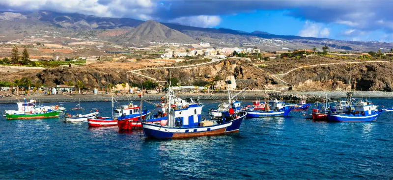
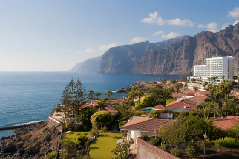
    Puerto de Santiago is the west-coast base I choose when I want Los Gigantes scenery without staying in the busiest part of Los Gigantes itself. The resort area stretches through a volcanic coastline with small black-sand beaches, restaurants, apartments and easy access to Playa de la Arena. It belongs to Santiago del Teide and works especially well for sunset, boat trips and a slower holiday where I do not need major nightlife every evening. Because nearby place names blend together on booking sites, this guide explains what Puerto de Santiago actually feels like and how I would use it as a base.

    Where Puerto de Santiago sits

    Puerto de Santiago lies between the Los Gigantes area and Playa de la Arena on Tenerife’s west coast. In practical terms, the urban areas merge, but hills and road layout still affect walking times. I check the exact accommodation pin rather than assuming every property described as “Los Gigantes” or “Puerto Santiago” is beside the same promenade.

    The setting is defined by dark volcanic coast, views toward La Gomera and the nearby cliffs. It is more compact and less nightlife-focused than Playa de las Américas.

    Playa de Puerto Santiago

    The small urban beach beside the harbour has black sand and a local, maritime atmosphere. Official tourism describes it as a sheltered cove near the fishing port with easy access and nearby food options. Its modest size is part of the charm but also means I keep expectations realistic during busy summer periods.

    I check sea conditions before swimming. Sheltered does not mean risk-free, and the volcanic west coast can still receive swell.

    Playa de la Arena

    Playa de la Arena is the best-known beach in the immediate area and one of the west coast’s most convenient black-sand options. Official tourism lists an urban setting, lifeguard service, accessible facilities, restaurants and a designated diving area. I like it because I can combine a genuine volcanic-sand beach with normal resort conveniences.

    The black sand becomes very hot in strong sun, so sandals are practical. I also respect flags and lifeguard instructions rather than assuming clear water means calm conditions.

    Los Gigantes cliffs and boat trips

    The cliffs dominate the northern view and are the main reason many travellers choose this part of Tenerife. Puerto de Santiago gives easy access to boat departures from nearby Los Gigantes for whale watching and coastal excursions. My whale-watching guide explains how I choose a responsible operator.

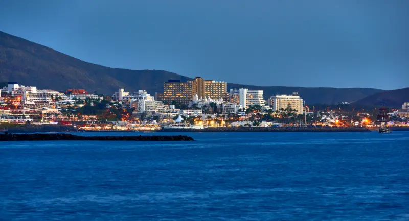
    Puerto De Santiago Tenerife At Night

    I do not schedule a boat trip on the only day I have in the area. Sea conditions can change, so a two- or three-night stay gives more flexibility if an excursion moves.

    Sunset and evening atmosphere

    West-facing orientation is one of Puerto de Santiago’s strongest advantages. La Gomera can appear on clear evenings, and the changing light on the cliffs makes sunset more than a beach event. I find a safe promenade or terrace rather than driving to a viewpoint at the last minute.

    Evenings are generally relaxed, with restaurants and bars rather than a large club scene. Travellers wanting intense nightlife should read my Tenerife nightlife guide before choosing this base.

    Walking, hills and accessibility

    The area is hillier than it first appears. A hotel can be close to the sea on a map but involve steep roads or steps. I check elevation and pedestrian routes before booking, particularly with a stroller or reduced mobility. Playa de la Arena itself has accessible services, but that does not make every surrounding street flat.

    For a fully level seafront holiday, parts of Los Cristianos or Costa Adeje can be easier. Puerto de Santiago trades some walking simplicity for west-coast scenery.

    Day trips from Puerto de Santiago

    Masca, Santiago del Teide, Teno and Teide are obvious inland excursions, while Playa San Juan and Alcalá work for a slower coastal day. I group these geographically rather than driving east to Anaga and back in one day. My Teno guide and Santiago del Teide guide are the most natural companions to this base.

    If I want a cross-island day, I start early and accept that the return drive after sunset can be tiring on winding roads.

    Where to stay and who will like it

    Puerto de Santiago suits couples, families who like smaller beaches, whale-watching visitors and travellers seeking a quieter west-coast base. I choose a property near Playa de la Arena for beach convenience or closer to Los Gigantes for marina access. Parking matters if I have a rental car.

    I compare Puerto de Santiago hotels and apartments with Los Gigantes accommodation before deciding which side of the same coastal area fits the trip best.

    Puerto De Santiago Tenerife At Sunset

    How I would plan it

    I would stay at least two nights if boat trips or Masca are important, because the west coast becomes much more enjoyable when one cancelled plan does not disrupt the whole itinerary.

    Puerto de Santiago is not a place I choose for a huge list of attractions. I choose it for cliffs, black sand, sunset and easy access to the west side of Tenerife.

    Eating in Puerto de Santiago

    I look for a mix of Canarian fish restaurants, casual terraces and simple local cafés. The waterfront has tourist-oriented menus, but walking a little away from the main viewpoints can produce more everyday options. I check recent opening days rather than planning dinner around one old recommendation.

    Transport without a car

    Buses connect the area with other southwest towns, and a no-car stay can work if the holiday is mostly local plus organised excursions. A rental car becomes more useful for rural Teno, mountain villages and flexible Teide days. I compare the trade-off with my Tenerife without a car guide.

    Planning Puerto de Santiago Tenerife around the rest of the trip

    I would not let Puerto de Santiago Tenerife dominate every day of the holiday. Tenerife works best when active or detailed plans are balanced with a slower meal, a short walk or time by the sea. I group nearby places together, leave a realistic margin for parking and changing conditions, and avoid crossing the island simply to add one more stop. That makes this part of the trip feel intentional rather than squeezed between unrelated attractions.

    What I check the evening before

    The evening before this part of the trip, I confirm weather, access, opening information and the exact route from my accommodation. For Puerto de Santiago Tenerife, small practical changes can matter more than they appear on a static itinerary. I save essential information offline, charge the phone and keep a nearby alternative in mind. That preparation means a closure, stronger wind or slower traffic changes the plan without ruining the day.

    How I keep the day geographically sensible

    I build this day around one section of Tenerife. Even when puerto de santiago guide: playa de la arena, los gigantes and tenerife west coast sounds easy to combine with several famous attractions, mountain roads and elevation can turn short map distances into long travel times. I prefer adding one nearby village, beach, viewpoint or lunch stop. The result is less time in the car and more time actually experiencing the area.

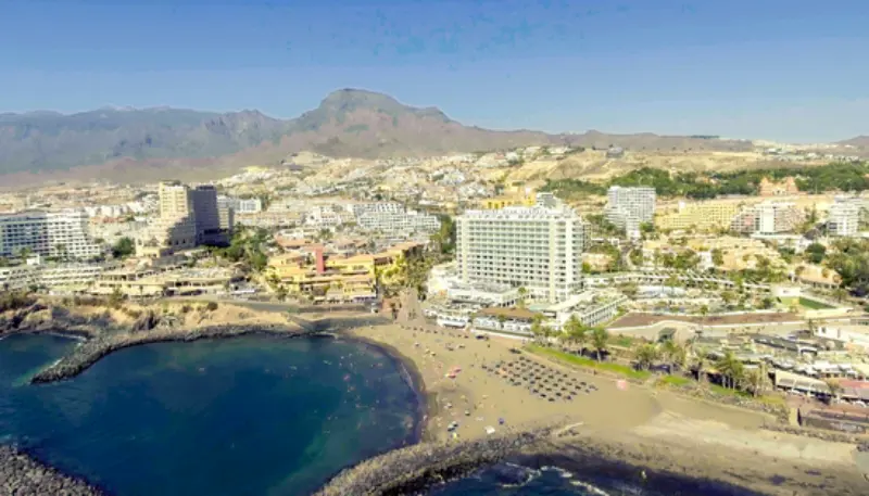
    Gavilan Beach Puerto De Santiago Tenerife

    The pace I recommend for a first visit

    For a first experience of Puerto de Santiago Tenerife, I deliberately leave more time than the minimum suggested by a map or booking page. I want room to stop, understand the setting and adapt to local conditions. Tenerife rewards that slower approach because weather, light and atmosphere change quickly. Finishing with spare energy is more useful than proving that I managed to fit another distant attraction into the same day.

    A useful backup plan

    My backup plan for Puerto de Santiago Tenerife is always something close by and simple: a town centre, sheltered café, promenade, museum, market or viewpoint that does not depend on the same conditions. I do not choose an alternative on the opposite coast. Keeping the backup local prevents a weather change or closure from becoming an exhausting cross-island drive and makes the itinerary much more resilient.

    Why I would verify details again on arrival

    Information connected with Puerto de Santiago Tenerife can change after an article is published, especially where permits, natural areas, operating hours or transport are involved. I therefore use this guide to understand the trip and then verify the final operational details shortly before going. That habit is more reliable than treating any travel article, including this one, as a permanent timetable.

    What I would avoid

    I would avoid turning Puerto de Santiago Tenerife into a race against the clock. The common mistakes are leaving too late, adding distant stops, relying on a single parking option and assuming conditions will match the coast where the day began. A simpler route with time for one proper break is usually more memorable. It also leaves enough flexibility to follow local signs and instructions instead of feeling pressured by a schedule.

    How this fits a longer stay

    On a week-long Tenerife trip, I place Puerto de Santiago Tenerife beside geographically related days rather than between two long drives. That lets me reuse knowledge of roads, parking and local weather instead of starting from zero each morning. On a shorter trip, I would keep only the element that matters most and save secondary stops for another visit. Tenerife has enough depth that leaving something for next time is not a failure.

  • San Miguel de Abona Guide: Historic Centre, Golf del Sur and Local Tenerife

    San Miguel de Abona Guide: Historic Centre, Golf del Sur and Local Tenerife

    San Miguel de Abona is one of the most useful municipalities for understanding how different inland and coastal Tenerife can be within a short drive. The historic town sits above the southern resorts with traditional architecture and local streets, while the municipal coastline includes Golf del Sur, Amarilla Golf and Marina San Miguel. Official tourism information describes the historic centre as one of the best-preserved traditional urban cores in southern Tenerife. I would visit San Miguel not as a substitute for La Laguna or La Orotava, but as a quieter south-island day that combines heritage, volcanic scenery and an easy connection to the coast.

    Start in the historic centre

    The traditional centre follows the old royal road around Calle de la Iglesia. I begin near Casa del Capitán and continue toward El Calvario, the church of San Miguel Arcángel and the civic buildings along the route. The scale is small enough for an unhurried walk, which is exactly the appeal. I pay attention to doors, courtyards and the relationship between houses and the sloping street rather than looking only for monumental landmarks.

    The town is inland and higher than the coast, so the air can feel different from Golf del Sur on the same day. I bring a light layer and do not assume resort weather applies at every elevation.

    Casa del Capitán and local history

    Casa del Capitán is one of the buildings that gives the old centre context. The official tourism material presents it as a historic residence now used as a museum, and I would check current opening hours before making it the centrepiece of the visit. Even when an interior is closed, the surrounding streets still make the trip worthwhile.

    I like small local museums because they explain agricultural life and migration patterns that large resort areas often hide. San Miguel becomes more interesting once I see the coastal development as only one recent layer of a much older municipality.

    Church of San Miguel Arcángel and the old road

    The parish church anchors the historic centre and reflects the late Canarian Baroque tradition described by official tourism sources. I use it as the point around which to orient the walk rather than trying to follow a rigid sightseeing route. From there, short side streets reveal a quieter town that feels far removed from the TF-1 corridor.

    I visit respectfully around services and local events. This is an active parish, not a museum set, and the best experience is often simply sitting in the square for a few minutes.

    Golf del Sur and Amarilla Golf

    The coastal part of San Miguel is much more international. Golf del Sur and Amarilla Golf are established golf areas with apartments, hotels and holiday infrastructure. My Tenerife golf guide covers course planning in more detail, but the important point here is that a traveller can stay on the coast and still reach the historic town quickly by car.

    Golf Course Near Los Cristianos Tenerife

    The environment is drier and more open than the inland streets. It suits travellers who want golf, marina activity and airport convenience more than a traditional beach-resort promenade.

    Marina San Miguel and the volcanic shoreline

    Marina San Miguel gives the coast a working leisure-harbour character and supports sailing, diving and other water activities. The shore around this part of Tenerife is volcanic and often more rugged than the broad beaches of Los Cristianos or Las Américas. I come for sea views, walking and activity access rather than expecting a long sandy bay.

    For swimming I choose designated, safe access and pay attention to conditions. The south coast can be sunny but wind-exposed, particularly around open headlands.

    Montaña Amarilla and nearby nature

    Montaña Amarilla lies close to the municipal boundary and is one of the south’s most distinctive volcanic coastal landscapes. If I include it, I treat the protected terrain carefully and stay on appropriate paths. It pairs well with San Miguel because the contrast between ochre coastal geology and the traditional inland centre is exactly what makes this area interesting.

    My Las Galletas and Costa del Silencio guide provides the practical coastal context if I want to extend the day eastward.

    Market, food and local produce

    The municipality’s farmers’ market is a useful stop when opening times align with the trip. Official tourism currently lists morning opening on selected midweek and weekend days, but I verify the schedule rather than hard-coding it into the itinerary. I look for seasonal fruit, vegetables, cheese, bread and local products rather than expecting a souvenir market.

    This is also a good area to explore Canarian food away from the busiest resort strips. My Tenerife food guide explains dishes and ingredients worth recognising on menus.

    Who should stay in San Miguel de Abona

    I would stay here for golf, a quieter southern base, airport convenience or a longer trip with a rental car. Golf del Sur and Amarilla Golf have the most visitor infrastructure; the historic town is better for local atmosphere but has fewer tourist services. Travellers whose priority is a classic sandy beach and nightlife will find stronger choices farther west.

    Golf Del Sur Volcanic Coast Tenerife

    For prices and availability I compare San Miguel de Abona accommodation with El Médano and Costa Adeje before deciding what kind of south-Tenerife experience I actually want.

    How I would plan it

    I would give San Miguel half a day for the historic centre and another half for the coast rather than rushing both in two hours. The municipality makes sense when I allow its inland-coastal contrast to be the theme of the day.

    Official San Miguel de Abona tourism information is worth checking for current opening hours, routes and municipal points of interest.

    A simple day route

    I would begin inland before the strongest afternoon heat, walk the historic centre, stop for lunch and then descend toward the marina and coast. If I want a sunset, I continue west only as far as necessary rather than turning the day into a full southern-island road trip.

    Parking and getting around

    A car is the easiest way to connect the old town with Golf del Sur and the coast. I still park considerately on narrow historic streets and walk the final section when possible. Buses serve the municipality, but combining several dispersed points takes more timetable planning than visiting one compact resort.

    Planning San Miguel de Abona around the rest of the trip

    I would not let San Miguel de Abona dominate every day of the holiday. Tenerife works best when active or detailed plans are balanced with a slower meal, a short walk or time by the sea. I group nearby places together, leave a realistic margin for parking and changing conditions, and avoid crossing the island simply to add one more stop. That makes this part of the trip feel intentional rather than squeezed between unrelated attractions.

    What I check the evening before

    The evening before this part of the trip, I confirm weather, access, opening information and the exact route from my accommodation. For San Miguel de Abona, small practical changes can matter more than they appear on a static itinerary. I save essential information offline, charge the phone and keep a nearby alternative in mind. That preparation means a closure, stronger wind or slower traffic changes the plan without ruining the day.

    How I keep the day geographically sensible

    I build this day around one section of Tenerife. Even when san miguel de abona guide: historic centre, golf del sur and local tenerife sounds easy to combine with several famous attractions, mountain roads and elevation can turn short map distances into long travel times. I prefer adding one nearby village, beach, viewpoint or lunch stop. The result is less time in the car and more time actually experiencing the area.

    Buenavista Golf Course Tenerife At Sunset

    The pace I recommend for a first visit

    For a first experience of San Miguel de Abona, I deliberately leave more time than the minimum suggested by a map or booking page. I want room to stop, understand the setting and adapt to local conditions. Tenerife rewards that slower approach because weather, light and atmosphere change quickly. Finishing with spare energy is more useful than proving that I managed to fit another distant attraction into the same day.

    A useful backup plan

    My backup plan for San Miguel de Abona is always something close by and simple: a town centre, sheltered café, promenade, museum, market or viewpoint that does not depend on the same conditions. I do not choose an alternative on the opposite coast. Keeping the backup local prevents a weather change or closure from becoming an exhausting cross-island drive and makes the itinerary much more resilient.

    Why I would verify details again on arrival

    Information connected with San Miguel de Abona can change after an article is published, especially where permits, natural areas, operating hours or transport are involved. I therefore use this guide to understand the trip and then verify the final operational details shortly before going. That habit is more reliable than treating any travel article, including this one, as a permanent timetable.

    What I would avoid

    I would avoid turning San Miguel de Abona into a race against the clock. The common mistakes are leaving too late, adding distant stops, relying on a single parking option and assuming conditions will match the coast where the day began. A simpler route with time for one proper break is usually more memorable. It also leaves enough flexibility to follow local signs and instructions instead of feeling pressured by a schedule.

  • San Juan de la Rambla Guide: Charco de La Laja, Historic Streets and North Coast

    San Juan de la Rambla Guide: Charco de La Laja, Historic Streets and North Coast

    San Juan de la Rambla is one of those north-Tenerife places that makes sense precisely because it is not a large attraction. The municipality combines a small historic centre, steep green slopes, Atlantic viewpoints and one of the island’s best-known volcanic bathing spots, Charco de La Laja. Official Tenerife tourism describes La Laja as a lava-formed natural pool with generally clear, calm water when sea conditions allow, while also warning that swell can become strong. That balance is exactly how I approach the area: beautiful, local and rewarding, but not a place where I ignore the Atlantic. I would include San Juan de la Rambla on a north-coast day with Los Realejos, La Guancha, Icod or Garachico rather than crossing the island solely for one swim.

    The historic centre

    The old centre is compact, and that is part of its charm. Traditional houses, small streets and ocean views create a slower atmosphere than Puerto de la Cruz. Official tourism highlights historic properties and religious buildings as part of the municipality’s character.

    I park carefully, walk rather than drive between nearby streets and accept that opening hours for small churches or cultural sites may be limited. The value is the ensemble, not a single must-see interior.

    Charco de La Laja

    Charco de La Laja is the place most visitors recognise. Lava created a protected-looking basin on the coast, reached by a path and steps. On a calm day the water can look almost swimming-pool smooth; on a rough day waves can change the situation completely.

    I check conditions at the site, respect closures and do not interpret other people swimming as proof that conditions are safe for me. My natural pools guide explains the same rule across Tenerife’s charcos.

    Las Aguas and the coast

    The coastal hamlet of Las Aguas is another reason to slow down. It gives access to sea views and restaurants in a setting that feels embedded in the north coast rather than built around tourism. I like it for lunch after the historic centre.

    This is a good place to try local fish or Canarian dishes without needing a formal food itinerary. My food guide provides the background.

    Walking and viewpoints

    The municipality is steep, so even short walks can involve gradients. I prefer coastal and village strolls unless I have researched a specific hiking route. After rain, stone and shaded surfaces can be slippery.

    For a larger walking day I continue to Los Realejos or choose a dedicated trail rather than improvising on rural roads.

    Weather on the north coast

    San Juan de la Rambla is greener and often cloudier than the south. That does not mean constant rain; it means more variable cloud, humidity and a different quality of light. I keep a flexible schedule and sometimes visit when the south is too hot.

    Swimming conditions depend more on swell than air temperature. A warm sunny day can still produce unsafe waves at a natural pool.

    Tenerife Rocky Coast And Natural Pool

    How to get there

    By car, the north motorway and connecting roads make San Juan de la Rambla straightforward to add to a north-coast itinerary, though parking in small centres can be limited. Official tourism places Tenerife North Airport roughly 40 km away and Tenerife South considerably farther.

    Buses connect the municipality with other northern towns, but I check current TITSA times for the exact stop. For a multi-village day, a car is more flexible.

    Where to stay

    This is not where I would send a first-time visitor seeking resort services. It suits rural stays, repeat visitors, couples who want quiet and travellers comfortable driving to beaches and attractions.

    If the atmosphere appeals, compare San Juan de la Rambla accommodation with Puerto de la Cruz or Icod before deciding. A beautiful rural property can also be isolated after dark.

    How I combine San Juan de la Rambla with nearby places

    My favourite logical combinations are Icod plus San Juan de la Rambla, or Los Realejos plus San Juan de la Rambla. Garachico can be added if I start early, but I do not try to swim in every natural pool along the coast.

    Tenerife Volcanic Coast Natural Pool

    Use my Icod guide and Garachico guide to build a route based on two or three strong stops rather than six rushed ones.

    My final planning advice

    I think San Juan de la Rambla is best treated as a place to experience rather than consume. A walk, one swim if conditions are right, lunch and a few quiet streets can be enough. That is exactly why it adds variety to a Tenerife trip dominated by big attractions.

    If you are staying in the south, I would include it only as part of a broader north-coast day. If you are based in Puerto de la Cruz, La Orotava or Icod, it becomes an easy half-day excursion that can be adjusted around weather.

    A north-coast half day

    From Puerto de la Cruz I can make San Juan de la Rambla a relaxed half day: historic centre, La Laja if the sea is calm, then lunch in Las Aguas. That leaves the afternoon free for Icod, Garachico or a return to the hotel. I prefer this rhythm to trying to collect every charco between Los Realejos and Buenavista.

    For a north-coast half day, I keep the decision flexible. I compare live conditions with the rest of the day, leave margin for slower roads or parking, and choose the version that keeps San Juan de la Rambla guide comfortable rather than ambitious. Tenerife can change quickly between coast, forest and high ground.

    Photography without taking risks

    La Laja is photogenic because of the contrast between black lava, white water and the village above. I take photos from established paths and platforms. Wet lava is not a tripod platform, and waves do not respect the edge that looks dry in a previous photograph.

    This is one part of San Juan de la Rambla guide that I do not lock in too early. Around photography without taking risks, current weather, access and the energy of the group matter more than the plan I wrote at home. I leave enough time to change direction without turning the day into a rush.

    When I skip the natural pool

    If waves are breaking over the outer lava or local authorities close access, I do not wait for a gap and jump in. I turn the visit into a photography and lunch stop. The north coast offers enough alternatives that missing one swim is never a ruined day.

    Before relying on when i skip the natural pool, I recheck anything time-sensitive and keep a nearby alternative. A closure, weather change or full car park should change one stop, not the whole day. For San Juan de la Rambla guide, that small amount of redundancy makes independent travel much calmer.

    Tenerife Volcanic Natural Pool

    Parking and steep streets

    The municipality is compact but not flat. I park where permitted and walk the last part, accepting the gradient. If mobility is limited, I study the exact access to the viewpoint or restaurant rather than assuming a village centre is step-free.

    I verify parking and steep streets close to the visit rather than assuming an older timetable or review is still correct. If conditions are different, I switch to the backup I already chose. This keeps San Juan de la Rambla guide practical without filling the itinerary with unnecessary contingency stops.

    Lunch in Las Aguas

    I like placing lunch after the pool because it removes any rush to reach the water at a particular time. Fresh fish and Canarian dishes fit the setting, and a slower meal gives me time to reassess weather before continuing along the north coast.

    The final check for lunch in las aguas happens on the day: weather, access, transport and any local notice. I would rather adapt early than spend an hour trying to rescue a plan that no longer works. That flexibility is especially useful when organising San Juan de la Rambla guide.

    A rainy-day alternative

    If the coast is wet or rough, I shift the emphasis to Icod, La Orotava or a museum in Puerto de la Cruz. North-coast weather often changes over short distances, so I keep the car itinerary flexible rather than cancelling the entire day.

    For a rainy-day alternative, I save one realistic alternative in the same area and avoid crossing the island just to replace a missed stop. That way San Juan de la Rambla guide stays geographically sensible even when Tenerife’s weather or access conditions change.

    Final planning check for San Juan de la Rambla guide

    Before I lock in this part of the trip, I compare the plan with the next day as well. A late finish, long drive or tiring activity can affect what follows. I prefer to leave a little unused time in the schedule, especially when San Juan de la Rambla guide is combined with mountain roads, swimming, hiking or a restaurant reservation. That margin is what lets me stop at an unexpected viewpoint, wait out a shower or simply stay longer somewhere I like without feeling that the itinerary is falling apart.

  • Taganana Tenerife Guide: Anaga Village, Beaches, Hikes and Practical Tips

    Taganana Tenerife Guide: Anaga Village, Beaches, Hikes and Practical Tips

    Taganana is the Anaga village that makes me slow down the most. Reaching it means crossing a mountain landscape of laurel forest and deep ravines before the road drops toward a remote-looking Atlantic coast. The village itself is small and lived-in; nearby beaches such as Roque de las Bodegas, Almáciga and Benijo give the day its dramatic seascape.

    I do not visit Taganana as if it were an attraction with a ticket gate. People live here, roads are narrow and parking is limited. I come for the landscape, traditional settlement, food and a sense of how isolated Anaga communities were before modern roads. Respecting that scale is essential to enjoying the place.

    Why Taganana feels different

    Tenerife’s official tourism information describes Taganana as one of Anaga’s traditional settlements and highlights its nearby beaches, including Roque de las Bodegas, Almáciga and Benijo. The official Taganana page is useful before the drive.

    The change begins before I arrive. Roads pass through cloud forest and then open onto steep cultivated slopes and ravines. I allow generous travel time because this is a mountain journey, not a quick coastal transfer from Santa Cruz.

    Walking through the village

    I explore Taganana on foot without expecting a long list of monuments. Traditional houses, small lanes, terraces and the church area create the character. The village’s history is connected with agriculture, wine and the difficulty of transport through Anaga.

    I keep noise down, avoid blocking doorways and remember that a picturesque lane may be someone’s access to home. Photography is fine from public space, but I do not treat private courtyards as open exhibits.

    Roque de las Bodegas

    Roque de las Bodegas is the easiest of the nearby coastal stops for combining ocean views with restaurants. The road runs close to the shore and the beach has a more accessible feel than Benijo. I often choose it for lunch after walking in the village.

    The sea can still be rough. I assess waves and flags rather than assuming the presence of restaurants and parking makes the beach sheltered. On a strong-swell day, I enjoy the coast from land.

    Almáciga

    Almáciga is a dark volcanic beach below Anaga’s steep slopes and is well known for surf. The official page warns that waves are often strong and describes the beach as a surf location. My Tenerife surf guide explains why I do not treat a surfer-filled beach as automatically safe for casual swimming.

    I like stopping here to watch the ocean, but parking is limited. I never leave the car where it narrows the road or blocks residents. If the area is crowded, I continue rather than circling repeatedly.

    Benijo

    Benijo is the most dramatic beach in the area, with black sand and views toward the Roques de Anaga. My detailed Playa de Benijo guide covers the stair access and strong-wave precautions.

    I arrive with enough daylight for the return climb and drive. Sunset can be beautiful, but the mountain road back is not the place to be tired, rushed or distracted. If I am unfamiliar with Anaga roads, I prefer an earlier visit.

    Las Vueltas de Taganana trail

    The historic Las Vueltas route once served as an important connection between Taganana and the highlands. Tenerife’s official trail description lists a 4.5-kilometre route of roughly 2 hours 30 minutes and medium difficulty, descending through laurel forest and traditional paths toward the village. I consult the official Las Vueltas page and current trail status before walking.

    Anaga Laurel Forest Path Tenerife

    This is not a casual add-on after a full beach day. I plan footwear, transport between trail endpoints and weather carefully. Wet stone can be slippery, and cloud in the upper forest may be very different from sunshine on the coast.

    PR-TF 8 Afur–Taganana–Afur

    For experienced hikers, the official PR-TF 8 description lists a demanding circular route of about 14.3 kilometres, around seven hours and substantial accumulated ascent and descent. It connects Afur, the Tamadite area, Taganana and the forest. I check current trail status before considering it.

    I would not recommend this as a spontaneous holiday walk. Seven hours in steep terrain requires fitness, water, food, daylight and a stable forecast. If I mainly want Taganana, a shorter walk plus village time is often the better travel experience.

    Food in Taganana

    The coast is known for simple fish restaurants, while the village and surrounding Anaga area also connect with traditional wine and agricultural products. I eat where it fits the day rather than driving back to the city for a famous restaurant.

    My food guide explains Canarian basics. In a small community, I am especially patient when service is slower; the point of the visit is not resort efficiency.

    Driving to Taganana

    The roads through Anaga are narrow, winding and scenic. I use my Tenerife driving guide as a reminder to keep speeds low, use legal parking and avoid stopping on blind bends. I also check fuel before entering the massif rather than expecting a station in every village.

    If I am uncomfortable with mountain roads, I do not force a rental-car day simply because the route is famous. Public transport or an organised excursion can make the visit more relaxing.

    Visiting by bus

    Taganana is served by TITSA, and buses are a realistic way to reach the village without driving. Schedules are less frequent than urban routes, so I check the current timetable and know my return option before leaving Santa Cruz or La Laguna. My no-car guide covers the practical side of using TITSA.

    A bus also changes the day positively: I can look out at the mountains instead of concentrating on bends and parking. The trade-off is that hopping between all three beaches becomes less flexible, so I choose priorities.

    Taganana and Anaga in one day

    I combine Taganana with one or two Anaga viewpoints or a short laurel-forest walk. My Anaga Rural Park guide explains the broader geography. I do not attempt every major trail, viewpoint and beach in a single day.

    Anaga Laurel Forest Tenerife

    A realistic plan could be forest walk in the morning, Taganana for lunch and one coastal beach afterward. That gives the landscape time to change naturally as I descend from cloud forest to the Atlantic.

    When to go

    I prefer a weekday morning outside the busiest holiday periods, but weather matters more than calendar. Anaga can be cloudy or wet even when the south is sunny. That is normal. I bring a light waterproof layer and do not cancel simply because the high forest is misty.

    Strong rain, wind or official warnings are different. I follow closures and do not enter ravines or exposed trails during unsafe conditions. The coast can also be rough independently of the mountain weather.

    Where to stay

    Most visitors see Taganana as a day trip, but rural accommodation can suit hikers or travellers who specifically want Anaga evenings and early mornings. Services are limited compared with a resort, so I check food options, parking and transport before booking. I compare accommodation in Anaga and northeast Tenerife rather than assuming every property is close to Taganana itself.

    For a first Tenerife trip, La Laguna or Santa Cruz is usually the easier base. Staying inside Anaga makes more sense when the rural setting is the purpose of the trip.

    My ideal Taganana day

    I leave early, stop at one high Anaga viewpoint, take a short forest walk, descend to Taganana, have lunch near the coast and choose either Roque de las Bodegas, Almáciga or Benijo depending on sea conditions and parking. Then I return before I am tired.

    Anaga Laurel Forest Trail Tenerife

    The most important choice is what to leave out. Anaga feels remote because the roads and terrain demand time. A day with fewer stops creates a stronger sense of place than a list of ten photo pins.

    Frequently asked questions

    Is Taganana worth visiting?

    Yes, especially if you enjoy mountain scenery, traditional villages, dark-sand beaches and a slower rural atmosphere.

    Can I drive to Taganana?

    Yes, but the Anaga roads are winding and parking near the coast is limited. I drive slowly and use legal spaces only.

    Can I reach Taganana by bus?

    Yes. TITSA serves the village, but I check the current timetable because frequencies are more limited than in the city.

    Which Taganana beach is best?

    Benijo is the most dramatic, Almáciga is known for surf and Roque de las Bodegas is often the easiest for combining the coast with restaurants. Sea conditions can change the best choice.

    How long do I need?

    A full day is ideal if I want to include an Anaga forest stop, village time, lunch and one beach without rushing.

    Respecting Anaga communities

    I buy lunch or coffee locally when it fits the day, take litter away and avoid parking across gates or agricultural access. In small settlements, a single badly parked car can affect residents far more than it would in a resort car park. I also keep music and drone activity under control; quiet is part of the value of the place.

    If a road, path or parking area is closed, I do not search for an unofficial bypass. Protected landscapes and rural communities function best when visitors accept that access sometimes changes.

  • Playa San Juan and Alcalá Guide: A Quieter Side of Southwest Tenerife

    Playa San Juan and Alcalá Guide: A Quieter Side of Southwest Tenerife

    Playa San Juan and Alcalá are two southwest Tenerife places I recommend when someone likes the climate of the south but not the intensity of the biggest resorts. They sit on the Guía de Isora coast, west of Costa Adeje, with fishing-harbour roots, black volcanic shoreline, long promenades and sunset views toward La Gomera.

    Neither is a “secret village.” Both have tourism, apartments and hotels. What they offer is a calmer scale: I can walk to dinner, swim from an urban beach when conditions are good and spend the evening by the sea without the same nightlife density as Playa de las Américas. They work as a day trip, but they can also be smart bases for a slower holiday.

    Playa San Juan: the practical beach town

    Tenerife’s official tourism page describes Playa San Juan as a sheltered black-sand and pebble beach beside the fishing harbour, protected by the breakwater and equipped with showers, parking, lifeguard services, accessible facilities and nearby restaurants. I check the official Playa San Juan beach page for current services.

    The protection from wind and waves makes it more approachable than many exposed north-coast beaches, though I still follow flags and local advice. The town’s scale is the main attraction for me: the beach, harbour, cafés and promenade sit close enough to create an easy day on foot.

    The Playa San Juan promenade

    The official tourism site notes a seafront walk of almost two kilometres, with cafés, restaurants and a historic lime kiln near the water. I use the promenade for an unstructured late afternoon: walk, stop for coffee, watch boats and stay for sunset.

    This is not a place where I need a detailed sightseeing checklist. The pleasure is the everyday coastal rhythm. I bring a light layer after sunset in winter because the breeze can feel cooler once the sun drops.

    Alcalá: village atmosphere and sunsets

    Alcalá lies a short distance north and has a small fishing harbour, volcanic beach and attractive seafront. The official page describes a small urban beach of dark sand and gravel with restaurants around it. I like Alcalá most around late afternoon when the light faces La Gomera.

    The centre feels compact and walkable. I explore the square, waterfront and side streets rather than trying to turn it into a museum visit. It is a good place for travellers who enjoy watching local life as much as visiting attractions.

    La Jaquita and the Alcalá coastal walk

    The Alcalá–La Jaquita promenade includes small dark-sand beaches, natural pools, landscaped areas and space for walking or cycling. The official promenade page explains the seafront layout.

    Alcala Seafront Tenerife

    I enjoy walking this stretch without needing to swim at every cove. Sea conditions can affect natural bathing areas, so I treat the pools as optional rather than guaranteed. The path itself is enough reason to come.

    Playa de La Jaquita

    The official beach information describes La Jaquita as a roughly 700-metre coastal front divided into small black-sand bathing areas with adapted facilities, showers, changing rooms and a children’s area. This makes it one of the more practical volcanic-coast options for travellers who want services.

    I still check which section is open and best for the day because coastal maintenance and sea conditions can affect individual areas. I use water shoes if the entry looks stony and keep children close around lava edges.

    Where to eat

    Both Playa San Juan and Alcalá are good for fish, seafood and simple Canarian meals. I prefer restaurants that fit naturally into the harbour or promenade day rather than driving away for a famous name. My Tenerife food guide helps with dishes and ordering.

    At seafood restaurants I ask what is fresh and whether prices are per portion or by weight. For sunset dinner, I reserve if the restaurant is small or the date is busy, especially on weekends and holidays.

    Sunset toward La Gomera

    One reason I choose this coast is the west-facing horizon. On clear evenings La Gomera can sit sharply across the water, and the sky often changes long after the sun reaches the horizon. I stay for the afterglow rather than leaving immediately after sunset.

    I do not need a cliff-top Instagram spot. The normal seafront gives a safer and more relaxed view, with cafés and lighting nearby for the walk back.

    How the area compares with Costa Adeje

    Costa Adeje has more large resorts, polished beaches, shopping and excursion infrastructure. Playa San Juan and Alcalá feel smaller and less nightlife-focused. I choose Costa Adeje for maximum convenience and these Guía de Isora towns for a slower coastal routine.

    The trade-off is fewer attractions within walking distance. If I want Siam Park, nightlife and constant tour departures, I will travel more from Playa San Juan. If I want morning coffee, a swim and sunset on foot, that quieter scale is the advantage.

    How the area compares with Los Gigantes

    Los Gigantes is more dramatic visually because of the cliffs and has a strong boat-trip identity. Playa San Juan and Alcalá are gentler, flatter-feeling coastal bases with longer everyday promenades.

    I can visit all three in one west-coast day, but I prefer not to rush. A good plan is Los Gigantes in the morning and Alcalá at sunset, or Playa San Juan for lunch followed by a boat trip elsewhere.

    Getting there by car

    The TF-1 makes the southwest coast easier to reach than it once was, and local roads connect the coastal settlements. Parking can still be limited around the oldest waterfront areas. My driving guide covers general road and parking habits.

    Alcala Tenerife Coastal Village

    I save the exact accommodation or car-park pin because “Alcalá” or “Playa San Juan” can bring navigation into tight central streets. I would rather park slightly outside the core and walk.

    Getting there without a car

    TITSA buses serve the southwest corridor, making both towns realistic without a car, especially for travellers who plan a slow stay rather than daily remote hikes. My no-car Tenerife guide explains how I use the network and ten+ travelcards.

    I check late-evening return times before committing to sunset if I am staying elsewhere. The atmosphere is relaxed enough that waiting for a bus is not a problem, but missing the last convenient connection can turn a cheap day trip into an expensive taxi ride.

    Where to stay

    Playa San Juan suits travellers who want a slightly larger local centre with a sheltered beach and promenade. Alcalá suits those who prioritise village atmosphere, sunset and access to La Jaquita. I compare accommodation in Playa San Juan, Alcalá and Guía de Isora and pay attention to whether a listing is genuinely walkable to the sea.

    Large resort properties exist around this coast too, so I read the map rather than assuming every “Alcalá” hotel sits in the old village. The experience changes significantly when the property is isolated behind a long resort entrance.

    My ideal day

    I start with a swim or coffee in Playa San Juan, walk the promenade and have lunch by the harbour. In the afternoon I move to Alcalá, walk toward La Jaquita and stay for sunset. If I am based nearby, I split that into two separate slow days instead.

    I do not add Teide or Anaga to this plan. The point of the Guía de Isora coast is a day that requires very little performance: ocean, food, walking and light.

    Frequently asked questions

    Which is better, Playa San Juan or Alcalá?

    Playa San Juan has a more practical sheltered beach and longer town promenade; Alcalá feels smaller and is excellent for sunset and the La Jaquita coastal walk.

    Playa San Juan Tenerife With Traditional Boats

    Are the beaches black sand?

    Yes, the coast is volcanic and includes dark sand, gravel and pebble sections.

    Can I stay here without a car?

    Yes, especially for a relaxed coastal holiday. Buses connect the southwest, though a car is more useful for remote mountain trips.

    Is this area quieter than Costa Adeje?

    Generally yes. There are hotels and tourism, but nightlife and large-resort density are lower in the village centres.

    Can I see La Gomera from the coast?

    On clear days, La Gomera is visible across the water and is particularly attractive around sunset.

    Who will enjoy this coast most

    I recommend Playa San Juan and Alcalá to couples, repeat Tenerife visitors, families who prefer a quieter evening, and travellers who want to walk to the sea without living inside a nightlife district. I would choose somewhere else for a first trip focused mainly on clubs, large shopping centres or a packed schedule of major attractions.

    For remote hiking, a car is still useful. For everyday coastal life, however, the ability to walk for coffee, groceries, dinner and sunset makes these towns much more practical than their small size suggests.

    I would also consider them for a split stay: a few nights here after a busier Costa Adeje stay can change the pace without requiring a move to the far north. The west-coast location still keeps Los Gigantes, whale-watching departures and Teide approaches within reasonable reach, while evenings remain noticeably calmer.

  • Bajamar and Punta del Hidalgo Guide: Natural Pools and Tenerife’s Northeast Coast

    Bajamar and Punta del Hidalgo Guide: Natural Pools and Tenerife’s Northeast Coast

    Bajamar and Punta del Hidalgo are where I go when I want a Tenerife coast day built around ocean swimming, walking and seafood rather than a sandy beach. Both sit on the northeast edge of San Cristóbal de La Laguna municipality, with Anaga rising behind them and the Atlantic directly in front. The coast feels open, local and much less resort-like than the southwest.

    The headline attractions are the seawater pools, but I like the whole rhythm: a morning swim if conditions allow, a long promenade walk, lunch with a view and then an Anaga or La Laguna stop on the way back. I always keep the ocean in charge. A natural pool can be closed or unsafe when swell is strong, and no itinerary is worth ignoring that.

    Natural Pool Near Los Gigantes Puerto De Santiago Tenerife

    Bajamar: easy-access seawater pools

    Bajamar is known for developed ocean pools protected from much of the open sea. The area has changing rooms, places to sit and a seafront setting that makes it practical for families and travellers who prefer infrastructure. My broader natural pools guide compares Bajamar with other volcanic bathing areas around the island.

    I arrive earlier on sunny weekends because local residents use these pools too. I do not treat them as a private resort facility; I keep belongings compact, avoid occupying extra space and follow any posted closure or safety instructions.

    Punta del Hidalgo pools

    Tenerife’s official tourism page describes Punta del Hidalgo’s seawater pools as Blue Flag bathing facilities with surveillance, showers and adapted access for people with reduced mobility. The official Punta del Hidalgo page is worth checking before the day.

    The setting is more open and dramatic than an inland swimming pool, with mountains and ocean framing the water. Even in a protected pool, spray and surge can increase during rough seas, so I listen to lifeguards and never cross barriers.

    The coastal walk between sea and mountains

    One of the best reasons to visit is simply walking beside the Atlantic. The road and promenade sections around Punta del Hidalgo reveal the abrupt meeting of Anaga and the sea, and the light changes constantly as cloud moves across the mountains.

    I bring sun protection even when the hills are cloudy. Coastal wind can make the temperature feel mild while UV remains strong. For a longer walk, I carry water because cafés may be spaced farther apart than in a southern resort promenade.

    Swimming versus watching the ocean

    I decide whether to swim only after I arrive. If flags, lifeguards or closures indicate poor conditions, I switch to walking and lunch. The northeast is beautiful precisely because it is exposed to the Atlantic; that exposure can produce rough days.

    This approach removes disappointment. A trip to Bajamar and Punta del Hidalgo is still worthwhile for scenery, food and atmosphere even without entering the water. I prefer that mindset to taking risks simply because I brought a swimsuit.

    Where to eat

    Fresh fish and simple Canarian dishes fit this coast perfectly. I look for daily fish, grilled options, potatoes with mojo and local desserts rather than searching for elaborate fine dining. Punta del Hidalgo in particular has a strong association with seafood restaurants.

    My food guide explains common island dishes. I ask about the fish and price by weight when relevant so there are no surprises at the end of the meal.

    Combine the coast with La Laguna

    Bajamar and Punta del Hidalgo are natural extensions of a La Laguna day. I might spend the morning in the historic centre, have lunch near the coast and swim in the afternoon, or reverse the order in hot weather.

    The city and coast have noticeably different microclimates. I keep a light layer in the car or bag because La Laguna can feel cooler, especially later in the day, even when the seafront is pleasant.

    Combine the coast with Anaga

    Punta del Hidalgo sits at the edge of the Anaga landscape, so it can be paired with selected viewpoints or a hike. I use my Anaga guide to choose a realistic route rather than trying to cross the entire massif after swimming.

    A good combination is one substantial activity plus the coast. If I hike for four or five hours, I keep the pool stop simple. If I want a relaxed swim and long lunch, I choose only a short forest walk or viewpoint.

    Getting there by car

    From La Laguna, roads descend toward the northeast coast through Tejina and Bajamar. Driving is generally less dramatic than deep Anaga roads, but local streets and coastal parking can become busy. My Tenerife driving guide covers general parking habits.

    I avoid leaving valuables visible in the car and do not park where a narrow lane becomes harder for residents or buses. If the closest spaces are full, I would rather walk a few extra minutes than create a problem.

    Getting there by bus

    The coast is one of the easier non-resort areas to visit by public transport from La Laguna because TITSA services connect the city with Bajamar and Punta del Hidalgo. I check current schedules before leaving and save the return options, particularly in the evening. My no-car guide explains travelcards and route planning.

    I build extra time around the bus because a coastal day should not feel like a race. If I miss one connection, a coffee by the ocean is a better response than stressing through the final hour.

    Accessibility and comfort

    Developed pools are a better choice than wild lava charcos for travellers who need railings, showers and easier entries. Punta del Hidalgo’s official listing specifically notes adapted access. I still check the exact facility I plan to use because maintenance or temporary closures can change what is available.

    I bring non-slip sandals, a warm layer for after swimming and a dry bag for phone and wallet. Wet volcanic surfaces can be slippery even where the pool itself is well designed.

    Best time to visit

    I prefer a calm-weather morning, then use the afternoon for lunch and walking. Weekdays can feel quieter than sunny weekends. In winter, air temperatures are often mild, but the water and wind may feel cool when I get out.

    I check marine conditions rather than just the weather icon. A sunny day can still have strong swell. That distinction matters at every natural pool in Tenerife.

    Tenerife Rocky Coast And Natural Pool

    Where to stay

    Punta del Hidalgo appeals to travellers who want a quiet edge-of-island base, walking access to the sea and proximity to Anaga rather than nightlife. Bajamar feels slightly more practical for pool-focused stays. I compare accommodation around Bajamar, Punta del Hidalgo and La Laguna and read recent comments about parking and road noise.

    For a first Tenerife holiday, I usually keep La Laguna or Puerto de la Cruz as the broader base and visit the northeast coast for the day. For a repeat trip, staying here can be wonderfully slow.

    My half-day and full-day plans

    For a half day, I choose one pool, take a coastal walk and have lunch. For a full day, I add La Laguna or a short Anaga walk. I do not add Santa Cruz, Las Teresitas and Taganana as well unless the purpose of the day is simply driving.

    The northeast feels best when there is time to sit by the ocean. I leave gaps in the plan because tide, swell and appetite decide the pace better than a minute-by-minute schedule.

    Frequently asked questions

    Are Bajamar and Punta del Hidalgo good for swimming?

    Yes, their developed seawater pools are popular, but ocean conditions still matter. I obey closures and lifeguard instructions.

    Which is better, Bajamar or Punta del Hidalgo?

    Bajamar is very convenient for pool time, while Punta del Hidalgo has a stronger edge-of-Anaga atmosphere and long coastal views. They are close enough to see both.

    Can I visit without a car?

    Yes. Public buses connect the area with La Laguna, making it one of the easier local coast trips without a car.

    Are the pools free?

    Public pool access is generally free, but I check current local information because services and maintenance arrangements can change.

    Can I combine the area with Anaga?

    Yes, but I choose a short Anaga element unless I am prepared for a long active day.

    What I bring for a natural-pool day

    My small kit is simple: swimsuit, towel, non-slip sandals, sunscreen, water, a light layer and a waterproof pouch for valuables. I do not bring inflatable toys into rough ocean pools unless local rules and conditions clearly allow them. Large inflatables can become dangerous when wind or surge increases.

    Tenerife Volcanic Coast Natural Pool

    After swimming, I change into dry clothes before a long bus ride or drive. The northeast breeze can make wet swimwear surprisingly uncomfortable even on an otherwise warm day.

    I also keep a small snack in the bag because a pool morning can easily extend into a long coastal walk. If the cafés are busy, I do not let hunger push me into rushing the return journey. A relaxed natural-pool day works best when I have enough water, something simple to eat and no strict reservation immediately afterward.

  • La Guancha Tenerife Guide: Charco del Viento, Rural North and Local Villages

    La Guancha Tenerife Guide: Charco del Viento, Rural North and Local Villages

    La Guancha is a north-Tenerife municipality I use to connect mountain villages with the lava coast. It stretches from the higher slopes toward the Atlantic between San Juan de la Rambla, Icod de los Vinos and La Orotava. Official tourism highlights its chapels, rural character, El Pinalete recreation area and Charco del Viento, one of the most photogenic natural bathing places in this part of the island. I would not rush through it as another pin on a map. The appeal is the gradual change in landscape as I move from pine and farmland down to black lava.

    La Guancha town: a small centre rather than a tourist attraction

    The municipal centre is useful for seeing ordinary north-island life away from the main resort strip. Churches, chapels, local shops and residential streets create a very different rhythm from Puerto de la Cruz. I spend enough time for a coffee and short walk, then continue into the surrounding landscape. This is not a place where I expect a major ticketed sight; the interest comes from context and from understanding how communities sit between the coast and upper slopes.

    This is the point where I slow the itinerary down. I leave enough time for parking, a short walk and a change of plan if weather or opening conditions are different from what I expected. Tenerife rewards flexibility, and I would rather enjoy one place properly than rush through three stops because they looked close together on a map.

    Charco del Viento: beautiful but dependent on the Atlantic

    Charco del Viento is the coastal stop that draws most visitors. Lava formations create natural pools and channels, but I never translate the word pool into guaranteed safe swimming. North-coast swell can make conditions dangerous even on a sunny day. I check local warnings, watch the water for several minutes and skip swimming if waves are breaking strongly over the outer rocks. The view alone can justify the stop.

    Tenerife Rocky Coast And Natural Pool

    In practical terms, I check this again on the morning of the visit. Opening hours, sea state, wind and local access can change, especially on an island where coast, forest and high ground behave very differently. I also keep one nearby alternative so a small change never means crossing Tenerife unnecessarily.

    El Pinalete and the higher forest

    Official tourism points to El Pinalete as a recreation area suited to a family day in the forest. The change from coast to pine is one of the reasons I enjoy La Guancha: within a relatively small municipality, temperature, vegetation and light can shift dramatically. I pack a layer and food rather than assuming facilities will match a resort park. Fire-risk restrictions also matter in dry periods, so I check current notices before planning a barbecue or forest activity.

    I would build the rest of the day around this stop rather than squeeze it between two distant attractions. That usually means choosing a nearby lunch, beach, viewpoint or town and accepting that driving time is part of the experience. The result is a calmer day and a much better sense of place.

    The road between coast and high ground

    Driving through La Guancha requires patience. Local roads can be steep and narrow, and navigation apps sometimes prefer a technically shorter route that is less comfortable than the main road. I do not treat every rural shortcut as a recommendation. If I am nervous about gradients, I stay on broader roads and accept a few extra minutes. Parking is also easier when I am willing to walk into a village centre rather than search for the closest possible space.

    For first-time visitors, the useful question is not only whether this is worth seeing, but whether it fits the base and transport plan. I compare the route with my Tenerife transport guide and avoid creating a day with repeated north-south crossings just to tick off one more place.

    Combining La Guancha with San Juan de la Rambla

    The most natural pairing is with San Juan de la Rambla. Both municipalities offer lava-coast scenery, traditional centres and a quieter north-Tenerife atmosphere. I would choose one main swimming stop according to sea conditions rather than trying every charco in a day. That reduces backtracking and gives more time for lunch or a short inland walk.

    I also think about the time after the main activity. A museum, flight, paddle or village visit is more enjoyable when I have not booked a rigid dinner on the opposite side of the island. I keep the final hours loose enough for an unexpected viewpoint, traffic, changing weather or simply staying longer somewhere I like.

    Combining La Guancha with Icod de los Vinos

    Icod is the stronger choice when I want a major attraction such as the Drago area or Cueva del Viento. La Guancha then becomes the quieter half of the day. My Icod de los Vinos guide helps organise that combination. I avoid booking a timed cave visit too close to an uncertain coastal swim because road, parking and sea decisions can all take longer than expected.

    My planning rule here is simple: use current information rather than copying an itinerary from an older trip report. Tenerife manages natural areas, sports zones and public facilities actively, so the best plan is the one that can absorb a closure or timetable change without becoming stressful.

    Tenerife Volcanic Coast Natural Pool

    Food and local produce

    This part of Tenerife is agricultural, and I use meals to reinforce that character. I look for Canarian dishes, local potatoes, cheese, meat and seasonal produce rather than expecting a large international restaurant scene. If wine or guachinches are important, I use my guachinches guide and Tenerife wine guide to decide whether I should continue toward other north-island municipalities.

    If I am travelling with children or a mixed-age group, I shorten the visit before anyone gets tired. That is particularly useful in Tenerife, where a sunny morning can turn into a windy afternoon at altitude or a rougher sea on the coast. I prefer leaving with energy for the next stop.

    Who I think will enjoy La Guancha most

    Repeat visitors, photographers, road trippers and travellers who enjoy small towns are the best fit. Someone with only three days in Tenerife will probably prioritise Teide, Anaga and a major coastal base. With a week or more, however, La Guancha becomes valuable precisely because it is not a headline attraction. It creates a day that feels less packaged and shows how quickly Tenerife changes away from the tourist centres.

    I treat this as part of a wider area rather than an isolated attraction. Linking places geographically creates better travel days: less driving, more time on foot and more chances to notice the cafés, promenades, architecture and landscapes that never make a top-ten list.

    My final planning advice

    I would keep a La Guancha day weather-led. If the sea is rough, I emphasise the town, forest and nearby Icod; if the coast is calm, Charco del Viento becomes the natural highlight.

    Tenerife Volcanic Natural Pool

    For a quieter north stay, compare current accommodation around La Guancha with Puerto de la Cruz and Icod before deciding how rural you want the evenings to feel.

    How I keep this day realistic

    I do not turn this guide into a checklist. I choose the two or three elements that matter most, leave the rest optional and build in time for a proper meal or a slower walk. Tenerife often looks compact on a map, but elevation changes, winding roads and parking can make a short distance consume more of the day than expected. A realistic plan also makes it easier to respond to cloud, wind or heat without feeling that the trip has gone wrong.

    What I check before leaving accommodation

    Before heading out I check the exact destination, current weather at that location rather than at the hotel, and any notice from the official operator or municipality. I also carry water, sun protection and a light layer because conditions change quickly between the coast and higher ground. If the activity is time-sensitive, I save the booking confirmation offline and keep enough battery for maps and transport information.

    Why I leave a backup option nearby

    A backup does not need to be another major attraction. It can be a beach, historic centre, market, café or viewpoint in the same part of Tenerife. That small amount of preparation prevents a closure or rough sea from turning into a long cross-island drive. It is one of the habits that makes independent travel here much easier, especially when several people have different interests and energy levels.

    The pace I would choose

    I would rather finish this day feeling that I could have stayed longer than arrive back exhausted. Many of Tenerife’s best experiences depend on atmosphere: sitting by the sea after an activity, walking a town at dusk, watching cloud move across a ridge or finding a local restaurant without a schedule. Leaving space for those moments is more valuable than adding another stop simply because it appears in a guidebook.

    How I keep this day realistic

    I do not turn this guide into a checklist. I choose the two or three elements that matter most, leave the rest optional and build in time for a proper meal or a slower walk. Tenerife often looks compact on a map, but elevation changes, winding roads and parking can make a short distance consume more of the day than expected. A realistic plan also makes it easier to respond to cloud, wind or heat without feeling that the trip has gone wrong.

  • Icod de los Vinos Guide: Drago Milenario, Cueva del Viento and Historic Centre

    Icod de los Vinos Guide: Drago Milenario, Cueva del Viento and Historic Centre

    Icod de los Vinos is one of the north Tenerife towns I would visit when I want history, a famous natural landmark and volcanic geology in the same day. Most first-time visitors come for the Drago Milenario, but I think the town is much more satisfying when you also walk the historic centre and, if you reserve ahead, add the Cueva del Viento lava-tube experience.

    Tenerife Tourism describes the celebrated Drago as around 800 years old and notes that the tree was declared a National Monument in 1917. The historic centre is compact, with squares, churches and traditional architecture close together, which makes Icod easy to combine with Garachico or another northwest stop without spending the whole day in the car.

    The Drago Milenario: what to expect

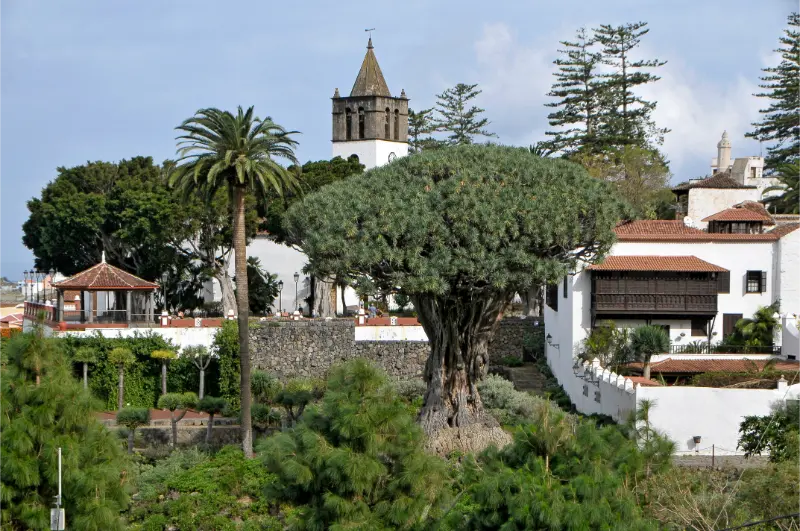
    The Drago is the visual symbol that pulls most people into Icod. You can see it from viewpoints around the historic centre, while the Parque del Drago offers a closer visit within a garden of Canary Islands flora and cultural interpretation. I would enter the park if I am genuinely interested in the tree and local botany rather than only trying to photograph it from every possible angle.

    Current Tenerife Tourism information lists the park as open daily, with seasonal hours and a modest admission fee. Because those details can change, I check the official page on the day rather than print an old price into my itinerary. The tree will still be there; there is no reason to rush the logistics.

    Walking the historic centre

    I start around the traditional squares near the Drago and San Marcos church, then walk slowly rather than navigate from one pin to the next. Icod’s appeal is the relationship between old buildings, stone, wood balconies, small plazas and the steep green landscape around the town. The centre is compact enough that wandering is part of the visit.

    Church In Icod De Los Vinos Tenerife

    The official tourism route highlights places such as Plaza de la Pila, Iglesia Matriz de San Marcos, the former convent of San Francisco and Plaza Andrés de Lorenzo Cáceres. I do not need to enter every building. One interior, one long coffee and time in the streets usually gives me a stronger sense of place than a hurried museum sequence.

    Cueva del Viento

    Cueva del Viento is the experience that changes Icod from a short town stop into a potentially full day. It is a major volcanic tube system and visits are controlled and guided. I reserve in advance and follow the operator’s instructions about footwear, meeting time and physical conditions. I would never arrive assuming I can simply walk into a cave on my own.

    The cave visit is not an amusement-park tunnel. Uneven ground, darkness and geological conservation are part of the experience. Travellers with mobility concerns, very young children or claustrophobia should read the current accessibility and participation requirements before booking.

    How much time to spend in Icod

    PlanTimeWhat fits
    Quick stop1.5–2 hoursHistoric centre and Drago viewpoints
    Half day3–4 hoursAdd Parque del Drago and lunch
    Full day6+ hoursAdd reserved Cueva del Viento visit
    Northwest loopFull dayIcod plus Garachico with careful pacing

    I prefer half a day if I am not visiting the cave. That gives time to stop for food rather than turn the town into a bus-tour photo break.

    Food and wine

    The town’s name reflects its historic relationship with wine, and the wider northwest has a strong agricultural identity. I use lunch to look for local wine, cheese, grilled meats, fish and Canarian staples rather than automatically return to the coast for international food. If driving, only one person should be responsible for tasting decisions, and that person should stay alcohol-free.

    My Tenerife food guide explains papas arrugadas, mojo, gofio, local cheeses and the guachinche tradition in more detail.

    Playa de San Marcos

    Icod also reaches the coast at Playa de San Marcos, a sheltered bay below the town. I would not automatically add it to a packed historic day, but it works well when I want a slower finish or I am staying in the northwest. The road drops significantly from Icod’s centre, so it is not simply a flat walk to the sea.

    Combine Icod with Garachico

    Garachico is the most natural partner because the towns are close and their stories complement one another. Icod gives me the Drago and volcanic tube; Garachico adds a beautiful historic centre, natural pools and the visible memory of the 1706 volcanic eruption. My Garachico guide helps plan the second half of the day.

    I would not also add Masca unless the objective is simply to drive all day. The mountain roads deserve concentration and the places deserve time.

    Getting to Icod by bus

    Icod is one of the northwestern towns that can work without a car. Tenerife Tourism currently highlights TITSA connections including line 363 from Puerto de la Cruz and Buenavista, line 108 from the Santa Cruz/La Laguna direction and line 460 connecting via the southwest. Timetables change, so I verify the exact journey in TITSA before leaving.

    From Puerto de la Cruz, public transport is particularly practical. From Costa Adeje, a car may save time if I am building a multi-stop northwest day, but the bus can still work for a dedicated Icod visit. See my no-car Tenerife guide.

    Parking

    The historic core has narrow streets and visitor demand, so I prefer a signed public parking facility and then walk. Tenerife Tourism identifies the Parking del Drago as one commonly used option near the centre. I do not waste holiday time searching for a free space directly beside the Drago.

    Where to stay

    Icod can be a good overnight base for slow travel in the northwest, particularly if I want the cave, rural accommodation and early access to nearby towns. For a first Tenerife holiday, Puerto de la Cruz often provides more evening choice while keeping Icod within easy reach. If you want to stay locally, you can compare accommodation in Icod de los Vinos.

    Dragon Tree In Icod De Los Vinos Tenerife

    My ideal Icod day

    I would arrive in the morning, walk the historic centre before the busiest period, visit the Drago park if it interests me and have lunch locally. If Cueva del Viento is reserved, I build the entire schedule around that fixed appointment. Without the cave, I continue to Garachico and end near the coast. I keep one stop optional so parking or lunch never becomes a crisis.

    Official sources

    For town information I use the official Icod de los Vinos tourism page and the official Parque del Drago page for current opening and visitor details.

    Icod De Los Vinos Tenerife City View

    Frequently asked questions

    Can I see the Drago without paying?

    There are public viewpoints from which the tree can be seen at a distance. Paying for the park gives a closer botanical and interpretive visit rather than simply a photograph.

    Is Cueva del Viento walk-in?

    I would never plan it that way. Visits are guided and capacity-controlled, so advance reservation and current instructions are essential.

    Is Icod worth visiting without the cave?

    Yes. The historic centre, Drago and a relaxed lunch make a good half-day, especially when combined with Garachico.

    Is it a good base?

    For quiet northwest exploration, yes. For a first-time traveller wanting nightlife, resort beaches and the broadest transport options, other bases may be easier.

    Why I would not reduce Icod to a single tree

    The Drago is famous enough that some itineraries allocate fifteen minutes: park, photograph, leave. I think that misses the relationship between the tree and the town. The squares, church, gardens and wine traditions explain why the landmark feels rooted in a living place rather than displayed in isolation. Even one extra hour changes the visit.

    The same applies to Cueva del Viento. The lava tube is not simply another attraction beside the Drago; it explains the volcanic processes that built the island. Together, botany, geology and architecture make Icod one of the most coherent educational stops in the north.

    A practical note about combining fixed reservations

    If I book Cueva del Viento, that appointment becomes the anchor of the day. I would not also buy a timed activity in Garachico with a tight connection, because parking, traffic and the cave check-in can create delays. I keep the Drago and historic-centre walk flexible around the fixed cave slot instead.

    This approach also leaves room for lunch. Northern Tenerife is more enjoyable when I can stop for local food without watching the clock every ten minutes. Icod is compact enough that a slower meal does not prevent me from seeing the essential centre; it often becomes one of the day’s best memories.

    Final planning advice

    For my own Icod de los Vinos guide planning, I keep the day flexible, verify the latest official information, avoid overloading the schedule and leave enough time for transport, food and weather changes. Tenerife rewards realistic pacing. The most memorable part of a day is often the unplanned coffee, viewpoint or conversation that only fits when the itinerary has margin. I also keep a simple backup plan so a closure, wind change or delayed bus does not turn one adjustment into a wasted day.

  • Playa de las Américas Guide: Beaches, Surf, Nightlife and Where to Stay

    Playa de las Américas Guide: Beaches, Surf, Nightlife and Where to Stay

    Playa de las Américas is the Tenerife resort I would choose when I want energy on the doorstep: beaches, surf schools, restaurants, shopping and nightlife within walking distance. It sits in the busy southern tourism zone between Arona and Adeje, merging almost continuously with Los Cristianos on one side and Costa Adeje on the other. That makes it extremely convenient, but it also means the exact street matters when choosing a hotel.

    The phrase “Playa de las Américas” can describe a wider resort area rather than one small beach. Before booking, I look at the map and decide whether I want to be close to nightlife, the surf zone, quieter promenades or family beaches. A property only ten minutes away can have a very different evening atmosphere.

    Who is Playa de las Américas best for?

    I recommend it most strongly to younger couples, groups of friends, first-time visitors without a car and travellers who want to walk to entertainment at night. It can also work for families, especially near calmer beaches and away from the loudest late-night streets. Travellers seeking traditional Canarian village life should use it as a practical base rather than expecting the resort itself to provide that atmosphere.

    The official Tenerife tourism site describes the south as a year-round leisure area and specifically notes that Playa de las Américas, between Arona and Adeje, has a large concentration of bars, restaurants, cafés and discos near the sea. For a broader comparison, see my where to stay in Tenerife guide.

    Beaches in and around the resort

    The coast is a sequence of beaches, rocky surf sections and promenades rather than one uninterrupted strip of sand. Playas de Troya are among the classic urban beaches in the area. The official tourism information describes Troya I and II as grey volcanic-sand beaches with relatively calm water in normal conditions and a full range of services.

    Farther toward Los Cristianos, Las Vistas offers a broad, accessible beach environment. Toward Costa Adeje, Fañabé and Playa del Duque provide a more polished resort feel. This variety is why I do not rent a car simply to find a beach when staying in Las Américas; several options are walkable or a short bus/taxi ride away.

    Surfing

    Playa de las Américas is one of Tenerife’s best-known surf zones. The coast around the resort includes reef and rock breaks used by experienced surfers, and local schools offer beginner lessons in appropriate conditions. The official Arona tourism material also highlights surf areas such as Fitenia and has introduced site-specific safety signage.

    Playa De Las Americas Bay Aerial View Tenerife

    If I am a beginner, I book a lesson rather than paddling into a crowded reef break because the wave looks close to shore. A good school chooses the correct spot for the day’s swell and explains priority rules. Experienced surfers should respect local users and understand entry/exit points before entering.

    Nightlife

    Nightlife is one of the main reasons people choose Las Américas, but it is not the entire resort. There are loud bars and clubs, relaxed cocktail venues, live music, beach clubs and quieter restaurants. The key is to sleep in the right sub-area for your priorities.

    If I want late nights, I stay within easy walking distance so I do not depend on taxis. If I want early Teide starts or have young children, I choose accommodation farther from the busiest nightlife corridors. Reading recent hotel reviews specifically for noise is more useful than simply checking the star category.

    Restaurants and eating well

    International choice is enormous, which is convenient but can make it easy to eat the same food you would find in any resort. I use Las Américas for variety, then travel inland or north for more traditional Canarian meals. Even within the resort, I look beyond the front row of tourist menus and check where local ingredients actually appear.

    My Tenerife food guide explains what dishes to look for, while the nearby Los Cristianos harbour area gives another atmosphere for an evening meal.

    Walking to Los Cristianos

    One of the resort’s great advantages is continuity. I can walk along the coast toward Los Cristianos, stop at Las Vistas and continue to the harbour. That means a holiday can feel more varied without using a car every day.

    Los Cristianos is also the departure point for ferries to La Gomera and other inter-island services. My Los Cristianos guide covers the harbour and transport in detail.

    Walking toward Costa Adeje

    In the other direction, the coast leads toward Costa Adeje, Puerto Colón, Fañabé and Del Duque. The atmosphere becomes more polished in sections, with large hotels and landscaped promenades. I like this for a long morning walk followed by a beach stop.

    See my Costa Adeje guide if you are deciding which of the two resort areas fits your style better.

    Siam Park

    Siam Park is close enough to make Las Américas one of the easiest bases for a water-park day. I treat it as a full-day attraction rather than squeezing it between other sightseeing. Arriving early, setting priorities and taking a proper lunch break makes the day much more relaxed.

    My Siam Park guide covers current planning, families and how I organise the first hour.

    Getting around without a car

    For a car-free holiday, Las Américas is one of Tenerife’s strongest bases. Buses serve the southern resorts and connect toward the airport and other parts of the island, while taxis are widely available for short trips. Many everyday needs are walkable.

    The disadvantage is that remote hiking areas and some north-coast villages take longer by public transport. I solve that with one or two organised excursions rather than renting a car for the entire stay. See Tenerife without a car for route-planning principles.

    Getting there from Tenerife South Airport

    Tenerife South Airport is the convenient airport for Playa de las Américas. I compare the current TITSA bus options with a taxi or pre-booked transfer, especially if the flight arrives late or I have children and luggage. The drive is much shorter than from Tenerife North Airport.

    Playa De Las Americas Coastal Buildings Aerial View Tenerife

    My getting around Tenerife guide includes both airports and the practical trade-offs between bus, taxi and rental car.

    Day trips from Las Américas

    I would use the resort as a base for Teide, Los Gigantes, Masca, La Gomera and perhaps a north-coast day. The mistake is scheduling a long excursion every day and never enjoying the walkable coast you paid to stay beside.

    A balanced week might include two beach/resort days, Teide, a west-coast day, one cultural/north day, Siam Park and one flexible day. My 7-day Tenerife itinerary provides a broader framework.

    Where exactly to stay

    For nightlife, I stay closer to the main evening venues. For surfing, I prioritise the reef coast and surf schools. For families, I look toward quieter edges and easy beach access. For couples who want a more refined hotel environment, I compare nearby Costa Adeje before committing.

    You can compare accommodation in Playa de las Américas and Tenerife and then use recent reviews to check noise, hill gradient and actual walking time to the beach.

    Safety and practical habits

    As in any busy resort, I keep normal awareness around nightlife, do not leave phones unattended on bar tables and use licensed transport. I also watch the ocean: calm urban beaches and rocky surf zones can be only a short walk apart, so I do not assume every stretch of coast is safe for swimming.

    Sun exposure is another easy mistake. The south can feel comfortable because of breeze, but a long promenade day still requires sunscreen and water.

    Frequently asked questions

    Is Playa de las Américas only for nightlife?

    No. Nightlife is important, but the area also has beaches, surfing, restaurants, shopping and excellent transport. Your experience depends heavily on the exact hotel location.

    Avenida De Las Americas Playa De Las Americas Tenerife

    Is it good for families?

    Yes if you choose a quieter area near a suitable beach. I would avoid booking directly beside late-night venues with young children.

    Do I need a car?

    No for the resort itself. A car or organised tours become useful for remote natural areas and ambitious island exploration.

    Is it better than Costa Adeje?

    They suit different styles. Las Américas is generally livelier and more nightlife-focused; Costa Adeje offers many calmer and more upscale pockets.

    What is the biggest booking mistake?

    Choosing solely by hotel price and ignoring the map. In a dense resort, a few streets can change noise, hill gradient and beach access.

    How I would choose between the neighbouring resorts

    I think of Las Américas, Los Cristianos and Costa Adeje as one connected southern zone with three different personalities. Las Américas suits me when nightlife, surfing and central location matter most. Los Cristianos is practical for ferries and has a slightly more established town feel around the harbour. Costa Adeje offers the widest choice of polished hotels and quieter upscale pockets.

    If I am undecided, I compare the exact hotel positions rather than the resort labels. A waterfront property at the edge of Las Américas may feel calmer than a busy hotel in another resort, while an inland bargain can involve steep walks every day. I also check where I expect to spend evenings, because walking home along the promenade is often easier than relying on taxis after dinner. Choosing the right micro-location can improve the holiday more than changing hotel category.