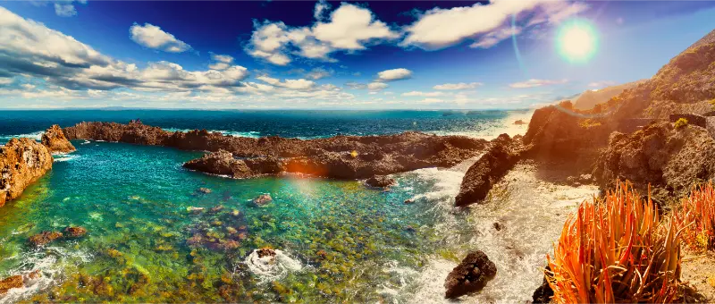
Alcalá La Jaquita promenade is the kind of Tenerife stop I include when I want a trip to go beyond the island’s headline attractions. It is specific, local and easy to connect with other places in the same municipality, which is exactly what makes a destination guide more useful for repeat visitors as well as first-timers.
In this guide I separate documented facts from practical planning. Historical and descriptive details come from official Tenerife tourism or municipal sources; suggestions about timing, combinations and pace are my travel-planning approach. I do not invent fixed opening hours, guaranteed access, prices or services when the responsible source does not publish dependable current information.
At a glance
| Where | Alcalá and La Jaquita on the Guía de Isora coast |
|---|---|
| Best for | sunset walks, easy coastal scenery, swimming stops and outdoor exercise |
| Time to allow | 1–2 hours for a relaxed walk, longer if you swim or stop for food |
| Planning style | Combine it with nearby stops, verify current conditions and keep enough flexibility for weather, access and local events. |
Why this place deserves a dedicated guide
Tenerife is often planned through a small set of famous names: Teide, Anaga, Los Gigantes and the main resort beaches. Those places deserve attention, but a complete trip becomes much more interesting when I add smaller sites that explain how people actually lived, worked, worshipped, travelled or used the landscape.
Alcalá La Jaquita promenade works best in that second category. I would not oversell it as a universal “must-see” that every visitor should cross the island to reach. Its value comes from context. When I combine it with other stops nearby, it adds a piece of history, landscape or everyday culture that the general municipal guide can only mention briefly.
This approach also reduces wasted driving. Tenerife may look compact on a map, but motorway traffic, steep local roads and dramatic changes in altitude can make an overpacked itinerary tiring. I prefer to build one coherent area per half-day and leave room for an unplanned coffee, viewpoint or weather change.
What the official record confirms
- Turismo de Tenerife describes a long seafront promenade along the coast of Alcalá.
- The route gives access to small black-sand beaches and natural swimming pools.
- The promenade is promoted for sunset views.
- It also includes a cycle lane and outdoor sports facilities.
How I use this promenade rather than treating it as a single attraction
The strength of the Alcalá–La Jaquita waterfront is choice. I can walk for exercise, stop at a cove, sit with an Atlantic view or build the promenade into a low-pressure afternoon after a busier excursion. That flexibility makes it particularly useful for mixed groups where not everyone wants the same activity.
Swimming conditions are the main variable. Natural pools and volcanic coves can look calm while sets of waves arrive unexpectedly, so I separate a pleasant walk from a guaranteed swimming plan. I check the sea, observe how local bathers are using the access points and stay out when waves are washing over exposed edges.
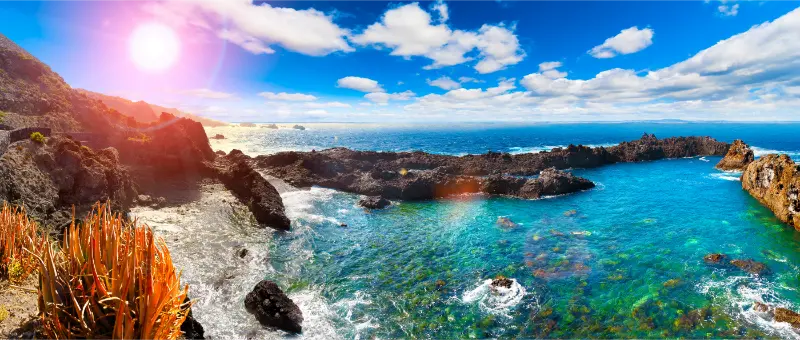
For sunset I arrive early enough to enjoy the light rather than racing for a single photograph. The west coast can be beautiful in the final hour of the day, but cloud layers, haze and swell change the view. I prefer a flexible walk with several possible stopping points.
What I would look for during the visit
- Small black-sand bathing areas along the volcanic shoreline.
- Natural pools that are attractive only when sea conditions allow safe use.
- The cycle lane and outdoor-sport infrastructure mentioned by the official tourism source.
- Open western views that make the promenade especially appealing late in the day.
How I plan access
I enter the official place name in navigation, then use local signs for the final approach. In historic centres and rural neighbourhoods I would rather park legally a little farther away than squeeze into a narrow street, block a doorway or stop on a bend. Where the attraction is on a walking route, I use the signed or clearly established access rather than an unofficial shortcut.
For buses I check TITSA on the actual travel date. Routes, frequencies and stop patterns can change, and a stop that looks close on a map may involve a steep walk. For driving I allow extra time for local roads and for finding an appropriate parking space rather than treating the map estimate as an exact arrival time.
I also separate “I can reach the location” from “the interior or facility is open”. Churches, cultural rooms, small businesses and public facilities can follow local schedules, close for maintenance or change access during events. When interior access matters, I check the official or municipal source shortly before travelling.
Best time of day
For most small heritage stops I prefer morning, when streets are often calmer and I have maximum flexibility if access changes. For coastal walks, late afternoon can be more comfortable and may produce better light. For forest and mountain stops, safety, visibility and current restrictions matter more than photography.
Tenerife’s microclimates are important. Conditions at the southwest coast can be completely different from conditions in the pine forest or high villages. I carry water, sun protection and a light extra layer even on apparently simple half-day trips. If a route involves a barranco or exposed coast, I also take recent weather and sea conditions seriously.
How I connect this stop with the rest of Tenerife
The easiest way to make this visit worthwhile is to keep the day geographically coherent. In the same broader cluster I would consider Playa San Juan and Alcalá guide, Playa de La Jaquita guide, Guía de Isora travel guide, Playa de Abama guide. These links are not a checklist to complete in one rushed sequence; they are options I use to build a route around my interests and available time.
When I have a car, I group stops by altitude as well as by municipality. Repeatedly driving from coast to medianías and back wastes time and fuel. Without a car, I simplify further: one town or coastal nucleus with two or three nearby points is usually a better day than trying to reproduce a driving itinerary by bus.
Food, breaks and local spending
I like to leave part of the day unscheduled for a café, bakery, guachinche, small restaurant or picnic depending on the area. Local spending is most useful when it fits the route naturally rather than when I chase a famous venue across the island. In smaller towns I also check opening patterns: kitchens may close between meal periods and some businesses take weekly rest days.
For picnics I use designated places where appropriate, take every piece of rubbish away and never assume that barbecue facilities can be used during fire-risk restrictions. On the coast I keep food and bags well back from wave-washed edges. In historic centres I avoid treating residential doorways and church steps as private picnic furniture.
Where to stay
If this area is going to be more than a quick day trip, I compare current accommodation on Booking.com. I look closely at the exact map position, parking, elevation and recent guest comments because a property marketed under one municipality can be several kilometres from the particular village or coast I plan to explore.
For a first Tenerife trip I still choose my base according to the majority of my itinerary, not one minor attraction. A southwest base suits repeated visits around Guía de Isora and the coast; a rural highland stay can be more atmospheric for Vilaflor; smaller eastern municipalities make more sense when the goal is slow local exploration rather than nightlife.
Activities and tours elsewhere on Tenerife
A small local stop often pairs well with one larger organised activity on another day. I use the following widget to compare current tours and experiences, but I avoid stacking a long excursion immediately before or after a rural walk or multi-stop driving day.
Accessibility and comfort
Accessibility varies significantly between old streets, promenades, rural paths and historic buildings. A place described as easy to reach does not automatically have step-free interior access, accessible toilets or reserved parking. Travellers who need specific access features should verify them with the responsible venue or municipality before relying on the visit.
I also plan around heat, shade and surfaces. Comfortable shoes are useful even for short historic-centre walks because paving can be uneven. On exposed coastal promenades I carry sun protection; in forest recreation areas I bring a layer; around ravines I avoid wet or unstable ground after poor weather.
Responsible visiting
Small places feel visitor pressure more quickly than major attractions. I keep voices low near homes and places of worship, park only where legal, avoid drones unless every relevant rule allows them and do not enter private land because a building looks abandoned. At natural sites I stay on established access, do not collect rocks or plants and do not leave cairns or markings.

Photography is usually more rewarding when it does not disrupt the place. I avoid photographing worshippers at close range without permission, keep tripods out of narrow passages and remember that a working bakery, parish house, cultural office or village street is not a studio set.
A simple half-day plan
- Start with the main stop while conditions are quiet and you have time to adapt.
- Spend long enough to understand the documented story rather than taking one photo and leaving.
- Add one or two nearby places from the same cluster instead of driving across the island.
- Pause for coffee, lunch or a picnic where it fits naturally.
- Keep the final stop optional so weather, sea state, traffic, opening arrangements or a local event cannot ruin the day.
This loose structure is much more resilient than a minute-by-minute schedule. It also gives me room to stop when I discover a viewpoint, market, bakery or village square that was not on the original plan.
Frequently asked questions
Is the Alcalá–La Jaquita promenade good for sunset?
Yes. Turismo de Tenerife specifically highlights the sunsets along this stretch of coast.
Can I swim along the route?
There are small black-sand beaches and natural pools, but whether I swim depends on sea conditions on the day.

Is there a cycle lane?
The official tourism listing notes a cycle lane and outdoor sports facilities.
How long should I allow?
For a relaxed walk I would allow 1–2 hours, then add extra time for swimming, food or sunset.
Official information
For documented background and any current operational information, I check the official Turismo de Tenerife listing for Alcalá La Jaquita promenade shortly before travelling. Same-day official notices, municipal information, weather alerts, fire restrictions, sea conditions and local event arrangements take priority over an evergreen travel article.
Final thoughts
I would include Alcalá La Jaquita promenade in a Tenerife itinerary when it fits the surrounding route and the interests of the people travelling with me. It is not about collecting another pin on a map. It is about understanding one more layer of the island and connecting that layer to the landscapes and communities around it.
My preferred approach is simple: know the key story before arriving, stay flexible about access, respect the place as part of local life and combine it with nearby stops. Done that way, even a small site becomes a meaningful part of a much richer Tenerife trip.