Tag: Teno Rural Park

  • Teno Rural Park Guide: Masca, Teno Alto, Hiking and Northwest Tenerife

    Teno Rural Park Guide: Masca, Teno Alto, Hiking and Northwest Tenerife

    Teno Rural Park is the Tenerife landscape I recommend when someone wants to understand the island beyond beaches and Teide. In the northwest, deep ravines, old volcanic massifs, laurel forest, farming hamlets and cliffs exist within a compact area that feels far more remote than the map suggests.

    The park covers more than 8,000 hectares across parts of Buenavista del Norte, Los Silos, El Tanque and Santiago del Teide. Famous Masca is only one piece of the landscape. I get more from Teno when I also think about Teno Alto, El Palmar, Monte del Agua, Punta de Teno and the traditional paths connecting the villages.

    Why Teno feels different

    Official Tenerife tourism information describes Teno as one of the island’s best-preserved natural and cultural areas, shaped partly by its historic isolation. The park contains cliffs, valleys, laurel forest and traditional architecture. I use the official Teno Rural Park page as a starting point for current information.

    The geography explains why driving times feel long. Roads cross ridges and ravines rather than following straight lines, and viewpoints constantly tempt me to stop. I plan fewer destinations than I would on the motorway coast.

    Masca village

    Masca is the best-known settlement, dramatically positioned among steep mountains. I visit for the landscape and village setting, but I do not assume I can descend the gorge spontaneously. The Barranco de Masca has a regulated access system and transport requirements described in my Masca guide.

    Even if I am not hiking, parking pressure and road conditions make public transport worth considering. Arriving by bus also lets the driver enjoy the views instead of concentrating on every bend.
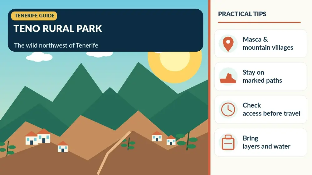
    Illustrated guide: Teno Rural Park, with practical visitor tips
    Illustrated guide: Teno Rural Park.

    Teno Alto

    Teno Alto feels much more rural and less visited than Masca. The area preserves farming and livestock traditions, and it is associated with local cheese and old paths across the massif. I come for quiet landscapes rather than a long list of attractions.

    When I stop in a small hamlet, I park carefully, respect private property and avoid treating doorways or agricultural land as photo sets. These communities are lived-in places inside a protected landscape.

    El Palmar and the visitor centre

    El Palmar is one of the practical gateways into the park. The Los Pedregales visitor centre area is useful for information about trails and the cultural landscape. If I am unsure about a route, I would rather ask locally than rely on an old GPS track.

    The valley around El Palmar also shows a softer agricultural side of Teno, a contrast with the dramatic cliffs that dominate photographs of Masca and Punta de Teno.

    Monte del Agua

    Monte del Agua is one of the forest landscapes I include when I want laurel vegetation without focusing only on Anaga. Trails connect areas such as Erjos and Las Portelas, and the atmosphere can be cool and humid even when the coast is sunny.

    Masca Village Tenerife

    I check official trail status before setting out because weather, maintenance or fire risk can affect access. Forest cloud is part of the experience, but poor visibility can make navigation harder on unfamiliar routes.

    Punta de Teno

    Punta de Teno marks the island’s western edge and offers extraordinary views toward the Los Gigantes cliffs. Access rules can change, and current restrictions related to the road mean I never assume I can drive a private car to the lighthouse area. My Punta de Teno guide contains the latest planning context I have used for the site.

    The important principle is simple: I check the current official access arrangement before leaving Buenavista. Old articles showing unrestricted car access can be misleading.

    The 355 bus through Teno

    The official park information identifies TITSA line 355 as an important public-transport link between Buenavista del Norte, Masca and Santiago del Teide. For visitors nervous about the TF-436 mountain road, the bus can be a very good choice.

    I verify the timetable in both directions before starting the day. Rural service frequency means missing a bus can create a long wait, and mobile coverage should not be the only place I have saved the schedule.

    Driving the TF-436

    The road between Buenavista and Santiago del Teide via Masca is scenic but demanding for drivers who dislike narrow, winding mountain routes. I pull over only in legal designated places, let faster local traffic pass when safe and avoid sunset return drives if I am uncomfortable after dark. My driving guide has broader mountain-road advice.

    Masca Mountain Valley Tenerife

    The driver should be looking at the road, not the ravine. If everyone wants to admire the scenery, the bus or a guided excursion is a genuine upgrade, not a compromise.

    Hiking options

    Teno has more than 100 kilometres of signposted or established walking routes according to official tourism information. One example, PR-TF 59 between Las Portelas and Masca, is listed at about 3.7 km and around two hours, with low difficulty on the official page. Difficulty labels are only a starting point; weather, footing and personal experience still matter.

    For a broader comparison, I use my Tenerife hiking guide and then verify each selected route on the current official source.

    Masca Gorge is not a normal park trail

    I separate Barranco de Masca from ordinary hiking plans because it has specific booking, access and exit arrangements. I do not arrive at the village expecting to decide at the trailhead. The regulated system exists because the gorge is a sensitive and demanding environment.

    If I cannot obtain the required booking, Teno still has enough villages, viewpoints and other walks to justify the day. I never make one sold-out trail the measure of whether the entire region is worth visiting.

    Food and local products

    Teno is a good place to look for simple Canarian food and local cheese, particularly in rural settlements where agriculture remains part of everyday life. I check opening days because small restaurants may not follow the continuous hours of a resort.

    I also avoid drinking alcohol if I am driving the TF-436 afterward. The combination of narrow roads and unfamiliar bends deserves full attention.

    Where to stay for Teno

    Buenavista del Norte, Los Silos, Garachico and Santiago del Teide are practical bases for exploring different sides of the park. Los Gigantes and Puerto de Santiago work if I want more tourist services while remaining close to the western cliffs. You can compare accommodation around Teno and northwest Tenerife by exact map location.

    A rural stay inside or near the park is ideal for quiet evenings, but I check restaurant access and road lighting before assuming I can walk everywhere after dark.

    My one-day Teno plan

    For a first visit I start near Buenavista, stop around El Palmar, choose one short walk or village, use the legal current access plan for Punta de Teno if it fits, and cross toward Masca only if time and road conditions are comfortable. I do not try to visit every hamlet.

    If Masca is the main priority, I reverse the day around its bus or hiking reservation. Teno rewards focus more than coverage.

    A two-day Teno plan

    With two days, I separate the western coast from the highland villages. Day one can focus on Buenavista, Punta de Teno and the Isla Baja; day two can focus on El Palmar, Teno Alto, Masca and a selected hike. This gives weather flexibility and removes pressure from the road.

    Masca Valley Panoramic View Tenerife

    I combine the stay with my Garachico guide or Los Gigantes guide rather than driving back to the far south every night.

    Frequently asked questions

    Where is Teno Rural Park?

    It is in northwest Tenerife and extends across parts of Buenavista del Norte, Los Silos, El Tanque and Santiago del Teide.

    Is Masca inside Teno Rural Park?

    Yes. Masca is one of the park’s best-known settlements, but the park includes many other villages, forests, cliffs and trails.

    Can I visit Teno without a car?

    Yes. TITSA line 355 is important for the Buenavista–Masca–Santiago del Teide corridor, and other services can support parts of the trip.

    Can I drive to Punta de Teno?

    Access rules can be restricted or changed. I check the current official arrangement before travelling and do not rely on old articles.

    How many days does Teno need?

    One day gives an introduction, while two days is much better if you want both coastal and highland areas without rushing.

    Weather and microclimates in Teno

    Teno can move from cloud and damp forest to bright coastal sun within the same day. I pack for both conditions and never judge the entire park by the weather at my hotel. On exposed ridges, wind is as important as temperature; in forest, damp paths can change footing.

    I check alerts before leaving and keep an alternative lower-level plan. A cancelled hike can become a very good day in Buenavista, Garachico or Los Gigantes without forcing unsafe conditions.

    Respecting the rural character of Teno

    The park is not an empty scenic reserve: people live and work in its hamlets. I keep noise down, never block agricultural access, close gates only if I found them closed and buy food or local products from legitimate businesses when possible. On narrow lanes I give priority patiently rather than treating every bend as a photo stop. These small habits matter in places where visitor numbers are concentrated in tiny settlements such as Masca and where daily life continues around the tourism.

  • Best Hikes in Tenerife: Anaga, Teide, Teno and Volcanic Trails

    Best Hikes in Tenerife: Anaga, Teide, Teno and Volcanic Trails

    Tenerife is a hiking destination disguised as a beach island. Within one trip you can walk through humid laurel forest, traverse volcanic highlands, follow pine-covered ridges and descend toward black-sand coves. The variety is exceptional, but so is the range of difficulty. A route that looks short on a map can involve steep elevation change, exposed terrain or regulated access.

    This guide is not a substitute for current trail information. Conditions, closures and reservation rules can change. I use it to decide which landscape I want to explore, then I verify the exact route on Tenerife ON and other official sources before setting out.

    Anaga Rural Park: laurel forest and dramatic ridges

    Anaga in northeastern Tenerife is the place I would choose for lush forest and atmospheric mountain scenery. Trade-wind moisture supports ancient laurel forest, and roads climb through cloud before opening onto ridge and coast views. The contrast with southern Tenerife is remarkable.

    For a first Anaga day, I prefer a short or moderate marked walk combined with viewpoints and La Laguna. Some trail areas have access controls, and weather can make paths slippery. Mist is part of the experience but can reduce visibility and make navigation more serious than the trail description suggests.

    Teide National Park: volcanic high-altitude hiking

    Teide is the island’s most iconic hiking environment and the one that deserves the most respect. Altitude, sun, cold, wind and terrain can all affect the same route. Several high-mountain paths have reservation requirements, and Trail 10 Telesforo Bravo to the summit is specifically controlled.

    View Of Mount Teide From Pine Forest Tenerife

    Do not choose a Teide hike solely from a social-media photo. Read current regulations, required equipment and route difficulty on Tenerife ON. My separate Mount Teide guide explains the cable car, summit access and altitude in more detail.

    Roques de García: accessible volcanic scenery

    If you want volcanic walking without a summit objective, the Roques de García area is one of the best introductions. The landscape is open, dry and highly exposed to sun, with views across the Teide caldera. Even relatively easy routes here feel very different from coastal walks.

    I bring more water than I think I need and start earlier on hot days. There is limited natural shade, and the high altitude can make exertion feel harder. This is an example of a walk where ‘not technical’ does not mean ‘effortless’.

    Teno Rural Park: rugged western Tenerife

    Teno offers steep ravines, remote hamlets and some of the island’s most dramatic relief. Masca is the name most travellers know, but Teno is larger than one gorge. Roads themselves can be part of the challenge, with bends, elevation and limited stopping places.

    The Masca route has had controlled access and transport arrangements, so never arrive expecting to hike simply because you saw an old itinerary. Verify the current system and permitted direction of travel. If reservations are unavailable, enjoy Teno’s viewpoints and villages without trying to improvise an unofficial alternative.

    Masca Village And Gorge Tenerife

    Coastal walking around El Médano and Montaña Roja

    For a lower-altitude option, the Montaña Roja area near El Médano combines volcanic terrain, sea views and a very different feel from Anaga. Wind is a defining feature. The walk may be easier logistically than a high-mountain route, but exposure to sun and wind still requires preparation.

    This is one of my favourite types of ‘travel day’ walk because it can fit around a beach or lunch in El Médano without taking over the entire itinerary.

    Pine forest walks

    Tenerife’s Canarian pine forest creates another distinct hiking environment between the coast and high volcanic zone. Trails around the upper slopes can offer shade, fragrant forest and occasional viewpoints toward Teide or the ocean. After the stark national park, the forest feels almost like a separate island.

    Fire risk and temporary closures matter here. Follow current restrictions, never light fires outside permitted conditions and do not assume a track is open because it appears in an old GPS file.

    How I choose a Tenerife hike

    QuestionWhy it matters
    What altitude?Changes temperature, oxygen and exposure
    How much ascent/descent?Distance alone can be misleading
    Is access regulated?Some routes require reservations
    What is the weather on that side?North, south and summit can differ
    How will I return?Linear routes may need transport planning
    When does darkness fall?Mountain roads and trails take longer than expected

    I compare elevation profile and terrain before distance. Ten kilometres on a coastal promenade is not the same as ten kilometres in Anaga or above 2,000 metres. If the route is near the limit of my ability, I choose a shorter alternative rather than hoping motivation will compensate for terrain.

    Reservations and trail closures

    Tenerife has expanded reservation and control systems in popular natural areas. These measures can protect fragile environments and improve safety, but they mean old blog posts become outdated quickly. Before every significant hike, check official information close to the date, not only when you book the flight.

    For high-altitude Teide routes, official resolutions specify mandatory reservations for certain paths and can require particular clothing or equipment. Access can also close because of snow, ice, fire risk or maintenance. A reservation does not override a closure.

    What I carry on Tenerife hikes

    • More water than a city walk would require
    • Sun protection even under cloud
    • Layered clothing; a windproof layer for exposed areas
    • Proper walking shoes with grip
    • Charged phone plus offline map
    • Small first-aid kit
    • Food appropriate to the route length
    • Identification and permit/reservation when required
    • Headlamp on longer mountain days, especially where regulations require it

    Weather: why Tenerife hikers need flexibility

    The south can be bright while Anaga is inside cloud, and the coast can be warm while Teide is cold. That microclimate is one of Tenerife’s beauties and one of its planning challenges. I keep at least one hiking day movable and avoid booking every restaurant or attraction around it.

    For seasonal conditions, see the best time to visit Tenerife guide. Official tourism information confirms the broad pattern: the north is generally more humid and the south sunnier, while high elevations have true mountain conditions.

    Hiking without a car

    Some trail areas can be reached by bus, and linear hikes can sometimes be easier when public transport solves the return problem. But timetables must be checked carefully. In remote areas I do not build a plan around the final bus of the day without a backup.

    Guided hiking is worth considering for high mountain routes, unfamiliar terrain or travellers who want local interpretation rather than navigation responsibility. My transport guide covers the broader car-versus-bus decision.

    Hiking with children

    With children, I choose short routes that deliver scenery quickly. Forest paths, volcanic viewpoints and easy coastal walks can be more successful than a famous route with hours of ascent. I avoid exposed edges and high-altitude objectives that require adult-level stamina or complicated permits.

    Volcanic Landscape Near Mount Teide Tenerife

    The family guide, Tenerife with kids, explains how I balance nature days with easier beach days.

    Leave no trace in volcanic and forest landscapes

    Stay on marked routes, do not remove rocks or plants, carry out all rubbish and respect barriers even when a shortcut is visible. Volcanic soils and endemic vegetation can be more fragile than they look. In popular areas, stepping around other walkers to create a parallel path gradually widens erosion.

    Three hiking styles for a first trip

    1. Forest: choose an Anaga walk with a realistic distance and current access information.
    2. Volcanic: walk around Teide National Park without making the summit compulsory.
    3. Coastal: add a lower-altitude route such as Montaña Roja or another signed coastal walk.

    Those three experiences show Tenerife’s range without requiring every day to be a major expedition. Add Teno only if you have enough time and are comfortable with the current access system.

    My biggest hiking mistake to avoid

    Do not confuse popularity with suitability. The route that appears most often online may be full, closed, beyond your fitness or simply wrong for that day’s weather. Tenerife has enough landscapes that changing route is not a failure; it is good mountain judgment.

    For a first week, I would combine one Anaga walk and one Teide-area walk, then use the rest of the trip for beaches, towns and food. That balance lets hiking deepen your experience of Tenerife instead of turning the entire holiday into a series of early alarms and sore legs.

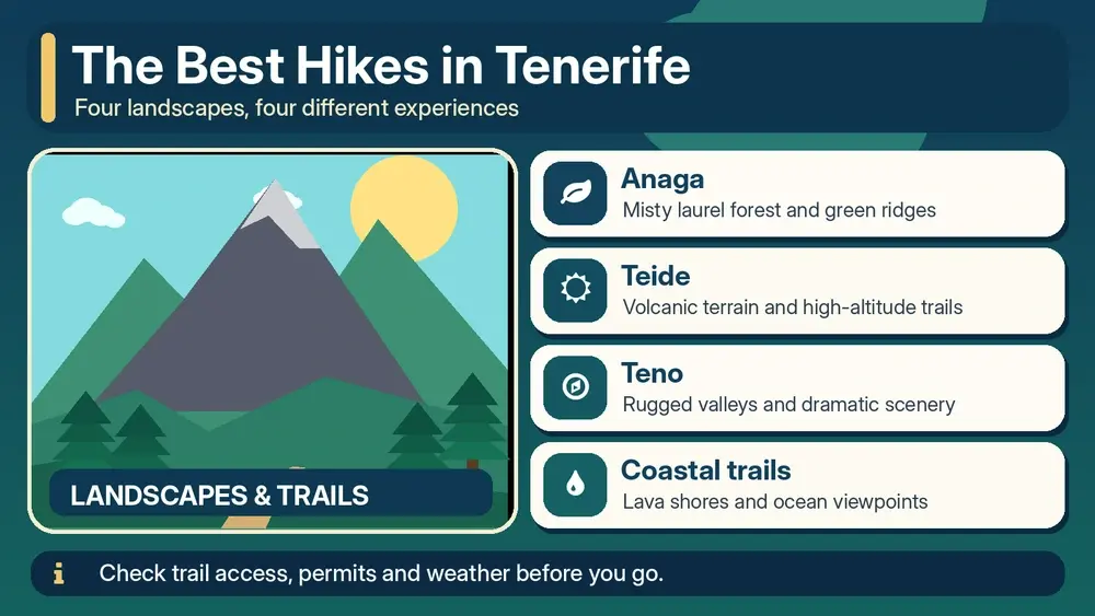
    Illustrated guide: Best Hikes in Tenerife, with practical visitor tips
    Illustrated guide: Best Hikes in Tenerife.

    Route planning the night before

    • Check the official access status and reservation conditions.
    • Look at wind, temperature and precipitation for the actual altitude.
    • Confirm sunset time and realistic driving time back to your base.
    • Download the route offline and tell someone where you are going.
    • Carry enough water even if a café appears on an old map.
    • Choose a shorter backup route in the same area.

    Why turning around is part of hiking

    Cloud, wind, heat, fatigue or a closed section can make the original plan a bad idea. Turning around early is not a failed hike. Tenerife offers so many alternative landscapes that conservative decisions rarely ruin a holiday. The objective is to return safely with enough energy to enjoy the next day.