Tag: Anaga villages

  • Las Carboneras Tenerife Guide: Anaga Village, Trails and Local Food

    Las Carboneras Tenerife Guide: Anaga Village, Trails and Local Food

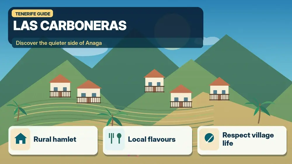
    Las Carboneras is one of the Anaga villages I would choose when I want to experience the massif as a lived-in rural landscape rather than only as a sequence of viewpoints. The hamlet belongs to the municipality of La Laguna and sits among steep green slopes, traditional houses and paths that historically connected the scattered communities of Anaga. It is small, quiet and best visited with realistic expectations: the appeal is the village setting, local food and access to walking routes, not a long list of monuments.

    Turismo de Tenerife groups Las Carboneras with Chinamada and Los Batanes among the rural hamlets of Anaga, highlighting examples of traditional Canarian architecture, the village square and chapel, local restaurants and trails into the surrounding landscape. That combination makes it a useful stop for travellers who already know the famous Cruz del Carmen viewpoints and want to see how people have lived in these mountains.

    Quick planning facts

    MunicipalitySan Cristóbal de La Laguna
    AreaAnaga Rural Park
    Best forRural atmosphere, traditional food, hiking connections
    Key nearby villagesChinamada and Taborno
    Main trail connectionPR-TF 10 and PR-TF 10.1
    Permit for PR-TF 10.1No, according to the official trail listing
    Ideal visit2–4 hours, or longer with a hike

    What Las Carboneras feels like

    The first thing I would notice is scale. Las Carboneras is compact, but the surrounding terrain is huge: ridges rise abruptly, ravines cut through the landscape and roads curve around slopes that make straight-line distances meaningless. The village is a reminder that Anaga is not empty wilderness. It is a cultural landscape shaped by agriculture, livestock, footpaths and small settlements that adapted to isolation for generations.

    I would walk slowly around the square and chapel area, look at the relationship between houses and terraces, and resist the urge to hunt for a single “must-see” angle. The value is in the whole setting. For a broader introduction to the massif, my Anaga Rural Park guide explains laurisilva, roads, weather and the main hiking zones.

    Traditional food and where lunch fits into the day

    One reason Las Carboneras works well in an Anaga itinerary is that the official tourism page specifically points visitors toward local restaurants serving traditional island food. I would use lunch as the anchor of the visit rather than squeezing it between two long drives. Simple dishes, local cheese, meat, potatoes with mojo or seasonal preparations make more sense here than chasing a fashionable restaurant far away.

    I do not assume every small restaurant opens every day or all afternoon. In rural Tenerife, hours can be narrower than in resort areas, so I check before building the itinerary around a meal. My what to eat in Tenerife guide gives context for the dishes and ingredients I look for.

    Walking from Las Carboneras

    Las Carboneras is linked to the PR-TF 10 network. The official PR-TF 10.1 route runs from Las Escaleras through Las Carboneras toward Chinamada. Turismo de Tenerife lists that route as 3.1 km, linear, about one hour, low difficulty, with no authorization required. Those numbers make it look easy, but I still treat wet stone, mud and steep edges with respect because Anaga weather can change quickly.

    Anaga Laurel Forest Tenerife

    For a longer day, the main PR-TF 10 links Cruz del Carmen with Punta del Hidalgo and passes through Las Carboneras and Chinamada. I would not improvise this as a casual extension after lunch; it is a proper linear hike with transport logistics. I have a separate PR-TF 10 hiking guide for that route.

    Las Carboneras or Chinamada?

    I see the two villages as complementary. Chinamada is especially known for its cave houses and the descent toward Punta del Hidalgo, while Las Carboneras feels more like a traditional roadside-rural stop with an easy connection into the same trail network. If I have half a day, I can see both without rushing, provided I keep parking and meal times under control.

    If cave-house heritage is the priority, I would give more time to Chinamada. If rural architecture, lunch and a shorter walk matter more, Las Carboneras can be the better centre of the outing.

    Best time of day and light

    I like morning in Anaga because traffic is generally easier and I have more flexibility if cloud moves in. Midday can be atmospheric in the village even when ridgelines disappear into mist. Late afternoon can be beautiful, but I do not start an unfamiliar trail too late because shaded valleys lose light quickly and roads require concentration after dark.

    Anaga Laurel Forest Trail Tenerife

    Official information I check before going

    For village context I use Turismo de Tenerife’s page on Las Carboneras and nearby hamlets. For hiking status I check the current PR-TF route listing and Tenerife ON close to the visit. Trail status always matters more than an old GPX file.

    How I fit it into a Tenerife itinerary

    I would not cross the island just to collect a quick photograph of Las Carboneras. I place it inside a coherent Anaga day, give it enough time to understand the setting and then add only one or two nearby stops. This approach matters in Tenerife because mountain roads, parking and microclimates can turn a short distance into a slow journey. It also makes small villages and local neighbourhoods feel less like attractions and more like places with their own rhythm.

    A sensible cluster is Cruz del Carmen, Chinamada and Taborno. I check the route before leaving, save the main parking or bus information offline and keep one optional stop that can be removed. For the wider area, I use my Cruz del Carmen guide so the day has a clear geographic logic instead of zig-zagging across the island.

    Driving, buses and parking strategy

    On rural roads I assume the final kilometres will take longer than navigation apps suggest. I keep to my lane, use safe pull-outs only, and never stop on a bend simply because a viewpoint looks attractive. If the destination has limited parking, arriving earlier is usually more useful than trying to find a “secret” space. I also avoid blocking house entrances, agricultural tracks, bus stops and emergency access.

    Public transport can be a good option for some Anaga days, but I verify the current TITSA timetable rather than relying on an old screenshot or blog. I identify the final practical return service before starting a walk. My Tenerife bus guide explains the ten+ system and the planning habits I use when I travel without a car.

    Weather and what I carry

    I pack for the exact environment rather than for the temperature at my hotel. In the north and in Anaga, cloud, wind and light rain can appear even when the south is sunny. On the coast, the Atlantic can be rough despite warm air temperatures. My basic kit is water, sun protection, a charged phone, a light layer and footwear appropriate to the surface. For rural walks I add a thin waterproof layer and a little more water than I think I will need.

    The island-wide forecast is only a starting point. I compare the coast, the hills and higher elevations separately and use my Tenerife weather by month guide to understand why the same day can feel very different across the island.

    Responsible travel in a lived-in place

    Las Carboneras is not a theme park. I keep noise low near homes, stay on marked paths, take rubbish away and ask before photographing people at close range. In agricultural areas I never enter terraces or fields to improve a photograph. Small decisions like buying a coffee, lunch or local product from an open business can also make the visit more connected to the community without turning local life into a performance for visitors.

    I also treat closures and temporary restrictions as part of the destination, not an inconvenience to bypass. Fire risk, storm damage, rockfall or maintenance can change access. If a road, beach or trail is closed, I use the backup plan and move on.

    Frequently asked questions

    Is Las Carboneras worth visiting without hiking?

    Yes, if you enjoy small villages, rural architecture and a slow lunch. I would not travel there expecting a large attraction, but as part of an Anaga day it adds a human dimension that viewpoints alone cannot provide.
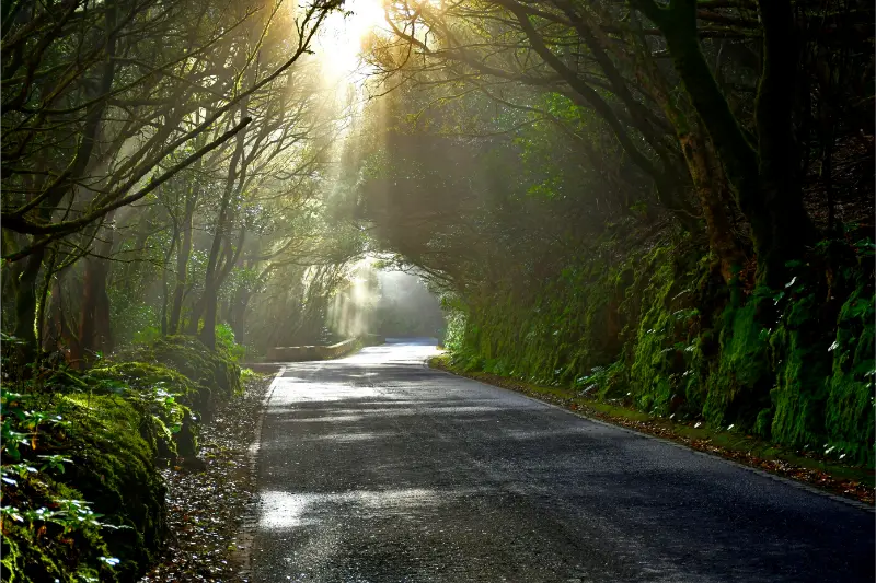
    Anaga Tenerife

    Do I need a permit for the short PR-TF 10.1 connection?

    The official Turismo de Tenerife listing states that authorization is not required for PR-TF 10.1. I still check the live trail status before setting out because weather or maintenance can create temporary closures.

    Can I combine Las Carboneras with Taborno?

    Yes, but I keep the day simple. The roads are slow and parking is limited in small hamlets. I would choose either a longer walk or several village stops, not try to do both at maximum intensity.

    Final thoughts

    Las Carboneras is the kind of Tenerife place that becomes more interesting when I stop measuring it by the number of attractions. A village square, traditional houses, a plate of local food and a path disappearing into Anaga are enough to make a memorable half-day. I would visit with time, respect the people who live there and let the landscape set the pace.
  • Chamorga Tenerife Guide: Remote Anaga Village, Trails and Practical Tips

    Chamorga Tenerife Guide: Remote Anaga Village, Trails and Practical Tips

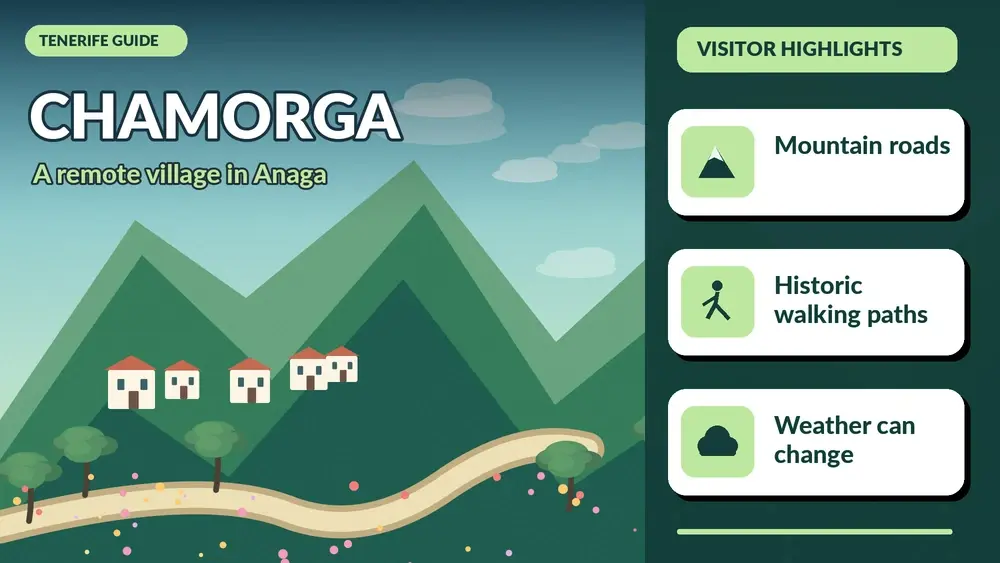
    Chamorga is one of the places that shows me why Anaga deserves more than a quick viewpoint stop. It is a small, remote hamlet deep in the northeastern massif, reached by mountain roads and surrounded by ridges, ravines and old walking routes. I do not come here for a list of monuments. I come for the feeling of being at the far end of Tenerife’s road network, where the landscape sets the pace.

    One of the most important official routes connected with Chamorga is PR-TF 5 toward Igueste de San Andrés. Turismo de Tenerife lists it as a linear route of about 10.3 km, around five hours, medium difficulty, with substantial descent and more than 600 metres of accumulated ascent. That immediately tells me how to plan: Chamorga is not a place where I casually start a long trail without transport, daylight and weather checks.

    Quick planning facts

    AreaAnaga Rural Park, northeast Tenerife
    CharacterRemote mountain hamlet
    Main trail linkPR-TF 5 Chamorga–Igueste de San Andrés
    Official route distanceAbout 10.3 km
    Official route timeAbout 5 hours
    DifficultyMedium
    PermitNo permit listed for PR-TF 5; check current status
    Best forRural Anaga, hiking, landscapes and slow travel

    Why Chamorga is worth the drive

    Chamorga gives me a different scale of Anaga. Cruz del Carmen is an excellent introduction, but Chamorga feels deeper inside the mountains and farther from the urban edge. The road takes time, which naturally filters out travellers trying to collect many attractions in one day.

    I like to think of it as a destination for people who already understand that Anaga is about roads, weather and small settlements as much as about famous viewpoints. My Anaga Rural Park guide is the best starting point if this is your first day in the massif.

    The road to Chamorga

    The road is narrow, winding and exposed to changing cloud. I leave extra time and never pressure myself to match a map app’s optimistic estimate. Buses, local vehicles, cyclists and walkers can all appear around bends, so I drive defensively and use pull-outs only where stopping is clearly safe.

    If mountain driving makes me anxious, I would not use Chamorga as a test. Anaga has easier places to experience by bus or on broader roads. My driving guide explains how I judge whether a scenic road is actually a good fit for my trip.

    PR-TF 5: what the numbers mean

    The official route from Chamorga to Igueste de San Andrés is linear, not circular. That is the single most important planning detail. A five-hour walk does not end where the car started, so I need a transport solution at the far end. The route also loses much more elevation than it gains, which can be hard on knees even if the climbing figure looks manageable.

    I do not treat the stated duration as a promise. Photography, heat, cloud, wet rock and route-finding can all add time. Before leaving, I check the official trail status and any alerts. The route is listed as not requiring authorization, but status can still change.

    A shorter visit without the long hike

    Chamorga is still worthwhile if I do not want PR-TF 5. I can explore the hamlet respectfully, walk a short section on a clear trail, enjoy the mountain landscape and then return the same way. That makes the destination more accessible to travellers who are comfortable with the drive but not with a multi-hour linear hike.

    I avoid wandering onto private terraces or treating homes as attractions. Small Anaga settlements are living communities. Quiet behaviour and careful parking matter more here than in a resort town.

    Weather and microclimate

    Anaga can be cool, damp and cloudy while the south coast is bright sunshine. I carry a light waterproof layer even on warm days and I do not worry if cloud briefly hides the views. In the laurel-forest zone, mist is part of the landscape rather than automatically a sign of bad weather.

    Anaga Forest Tenerife

    What makes me cancel a long walk is not ordinary cloud but unsafe conditions: strong wind, heavy rain, poor visibility on exposed sections or official warnings. I use my best time to visit Tenerife guide only as seasonal context and check same-day conditions separately.

    Parking and local etiquette

    Parking capacity is limited in remote hamlets. I use only clear legal spaces and never leave a car where it narrows the road for buses or emergency vehicles. If the obvious area is full, I change the plan rather than inventing a parking space on a bend.

    I also keep noise low, take rubbish away and buy something locally when a small café or shop is open. Tourism works better in places like Chamorga when visitors act like guests rather than like the village is an outdoor set.

    What I bring for a Chamorga day

    • Closed walking shoes with reliable grip.
    • A light rain and wind layer even if the coast is sunny.
    • Enough water and food for the planned route.
    • Offline mapping and a charged phone.
    • Sun protection for exposed ridges.
    • Extra time and a backup plan if the trail is unsuitable.

    For a full hike, I add emergency basics and tell someone the route. For a simple village visit, I still carry more water than I would for a resort afternoon because services are limited.

    Combining Chamorga with other Anaga stops

    I keep the combinations modest. Cruz del Carmen, a viewpoint and Chamorga can already fill a day once road time is included. Trying to add Taganana, Benijo and multiple hikes often turns Anaga into a rushed driving exercise.

    For a more coastal day, I would pair Taganana with Almáciga instead. For a forest-focused day, Cruz del Carmen and the Sendero de los Sentidos are easier.

    Getting there without a car

    Public transport in remote Anaga requires more attention than urban routes. Services can be limited and seasonal or timetable changes matter. I use TITSA’s current journey planner, not an old screenshot from a blog.

    If I am planning a linear hike, the bus schedule becomes part of the safety plan. Missing the final connection is not a minor inconvenience when the route ends far from the starting point.

    Where to stay for a Chamorga day

    La Laguna is my favourite practical base for exploring Anaga because it keeps me close to the mountain roads while offering a full range of food and accommodation. I can compare La Laguna accommodation on Booking.com.

    Santa Cruz can also work well, especially if I am combining Anaga with San Andrés or the east side of the massif. I would not choose a distant southern resort if my main goal for several days is deep Anaga exploration.

    Official trail information

    I use the official PR-TF 5 route page for the route statistics and safety reminders. I also check current trail status before setting out because closures can follow weather or maintenance.

    My hiking permits and trail rules guide explains the wider Tenerife ON system and why “no permit required” does not mean “always open.”

    Mistakes I would avoid

    • Starting PR-TF 5 without a plan for the finish at Igueste.
    • Underestimating the drive because the distance looks short.
    • Parking on a narrow bend or in front of local access.
    • Assuming a south-coast weather forecast applies to Anaga.
    • Packing too little water because the route passes through settlements.

    Chamorga rewards preparation. Once logistics are handled, the day can feel wonderfully simple: road, mountains, walking and a tiny community at the edge of the island.

    Frequently asked questions

    Is Chamorga worth visiting without hiking?

    Yes, if you enjoy remote landscapes and scenic drives. I would still keep the visit respectful and simple.

    Does PR-TF 5 require a permit?

    The official route page currently lists no authorization requirement, but I check current status before walking.

    Is PR-TF 5 circular?

    No. It is a linear route from Chamorga to Igueste de San Andrés, so transport planning is essential.

    How long does the official route take?

    Turismo de Tenerife lists about five hours, but I allow extra time.

    Where would I stay?

    La Laguna is my preferred practical base for multiple Anaga days.

    How I decide whether this fits my itinerary

    Before adding Chamorga Tenerife to a Tenerife plan, I ask what role it plays in the day. If it is the main experience, I leave enough time for weather, transport and an unhurried visit. If it is a secondary stop, I keep expectations smaller and avoid turning a flexible day into a chain of deadlines. This distinction sounds simple, but it is one of the most useful ways I have found to plan an island with mountain roads and very different microclimates.

    I also compare travel time with time actually spent at the destination. A place can look close on the map and still require slow roads, parking searches or bus connections. I would rather visit two places properly than spend the day moving between five. This is especially true in Anaga, Teno and the north coast, where the journey is often part of the experience.

    My practical backup plan

    I always choose a nearby alternative before leaving accommodation. If the sea is rough, I switch from swimming to a town, market or viewpoint. If cloud removes a mountain panorama, I walk in the forest or move to a different elevation. If parking is full, I do not wait indefinitely; I continue to the backup stop and return later only if it still makes sense.

    Anaga Laurel Forest Tenerife

    That flexibility is not a compromise. In Tenerife it is often the difference between a stressful day and a memorable one. The island is compact enough that several different landscapes may be available within the same region, so changing the plan does not mean losing the day.

    Responsible travel notes

    I treat small villages, beaches and natural areas as shared local spaces. I use legal parking, keep noise low near homes, stay on marked paths, take rubbish away and follow temporary closures even when other people ignore them. On the coast I avoid climbing barriers for photographs, and in protected landscapes I do not collect plants, rocks or other natural material.

    I also try to spend some money locally when it is appropriate: a coffee, lunch, market purchase or small shop can make a visit more connected to the community. Responsible travel is not about making a performance of being perfect; it is mostly a series of ordinary decisions that reduce pressure on places I want to remain enjoyable.

    My final take

    Chamorga is not a place I would add merely to say I reached a remote corner of Tenerife. I go because the road, hamlet and walking landscape show Anaga at its most rural. The trip works best when I give it time, respect the community and treat trail logistics as seriously as the scenery.

  • Chinamada Tenerife Guide: Cave Houses, Anaga Views and Hiking Tips

    Chinamada Tenerife Guide: Cave Houses, Anaga Views and Hiking Tips

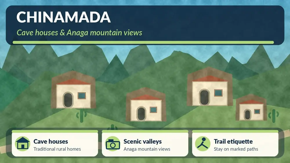
    Chinamada is one of the places in Anaga where I would slow down because the settlement itself matters more than any single viewpoint. The hamlet is known for traditional cave houses that remain inhabited, set within steep agricultural and ravine landscapes in the municipality of La Laguna. I would visit to understand how people have adapted to Anaga’s terrain, not to treat the homes as an open-air attraction.

    Tenerife Tourism describes Chinamada as an old settlement with around thirty well-preserved cave houses still in use. The official trail information also identifies Chinamada as the starting point for the 4.7 km PR-TF 10 section down to Punta del Hidalgo, a medium-difficulty route with an estimated time of about 2 hours 15 minutes. I would separate the village visit from the hike in my planning because they require different time, footwear and transport decisions.

    Chinamada at a glance

    AreaAnaga Rural Park / municipality of La Laguna
    Known forTraditional inhabited cave houses and mountain agriculture
    Best forRural culture, landscape, photography, hiking
    Important etiquetteHomes are private; observe respectfully
    Major hikePR-TF 10 Chinamada–Punta del Hidalgo, check current status before starting

    I would use the official Chinamada and Anaga hamlets page plus the official PR-TF 10 trail information when planning.

    Why the cave houses matter

    The cave houses are not abandoned heritage displays. They are part of a living settlement tradition that uses the volcanic terrain itself as architecture. That is what makes Chinamada culturally interesting and also why visitor behaviour matters.

    I would admire homes from public paths, never enter without invitation, keep voices low and avoid photographing people or private entrances closely. A settlement does not become public property because guidebooks mention it.

    The landscape around Chinamada

    Anaga is a landscape of steep ridges, ravines and agricultural terraces. Chinamada sits within that geometry, and the views can shift dramatically with cloud. On a clear day I would expect wide mountain and coastal perspectives; in mist the scene becomes more intimate but road visibility can deteriorate.

    I would not judge the day only by sunshine. Thin cloud moving through Anaga can be beautiful. Dense fog that makes driving uncomfortable is different, and I would be willing to change plans.

    Driving to Chinamada

    The road into Anaga requires patience. I would expect bends, narrow sections and slower local traffic. I would not drive as if the estimated map time were a target to beat. Pulling over safely for faster local drivers is better than feeling pressured.

    Anaga Forest Tenerife

    My Anaga Rural Park guide explains the broader road and weather logic. If I am nervous about mountain driving, I would consider visiting easier Anaga access points first.

    Parking and village access

    I would use designated or clearly legal spaces and keep turning areas free. Small mountain settlements need access for residents, deliveries and emergency vehicles. I would never park partly across a lane because a viewpoint is only twenty metres away.

    Once parked, I would explore on foot and accept that the best experience may come from quiet observation rather than constant movement.

    PR-TF 10: Chinamada to Punta del Hidalgo

    The official tourism page lists this section at 4.7 km, about 2 hours 15 minutes and medium difficulty. The trail descends through rugged ravine scenery toward Punta del Hidalgo, with views around Roque de los Dos Hermanos and the coast.

    I would treat the numbers as a planning reference, not a promise. Heat, wet rock, fitness, photo stops and transport at the end can change the real duration. Most importantly, I would check current trail status before starting; closures and restrictions in protected areas can change.

    The transport problem with a one-way hike

    A linear descent creates a practical question: where is my car? I would solve this before starting. Options may include public transport connections, two vehicles, taxi arrangements or hiking the route in a different configuration where allowed.

    I would never reach Punta del Hidalgo late in the day and only then begin searching for a way back to a mountain hamlet. Trail logistics are part of the hike.

    What to wear

    For a village-only visit, comfortable walking shoes and a light layer are enough. For the trail, I would use proper footwear with grip, carry water and sun protection, and bring a light waterproof or windproof layer. Anaga can change from cool mist to exposed sun within the same outing.

    I would also keep offline navigation available, while still following official trail markings rather than shortcuts.

    Combining Chinamada with Las Carboneras

    Las Carboneras is one of the nearby Anaga hamlets and makes a natural companion if I am driving through the area. I would keep the day small: two settlements, perhaps a short walk and one viewpoint. Trying to include Taganana, Benijo, Chamorga and Punta del Hidalgo on the same road day is how Anaga becomes tiring instead of magical.

    Combining Chinamada with Punta del Hidalgo

    If I am not hiking, Punta del Hidalgo is still a logical coastal finish. I can descend later for the natural pools, promenade and ocean views. My Bajamar and Punta del Hidalgo guide helps plan the coast.

    La Laguna as the urban base

    Chinamada lies within the municipality of La Laguna, and I would often base the day from the city. La Laguna gives me accommodation, restaurants and an easy cultural backup if Anaga weather becomes poor. It also lets me combine a mountain morning with an evening in the UNESCO historic centre.

    I would compare La Laguna accommodation on Booking.com and look for parking if I am renting a car.

    Food and local spending

    I would use local cafés or restaurants when they are open, but I would not assume a small hamlet can provide meals at any hour. I would carry water and a snack, especially if walking.

    Spending locally is one of the simplest ways to make rural tourism more useful to the communities receiving visitors. I would prefer that over buying generic souvenirs elsewhere.

    Photography with respect

    Chinamada is photogenic because homes and landscape are intertwined. I would photograph wider scenes, paths and ridgelines rather than point a lens into private doors or windows. If a person becomes the main subject, I would ask.

    I would also avoid drones unless I have checked every applicable rule. Protected natural areas and inhabited settlements can have restrictions and privacy concerns beyond basic aviation law.

    Best time to visit

    I would choose morning for the best flexibility. Roads are easier when I am not racing fading light, and I can continue to La Laguna or the coast if the weather changes. Summer can still be hot on exposed trails; winter and shoulder seasons can bring damp, cool conditions in the mountains.

    How I would plan Chinamada on a first Anaga visit

    If Chinamada is my main goal, I would not also plan the full north-coast circuit. I would start from La Laguna, drive into Anaga with one or two viewpoint stops, spend proper time in the hamlet and then choose either a short local walk or the descent toward Punta del Hidalgo. That keeps the day geographically coherent and leaves room for cloud, slow roads and a meal.

    If the weather deteriorates, I would return to La Laguna rather than chase clearer skies across the massif. The historic centre gives me an excellent backup day, and I can try Chinamada again later if the trip is long enough.

    Anaga Laurel Forest Tenerife

    Why the place is better on foot

    Once I have parked legally, I would stop thinking like a driver. Walking a short distance reveals terraces, rock textures, cultivation and the relationship between houses and ravines much better than moving from one roadside photo point to another. Even without doing PR-TF 10, comfortable shoes are worth bringing.

    Common mistakes I would avoid

    • Treating inhabited cave houses as attractions I can approach closely without permission.
    • Starting the one-way hike without a return transport plan.
    • Driving too quickly on Anaga roads.
    • Attempting too many villages in a single day.
    • Assuming an old trail blog proves the route is currently open.

    Frequently asked questions

    Do people still live in Chinamada cave houses?

    Yes. Official tourism information describes around thirty cave houses in good condition that remain inhabited.

    Can I visit the cave houses inside?

    I would treat them as private homes unless a specific authorised visit is clearly offered.

    How long is the hike to Punta del Hidalgo?

    The official PR-TF 10 information lists 4.7 km and about 2 hours 15 minutes for the Chinamada–Punta del Hidalgo section, with medium difficulty.

    Is Chinamada good without hiking?

    Yes. The settlement and Anaga landscape are worthwhile on their own.

    Where should I stay?

    La Laguna is the most practical urban base; Bajamar or Punta del Hidalgo can work for a quieter coastal stay.

    My final take

    I would visit Chinamada for a form of Tenerife travel that asks for more restraint than consumption: look, walk, listen and understand that the famous cave houses are still part of people’s lives. Combined with Anaga scenery and a carefully planned hike, it can be one of the island’s most meaningful rural stops.

  • Taganana Tenerife Guide: Anaga Village, Beaches, Hikes and Practical Tips

    Taganana Tenerife Guide: Anaga Village, Beaches, Hikes and Practical Tips

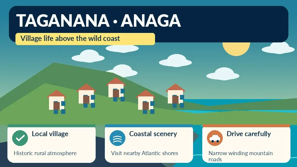
    Taganana is the Anaga village that makes me slow down the most. Reaching it means crossing a mountain landscape of laurel forest and deep ravines before the road drops toward a remote-looking Atlantic coast. The village itself is small and lived-in; nearby beaches such as Roque de las Bodegas, Almáciga and Benijo give the day its dramatic seascape.

    I do not visit Taganana as if it were an attraction with a ticket gate. People live here, roads are narrow and parking is limited. I come for the landscape, traditional settlement, food and a sense of how isolated Anaga communities were before modern roads. Respecting that scale is essential to enjoying the place.

    Why Taganana feels different

    Tenerife’s official tourism information describes Taganana as one of Anaga’s traditional settlements and highlights its nearby beaches, including Roque de las Bodegas, Almáciga and Benijo. The official Taganana page is useful before the drive.

    The change begins before I arrive. Roads pass through cloud forest and then open onto steep cultivated slopes and ravines. I allow generous travel time because this is a mountain journey, not a quick coastal transfer from Santa Cruz.

    Walking through the village

    I explore Taganana on foot without expecting a long list of monuments. Traditional houses, small lanes, terraces and the church area create the character. The village’s history is connected with agriculture, wine and the difficulty of transport through Anaga.

    I keep noise down, avoid blocking doorways and remember that a picturesque lane may be someone’s access to home. Photography is fine from public space, but I do not treat private courtyards as open exhibits.

    Roque de las Bodegas

    Roque de las Bodegas is the easiest of the nearby coastal stops for combining ocean views with restaurants. The road runs close to the shore and the beach has a more accessible feel than Benijo. I often choose it for lunch after walking in the village.

    The sea can still be rough. I assess waves and flags rather than assuming the presence of restaurants and parking makes the beach sheltered. On a strong-swell day, I enjoy the coast from land.

    Almáciga

    Almáciga is a dark volcanic beach below Anaga’s steep slopes and is well known for surf. The official page warns that waves are often strong and describes the beach as a surf location. My Tenerife surf guide explains why I do not treat a surfer-filled beach as automatically safe for casual swimming.

    I like stopping here to watch the ocean, but parking is limited. I never leave the car where it narrows the road or blocks residents. If the area is crowded, I continue rather than circling repeatedly.

    Benijo

    Benijo is the most dramatic beach in the area, with black sand and views toward the Roques de Anaga. My detailed Playa de Benijo guide covers the stair access and strong-wave precautions.

    I arrive with enough daylight for the return climb and drive. Sunset can be beautiful, but the mountain road back is not the place to be tired, rushed or distracted. If I am unfamiliar with Anaga roads, I prefer an earlier visit.

    Las Vueltas de Taganana trail

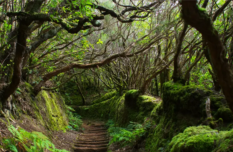
    The historic Las Vueltas route once served as an important connection between Taganana and the highlands. Tenerife’s official trail description lists a 4.5-kilometre route of roughly 2 hours 30 minutes and medium difficulty, descending through laurel forest and traditional paths toward the village. I consult the official Las Vueltas page and current trail status before walking.

    Anaga Laurel Forest Path Tenerife

    This is not a casual add-on after a full beach day. I plan footwear, transport between trail endpoints and weather carefully. Wet stone can be slippery, and cloud in the upper forest may be very different from sunshine on the coast.

    PR-TF 8 Afur–Taganana–Afur

    For experienced hikers, the official PR-TF 8 description lists a demanding circular route of about 14.3 kilometres, around seven hours and substantial accumulated ascent and descent. It connects Afur, the Tamadite area, Taganana and the forest. I check current trail status before considering it.

    I would not recommend this as a spontaneous holiday walk. Seven hours in steep terrain requires fitness, water, food, daylight and a stable forecast. If I mainly want Taganana, a shorter walk plus village time is often the better travel experience.

    Food in Taganana

    The coast is known for simple fish restaurants, while the village and surrounding Anaga area also connect with traditional wine and agricultural products. I eat where it fits the day rather than driving back to the city for a famous restaurant.

    My food guide explains Canarian basics. In a small community, I am especially patient when service is slower; the point of the visit is not resort efficiency.

    Driving to Taganana

    The roads through Anaga are narrow, winding and scenic. I use my Tenerife driving guide as a reminder to keep speeds low, use legal parking and avoid stopping on blind bends. I also check fuel before entering the massif rather than expecting a station in every village.

    If I am uncomfortable with mountain roads, I do not force a rental-car day simply because the route is famous. Public transport or an organised excursion can make the visit more relaxing.

    Visiting by bus

    Taganana is served by TITSA, and buses are a realistic way to reach the village without driving. Schedules are less frequent than urban routes, so I check the current timetable and know my return option before leaving Santa Cruz or La Laguna. My no-car guide covers the practical side of using TITSA.

    A bus also changes the day positively: I can look out at the mountains instead of concentrating on bends and parking. The trade-off is that hopping between all three beaches becomes less flexible, so I choose priorities.

    Taganana and Anaga in one day

    I combine Taganana with one or two Anaga viewpoints or a short laurel-forest walk. My Anaga Rural Park guide explains the broader geography. I do not attempt every major trail, viewpoint and beach in a single day.

    Anaga Laurel Forest Tenerife

    A realistic plan could be forest walk in the morning, Taganana for lunch and one coastal beach afterward. That gives the landscape time to change naturally as I descend from cloud forest to the Atlantic.

    When to go

    I prefer a weekday morning outside the busiest holiday periods, but weather matters more than calendar. Anaga can be cloudy or wet even when the south is sunny. That is normal. I bring a light waterproof layer and do not cancel simply because the high forest is misty.

    Strong rain, wind or official warnings are different. I follow closures and do not enter ravines or exposed trails during unsafe conditions. The coast can also be rough independently of the mountain weather.

    Where to stay

    Most visitors see Taganana as a day trip, but rural accommodation can suit hikers or travellers who specifically want Anaga evenings and early mornings. Services are limited compared with a resort, so I check food options, parking and transport before booking. I compare accommodation in Anaga and northeast Tenerife rather than assuming every property is close to Taganana itself.

    For a first Tenerife trip, La Laguna or Santa Cruz is usually the easier base. Staying inside Anaga makes more sense when the rural setting is the purpose of the trip.

    My ideal Taganana day

    I leave early, stop at one high Anaga viewpoint, take a short forest walk, descend to Taganana, have lunch near the coast and choose either Roque de las Bodegas, Almáciga or Benijo depending on sea conditions and parking. Then I return before I am tired.

    Anaga Laurel Forest Trail Tenerife

    The most important choice is what to leave out. Anaga feels remote because the roads and terrain demand time. A day with fewer stops creates a stronger sense of place than a list of ten photo pins.

    Frequently asked questions

    Is Taganana worth visiting?

    Yes, especially if you enjoy mountain scenery, traditional villages, dark-sand beaches and a slower rural atmosphere.

    Can I drive to Taganana?

    Yes, but the Anaga roads are winding and parking near the coast is limited. I drive slowly and use legal spaces only.

    Can I reach Taganana by bus?

    Yes. TITSA serves the village, but I check the current timetable because frequencies are more limited than in the city.

    Which Taganana beach is best?

    Benijo is the most dramatic, Almáciga is known for surf and Roque de las Bodegas is often the easiest for combining the coast with restaurants. Sea conditions can change the best choice.

    How long do I need?

    A full day is ideal if I want to include an Anaga forest stop, village time, lunch and one beach without rushing.

    Respecting Anaga communities

    I buy lunch or coffee locally when it fits the day, take litter away and avoid parking across gates or agricultural access. In small settlements, a single badly parked car can affect residents far more than it would in a resort car park. I also keep music and drone activity under control; quiet is part of the value of the place.

    If a road, path or parking area is closed, I do not search for an unofficial bypass. Protected landscapes and rural communities function best when visitors accept that access sometimes changes.