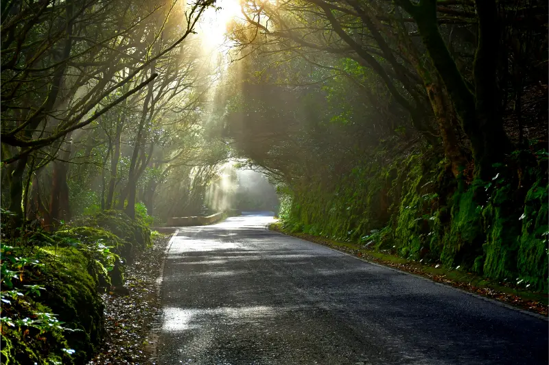
Pista de Las Hiedras Hiking Guide is a forest-first walk rather than a summit objective, with laurisilva, ferns, mosses and cloud often providing more atmosphere than distant panoramas. The altitude range is small, but accumulated ascent and descent are not zero. The track rolls gently, so I still wear proper shoes and expect damp ground when cloud is sitting on Anaga.
Anaga rewards slower planning. Roads are narrow, cloud can sit on the ridge while the coast stays bright, and a short distance on the map can hide a large amount of vertical movement. For this guide I use the current Turismo de Tenerife route sheet as the technical baseline. Trail status can change after fire risk, storms, maintenance or rockfall, so I check the official page again shortly before walking rather than relying on an old GPX file or a saved screenshot.
Quick route facts
| Official route | Pista de Las Hiedras |
|---|---|
| Start | TF-143 El Batán road, km 0.7 |
| Finish | TF-145 Casas de El Río, km 1 |
| Route type | Linear |
| Distance | 4.48 km |
| Official duration | 1 hr 30 min |
| Difficulty | Low |
| Maximum altitude | 856 m |
| Minimum altitude | 814 m |
| Accumulated ascent | 267 m |
| Accumulated descent | 280 m |
| Protected area | Anaga Rural Park |
| Permit | No |
| Homologation status | Not listed as homologated |
Why this route deserves its own guide
The route is only one line on Tenerife’s trail map, but it solves a specific travel question: how to experience Anaga Rural Park on foot without pretending that every path has the same character. Here, the numbers matter. A route of 4.48 km with 267 m of accumulated ascent and 280 m of descent asks for a different day plan from a coastal promenade or a viewpoint stop.
I also like to place it inside a wider cluster rather than treating it as an isolated hike. Useful planning pages on this site are Anaga Rural Park guide; Cruz del Carmen guide; Sendero de los Sentidos guide; La Laguna guide. Reading those together gives a much better picture of roads, buses, nearby villages, alternative trails and what to do if weather makes the original plan unattractive.
How the route unfolds
1. the TF-143 access near the El Batán road
I use the TF-143 access near the El Batán road as a deliberate orientation point. Before moving, I confirm the first waymark, the direction of travel and whether the terrain matches the official description. Starting correctly saves far more time than correcting a mistake later.
2. the broad forest track under laurisilva
Around the broad forest track under laurisilva, the route changes character enough that I use it as a mental checkpoint. I compare progress with the planned time and decide whether the pace still leaves a comfortable margin.
3. small rises and dips through fayal-brezal vegetation
At small rises and dips through fayal-brezal vegetation, I pay more attention to surfaces and junctions than to speed. Old paths can meet farm tracks or roads here, and the correct line is not always the widest one.
4. the TF-145 side near Casas de El Río
The final approach reaches the TF-145 side near Casas de El Río. I keep enough water and concentration for this part rather than treating the last kilometre as automatic. On linear routes, I already know how I am leaving the finish before I start walking.
How difficult does it feel in practice?
The official grade is low. The figures—4.48 km, 267 m ascent and 280 m descent—suggest a manageable outing for prepared walkers, but wet ground, heat or poor visibility can raise the effort quickly.
I separate technical difficulty from physical effort. A well-made path can still be tiring when it climbs continuously; a short route can feel serious when it is steep; and a long descent can be harder on knees than the climb was on lungs. I therefore use the official grade as one input, not as a guarantee that the route will feel easy for every visitor.
Navigation and waymarking
I download an offline map before leaving and keep the route name in Spanish. At junctions I look for the painted trail marks and signs before checking the phone, because GPS can drift beside cliffs, in ravines and under dense forest. I never follow another hiking group simply because they appear confident; they may be taking a different branch or returning to a different vehicle.
When a junction is unclear, I stop immediately. Walking ten uncertain minutes downhill can create a long climb back. This habit is especially useful in Anaga and Teno, where historic paths cross agricultural tracks and local access roads, and in Corona Forestal where forestry tracks can look deceptively similar.
Weather: the forecast I actually check
For Anaga I check the ridge forecast as well as the coast. Moist trade-wind cloud can reduce visibility and make stone or roots slippery while Santa Cruz or Bajamar remains bright. I carry a light shell even on a warm day and avoid assuming that a coastal temperature represents the forest.

I also check wind and any civil-protection or wildfire restrictions. Calima can reduce visibility and raise heat stress; heavy rain can polish stone and destabilise steep ground; strong trade-wind cloud can make a ridge feel cold even when the coast is comfortable. If an official closure is active, I change the plan. A hiking article is never a substitute for the live status of the trail.
Water, food and clothing
- Carry water with a reserve; I do not assume fountains are available or safe unless the current route information explicitly says so.
- Use closed shoes with real grip. Wet laurisilva, polished stone and loose volcanic material all punish smooth urban soles.
- Take a light windproof or waterproof layer even when the coast looks sunny.
- Pack sun protection: UV exposure remains strong above cloud and on open ridges.
- Bring compact food that can be eaten in small portions without a long stop.
- Keep a charged phone, offline map and a small power bank on longer or remote routes.
Transport and the linear-route problem
This is a linear route from TF-143 El Batán road, km 0.7 to TF-145 Casas de El Río, km 1, so I solve the return journey before I leave. Rural bus frequency can be limited, and the first or last service may not fit hiking hours. I check current TITSA timetables on the day, save taxi numbers when appropriate and never assume that a bus shown on an old blog still runs at the same time.
If I want to reduce early driving, I sometimes compare accommodation around La Laguna. I choose the base for the trail network I plan to use rather than simply booking the cheapest room on the opposite side of the island.
A route plan that leaves margin
My day plan has three times, not one: intended start, latest sensible turnaround or decision point, and an absolute finish target. I add margin for photographs, wrong turns, slower companions and bus delays. The official duration is useful for comparison, but it is not a reservation slot.
On longer routes I avoid stacking another timed attraction immediately afterwards. A hike that finishes later than expected should not create pressure to rush the final descent or drive tired across the island. On short routes I may combine the walk with a nearby village, but I still leave enough daylight to handle a navigation mistake or a change in weather.
What I pay attention to in the landscape
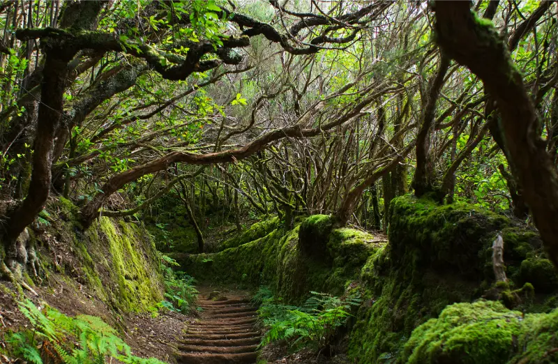
In Anaga I look for the transition between laurisilva, fayal-brezal, cultivated terraces and drier coastal vegetation. The old paths are cultural infrastructure as much as hiking routes: they connected hamlets long before modern roads made the mountains easier to cross.
I stay on the signed route, avoid shortcuts and leave terraces, walls, plants and abandoned structures untouched. Stone cairns added by visitors can be misleading, so I do not build them. In protected areas I also avoid loud music: hearing wind, birds and village sounds is part of what makes these routes different from a resort walk.
Photography without creating extra risk
I plan photographs at safe pauses rather than stopping in the middle of a descent or road section. A wide image often works better when the trail itself leads into the frame, and forest photographs benefit from texture and layers rather than a single distant landmark. I never cross a barrier, step onto an unstable edge or trample vegetation to remove an obstruction from a photo.
Who I would recommend this route to
I recommend it to travellers who are comfortable walking on natural surfaces and who want a specific piece of the island rather than a checklist attraction. The short distance can work well as part of a broader day, provided the transport and weather are straightforward.
How I would combine it with nearby places
I keep the rest of the day light: a nearby hamlet, a viewpoint or a meal is enough. Anaga roads are slow and winding, so pairing two ambitious hikes usually creates more driving and less enjoyment. If cloud closes in on the ridge, I switch to a lower coastal stop rather than chasing clear sky across several mountain roads.
Official information to check before setting out
The technical source for this guide is the official Turismo de Tenerife route page. I check it shortly before departure for status notices, management advice and any change to access. I also check the current weather and the daylight available for the date of the hike.
Common mistakes I avoid
- Using a beach-resort forecast for a mountain or forest route.
- Starting without an offline map because mobile signal looked strong at the road.
- Following another group at a junction instead of checking the route markings.
- Assuming “no permit” means “always open.” Temporary closures are a separate issue.
- Carrying exactly the expected amount of water with no reserve.
- Leaving the return transport of a linear hike to the finish.
Frequently asked questions
Do I need a permit?
The current official route sheet lists the permit requirement as No. That does not mean the trail can never close temporarily, so I still verify the live status before leaving.
Is the official hiking time realistic?
The official reference is 1 hr 30 min. I treat that as a comparison figure, then add my own margin for breaks, photography, navigation and the pace of the slowest person in the group.
Can I do it in ordinary trainers?
I prefer trail or hiking shoes with useful grip. The cost of carrying slightly more suitable footwear is small compared with the loss of confidence that comes from slippery soles on wet stone or loose volcanic ground.
What if the cloud comes in?
I slow down, check the route more often and reassess whether the next section still makes sense. If visibility, rain or wind removes my safety margin, I turn back or use the backup plan. Tenerife’s microclimates are part of the island, not an exception to the itinerary.
Is it suitable for children?
For active children who are comfortable on natural paths, it can be a realistic option with close supervision, good weather and plenty of time. I would still avoid exposed edges, wet conditions and any pressure to finish on a timetable.
Final thoughts
Pista de Las Hiedras works best when I treat the numbers and the landscape with equal seriousness. The route gives a focused way to experience Anaga Rural Park, but the useful preparation is simple: verify the live status, start with enough daylight, carry a small reserve of food and water, and solve the return journey before walking. That approach leaves more attention for the path itself—and less for avoidable problems.
