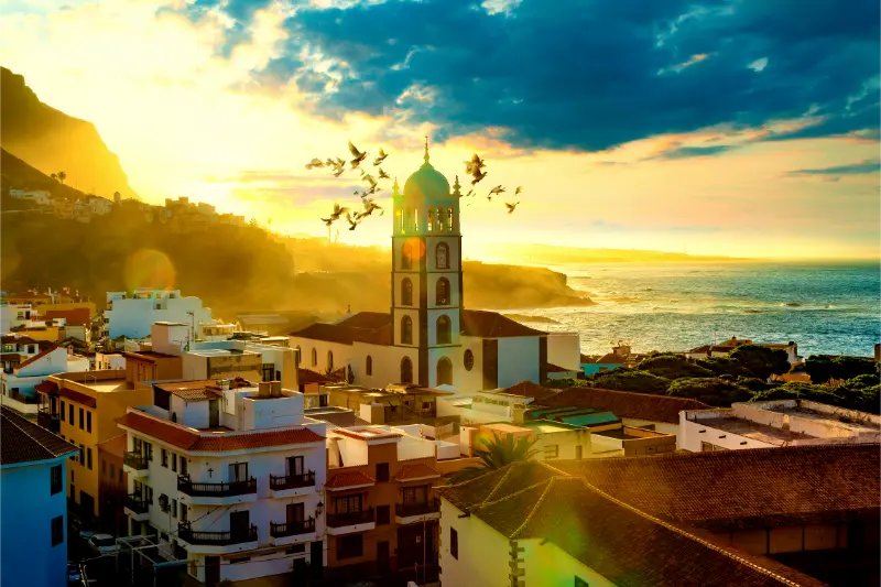
Tag: northwest Tenerife

  • Masca Road TF-436 Guide: Driving, Viewpoints, Buses and Safety

    Masca Road TF-436 Guide: Driving, Viewpoints, Buses and Safety

    The TF-436 through Masca is one of Tenerife’s most spectacular roads, but I think it is better described as a mountain road that happens to be scenic rather than as a sightseeing attraction built for drivers. It connects Santiago del Teide with Masca, Las Portelas, El Palmar and Buenavista del Norte through the Teno massif, using tight bends and steep gradients to cross a landscape that would otherwise feel almost inaccessible.

    The official Tenerife tourism page for Masca identifies TF-436 as the main road to the hamlet and notes its many curves and narrow sections. TITSA line 355 connects Buenavista del Norte, Masca and Santiago del Teide. That bus matters because it gives travellers an alternative to driving and reduces the temptation to park in an already constrained village.

    Quick planning facts

    RoadTF-436 through Teno Rural Park
    ConnectsSantiago del Teide – Masca – Las Portelas – El Palmar – Buenavista del Norte
    CharacterNarrow, winding mountain road
    Bus alternativeTITSA line 355
    Parking in MascaLimited
    Best forMountain scenery, viewpoints, villages and Teno landscapes
    Main ruleDrive slowly and never stop on unsafe bends

    Why the road deserves its own plan

    Masca is famous enough that many visitors think only about the village. I think the road is equally important. The changing views into ravines, terraces and ridges explain why the settlement developed in such a dramatic location. If I rush the drive, I miss the landscape and increase stress at the same time.

    My Masca guide covers the village and gorge separately. Here I focus on how to travel the road without turning it into a competition for parking or photos.

    Driving from Santiago del Teide toward Masca

    This is the direction many south-coast visitors use. After Santiago del Teide, the road climbs and then begins its twisting descent toward Masca. I use lower gears, keep a large following distance and expect buses to need more space on bends.

    If another driver wants to go faster, I use a safe pull-out when available rather than speeding up. The road rewards calm driving; pressure from the car behind is never a reason to enter a bend too quickly.
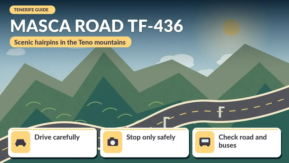
    Illustrated guide: Masca Road TF-436, with practical visitor tips
    Illustrated guide: Masca Road TF-436.

    Driving from Buenavista del Norte

    The northern approach passes El Palmar and Las Portelas before the most dramatic central section. I like this direction when I am already exploring Isla Baja because it creates a natural route from Buenavista into the Teno mountains.

    The road can feel narrower when I meet traffic on the inner sections. I watch well ahead for buses and use passing space cooperatively. Courtesy saves more time than aggressive driving.

    Cruz de Hilda and Altos de Baracán

    Official tourism information highlights viewpoints along TF-436 such as Cruz de Hilda, which overlooks Masca, and Altos de Baracán, where the ridge can reveal a striking climate contrast between the northern and southern slopes. These are the places I use for photos—not random bends.

    I still check whether parking is actually available before committing to a stop. If a viewpoint is full, I continue. There will be another view, and blocking traffic is never worth a photograph.

    Parking in Masca

    Parking is limited because the village sits in difficult terrain and the road itself has little spare space. I arrive early or use the bus when possible. I do not circle the central area repeatedly hoping someone will leave; that simply adds traffic to the exact place already under pressure.

    Masca Village And Gorge Tenerife

    If my goal includes the Masca Gorge, I follow the current booking and access instructions separately. A hiking reservation does not magically create a parking space.

    Why the TITSA 355 bus is useful

    The 355 connects Santiago del Teide, Masca and Buenavista del Norte, according to official destination information. Using it can make a Teno day much more relaxed, especially if I am uncomfortable with hairpin bends or want to walk between villages.

    I check the current timetable because rural frequencies matter. My Tenerife bus guide explains fares, ten+ cards and how I leave time for connections.

    Cyclists, hikers and buses

    TF-436 is not only a tourist road. Cyclists use it, residents depend on it and buses operate on it. I expect slower traffic and wait for a genuinely safe passing opportunity. I also watch for walkers near village sections and viewpoints.

    When a bus approaches on a narrow bend, I follow the driver’s cues and use available space. Local drivers know the road dimensions better than I do.

    Weather and visibility

    Teno can produce rapid changes in cloud and visibility. Altos de Baracán is famous precisely because the ridge can separate different weather conditions. I bring a light layer and accept that a misty drive may reveal fewer panoramas.

    After heavy rain or strong winds, I check current road information for rockfall or closures. Steep terrain means weather can affect roads even when the destination itself looks sunny.

    Combining the road with Teno villages

    I like a route that includes El Palmar, Teno Alto on a separate spur if time allows, and Buenavista del Norte. I do not try to combine all of these with a full Masca Gorge hike on the same day.
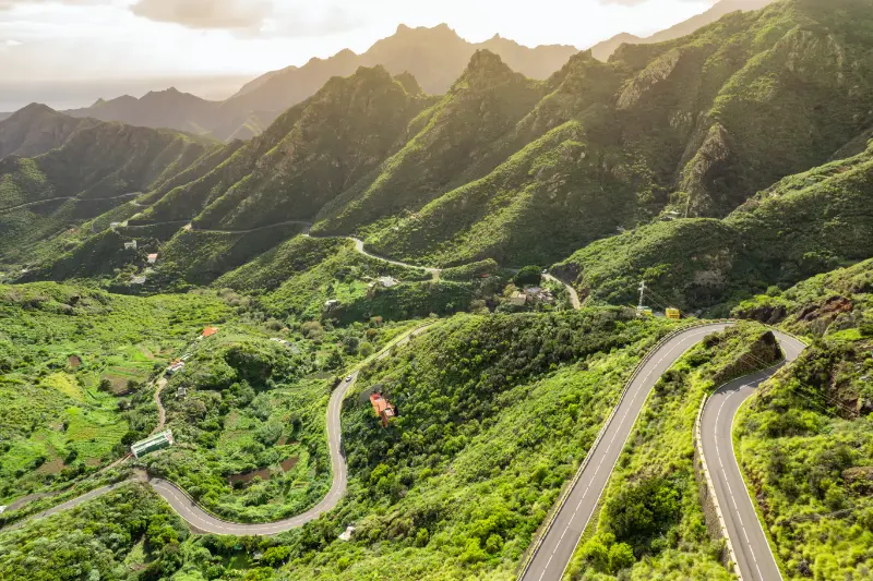
    Hairpin bends on the winding road through the Masca valley

    The Teno massif rewards slow travel. One village, one short walk and the road itself can be a better day than six rushed stops.

    A realistic driving itinerary

    • Start early from Santiago del Teide or Buenavista del Norte.
    • Stop only at signed viewpoints with legal space.
    • Visit Masca briefly if parking or bus timing allows.
    • Continue through Las Portelas and El Palmar rather than immediately turning around.
    • Have lunch in a village away from the busiest parking pressure.
    • Return by a wider main road if you do not want to repeat every hairpin.

    I check daylight before committing to a full loop, especially in winter. Mountain roads feel very different after dark.

    Who should not drive TF-436

    If hairpin bends, cliffside roads or meeting buses on narrow sections create serious anxiety, I would take the bus or join a well-run tour rather than forcing the drive. Travel is not improved by proving something to myself.

    I also avoid making TF-436 my first drive immediately after landing if I am tired or unfamiliar with the rental car. I prefer to learn the vehicle on easier roads first.

    Official information

    I use the official Masca destination page for current access context and the official viewpoint pages for locations such as Cruz de Hilda and Altos de Baracán. For same-day road issues I check current Cabildo traffic information.

    Masca Village Tenerife

    My Tenerife by car guide covers rental, parking and mountain-road basics across the island.

    Mistakes I would avoid

    • Stopping on a bend because the view looks good.
    • Assuming Masca has abundant parking.
    • Driving faster because a local car is close behind.
    • Ignoring buses and cyclists when overtaking.
    • Planning the road, gorge hike and multiple villages on an unrealistic timetable.

    A good TF-436 drive feels slow, controlled and scenic. If I am constantly braking hard or searching for parking, the plan is too aggressive.

    Frequently asked questions

    Is the Masca road dangerous?

    It is a narrow mountain road with many bends. In normal open conditions it is drivable, but it requires attention and calm speed.

    Can I avoid driving to Masca?

    Yes. TITSA line 355 connects Santiago del Teide, Masca and Buenavista del Norte.

    Is parking easy in Masca?

    No. Official tourism information describes parking as limited, so I plan an early arrival or use the bus.

    Which direction is better?

    Both are scenic. I choose based on the rest of the day rather than chasing a “best” direction.

    Can I drive it in a normal rental car?

    Yes when the road is open and conditions are normal; a special vehicle is not required.

    How I decide whether this fits my itinerary

    Before adding Masca road TF-436 to a Tenerife plan, I ask what role it plays in the day. If it is the main experience, I leave enough time for weather, transport and an unhurried visit. If it is a secondary stop, I keep expectations smaller and avoid turning a flexible day into a chain of deadlines. This distinction sounds simple, but it is one of the most useful ways I have found to plan an island with mountain roads and very different microclimates.

    Masca Mountain Valley Tenerife

    I also compare travel time with time actually spent at the destination. A place can look close on the map and still require slow roads, parking searches or bus connections. I would rather visit two places properly than spend the day moving between five. This is especially true in Anaga, Teno and the north coast, where the journey is often part of the experience.

    My practical backup plan

    I always choose a nearby alternative before leaving accommodation. If the sea is rough, I switch from swimming to a town, market or viewpoint. If cloud removes a mountain panorama, I walk in the forest or move to a different elevation. If parking is full, I do not wait indefinitely; I continue to the backup stop and return later only if it still makes sense.

    That flexibility is not a compromise. In Tenerife it is often the difference between a stressful day and a memorable one. The island is compact enough that several different landscapes may be available within the same region, so changing the plan does not mean losing the day.

    Responsible travel notes

    I treat small villages, beaches and natural areas as shared local spaces. I use legal parking, keep noise low near homes, stay on marked paths, take rubbish away and follow temporary closures even when other people ignore them. On the coast I avoid climbing barriers for photographs, and in protected landscapes I do not collect plants, rocks or other natural material.

    I also try to spend some money locally when it is appropriate: a coffee, lunch, market purchase or small shop can make a visit more connected to the community. Responsible travel is not about making a performance of being perfect; it is mostly a series of ordinary decisions that reduce pressure on places I want to remain enjoyable.

    My final take

    TF-436 is one of Tenerife’s memorable roads because the landscape is genuinely difficult terrain, not because someone designed a scenic route for tourists. I enjoy it most when I respect that fact: slow driving, legal viewpoint stops, realistic parking expectations and enough time to include the villages beyond Masca.

  • Garachico Tenerife Guide: Historic Streets, Natural Pools and Volcanic History

    Garachico Tenerife Guide: Historic Streets, Natural Pools and Volcanic History

    Garachico is one of the places in Tenerife where the landscape and the town’s history make sense together. Today it is a peaceful northwest town of cobbled streets, churches, squares and volcanic natural pools, but it was once one of the island’s most important ports. The 1706 eruption of the Trevejo volcano sent lava toward the coast and transformed that port economy. Garachico rebuilt, and the contrast between historic architecture and black volcanic rock is still central to the visit.

    I would not treat Garachico as a quick photo stop between other attractions. The town is compact, but it rewards a few unhurried hours: walk the centre, look at the coastline, have lunch and only then decide whether the sea is suitable for a swim at El Caletón. It combines naturally with La Orotava, Icod de los Vinos or the wider Isla Baja region.

    Why Garachico is worth visiting

    The strongest reason is atmosphere. Garachico has enough historic architecture to feel important but is small enough that the visit remains relaxed. Tenerife’s official tourism information highlights its sixteenth- and seventeenth-century heritage and its protected historic centre. You can understand much of the town on foot without a checklist.

    It is also a useful counterpoint to Tenerife’s resort coast. If you are staying in Costa Adeje, the drive north shows how much climate, vegetation and architecture change across the island. I would include Garachico in a first week if you enjoy historic towns or natural pools.

    Plaza de la Libertad and the historic core

    Plaza de la Libertad is the place I use to orient myself. Around it and the nearby streets you will find traditional façades, religious buildings and old civic architecture. Sit down for a few minutes before deciding where to walk next; Garachico is more enjoyable when you notice details rather than follow a rushed monument route.

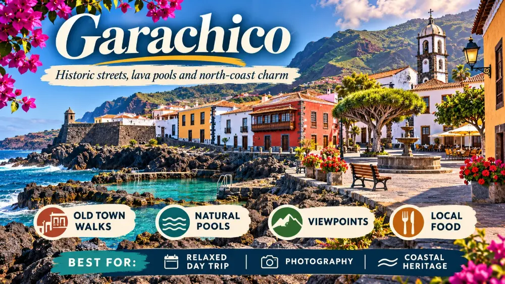
    Illustrated guide: Garachico Tenerife, with practical visitor tips
    Illustrated guide: Garachico Tenerife.

    The Church of Santa Ana and former convent buildings help explain the wealth and significance of the old port. Some interiors have limited hours, so I focus on the townscape first and treat any open building as a bonus.

    Castillo de San Miguel

    The small coastal fortress of San Miguel is one of Garachico’s landmarks and a reminder that the old port needed defence as well as commerce. Its setting beside the volcanic shoreline makes it easy to include in the seafront walk.

    El Caletón natural pools

    El Caletón is one of the main reasons many visitors know Garachico. Lava formations created pools and channels along the coast that can offer a memorable swim when the Atlantic is calm enough. The important phrase is when conditions allow. Natural pools are not ordinary swimming pools, and waves can make them dangerous or lead to closures.

    Check barriers, flags and local instructions when you arrive. If access is restricted, do not treat the visit as a failure. The volcanic coast is still worth seeing, and forcing a swim defeats the point of travelling safely.

    The 1706 eruption and how to read the landscape

    Knowing the basic story of the 1706 eruption changes how Garachico looks. Lava reached the sea and damaged the harbour that had supported the town’s commercial importance. Instead of seeing black rock as a decorative backdrop, you begin to read it as part of the town’s economic history.

    This is one reason I enjoy Garachico more after visiting Teide or learning about Tenerife’s volcanic formation. The island’s geology is not confined to the national park; it shaped where communities developed and how they changed.

    How long to spend in Garachico

    TimeWhat I would include
    1–2 hoursHistoric centre + seafront
    Half dayAdd lunch and El Caletón if open
    Full day in northwestCombine Garachico with Icod, Buenavista or Teno
    OvernightEnjoy the town after day visitors leave

    A half day is ideal for most first-time visitors. If you love historic towns and quiet evenings, staying overnight can be surprisingly rewarding.

    Combine Garachico with La Orotava

    La Orotava and Garachico make a strong cultural day from Puerto de la Cruz. Start in La Orotava when the streets are quieter, then continue west for lunch and an afternoon in Garachico. Trying to add Teide as well turns the day into too much driving.

    Use my La Orotava guide to plan the first half. If you are based in the south, consider returning by a different route only if daylight and road conditions make sense.

    Garachico and Teno

    The northwest also leads toward Buenavista del Norte and Teno Rural Park. This is a beautiful extension for travellers with more than one week, but access rules around popular points such as Punta de Teno can restrict private vehicles. Check current Tenerife ON information rather than assuming you can drive everywhere.

    Garachico Historic Town Tenerife

    Masca is also in the wider Teno area, but its gorge walk now has a regulated system and mandatory transport arrangements. My Masca guide explains why it should be planned separately.

    Food

    Garachico is an excellent place for a slow lunch. I look for Canarian fish dishes, octopus, potatoes with mojo, cheese and local wine rather than eating quickly to reach the next stop. The town’s pace suits a proper midday break.

    For a wider island food list, see what to eat in Tenerife.

    Getting there and parking

    Garachico is on Tenerife’s northwest coast. The final approach is slower than motorway driving and can be busy on popular days. Parking near the centre is finite, so arriving earlier helps. If you park outside the oldest streets, the walk is short enough that I prefer that to circling for the closest possible space.

    Public buses also serve the area, which can work well if you are staying in the north. For island transport strategy, use getting around Tenerife.

    Where to stay

    Most visitors see Garachico as a day trip, which is exactly why an overnight stay can feel special. After buses and rental cars leave, the squares become quieter and dinner feels less rushed. I would choose a historic property or small hotel in or near the old centre rather than expect large-resort facilities.

    Garachico Town And Coast Tenerife

    If that suits your travel style, compare accommodation in Garachico and check parking before confirming.

    What to bring

    • Comfortable shoes for cobbled streets.
    • Swimwear only if you are willing to accept that natural pools may be closed.
    • A light layer for the north-coast weather.
    • Water and sun protection even on cloudy days.
    • Enough time for lunch rather than a schedule built around ten-minute stops.

    My ideal Garachico visit

    I would arrive before late morning, walk Plaza de la Libertad and the historic streets, continue to the seafront and Castillo de San Miguel, inspect the ocean conditions at El Caletón and then have lunch. If swimming is safe, I would stay longer. If not, I would drive toward Buenavista, Icod or return slowly through the north rather than waiting for the sea to change.

    For current background and municipal visitor information, see the official Tenerife tourism page for Garachico.

    Natural pools are weather-dependent attractions

    This point is worth repeating because it changes expectations. A natural pool is connected to the ocean, and the ocean decides whether it is safe. When a pool is closed, the correct response is to enjoy the town and coastline, not search for an unguarded entry point nearby. I build Garachico around history and food so swimming is a bonus rather than the single purpose of the visit.

    Garachico Town At Sunset Tenerife

    A slower north-coast road trip

    If I have ten days or more, I like Garachico as part of a northwestern day that begins in the Orotava Valley and ends toward Buenavista. I reduce the number of stops and increase the time spent in each. This is one of the areas where Tenerife feels most rewarding when you stop trying to complete a checklist.

    Practical planning notes I would save before the trip

    For Garachico Tenerife guide, I save the accommodation address, parking or bus information, one official information link and the route back to my base before leaving. Tenerife is easy to travel around, but mountain roads, microclimates and busy coastal areas can turn a simple day into a slower one. I therefore keep one optional stop that can be removed without losing the main purpose of the day.

    I also carry water, sun protection and a light layer whenever the day leaves the immediate coast. Even short journeys can move from warm sunshine to wind, cloud or cooler high ground. That small amount of preparation makes it easier to respond to the island as it actually is rather than force a schedule created before arrival.

    Finally, I avoid judging a destination by the busiest thirty minutes of the day. Arriving earlier, staying later, walking one street beyond the obvious viewpoint and sitting down for a proper meal often changes the experience completely. My goal with these guides is not to collect attractions but to make each place easier to understand and enjoy at a realistic pace.

    I also keep the final hour of the day deliberately open. Traffic, parking, weather and a meal that lasts longer than expected are normal parts of travel in Tenerife, not problems to solve by rushing. Leaving that margin means I can stop at an unexpected viewpoint, wait for safer sea conditions, or simply stay longer in a town that I am enjoying. It also makes the return drive more comfortable because I am not trying to recover time lost earlier in the itinerary. For me, that flexibility is one of the most useful habits on an island where short distances can hide very different roads and conditions.