
Anaga is the part of Tenerife that most completely breaks the stereotype of a dry volcanic holiday island. In the northeast, steep ridges fall into deep ravines, laurel forest catches mist and small settlements cling to slopes above the Atlantic. On the same trip you can see Teide’s high volcanic desert and Anaga’s green woodland, and that contrast is one of the reasons I think Tenerife deserves more than a beach weekend.
The Parque Rural de Anaga covers roughly 14,500 hectares across parts of Santa Cruz de Tenerife, La Laguna and Tegueste. It was recognised as a UNESCO Biosphere Reserve in 2015. The area is ecologically sensitive, and some trails or zones have access controls. I plan Anaga around official trail information first, weather second and scenic ambition third—not the other way around.
What makes Anaga special?
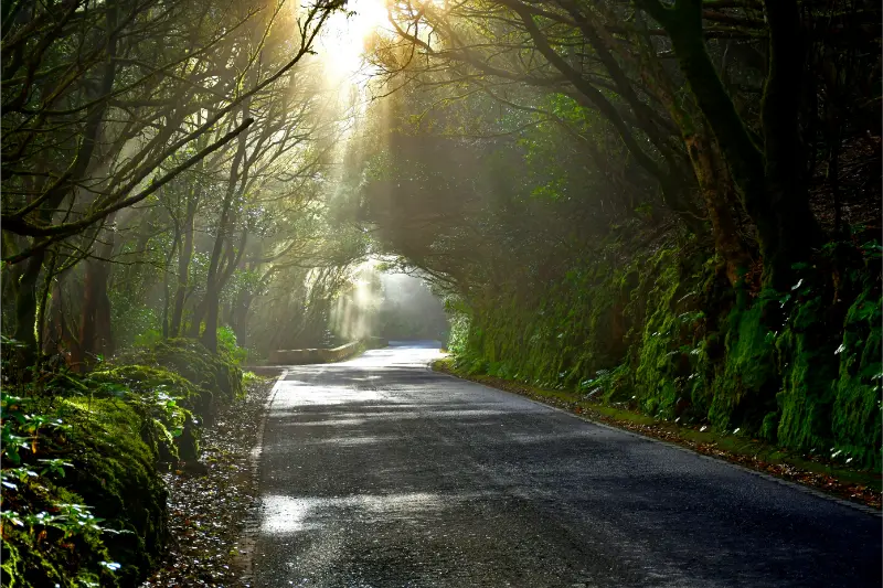
Anaga is one of the geologically oldest parts of Tenerife. Erosion has carved the massif into sharp ridges and ravines, while humid trade-wind conditions help support laurel forest that feels almost prehistoric. The scenery changes quickly: forest viewpoints on the ridge, agricultural hamlets, exposed coastal roads and black-sand beaches can all appear in one day.
The temptation is to drive everywhere because the map looks small. That is exactly what I would avoid. Roads are slow and winding, parking is limited at popular points and repeated stops create more fatigue than the kilometres suggest. Choose one side of Anaga and explore it properly.
Cruz del Carmen: the easiest introduction
Cruz del Carmen is one of the most practical starting points from La Laguna. It gives access to viewpoints, visitor information and several walking options. On a misty day the forest can be atmospheric rather than disappointing, but if the cloud is thick enough to remove every view, I shorten the drive and focus on woodland instead of chasing the coast.
A short walk near Cruz del Carmen is often enough for a first-time visitor who is not a serious hiker. If hiking is a priority, use my Tenerife hiking guide as an overview and then confirm the exact route on Tenerife ON.
El Pijaral and restricted areas
Some of Anaga’s most sensitive trails, including routes in the El Pijaral Integral Nature Reserve, are subject to access restrictions or reservations. Do not rely on an old blog post or a saved map. The official Tenerife ON platform is the reference I use for current authorisations, closures and route status.
This matters for conservation as much as convenience. Anaga’s popularity puts pressure on narrow roads, fragile vegetation and small rural communities. A trip that respects access rules is also usually more enjoyable because you arrive with realistic expectations.
Taganana, Almáciga and Benijo
The drive down toward Taganana reveals Anaga’s dramatic scale. Taganana is one of the area’s historic settlements, while the coast around Almáciga and Benijo gives you wild Atlantic scenery and dark volcanic beaches. I treat the coast as a landscape experience first and a swimming destination second because currents and waves can be powerful.
Benijo is especially beautiful near the end of the day, but sunset planning requires caution. Mountain roads are slower after dark, parking is limited and the beach involves steps. I would never let a photograph deadline force me into unsafe swimming or rushed night driving.
Hiking in Anaga
Routes range from short forest walks to demanding paths that descend through ravines and connect remote hamlets. Distance alone does not define difficulty. Mud, steep gradients, exposed sections, heat on the coast and fog on the ridge can change the effort substantially. Wear proper footwear and carry more water than a city walk would require.
Download route information before leaving because reception can be inconsistent in mountain terrain. Tell someone your plan for longer hikes, avoid closed routes and turn back if conditions no longer match your equipment.
Getting to Anaga without a car
Public transport is possible and can be a smart choice for some routes. Official tourism information lists buses from Santa Cruz and La Laguna to different parts of the massif. Frequencies are more limited than in the main urban areas, so build the day around the timetable rather than assuming a bus will appear when you finish.
A car gives flexibility but adds parking pressure. If you drive, avoid stopping where you block local traffic or narrow roads. For general island transport choices, see getting around Tenerife.
Can you combine Anaga with La Laguna?
Yes, and this is one of my favourite first-trip combinations. Spend the morning walking La Laguna’s UNESCO-listed centre, have an early lunch and then choose a short Anaga route or viewpoint sequence. The combination works because the two places are close but completely different.
Read my La Laguna guide if you want to build that day. If you are a serious hiker, give Anaga a full day instead.
Anaga and Santa Cruz
Santa Cruz also makes a logical gateway, particularly for the coastal road toward San Andrés, Taganana and the eastern approaches. A city morning followed by Las Teresitas is easy; a city morning plus a deep Anaga hike is not. Choose between sightseeing and hiking rather than stacking both.

My Santa Cruz guide includes a practical city-and-coast version.
Where to eat
Small restaurants in Anaga’s villages can be one of the pleasures of the day, but opening hours are not as continuous as in the resorts. I keep water and a simple snack in the car even when lunch is planned. Look for local fish near the coast and traditional Canarian dishes inland.
Do not turn every rural restaurant into a social-media stop. These are small communities where tourism shares roads, parking and public space with residents.
Weather and what to pack
| Condition | What it means for the day |
|---|---|
| Mist on the ridge | Forest can still be beautiful; viewpoints may disappear |
| Rain or wet trail | Roots and stone become slippery; shorten or change route |
| Strong sun on coast | Heat exposure rises quickly away from forest |
| Wind | Exposed ridges and beaches may feel much harsher |
I carry a light waterproof or windproof layer, water, sun protection and closed footwear. The fact that you left a sunny southern resort in shorts does not mean the Anaga ridge will feel the same.
Where to stay for Anaga
For repeated Anaga exploration, La Laguna is my favourite practical base because you have restaurants, transport and quick mountain access. Santa Cruz also works well, particularly for the eastern coast. Rural accommodation inside or near the park can be memorable for slow travel, but I would confirm access and parking carefully before booking.
If you want an urban base, compare accommodation in La Laguna; for a full island comparison use where to stay in Tenerife.
My first-time Anaga plan
I would start from La Laguna, stop around Cruz del Carmen, choose one short legal trail, then continue only as far as the weather and daylight comfortably allow. If visibility is good and roads are quiet, I might descend toward Taganana and the coast. If the ridge is soaked in cloud, I would enjoy the forest, return to La Laguna and save the coastal drive for another day.
Before every visit, check the official Tenerife ON platform for trail status, restrictions and reservations, and use the official tourism overview of Anaga Rural Park for destination background.
Low-impact visiting
The simplest way to reduce pressure on Anaga is to do less. Do not stop at every viewpoint, do not park on verges, avoid loud behaviour near villages and stay on legal trails. Carry out every piece of rubbish and use established businesses rather than treating rural communities as scenery. The park’s value depends on the same small settlements and ecosystems that tourism can easily overwhelm.
Navigation and offline planning
I save the exact route, official status page and return plan before entering the mountains. A generic map app may show paths that are unsuitable, private or restricted. Tenerife ON should be the reference for official trails. On longer walks I carry a power bank and do not depend on streaming navigation for the whole day.
Practical planning notes I would save before the trip
For Anaga Rural Park guide, I save the accommodation address, parking or bus information, one official information link and the route back to my base before leaving. Tenerife is easy to travel around, but mountain roads, microclimates and busy coastal areas can turn a simple day into a slower one. I therefore keep one optional stop that can be removed without losing the main purpose of the day.
I also carry water, sun protection and a light layer whenever the day leaves the immediate coast. Even short journeys can move from warm sunshine to wind, cloud or cooler high ground. That small amount of preparation makes it easier to respond to the island as it actually is rather than force a schedule created before arrival.
Finally, I avoid judging a destination by the busiest thirty minutes of the day. Arriving earlier, staying later, walking one street beyond the obvious viewpoint and sitting down for a proper meal often changes the experience completely. My goal with these guides is not to collect attractions but to make each place easier to understand and enjoy at a realistic pace.