
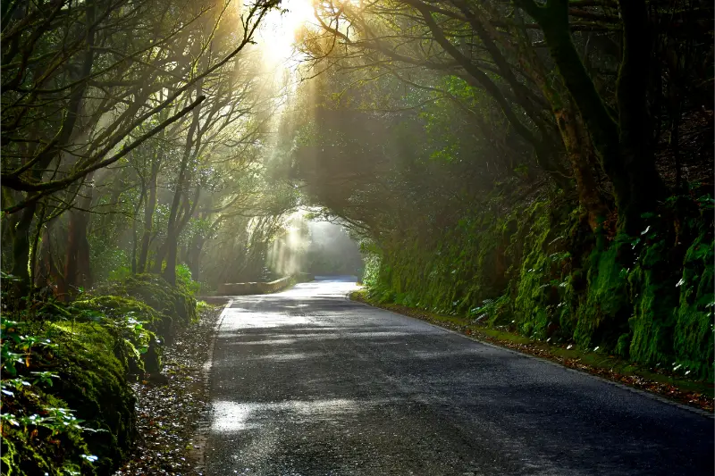
Camino de Los Laureles Tegueste is one of the Tenerife stops I would use to go beyond the island’s headline attractions. Camino de Los Laureles is a short historic route with a bigger story about how people moved through Tenerife before modern roads. Turismo de Tenerife identifies it as part of an old camino real used to reach the settlement even before the conquest, with a connection toward Camino de las Peñuelas. Remnants of laurisilva add a natural layer to the route. I like this combination because it shows that a path is not just recreation: it can preserve transport history, vegetation and the relationship between Tegueste and neighbouring La Laguna.
In this guide I separate documented facts from planning advice. Historical or descriptive details come from official tourism information, while suggestions about timing, parking, combinations and pace are my practical way of building a realistic Tenerife day. I deliberately avoid inventing fixed opening hours when the responsible source does not publish a reliable current schedule.
At a glance
| Area | Tegueste |
|---|---|
| Best for | travellers interested in local history, landscape and a more detailed Tenerife itinerary |
| Time to allow | 20–60 minutes for the core stop; 2–4 hours with nearby places |
| My planning rule | combine it with the same area rather than crossing the island for one small attraction |
Why this place deserves a dedicated guide
Camino de Los Laureles is a short historic route with a bigger story about how people moved through Tenerife before modern roads. Turismo de Tenerife identifies it as part of an old camino real used to reach the settlement even before the conquest, with a connection toward Camino de las Peñuelas. Remnants of laurisilva add a natural layer to the route. I like this combination because it shows that a path is not just recreation: it can preserve transport history, vegetation and the relationship between Tegueste and neighbouring La Laguna.
What the official record confirms
The route forms part of an old camino real used to access Tegueste.
Official tourism information states that the route was in use from before the conquest of Tenerife.
Camino de Los Laureles connects with Camino de las Peñuelas.
Remnants of laurisilva are one of the path’s characteristic natural features.
The Tegueste historic-centre information presents the path as part of the old network connecting rural settlements before modern island roads.
What I would pay attention to
I would pay attention to the path surface, walls, vegetation and changes in gradient rather than walking it only for exercise. Historic routes often reveal where movement was easiest and how settlements connected before the road network reorganised travel. The surviving laurel-forest elements are equally important: they hint at vegetation that was once much more widespread. I avoid leaving the path to photograph plants or private properties, and after rain I expect stone and leaf litter to be more slippery than they look.

I also spend a minute looking at what sits around the site. Tenerife’s heritage is rarely isolated from topography. Ravines determined movement, water shaped agriculture, altitude affected crops and building materials came directly from volcanic terrain. Reading that setting helps me understand why a place exists where it does instead of reducing the visit to dates and names.
How I would combine it with nearby places
I combine Camino de Los Laureles with Tegueste’s historic core. Casa de los Tacoronte sits beside the route, while the church, Casa del Prebendado and Finca de los Zamorano are all useful for understanding the town that these paths served. For a longer walking day, Tegueste also links into the wider trail network around Anaga, but I treat those mountain routes as separate hikes with their own weather and transport planning.
- Tegueste Tenerife guide
- Iglesia de San Marcos Tegueste
- Casa del Prebendado Pacheco
- Mirador de El Boquerón
How I would plan the visit
I treat this outdoor site as part of a geographically compact day. Tenerife looks small on a map, but steep roads, motorway traffic and very different weather by altitude can turn a simple list of stops into too much driving. My rule is to choose one municipality or one landscape corridor and let nearby places build the story.
I also distinguish between what is always visible from public space and what depends on opening hours, authorised access or weather. Small museums and chapels can change schedules; ravines and old paths can be affected by rain; viewpoints can disappear into low cloud; forest facilities can be restricted during high fire risk. I verify operational details shortly before travelling instead of publishing a timetable that may age badly.
Best time of day
Morning is usually my easiest choice in north Tenerife. Parking tends to be calmer, I have time to change the plan if access differs from expectations, and cloud often evolves through the day. Late afternoon can produce beautiful light on the coast, but it can also bring more shade on steep north-facing terrain. For a forest or ravine stop I care more about recent rain, wind and daylight than about chasing a perfect photograph.
If the place is active religious heritage, I avoid visiting in the middle of worship simply because a door is open. If it is a protected natural or archaeological site, I do not treat open ground as permission to wander anywhere. The best time is the one that combines respectful access, safe conditions and enough daylight for the rest of the route.
Getting there and parking
I use the official address or map position as an orientation point, then follow local signs for the final approach. Historic centres and rural lanes are exactly where navigation apps can suggest an impractical shortcut. I never block a resident entrance, farm track, church doorway or emergency route for the sake of saving a five-minute walk.
Public transport works for many north-Tenerife towns, but upland recreation areas, ravines and viewpoints can be less convenient without a car. I check the current TITSA journey planner close to the date of travel. If I drive, I save the parking location before walking away; steep streets and similar-looking lanes can make the return less obvious than expected.
Visiting with children
For families, I keep the explanation concrete. I ask children to notice one thing: a carved doorway, an old wine press, the shape of a ravine, a craft object, a forest species or the difference between coast and pine zone. A short heritage stop followed by a picnic, viewpoint or easy walk usually works better than stacking several interiors in succession.
I also keep safety specific to the setting. Old streets can be steep and uneven; ravine edges can lack barriers; forest ground can hide roots and loose needles; coastal viewpoints can be windy. I keep children close where terrain drops away and never encourage climbing on historic structures.
Accessibility and comfort
I never assume that “close to the road” means step-free. Historic buildings can have thresholds, old paving or narrow doors, while outdoor sites may involve slopes and uneven ground. If step-free access is essential, I verify it directly with the responsible authority before travelling.
I carry water, sun protection and a light layer year-round. The north coast can feel humid and mild while upland Tegueste or La Guancha is cooler and windier. That difference is easy to underestimate when the driving distance is short.
Photography and respectful behaviour
I photograph from public space unless access is clearly permitted. I do not cross gates, climb walls, enter archaeological areas, move museum objects or step onto private agricultural land for a cleaner composition. At religious sites I keep my voice low and put the camera away during worship.
At protected landscapes I use photography as a reason to observe, not to leave the route. The details that usually make the strongest images—stone, vegetation, changing cloud and layers of terrain—can be seen without damaging the place.
Food and a slower local day
These north-Tenerife municipalities are well suited to a slower lunch rather than a rushed cross-island itinerary. I prefer to eat in the same area after the visit, especially in Acentejo where wine culture and local food are part of the destination itself. I keep a second option in mind because smaller restaurants and guachinches can have changing weekly opening days.
For picnic areas I take rubbish away even when bins are present, avoid feeding wildlife and check fire regulations before using any cooking facility. A recreation area is shared infrastructure, not a private campsite.
Where to stay nearby
If the north is a priority, sleeping nearby reduces motorway time and makes morning visits easier. I compare the exact property location as carefully as the town name because Tenerife’s slopes can turn a short map distance into a steep walk. Compare accommodation around Tegueste on Booking.com.
Tours and activities
For travellers who want to add a guided experience elsewhere on the island, I compare current tours rather than hard-coding one product that may disappear or change. The widget below can surface available Tenerife activities while this article remains focused on the specific place.
Common mistakes I would avoid
- Driving across Tenerife for one small stop instead of building a local cluster.
- Assuming an interior is open because the exterior is publicly accessible.
- Entering a ravine, water gallery, archaeological zone or private field without clear authorisation.
- Using old blog opening hours instead of checking an official source.
- Ignoring low cloud, recent rain, wind or fire-risk restrictions.
- Treating a working neighbourhood or devotional place like a theme-park attraction.
A realistic half-day itinerary
- Arrive early enough to find legal parking without circling narrow streets.
- Spend the first part of the visit on the main site, reading the setting before taking photos.
- Walk or drive only a short distance to one or two related places in the same cluster.
- Take a coffee, lunch or picnic break locally.
- Use the final hour for a viewpoint, coast stop or easy walk only if weather and access are good.
This loose structure is more useful to me than a minute-by-minute plan. It gives room for an interior that is unexpectedly closed, a local event, a cloud layer that changes a viewpoint or a path that is wetter than expected. Tenerife travel becomes easier when I plan a strong cluster and a flexible order.
Why the north of Tenerife rewards slower travel
La Victoria, Tegueste and La Guancha are not places I would rush through simply because they sit between more famous names on the map. Their value comes from accumulated small details: a path older than the modern road network, a craft technique, a ravine associated with Guanche history, a chapel beside a pine forest or a viewpoint over a coast shaped by Atlantic weather.

That scale also makes the visit feel more personal. Instead of spending the day moving from ticketed attraction to ticketed attraction, I can walk, look, stop for food and understand how people used the same terrain for agriculture, worship, transport and community life. For repeat visitors to Tenerife, these smaller layers are often what make a second or third trip feel genuinely different.
Frequently asked questions
Is Camino de Los Laureles a modern walking path?
No. It follows part of an old camino real that official tourism information says was used to access Tegueste even before the conquest.
What vegetation is notable?
The route preserves remnants of laurisilva, adding natural interest to its historic transport role.
Does it connect to another old route?
Yes. Turismo de Tenerife notes a connection with Camino de las Peñuelas.
What footwear would I use?
I prefer grippy walking shoes, especially after rain, because old stone or earthy surfaces can become slippery even on a short route.
Official information
For the documented facts and the latest operational information, I check Turismo de Tenerife – Camino de Los Laureles shortly before travelling. Local events, restoration, weather, fire restrictions and access conditions can change after an article is published, so the official source always takes priority for same-day conditions.
Final thoughts
I would not describe every small Tenerife stop as a universal “must-see”. That language is not helpful. The value of Camino de Los Laureles Tegueste is that it adds a precise layer to the island and makes a local cluster richer. When several of these places are combined, the municipality stops being a name on the motorway and becomes a destination with its own history, landscape and rhythm.
My preferred approach is simple: know the key story before arriving, keep the visit respectful, stay flexible about access and spend enough time in the surrounding area for the place to make sense. That is how a small stop becomes useful rather than just another pin on a map.