
Alto de Guajara is the high Teide hike I choose when I want a genuine mountain objective without climbing Pico del Teide itself. At 2,715 metres, Guajara is the highest point of the caldera wall and the third-highest elevation in Teide National Park.
The official trail 15 segment runs 2.0 km from Degollada de Guajara to the summit, with about 357 metres of ascent and an estimated duration of 1 hour 30 minutes. That number is only the summit segment: I still need to reach Degollada de Guajara and return, so the complete outing is much longer.
Quick planning facts
| Trail | 15 Alto de Guajara |
|---|---|
| Official segment | Degollada de Guajara to Alto de Guajara |
| Segment distance | 2.0 km one way |
| Official segment duration | About 1 h 30 min |
| Maximum elevation | 2,715 m |
| Segment ascent | About 357 m |
| Difficulty | Medium |
| Authorisation | Not normally required for trail 15 |
Why Guajara is a serious step up
Alto de Guajara reaches 2,715 metres and forms the highest point of the caldera wall. The official trail 15 section begins at Degollada de Guajara and climbs 2.0 km to the summit, with around 357 metres of ascent and an estimated 1 hour 30 minutes for that segment.
The important planning detail is that most visitors must also reach Degollada de Guajara first and then return, so the full day is substantially longer than the 2 km summit segment. I never quote the official segment distance as if it represents the entire outing from a road-access point.
Building the full route
I connect trail 15 with the approach that fits current park access and my ability, commonly via the Siete Cañadas/Degollada area. Before walking I check the current official map because route status and permitted access can change.
I calculate total distance, ascent and daylight for the exact combination I intend to walk. Guajara is not the place to improvise a route from screenshots after leaving the car.
Altitude and physical demand
At 2,715 metres, altitude is part of the challenge. I walk slower than I would at sea level, drink regularly and turn around if I develop significant headache, nausea, unusual dizziness or other concerning symptoms.
The climb is officially graded medium for the trail segment, but the overall day can feel demanding because of exposure, altitude and the approach distance.
Weather and visibility
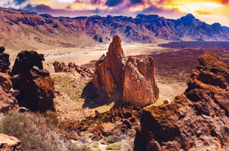
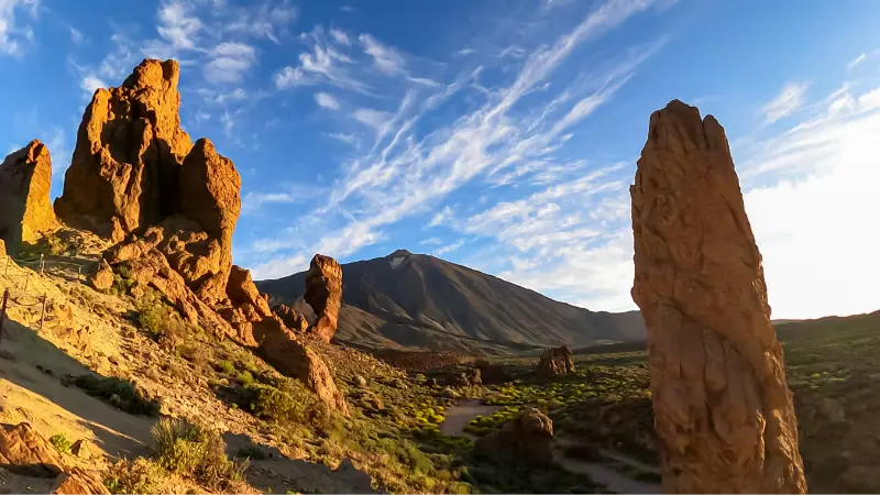
Guajara can deliver extraordinary views across the Teide caldera and, on clear days, toward other islands. It can also sit in wind, cloud or rapidly changing mountain conditions. I choose the day based on a mountain forecast, not simply a beach forecast from Costa Adeje.
I carry a warm and windproof layer in every season. My Tenerife packing list covers how I layer for Teide.
Why sunrise and sunset require extra caution
Photographers are naturally drawn to high viewpoints at low light, but I only consider sunrise or sunset if I am experienced, equipped with a reliable headlamp and fully understand the route. Temperature drops quickly once the sun disappears.
For most travellers I prefer a daylight hike and a separate roadside viewpoint for sunset. The safer plan usually produces a better overall day.
No normal permit, but rules still matter
The official Alto de Guajara trail page states that authorisation is not required for trail 15. That does not mean every connecting path is always open or that weather closures can be ignored.
I check Tenerife ON and Teide National Park information before departure. My Tenerife hiking permits and trail rules guide explains the wider system.
Who should choose another trail
I would choose a lower or shorter trail for travellers who are not comfortable with sustained climbing, exposed high-altitude terrain or several hours away from roadside services. Roques de García and Sámara offer excellent volcanic scenery with less commitment.
Changing route is not a failure. Tenerife has enough hiking options that I can match the day to fitness and weather rather than forcing one summit.
Official source and route verification
I use the official Alto de Guajara trail page for the summit-segment facts. I then verify the entire approach route separately because the official 2 km figure begins at Degollada de Guajara, not at my car.
That distinction is the most important practical detail in this guide and prevents a common planning mistake.
How I fit it into a realistic Tenerife day
I treat Alto de Guajara as part of a wider Teide National Park day rather than an isolated pin on the map. Tenerife looks compact, but mountain roads, parking searches and changing weather can turn short distances into slow travel. I decide in advance which stop is the priority and which stops are optional.

My preferred approach is to pair it with Siete Cañadas, Parador viewpoints or a lower-elevation stop after the hike. That creates a day with contrast without spending most of the time in the car. I also keep one backup plan nearby in case wind, cloud, surf or temporary access restrictions change the experience.
Weather, clothing and microclimates
I never use a single Tenerife forecast for the whole island. North-coast cloud, Anaga mist, Teide sunshine and south-coast heat can all occur on the same day. I check the forecast for the exact municipality and, for mountain or coastal activities, I also look at wind and sea conditions.
Even on warm days I carry sun protection, water and a light layer. At higher elevations I add a windproof layer, while on the coast I bring footwear with grip because volcanic rock, wet steps and black sand can all be slippery or hot.
Responsible travel habits I use here
Small beaches, villages, viewpoints and trailheads are shared local spaces. I park only where it is legal, keep access to homes and farm tracks clear, take rubbish away and avoid turning narrow roads into informal photo stops. In protected areas I stay on the marked route and never collect volcanic material, plants or other natural objects.
I also prefer to support the area in a simple way: a coffee, lunch, market purchase or locally made product is often a better souvenir than something generic. Respectful travel is mostly about ordinary decisions that reduce pressure on places I want to remain enjoyable.
My backup plan when conditions are wrong
If the sea is rough, I do not force a swim. If a viewpoint is inside cloud, I move lower or switch to a village, museum or food stop. If parking is full, I continue to the next planned place rather than circling residential streets. This flexibility is especially useful in Tenerife because very different landscapes sit close together.
I build the day around one must-do experience and several optional stops. That structure produces better trips than trying to complete a rigid checklist, and it makes it easier to respond to closures, weather and local events without feeling that the day has failed.
Frequently asked questions
Do I need a permit for Alto de Guajara?
The official trail page says authorisation is not required for trail 15, but temporary closures and connecting-route rules can still apply.
Is the hike only 2 km?
No. The official 2 km figure starts at Degollada de Guajara, which most hikers must first reach by another trail.
How high is Guajara?
The summit is 2,715 metres above sea level.
Is altitude a problem?
It can be. I slow down, hydrate and take symptoms seriously because the summit is well above 2,500 metres.
Is Guajara harder than Sámara?
Yes. Guajara is a more demanding high-altitude objective with a longer overall outing once the approach is included.
Questions I ask myself before I go
I check four things before leaving: current access, exact weather, realistic travel time and what I will do if the first plan fails. Tenerife is an easy island to underestimate because distances look short on a map. A mountain road, coastal traffic or a full car park can add far more time than expected.
I also decide whether the destination is the purpose of the day or simply one stop. When it is the main purpose, I leave enough time to experience it slowly. When it is secondary, I set a clear limit so the rest of the itinerary does not become rushed.
What makes this worth adding to a longer Tenerife trip
The strongest Tenerife itineraries mix famous landmarks with smaller places and experiences. Teide, Anaga and the main beaches explain the island at a large scale, while a local pool, rural trail, village festival or food tradition explains how people actually use and understand the landscape.
I therefore do not judge a place only by the number of attractions. A short viewpoint can be valuable if it helps me read the geography; a small village can be memorable if I slow down for lunch; a modest trail can reveal volcanic history better than a long drive through the same area.
Practical travel habits that improve the day
I download maps or save the route before entering areas with weaker mobile coverage. I start with a full bottle of water, keep a layer in the car, carry some cash for small local businesses and avoid planning every meal at the most obvious tourist time. These are small habits, but they make rural Tenerife much easier.
I also leave more space between stops than a navigation app suggests. That time absorbs photo stops, roadworks, wrong turns and simple curiosity. The best travel days on Tenerife often improve when I have enough margin to stop somewhere I had not planned.
My final take
Guajara is rewarding because it demands real planning. I treat the official 2 km summit segment as only one piece of the route, prepare for 2,715 metres and choose the day for stable mountain weather rather than trying to force the hike into a fixed itinerary.